Items Similar to Rare Antique Bird's-eye View Map of The Island of Malta, 1729
Want more images or videos?
Request additional images or videos from the seller
1 of 5
Rare Antique Bird's-eye View Map of The Island of Malta, 1729
About the Item
Antique print titled 'D'oude Schets van het Eyland Malta, alwaer, Paulus na zyn Schipbreuk Aenlandde.'
This is an uncommon bird's-eye view map of the island of Malta. The map presents a contemporary view of the island, but also illustrates Apostle Paul's shipwreck on the island in the year 60 AD. According to the legend this shipwreck took place at St. Paul's Bay, which is shown here at lower right; the map is oriented with north in the lower right corner. Saint Paul stayed in Malta for three months and performed a number of miracles, like the healing of the father of Publius, the Roman governor. Engraved by A. de Putter.
Source unknown, to be determined. Artists and Engravers: Antoine Augustin Calmet (February 26, 1672 - October 25, 1757) was a French Benedictine monk and Biblical scholar active in the late 17th and early 18th century. Calmut was born at Ménil-la-Horgne in Lorraine. He joined the Abbey of St-Mansuy at Toul in 1688. Approximately ten years later he was assigned to teach philosophy and theology in Moyenmoutier Abby. There he gathered the various materials and commentary with which he would eventually compose his important theological studies. Calmet's work initiated a new era of Biblical exegesis in which the dominant allegorical approach to theological analysis was replaced with a critical search for meaning and significance. Calmet was a religious as well as a learned man, and one of the most distinguished members of the Congregation of St. Vanne. In recognition of these qualities he was elected prior of Lay-Saint-Christophe in 1715, abbot of St-Léopold at Nancy in 1718, and of Senones Abbey in 1729; he was also twice entrusted with the office of president or superior general of the congregation. Pope Benedict XIII wished to confer Episcopal Dignity upon him, but in his humility could not be brought to accept the honor. Among Calmet's more interesting works is a 1746 treatise that ambiguously, though not explicitly, considers the existence of Vampires. Calmet died at Senones Abbey, near Saint-Dié, on 25 October 1757.
Artist: Antoine Augustin Calmet (February 26, 1672 - October 25, 1757) was a French Benedictine monk and Biblical scholar active in the late 17th and early 18th century. Calmut was born at Ménil-la-Horgne in Lorraine. He joined the Abbey of St-Mansuy at Toul in 1688. Approximately ten years later he was assigned to teach philosophy and theology in Moyenmoutier Abby. There he gathered the various materials and commentary with which he would eventually compose his important theological studies. Calmet's work initiated a new era of Biblical exegesis in which the dominant allegorical approach to theological analysis was replaced with a critical search for meaning and significance. Calmet was a religious as well as a learned man, and one of the most distinguished members of the Congregation of St. Vanne. In recognition of these qualities he was elected prior of Lay-Saint-Christophe in 1715, abbot of St-Léopold at Nancy in 1718, and of Senones Abbey in 1729; he was also twice entrusted with the office of president or superior general of the congregation. Pope Benedict XIII wished to confer Episcopal Dignity upon him, but in his humility could not be brought to accept the honor. Among Calmet's more interesting works is a 1746 treatise that ambiguously, though not explicitly, considers the existence of Vampires. Calmet died at Senones Abbey, near Saint-Dié, on 25 October 1757.
Condition: Good, given age. Edges browned. Light soiling in the margins. A few minor crinkles. Original middle fold as issued. General age-related toning and/or occasional minor defects from handling. Please study image carefully.
Date: 1729
Overall size: 45.5 x 36.5 cm.
Image size: 43.5 x 30.5 cm.
- Dimensions:Height: 17.92 in (45.5 cm)Width: 14.38 in (36.5 cm)Depth: 0 in (0.01 mm)
- Materials and Techniques:
- Period:
- Date of Manufacture:1729
- Condition:
- Seller Location:Langweer, NL
- Reference Number:
About the Seller
5.0
Platinum Seller
These expertly vetted sellers are 1stDibs' most experienced sellers and are rated highest by our customers.
Established in 2009
1stDibs seller since 2017
1,933 sales on 1stDibs
Typical response time: <1 hour
- ShippingRetrieving quote...Ships From: Langweer, Netherlands
- Return PolicyA return for this item may be initiated within 14 days of delivery.
More From This SellerView All
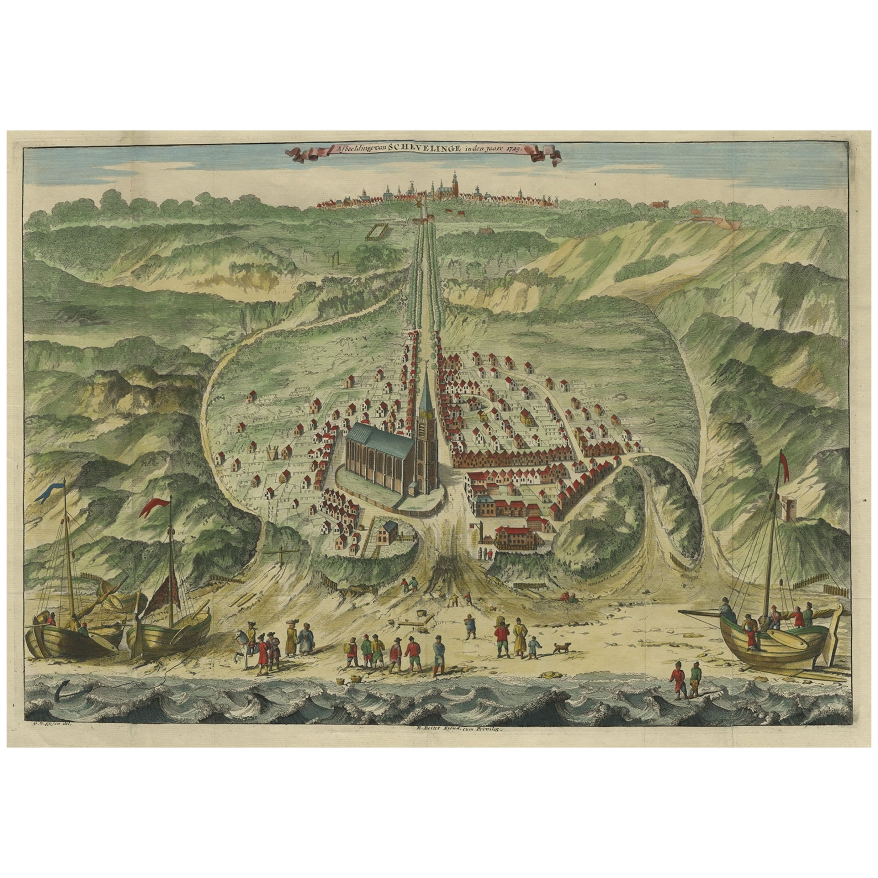
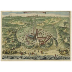
- Antique Bird's Eye View of Scheveningen Near The Hague, the Netherlands, 1730Located in Langweer, NLAntique print titled 'Afbeeldinge van Schevelinge in den Jaare 1729'. Bird's eye view of Scheveningen near The Hague / Den Haag, the Netherlands. This print originates from 'Besc...Category
Antique 1730s Maps
MaterialsPaper
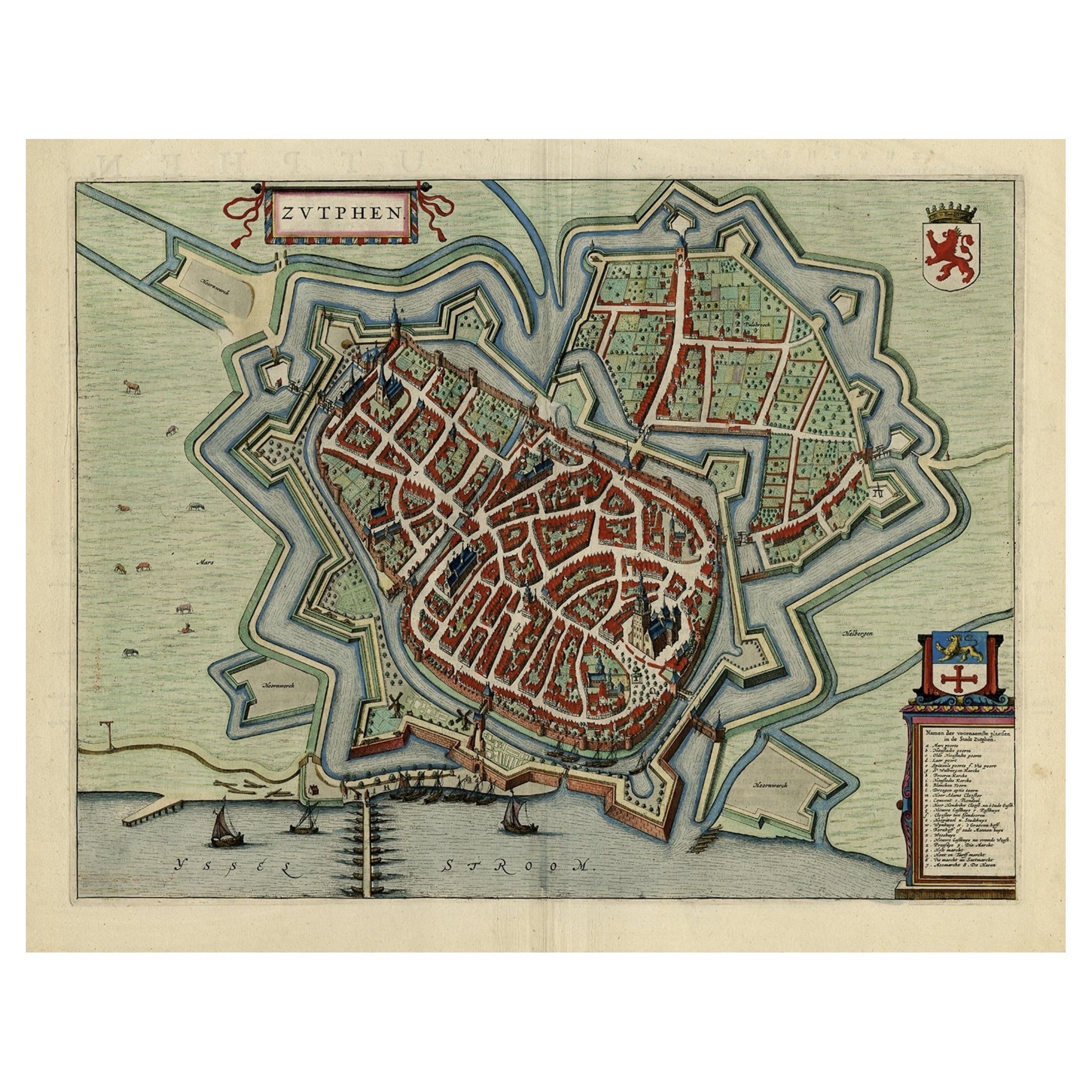
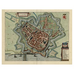
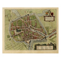
- Original Map with Bird's-Eye View of Zutphen in the Netherlands by Blaeu, 1649Located in Langweer, NLAntique print, titled: 'Zutphen.' - Bird's-eye view plan of Zutphen in The Netherlands, with key to locations and coats of arms. Text in Dutch on verso. This plan originates from the famous city Atlas: 'Toneel der Steeden' published by Joan Blaeu...Category
Antique 1640s Maps
MaterialsPaper
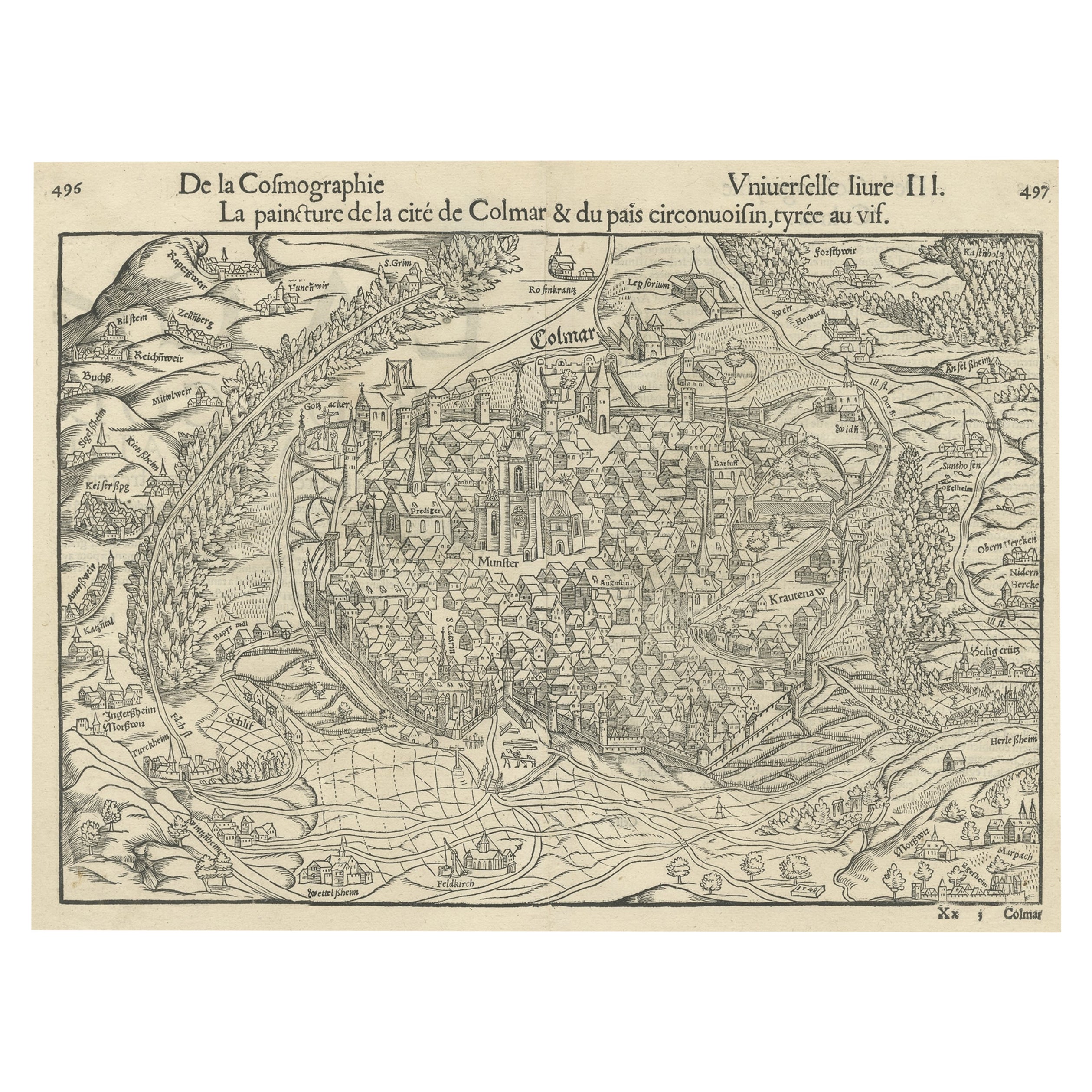
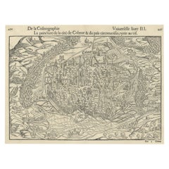
- Original Antique Bird's-Eye View of Colmar, Alsace, France, 1552Located in Langweer, NLAntique map titled 'La Paincture de la cité de Colmar & du pais circonuoisin'. Original antique bird's-eye view of Colmar, Alsace, France. This map originates from 'La Cosmograph...Category
Antique 16th Century Maps
MaterialsPaper
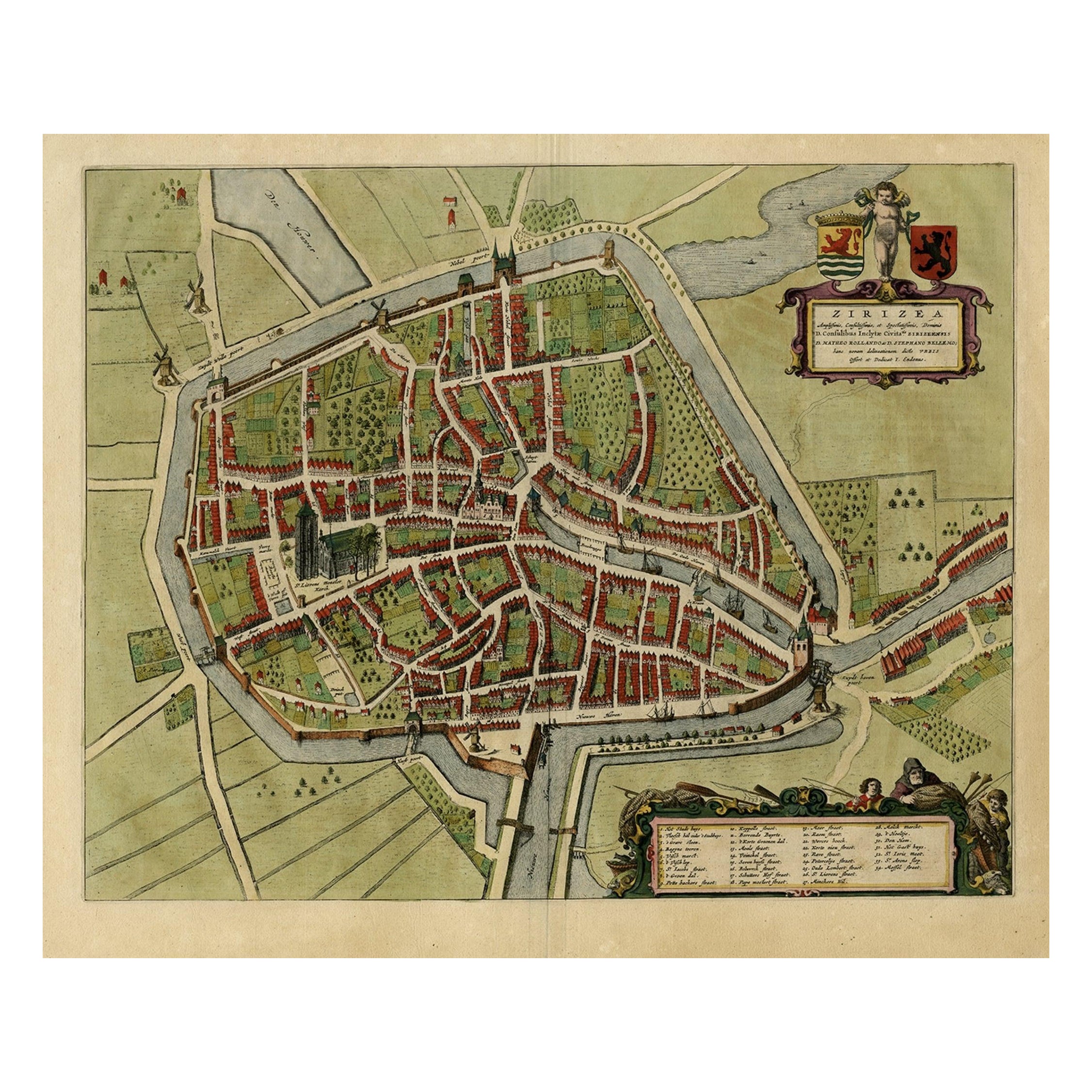
- Antique Bird's-eye View Plan of Zierikzee in Zeeland, The Netherlands, 1649Located in Langweer, NLAntique print, titled: 'Zirizea.' - A bird's-eye view plan of Zierikzee in The Netherlands, with key to locations and coats of arms. After Matheo Rollando and Stephano Bellemo. Latin tekst on verso. From the city Atlas: 'Toneel der Steeden' published by Joan Blaeu...Category
Antique 1640s Maps
MaterialsPaper
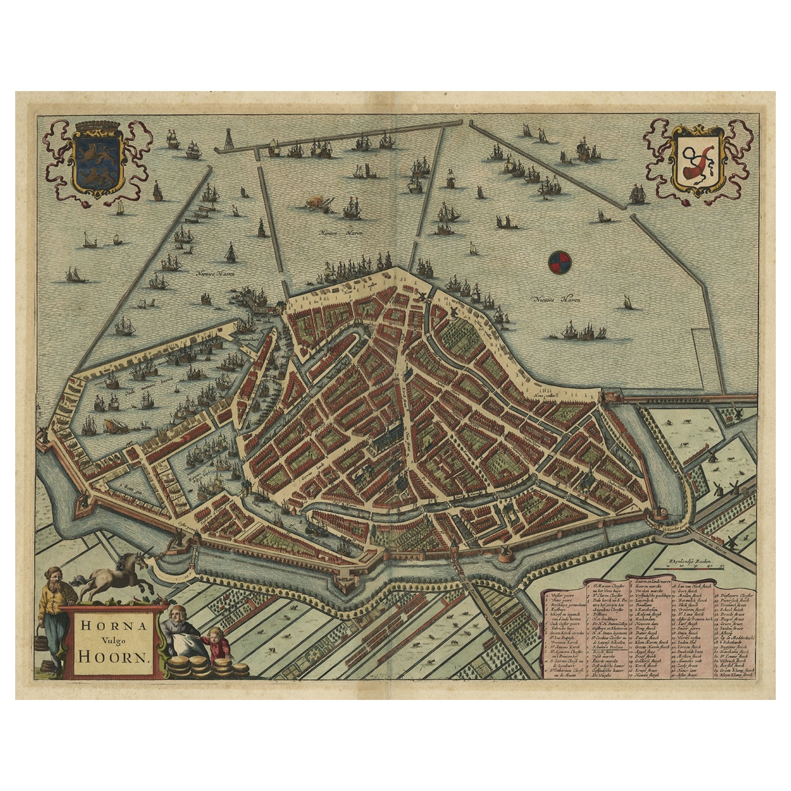
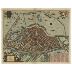
- Original Antique Bird's Eye View Plan of Hoorn, The Netherlands by Blaeu, c.1700Located in Langweer, NLAntique map titled 'Horna vulgo Hoorn'. Bird's eye view plan of Hoorn, The Netherlands. With title cartouche, coats of arms and key. From an atlas published by De Wit, ca. 1698-1...Category
Antique Early 1700s Maps
MaterialsPaper
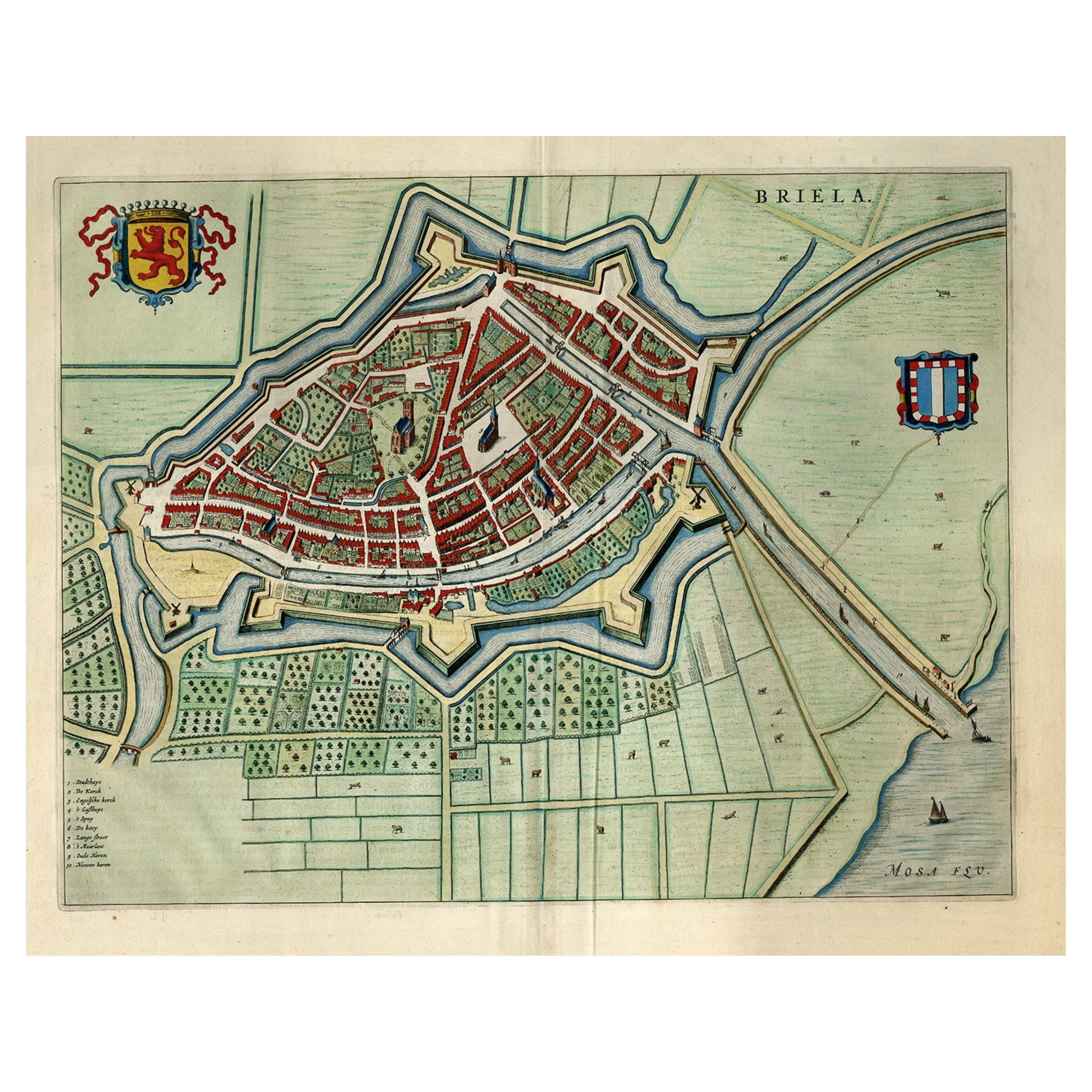
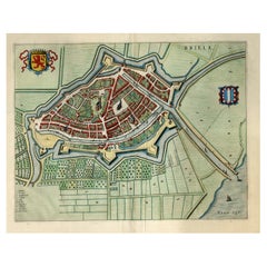
- Great Antique Bird's-Eye View Plan of Brielle by Blaeu in The Netherlands, 1649Located in Langweer, NLAntique print, titled: 'Briela.' Bird's-eye view plan of Brielle in The Netherlands. With key to locations and coats of arms. Text in Dutch on verso. This plan originates from the famous city Atlas: 'Toneel der Steeden' published by Joan Blaeu...Category
Antique 1640s Maps
MaterialsPaper
You May Also Like
- Vintage "View of the Center of Paris Taken from the Air" Lithograph MapLocated in San Diego, CAA very stylish "View of the Center of Paris Taken from the Air" lithograph map published by the Paris Ministry of Tourism, circa early 1950s. The piece measures 27" x 43" and shows...Category
20th Century French Mid-Century Modern Prints
MaterialsPaper
- Map of the Republic of GenoaLocated in New York, NYFramed antique hand-coloured map of the Republic of Genoa including the duchies of Mantua, Modena, and Parma. Europe, late 18th century. Dimension: 25...Category
Antique Late 18th Century European Maps
- Hand-Colored 18th Century Homann Map of Denmark and Islands in the Baltic SeaBy Johann Baptist HomannLocated in Alamo, CAAn 18th century copper plate hand-colored map entitled "Insulae Danicae in Mari Balthico Sitae utpote Zeelandia, Fionia, Langelandia, Lalandia, Falstria, Fembria Mona" created by Joh...Category
Antique Early 18th Century German Maps
MaterialsPaper
- Antique Map of Principality of MonacoBy Antonio Vallardi EditoreLocated in Alessandria, PiemonteST/619 - "Old Geographical Atlas of Italy - Topographic map of ex-Principality of Monaco" - ediz Vallardi - Milano - A somewhat special edition ---Category
Antique Late 19th Century Italian Other Prints
MaterialsPaper
- Antique 18th Century Map of the Province of Pensilvania 'Pennsylvania State'Located in Philadelphia, PAA fine antique of the colony of Pennsylvania. Noted at the top of the sheet as a 'Map of the province of Pensilvania'. This undated and anonymous map is thought to be from the Gentleman's Magazine, London, circa 1775, although the general appearance could date it to the 1760's. The southern boundary reflects the Mason-Dixon survey (1768), the western boundary is placed just west of Pittsburgh, and the northern boundary is not marked. The map has a number of reference points that likely refer to companion text and appear to be connected to boundaries. The western and southern boundaries are marked Q, R, S, for example. A diagonal line runs from the Susquehanna R to the Lake Erie P. A broken line marked by many letters A, B, N, O, etc., appears in the east. There are no latitude or longitude markings, blank verso. Framed in a shaped contemporary gilt wooden frame and matted under a cream colored matte. Bearing an old Graham Arader Gallery...Category
Antique 18th Century British American Colonial Maps
MaterialsPaper
- Original Antique Map of The World by Thomas Clerk, 1817Located in St Annes, LancashireGreat map of The Eastern and Western Hemispheres On 2 sheets Copper-plate engraving Drawn and engraved by Thomas Clerk, Edinburgh. Published by Mackenzie And Dent, 1817 ...Category
Antique 1810s English Maps
MaterialsPaper


Recently Viewed
View AllMore Ways To Browse
French Antique Island
Abbey Antique
Antique Bird Light
Antique Furniture St Paul
Antique Maltese
18th Century Allegorical
Shipwreck Antique
Orient Map
Map Of Orient
Shipwreck Furniture
Antique Maltese Furniture
Antique Furniture Malta
Biblical Antiques
Used Furniture North Bay
Malta Antique
Maltese Antique
Antique Roman Map
Roman Map