Items Similar to Antique Bird's-eye View Plan of Zierikzee in Zeeland, The Netherlands, 1649

Want more images or videos?
Request additional images or videos from the seller
1 of 5
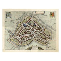
Antique Bird's-eye View Plan of Zierikzee in Zeeland, The Netherlands, 1649
About the Item
Antique print, titled: 'Zirizea.' - A bird's-eye view plan of Zierikzee in The Netherlands, with key to locations and coats of arms. After Matheo Rollando and Stephano Bellemo. Latin tekst on verso. From the city Atlas: 'Toneel der Steeden' published by Joan Blaeu in 1649.
Artists and Engravers: Made by 'Joan Blaeu' after an anonymous artist. Joan Blaeu (23 September 1596 - 28 May 1673) was a Dutch cartographer. He was born in Alkmaar, the son of cartographer Willem Blaeu. In 1620 he became a doctor of law but he joined the work of his father. In 1635 they published the Atlas Novus (full title: Theatrum orbis terrarum, sive, Atlas novus) in two volumes. Joan and his brother Cornelius took over the studio after their father died in 1638. Joan became the official cartographer of the Dutch East India Company. Around 1649 Joan Blaeu published a collection of Dutch city maps named Tooneel der Steeden (Views of Cities). In 1651 he was voted into the Amsterdam council. In 1654 Joan published the first atlas of Scotland, devised by Timothy Pont. In 1662 he reissued the atlas with 11 volumes, and one for oceans. It was also known as Atlas Maior. A cosmology was planned as their next project, but a fire destroyed the studio completely in 1672. Joan Blaeu died in Amsterdam the following year.
- Dimensions:Height: 21.46 in (54.5 cm)Width: 25.75 in (65.4 cm)Depth: 0 in (0.02 mm)
- Materials and Techniques:
- Period:1640-1649
- Date of Manufacture:1649
- Condition:Condition: Good, given age. Margins somewhat browned. A few small spots in the margins. A few light creases. Paper separation lower middle fold, outside image area. Middle fold as issued. Overall good. General age-related toning.
- Seller Location:Langweer, NL
- Reference Number:
About the Seller
5.0
Platinum Seller
These expertly vetted sellers are 1stDibs' most experienced sellers and are rated highest by our customers.
Established in 2009
1stDibs seller since 2017
1,928 sales on 1stDibs
Typical response time: <1 hour
- ShippingRetrieving quote...Ships From: Langweer, Netherlands
- Return PolicyA return for this item may be initiated within 14 days of delivery.
More From This SellerView All
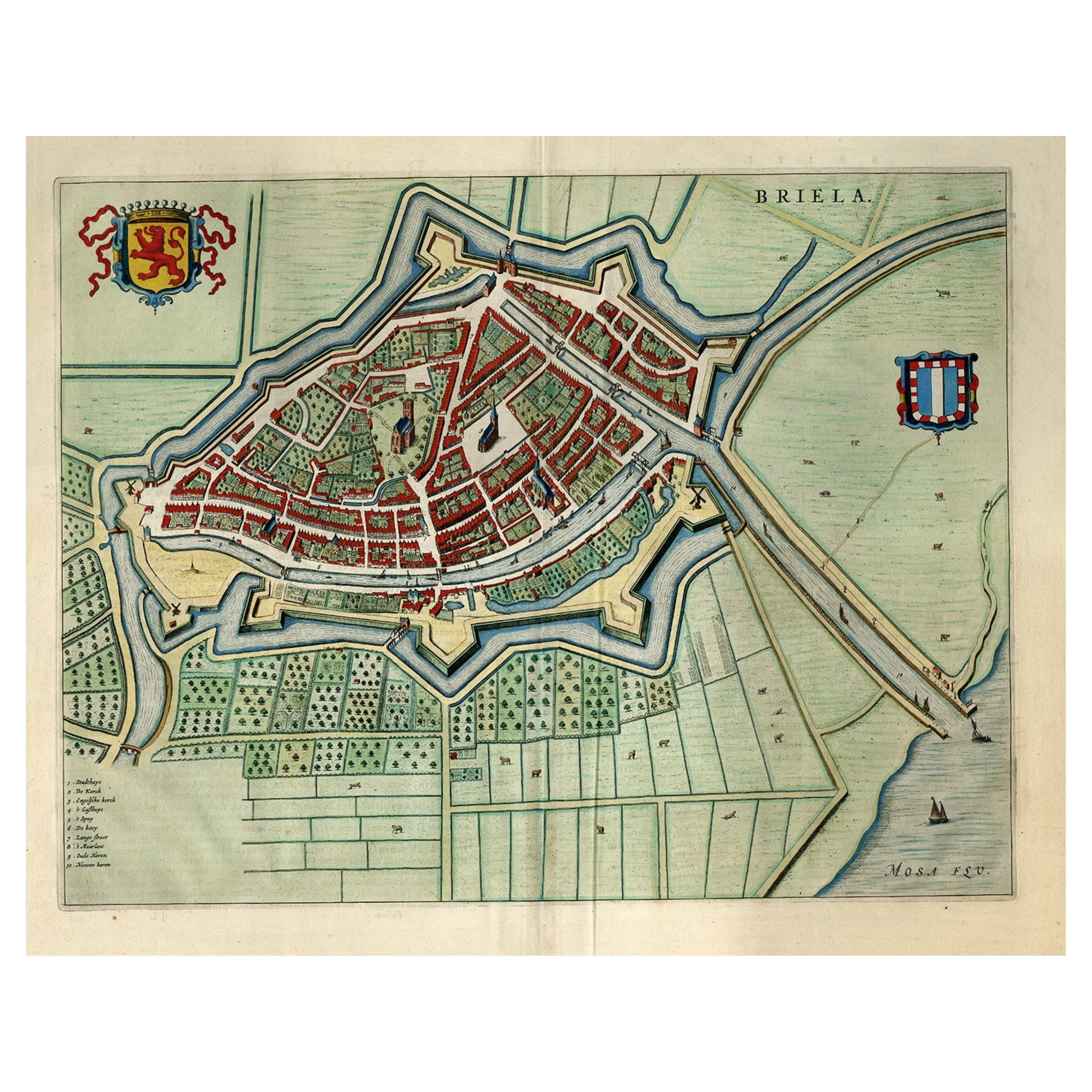
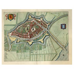
- Great Antique Bird's-Eye View Plan of Brielle by Blaeu in The Netherlands, 1649Located in Langweer, NLAntique print, titled: 'Briela.' Bird's-eye view plan of Brielle in The Netherlands. With key to locations and coats of arms. Text in Dutch on verso. This plan originates from the famous city Atlas: 'Toneel der Steeden' published by Joan Blaeu...Category
Antique 1640s Maps
MaterialsPaper
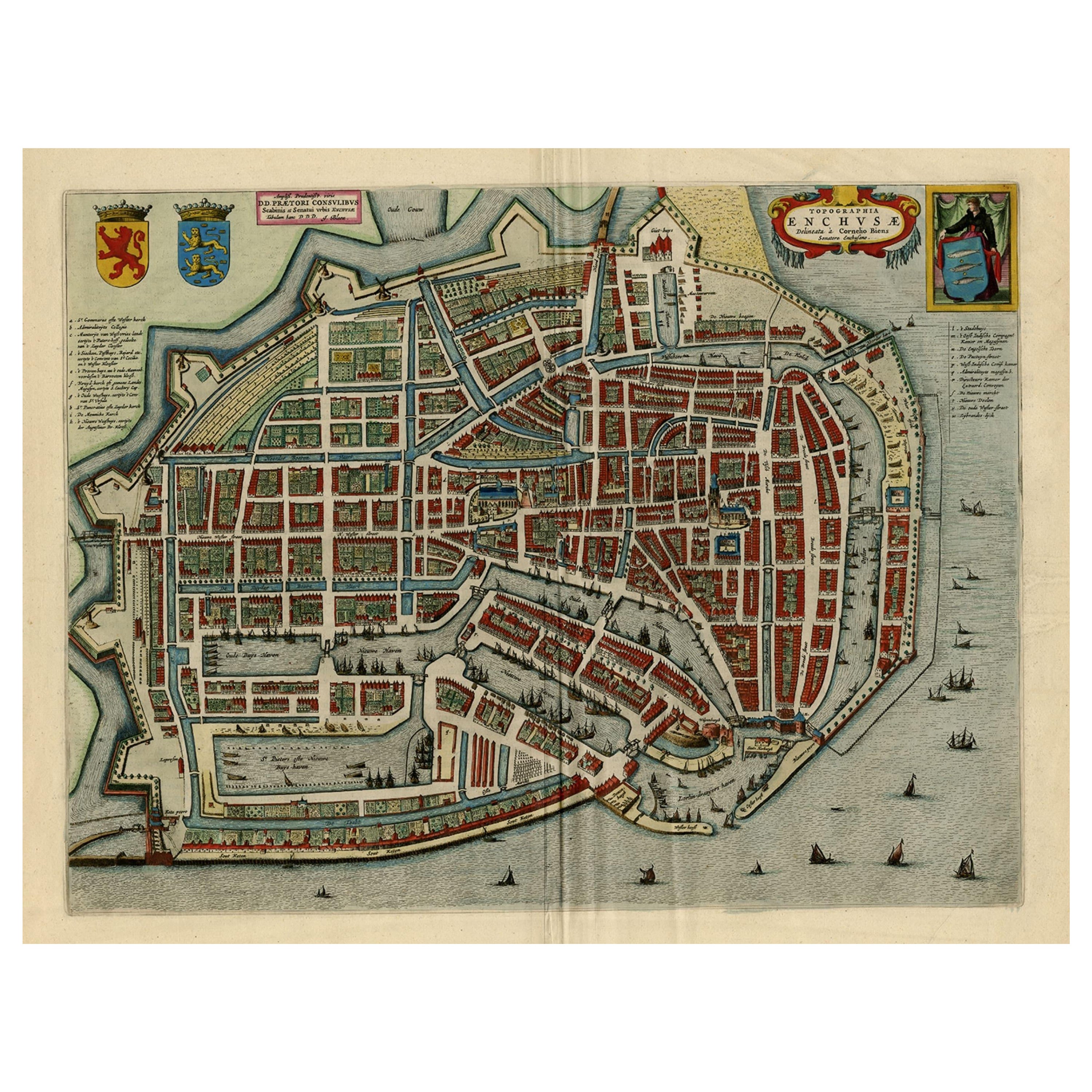
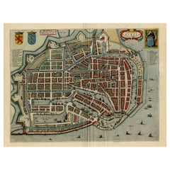
- Beautiful Bird's-Eye View Plan of Enkhuizen in The Netherlands by Blaeu, 1649Located in Langweer, NLAntique print, titled: 'Topograhpiae Enchusae.' Bird's-eye view plan of Enkhuizen in The Netherlands, with key to locations and coats of arms. Text in Dutch on verso. This plan o...Category
Antique 1640s Maps
MaterialsPaper
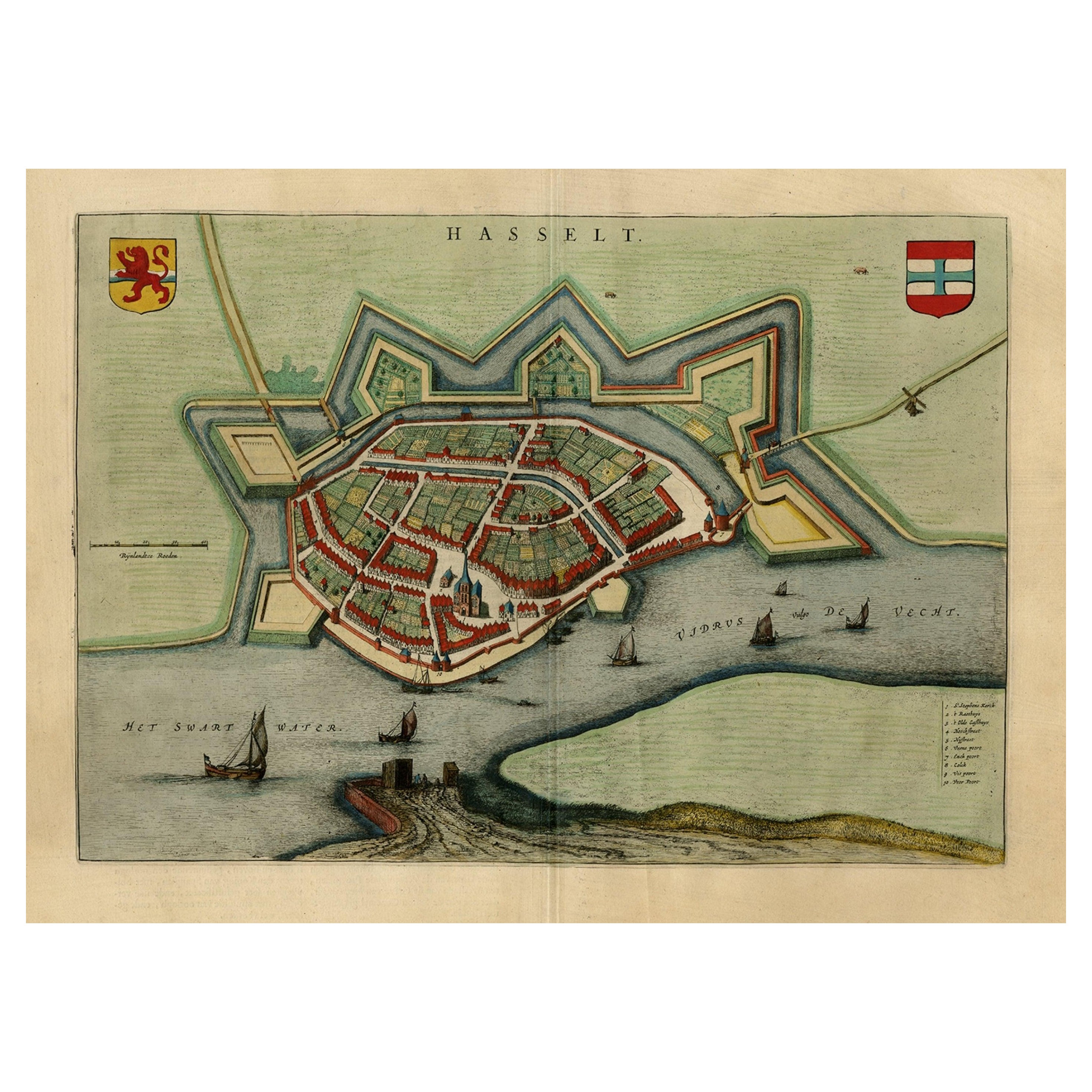
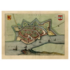
- Stunning Bird's-Eye View Plan of Hasselt by Blaeu in The Netherlands, 1649Located in Langweer, NLAntique print, titled: 'Hasselt.' Bird's-eye view plan of Hasselt in The Netherlands. With key to locations and coats of arms. Text in Dutch on verso. This plan originates from the famous city Atlas: 'Toneel der Steeden' published by Joan Blaeu...Category
Antique 1640s Maps
MaterialsPaper
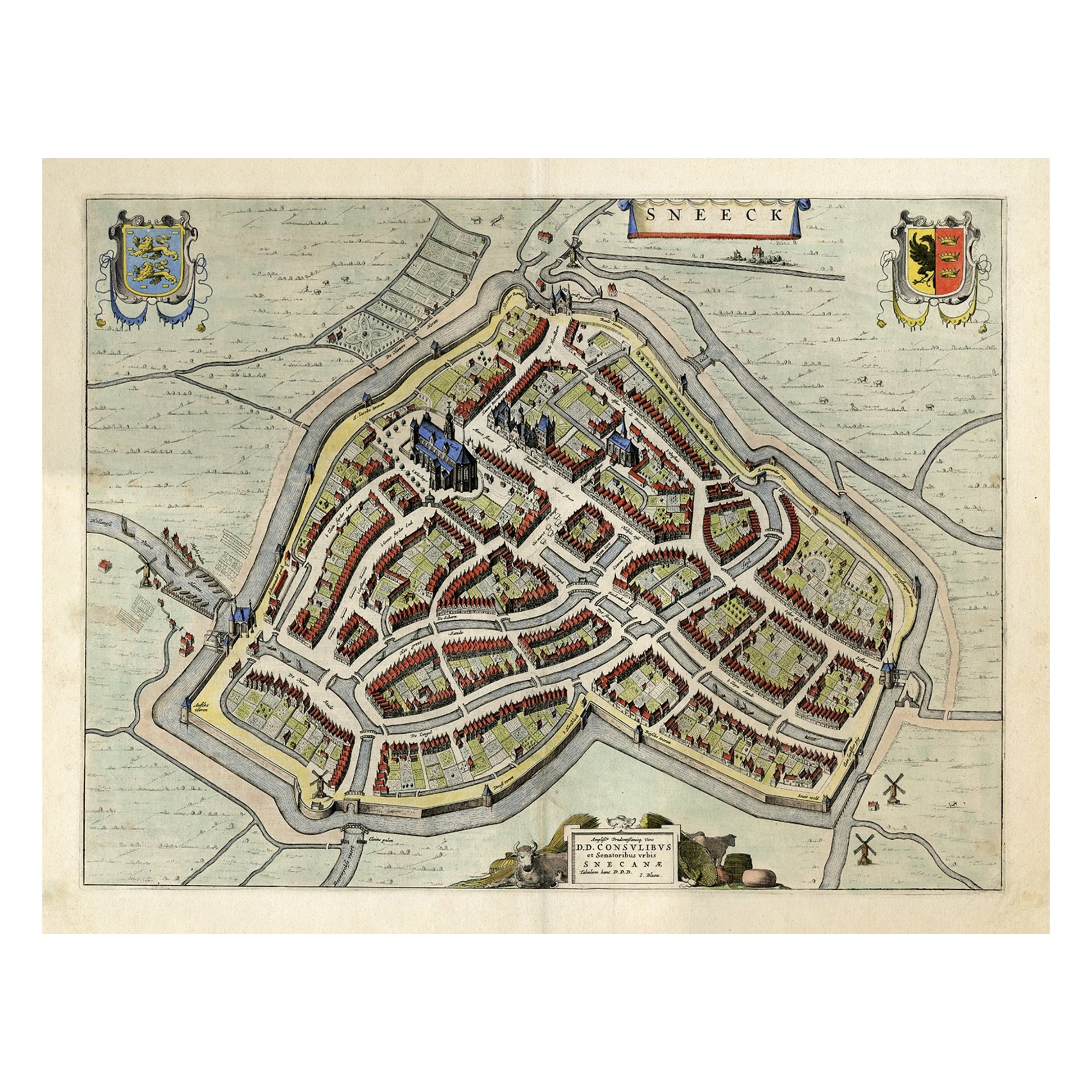
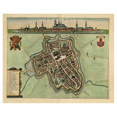
- Original Old Bird's-eye View plan of Sneek, Friesland, The Netherlands, 1649Located in Langweer, NLAntique map titled: 'Sneeck.' Bird's-eye view plan of Sneek, Friesland, The Netherlands. Text in Latin on verso. This plan originates from the famous city Atlas: 'Toneel der Steeden'...Category
Antique 1640s Maps
MaterialsPaper
- Decorative Bird's-Eye View Plan of Ieper or Ypres in Belgium, 1649Located in Langweer, NLAntique print, titled: 'Ypra.' Bird's-eye view plan of Ieper / Ypres in Belgium. With key to locations and coats of arms. Text in Latin on verso. This plan originates from the famous city Atlas: 'Toneel der Steeden' published by Joan Blaeu...Category
Antique 1640s Maps
MaterialsPaper
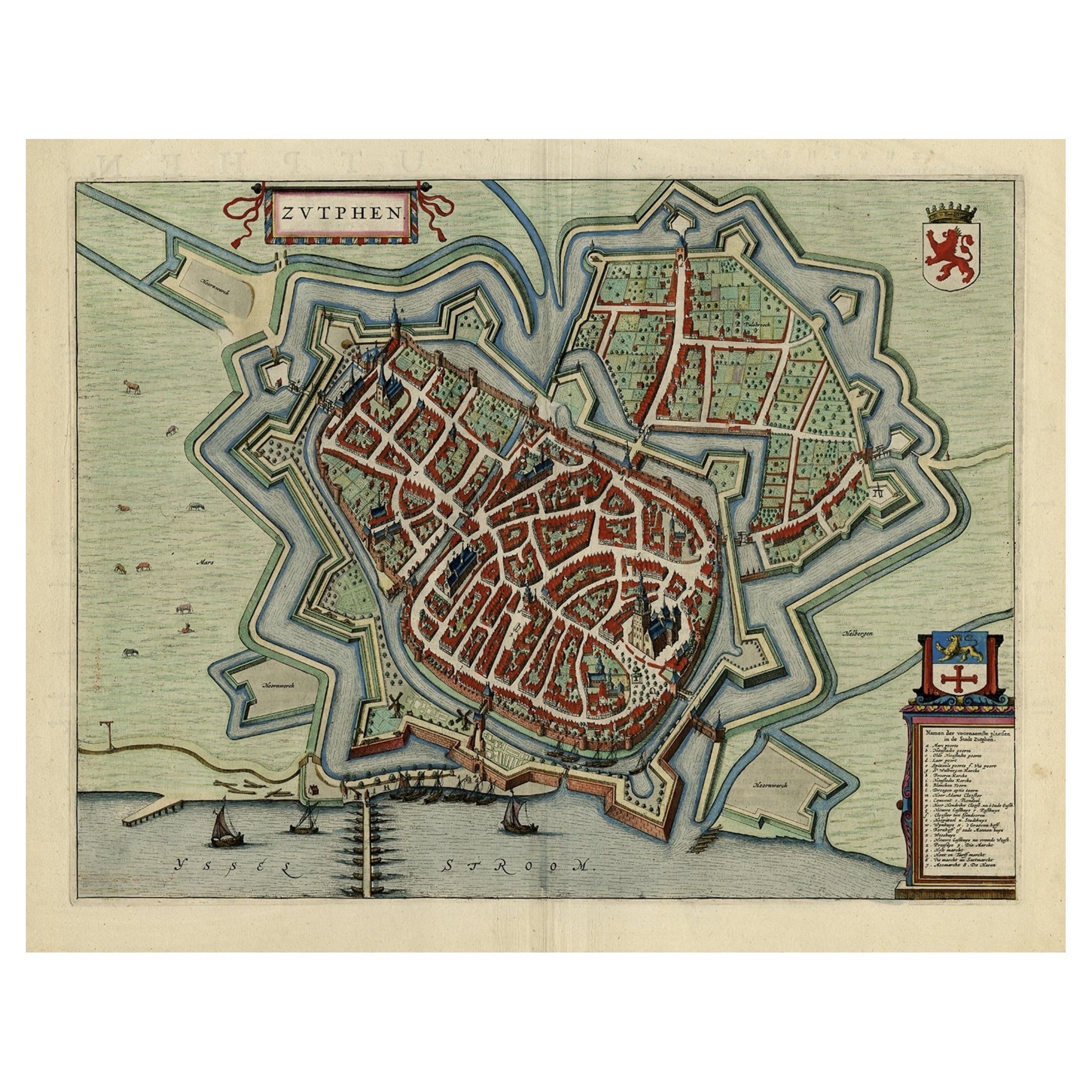
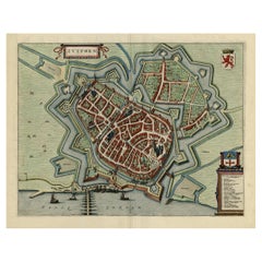
- Original Map with Bird's-Eye View of Zutphen in the Netherlands by Blaeu, 1649Located in Langweer, NLAntique print, titled: 'Zutphen.' - Bird's-eye view plan of Zutphen in The Netherlands, with key to locations and coats of arms. Text in Dutch on verso. This plan originates from the famous city Atlas: 'Toneel der Steeden' published by Joan Blaeu...Category
Antique 1640s Maps
MaterialsPaper
You May Also Like
- Catalogue of Engraved Views, Plans, Etc., Of New York City, 1st EdLocated in valatie, NYA catalogue of engraved views, plans, etc., Of New York City, (The Collection of Percy R. Pyne II). Privately Printed by The De Vinne Press, New York, 1912. Limited to 100 copies. Gr...Category
Early 20th Century American Books
MaterialsPaper
- Original Antique Map of The Netherlands, Sherwood, Neely & Jones, Dated 1809Located in St Annes, LancashireGreat map of The Netherlands Copper-plate engraving by Cooper Published by Sherwood, Neely & Jones. Dated 1809 Unframed.Category
Antique Early 1800s English Maps
MaterialsPaper
- Original Antique Map of The Netherlands, Engraved by Barlow, Dated 1807Located in St Annes, LancashireGreat map of Netherlands Copper-plate engraving by Barlow Published by Brightly & Kinnersly, Bungay, Suffolk. Dated 1807 Unframed.Category
Antique Early 1800s English Maps
MaterialsPaper
- N.E. View of the United States Capitol, Washington, DC Antique Proof Print 1858Located in Colorado Springs, COThis engraved print shows a view of the United States Capitol Building, in Washington, D.C. The print depicts the neoclassical building from the northeast orientation, with a bustling street scene in front. The steel engraving is a proof printing, drawn and engraved by Henry Sartain and published in 1858. Plans began in May 1854 to build a new cast-iron dome for the United States Capitol. The then-architect of the Capitol Thomas Walter and his team were sold on the aesthetics of a new dome, as well as the utility of a fire-proof one. A year later, on March 3, 1855, President Franklin Pierce...Category
Antique 1850s American Prints
MaterialsPaper
- Original Antique Map / City Plan of Brussels by Tallis, circa 1850Located in St Annes, LancashireGreat map of Brussels. Steel engraving. Published by London Printing & Publishing Co. (Formerly Tallis), C.1850 Free shipping.Category
Antique 1850s English Maps
MaterialsPaper
- Vintage "View of the Center of Paris Taken from the Air" Lithograph MapLocated in San Diego, CAA very stylish "View of the Center of Paris Taken from the Air" lithograph map published by the Paris Ministry of Tourism, circa early 1950s. The piece measures 27" x 43" and shows...Category
20th Century French Mid-Century Modern Prints
MaterialsPaper


Recently Viewed
View AllMore Ways To Browse
Antique Plan
Antique Plans
Antique City Views
Collecting Antique Keys
Keys Collectible Antique
Key Bird
Scottish Bird
Dutch East India Company
Dutch East India
Antique City Plans
Timothy Brown
Antique Doctors Office Furniture
Atlas Furniture Company
Cornelius Hollander
East India Map
Cornelius Brown
Amsterdam Coat Of Arms
Scottish Coat Of Arms