South Pacific Map

5
59
2
to
6
43
16
61
61
61
3
2
2
1
31
18
10
2
2
8
2
3
1
2
2
57
10
4
3
2
25
14
11
8
8
2
1
1
1
1
Sort By
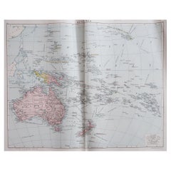
Large Original Vintage Map of The South Pacific, circa 1920
Located in St Annes, Lancashire
Great map of The South Pacific Original color. Good condition / repairs to minor edge tears
Category

Vintage 1920s English Edwardian Maps

Materials

Paper

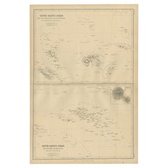
Antique Map of South Pacific Ocean by W. G. Blackie, 1859
Located in Langweer, NL
Antique map titled 'South Pacific Ocean'. Original antique map of South Pacific Ocean with inset
Category

Antique Mid-19th Century Maps

Materials

Paper

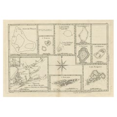
Print of Maps of Islands of the South Pacific, Incl. Pitcairn & Dusky Bay, 1788
Located in Langweer, NL
Pickersgill / I de Pasques.' Detailed set of maps of the islands of the South Pacific, with a large compass
Category

Antique 1780s Maps

Materials

Paper

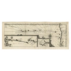
Antique Map of the Pacific Ocean by Renneville, 1702
Located in Langweer, NL
Antique map, untitled. A map of the Pacific Ocean, with the coast of Peru in the right edge and the
Category

Antique 18th Century Maps

Materials

Paper

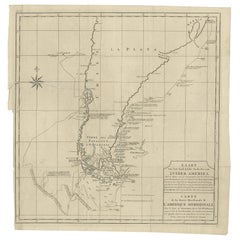
Antique Map of South America by G. Anson, 1749
Located in Langweer, NL
Antique map titled 'Kaart van het Zuidelykste Gedeelte van Zuider Amerika (..) - Carte de la Partie
Category

Antique Mid-18th Century Dutch Maps

Materials

Paper

Antique Map of South America by G. Anson, 1749
H 20.87 in W 20.48 in D 0.02 in
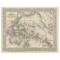
Old Map of the Pacific, Incl Australia, Polynesia, Melanesia and Malaysia, 1872
Located in Langweer, NL
'. Map of the Pacific, including Australia, Polynesia, Melanesia and Malaysia. Covers the region in
Category

Antique 1870s Maps

Materials

Paper

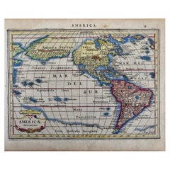
North & South America: A 17th Century Hand-colored Map by Jansson & Goos
By Johannes Janssonius
Located in Alamo, CA
A 17th century hand-colored map of North & South America entitled "Americae Descriptio" by the
Category

Antique 1620s Dutch Maps

Materials

Paper

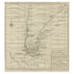
Antique Map of Tracks of Anson's Ships around South America & Cape Horn, 1749
Located in Langweer, NL
Description: Antique map titled 'Kaart van het Zuidelykste Gedeelte van Zuider Amerika (..) - Carte
Category

Antique 1740s Maps

Materials

Paper

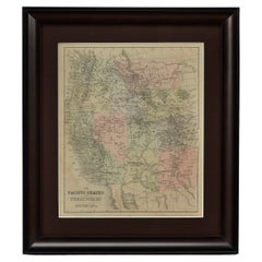
1889 "The Pacific States and Territories"
Located in Colorado Springs, CO
Presented is an uncommon 1889 map of the western United States, titled “The Pacific States and
Category

Antique 1880s American Maps

Materials

Paper

1889 "The Pacific States and Territories"
H 16.25 in W 14.25 in D 1 in
Antique Map of the Admiralty Islands, Bismarck Archipelago
Located in Langweer, NL
Islands, Bismarck Archipelago, to the north of New Guinea in the South Pacific Ocean. Published in an
Category

Antique Late 18th Century Maps

Materials

Paper

Antique Detailed World Map Drawn on Mercator's Projection, 1700
Located in Langweer, NL
appear to the south, including Van Diemen's Land. The most interesting features of the map are the five
Category

Antique 17th Century Maps

Materials

Paper

Antique Map of Juan Fernandez Island by Anson '1749'
Located in Langweer, NL
sparsely inhabited island group in the South Pacific Ocean reliant on tourism and fishing. Situated 670 km
Category

Antique Mid-18th Century Maps

Materials

Paper

Antique Map of the Bay of Terney by La Pérouse, 1797
Located in Langweer, NL
Antique map titled 'Plan de la Baie de Ternai'. Old map of the north eastern coast of Russia. This
Category

Antique 18th Century Maps

Materials

Paper

Antique Map of the Eastside of Coiba Island 'Quibo', Panama, 1749
Located in Langweer, NL
Antique map titled 'Plan de la partie orientale de l'Isle de Quibo'. Map of the eastside of Coiba
Category

Antique 18th Century Maps

Materials

Paper

Antique Map of the Coast of Juan Fernandez by Van Schley, 1757
Located in Langweer, NL
Antique map titled 'Cote du Nord Est de l'Isle de Juan Fernandez (..).' Map of the Chilean South
Category

Antique 18th Century Maps

Materials

Paper

California, Alaska and Mexico: 18th Century Hand-Colored Map by de Vaugondy
By Didier Robert de Vaugondy
Located in Alamo, CA
day Alaska in the north to Baja California in the south. The map includes the Strait of Anian in the
Category

Antique 1770s French Maps

Materials

Paper

Antique Map of Juan Fernandez Island and Cumberland Bay, Chile - c. '1749'
Located in Langweer, NL
the South Pacific Ocean reliant on tourism and fishing. Situated 670 km (362 nmi; 416 mi) off the
Category

Antique Mid-18th Century Maps

Materials

Paper

Large Antique Sea Chart of the South-Eastern Coast of Sumatra, Indonesia
Located in Langweer, NL
route of Julien Crozet in April 1772, who led a French expedition to the South Pacific after the
Category

Antique Late 18th Century Maps

Materials

Paper

Map of the East Coast of Hanshu or Honshu & a View of the Japanese Coast, 1803
Located in Langweer, NL
Antique map titled 'Gedeelte van Japan of Nipon'. Map of the east coast of Hanshu, with a view
Category

Antique Early 1800s Maps

Materials

Paper

Large Chart of the Gambier Islands, Tuamotu Archipelago, French Polynesia
Located in Langweer, NL
South Pacific Ocean. This map focuses on the Gambier Islands, French Îles Gambier, also called Mangareva
Category

Antique Mid-19th Century Maps

Materials

Paper

Antique Engraving of the Islands Wanooa, Wateeoo, Mangeea, Toobouai, Cook, 1803
Located in Langweer, NL
Antique map South Pacific Islands, Polynesia. Originates from 'Reizen Rondom de Waereld door James
Category

Antique 19th Century Maps

Materials

Paper

1879 "United States of America, Western Part" by O. J. Stuart
Located in Colorado Springs, CO
This colorful original map, titled “United States of America, Western Part,” was issued in Volume
Category

Antique 1870s American Maps

Materials

Paper

Rare Engraving of New Caledonia & New Hebrides from Capt. Cook's Travels, 1777
Located in Langweer, NL
Antique map titled 'Chart of Discoveries made in the South Pacific Ocean'. Rare engraving from
Category

Antique 1770s Maps

Materials

Paper

Navigational Chart of Mexico's Coast, with Acapulco and Port Marquis, 1748
Located in Langweer, NL
Antique map titled 'The Form of cruising off Acapulca on the Coast of Mexico in the South Seas in
Category

Antique 1740s Maps

Materials

Paper

Miniature Terrestrial Globe Newton & Son London, Post 1833, Ante 1858
By Newton and Son
Located in Milano, IT
sphere is made of papier-mâché and is covered with twelve printed paper gores. In the North Pacific
Category

Antique 1840s English Early Victorian Maps

Materials

Bronze

Pair of Miniature Globes Lane’s on Tripod Bases, London post 1833, ante 1858
By Lane's
Located in Milano, IT
original "English" tripod bases in carved wood. The terrestrial globe in the North Pacific Ocean, above
Category

Antique 1840s English Early Victorian Maps

Materials

Paper, Wood

Original Vintage Illustrated Map Poster Schematic Map Soviet Union USSR Russia
Located in London, GB
and marking The USSR's West and South region, the key on the Pacific Ocean side and below. Horizontal
Category

Vintage 1960s Russian Posters

Materials

Paper

The Travel Sale: Natural History and Maps. November 2001: Sotheby's London
By Sotheby's
Located in valatie, NY
-87; Pacific 88-91; America 92-122; Central America and the Caribbean 122-140; South America 141-162
Category

21st Century and Contemporary English Books

Materials

Paper

Original Vintage WWII Poster De Dollarpoliep The US Dollar Polyp Octopus War Map
Located in London, GB
like tentacles reaching into different countries on a map in and around North and South America marking
Category

Vintage 1940s Dutch Posters

Materials

Paper

Antique 1798 James Colnett A Voyage to the South Atlantic & Round Cape Hope Book
Located in Hamilton, Ontario
This antique book titled "A Voyage to the South Atlantic and Round Cape Horn into the Pacific Ocean
Category

Antique Late 18th Century English Georgian Books

Materials

Leather, Paper

Antique Print of Ambon Island, Indonesia, by Dumont d'Urville, 1833
Located in Langweer, NL
officer. For thirty-eight months he explored the south and western Pacific, Australia, New Zealand, and
Category

Antique 19th Century Prints

Materials

Paper

Pocket Globe, Nicholas Lane, London, post 1779
By Nicholas Lane
Located in Milano, IT
the North Pacific Ocean, above the Tropic of Cancer, the globe bears a cartouche framed with small
Category

Antique 1780s English Other Models and Miniatures

Materials

Leather, Wood, Paper

Antique Print of Two Japanese Vessels, 1799
Located in Langweer, NL
Oceania. La Pérouse crossed the Pacific Ocean in 100 days, arriving at Macau, where he sold the furs
Category

Antique 1790s Prints

Materials

Paper

Wonderful and extremely rare Dutch pocketglobe
By Dementz Family DEUR Art Company
Located in ZWIJNDRECHT, NL
-mapped. The continent of Africa is much the same as South America, with a mixture of old regions and more
Category

Antique Early 18th Century Dutch Dutch Colonial Globes

Materials

Hardwood, Paper

Wonderful and extremely rare Dutch pocketglobe
Free Shipping
H 2.5 in Dm 2.5 in
A truly delightful miniature terrestrial pocket globe
By Nathaniel Mills
Located in ZWIJNDRECHT, NL
South America. It is partly worn in other places and has some slight spotting. It is lacking the axis
Category

Antique Mid-18th Century British Dutch Colonial Globes

Materials

Other

An exceptional pair of BLAEU table globes
By Willem Blaeu
Located in ZWIJNDRECHT, NL
Cornelis Schouten and Jacob Le Maire, who both traversed the South Pacific and the Atlantic. The findings
Category

Antique 17th Century European Dutch Colonial Globes

Materials

Other

        An exceptional pair of BLAEU table globes
        An exceptional pair of BLAEU table globes
Free Shipping
H 15 in Dm 9 in
Antique Print of Various Island in French Polynesia, circa 1774
Located in Langweer, NL
located in French Polynesia, South Pacific. By Capt James Cook during his first voyage of discovery in
Category

Antique 18th Century Prints

Materials

Paper

English Pocket Globe, London, Circa 1775-1798
By Herman Moll
Located in Milano, IT
globe is made up of twelve printed paper gores aligned and glued to the sphere. In the North Pacific
Category

Antique Late 18th Century English George III Globes

Materials

Shagreen, Paper

Rare Robert Bénard Map Engraving - South Pacific Australia New Zealand 1774
Located in Malvern, Victoria
Rare Robert Bénard map of the South Pacific, showing Australia and New Zealand Bénard, Robert
Category

Antique 1770s Maps

Highly Decorative Italian Wall Map of the World
By Paolo Petrini
Located in La Jolla, CA
depiction of the Americas is in good part based on Vincenzo Maria Coronelli’s maps of North and South
Category

Antique Early 1700s Italian Baroque Prints

Materials

Paper

Antique Map of South Pacific Islands by J. Cook, 1803
By James Cook
Located in Langweer, NL
Antique map South Pacific Islands, Polynesia. Islands titled 'Wanooa, Mangeea, Wateeoo and Toobouai
Category

Antique Early 19th Century Dutch Maps

Materials

Paper

1828 "Map of the United States" by T. Ensign
Located in Colorado Springs, CO
first to show the United States stretching all the way to the Pacific Ocean. The map’s area covers
Category

Antique 1820s American Maps

Materials

Paper

Republic of Texas and Mexico, Antique French Map, circa 1840
Located in Colorado Springs, CO
First published in 1834, this is the sixth edition of Adrien H. Brue's landmark map of the North
Category

Antique 1840s French Maps

Materials

Paper

1885 Denver and Rio Grande System Antique Map by Rand McNally & Co.
Located in Colorado Springs, CO
This map details the Denver & Rio Grande Railroad and was published in 1885. The map extends as far
Category

Antique 1880s American Maps

Materials

Paper

English Pocket Globe by Lane, London, between 1817 and 1833
By Lane's
Located in Milano, IT
inserted on the poles. In the North Pacific Ocean, above the Tropic of Cancer, the globe bears a cartouche
Category

Antique 1820s English George IV Maps

Materials

Shagreen, Paper

Original Vintage Pacific Line Cruise Ship Poster Sunshine Route to South America
Located in London, GB
Original vintage Pacific Line poster advertising. The Sunshine Route to South America - Europe
Category

Vintage 1930s British Posters

Materials

Paper

Original Vintage London Underground Poster Visit The Empire Map Tube Travel Art
Located in London, GB
Dinkel (1894-1983) showing a map marking the British Empire islands and areas in North America and South
Category

Vintage 1930s British Posters

Materials

Paper

Original Vintage TWA Poster Trans World Airline Route Map Art Europe Africa Asia
Located in London, GB
Original vintage travel advertising map poster for TWA / Trans World Airlines USA Europe Africa
Category

Vintage 1950s American Posters

Materials

Paper

Chase Langford “San Francisco”, Large Expressionist Oil Painting, 2001
By Chase Langford 1
Located in San Francisco, CA
Chase Langford from his early "maps" series. Absolutely delightful color-blocked block-by-block
Category

Early 2000s American Expressionist Paintings

Materials

Wood, Masonite, Paint, Paper

1964 Harland & Wolff Boat Ship Martime Naval Blueprint Diagram Rigging Plans
By Harland and Wolff
Located in Dayton, OH
"Monumental 1964 Harland & Wolff architectural ship map / rigging plan print. H&W were naval
Category

Vintage 1960s Prints

Materials

Paper

An English Sailor's Woolie of H.M.S. Tribune,
Located in Downingtown, PA
Captain Harry Edmond Edgell, Pacific (including 2nd Anglo-Chinese War) 18 August 1858
Category

Antique 19th Century English Nautical Objects

Materials

Wool

Large Original Vintage Map of The South Pacific, circa 1920
Located in St Annes, Lancashire
Great map of The South Pacific Original color. Good condition / repairs to minor edge tears
Category

Vintage 1920s English Edwardian Maps

Materials

Paper

Large Original Vintage Map of The South Pacific, circa 1920
1 bid
No Reserve
H 25 in W 19.5 in D 0.07 in
Antique Map of Christmas Island or now the Republic of Kiribati, 1803
Located in Langweer, NL
Antique map Kiribati titled 'Kersmis-Eiland'. Antique map of Christmas Island, also known as
Category

Antique 19th Century Maps

Materials

Paper

Antique Map of North America and the West Indies by Homann, circa 1720
Located in Langweer, NL
extending south almost to St. Augustine, deep into Spanish-claimed territory. The map itself is filled with
Category

Antique Early 18th Century Maps

Materials

Paper

Antique Framed Hand Colored Map of the Americas by Frederick De Wit, circa 1675
By Frederick de Wit
Located in Morristown, NJ
both North and South America, as well as much of the Pacific. It is based on De Wit’s earlier two maps
Category

Antique 1670s Dutch Baroque Maps

Materials

Glass, Wood, Giltwood, Paint, Paper

Set of 2 Antique Maps of The Marquesas & South Pacific Islands by J. Cook
Located in Langweer, NL
1.Antique Map of The Marquesas Islands 'Oceania' by J. Cook, 1795 2.Antique Map of South Pacific
Category

Antique 17th Century Prints

Materials

Paper

Original Vintage Travel Poster TWA World Routes Pictorial Map Continents Oceans
Located in London, GB
Original vintage travel advertising map poster for TWA / Trans World Airlines USA Europe Africa
Category

Vintage 1950s American Posters

Materials

Paper

Antique Chart of The East Coast of Australia by Cook, C.1770
Located in Langweer, NL
Antique map titled 'Chart of Part of the Coast of New South Wales from Cape Tribulation to
Category

Antique 18th Century Prints

Materials

Paper

Set of 5 maps of the World and Continents
Located in Los Angeles, CA
entirely unknown. While South America is quite well mapped, reflecting cecnturies of spanish and portuguese
Category

Antique 18th Century and Earlier French Decorative Art

Monumental Pair of Cary's Library Globes
Located in New York, NY
discoveries of Cook's protégé Captain George Vancouver, sent by the British to map the northwest Pacific coast
Category

Antique 19th Century English Globes

Materials

Mahogany

  • 1
Get Updated with New Arrivals
Save "South Pacific Map", and we’ll notify you when there are new listings in this category.

South Pacific Map For Sale on 1stDibs

With a vast inventory of beautiful furniture at 1stDibs, we’ve got just the south pacific map you’re looking for. Each south pacific map for sale was constructed with extraordinary care, often using paper, animal skin and wood. Whether you’re looking for an older or newer south pacific map, there are earlier versions available from the 18th Century and newer variations made as recently as the 20th Century. When you’re browsing for the right south pacific map, those designed in Georgian and Victorian styles are of considerable interest. Didier Robert de Vaugondy, Herman Moll and Johannes Janssonius each produced at least one beautiful south pacific map that is worth considering.

How Much is a South Pacific Map?

The average selling price for a south pacific map at 1stDibs is $446, while they’re typically $50 on the low end and $12,310 for the highest priced.

Read More

Pamela Shamshiri Shares the Secrets behind Her First-Ever Book and Its Effortlessly Cool Interiors

The sought-after designer worked with the team at Hoffman Creative to produce a monograph that beautifully showcases some of Studio Shamshiri's most inspiring projects.

Moroccan Artworks and Objects Take Center Stage in an Extraordinary Villa in Tangier

Italian writer and collector Umberto Pasti opens the doors to his remarkable cave of wonders in North Africa.

Montecito Has Drawn Royalty and Celebrities, and These Homes Are Proof of Its Allure

Hollywood A-listers, ex-pat aristocrats and art collectors and style setters of all stripes appreciate the allure of the coastal California hamlet — much on our minds after recent winter floods.

Whaam! Blam! Pow! — a New Book on Pop Art Packs a Punch

Publishing house Assouline and writer Julie Belcove have teamed up to trace the history of the genre, from Roy Lichtenstein, Andy Warhol and Yayoi Kusama to Mickalene Thomas and Jeff Koons.

The Sparkling Legacy of Tiffany & Co. Explained, One Jewel at a Time

A gorgeous new book celebrates — and memorializes — the iconic jeweler’s rich heritage.

What Makes a Gem-Encrusted Chess Set Worth $4 Million?

The world’s most opulent chess set, weighing in at 513 carats, is literally fit for a king and queen.

Tauba Auerbach’s Geometric Pop-Up Book Is Mighty Rare, Thanks to a Hurricane

This sculptural art book has an epic backstory of its own.

Step inside the Storied Mansions of Palm Beach’s Most Effervescent Architect

From Spanish-style courtyards to fanciful fountains, these acclaimed structures abound in surprising and elegant details.