Lanka Map

4
to
12
80
2
57
35
15
14
14
9
8
8
7
7
5
5
5
4
3
3
3
2
2
2
2
2
2
2
1
1
1
1
1
1
1
1
1
1
3
2
1
1
1
Sort By
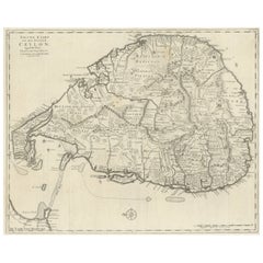
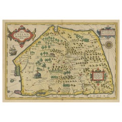
Large Antique Map of Ceylon, Sri Lanka
Located in Langweer, NL
map of Sri Lanka. Originates from 'Oud en Nieuw Oost Indien (..)' by F. Valentijn, 1724. Francois
Category

Antique Mid-18th Century Maps

Materials

Paper

Large Antique Map of Ceylon, Sri Lanka
H 19.18 in W 24.22 in D 0.02 in
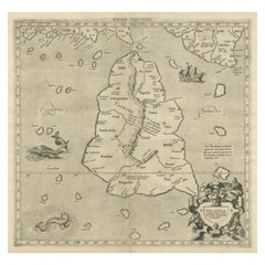
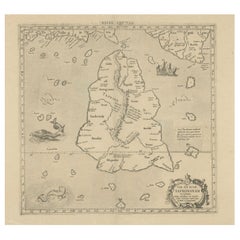
Mercator's Ptolemaic map of Taprobana, (Ceylon) Sri Lanka
Located in Langweer, NL
Antique map titled 'Asiae XII Tab'. Mercator's Ptolemaic map of Taprobana. The map shows Ptolemy's
Category

Antique 16th Century Maps

Materials

Paper

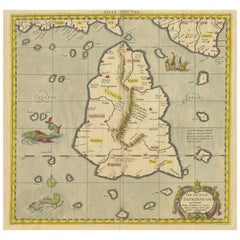
Antique Ptolemaic Map of Ceylon or nowadays Sri Lanka
Located in Langweer, NL
Antique map titled 'Tab XII. Asiae Taprobanam'. Ptolemaic map of Sri Lanka. Ptolemy drew on the
Category

Antique Mid-18th Century Maps

Materials

Paper

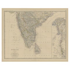
Old Map of Southern India and Ceylon 'Sri Lanka', 1882
Located in Langweer, NL
Antique map titled 'India (Southern Sheet)'. Old map of Southern India and Ceylon (Sri Lanka
Category

Antique 1880s Maps

Materials

Paper

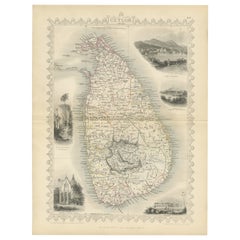
19th Century Illustrated Map of Ceylon (Sri Lanka) with Notable Landmarks
Located in Langweer, NL
the places on the map. The map of Ceylon, now known as Sri Lanka, from Tallis's series would be a
Category

Antique 1850s Maps

Materials

Paper

Antique Map of Sri Lanka with an unusual five-sided shape
Located in Langweer, NL
Antique map titled 'Ins. Ceilan quae incolis Tenarisin dicitur'. This exquisite, early map of Sri
Category

Antique Early 17th Century Maps

Materials

Paper

Rare Original Antique Ptolemy Map of Ceylon, Present Day Sri Lanka
Located in Langweer, NL
Original antique map titled 'Tab XII Asiae Taprobanam (..)'. For this map of Toprobana (Sri Lanka
Category

Antique Late 17th Century Maps

Materials

Paper

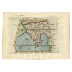
Antique Hand-Coloured Map of India, Sri Lanka, Maldives, ca.1599
Located in Langweer, NL
Title: Tabula Asiae XI - 1599 Very old and decorative map of India, Sri Lanka and the Maledives
Category

Antique 16th Century Maps

Materials

Paper

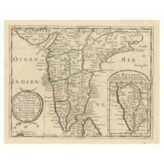
Original Antique Map showing Southern India, Northern Sri Lanka & Malabar, 1652
Located in Langweer, NL
part of India, including the northern part of Sri Lanka. With inset map of Southern India (Malabar
Category

Antique 1650s Maps

Materials

Paper

Rare Attractive Antique Map of Asia, India, Sri Lanka, Maldives, 1599
Located in Langweer, NL
Original Antique map of Asia, India, Ceylon (Sri Lanka), Maldives by Rosaccio / Ruscelli in
Category

Antique 16th Century European Maps

Materials

Paper

Antique German Map of India and Sri Lanka or Ceylon, 1902
By Meyer
Located in Langweer, NL
Antique map titled 'Ostindien.' (Map of India with an inset map of East-Bengal.) This attractive
Category

20th Century Maps

Materials

Paper

Original Antique Map of Southern India and Ceylon 'Present-Day Sri Lanka'
By Jakob van der Schley
Located in Langweer, NL
(..)'. Original antique map of Southern India and Ceylon (present-day Sri Lanka). This map originates from
Category

Antique Mid-18th Century Maps

Materials

Paper

Old Original Map of Chormandel & Malabar, India & Ceylon, Now Sri Lanka, 1726
Located in Langweer, NL
southern part of India and the northern tip of Ceylon, Sri Lanka. This map originates from 'Oud en Nieuw
Category

Antique 1720s Maps

Materials

Paper

Antique Map of Southern India, the Maldives and Sri Lanka with Currents
Located in Langweer, NL
Antique map titled 'Carte de la Partie Inferieure De L'Inde En Deca Du Gange (..)'. Interesting map
Category

Antique Late 18th Century Maps

Materials

Paper

Antique Map of Ceylon or Sri Lanka by Ptolemy/Mercator, circa 1695
Located in Langweer, NL
Antique map titled 'Tab XII Asiae Taprobanam'. Ptolemaic map of Taprobana (Sri Lanka). Ptolemy drew
Category

Antique Late 17th Century Maps

Materials

Paper

Antique Miniature Map of Ceylon 'Sri Lanka' and the Maldives by Bertius, 1618
Located in Langweer, NL
Ceylon/Sri Lanka and the Maldives. This map originates from 'Tabularum Geographicarum Contractarum Libri
Category

Antique Early 17th Century Maps

Materials

Paper

Map of Choromandel & Malabar, Incl Kerala, Tamil Nadu & Part of Sri Lanka, 1726
Located in Langweer, NL
edge of Sri Lanka. This map originates from 'Oud en Nieuw Oost-Indiën (..)' by François Valentyn
Category

Antique 1720s Maps

Materials

Paper

Antique 17th Century Map of the Islands Near Ceylon or Sri Lanka, 1672
Located in Langweer, NL
Antique map titled 'Eyland Ceylon.' Map of the islands near Ceylon or Sri Lanka. Dutch text on
Category

Antique 17th Century Maps

Materials

Paper

Old Map of Ceylon 'Sri Lanka' with The North Oriented to The Left, 1731
Located in Langweer, NL
Description: Antique map Ceylon titled 'Nieuwe Kaart van t Eland Ceilon'. Old map of present
Category

Antique 1730s Maps

Materials

Paper

Antique Map of Hindustan, or India
Located in Langweer, NL
Antique map titled 'Hindoostan, or India'. Original antique map of India (Hindustan) and Sri Lanka
Category

Antique Early 19th Century Maps

Materials

Paper

Antique Map of Hindustan, or India
H 10.52 in W 8.19 in D 0.02 in
Antique Map of India to Southeast Asia
Located in Langweer, NL
Antique map titled 'Indes en-decà et au-delà du Gange'. Original old map of India to Southeast Asia
Category

Antique Mid-19th Century Maps

Materials

Paper

Antique Map of India to Southeast Asia
H 10.01 in W 12.05 in D 0.02 in
Print of a Dutch VOC Fort on the Peninsula Trincomalee, Ceylon (Sri Lanka), 1726
Located in Langweer, NL
-Berg (Trincomalee, Sri Lanka) The map is taken from: 'Oud en Nieuw Oost-Indiën' van François
Category

Antique 1720s Maps

Materials

Paper

Large Original Vintage Map of India, circa 1920
Located in St Annes, Lancashire
Great map of India Original color. Good condition / repair to some minor damage just above Sri
Category

Vintage 1920s English Maps

Materials

Paper

Large Original Vintage Map of India, circa 1920
No Reserve
H 19.5 in W 25 in D 0.07 in
Antique Map of Trincomalee and Tambalagam Bay, 1758
Located in Langweer, NL
Antique map titled 'Bay de Trinquemale'. Map of Trincomalee and Tambalagam Bay in Sri Lanka. While
Category

Antique 18th Century Maps

Materials

Paper

Antique Map of India and Ceylon by Lapie, 1842
Located in Langweer, NL
Lanka). This map originates from 'Atlas universel de géographie ancienne et moderne (..)' by Pierre M
Category

Antique Mid-19th Century Maps

Materials

Paper

Antique Map of India and Ceylon by Lapie, 1842
H 19.89 in W 26.78 in D 0.02 in
Original Antique Map of Malabar, Coromandel 'India' and Ceylon
Located in Langweer, NL
(..)'. Large and attractive original hand colored map of Sri Lanka and the Southern part of the Indian
Category

Antique Mid-18th Century Maps

Materials

Paper

Antique Map of India and Southeast Asia by Sanson '1654'
Located in Langweer, NL
Antique map titled 'Partie Meridionale de l'Inde'. Early map of India and Southeast Asia. The map
Category

Antique Mid-17th Century Maps

Materials

Paper

Antique Map of the Islands Near Ceylon by Baldaeus, 1672
By Philip Baldaeus
Located in Langweer, NL
, Hammenhiel, Bramines, Dona Clara and Deserta near Ceylon / Sri Lanka, with their Dutch names. Dutch text on
Category

Antique 17th Century Maps

Materials

Paper

Original Hand-colored Antique Map of the Southern Part of India
Located in Langweer, NL
Antique map titled 'Orarum Malabariae, Coromandelae &c Tabula Accuratissima - Carte des Cotes de
Category

Antique Early 18th Century Maps

Materials

Paper

Antique Map of India during the height of the Mughal Imperial Expansion, 1713
Located in Langweer, NL
Antique map titled 'L'Inde de ca le Gange (..)'. Beautiful original antique map embracing most of
Category

Antique Early 18th Century Maps

Materials

Paper

Detailed Decorative Antique Map of the Coast of Malabar and Coromandel, India
Located in Langweer, NL
Antique map titled 'Carte des Côtes de Malabar et de Coromandel'. Finely engraved map of the
Category

Antique Mid-18th Century Maps

Materials

Paper

Charting the Course of Empire: Bonne's 1770 Masterpiece Maps of the Indian Ocean
Located in Langweer, NL
A voyage through history with an exquisite collection of Rigobert Bonne's 1770 maps, as featured in
Category

Antique 1770s Maps

Materials

Paper

Attractive Detailed Map of the Empire of the Great Mogul, Incl India, 1731
Located in Langweer, NL
Antique map titled 'Nieuwe Kaart van t Keyzer Ryk Grooten Mogol.' Attractive detailed map of
Category

Antique 1730s Maps

Materials

Paper

Rare Engraved Antique Map of India with Elephants in the Cartouche, c.1725
Located in Langweer, NL
map of India, with part of Sri Lanka. Compass rose and decorative cartouche lower right with scale and
Category

Antique 18th Century Maps

Materials

Paper

Antique Map of Southern Asia with India, the Maldives, Ceylon and Arabia, c.1700
Located in Langweer, NL
Stunning Old Map of Asia. Description: Two-sheet map of Asia, joined. The left part of this
Category

Antique Early 18th Century Maps

Materials

Paper

Old Map of The Mughal Empire and the Indian Peninsula South of the Ganges, 1787
Located in Langweer, NL
This is a historical map titled "L'Empire Du Mogol, Et La Presqu Isle De L'Inde En Deca Du Gange
Category

Antique 1780s Maps

Materials

Paper

Original Antique Map of the Peninsula of India with Part of Ceylon by Wyld, 1844
Located in Langweer, NL
This extensive map of India, spanning two sheets, draws from Reynell’s original map and
Category

Antique Mid-18th Century Maps

Materials

Paper

A Rare and Old Trapezoidal Projection of the Ganges and Himalaya Range in India
Located in Langweer, NL
. The top of a large unnamed Sri Lanka appears at bottom. Latin text on verso. This map originates from
Category

Antique 16th Century Maps

Materials

Paper

Cartographic Elegance: The British Raj's India, 1882 Atlas by Blackie and Son
Located in Langweer, NL
These two maps are part of an 1882 atlas published by Blackie and Son, a notable publishing company
Category

Antique 1880s Maps

Materials

Paper

18th Century Cartographic Depiction of Upper India and Ceylon, 1835
Located in Langweer, NL
, showcasing detailed renderings of India and Ceylon (now known as Sri Lanka). The maps reflect the
Category

Antique 1830s Maps

Materials

Paper

Renaissance Mapping of Sumatra: Featuring Singapore in Münster’s Woodcut, c.1590
Located in Langweer, NL
Description: Antique map titled 'Sumatra ein grosse Insel / so von den alten Geographen Taprobana
Category

Antique 16th Century Maps

Materials

Paper

Antique Print of the Malabar Coast of India showing the VOC establishments, 1726
Located in Langweer, NL
-Berg (Trincomalee, Sri Lanka) The map is taken from: 'Oud en Nieuw Oost-Indiën' van François
Category

Antique 1720s Maps

Materials

Paper

"Choke II: Palk Strait (India & Sri Lanka)" - ceramic - map - Louise Nevelson
By Gregor Turk
Located in Atlanta, GA
This ceramic wall sculpture features a topographic map in black and white. Gregor is inspired by
Category

2010s Abstract Sculptures

Materials

Ceramic

Original Vintage Pictorial Map Poster Ceylon Tea And Other Industries Sri Lanka
By "Leslie MacDonald ""Max"" Gill"
Located in London, GB
) on a map of Ceylon / Sri Lanka with illustrations of trees, animals and ships and the city and place
Category

Vintage 1940s British Posters

Materials

Paper

Antique Print of Don Pedro in Ceylon or Sri Lanka, 1726
Located in Langweer, NL
Overall size: 21 x 33.5 cm. Image size: 17.5 x 15 cm. We sell original antique maps to collectors
Category

Antique 18th Century Prints

Materials

Paper

Antique Print of Adam's Peak in Sri Lanka, by Arkstee & Merkus, 1761
Located in Langweer, NL
central Sri Lanka. This print originates from 'Histoire generale des voyages ou nouvelle collection de
Category

Antique 18th Century Prints

Materials

Paper

Antique Print of the Churches of Cathay and Sundecouli 'Ceylon, Sri Lanka'
Located in Langweer, NL
Antique map titled 'Cathay, Sundecouli'. View of two churches on Ceylon / Sri Lanka, This print
Category

Antique Mid-18th Century Prints

Materials

Paper

Antique Print of a Funeral on Ceylon 'Sri Lanka' is Asia, 1672
Located in Langweer, NL
sell original antique maps to collectors, historians, educators and interior decorators all over the
Category

Antique 17th Century Prints

Materials

Paper

Antique Print of a Church in Oudewil in Ceylon or Nowadays Sri Lanka, 1672
Located in Langweer, NL
Antique print titled 'Oudewil'. View of a church in Oudewil, Ceylon/Sri Lanka. This print was
Category

Antique 17th Century Prints

Materials

Paper

MacDonald Gill's 1937 original map, titled A Great Industry Where Our Tea Comes
By "Leslie MacDonald ""Max"" Gill"
Located in PARIS, FR
MacDonald Gill's 1937 original map, titled "A Great Industry Where Our Tea Comes," stands as a
Category

1930s Prints and Multiples

Materials

Lithograph, Paper, Linen

Original Vintage Illustrated Map Poster Empire Industry Where Our Tea Comes From
Located in London, GB
version depicting colourful illustrated maps of India and Ceylon (now Sri Lanka) featuring the city names
Category

Vintage 1930s British Posters

Materials

Paper

Antique Print of Figures and an Elephant on Ceylon, 1726
Located in Langweer, NL
Untitled print of various figures and an elephant on Ceylon, Sri Lanka. Text on verso. This print
Category

Antique 18th Century Prints

Materials

Paper

Original Vintage Pictorial Map Poster Ceylon Tea And Other Industries Sri Lanka
By "Leslie MacDonald ""Max"" Gill"
Located in London, GB
) on a map of Ceylon / Sri Lanka with illustrations of trees, animals and ships and the city and place
Category

1940s More Prints

Materials

Paper

Original Vintage Illustrated Map Poster Empire Industry Where Our Tea Comes From
Located in London, GB
version depicting colourful illustrated maps of India and Ceylon (now Sri Lanka) featuring the city names
Category

1930s More Prints

Materials

Paper

Ptolemaic map of India and Himalayan mountains by Mercator - Engraving - 17th c.
By Gerard Mercator
Located in Zeeland, Noord-Brabant
Ptolemaic map covering India. The Himalayan Mountains stretch across the top of the map and the Indus and
Category

1690s Old Masters More Prints

Materials

Engraving

Oost Indien Wassende-Graade Paskaart
By Johannes van Keulen
Located in La Jolla, CA
A hugely desirable map for Western Australia, Southeast Asia and the Indian Ocean generally. This
Category

Antique 1690s Dutch Baroque Prints

Materials

Paper

Oost Indien Wassende-Graade Paskaart
H 24 in W 31.5 in D 1 in
Stunning Antique Map of the Island Ceylon or Sri Lanka
By Gerard Mercator
Located in Langweer, NL
Antique map titled 'Ins. Ceilan quae incolis Tenarisin dicitur'. This exquisite, early map of Sri
Category

Antique Early 17th Century Maps

Materials

Paper

Antique Map of India and Ceylon by Lowry, '1852'
Located in Langweer, NL
Original map of India and Ceylon (Sri Lanka). This map originates from 'Lowry's Table Atlas
Category

Antique Mid-19th Century Maps

Materials

Paper

Antique Map of Southern India by Churchill, c.1704
Located in Langweer, NL
"Antique map titled 'A Map of the Coast of Malabar, Madura and Cormendel'. Antique map depicting
Category

Antique 18th Century Maps

Materials

Paper

Antique Map of the Island of Ceylon by W. G. Blackie, 1859
Located in Langweer, NL
Antique map titled 'The Island of Ceylon'. Original antique map of the Island of Ceylon (Sri Lanka
Category

Antique Mid-19th Century Maps

Materials

Paper

  • 1
Get Updated with New Arrivals
Save "Lanka Map", and we’ll notify you when there are new listings in this category.

Lanka Map For Sale on 1stDibs

With a vast inventory of beautiful furniture at 1stDibs, we’ve got just the lanka map you’re looking for. Frequently made of paper, every lanka map was constructed with great care. Your living room may not be complete without a lanka map — find older editions for sale from the 18th Century and newer versions made as recently as the 20th Century. A well-made lanka map has long been a part of the offerings for many furniture designers and manufacturers, but those produced by Meyer are consistently popular.

How Much is a Lanka Map?

A lanka map can differ in price owing to various characteristics — the average selling price 1stDibs is $636, while the lowest priced sells for $80 and the highest can go for as much as $1,350.

Read More

Pamela Shamshiri Shares the Secrets behind Her First-Ever Book and Its Effortlessly Cool Interiors

The sought-after designer worked with the team at Hoffman Creative to produce a monograph that beautifully showcases some of Studio Shamshiri's most inspiring projects.

Moroccan Artworks and Objects Take Center Stage in an Extraordinary Villa in Tangier

Italian writer and collector Umberto Pasti opens the doors to his remarkable cave of wonders in North Africa.

Montecito Has Drawn Royalty and Celebrities, and These Homes Are Proof of Its Allure

Hollywood A-listers, ex-pat aristocrats and art collectors and style setters of all stripes appreciate the allure of the coastal California hamlet — much on our minds after recent winter floods.

Whaam! Blam! Pow! — a New Book on Pop Art Packs a Punch

Publishing house Assouline and writer Julie Belcove have teamed up to trace the history of the genre, from Roy Lichtenstein, Andy Warhol and Yayoi Kusama to Mickalene Thomas and Jeff Koons.

The Sparkling Legacy of Tiffany & Co. Explained, One Jewel at a Time

A gorgeous new book celebrates — and memorializes — the iconic jeweler’s rich heritage.

What Makes a Gem-Encrusted Chess Set Worth $4 Million?

The world’s most opulent chess set, weighing in at 513 carats, is literally fit for a king and queen.

Tauba Auerbach’s Geometric Pop-Up Book Is Mighty Rare, Thanks to a Hurricane

This sculptural art book has an epic backstory of its own.

Step inside the Storied Mansions of Palm Beach’s Most Effervescent Architect

From Spanish-style courtyards to fanciful fountains, these acclaimed structures abound in surprising and elegant details.