Items Similar to Cartographic Elegance: The British Raj's India, 1882 Atlas by Blackie and Son
Want more images or videos?
Request additional images or videos from the seller
1 of 9
Cartographic Elegance: The British Raj's India, 1882 Atlas by Blackie and Son
About the Item
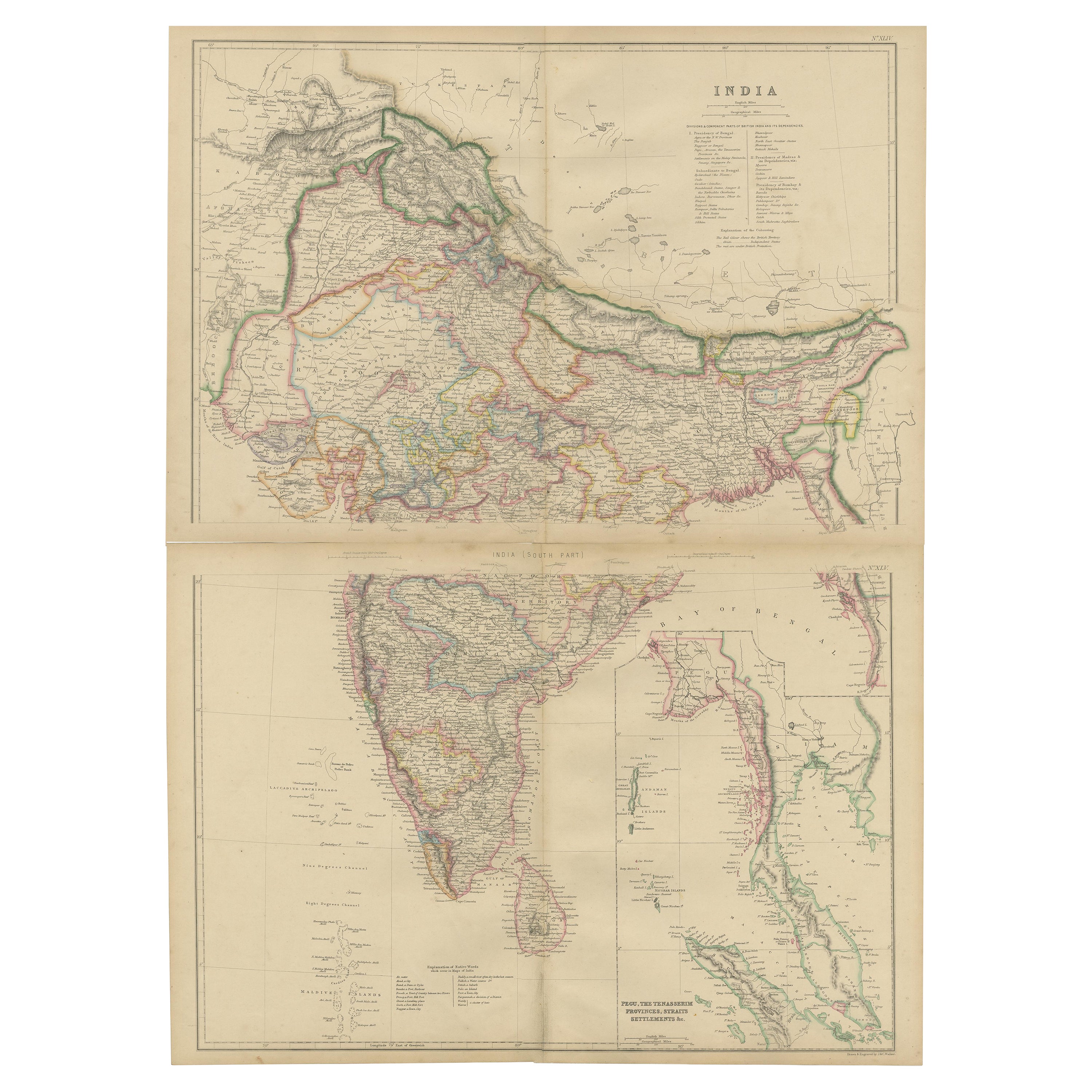
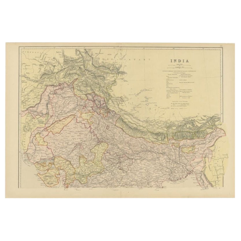
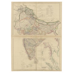
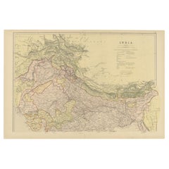
These two maps are part of an 1882 atlas published by Blackie and Son, a notable publishing company in the 19th century known for their educational books and detailed atlases. The maps represent the geographical understanding of India during the British Raj, with an impressive degree of detail and accuracy for the time.
The northern map includes the Himalayan frontier, with color-coded regions denoting various provinces and princely states such as Punjab, Kashmir, and Nepal. Each region is outlined with distinct colors like red and yellow, and the map is rich with place names, including cities, rivers, and mountain ranges. This part of the map also extends into Central Asia, indicating areas labeled as 'Turkestan,' reflecting the interest and influence of the British Empire in the region.
The southern map details the subcontinent from the central plains downward, incorporating the Deccan Plateau, the Eastern and Western Ghats, and extending to the southernmost point of the Indian peninsula. The island of Ceylon, now known as Sri Lanka, is prominently featured along with the coastal outlines and internal administrative boundaries. The Maldives and Lakshadweep archipelagos are also depicted, showcasing the expanse of British nautical knowledge.
Both maps display an overlay of longitude and latitude lines, indicative of their navigational utility. The legends and notations, written in English, provide information about the transportation routes, including railways, which were an essential aspect of colonial administration and economic activity at the time. These maps would have served as critical tools for travel, trade, and governance during the period of British colonial rule in India. The meticulous craftsmanship of these maps provides a window into the era's cartography and the geopolitical landscape as perceived by the British.
- Dimensions:Height: 14.97 in (38 cm)Width: 22.45 in (57 cm)Depth: 0 in (0.02 mm)
- Sold As:Set of 2
- Materials and Techniques:
- Period:
- Date of Manufacture:1882
- Condition:Good condition, folding line in the middle of both maps. The outer borders are slightly discolored due to age, but not the image. This two maps is ideal for joined framing. Study the images carefully.
- Seller Location:Langweer, NL
- Reference Number:
About the Seller
5.0
Platinum Seller
These expertly vetted sellers are 1stDibs' most experienced sellers and are rated highest by our customers.
Established in 2009
1stDibs seller since 2017
1,919 sales on 1stDibs
Typical response time: <1 hour
- ShippingRetrieving quote...Ships From: Langweer, Netherlands
- Return PolicyA return for this item may be initiated within 14 days of delivery.
More From This SellerView All
- Vintage Cartographic Collection Set of India Explored - W. G. Blackie's 1859Located in Langweer, NLAntique map titled 'India'. Original antique map of India with inset maps of Pegu, the Tenasserim Provinces, straits settlements. This map originate...Category
Antique Mid-19th Century Maps
MaterialsPaper
- Antique Map of Northern India by Blackie & Son, 1860Located in Langweer, NLAntique map titled 'India'. Old map depicting northern India. This map originates from 'The Comprehensive Atlas & Geography of the World, Compiled and Engraved from the most Authenti...Category
Antique 19th Century Maps
MaterialsPaper
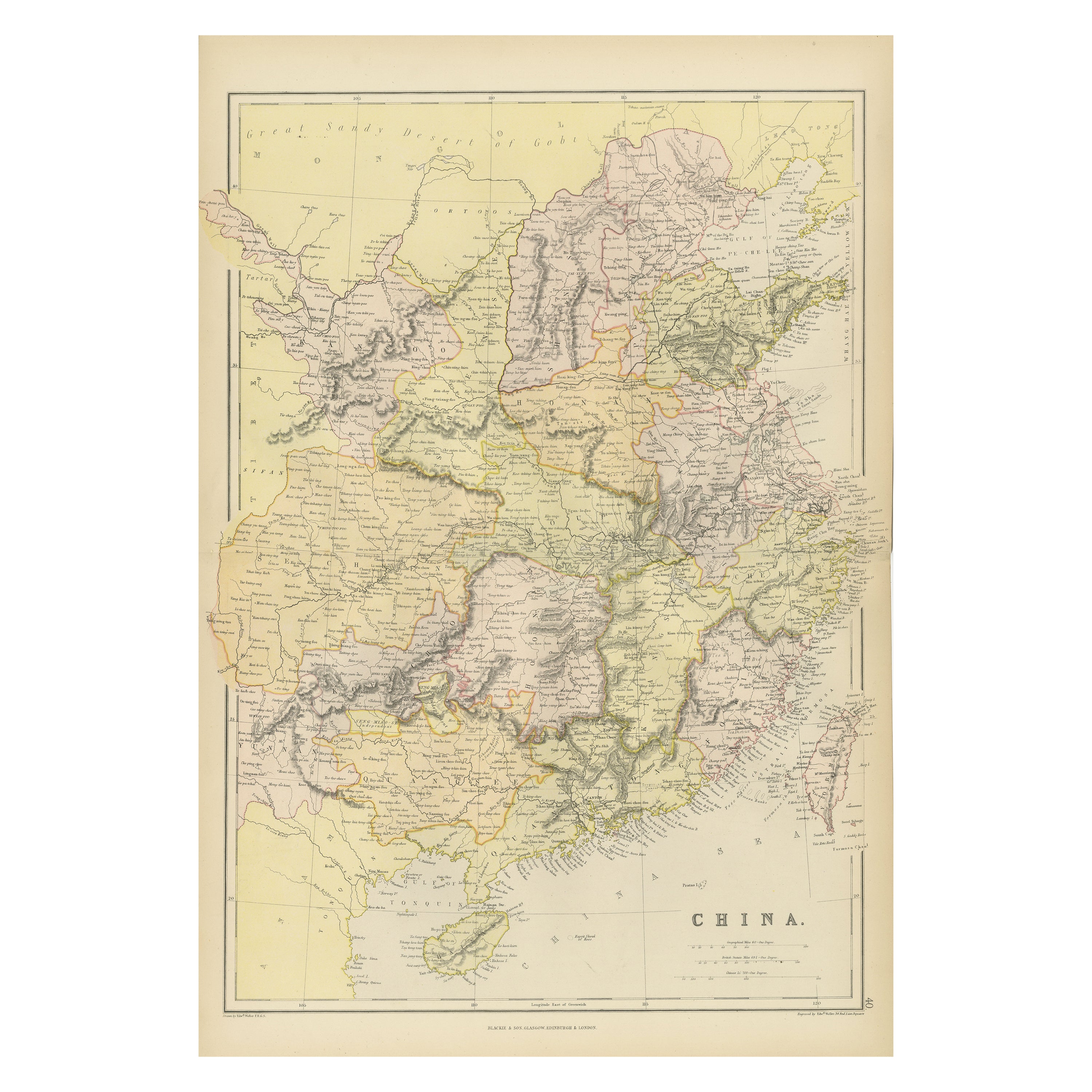
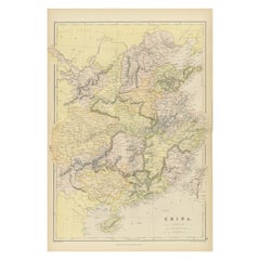
- Antique 19th Century Map of China by Blackie & Son, 1882Located in Langweer, NLThis map is an 1882 Blackie & Son map of China. The title "CHINA." is prominently displayed at the bottom. The map is colored to differentiate various regions, possibly indicating di...Category
Antique 1880s Maps
MaterialsPaper
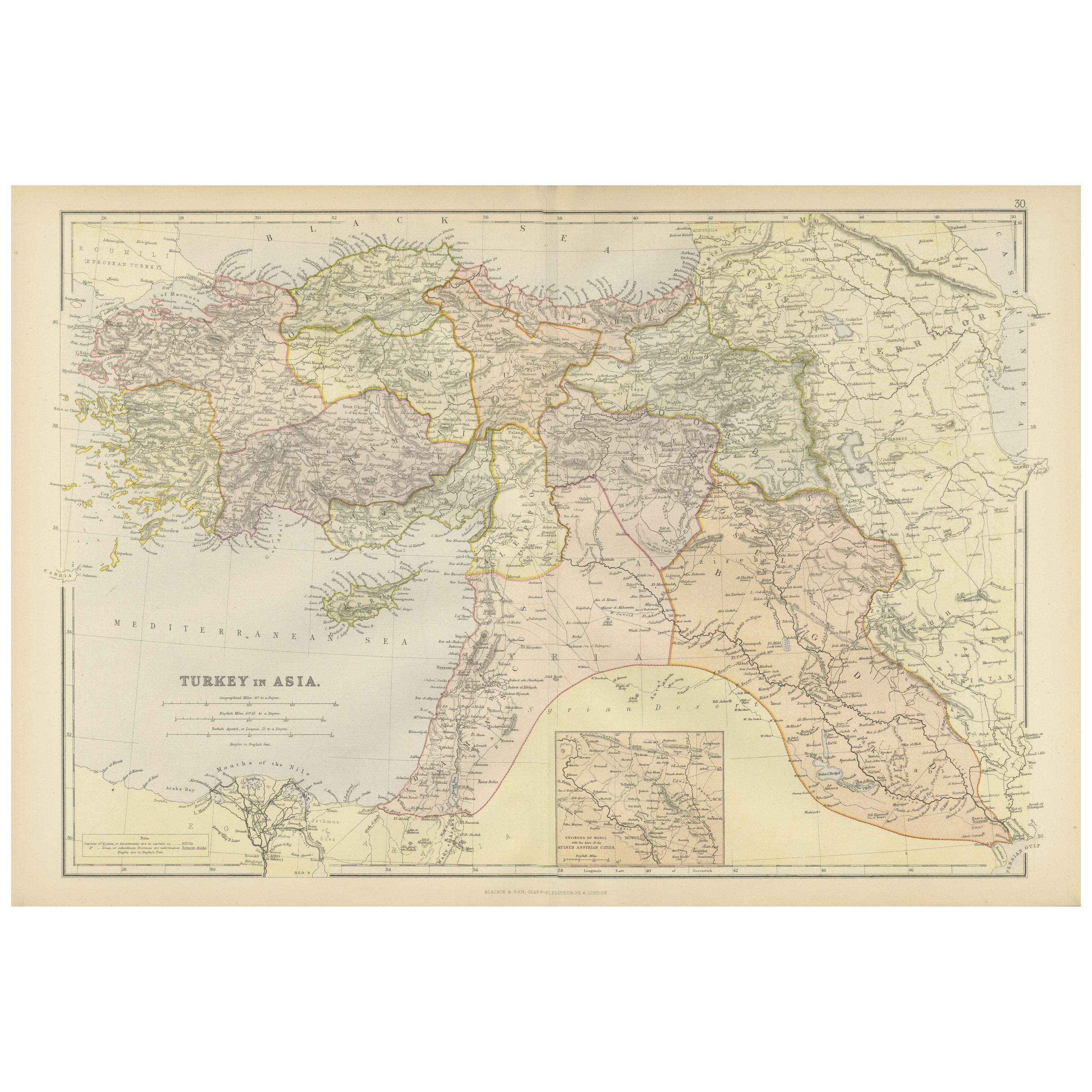
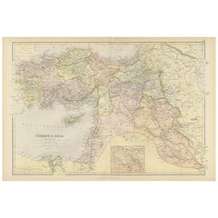
- Empire's Crossroads: An 1882 Map of Turkey in Asia by Blackie & SonLocated in Langweer, NLThis map, titled "Turkey in Asia," is another detailed illustration from the 1882 atlas by Blackie & Son. It showcases the vastness of the Asian territories of the Ottoman Empire, sp...Category
Antique 1880s Maps
MaterialsPaper
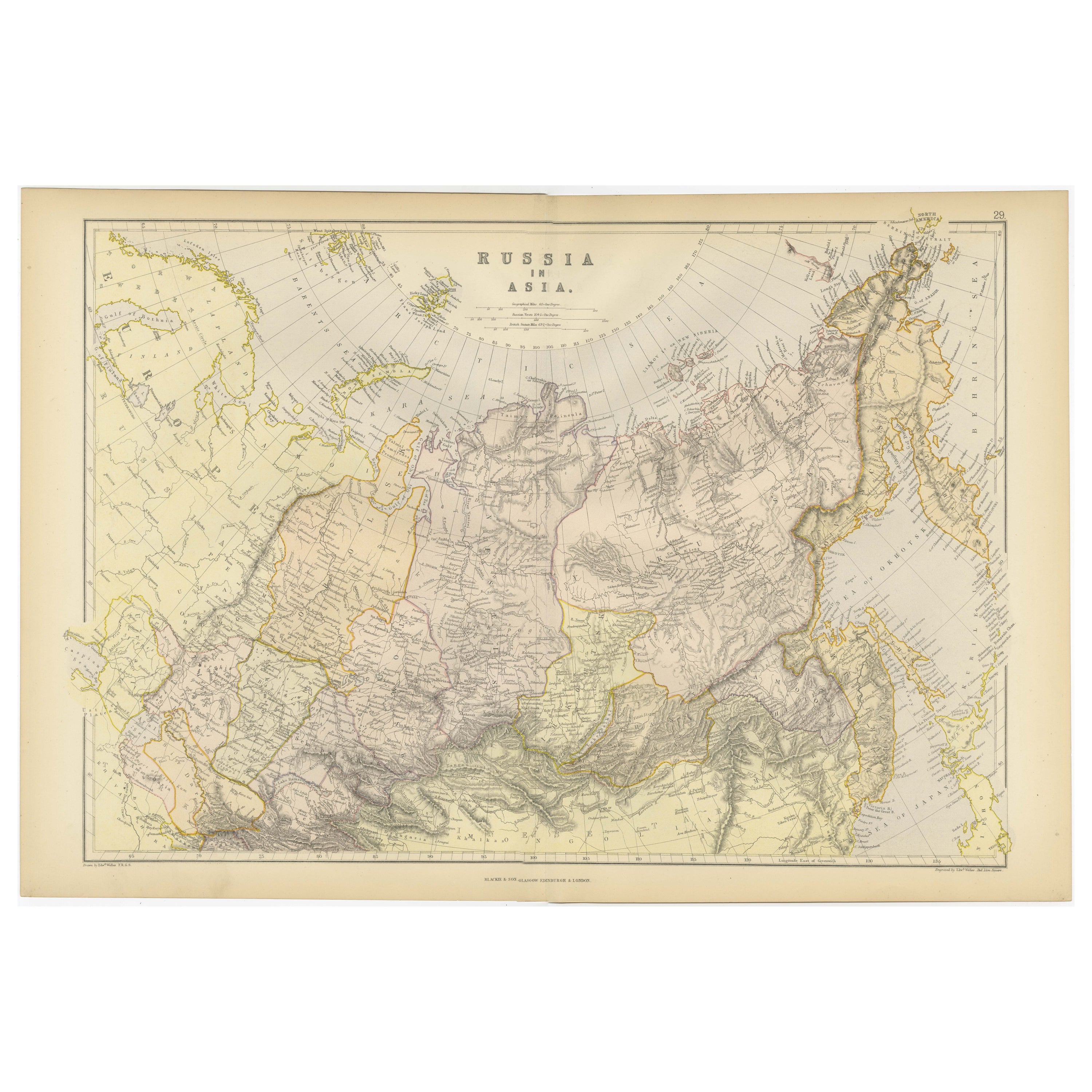
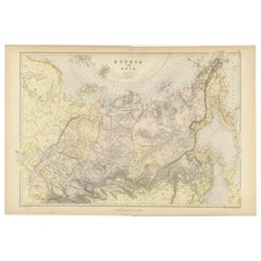
- Detailed Antique Cartography of Asian Russia, 1882Located in Langweer, NLThis exquisite map, hailing from the year 1882, is a remarkable historical cartographic artifact, which was included as part of the prestigious 'Comprehensive Atlas and Geography of ...Category
Antique 1880s Maps
MaterialsPaper
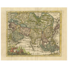
- Cartographic Elegance: The Art and Science of 17th-Century Asian Maps, ca.1681Located in Langweer, NLThis original antique map is an artifact from a pivotal era in cartography, reflecting not only the geographical knowledge of its time but also the intertwining of art and science in...Category
Antique 1680s Maps
MaterialsPaper
You May Also Like
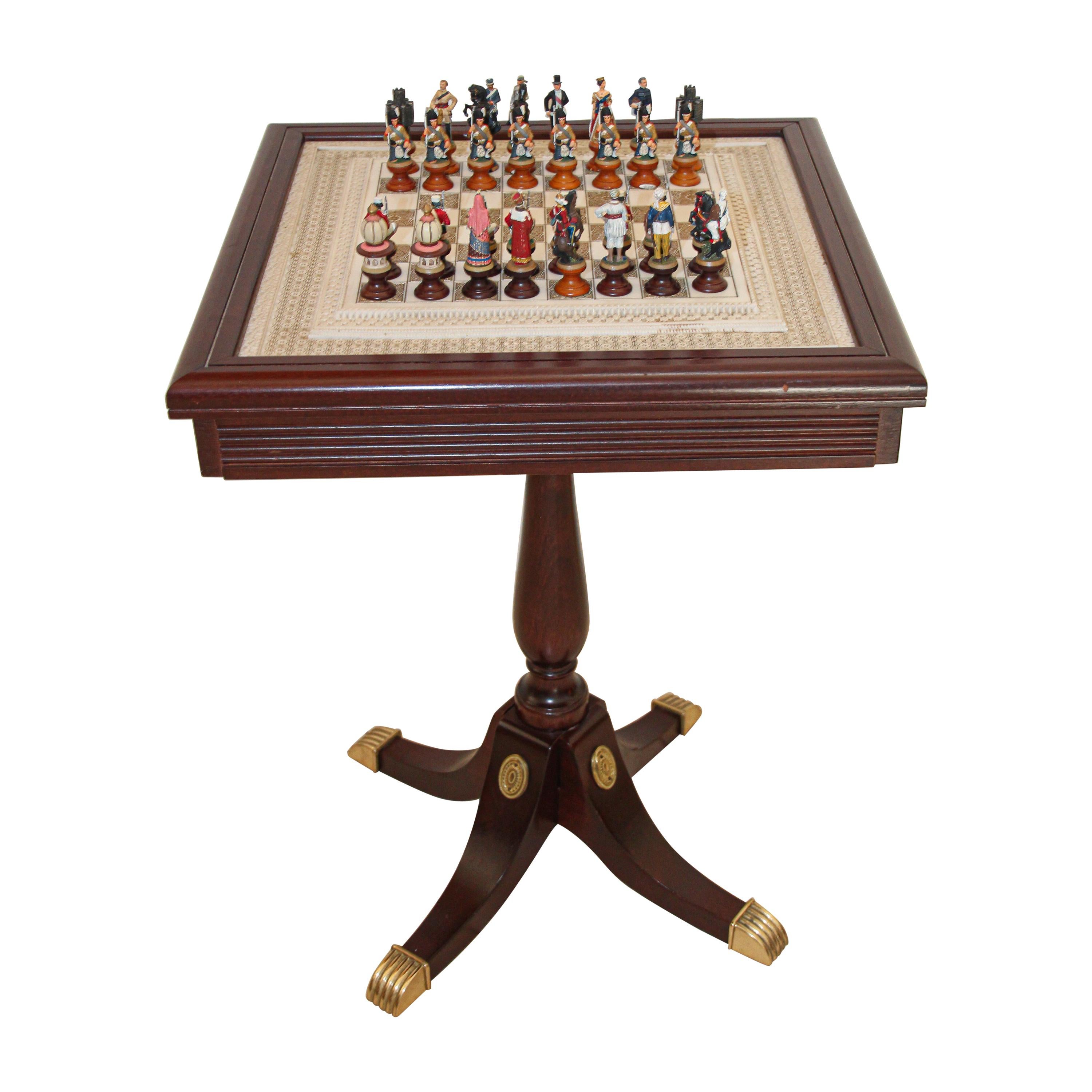
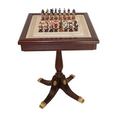
- The Raj Hand Painted India-British War 1857 Game Chess with TableLocated in North Hollywood, CARare – 1987 Franklin Mint ‘The Raj’ Chess Set "The RAJ" hand painted India-British War 1857, Franklin Mint highest quality metal chess set game year 1...Category
20th Century Malaysian Anglo Raj Games
MaterialsMarble, Bronze
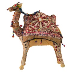
- Vintage Raj Handcrafted Camel Toy India, 1950Located in North Hollywood, CAVintage Raj embroidered large camel toy, India, 1950. Handmade in Rajasthan, India, colorful fabric camel toy. Vintage oversized camel stuffed cotton embroidered and decorated with...Category
Mid-20th Century Indian Moorish Toys and Dolls
MaterialsCotton
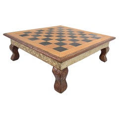
- Anglo Raj Hand-Crafted Game Chess Low Table IndiaLocated in North Hollywood, CAThe board is nicely carved with Rajasthani designs at the rim, the sides and feet are covered with clad silver metal hammered with Moorish Raj designs. In good vintage condition. ...Category
Mid-20th Century Indian Anglo Raj Games
MaterialsMetal, Bronze, Brass
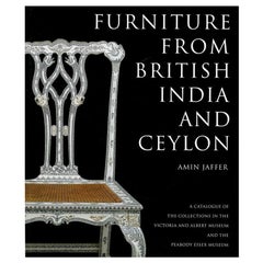
- Furniture from British India and Ceylon by Amin Jaffer (Book)Located in North Yorkshire, GBA hardback book with dust jacket in very good condition by noted expert Amin Jaffer. This is the first book to deal in depth with the subject of colonial Indian furniture...Category
Antique 19th Century Books
MaterialsPaper
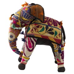
- Vintage Handcrafted Stuffed Cotton Embroidered Ceremonial Elephant Toy Raj IndiaLocated in North Hollywood, CAVintage Raj hand-crafted stuffed cotton embroidered elephant, India, 1950. Collectible, one of a kind, Anglo Raj vintage hand-crafted stuffed cotton embroidered elephant. Handmade in Rajasthan, India using recycled colorful vintage fabric to make this beautiful elephant toy. Vintage small elephant stuffed cotton embroidered and decorated with small mirrors, great collector piece. Anglo Raj, small stuffed elephant...Category
Mid-20th Century Indian Anglo Raj Toys and Dolls
MaterialsTextile
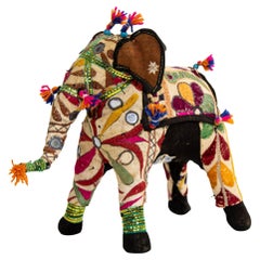
- Vintage Raj Hand-Crafted Stuffed Cotton Embroidered Elephant, India, 1950Located in North Hollywood, CAVintage Raj Hand-Crafted Stuffed Cotton Embroidered Elephant, India, 1950. Anglo Raj vintage hand-crafted stuffed cotton embroidered elephant, India, 1950. Handmade in Rajasthan, India, colorful fabric elephant toy. Vintage small elephant stuffed cotton embroidered and decorated with small mirrors, great collector piece. Anglo Raj, small stuffed elephant...Category
Mid-20th Century Indian Anglo Raj Toys and Dolls
MaterialsFabric
Recently Viewed
View AllMore Ways To Browse
Engraved Cross
Collectors And Curiosities
Minature Map
Anguilla Map
James Calvert Smith
Winkler Prins
A Plan City And Castle Of Batavia
Malacca Strait Map
John Speed Isle Of Wight Maps
Antique Map Of Shanghai
Heinrich Kiepert On Sale
Old Teak Petite Artisan
Antique Maps Of Amsterdam
Antique Map Coats Of Arms
Albania Antique Map
Framed Map India
Maps Balkans
Paraguay Antique Map