Items Similar to Cartographic Elegance: The Art and Science of 17th-Century Asian Maps, ca.1681

Want more images or videos?
Request additional images or videos from the seller
1 of 9
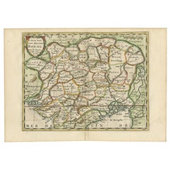
Cartographic Elegance: The Art and Science of 17th-Century Asian Maps, ca.1681
About the Item
This original antique map is an artifact from a pivotal era in cartography, reflecting not only the geographical knowledge of its time but also the intertwining of art and science in map-making.
The description indicates that it is an original colored copperplate print, which was a common technique used in the 17th century for producing maps. The copperplate engraving process involves etching or engraving the map onto a copper plate, which is then used to print the image onto paper. The addition of color was often done by hand, making each colored map from this period unique.
As for the cartographer, J. Harrewijn (also known as Jacques Harrewijn), he was an artist and engraver from the Low Countries, working around the late 17th century. While not as widely known as some of his contemporaries, Harrewijn contributed to the craft of mapmaking during a time often referred to as the "Golden Age of Cartography." This period was characterized by significant advancements in navigational techniques and a growing European interest in global exploration and trade. It was common during this era for cartographers to integrate current knowledge from explorers and scholars with decorative elements that made the maps not only informative but also visually appealing.
In terms of historical context, the map captures a time when the understanding of Asia's geography was evolving rapidly due to increased exploration and trade. The map's detail and artistic style provide insight into how Europeans of the time perceived the vast and diverse continent of Asia. The historical significance of such a map is profound, as it represents a bridge between ancient knowledge and the modern understanding of the world.
Asia's history, as mentioned, is vast and complex, with the development of civilizations across its various regions. It's important to recognize that while maps from this period attempted to be accurate, they were often influenced by the cartographer's limited knowledge and the geopolitical agendas of their patrons.
Given Harrewijn's contributions as a cartographer, his works would be of interest to historians, geographers, and collectors of antique maps. His engravings, like this map of Asia, serve as historical records that tell us about the state of geographical knowledge, as well as the artistry involved in the map-making process of his time.
- Dimensions:Height: 7.49 in (19 cm)Width: 9.22 in (23.4 cm)Depth: 0 in (0.02 mm)
- Materials and Techniques:Paper,Engraved
- Period:1680-1689
- Date of Manufacture:circa 1681
- Condition:Condition: good, given age. General age-related toning and/or occasional minor defects from handling. Please study scan carefully.
- Seller Location:Langweer, NL
- Reference Number:
About the Seller
5.0
Platinum Seller
These expertly vetted sellers are 1stDibs' most experienced sellers and are rated highest by our customers.
Established in 2009
1stDibs seller since 2017
1,916 sales on 1stDibs
Typical response time: <1 hour
- ShippingRetrieving quote...Ships From: Langweer, Netherlands
- Return PolicyA return for this item may be initiated within 14 days of delivery.
More From This SellerView All
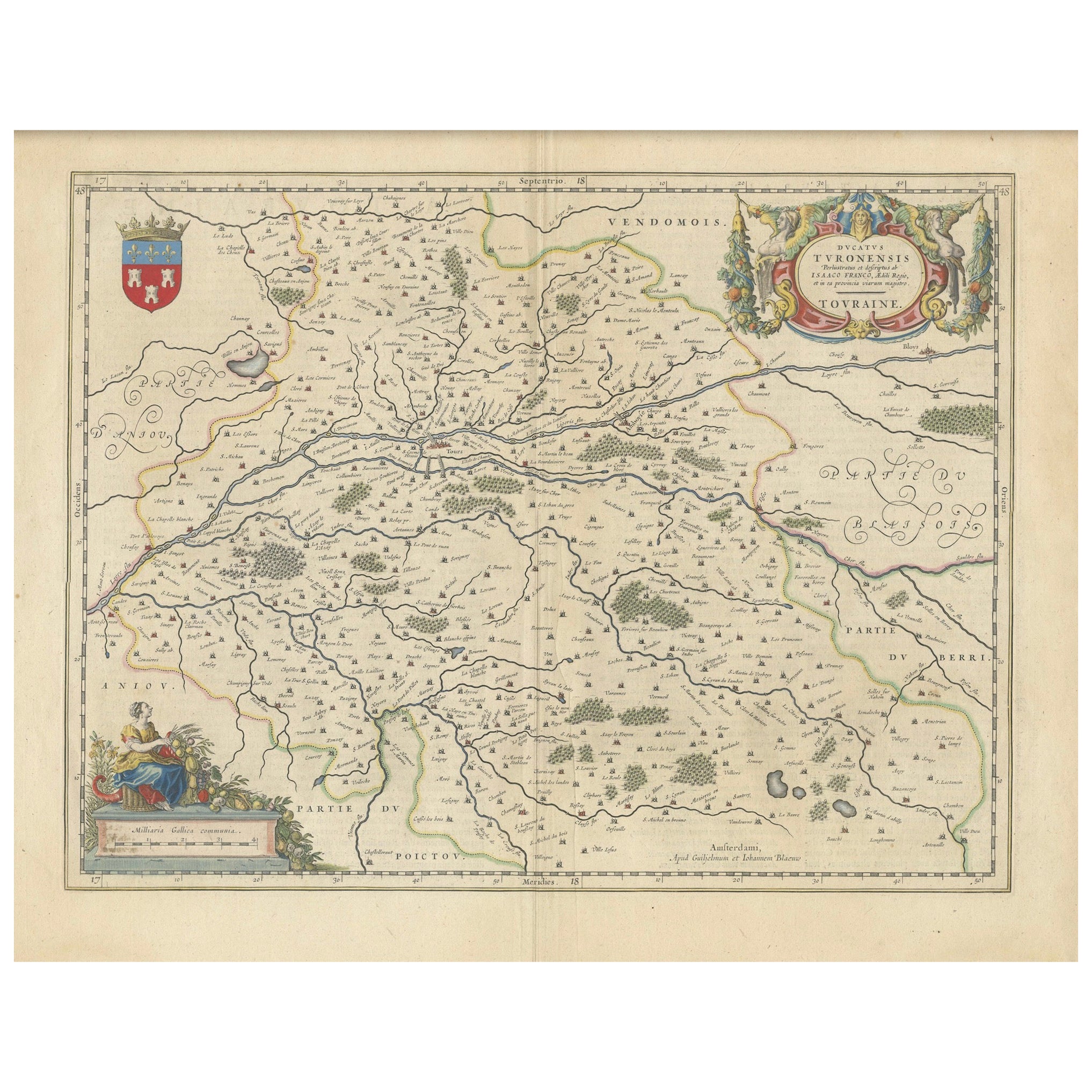
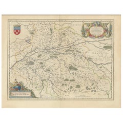
- Cartographic Elegance of Touraine: A 17th-Century Map Showing French HeritageLocated in Langweer, NL"Ducatus Turonensis - Touraine," is a original antique historical map of the Touraine region, which is located in the heart of France, centered...Category
Antique 1630s Maps
MaterialsPaper
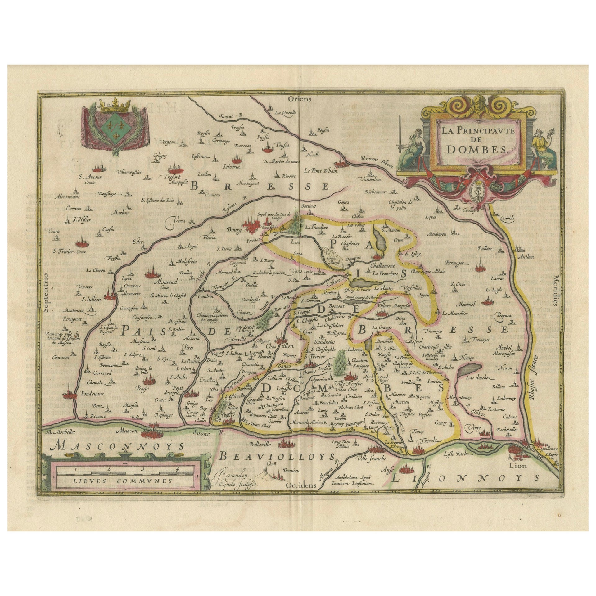
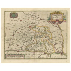
- The Principality of Dombes: A 17th-Century Cartographic Jewel by Jan JanssonLocated in Langweer, NLThe text on the map "La principaute de Dombes; J. van den Eynde sculpit.; La Principavte de Dombes" indicates that it is a map of the principality of Dombes, engraved by J. van den E...Category
Antique 1630s Maps
MaterialsPaper
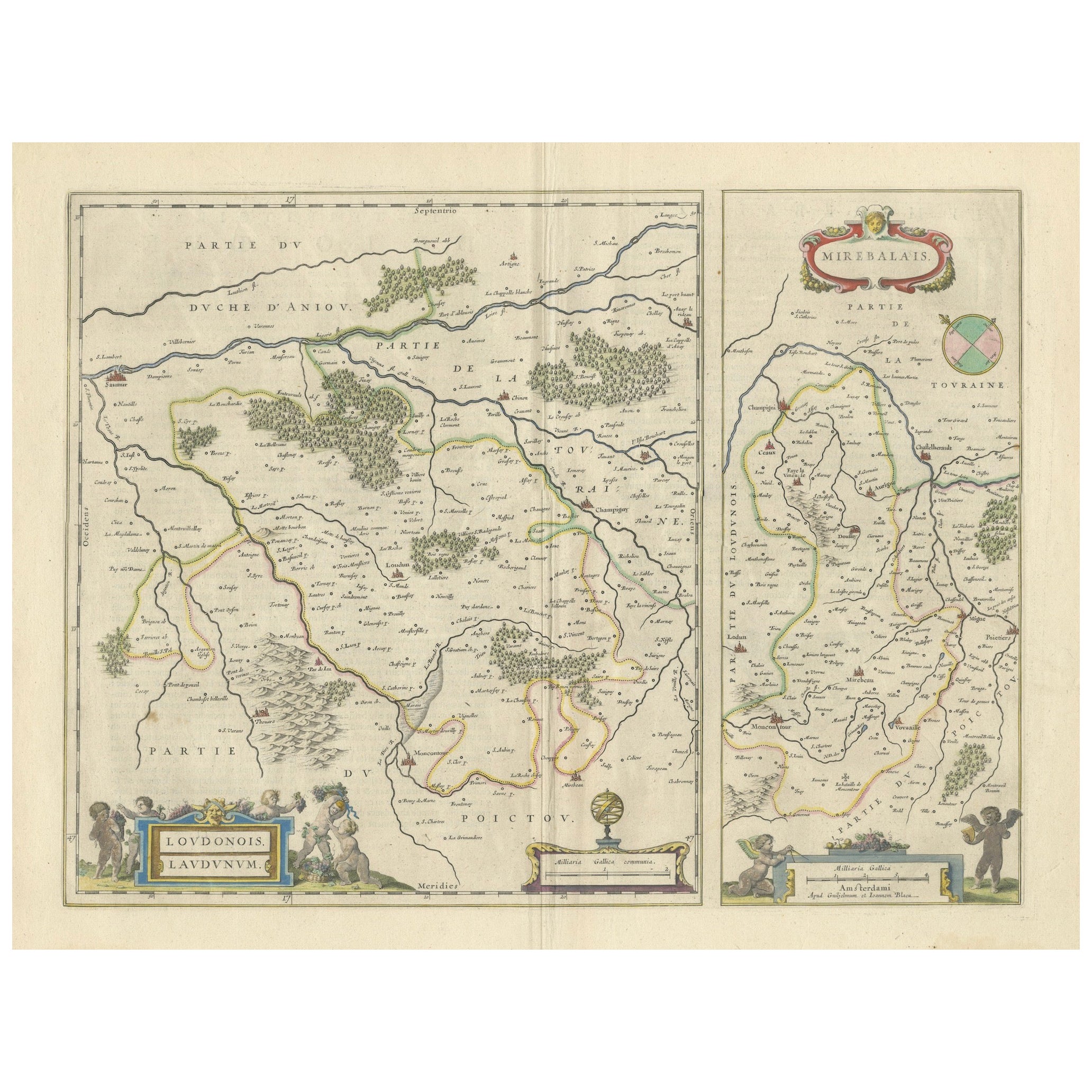
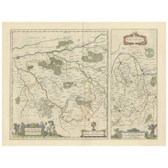
- Loudun and Mirebeau: A Cartographic Masterpiece of 17th Century France by BlaeuLocated in Langweer, NLCartography, 17th century. Willem (1571-1638) and Joan Blaeu (1596-1673), Theatrum Orbis Terrarum sive Atlas Novus..., 1635. Figure: Loudonois. Laudunum (Loudun); Mirebalais (Mirebea...Category
Antique 1650s Maps
MaterialsPaper
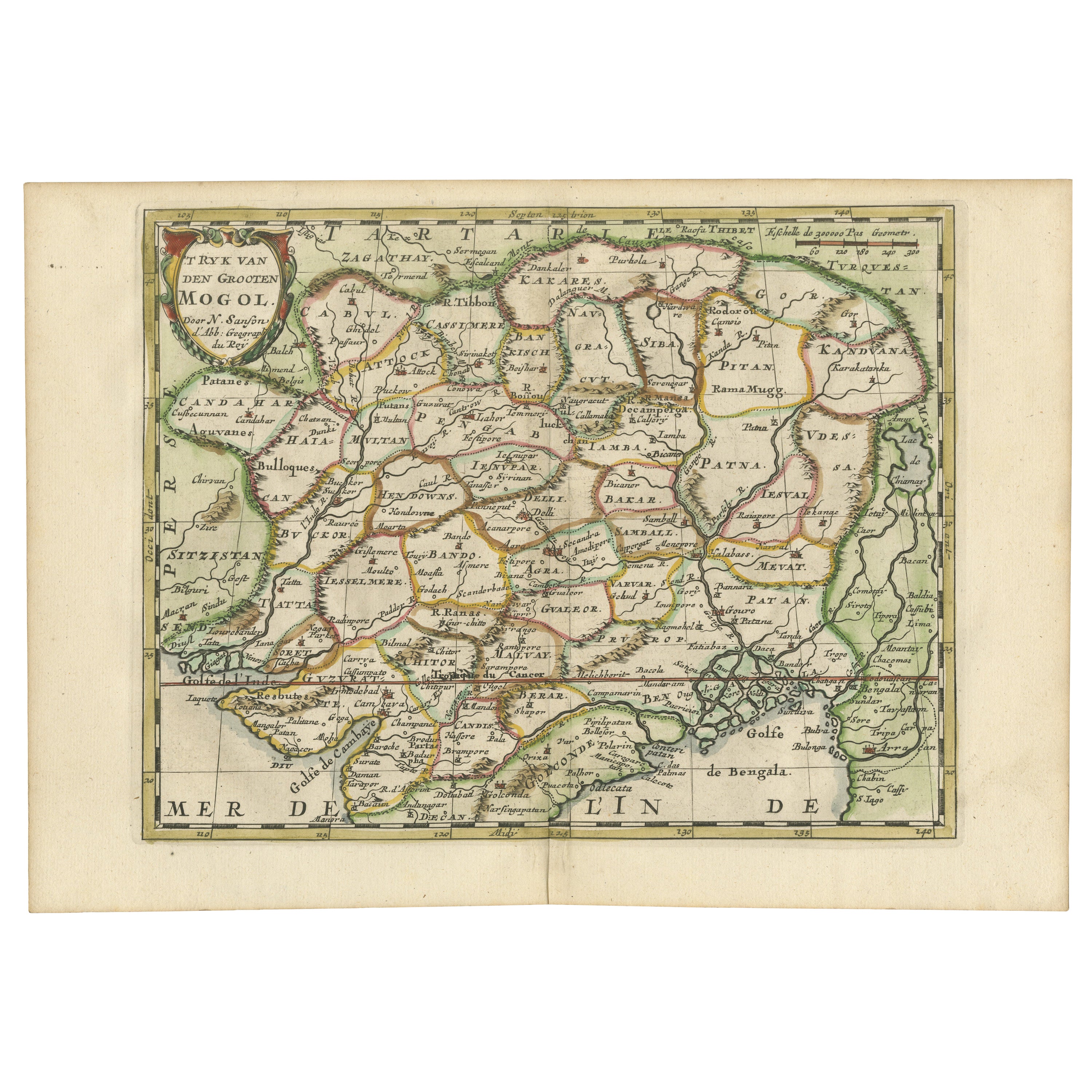
- Cartographic Elegance of the Mughal Dominion in a Hand-Colored Antique Map, 1705Located in Langweer, NLThis original antique map titled “'T Ryk van den Grooten Mogol” by Nicolas Sanson from 1705 is an interesting historical artifact. It depicts the extent of the Mughal Empire in North...Category
Antique Early 1700s Maps
MaterialsPaper
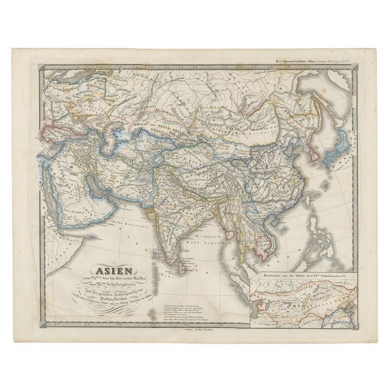
- Old Map of Asia Depicting Asia in the 6th through the 9th Centuries, ca. 1855Located in Langweer, NLAntique map Asia titled 'Asien vom VIten bis in die erste Haelfte des IXten Jahrhundert’s Zeit der grossfen Ausdehnung des Ralifen Reiches; des Reiche...Category
Antique 19th Century Maps
MaterialsPaper
- Cartographic Tapestry: Antique Map of Asia Minor, circa 1640Located in Langweer, NLTitle: "Historical Tapestry: Antique Map of Asia Minor, circa 1640" Description: This authentic antique map, created by Willem Blaeu and published in Amsterdam circa 1640, is a capt...Category
Antique Mid-17th Century Maps
MaterialsPaper

You May Also Like
- Vintage Reproduction 17th Century Map of Europe, American, Cartography, BlaeuwLocated in Hele, Devon, GBThis is a vintage reproduction map of Europe. An American, paper stock cartography print in frame after the work by Blaeuw, dating to the late 20t...Category
Late 20th Century Central American Mid-Century Modern Maps
MaterialsGlass, Wood, Paper
- 17th Century John Speed Map of the Barkshire Described, c.1616By John SpeedLocated in Royal Tunbridge Wells, KentAntique 17th century British very rare and original John Speed (1551-1629) map of the Barkshire Described, J. Sud and Georg Humble, publication (1616 or lat...Category
Antique 17th Century British Maps
MaterialsPaper
- 17th Century John Speed Map of Denbighshire, c.1610By John SpeedLocated in Royal Tunbridge Wells, KentAntique early 17th century British very rare and original John Speed, hand coloured map of Denbighshire, dated 1610, by John Sunbury and George Humble. John...Category
Antique 17th Century British Maps
MaterialsWood, Paper
- 17th Century Nicolas Visscher Map of Southeastern EuropeLocated in Hamilton, OntarioA beautiful, highly detailed map of southeastern Europe by Nicolas Visscher. Includes regions of Northern Italy (showing the cities Bologna, Padua, and Venice), Bohemia, Austria (sho...Category
Antique 17th Century Dutch Maps
MaterialsPaper
- The Holy Land at the Time of Jesus: A 17th Century Dutch Map by VisscherBy Nicolaes Visscher IILocated in Alamo, CAThis detailed Dutch map entitled "Het Beloofe de Landt Canaan door wandelt van onsen Salichmaecker Iesu Christo, nessens syne Apostelen" by Nicolaes Visscher was published in Amsterd...Category
Antique Mid-17th Century Dutch Maps
MaterialsPaper
- 17th Century Hand Colored Map of the Liege Region in Belgium by VisscherBy Nicolaes Visscher IILocated in Alamo, CAAn original 17th century map entitled "Leodiensis Episcopatus in omnes Subjacentes Provincias distincté divisusVisscher, Leodiensis Episcopatus" by Nicolaes Visscher II, published in Amsterdam in 1688. The map is centered on Liege, Belgium, includes the area between Antwerp, Turnhout, Roermond, Cologne, Trier and Dinant. This attractive map is presented in a cream-colored mat measuring 30" wide x 27.5" high. There is a central fold, as issued. There is minimal spotting in the upper margin and a tiny spot in the right lower margin, which are under the mat. The map is otherwise in excellent condition. The Visscher family were one of the great cartographic families of the 17th century. Begun by Claes Jansz Visscher...Category
Antique Late 17th Century Dutch Maps
MaterialsPaper


