Items Similar to Print of a Dutch VOC Fort on the Peninsula Trincomalee, Ceylon (Sri Lanka), 1726

Want more images or videos?
Request additional images or videos from the seller
1 of 6
Print of a Dutch VOC Fort on the Peninsula Trincomalee, Ceylon (Sri Lanka), 1726
About the Item
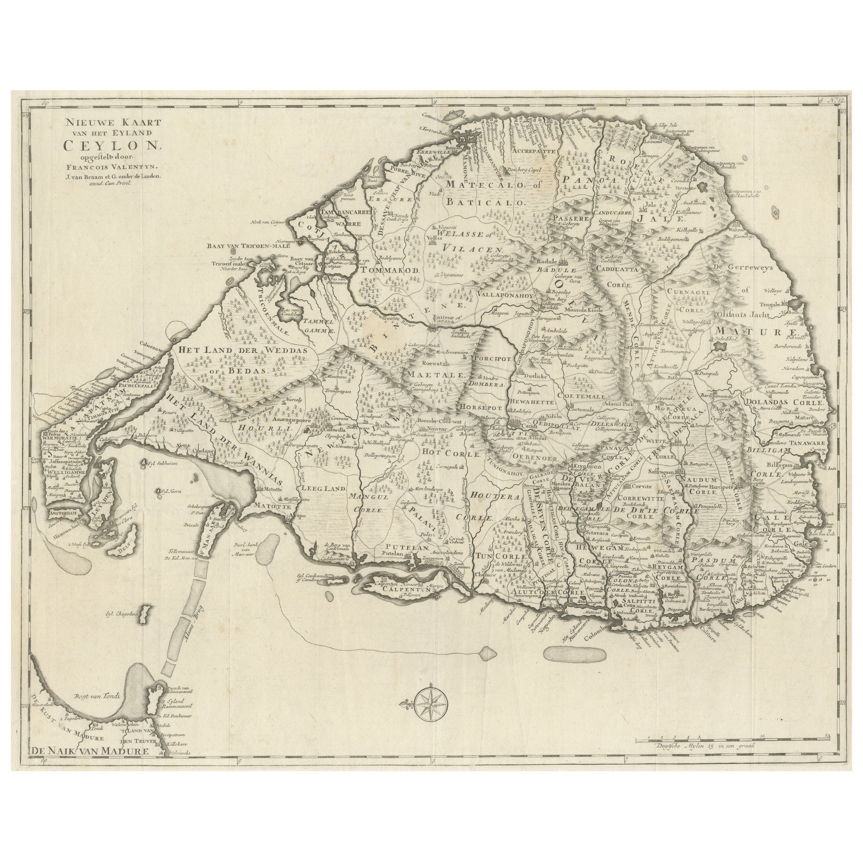
Dutch print with the title: Platte Grond van t'Fort Tricoen male met de daar aangelegen Pagoods-Berg (Trincomalee, Sri Lanka)
The map is taken from: 'Oud en Nieuw Oost-Indiën' van François Valentyn.
1) Ottens, Frederik (engraver / etcher)
2) Braam, J. van (publisher)
3) Linden, Gerard onder de (publisher)
This detailed map unveils Fort Frederick and the surrounding peninsula situated on Sri Lanka's northeastern coast. Originally featured in Francois Valentyn's "Oud en Nieuw Oost Indien," it presents a comprehensive view of the fort, depicting its numerous buildings and defensive structures meticulously.
Highlighted with intricate detail, the map showcases Fort Frederick's layout, accentuating its architectural features and defenses. Notably, it includes essential cartographic elements such as a scale bar and a compass rose, enhancing its navigational utility.
Historically, the Dutch maritime ventures in Sri Lanka began in 1603 with the arrival of the first Dutch fleet at Trincomalee and Batticaloa ports. In 1660, the Dutch erected Fort Frederick at the base of what they referred to as Pagoda Hill. Simultaneously, another stronghold named Fort Ostenburg was constructed at the harbor mouth, marking the Dutch presence and strategic fortification in the region.
- Dimensions:Height: 13.39 in (34 cm)Width: 8.27 in (21 cm)Depth: 0 in (0.02 mm)
- Materials and Techniques:Paper,Engraved
- Period:1720-1729
- Date of Manufacture:1726
- Condition:Almost excellent condition, especially considering its age. The margin on the left is short, but enough space for proper matting. One folding line is hardly visible. The coloring is from recent years.
- Seller Location:Langweer, NL
- Reference Number:
About the Seller
5.0
Platinum Seller
These expertly vetted sellers are 1stDibs' most experienced sellers and are rated highest by our customers.
Established in 2009
1stDibs seller since 2017
1,933 sales on 1stDibs
Typical response time: <1 hour
- ShippingRetrieving quote...Ships From: Langweer, Netherlands
- Return PolicyA return for this item may be initiated within 14 days of delivery.
More From This SellerView All
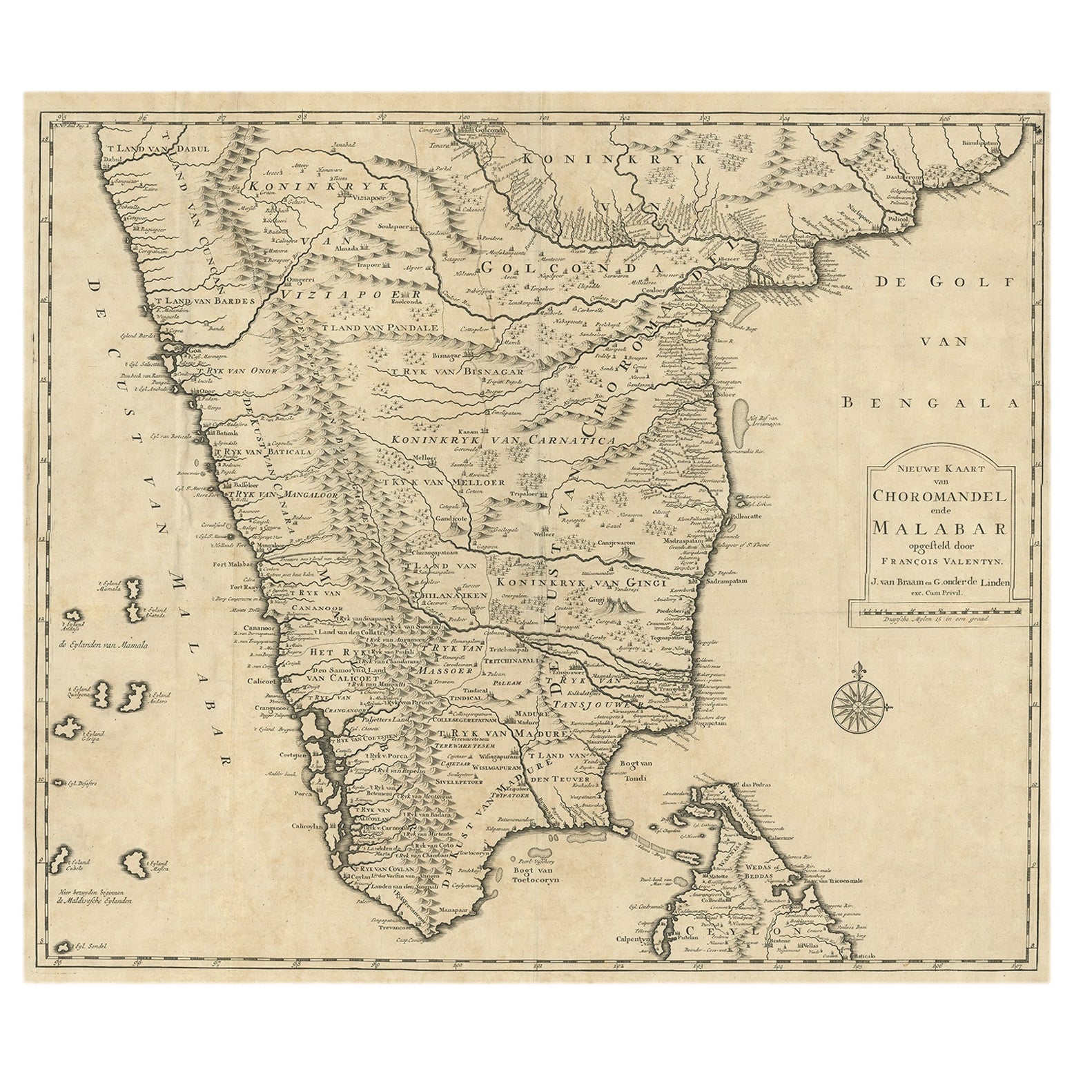
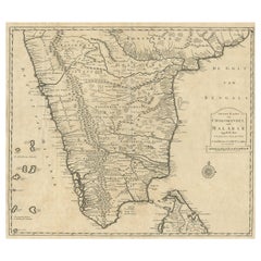
- Old Original Map of Chormandel & Malabar, India & Ceylon, Now Sri Lanka, 1726Located in Langweer, NLAntique map titled 'Nieuwe Kaart van Choromandel ende Malabar'. Antique map depicting the southern part of India and the northern tip of Ceylon, Sri Lanka. This map originates from...Category
Antique 1720s Maps
MaterialsPaper
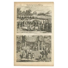
- Antique Print of a Funeral on Ceylon 'Sri Lanka' is Asia, 1672Located in Langweer, NLUntitled print of the death of the prince heir, and his burial. Two prints, one with a long burial train including numerous horses, carrying the coffin, covered with cloth. The other...Category
Antique 17th Century Prints
MaterialsPaper
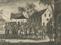
- Antique Print of Musicians on Ceylon ' Sri Lanka ' by Valentijn, 1726Located in Langweer, NLUntitled print of Musicians on Ceylon, Sri Lanka. Text on verso. This print originates from 'Oud en Nieuw Oost-Indiën' by F. Valentijn. Artists and Engravers: François Valentijn (166...Category
Antique 18th Century Prints
MaterialsPaper
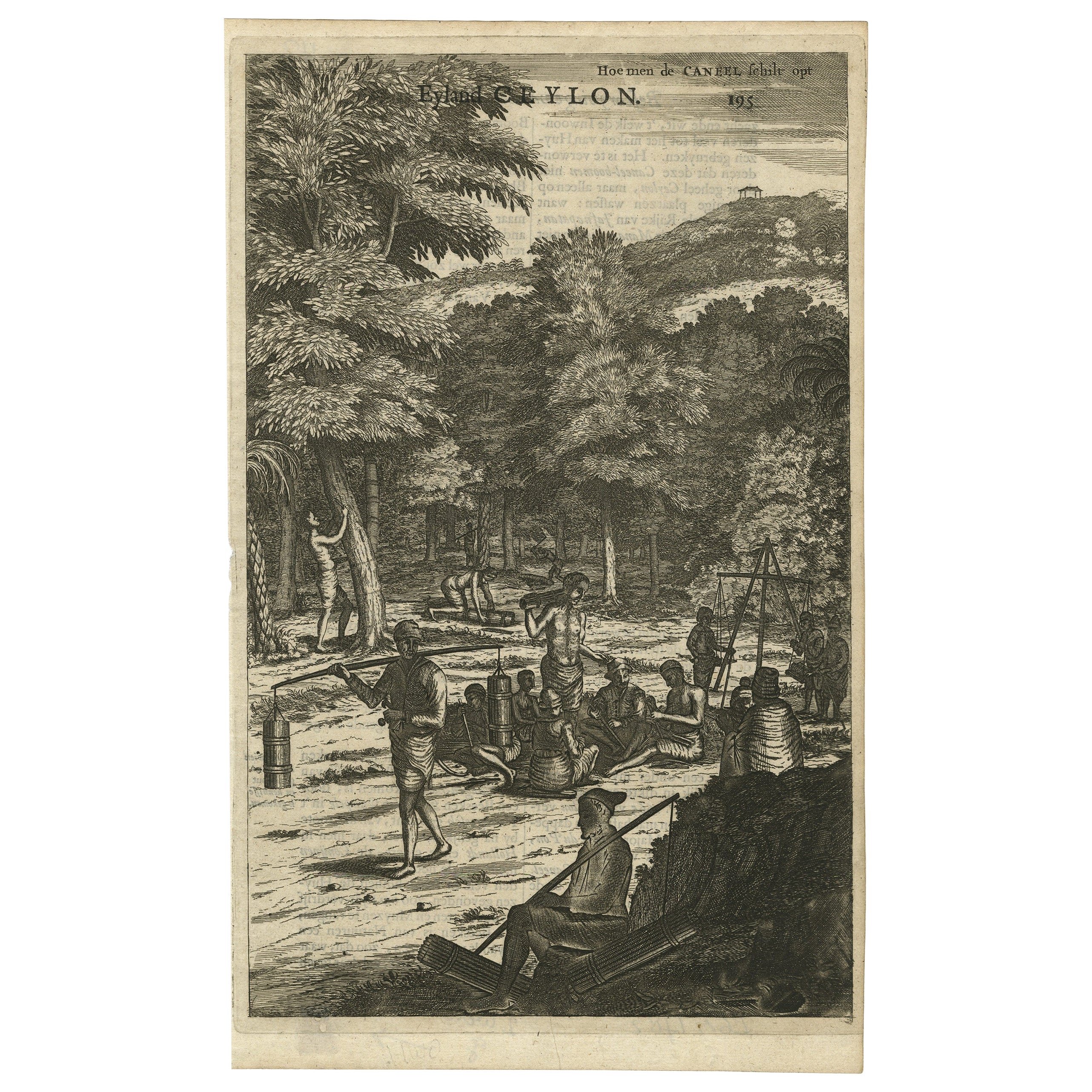
- Old Print of Farmers Harvesting Cinnamon on the Island Ceylon or Sri Lanka, 1672Located in Langweer, NLAntique print, titled: 'Hoe men de Caneel schilt opt Eyland Ceylon.' This rare original plate shows a group of farmers harvesting cinnamon on the island of Ceylon / Sri Lanka. Du...Category
Antique 1670s Prints
MaterialsPaper
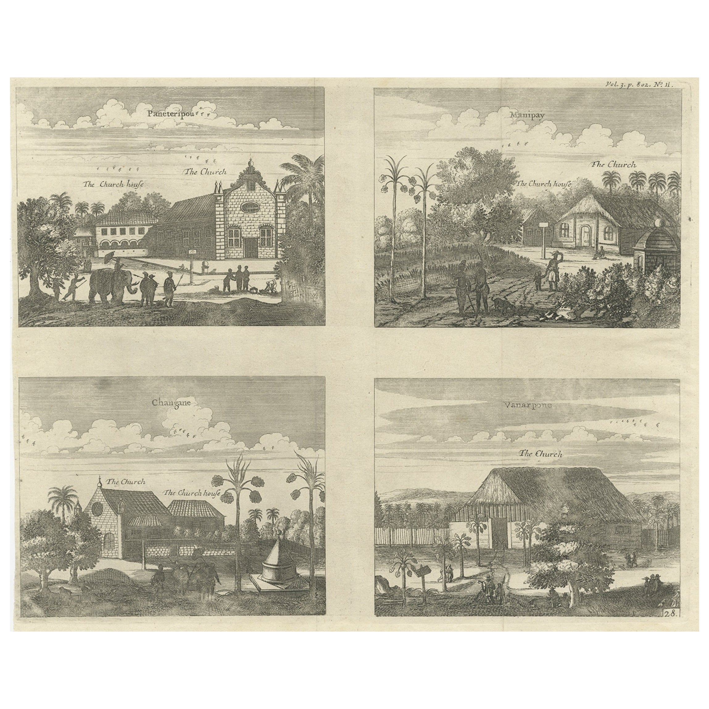
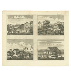
- Antique Print of Various Churches on Ceylon or Nowadays Sri Lanka, 1732Located in Langweer, NLAntique print titled 'Paneteripou, Manipay, Changane, Vanarpone'. Antique print with four views of the churches of Paneteripoum, Manipay, Changane and Vanarpone (Ceylon/Sri Lanka). This print originates from 'A Collection of Voyages and Travels, some now first printed from original manuscripts others now first printed in English'. Artists and Engravers: Published by Awnsham and John Churchill...Category
Antique 18th Century Prints
MaterialsPaper
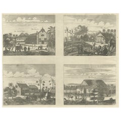
- Antique Print of various Churches on Ceylon or Nowadays Sri Lanka, 1704Located in Langweer, NLAntique print titled 'Paneteripou, Manipay, Changane, Vanarpone'. Antique print with four views of the churches of Paneteripoum, Manipay, Changane and Vanarpone (Ceylon/Sri Lanka). This print originates from 'A Collection of Voyages and Travels, some now first printed from original manuscripts'. Artists and Engravers: Published by Awnsham and John Churchill...Category
Antique 18th Century Prints
MaterialsPaper

You May Also Like
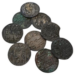
- Dutch VOC Silver Shipwreck Treasure Coins From The Akerendam Shipwreck 1724Located in AMSTERDAM, NHOrigin: Holland Value: 2 pennies / 2 stuiver Date: 1724 A VOC Akerendam shipwreck treasure of nine 2 stuivers minted by the Province of Holland ...Category
Antique 1720s Dutch Nautical Objects
MaterialsSilver
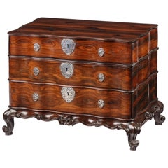
- A Dutch-colonial Sri Lankan coromandel wood miniature chest of drawersLocated in Amsterdam, NLA Dutch-colonial Sri Lankan coromandel wood miniature chest of drawers with silver mounts Sri Lanka, 18th century, circa 1750 H. 35 x W. 48 x D....Category
Antique 18th Century Sri Lankan Dutch Colonial Furniture
MaterialsSilver
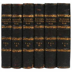
- History of the War in the Peninsula by W.F.P. Napier with Lord Elgin ProvenanceBy W.F.P. Napier, C.B.Located in valatie, NYA complete set of "History of the War in the Peninsula" by W.F.P. Napier, in 6 volumes, numbered 1-6. London: Thomas & William Boone all volumes are published in different years from 1828-1840 and are all 1st Ed's. 3/4 leather and marbled board hard covers. The history of the war in the Iberian Peninsula and in the South of France, from 1807 to the 1846 written by W.F.P. Napier, C.B., Colonel H.P. Forty-Third Regiment, and a member of the Royal Swedish Academy of Military Sciences. The wars describe the military conflict between Napoleon's Empire and Bourbon Spain. The United Kingdom of Great Britain and Ireland allied with the Kingdom of Portugal, for control of the Iberian Peninsula during the Napoleonic wars. The volumes have illustrated fold out maps portraying various battles. The set was owned originally by Colonel Thomas Bruce (Lord Elgin) the 7th Earl of Elgin. He sold the "Elgin Marbles" taken from the Parthenon to the British government in 1816. The books were later owned by George Woods...Category
Antique Early 19th Century English Books
MaterialsPaper
- Rare Chinese Export Porcelain Voc DishLocated in Amsterdam, NLA Chinese export porcelain VOC (Dutch East India Company) dish Canton, Yongzheng period, circa 1730 Diam. 23 cm Executed in rose-pink, ...Category
Antique 18th Century Chinese Chinese Export Ceramics
MaterialsPorcelain
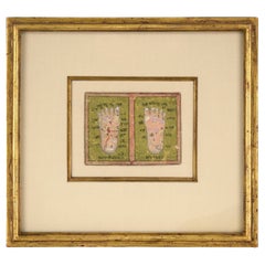
- Antique Illustration of the Feet of Lord Rama, 'Sri Ram Prada Yatra'Located in Soquel, CAFinely detailed illustration of the feet of Lord Rama. The feet are labeled with illustrative symbols, including a lotus flower, shells, and crescent moons. There are a total of 17 s...Category
Antique 19th Century Indian Other Religious Items
MaterialsGold Leaf
- Colonial Silver VOC 'East-India Company' IngotLocated in Amsterdam, NLA silver 'V.O.C. AMSTERDAM' ingot circa 1738, with monogram and the assay mark of the Amsterdam Grill family With V.O.C. monogram and the A for Amsterdam. L. approx. 15.5 cm Weight approx. 2000 grams Note: The ingots were salvaged in 2004 from the wreck of the VOC indiaman Rooswijk, equipped by the Amsterdam VOC Chamber. The Rooswijk sank on its second voyage to the Dutch East Indies off the English coast on the Goodwin Sands...Category
Antique 18th Century Dutch Historical Memorabilia
MaterialsSterling Silver
Recently Viewed
View AllMore Ways To Browse
Antique Map Of North And East Asia 1751
Map Of Mississippi
Bedfordshire Antique Map
Auge En Pierre
Covens & Mortier On Sale
Larousse Universel
Staffordshire Antique Map
Staffordshire Map
Tam Austria
Antique Furniture Manitoba
Nova Hollandia
William Wyld
Matthew Seutter On Sale
Menorca Map
Pierre Fran�ois Tardieu On Sale
Rand Mcnally Map Of Kansas
Sumba Map
1681 Moses Pitt