Ceylon Map

3
89
to
17
87
2
89
89
89
65
17
7
3
3
3
1
1
88
1
1
1
8
6
1
4
2
1
1
1
Sort By
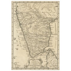
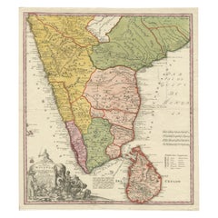
Original Detailed Antique Map of Southern India and Most of Ceylon, 1744
Located in Langweer, NL
Malabar, Coromandel and the Island Ceylon'. Map of Southern India and most of Ceylon, from Baglana
Category

Antique 1740s Maps

Materials

Paper

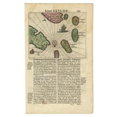
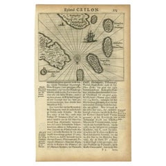
Antique 17th Century Map of the Islands Near Ceylon or Sri Lanka, 1672
Located in Langweer, NL
Antique map titled 'Eyland Ceylon.' Map of the islands near Ceylon or Sri Lanka. Dutch text on
Category

Antique 17th Century Maps

Materials

Paper

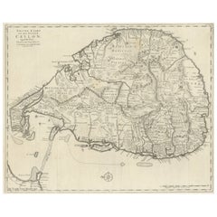
Large Antique Map of Ceylon, Sri Lanka
Located in Langweer, NL
Antique map titled 'Nieuwe Kaart van het Eyland Ceylon opgestelt door Francois Valentyn'. Beautiful
Category

Antique Mid-18th Century Maps

Materials

Paper

Large Antique Map of Ceylon, Sri Lanka
H 19.18 in W 24.22 in D 0.02 in
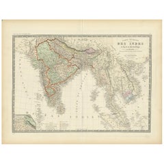
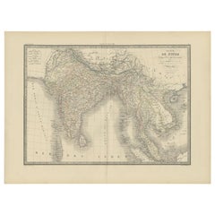
Authentic Antique Map of India and Ceylon, '1875'
Located in Langweer, NL
Antique map titled 'Carte générale des Indes'. Large map of India and Ceylon. This map originates
Category

Antique Late 19th Century Maps

Materials

Paper

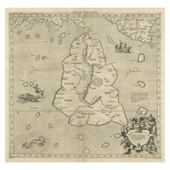
Mercator's Ptolemaic map of Taprobana, (Ceylon) Sri Lanka
Located in Langweer, NL
Antique map titled 'Asiae XII Tab'. Mercator's Ptolemaic map of Taprobana. The map shows Ptolemy's
Category

Antique 16th Century Maps

Materials

Paper

Antique Map of India and Ceylon by Lapie, 1842
Located in Langweer, NL
Antique map titled 'Carte de l'Inde en deca et au dela du Gange'. Map of India and Ceylon (Sri
Category

Antique Mid-19th Century Maps

Materials

Paper

Antique Map of India and Ceylon by Lapie, 1842
H 19.89 in W 26.78 in D 0.02 in
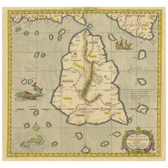
Antique Ptolemaic Map of Ceylon or nowadays Sri Lanka
Located in Langweer, NL
Antique map titled 'Tab XII. Asiae Taprobanam'. Ptolemaic map of Sri Lanka. Ptolemy drew on the
Category

Antique Mid-18th Century Maps

Materials

Paper

Original Antique Map of Malabar, Coromandel 'India' and Ceylon
Located in Langweer, NL
Antique map titled 'Peninsula Indiae citra Gangem, hoc est Orae celeberrimae Malabar & Coromandel
Category

Antique Mid-18th Century Maps

Materials

Paper

Antique Map of the Islands Near Ceylon by Baldaeus, 1672
By Philip Baldaeus
Located in Langweer, NL
, Hammenhiel, Bramines, Dona Clara and Deserta near Ceylon / Sri Lanka, with their Dutch names. Dutch text on
Category

Antique 17th Century Maps

Materials

Paper

Antique Map of India and Ceylon, along with the Maldives
Located in Langweer, NL
Ceylon, along with the Maldives. Includes a large decorative title cartouche. The map was issued in
Category

Antique Late 18th Century Maps

Materials

Paper

Old Map of Southern India and Ceylon 'Sri Lanka', 1882
Located in Langweer, NL
Antique map titled 'India (Southern Sheet)'. Old map of Southern India and Ceylon (Sri Lanka
Category

Antique 1880s Maps

Materials

Paper

Antique Map of Southern India and Ceylon by Thomson, 1816
Located in Langweer, NL
"Antique map titled 'Southern Hindostan'. A map of Southern India and the North of Ceylon. From
Category

Antique 19th Century Maps

Materials

Paper

19th Century Illustrated Map of Ceylon (Sri Lanka) with Notable Landmarks
Located in Langweer, NL
the places on the map. The map of Ceylon, now known as Sri Lanka, from Tallis's series would be a
Category

Antique 1850s Maps

Materials

Paper

Rare Original Antique Ptolemy Map of Ceylon, Present Day Sri Lanka
Located in Langweer, NL
Original antique map titled 'Tab XII Asiae Taprobanam (..)'. For this map of Toprobana (Sri Lanka
Category

Antique Late 17th Century Maps

Materials

Paper

Colorful and Decorative Miniature Map of India, Ceylon by Bertius 1616
Located in Langweer, NL
Old 17th century miniature antique map of India - Ceylon from the 1616 edition of Jadocus Hondius
Category

Antique 17th Century Maps

Materials

Paper

Antique German Map of India and Sri Lanka or Ceylon, 1902
By Meyer
Located in Langweer, NL
Antique map titled 'Ostindien.' (Map of India with an inset map of East-Bengal.) This attractive
Category

20th Century Maps

Materials

Paper

Original Antique Map of Southern India and Ceylon 'Present-Day Sri Lanka'
By Jakob van der Schley
Located in Langweer, NL
(..)'. Original antique map of Southern India and Ceylon (present-day Sri Lanka). This map originates from
Category

Antique Mid-18th Century Maps

Materials

Paper

Old Original Map of Chormandel & Malabar, India & Ceylon, Now Sri Lanka, 1726
Located in Langweer, NL
southern part of India and the northern tip of Ceylon, Sri Lanka. This map originates from 'Oud en Nieuw
Category

Antique 1720s Maps

Materials

Paper

Antique Map of Ceylon or Sri Lanka by Ptolemy/Mercator, circa 1695
Located in Langweer, NL
Antique map titled 'Tab XII Asiae Taprobanam'. Ptolemaic map of Taprobana (Sri Lanka). Ptolemy drew
Category

Antique Late 17th Century Maps

Materials

Paper

Antique Miniature Map of Ceylon 'Sri Lanka' and the Maldives by Bertius, 1618
Located in Langweer, NL
Ceylon/Sri Lanka and the Maldives. This map originates from 'Tabularum Geographicarum Contractarum Libri
Category

Antique Early 17th Century Maps

Materials

Paper

Antique Map of Southern Asia with India, the Maldives, Ceylon and Arabia, c.1700
Located in Langweer, NL
D'Andemaon, Ceylan, Les Maldives'. This map depicts the Maldives, the Andaman Islands, and Ceylon (Sri
Category

Antique Early 18th Century Maps

Materials

Paper

Old Map of Ceylon 'Sri Lanka' with The North Oriented to The Left, 1731
Located in Langweer, NL
Description: Antique map Ceylon titled 'Nieuwe Kaart van t Eland Ceilon'. Old map of present
Category

Antique 1730s Maps

Materials

Paper

Original Antique Map of the Peninsula of India with Part of Ceylon by Wyld, 1844
Located in Langweer, NL
This extensive map of India, spanning two sheets, draws from Reynell’s original map and
Category

Antique Mid-18th Century Maps

Materials

Paper

Antique Map of Hindustan, or India
Located in Langweer, NL
Antique map titled 'Hindoostan, or India'. Original antique map of India (Hindustan) and Sri Lanka
Category

Antique Early 19th Century Maps

Materials

Paper

Antique Map of Hindustan, or India
H 10.52 in W 8.19 in D 0.02 in
Antique Map of India to Southeast Asia
Located in Langweer, NL
Antique map titled 'Indes en-decà et au-delà du Gange'. Original old map of India to Southeast Asia
Category

Antique Mid-19th Century Maps

Materials

Paper

Antique Map of India to Southeast Asia
H 10.01 in W 12.05 in D 0.02 in
18th Century Cartographic Depiction of Upper India and Ceylon, 1835
Located in Langweer, NL
cultural and geographical tapestry of Upper India and Ceylon. The maps invite admiration and contemplation
Category

Antique 1830s Maps

Materials

Paper

Antique Map of the Malabar Coast by Baldaeus, 1744
By Philip Baldaeus
Located in Langweer, NL
Antique map titled 'Descriptio Nova Imperii Malabar (..).' Nice map of the Malabar Coast. This map
Category

Antique 18th Century Maps

Materials

Paper

Antique Map of Choromandel, Golconda and Orixa, Malabar, India, 1744
By Philip Baldaeus
Located in Langweer, NL
Antique map titled 'Regionum Choromandel, Golconda (..).' Handsome map of Choromandel, Golconda and
Category

Antique 18th Century Maps

Materials

Paper

Original Hand-colored Antique Map of the Southern Part of India
Located in Langweer, NL
Antique map titled 'Orarum Malabariae, Coromandelae &c Tabula Accuratissima - Carte des Cotes de
Category

Antique Early 18th Century Maps

Materials

Paper

Original Antique Map showing Southern India, Northern Sri Lanka & Malabar, 1652
Located in Langweer, NL
). This map covers the subcontinent from the Bay of Bengal and the Gulf of Cambay to Ceylon. The Mogul
Category

Antique 1650s Maps

Materials

Paper

Rare Attractive Antique Map of Asia, India, Sri Lanka, Maldives, 1599
Located in Langweer, NL
Original Antique map of Asia, India, Ceylon (Sri Lanka), Maldives by Rosaccio / Ruscelli in
Category

Antique 16th Century European Maps

Materials

Paper

Print of a Dutch VOC Fort on the Peninsula Trincomalee, Ceylon (Sri Lanka), 1726
Located in Langweer, NL
-Berg (Trincomalee, Sri Lanka) The map is taken from: 'Oud en Nieuw Oost-Indiën' van François
Category

Antique 1720s Maps

Materials

Paper

Detailed Decorative Antique Map of the Coast of Malabar and Coromandel, India
Located in Langweer, NL
Antique map titled 'Carte des Côtes de Malabar et de Coromandel'. Finely engraved map of the
Category

Antique Mid-18th Century Maps

Materials

Paper

Antique Map of Southeast Asia from Persia to the Timor Island, 1712
Located in Langweer, NL
Antique map titled 'A New Map of the East Indies'. Old map covering all of Southeast Asia from
Category

Antique 1710s Maps

Materials

Paper

Charting the Course of Empire: Bonne's 1770 Masterpiece Maps of the Indian Ocean
Located in Langweer, NL
A voyage through history with an exquisite collection of Rigobert Bonne's 1770 maps, as featured in
Category

Antique 1770s Maps

Materials

Paper

Antique Map of the Moluccas or the Famed Spice Islands of Indonesia, 1724
Located in Langweer, NL
Antique map Spice Islands titled 'De landvoogdy van Amboina met de elf onderhoorige Eylanden
Category

Antique 1720s Maps

Materials

Paper

Antique Map of the Gulf of Bengal by J.N. Bellin, circa 1760
Located in Langweer, NL
Beautiful chart of the Gulf of Bengal. The map extends from Malabar to Sumatra and today Phuket
Category

Antique Mid-18th Century Maps

Materials

Paper

West Coast of Africa, Guinea & Sierra Leone: An 18th Century Map by Bellin
By Jacques-Nicolas Bellin
Located in Alamo, CA
Jacques Bellin's copper-plate map entitled "Partie de la Coste de Guinee Dupuis la Riviere de
Category

Antique Mid-18th Century French Maps

Materials

Paper

Old Steel Engraved Map of the Western Part of the Madras Presidency, 1831
Located in Langweer, NL
Antique map titled 'India II Madras Presidency'. Old steel engraved map of the western part of
Category

Antique 1830s Maps

Materials

Paper

Old Map Covering All of Southeast Asia from Persia to the Timor Island, 1712
Located in Langweer, NL
Description: Antique map titled 'A New Map of the East Indies'. Old map covering all of Southeast
Category

Antique 1710s Maps

Materials

Paper

Antique Map of the Islands Near Batavia, Capital of the Dutch East Indies, 1682
Located in Langweer, NL
Antique map titled 'Caerte van de Eylanden voor Batavia.' Map of the islands near Batavia
Category

Antique 17th Century Maps

Materials

Paper

Cartographic Elegance: The British Raj's India, 1882 Atlas by Blackie and Son
Located in Langweer, NL
These two maps are part of an 1882 atlas published by Blackie and Son, a notable publishing company
Category

Antique 1880s Maps

Materials

Paper

Antique Bird's-Eye Plan of Tutecoryn (Tuticorin or Thoothukudi), India, 1672
Located in Langweer, NL
Antique map, titled: 'Tutecoryn.' Bird's-eye plan of map of Tutecoryn (Tuticorin or Thoothukudi
Category

Antique 1670s Maps

Materials

Paper

Very Attractive Handcolored Antique Plan of Cochin in India, 1744
By Philip Baldaeus
Located in Langweer, NL
Antique map titled 'The City of Cochin (..).' Plan of Cochin, Malabar Coast, India, during the
Category

Antique 18th Century Maps

Materials

Paper

Antique Engraving of a Bird's-Eye Plan of Nagapattinam or Negapatam, India, 1672
Located in Langweer, NL
Antique map titled 'Negapatam.' Bird's-eye plan of Nagapattinam or Negapatam, India. This map
Category

Antique 1670s Maps

Materials

Paper

Antique Engraving of a Print Showing the Indian City of Suratte 'Surat', 1672
Located in Langweer, NL
Choromandel, derz. aangrenzend rijken, en het machtige eiland Ceylon.' (transl: Description of the East Indian
Category

Antique 1670s Maps

Materials

Paper

Antique Engraving of a Print with a View of Masulipatam, India, 1672
Located in Langweer, NL
' 'Nauwkeurige beschrijving Malabar en Choromandel, derz. aangrenzend rijken, en het machtige eiland Ceylon
Category

Antique 1670s Maps

Materials

Paper

Original Antique Print of the Chinese City of Kinnungam with its Ramparts, 1665
Located in Langweer, NL
India Company (or VOC) - between 1660 and 1667 he occupied posts in India and on Ceylon - he then lived
Category

Antique 1660s Maps

Materials

Paper

Original Vintage Pictorial Map Poster Ceylon Tea And Other Industries Sri Lanka
By "Leslie MacDonald ""Max"" Gill"
Located in London, GB
Original vintage pictorial map poster for Ceylon Her Tea & Other Industries featuring artwork by
Category

Vintage 1940s British Posters

Materials

Paper

Antique Print of Figures and an Elephant on Ceylon, 1726
Located in Langweer, NL
Untitled print of various figures and an elephant on Ceylon, Sri Lanka. Text on verso. This print
Category

Antique 18th Century Prints

Materials

Paper

Antique Print of Don Pedro in Ceylon or Sri Lanka, 1726
Located in Langweer, NL
Overall size: 21 x 33.5 cm. Image size: 17.5 x 15 cm. We sell original antique maps to collectors
Category

Antique 18th Century Prints

Materials

Paper

Antique Print of a Funeral on Ceylon 'Sri Lanka' is Asia, 1672
Located in Langweer, NL
machtige eiland Ceylon'. Artists and Engravers: Father Philippus Baldaeus, Baelde or Philip Balde
Category

Antique 17th Century Prints

Materials

Paper

Antique Print of the Churches of Cathay and Sundecouli 'Ceylon, Sri Lanka'
Located in Langweer, NL
Antique map titled 'Cathay, Sundecouli'. View of two churches on Ceylon / Sri Lanka, This print
Category

Antique Mid-18th Century Prints

Materials

Paper

Antique Print of a Church in Oudewil in Ceylon or Nowadays Sri Lanka, 1672
Located in Langweer, NL
Antique print titled 'Oudewil'. View of a church in Oudewil, Ceylon/Sri Lanka. This print was
Category

Antique 17th Century Prints

Materials

Paper

Antique Print of an Army in the Woods., Riding an Elephant in Ceylon, 1726
Located in Langweer, NL
antique maps to collectors, historians, educators and interior decorators all over the world. Our
Category

Antique 18th Century Prints

Materials

Paper

Original Vintage Illustrated Map Poster Empire Industry Where Our Tea Comes From
Located in London, GB
version depicting colourful illustrated maps of India and Ceylon (now Sri Lanka) featuring the city names
Category

Vintage 1930s British Posters

Materials

Paper

Antique Frontispiece by Tirion, Showing a Map of Africa, an Elephant Etc, 1731
Located in Langweer, NL
volkeren (..)' by Thomas Salmon. This volume describes Pegu, Arrakan, India, Ceylon, Malabar and other
Category

Antique 18th Century Prints

Materials

Paper

Antique Print of a Battle in Vidia Rajoe in India, 1726
Located in Langweer, NL
Untitled print of a Battle Scene in Vidia Rajoe, Ceylon. Text on verso. This print originates from
Category

Antique 18th Century Prints

Materials

Paper

Antique Portrait of Dutch General Gerard Pietersz, Hulft, c.1670
Located in Langweer, NL
, Opper Bevelhebber over de Krygs-Mach soo te Water als te Lande afgesonden na Ceylon en de kusten van
Category

Antique 17th Century Prints

Materials

Paper

Antique Portrait of Rijckloff v Goens, Governor-General of the Dutch East Indies
Located in Langweer, NL
19 November 1664 to 1675 during the Dutch period in Ceylon. This print originates from 'Oud en Nieuw
Category

Antique 18th Century Prints

Materials

Paper

  • 1
Get Updated with New Arrivals
Save "Ceylon Map", and we’ll notify you when there are new listings in this category.

Ceylon Map For Sale on 1stDibs

Choose from an assortment of styles, material and more with respect to the ceylon map you’re looking for at 1stDibs. Each ceylon map for sale was constructed with extraordinary care, often using paper. You’ve searched high and low for the perfect ceylon map — we have versions that date back to the 18th Century alongside those produced as recently as the 19th Century are available.

How Much is a Ceylon Map?

The average selling price for a ceylon map at 1stDibs is $646, while they’re typically $121 on the low end and $1,393 for the highest priced.

Read More

Pamela Shamshiri Shares the Secrets behind Her First-Ever Book and Its Effortlessly Cool Interiors

The sought-after designer worked with the team at Hoffman Creative to produce a monograph that beautifully showcases some of Studio Shamshiri's most inspiring projects.

Moroccan Artworks and Objects Take Center Stage in an Extraordinary Villa in Tangier

Italian writer and collector Umberto Pasti opens the doors to his remarkable cave of wonders in North Africa.

Montecito Has Drawn Royalty and Celebrities, and These Homes Are Proof of Its Allure

Hollywood A-listers, ex-pat aristocrats and art collectors and style setters of all stripes appreciate the allure of the coastal California hamlet — much on our minds after recent winter floods.

Whaam! Blam! Pow! — a New Book on Pop Art Packs a Punch

Publishing house Assouline and writer Julie Belcove have teamed up to trace the history of the genre, from Roy Lichtenstein, Andy Warhol and Yayoi Kusama to Mickalene Thomas and Jeff Koons.

The Sparkling Legacy of Tiffany & Co. Explained, One Jewel at a Time

A gorgeous new book celebrates — and memorializes — the iconic jeweler’s rich heritage.

What Makes a Gem-Encrusted Chess Set Worth $4 Million?

The world’s most opulent chess set, weighing in at 513 carats, is literally fit for a king and queen.

Tauba Auerbach’s Geometric Pop-Up Book Is Mighty Rare, Thanks to a Hurricane

This sculptural art book has an epic backstory of its own.

Step inside the Storied Mansions of Palm Beach’s Most Effervescent Architect

From Spanish-style courtyards to fanciful fountains, these acclaimed structures abound in surprising and elegant details.