Items Similar to Old Steel Engraved Map of the Western Part of the Madras Presidency, 1831

Want more images or videos?
Request additional images or videos from the seller
1 of 5
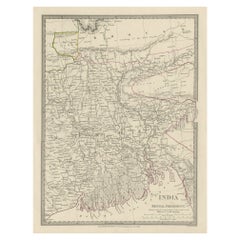
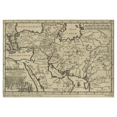
Old Steel Engraved Map of the Western Part of the Madras Presidency, 1831
About the Item
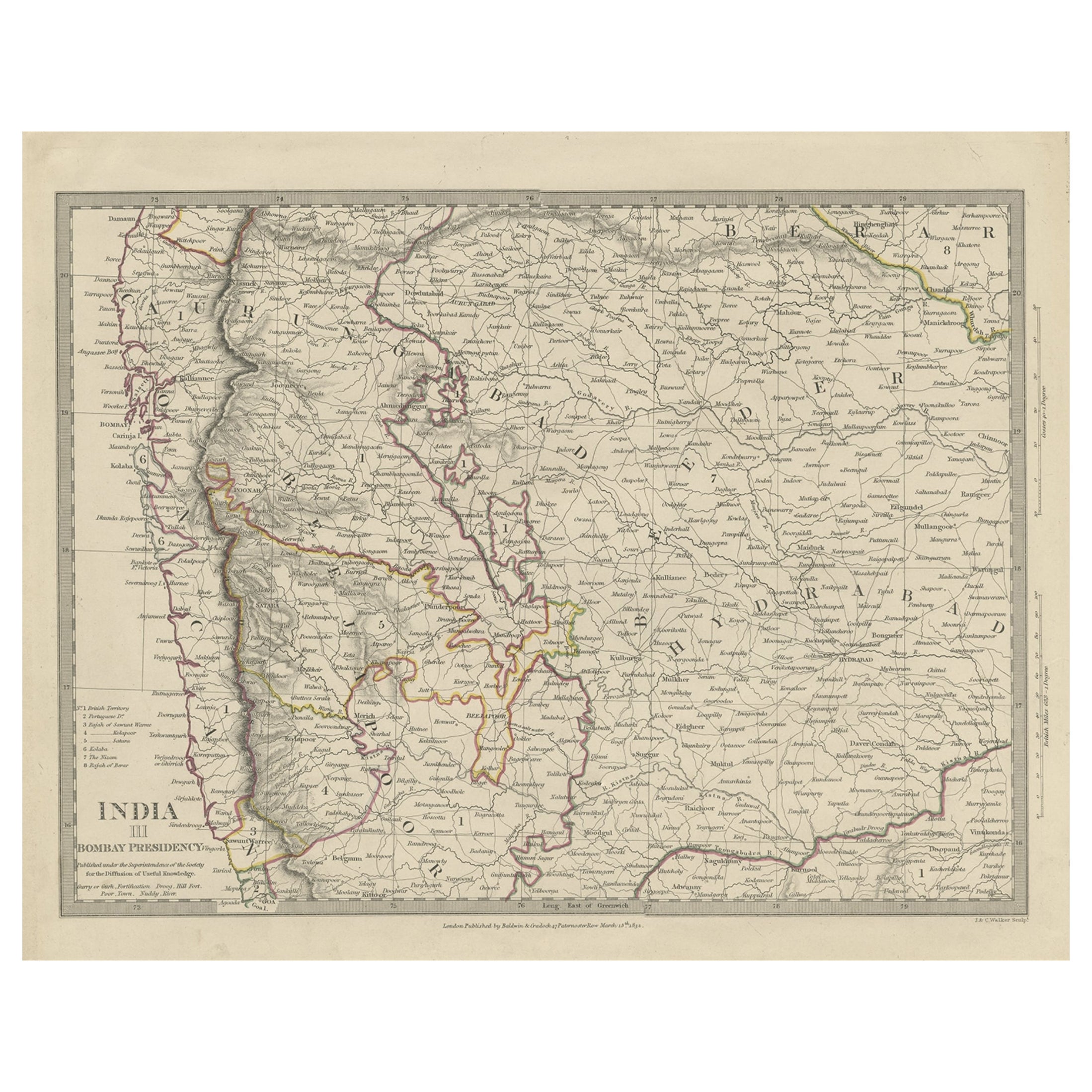
Antique map titled 'India II Madras Presidency'.
Old steel engraved map of the western part of the Madras Presidency. The Madras Presidency, or the Presidency of Fort St. George, and also known as Madras Province, was an administrative subdivision (presidency) of British India. At its greatest extent, the presidency included most of southern India, including the whole of the Indian states of Tamil Nadu and Andhra Pradesh, and parts of Odisha, Kerala, Karnataka and the union territory of Lakshadweep. The city of Madras was the winter capital of the Presidency and Ootacamund or Ooty, the summer capital. The Island of Ceylon was a part of Madras Presidency from 1793 to 1798 when it was created a Crown colony.
Artists and Engravers: Engraved by J. & C. Walker. Published under the superintendence of the Society for the Diffusion of Useful Knowledge. Published by Baldwin & Cradock.
- Dimensions:Height: 13.78 in (35 cm)Width: 16.15 in (41 cm)Depth: 0 in (0.02 mm)
- Materials and Techniques:
- Period:
- Date of Manufacture:1831
- Condition:Very good, general age-related toning. Please study image carefully.
- Seller Location:Langweer, NL
- Reference Number:
About the Seller
5.0
Platinum Seller
These expertly vetted sellers are 1stDibs' most experienced sellers and are rated highest by our customers.
Established in 2009
1stDibs seller since 2017
1,933 sales on 1stDibs
Typical response time: <1 hour
- ShippingRetrieving quote...Ships From: Langweer, Netherlands
- Return PolicyA return for this item may be initiated within 14 days of delivery.
More From This SellerView All
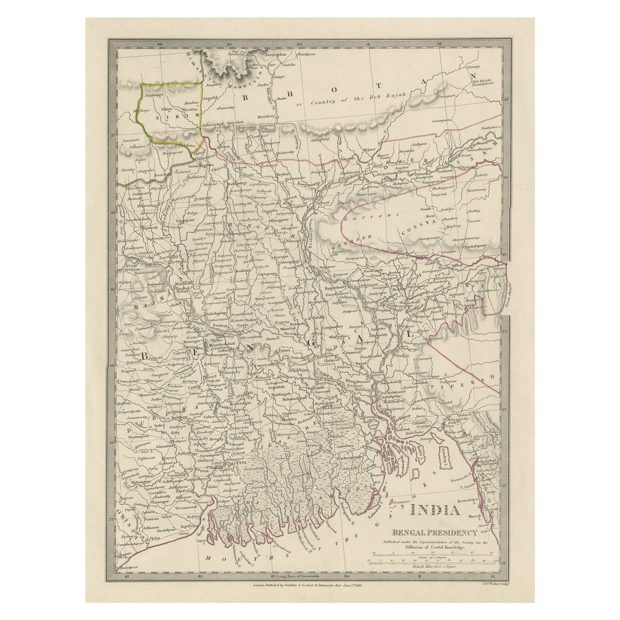
- Steel Engraved Map of Part of the Bengal Presidency 'India & Bangladesh', 1831Located in Langweer, NLAntique map titled 'India Bengal Presidency'. Old steel engraved map of part of the Bengal Presidency. The Bengal Presidency (1757–1912), later reorganized as the Bengal Province (19...Category
Antique 1830s Maps
MaterialsPaper
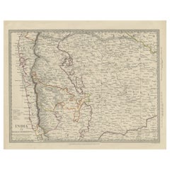
- Antique Map of Part of the Bombay Presidency in India, 1831Located in Langweer, NLAntique map titled 'India III Bombay Presidency'. Old steel engraved map of part of the Bombay Presidency. The Bombay Presidency, also known as Bombay and Sind from 1843 to 1936 and ...Category
Antique 19th Century Maps
MaterialsPaper
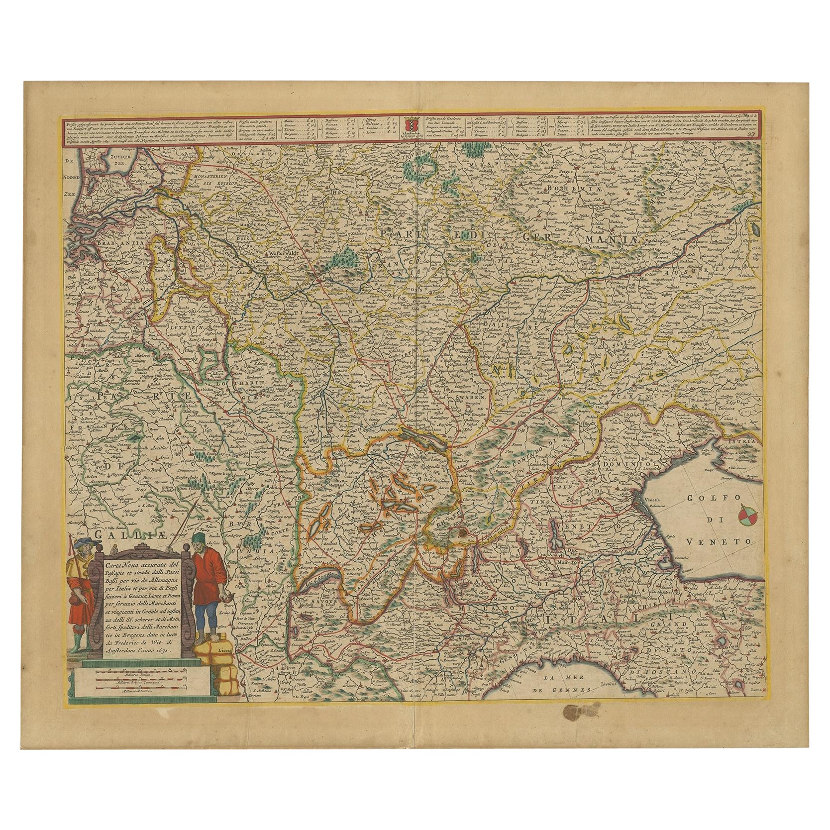
- Old Map of the Western Part of Central Europe, c.1680Located in Langweer, NLAntique map titled 'Carta nova accurate del Passagio et strada dalli Paesi Bassi'. Old map of the western portion of Central Europe. Oriented to the Northeast. Artists and Engrav...Category
Antique 17th Century Maps
MaterialsPaper
- Antique Map of North Carolina, with inset map of the western partLocated in Langweer, NLAntique map titled 'North Carolina'. Original antique map of North Carolina, United States. With inset map of the western part of North Carolina....Category
Antique Late 19th Century Maps
MaterialsPaper
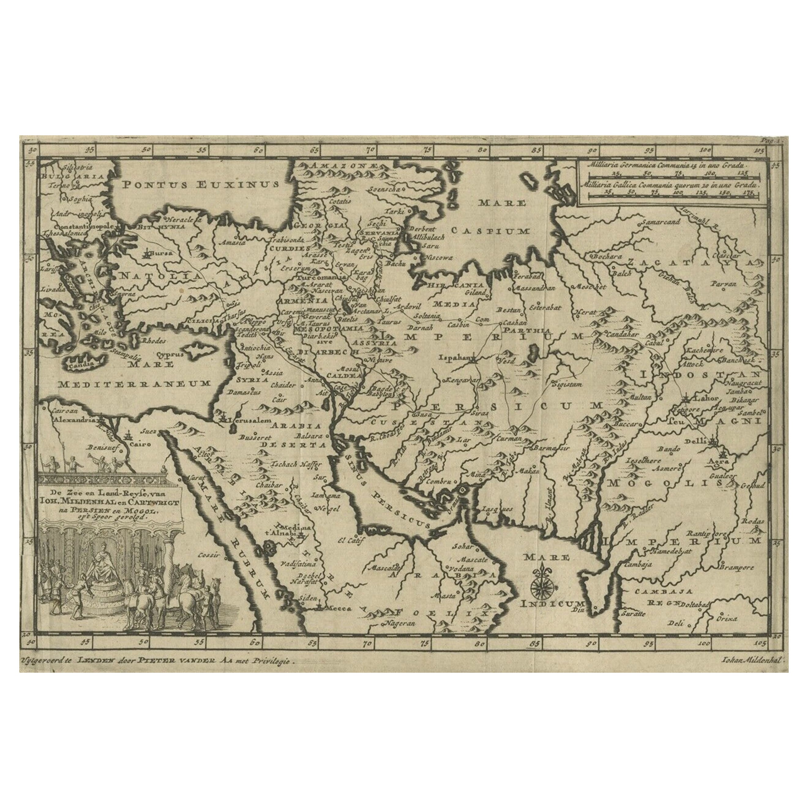
- Old Engraved Map of the Middle East, Arabia and Part of Greece 'Cyprus', 1706Located in Langweer, NLTitle: Antique map titled 'De Zee en Land-Reyse, van Ioh. Mildenhal en Cartwrigt na Persien en Mogol, opt spoor gevolgd'. Old map of the Middle East, also depicting part of Greece ...Category
Antique Early 1700s Maps
MaterialsPaper
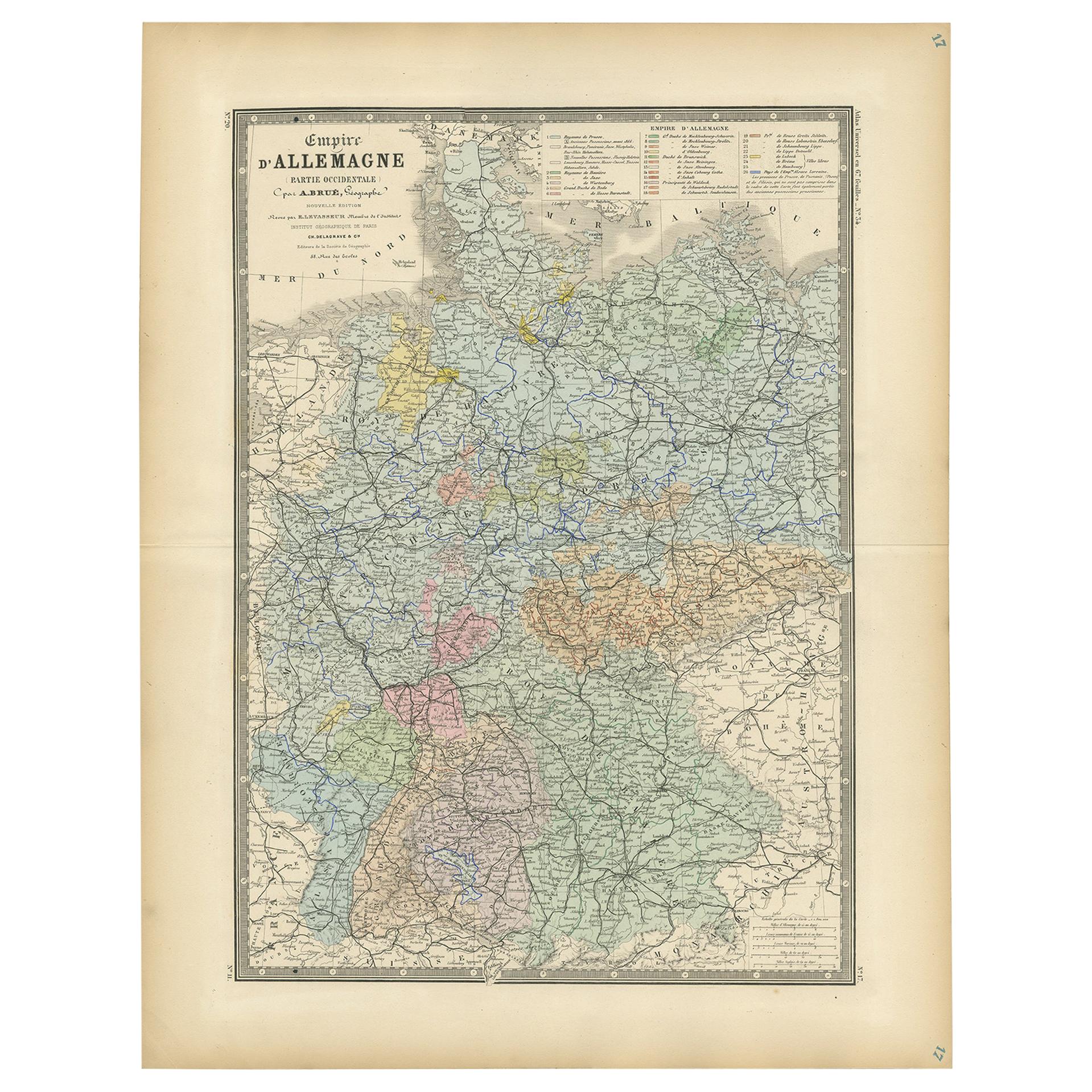
- Antique Map of the Western Part of the German Empire by Levasseur, '1875'Located in Langweer, NLAntique map titled 'Empire d'Allemagne (..)'. Large map of the western part of the German Empire. This map originates from 'Atlas de Géographie Moderne Physique et Politique' by A. L...Category
Antique Late 19th Century Maps
MaterialsPaper


You May Also Like
- Old Nautical Map of CorsicaLocated in Alessandria, PiemonteST/556/1 - Old map of Corsica isle, surveyed by Captain Hell, of the French Royal Navy in 1824, engraved and published on 1874, with additions and corre...Category
Antique Early 19th Century English Other Prints
MaterialsPaper
- Old Horizontal Map of EnglandBy TassoLocated in Alessandria, PiemonteST/520 - Old rare Italian map of England, dated 1826-1827 - by Girolamo Tasso, editor in Venise, for the atlas of M.r Le-Sage.Category
Antique Early 19th Century Italian Other Prints
MaterialsPaper
- Original Antique Map of The Netherlands, Engraved by Barlow, Dated 1807Located in St Annes, LancashireGreat map of Netherlands Copper-plate engraving by Barlow Published by Brightly & Kinnersly, Bungay, Suffolk. Dated 1807 Unframed.Category
Antique Early 1800s English Maps
MaterialsPaper
- Original Antique Map of Sweden, Engraved by Barlow, 1806Located in St Annes, LancashireGreat map of Sweden Copper-plate engraving by Barlow Published by Brightly & Kinnersly, Bungay, Suffolk. 1806 Unframed.Category
Antique Early 1800s English Maps
MaterialsPaper
- Map of the Republic of GenoaLocated in New York, NYFramed antique hand-coloured map of the Republic of Genoa including the duchies of Mantua, Modena, and Parma. Europe, late 18th century. Dimension: 25...Category
Antique Late 18th Century European Maps
- Original Antique Map of Switzerland, Engraved By Barlow, Dated 1807Located in St Annes, LancashireGreat map of Switzerland Copper-plate engraving by Barlow Published by Brightly & Kinnersly, Bungay, Suffolk. Dated 1807 Unframed.Category
Antique Early 1800s English Maps
MaterialsPaper


