George Map
41
to
53
469
396
316
201
193
188
187
146
71
62
54
53
45
42
38
38
37
35
34
31
29
23
15
14
13
13
13
12
12
11
11
11
10
10
9
9
8
8
7
5
5
5
5
5
5
4
3
3
3
2
1
1
1
1
1
1
45
42
42
42
41
Sort By
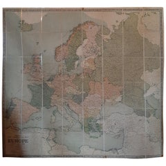
Large Wall Map of Europe by George Philip & Son, circa 1920
Located in Langweer, NL
Antique map titled 'Philips' New Commercial Map of Europe'. Very large wall map of Europe including
Category
Early 20th Century Maps
Materials
Linen, Paper
No Reserve
H 72.05 in W 66.15 in D 0.02 in
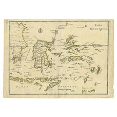
Antique Map of the Maluku Islands by Le Rouge, c.1750
By George Louis Le Rouge
Located in Langweer, NL
Antique map Moluccas/Spice Islands titled 'Isles Moluques'. Detailed map of the famous Spice
Category
Antique 18th Century Maps
Materials
Paper
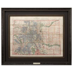
1907 Map of Colorado, Antique Topographical Map, by Louis Nell
Located in Colorado Springs, CO
This highly detailed pocket map is a topographical map of the state of Colorado by Louis Nell from
Category
Antique Early 1900s American Maps
Materials
Paper
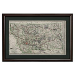
"Clason's Guide Map of Montana" by The Clason Map Company, Circa 1920s
Located in Colorado Springs, CO
Presented is “Clason's Guide Map of Montana,” published in the early 1920s by the Clason Map
Category
Vintage 1920s American Art Deco Maps
Materials
Paper
H 23.13 in W 33.88 in D 1.5 in
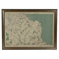
1891 Map of Plymouth County Mass
Located in Norwell, MA
Original 1891 map showing Sandwich, Bourne, Plymouth Carver, Middleborough, Plympton and Kingston
Category
Antique 1890s North American Maps
Materials
Paper
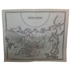
Large1852 Map "Russian Empire" Ric.r0011
Located in Norton, MA
Large
1852 map "Russian Empire"
George Phillips & Son 1852
Ric.r0011
Dimension: Paper: 67 cm
Category
Antique 19th Century Unknown Maps
Materials
Paper
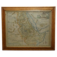
London 1744 Published Watercolour Antique Map of East Africa by Eman Bowen
Located in GB
We are delighted to offer for sale this New and Accurate Map of Nubia & Abissinia, together with
Category
Antique 1740s English George III Maps
Materials
Paper
H 17.52 in W 21.07 in D 0.79 in
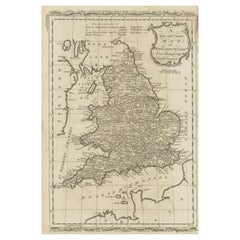
Original Antique Map of England and Wales
Located in Langweer, NL
Improvements'. Original antique map of England and Wales. Printed by Alex Hogg, London for George Henry
Category
Antique Late 18th Century Maps
Materials
Paper
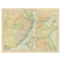
Antique Political Map of Eastern China, 1922
Located in Langweer, NL
Antique map of China titled 'Eastern China - Political Map'. Old map of eastern China depicting
Category
20th Century Maps
Materials
Paper
Antique Political Map of the Japanese Empire, 1922
Located in Langweer, NL
Antique map of Japan titled 'Japanese Empire - Political Map'. Old map of Japan depicting Japan
Category
20th Century Maps
Materials
Paper
Antique Map of Coiba Island by Anson '1749'
Located in Langweer, NL
Canales. This map originates from 'Reize rondsom de Werreld (..)' by George Anson, published 1749.
Category
Antique Mid-18th Century Maps
Materials
Paper
Antique Map of the Philippines by Anson '1749'
Located in Langweer, NL
Antique map titled 'Carte du Canal des Iles Philippines - Kaart van het Kanaal in de Filippynsche
Category
Antique Mid-18th Century Maps
Materials
Paper
Map Turkey in Europe & Hungary Thomas Kitchin, 1783
Located in BUNGAY, SUFFOLK
Hydrographer to King George III.' He is responsible for numerous maps published in the The Star, Gentleman's
Category
Antique 18th Century English Georgian Maps
Materials
Paper
Antique Map of Juan Fernandez, Chile, c.1740
Located in Langweer, NL
Antique map titled 'l'Ile de Juan Fernandes dans la Mer du Sud (..)'.
This map depicts Juan
Category
Antique 18th Century Maps
Materials
Paper
Antique Map of Northwest Africa by Bartholomew, 1922
Located in Langweer, NL
Antique map of Africa titled 'North-West Africa'. Old map of north-west Africa depicting Morocco
Category
20th Century Maps
Materials
Paper
English Engraved Hand Colored Map of the North Eastern United States, circa 1817
Located in Hollywood, SC
English copper engraved hand colored map of the North Eastern United States matted under glass in a
Category
Antique 1810s English George III Maps
Materials
Glass, Giltwood, Paint, Paper
H 22 in W 25.75 in D 1 in
Large Original Antique Map of Arizona, Usa, C.1900
Located in St Annes, Lancashire
Fabulous map of Arizona
Original color.
Engraved and printed by the George F. Cram Company
Category
Antique 1890s American Maps
Materials
Paper
Large Original Antique Map of Ohio, Usa, C.1900
Located in St Annes, Lancashire
Fabulous map of Ohio
Original color.
Engraved and printed by the George F. Cram Company
Category
Antique 1890s American Maps
Materials
Paper
Large Original Antique Map of Georgia, USA, circa 1900
Located in St Annes, Lancashire
Fabulous map of Georgia
Original color
Engraved and printed by the George F. Cram Company
Category
Antique 1890s American Maps
Materials
Paper
Large Original Antique Map of Wisconsin, USA, circa 1900
Located in St Annes, Lancashire
Fabulous map of Wisconsin
Original color
Engraved and printed by the George F. Cram Company
Category
Antique 1890s American Maps
Materials
Paper
Large Original Antique Map of California, USA, circa 1900
Located in St Annes, Lancashire
Fabulous map of California
Original color
Engraved and printed by the George F. Cram Company
Category
Antique 1890s American Maps
Materials
Paper
Large Original Antique Map of Kentucky, USA, C.1900
Located in St Annes, Lancashire
Fabulous map of Kentucky
Original color
Engraved and printed by the George F. Cram Company
Category
Antique 1890s American Maps
Materials
Paper
Large Original Antique Map of Alaska, USA, C.1900
Located in St Annes, Lancashire
Fabulous map of Alaska
Original color
Engraved and printed by the George F. Cram Company
Category
Antique 1890s American Maps
Materials
Paper
Large Original Antique Map of Maine, USA, C.1900
Located in St Annes, Lancashire
Fabulous map of Maine
Original color
Engraved and printed by the George F. Cram Company
Category
Antique 1890s American Maps
Materials
Paper
Large Original Antique Map of Colorado, USA circa 1900
Located in St Annes, Lancashire
Fabulous map of Colorado
Original color
Engraved and printed by the George F. Cram Company
Category
Antique 1890s American Maps
Materials
Paper
Antique Map of South America by Philip & Son, 1875
Located in Langweer, NL
.
Artists and Engravers: George Philip (1800–1882) was a cartographer, map publisher and founder of the
Category
Antique 19th Century Maps
Materials
Paper
Large Original Antique Map of Massachusetts, USA, circa 1900
Located in St Annes, Lancashire
Fabulous map of Massachusetts
In 2 sheets. They can be joined but I have not done it
Original
Category
Antique 1890s American Maps
Materials
Paper
Large Original Antique Map of Oklahoma, USA, circa 1900
Located in St Annes, Lancashire
Fabulous map of Oklahoma
Original color
Engraved and printed by the George F. Cram Company
Category
Antique 1890s American Maps
Materials
Paper
Map of the British Isles with Historical Kings, 1719
Located in Langweer, NL
This antique map, titled "Les Royaumes d'Angleterre d'Escosse et d'Irlande," offers a detailed view
Category
Antique Early 18th Century Maps
Materials
Paper
Large Original Antique Map of Louisiana, USA, C.1900
Located in St Annes, Lancashire
Fabulous map of Louisiana.
Original color.
Engraved and printed by the George F. Cram Company
Category
Antique 1890s American Maps
Materials
Paper
Large Original Antique Map of Minnesota, USA, C.1900
Located in St Annes, Lancashire
Fabulous map of Minnesota
Original color
Engraved and printed by the George F. Cram Company
Category
Antique 1890s American Maps
Materials
Paper
Large Original Antique Map of Alabama, USA, C.1900
Located in St Annes, Lancashire
Fabulous map of Alabama
Original color
Engraved and printed by the George F. Cram Company
Category
Antique 1890s American Maps
Materials
Paper
Antique Map of the Pacific Ocean by Anson, 1765
Located in Langweer, NL
Antique map titled 'Carte de la Mer du Sud ou Mer Pacifique - Kaart van de Zuyd-Zee of stille
Category
Antique 18th Century Maps
Materials
Paper
Orginal Antique Handcolored Map of the Turkish Empire, 1748
Located in Langweer, NL
Antique map titled 'L'Empire des Turcs'. Old map of the Turkish Empire with an inset of the North
Category
Antique 18th Century Maps
Materials
Paper
Antique Map of New Ireland with 7 Coastal Profiles
Located in Langweer, NL
Antique print titled 'l'Isle St. Jean (..) - Cap St. George (..)'. Antique map of New Ireland, an
Category
Antique Late 18th Century Maps
Materials
Paper
17th Century John Speed Map of Denbighshire, c.1610
By John Speed
Located in Royal Tunbridge Wells, Kent
Antique early 17th century British very rare and original John Speed, hand coloured map of
Category
Antique 17th Century British Maps
Materials
Wood, Paper
Antique Map of Puerto San Julian in Patagonia, 1749
Located in Langweer, NL
Antique map titled 'Plan van de Haven van St. Juliaan op de Kust van Patagonia (..) - Plan du Port
Category
Antique 18th Century Maps
Materials
Paper
Map Bedfordshire WilliamSchmollinger Dunstable Priory Woburn Abbey Moules Gothic
Located in BUNGAY, SUFFOLK
Artist William Schmollinger (1811-1869)
London : George Virtue, 1832. A highly attractive map in
Category
Antique 19th Century English Victorian Maps
Materials
Paper
H 37 in W 29 in D 2 in
Map Bedfordshire WilliamSchmollinger Dunstable Priory Woburn Abbey Moules Gothic
Located in BUNGAY, SUFFOLK
ARTIST William Schmollinger (1811-1869)
London : George Virtue, 1832. A highly attractive map in
Category
Antique 19th Century English Victorian Maps
Materials
Paper
H 14.18 in W 11.03 in D 0.79 in
Striking Large Format Antique Map of Southeastern France, 1799
Located in Langweer, NL
Antique map titled 'The South Eastern Part of France which includes Roussillon-Languedoc, with a
Category
Antique 1790s Maps
Materials
Paper
Large Original Antique Map of New Mexico, Usa, C.1900
Located in St Annes, Lancashire
Fabulous map of New Mexico.
Original color.
Engraved and printed by the George F. Cram Company
Category
Antique 1890s American Maps
Materials
Paper
Antique Map of South America by G. Anson, 1749
Located in Langweer, NL
Antique map titled 'Kaart van het Zuidelykste Gedeelte van Zuider Amerika (..) - Carte de la Partie
Category
Antique Mid-18th Century Dutch Maps
Materials
Paper
Antique Map of Juan Fernandez Island by Anson '1749'
Located in Langweer, NL
Antique map titled 'l'Ile de Juan Fernandes dans la Mer du Sud (..) - Het Eiland Juan Fernandes in
Category
Antique Mid-18th Century Maps
Materials
Paper
Large Original Antique Map of New Jersey, USA, circa 1900
Located in St Annes, Lancashire
Fabulous map of New Jersey
Original color
Engraved and printed by the George F. Cram Company
Category
Antique 1890s American Maps
Materials
Paper
Antique Map of Juan Fernandez Island, Chile, c.1750
Located in Langweer, NL
Antique map titled 'Plan de la Côte du N.E. de l 'Ile de Juan Fernandes'.
Map of the northeast
Category
Antique 18th Century Maps
Materials
Paper
Large Original Antique Map of North Dakota, USA, circa 1900
Located in St Annes, Lancashire
Fabulous map of North Dakota
Original color
Engraved and printed by the George F. Cram Company
Category
Antique 1890s American Maps
Materials
Paper
Vintage Map of Nantucket Town by Ruth Haviland Sutton, 1946
Located in Nantucket, MA
Haviland Sutton 1946, lithographed by George C. Miller."
The map is in mint collection having been kept in
Category
Vintage 1940s American Other Maps
Materials
Paper
Large Original Antique Map of West Virginia, USA, C.1900
Located in St Annes, Lancashire
Fabulous map of West Virginia
Original color
Engraved and printed by the George F. Cram Company
Category
Antique 1890s American Maps
Materials
Paper
Large Original Antique Map of Rhode Island, USA, C.1900
Located in St Annes, Lancashire
Fabulous map of Rhode Island
Original color
Engraved and printed by the George F. Cram Company
Category
Antique 1890s American Maps
Materials
Paper
Antique Map of the Port of Acapulco in Mexico, 1749
Located in Langweer, NL
Antique map titled 'Plan van de Haven van Acapulco (..) - Plan du Port d'Acapulco (..)'. Original
Category
Antique 18th Century Maps
Materials
Paper
Antique Map of Western Germany with part of the Netherlands
Located in Langweer, NL
Antique map titled 'Ducatus Iuliacensis Cliviensis et Montensis (..)'. Original old map of Western
Category
Antique Mid-18th Century Maps
Materials
Paper
Antique Map of Spain & Portugal 'Iberian Peninsula', Decorative Cartouche, c1755
Located in Langweer, NL
), "Geographer to King George III", was an English cartographer who was the leading map supplier of his day. He
Category
Antique 1750s Maps
Materials
Paper
H 7.88 in W 9.85 in D 0 in
Antique Map of The Harbour of Acapulco in Mexico, 1749
Located in Langweer, NL
Description: Antique map titled 'Plan van de Haven van Acapulco (..) - Plan du Port d'Acapulco
Category
Antique 1740s Maps
Materials
Paper
Antique Map of the Port of Zihuatanejo by Anson '1749'
Located in Langweer, NL
times. This map originates from 'Reize rondsom de Werreld (..)' by George Anson, published 1749.
Category
Antique Mid-18th Century Maps
Materials
Paper
Antique Map of Coiba Island, Panama, South America, C.1740
Located in Langweer, NL
Antique map titled 'Plan de la partie orientale de l'Isle de Quibo'. Map of the eastside of Coiba
Category
Antique 18th Century Maps
Materials
Paper
Antique Map of the Low Countries by Seutter, c.1745
Located in Langweer, NL
Antique map titled ‘XVII Provinciae Belgii sive Germaniae Inferioris (..)’. Detailed hand colored
Category
Antique 18th Century Maps
Materials
Paper
Antique Map of the Bay of Manila, Capital of the Philippines
Located in Langweer, NL
the Philippines. This map originates from a German edition of 'Voyage around the World' by Lord George
Category
Antique Mid-18th Century Maps
Materials
Paper
No Reserve
H 8.47 in W 10.63 in D 0.02 in
Original Antique Map of Juan Fernandez by Van Schley, 1757
Located in Langweer, NL
Antique map titled 'Carte Particuliere de l'Isle de Juan Fernandez - Byzondere Kaart van 't Eiland
Category
Antique 18th Century Maps
Materials
Paper
Antique Map of the World on Mercator Projection by Anson, 1749
Located in Langweer, NL
tracks around the world. This map originates from 'Reize rondsom de Werreld (..)' by George Anson
Category
Antique 18th Century Maps
Materials
Paper
Antique Map of Juan Fernandez Island by Anson, c.1740
Located in Langweer, NL
Antique map titled 'Plan de la Côte du N.E. de l 'Ile de Juan Fernandes'.
Map of the northeast
Category
Antique 18th Century Maps
Materials
Paper
- 1
- ...
Get Updated with New Arrivals
Save "George Map", and we’ll notify you when there are new listings in this category.
George Map For Sale on 1stDibs
Find many varieties of an authentic george map available at 1stDibs. Frequently made of paper, wood and giltwood, every george map was constructed with great care. You’ve searched high and low for the perfect george map — we have versions that date back to the 18th Century alongside those produced as recently as the 20th Century are available. A george map is a generally popular piece of furniture, but those created in Georgian styles are sought with frequency. A well-made george map has long been a part of the offerings for many furniture designers and manufacturers, but those produced by George D. Painter, George Louis Le Rouge and George Philip & Son are consistently popular.
How Much is a George Map?
The average selling price for a george map at 1stDibs is $628, while they’re typically $69 on the low end and $12,000 for the highest priced.
More Ways To Browse
Cortez Table
Antique Puerto Rico Map
Antique Minnesota Map
Antique Map Of Michigan
Antique Map Of Puerto Rico
Antique Map Of Argentina
Antique Map Argentina
Antique Maps Of Puerto Rico
Vintage Map Holder
Aria Antique
Minnesota Map
Antique Navigational Tools
Antique Navigation Tools
Antique Maps Rhode Island
Antique Map Louisiana
Vintage Bartholomew Maps
Panama Antique Map
Antique Map Colorado
