Items Similar to Antique Map of Western Germany with part of the Netherlands

Want more images or videos?
Request additional images or videos from the seller
1 of 6
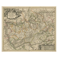
Antique Map of Western Germany with part of the Netherlands
About the Item
Antique map titled 'Ducatus Iuliacensis Cliviensis et Montensis (..)'. Original old map of Western Germany with part of the Netherlands. Published by M. Seutter, circa 1750.
George Matthaus Seutter, a German publisher, cartographer and engraver from Augsburg, was born 1678 as the son of a goldsmith. After an apprenticeship at J. B. Homann in Nuremberg, he returned to his native city of Augsburg and worked in the publishing firm of Jeremiah Wolf. In 1707 he founded his own successful publishing company and produced maps, atlases and globes. Seutter died in 1757. The company went over to his son Albrecht Carl and his stepsons G. B. Probst and T. C. Lotter in after his death in 1757.
- Dimensions:Height: 24.53 in (62.3 cm)Width: 20.79 in (52.8 cm)Depth: 0.02 in (0.5 mm)
- Materials and Techniques:
- Period:
- Date of Manufacture:c.1750
- Condition:Repaired: Right margin extended. General age-related toning. Minor wear and soiling. Original folding line. Right margin extended. Blank verso. Please study image carefully.
- Seller Location:Langweer, NL
- Reference Number:
About the Seller
5.0
Platinum Seller
These expertly vetted sellers are 1stDibs' most experienced sellers and are rated highest by our customers.
Established in 2009
1stDibs seller since 2017
1,929 sales on 1stDibs
Typical response time: <1 hour
- ShippingRetrieving quote...Ships From: Langweer, Netherlands
- Return PolicyA return for this item may be initiated within 14 days of delivery.
More From This SellerView All
- Antique Map of North Carolina, with inset map of the western partLocated in Langweer, NLAntique map titled 'North Carolina'. Original antique map of North Carolina, United States. With inset map of the western part of North Carolina....Category
Antique Late 19th Century Maps
MaterialsPaper
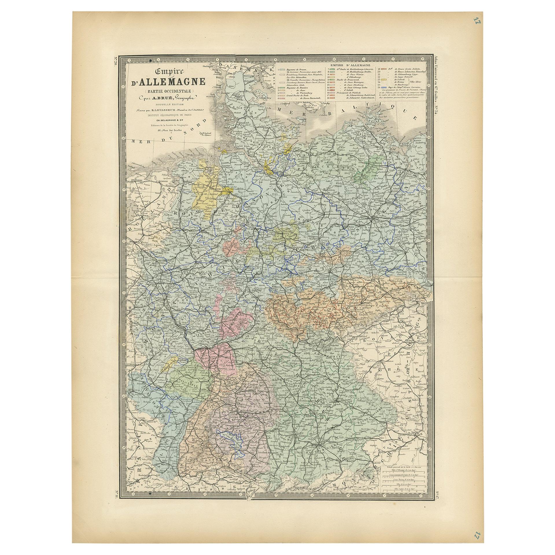
- Antique Map of the Western Part of the German Empire by Levasseur, '1875'Located in Langweer, NLAntique map titled 'Empire d'Allemagne (..)'. Large map of the western part of the German Empire. This map originates from 'Atlas de Géographie Moderne Physique et Politique' by A. L...Category
Antique Late 19th Century Maps
MaterialsPaper
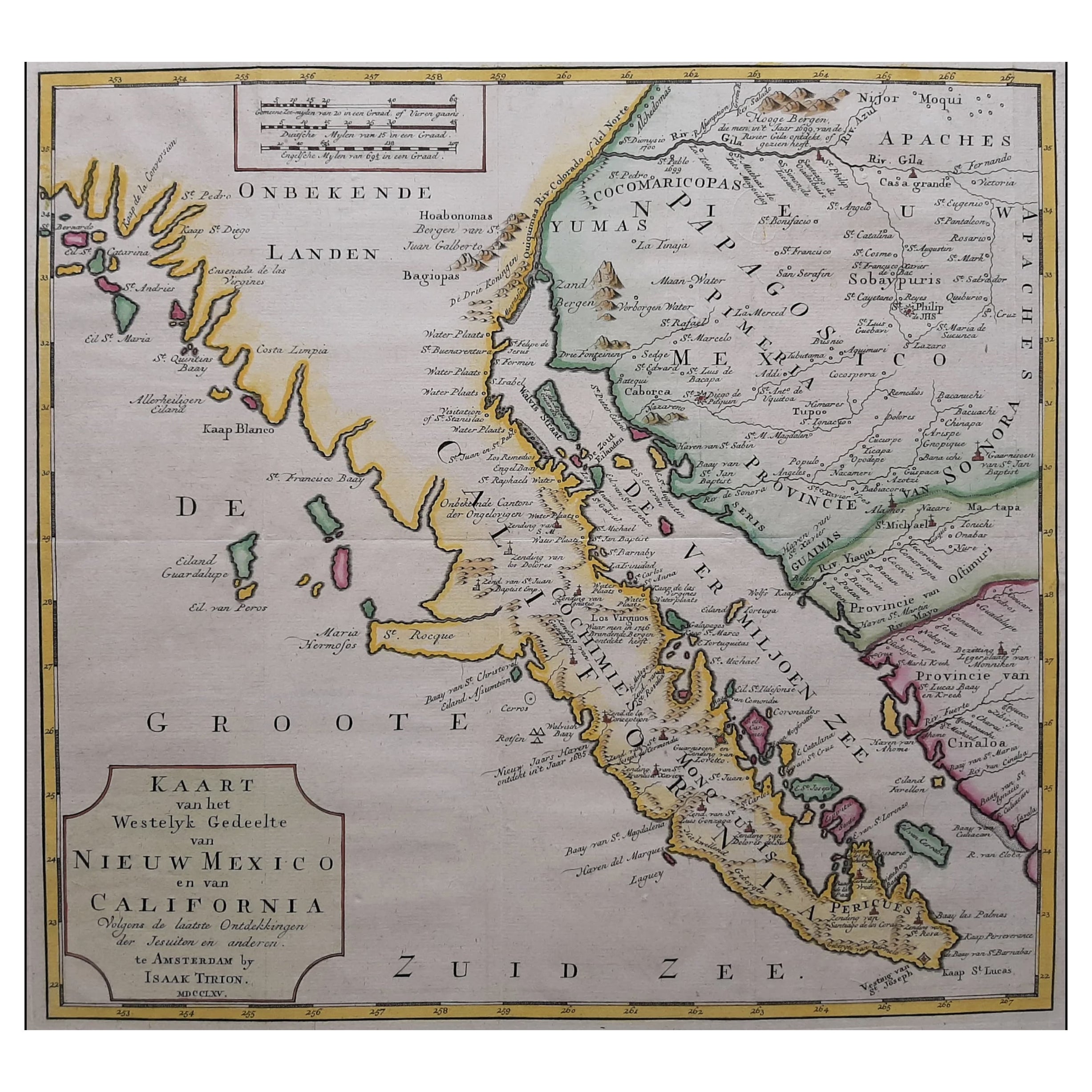
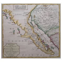
- Original Antique Map of the Western Part of NEW MEXICO & CALIFORNIALocated in Langweer, NLTitle: "Map of the Western Part of NEW MEXICO and CALIFORNIA According to the Latest Discoveries by the Jesuits and Others" Description: This exquisite original Dutch map, titled "...Category
Antique 1760s Maps
MaterialsPaper
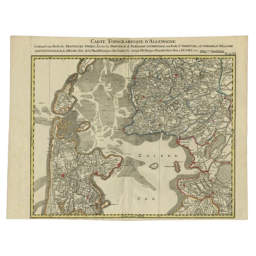
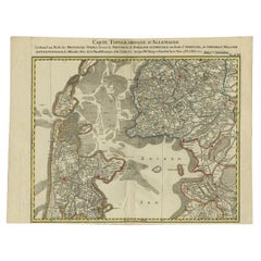
- Antique Map of the Northern Part of the Netherlands by Jaeger, 1784Located in Langweer, NLAntique print, titled: 'Carte topographique d'Allemagne contenant une partie des Provinces Unies, savoir la province de Friesland occidentale : une partie d'Overyssel, de Gueldre, d'...Category
Antique 18th Century Maps
MaterialsPaper
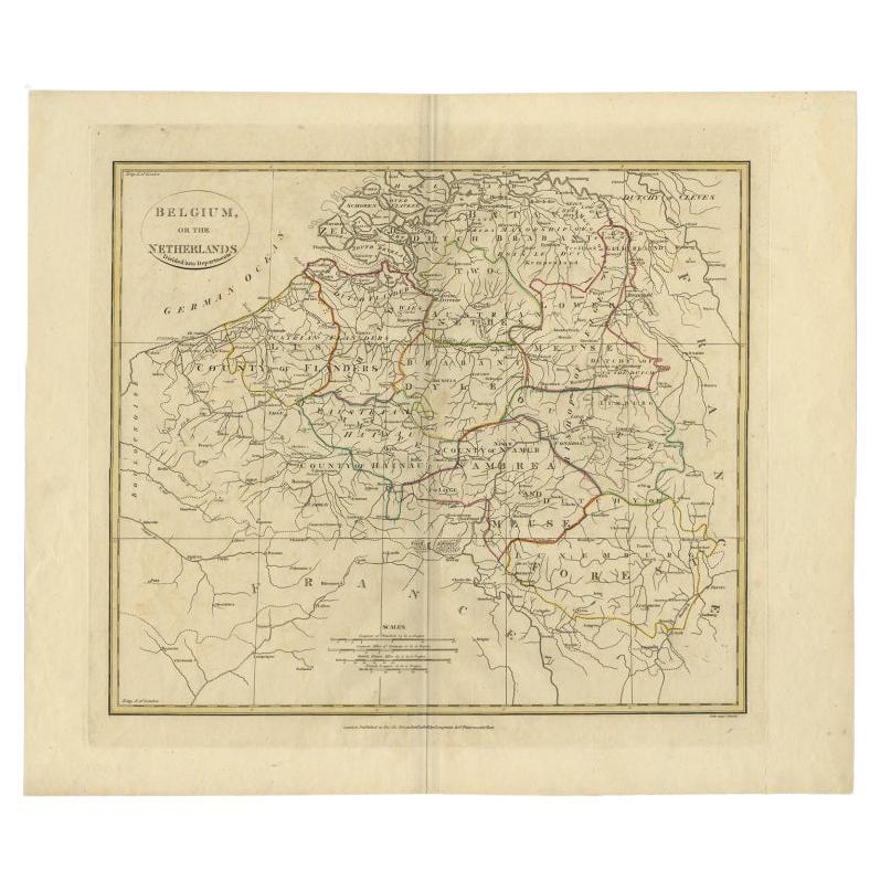
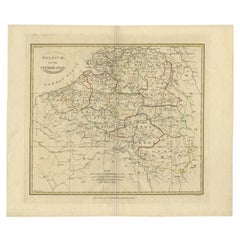
- Antique Map of Belgium and Part of the Southern Netherlands, 1810Located in Langweer, NLAntique map titled 'Belgium, or the Netherlands divided into Departments'. Original antique map of Belgium and the southern part of the Netherlands. This map originates from 'The Mod...Category
Antique 19th Century Maps
MaterialsPaper
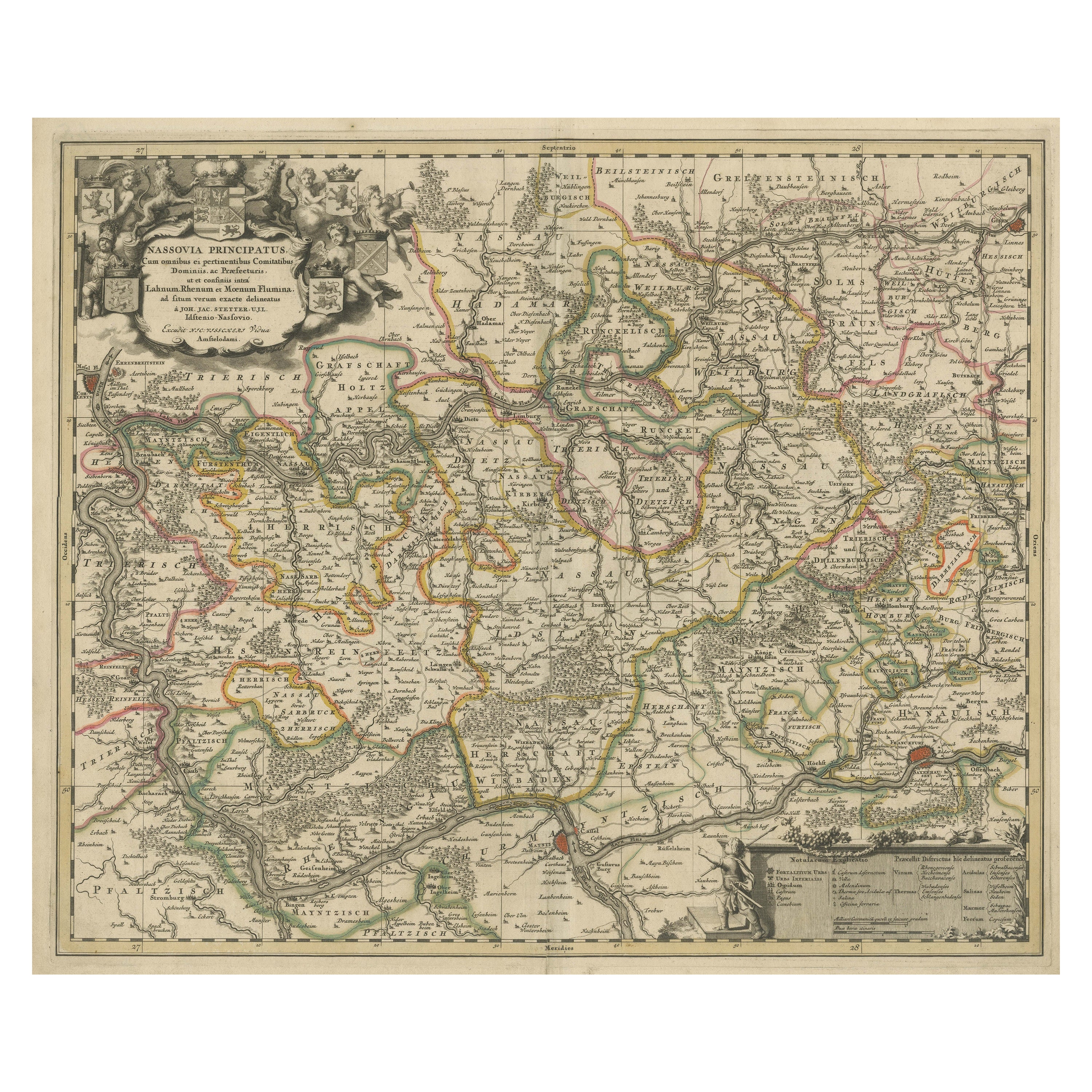
- Antique Map of the Nassau Region in Western GermanyLocated in Langweer, NLAntique map titled 'Nassovia Principatus (..)'. Detailed map of the Nassau region in western Germany between Koblenz, Hadamar, Giessen, Frankfurt and Mainz. The map is filled with in...Category
Antique Early 18th Century Maps
MaterialsPaper


You May Also Like
- Original Antique Map of The Netherlands, Sherwood, Neely & Jones, Dated 1809Located in St Annes, LancashireGreat map of The Netherlands Copper-plate engraving by Cooper Published by Sherwood, Neely & Jones. Dated 1809 Unframed.Category
Antique Early 1800s English Maps
MaterialsPaper
- Original Antique Map of The Netherlands, Engraved by Barlow, Dated 1807Located in St Annes, LancashireGreat map of Netherlands Copper-plate engraving by Barlow Published by Brightly & Kinnersly, Bungay, Suffolk. Dated 1807 Unframed.Category
Antique Early 1800s English Maps
MaterialsPaper
- 1840 "New Map of the City of New York With Part of Brooklyn & Williamsburg"Located in Colorado Springs, COPresented is a hand-colored, engraved folding map titled "New Map of the City of New York With Part of Brooklyn & Williamsburg" by J. Calvin Smith. The map was issued bound in the bo...Category
Antique 1840s American Maps
MaterialsPaper
- Map of the Kingdom of Sardinia and Part of the Kingdom of Genoa, RomeBy Giovanni Maria CassiniLocated in Hamilton, Ontario18th century map by Italian engraver Giovanni Maria Cassini (Italy 1745-1824). Map of Part of the Kingdom of Sardinia and Part of the Kingdom of Genoa: Rome. This is a hand colored a...Category
Antique 18th Century Italian Maps
MaterialsPaper
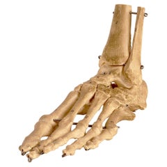
- Anatomical Model: the Skeletal Part of a Foot, Germany, 1970’sBy SomsoLocated in Milan, ITAnatomical model depicting the skeletal part of a foot, made by Somso, Sonenberg. Germany, circa 1970.Category
Vintage 1970s German Scientific Instruments
MaterialsMetal
- School Chart or Pull Down Map of Geography of the Netherlands, 1950sLocated in Hemiksem, VANA beautiful old school map of the Netherlands, painted on linen. The map shows the 3 different reliefs (low, middle, high) of the Netherlands. The beau...Category
Vintage 1950s Belgian Mid-Century Modern Maps
MaterialsLinen, Paint


Recently Viewed
View AllMore Ways To Browse
Map Of Ural
Rail Road Collectables
Australasia Antique Map
The Grand Mogol
Antique Map Austro Hungarian
Antique Montana Map
Map Of Montana
Mauritius Antique Map
Manchester Antique Map
Georgetown Map
Guatemala Antique Map
Map Montana
Montana Maps
Antique Chesapeake Bay Map
Antique Map Of Chesapeake Bay
J Thayer
Indie Vintage
Paraguay Antique Map