Items Similar to Antique Map of the Nassau Region in Western Germany

Want more images or videos?
Request additional images or videos from the seller
1 of 6
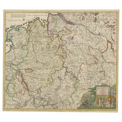
Antique Map of the Nassau Region in Western Germany
About the Item
Antique map titled 'Nassovia Principatus (..)'. Detailed map of the Nassau region in western Germany between Koblenz, Hadamar, Giessen, Frankfurt and Mainz. The map is filled with information of roads, fortification, forests, castles, hot springs, salt mines, and blacksmiths. The pictorial cartouche has cherubs holding six coats of arms, and a table of explanations decorates the opposite corner. Published by N. Visscher, circa 1720.
IN MORE DETAIL:
This is an intricate and historically significant map, titled 'Nassovia Principatus,' which translates to 'Principality of Nassau.' It offers a detailed view of the Nassau region in western Germany, an area known for its rich history and economic activities during the period around 1720.
The map would be of considerable interest to collectors and enthusiasts of cartography, especially those focused on German history or the cartographic work of the early 18th century. The detailed representation of the region includes cities such as Koblenz, Hadamar, Giessen, Frankfurt, and Mainz, which are key historical and economic centers, even today.
Prospective buyers would be drawn to the meticulous depiction of roads, fortresses, expansive forests, and the precise locations of castles, signifying the region's strategic and defensive importance. The inclusion of natural resources such as hot springs, salt mines, and blacksmith sites not only offers insights into the economic activities of the time but also hints at the region's wealth and self-sufficiency.
The artistic elements of the map, such as the pictorial cartouche adorned with cherubs and the six coats of arms, reflect the status and power of the region, adding a noble allure to the map's visual appeal. The opposite corner's table of explanations suggests a high level of detail and care taken in the map's creation.
Published by Nicolaes Visscher, a renowned name in the world of cartography, this map would be a prized possession for its historical cartographic value and as a representation of the Visscher family's craftsmanship in map-making.
Such a map would resonate well with institutions specializing in historical studies, private collectors with a penchant for European history, and antique enthusiasts seeking to own a piece of the intricate tapestry of German regional development during the early modern period.
- Dimensions:Height: 20.67 in (52.5 cm)Width: 24.1 in (61.2 cm)Depth: 0.02 in (0.5 mm)
- Materials and Techniques:
- Period:
- Date of Manufacture:c.1720
- Condition:Repaired: Closed split on folding line. Original/contemporary hand coloring, with a few small defects along outlines. Some wear and soiling. Blank verso. Please study image carefully.
- Seller Location:Langweer, NL
- Reference Number:Seller: BG-13441-141stDibs: LU3054336262402
About the Seller
5.0
Platinum Seller
These expertly vetted sellers are 1stDibs' most experienced sellers and are rated highest by our customers.
Established in 2009
1stDibs seller since 2017
1,932 sales on 1stDibs
Typical response time: <1 hour
- ShippingRetrieving quote...Ships From: Langweer, Netherlands
- Return PolicyA return for this item may be initiated within 14 days of delivery.
Auctions on 1stDibs
Our timed auctions are an opportunity to bid on extraordinary design. We do not charge a Buyer's Premium and shipping is facilitated by 1stDibs and/or the seller. Plus, all auction purchases are covered by our comprehensive Buyer Protection. Learn More
More From This SellerView All
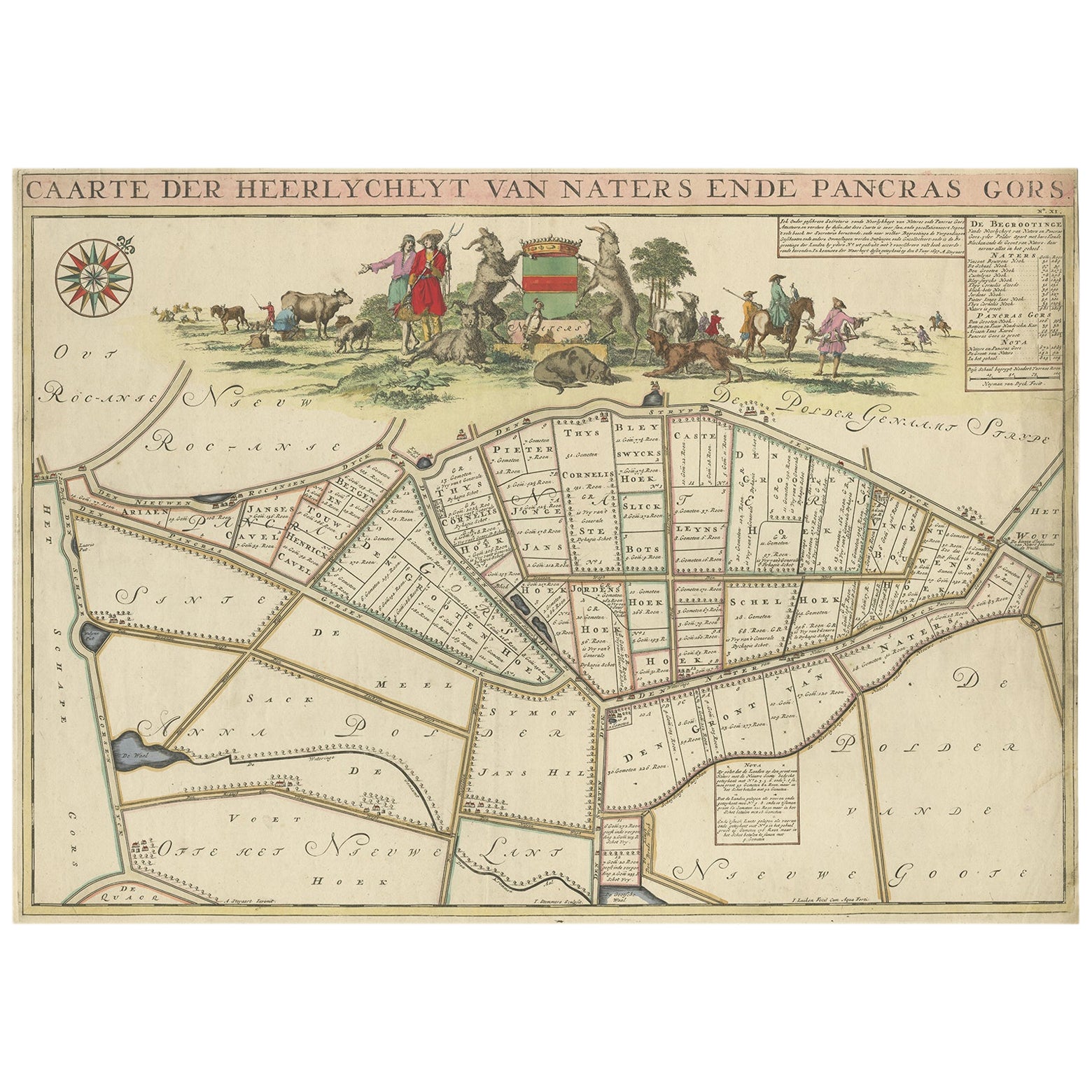
- Antique Map of the Niederrhein region, GermanyLocated in Langweer, NLAntique map titled 'Circulus Electorum Rheni sive Rhenanus Inferior (..)'. Original antique map of the Niederrhein region, Germany. By F. de Wit, circa 1690. Frederick de Wit (1629-...Category
Antique Late 17th Century Maps
MaterialsPaper
- Antique Map of the Westphalia region of GermanyLocated in Langweer, NLAntique map titled 'Circulus Westphaliae (..)'. Original old map of the Westphalia region, Germany. Published by Justus Danckerts, circa 1696. Justus Danckerts I (11 November 1635 ...Category
Antique Late 17th Century Maps
MaterialsPaper
- Antique Map of the Region of Oldenburg, GermanyBy Willem BlaeuLocated in Langweer, NLAntique map titled 'Oldenburg Comitatus'. Detailed old map of Oldenburg, Germany. The map also shows Bremen and the Jade Bight. Published by W. Blaeu, circa 1640. Willem Jansz. Blaeu...Category
Antique Mid-17th Century Maps
MaterialsPaper
- Antique Map of the Region of Gommern in Germany, 1749By SchreiberLocated in Langweer, NLAntique map titled 'Das Amt Gommern und die Graffschafft Barby (..)'. Map of the region of Gommern, Germany. This map originates from 'Atlas Selectus von allen Konigreichen und Lande...Category
Antique 18th Century Maps
MaterialsPaper
- Antique Map of the Region of Zeitz in Germany, 1749By SchreiberLocated in Langweer, NLAntique map titled 'Das Stifft Zeitz (..)'. Map of the region of Zeitz, Germany. Zeitz is a town in the Burgenlandkreis district, in Saxony-Anhalt, Germany. It is situated on the riv...Category
Antique 18th Century Maps
MaterialsPaper
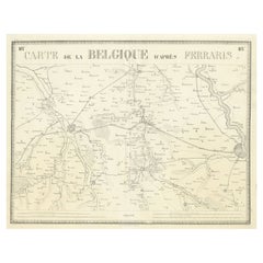
- Antique Map of the Region near Cologne, GermanyLocated in Langweer, NLAntique map titled 'Carte de la Belgique d'après Ferraris'. Original antique map of the region near Cologne, Germany. Cologne is the largest city of the German western state of North...Category
Antique Mid-19th Century Maps
MaterialsPaper


You May Also Like
- 17th Century Hand-Colored Map of a Region in West Germany by JanssoniusBy Johannes JanssoniusLocated in Alamo, CAThis attractive highly detailed 17th century original hand-colored map is entitled "Archiepiscopatus Maghdeburgensis et Anhaltinus Ducatus cum terris adjacentibus". It was published ...Category
Antique Mid-17th Century Dutch Maps
MaterialsPaper
- 1594 Maurice Bouguereau Map of the Region Limoges, France, Ric0015Located in Norton, MA1594 Maurice Bouguereau map of the region Limoges, France, entitled "Totivs Lemovici et Confinium Pro Uinciarum Quantum ad Dioecefin Lemo Uicenfen Fpectant," Hand Colored Ric0015 Jean IV Le Clerc...Category
Antique 16th Century Dutch Maps
MaterialsPaper
- 17th Century Hand Colored Map of the Liege Region in Belgium by VisscherBy Nicolaes Visscher IILocated in Alamo, CAAn original 17th century map entitled "Leodiensis Episcopatus in omnes Subjacentes Provincias distincté divisusVisscher, Leodiensis Episcopatus" by Nicolaes Visscher II, published in Amsterdam in 1688. The map is centered on Liege, Belgium, includes the area between Antwerp, Turnhout, Roermond, Cologne, Trier and Dinant. This attractive map is presented in a cream-colored mat measuring 30" wide x 27.5" high. There is a central fold, as issued. There is minimal spotting in the upper margin and a tiny spot in the right lower margin, which are under the mat. The map is otherwise in excellent condition. The Visscher family were one of the great cartographic families of the 17th century. Begun by Claes Jansz Visscher...Category
Antique Late 17th Century Dutch Maps
MaterialsPaper
- Antique Lithography Map, Western Russia, English, Framed, Cartography, VictorianLocated in Hele, Devon, GBThis is an antique lithography map of Western Russia. An English, framed atlas engraving of cartographic interest by John Rapkin, dating to the early Victorian period and later, circ...Category
Antique Mid-19th Century British Early Victorian Maps
MaterialsWood
- 1861 Topographical Map of the District of Columbia, by Boschke, Antique MapLocated in Colorado Springs, COPresented is an original map of Albert Boschke's extremely sought-after "Topographical Map of the District of Columbia Surveyed in the Years 1856 ...Category
Antique 1860s American Historical Memorabilia
MaterialsPaper
- The Normandy Region of France: A 17th C. Hand-colored Map by Sanson and JaillotBy Nicolas SansonLocated in Alamo, CAThis large hand-colored map entitled "Le Duché et Gouvernement de Normandie divisée en Haute et Basse Normandie en divers Pays; et par evêchez, avec le Gouvernement General du Havre ...Category
Antique 1690s French Maps
MaterialsPaper


Recently Viewed
View AllMore Ways To Browse
Antique Map Coats Of Arms
18th Engineer
Antique Map Of Cuba
Antique Maps Of Cuba
Cuba Antique Map
Nebraska Map
Santa Cruz Island
Map Of Kentucky
Yorkshire Ridings Map
Idaho Map
Rail Road Collectables
Antique Map Delaware
Antique Maps San Diego
Australasia Antique Map
Hawaii Map Vintage
Hawaii Vintage Map
Map Of Ural
Trinidad Map