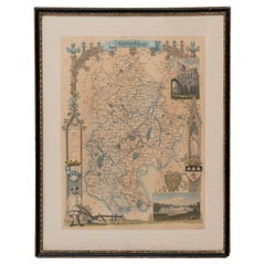
Items Similar to Map Bedfordshire WilliamSchmollinger Dunstable Priory Woburn Abbey Moules Gothic

Want more images or videos?
Request additional images or videos from the seller
1 of 8
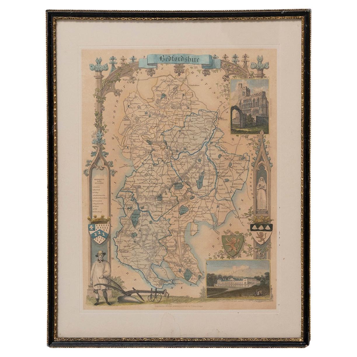
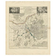
Map Bedfordshire WilliamSchmollinger Dunstable Priory Woburn Abbey Moules Gothic
About the Item
Artist William Schmollinger (1811-1869)
London : George Virtue, 1832. A highly attractive map in gothick style, with an ornamental architectural border, inset views of Dunstable Priory and Woburn Abbey, coats of arms, and a farmer in a smock with a plough. Engraved by William Schmollinger (1811-1869) and originally produced in 1832 for Moule’s partwork series The English Counties Delineated (London : 1830-1837) – and here in early state before the addition of railways, etc.
Steel line engraving on paper. Original hand colour. Engraved surface 267 x 203mm approx. 10-1/2” x 8”
Rare in this early state and with original colour
In a brown mount and traditional black and gold map frame.
- Dimensions:Height: 37 in (93.98 cm)Width: 29 in (73.66 cm)Depth: 2 in (5.08 cm)
- Style:Victorian (Of the Period)
- Materials and Techniques:
- Place of Origin:
- Period:
- Date of Manufacture:1832
- Condition:Wear consistent with age and use.
- Seller Location:BUNGAY, GB
- Reference Number:1stDibs: LU3867332646122
About the Seller
5.0
Vetted Seller
These experienced sellers undergo a comprehensive evaluation by our team of in-house experts.
Established in 1985
1stDibs seller since 2018
84 sales on 1stDibs
Typical response time: 13 hours
- ShippingRetrieving quote...Ships From: BUNGAY, United Kingdom
- Return PolicyA return for this item may be initiated within 7 days of delivery.
More From This SellerView All
- Map Bedfordshire WilliamSchmollinger Dunstable Priory Woburn Abbey Moules GothicLocated in BUNGAY, SUFFOLKARTIST William Schmollinger (1811-1869) London : George Virtue, 1832. A highly attractive map in gothick style, with an ornamental architectural border, inset views of Dunstable Priory and Woburn Abbey...Category
Antique 19th Century English Victorian Maps
MaterialsPaper
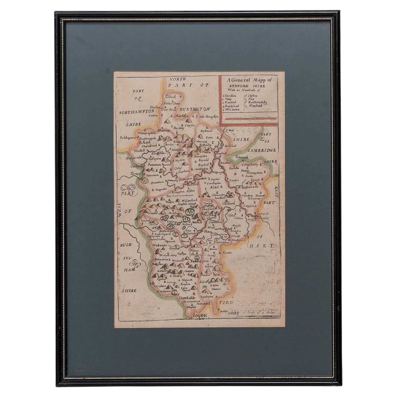
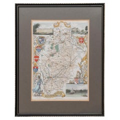
- Map Bedfordshire General FramedLocated in BUNGAY, SUFFOLKA general map of Bedfordshire with its hundreds A scale of 5 miles in the original green mount and traditional black and gold frame. Measures: 36cm 14" high.Category
Antique 18th Century English Georgian Maps
MaterialsPaper
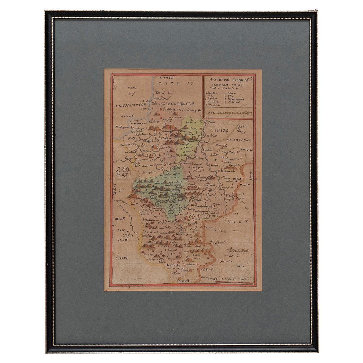
- Map Bedfordshire No 3 General FramedLocated in BUNGAY, SUFFOLKA general map of Bedfordshire with its hundreds. Measure: 37cm 14 1/2" high A scale of 5 miles. in the original green mount and traditional black and gold frame. charming map with...Category
Antique 18th Century English Georgian Maps
MaterialsPaper
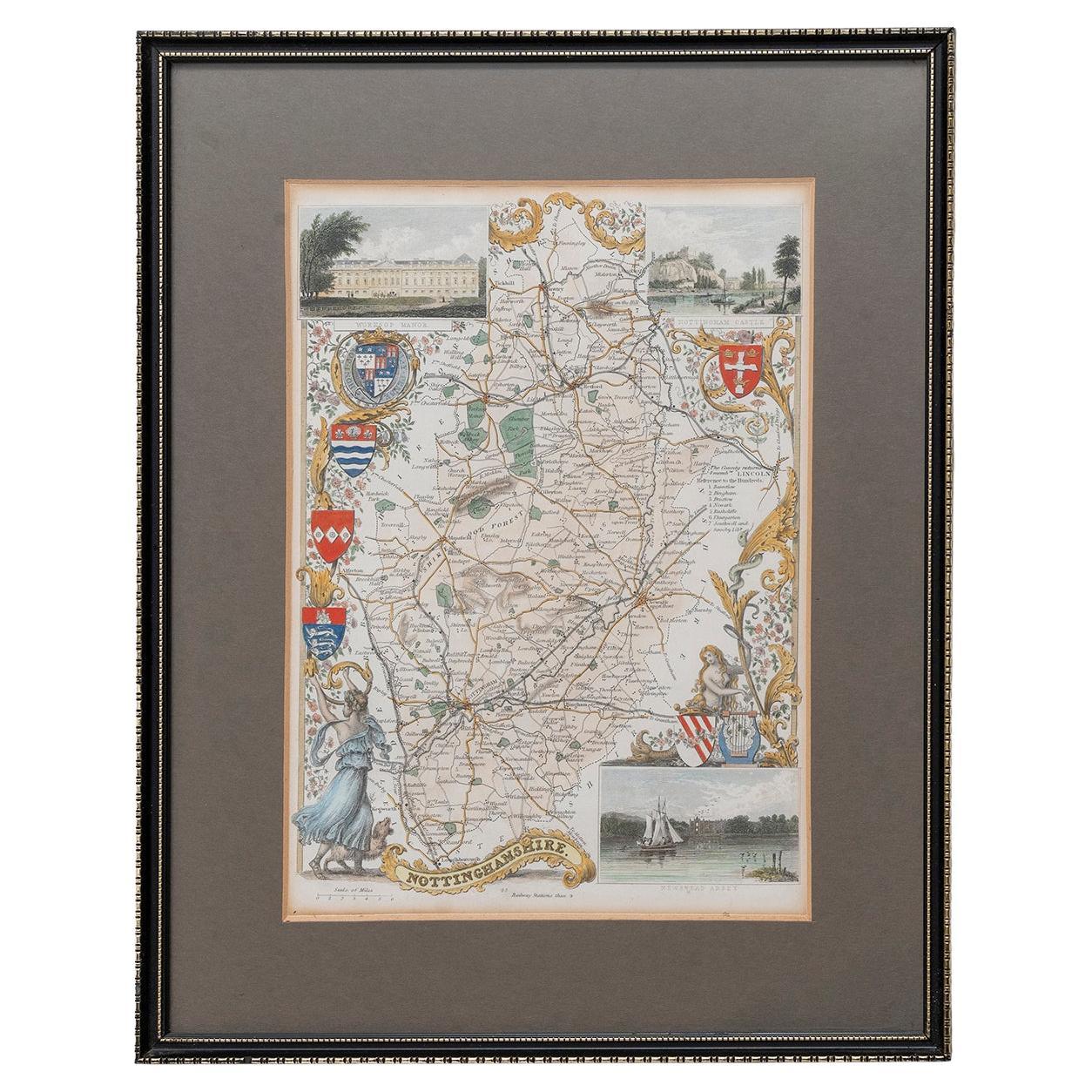
- Map Nottinghamshire Worksop Manor Newstead Abbey Nottingham Castle Shields H37cmLocated in BUNGAY, SUFFOLKMap of Nottinghamshire with engravings of Worksop Manor Nottingham Castle Newstead Abbey BIBLIOGRAPHY published in Barclay's Universal English Dicti...Category
Antique 19th Century English Victorian Maps
MaterialsPaper
- Map SussexLocated in BUNGAY, SUFFOLKMap of Sussex with explanation Maker unknown.Category
Antique 19th Century English Victorian Maps
MaterialsPaper
- Map Huntingdonshire R Scott Archibald Fullarton & Co GlasgowLocated in BUNGAY, SUFFOLKFolding Map of Huntingdonshire by R Scott with distances from London and reference to the hundreds. Published by Archibald Fullarton & Co Glasgow. Measure: 40...Category
Antique 19th Century English Victorian Maps
MaterialsPaper


You May Also Like
- Antique Lithography Map, Bedfordshire, English, Framed Engraving, CartographyLocated in Hele, Devon, GBThis is an antique lithography map of Bedfordshire. An English, framed atlas engraving of cartographic interest, dating to the mid 19th century and...Category
Antique Mid-19th Century British Victorian Maps
MaterialsWood
- Antique Colourful and Decorative County Map of Bedfordshire, England, 1804Located in Langweer, NLAntique county map of Bedfordshire first published c.1800. Villages, towns, and cities illustrated include Bedford, Todington, and Potton. Charl...Category
Antique Early 1800s Maps
MaterialsPaper
- Antique Map of the Area around the Abbey in Soligny-la-Trappe 'c.1710'Located in Langweer, NLAntique map titled 'La nouvelle Thebaide ou la Carte tres particuliere et exacte de l'Abbaye de la Maison Dieu Nostre Dame de la Trappe (..)'. Rare, original map of the area around t...Category
Antique Early 18th Century Maps
MaterialsPaper
- Original Antique Map of Indonesia, 1861Located in St Annes, LancashireGreat map of Indonesia Drawn and engraved by Edward Weller Original color Published in The Weekly Dispatch Atlas, 1861 Repairs to minor e...Category
Antique 1860s English Victorian Maps
MaterialsPaper

- Original Antique Map of Missouri, 1889Located in St Annes, LancashireGreat map of Missouri Drawn and Engraved by W. & A.K. Johnston Published By A & C Black, Edinburgh. Original colour Unframed.Category
Antique 1880s Scottish Victorian Maps
MaterialsPaper

- 1900s Stielers Hand Atlas 100 MapsLocated in Seguin, TXStielers Hand Atlas, Gotha: Justus Perthes, Germany, circa 1905. Linen covered wood box containing 100 folded individual loose leaf maps of the world, text in german. Box made to loo...Category
Early 20th Century German Victorian Maps
MaterialsPaper

Recently Viewed
View AllMore Ways To Browse
Steel Line
Antique Abbey
Abbey Antique
English Gothic Style Furniture
Victorian Furniture English 1830
Gothic Engraving
Antique English County Maps
Antique Plough
Antique Ploughs
Priory Furniture
Antique Priory Furniture
Antique Smock
Delineator Series
Antique Railway Maps
Moule Antique
Gothick Furniture
Antique Furniture Bedfordshire
Woburn Abbey