Items Similar to Antique Map of the Area around the Abbey in Soligny-la-Trappe 'c.1710'


Want more images or videos?
Request additional images or videos from the seller
1 of 5
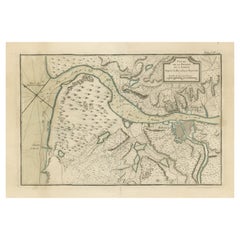
Antique Map of the Area around the Abbey in Soligny-la-Trappe 'c.1710'
$770.33
$962.9220% Off
£560.41
£700.5120% Off
€640
€80020% Off
CA$1,051.28
CA$1,314.1120% Off
A$1,170.70
A$1,463.3720% Off
CHF 609.28
CHF 761.6120% Off
MX$14,434.59
MX$18,043.2420% Off
NOK 7,759.71
NOK 9,699.6320% Off
SEK 7,293.37
SEK 9,116.7120% Off
DKK 4,870.70
DKK 6,088.3720% Off
Shipping
Retrieving quote...The 1stDibs Promise:
Authenticity Guarantee,
Money-Back Guarantee,
24-Hour Cancellation
About the Item
Antique map titled 'La nouvelle Thebaide ou la Carte tres particuliere et exacte de l'Abbaye de la Maison Dieu Nostre Dame de la Trappe (..)'. Rare, original map of the area around the Abbey in Soligny-la-Trappe, France. Published by P. Mortier, circa 1710.
- Dimensions:Height: 24.02 in (61 cm)Width: 20.08 in (51 cm)Depth: 0.02 in (0.5 mm)
- Materials and Techniques:
- Period:
- Date of Manufacture:circa 1710
- Condition:General age-related toning. Original/contemporary hand coloring, original folding line. Minor wear, blank verso. Please study images carefully.
- Seller Location:Langweer, NL
- Reference Number:Seller: BG-12834-151stDibs: LU3054323226542
About the Seller
5.0
Recognized Seller
These prestigious sellers are industry leaders and represent the highest echelon for item quality and design.
Platinum Seller
Premium sellers with a 4.7+ rating and 24-hour response times
Established in 2009
1stDibs seller since 2017
2,482 sales on 1stDibs
Typical response time: <1 hour
- ShippingRetrieving quote...Shipping from: Langweer, Netherlands
- Return Policy
Authenticity Guarantee
In the unlikely event there’s an issue with an item’s authenticity, contact us within 1 year for a full refund. DetailsMoney-Back Guarantee
If your item is not as described, is damaged in transit, or does not arrive, contact us within 7 days for a full refund. Details24-Hour Cancellation
You have a 24-hour grace period in which to reconsider your purchase, with no questions asked.Vetted Professional Sellers
Our world-class sellers must adhere to strict standards for service and quality, maintaining the integrity of our listings.Price-Match Guarantee
If you find that a seller listed the same item for a lower price elsewhere, we’ll match it.Trusted Global Delivery
Our best-in-class carrier network provides specialized shipping options worldwide, including custom delivery.More From This Seller
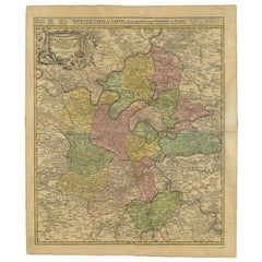
View AllAntique Map of the Lorraine Region 'France' (c.1735)
Located in Langweer, NL
Antique map titled 'Carte du Duche de Lorraine - Kaart van Lotharingen'. A detailed map of the Duchy of Lorraine. The map is surrounded by thirteen vignette bird-eye view of fortifie...
Category
Antique Mid-18th Century Maps
Materials
Paper

$264 Sale Price
20% Off
Antique Map of Boulogne-sur-Mer by Bellin '1764'
Located in Langweer, NL
Antique map titled 'Plan de la Ville de Boulogne'. Original antique map of Boulogne-sur-Mer, France. This map originates from 'Le petit atlas maritime: recueil de cartes et plans des...
Category
Antique Mid-18th Century Maps
Materials
Paper

$144 Sale Price
20% Off
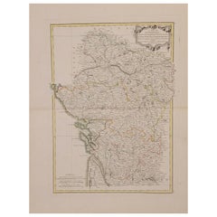
Antique Map of the Lorraine Region, c.1760
Located in Langweer, NL
Untitled antique map of the Lorraine region, France. A cultural and historical region in north-eastern France, now located in the administrative region of Grand Est. Lorraine's name ...
Category
Antique 18th Century Maps
Materials
Paper

$211 Sale Price
20% Off
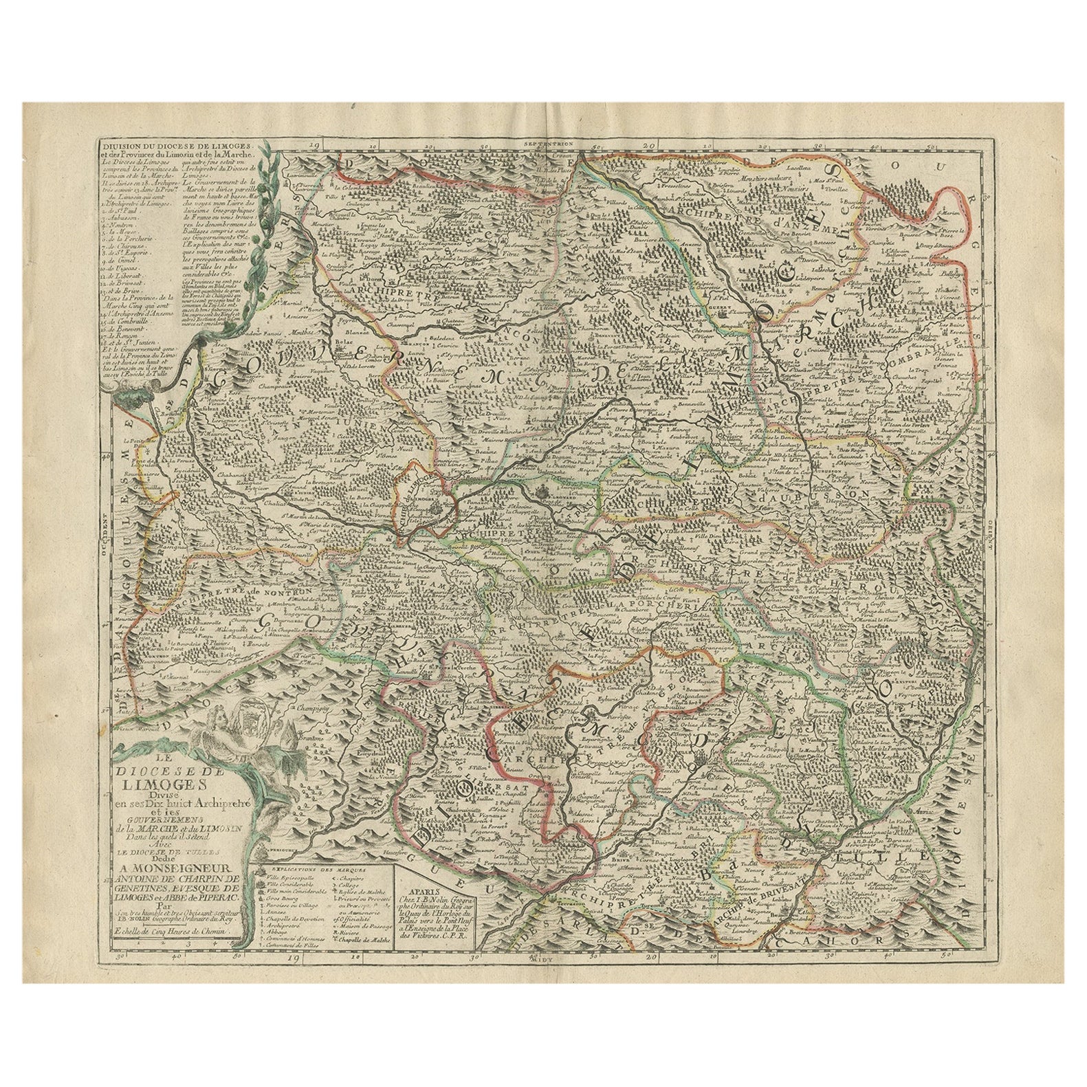
Antique Map of the Limoges Region in France, c.1690
Located in Langweer, NL
Antique map titled 'Le Diocèse de Limoges'. Large map of the Limoges region, France.
The map is dedicated to the bishop of Limoges, Antoine de Charpin.
Artists and Engravers:...
Category
Antique 17th Century Maps
Materials
Paper
$625 Sale Price
20% Off
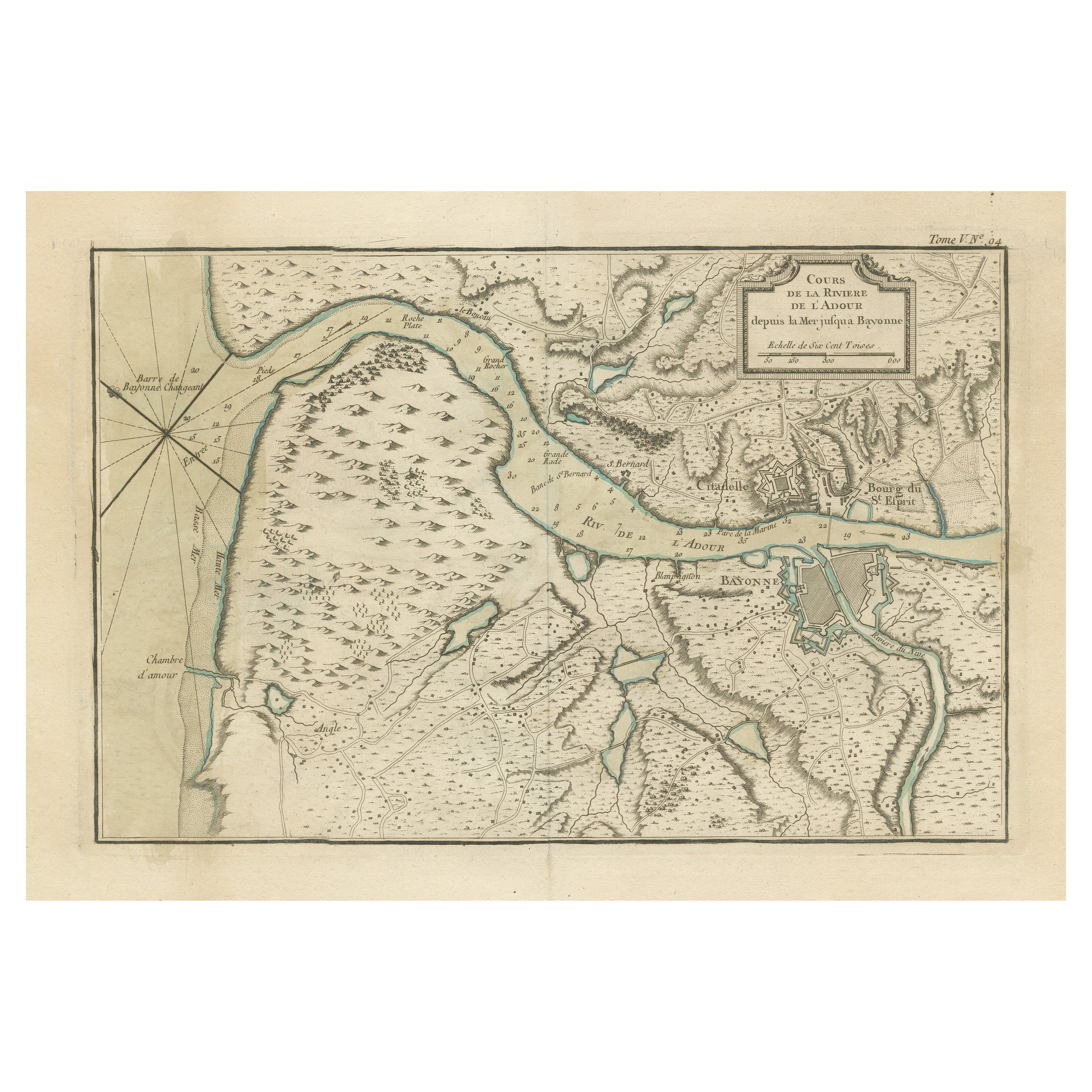
Antique Map of the Adour River, Near Bayonne, France
Located in Langweer, NL
Antique map titled 'Cours de la riviere de l'Adour depuis la mer jusqua Bayonne'. Original old map of the Adour river, near Bayonne, France. This map originates from 'Le Petit Atlas ...
Category
Antique Mid-18th Century Maps
Materials
Paper
$327 Sale Price
20% Off
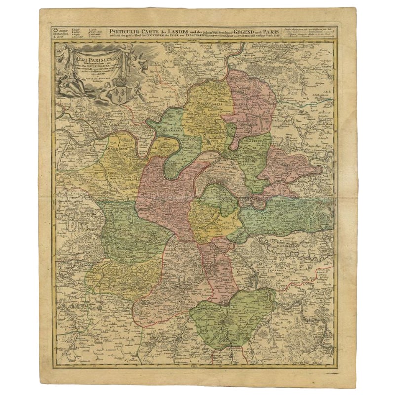
Antique Map of the Region of Paris by Homann Heirs, c.1720
By Homann Heirs
Located in Langweer, NL
Antique map titled 'Agri Parisiensis Tabula particularis, qua maxima Pars Insulae Franciae (..).' Incredibly detailed map showing everything from tiny villages to forests, farmland, ...
Category
Antique 18th Century Maps
Materials
Paper
$192 Sale Price
20% Off
You May Also Like
1771 Bonne Map of Poitou, Touraine and Anjou, France, Ric.a015
Located in Norton, MA
1771 Bonne Map of Poitou,
Touraine and Anjou, France
Ric.a015
1771 Bonne map of Potiou, Touraine and Anjou entitled "Carte des Gouvernements D'Anjou et du Saumurois, de la Touraine, du Poitou,du Pays d'aunis, Saintonge?Angoumois,"
Carte des gouvernements d'Anjou et du Saumurois, de la Touraine, du Poitou, du Pays d'Aunis, Saintonge-Angoumois. Projettee et assujettie au ciel par M. Bonne, Hyd. du Roi. A Paris, Chez Lattre, rue St. Jacques a la Ville de Bord(ea)ux. Avec priv. du Roi. 1771. Arrivet inv. & sculp., Atlas moderne ou collection de cartes sur toutes...
Category
Antique 17th Century Unknown Maps
Materials
Paper
1657 Janssonius Map of Vermandois and Cappelle, Ric. A-004
Located in Norton, MA
1657 Janssonius map of
Vermandois and Cappelle
Ric.a004
Description: Antique map of France titled 'Descriptio Veromanduorum - Gouvernement de la Cappelle'. Two detailed maps o...
Category
Antique 17th Century Unknown Maps
Materials
Paper

1640 Joan Bleau Map Entitled"Diocecese de rheims et le pais de rethel, " Eic.a011
Located in Norton, MA
1640 Joan Bleau map entitled
"Diocecese de rheims et le pais de rethel,"
Ric.a011
OAN BLAEU
Diocecese de Rheims, et le pais de Rethel.
Handcolored engraving, c.1640.
...
Category
Antique 17th Century Dutch Maps
Materials
Paper

1627 Hondius Map "La Principaute d'Orange et Comtat de Ve", Ric.0003
Located in Norton, MA
1627 Hondius map entitled
"La Principaute d'Orange et Comtat de Venaissin,"
Original Hand-Colored
Description: From Johannes Janssonius's Atlantis Maioris Appendix of 1630.
...
Category
Antique 17th Century Unknown Maps
Materials
Paper

1633 Map "La Souverainete De Sedan Et De Raucourt, Et La Prevoste Ric0011
Located in Norton, MA
1653 map entitled
"La Souverainete de Sedan et de Raucourt, et la Prevoste de Doncheri,"
Ric0011
Description:
Lovely map centered on Sedan and Doncheri and the Meuze River fr...
Category
Antique 17th Century Dutch Maps
Materials
Paper

17th Century Toulouse, Savve, Sommieres Topographical Map by Iohan Peeters
Located in New York, NY
Fine topographical 17th century map of Toulouse, Savve and Sommieres by Iohan Peeters
Beautiful engraving of the capital of France's Occitanie Region, Toulouse, called La Ville Rose- the Pink City, for the terracotta bricks used in its many buildings, giving the city a distinct apricot-rose hue. An important cultural and educational center, the city's residents included Nobel Prize winners and world renown artists- Henri de Toulouse-Lautrec, Henri Martin, Jean-Auguste-Dominique Ingres, Antonin Mercie, Alexandre Falguiere and more recently Cyril Kongo...
Category
Antique 17th Century Dutch Maps
Materials
Paper

More Ways To Browse
Poul Volther Frem Rojle
Pre Columbian Beads
Prefab Architecture
Pressed Fern Art
Pressed Ferns
Prie Dieu Chair
Puiforcat Elysee
Pull Out Daybed
Pull Out Sofa Bed
Purple Loveseat
Pussy Willow
Queen Anne Dressing Table
Queen Anne Lacquered Chairs
Queen Anne Tilt Table
R Blackinton Co
Rabbit Dish
Radio Console
Rafraichissoir Table