Antique Railway Maps

1
to
12
97
23
73
73
47
45
24
18
11
10
6
5
4
2
2
2
3
2
2
2
2
Sort By
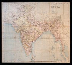
Railway Map of India.
Located in London, GB
THUILLIER, Colonel Henry Ravenshaw. Railway Map of India. Railways Brought up to October 1895
Category

1890s Other Art Style Antique Railway Maps

Materials

Lithograph

Antique Railway Map of India.
Railway Map of India.
H 50.79 in W 61.03 in D 1.58 in
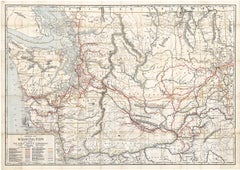
Original 1917 Railroad Map of Washington State railway map
Located in Spokane, WA
This is an Original Lithograph Vintage Railroad Map of Washington State; it is not a reproduction
Category

1910s Academic Antique Railway Maps

Materials

Lithograph

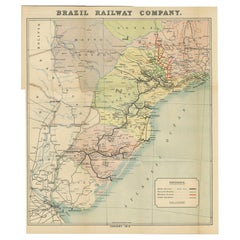
Antique Map of the Brazil Railway Company, '1912'
Located in Langweer, NL
Antique map titled 'Brazil Railway Company'. This folding map is attached to the booklet titled
Category

Early 20th Century Antique Railway Maps

Materials

Paper

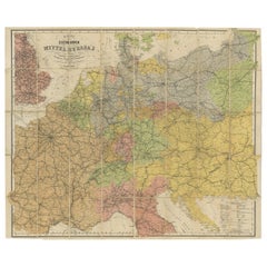
Antique Railway Folding Map of Central Europe by Müller, 1870
Located in Langweer, NL
Antique map titled 'Karte der Eisenbahnen Mittel-Europa's (..)'. Railway folding map of Central
Category

Late 19th Century Antique Railway Maps

Materials

Paper

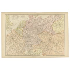
Antique Map of Central Europe Showing The Railways and The Political Bounderies
Located in Langweer, NL
Explore the Heart of Europe with the 'Central Europe' Map, Featuring Principal Railways and
Category

1880s Antique Railway Maps

Materials

Paper

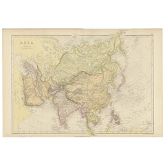
Historical Map Depicting the Continent of Asia, 1882
Located in Langweer, NL
This 1882 map presents a meticulously detailed representation of the continent of Asia, a testament
Category

1880s Antique Railway Maps

Materials

Paper

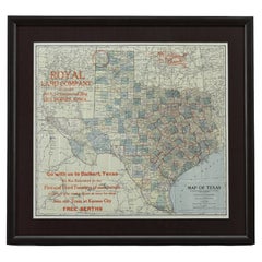
1908 "Map of Texas" by The Kenyon Company
Located in Colorado Springs, CO
Presented is an antique map of the state of Texas, printed as a pocket map in 1908 by The Kenyon
Category

Early 1900s American Antique Railway Maps

Materials

Paper

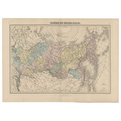
Antique Map of Siberia and Russia, c.1885
Located in Langweer, NL
Antique map titled 'Siberie ou Russie d?Asie'. This is a fine example of J. Migeon's map of Russia
Category

19th Century Antique Railway Maps

Materials

Paper

Antique Map of Siberia and Russia, c.1885
H 13.39 in W 18.71 in D 0 in
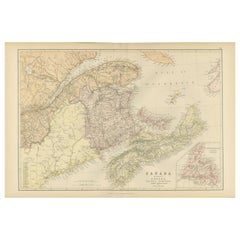
Decorative Antique Map of Eastern Canada, Published in 1882
Located in Langweer, NL
This is a historical map from the 1882 Blackie Atlas, focused on eastern Canada and the maritime
Category

1880s Antique Railway Maps

Materials

Paper

Decorative Antique Map of Eastern Canada, Published in 1882
Free Shipping
H 14.97 in W 22.45 in D 0 in
Madrid 1901: A Historical Map of Spain's Capital Province
Located in Langweer, NL
The map is of the province of Madrid, the capital region of Spain, as it appeared in 1901. Here are
Category

Early 1900s Antique Railway Maps

Materials

Paper

Madrid 1901: A Historical Map of Spain's Capital Province
Free Shipping
H 20.08 in W 14.77 in D 0 in
Map Bedfordshire WilliamSchmollinger Dunstable Priory Woburn Abbey Moules Gothic
Located in BUNGAY, SUFFOLK
Artist William Schmollinger (1811-1869) London : George Virtue, 1832. A highly attractive map in
Category

19th Century English Victorian Antique Railway Maps

Materials

Paper

Map Bedfordshire WilliamSchmollinger Dunstable Priory Woburn Abbey Moules Gothic
Located in BUNGAY, SUFFOLK
ARTIST William Schmollinger (1811-1869) London : George Virtue, 1832. A highly attractive map in
Category

19th Century English Victorian Antique Railway Maps

Materials

Paper

1859 Antique Swiss Panorama: Blackie's Detailed Map of Switzerland
Located in Langweer, NL
The "Antique Map of Switzerland" is a distinguished piece from 'The Imperial Atlas of Modern
Category

Mid-19th Century Antique Railway Maps

Materials

Paper

1859 Classic Map of France: Blackie's Imperial Geographic Masterpiece
Located in Langweer, NL
The "Antique Map of France" from 'The Imperial Atlas of Modern Geography', published in 1859 by W
Category

Mid-19th Century Antique Railway Maps

Materials

Paper

1866 Ensign & Bridgman's Rail Road Map of the United States
Located in Colorado Springs, CO
ornamental border. The map captures the burgeoning American railway infrastructure and documents the
Category

1860s American Late Victorian Antique Railway Maps

Materials

Paper

Topographical and Infrastructure Map of the Province of Valencia, 1901
Located in Langweer, NL
boundaries are clearly outlined, and various types of roads and railways are indicated, suggesting the map
Category

Early 1900s Antique Railway Maps

Materials

Paper

Antique Map of Russia and Siberia by Migeon, 1880
Located in Langweer, NL
Antique map titled 'Sibérie ou Russie d'Asie'. Migeon's map covers the Russian empire in Asia from
Category

19th Century Antique Railway Maps

Materials

Paper

Antique Map of the United States with Vignette of Washington
Located in Langweer, NL
Antique map titled 'États-Unis'. A very attractive and detailed late 19th century map of the United
Category

Late 19th Century Antique Railway Maps

Materials

Paper

Burgos 1902: Geographic Map of Castile's Historic Heartland in Spain
Located in Langweer, NL
The map of the province of Burgos in the autonomous community of Castile and León in Spain, dated
Category

Early 1900s Antique Railway Maps

Materials

Paper

Anrtique Map of the Province of Valladolid, Central Spain, 1902
Located in Langweer, NL
Origen). The map likely shows a network of roads and railways as they existed in the early 20th century
Category

Early 1900s Antique Railway Maps

Materials

Paper

Antique Map of The United States of North America, 1882
Located in Langweer, NL
This is a historical map titled "The United States of North America, Central Part" from the 1882
Category

1880s Antique Railway Maps

Materials

Paper

Antique Map of The United States of North America, 1882
Free Shipping
H 14.97 in W 22.45 in D 0 in
Original Antique Map Covering the Russian Empire in Asia, 1880
Located in Langweer, NL
Antique map titled 'Sibérie ou Russie d'Asie'. Migeon's map covers the Russian empire in Asia
Category

1880s Antique Railway Maps

Materials

Paper

Girona 1902: Geographic and Infrastructural Map of Catalonia’s Northern Province
Located in Langweer, NL
The map provided is of the province of Girona (in Catalan, Girona), located in the northeast of
Category

Early 1900s Antique Railway Maps

Materials

Paper

Cortesi's Masterpiece: A Comprehensive and Authoritative Map of Uruguay, 1903
Located in Langweer, NL
Antique map titled 'Mapa de la Republica Oriental del Uruguay'. Large and detailed folding map of
Category

Early 20th Century Antique Railway Maps

Materials

Paper

Orense in Depth: A 1902 Topographical Map of Galicia's Mountainous Province
Located in Langweer, NL
The map is a detailed cartographic representation of the province of Orense (Ourense in Galician
Category

Early 1900s Antique Railway Maps

Materials

Paper

1859 Vintage Map of Holland and Belgium: Blackie's Imperial Geographic Insight
Located in Langweer, NL
The "Antique Map of Holland and Belgium" from 'The Imperial Atlas of Modern Geography', published
Category

Mid-19th Century Antique Railway Maps

Materials

Paper

1859 Vintage Maps of England and Wales: Blackie's Imperial Geographic Detail
Located in Langweer, NL
The "Antique Map of England & Wales" from 'The Imperial Atlas of Modern Geography', published by W
Category

Mid-19th Century Antique Railway Maps

Materials

Paper

Antique Map of Italy, North Part, by W. G. Blackie, 1859
Located in Langweer, NL
The "Antique Map of Italy, North Part" by W. G. Blackie, dated 1859, is a historically significant
Category

Mid-19th Century Antique Railway Maps

Materials

Paper

Mid-19th Century Decorative Map of India with Cultural and Natural Vignettes
Located in Langweer, NL
The Tallis maps, including the one of India, are known for their detailed and ornamental style
Category

1850s Antique Railway Maps

Materials

Paper

Alicante in a 1901 Antique Map: Maritime Gateway of Spain's Costa Blanca
Located in Langweer, NL
An original antique map of the province of Alicante, dated 1901. It is part of the atlas series by
Category

Early 1900s Antique Railway Maps

Materials

Paper

Algarve: A Tapestry of Sea and Sunlight in an Antique Map, 1903
Located in Langweer, NL
administrative center of the Algarve. The map details the intricate network of roads and railways, the varied
Category

Early 1900s Antique Railway Maps

Materials

Paper

1899 Poole Brothers Antique Railroad Map of the Illinois Central Railroad
Located in Colorado Springs, CO
lead to the creation of the Louisville, New Orleans, and Texas Railway. This map was first produced by
Category

1890s American Antique Railway Maps

Materials

Paper

1859 Detailed Map of North West Germany with Bavaria Inset - Blackie's Atlas
Located in Langweer, NL
The "Antique Map of North West Germany" with an inset map of Bavaria is a distinguished piece from
Category

Mid-19th Century Antique Railway Maps

Materials

Paper

Antique Map of Canada, The Province of Ontario and Part of Quebec, 1882
Located in Langweer, NL
This is a historical map from the 1882 Blackie Atlas, this time detailing "The Province of Ontario
Category

1880s Antique Railway Maps

Materials

Paper

1859 "Map of the United States of America..." by J. H. Colton
By J.H. Colton
Located in Colorado Springs, CO
Presented is an 1859 “Map of the United States of America, the British Provinces, Mexico, the West
Category

1850s American Antique Railway Maps

Materials

Paper

Navarra in Cartographic Detail: A 1902 Map of the Crossroads of Northern Spain
Located in Langweer, NL
The original antique map for sale shows the Spanish province of Navarra as it was in 1902. Here's a
Category

Early 1900s Antique Railway Maps

Materials

Paper

Balkan Convergence: A Map of Turkey and Greece with the Balkan States, 1882
Located in Langweer, NL
This map, "TURKEY AND GREECE including ROUMANIA, SERVIA, BULGARIA, BOSNIA & MONTENEGRO," extracted
Category

1880s Antique Railway Maps

Materials

Paper

1863 "Lloyd's New Map of the United States, the Canadas, and New Brunswick"
Located in Colorado Springs, CO
map’s title, this map is especially notable for the countless railway lines and stations depicted, with
Category

1860s American Antique Railway Maps

Materials

Linen, Wood, Paper

Antique Map of Mexico, Central America and West Indies by A & C. Black, 1870
Located in Langweer, NL
, Central America and West Indies with inset map of Panama railway. This map originates from ‘Black's
Category

Late 19th Century Antique Railway Maps

Materials

Paper

Antique Map of Walcheren in the Province of Zeeland, the Netherlands, ca.1910
Located in Langweer, NL
Antique map of Walcheren, part of the province of Zeeland, the Netherlands. Shows the cities of
Category

1910s Antique Railway Maps

Materials

Paper

Toledo 1902: A Historical Cartographic Study of this Spanish Province
Located in Langweer, NL
like roads and railways. The map includes symbols that represent cities, towns, and other points of
Category

Early 1900s Antique Railway Maps

Materials

Paper

Málaga 1901: A Cartographic Detailing of Andalusia's Coastal Jewel
Located in Langweer, NL
The map depicts the province of Málaga, located in the autonomous community of Andalusia in
Category

Early 1900s Antique Railway Maps

Materials

Paper

Córdoba 1901: A Cartographic Journey Through Andalusia’s Heartland in Spain
Located in Langweer, NL
The map provided is of the province of Córdoba, part of the autonomous community of Andalusia in
Category

Early 1900s Antique Railway Maps

Materials

Paper

La Coruña 1901: A Cartographic View of Galicia's Maritime Province
Located in Langweer, NL
This antique map for sale showcases the province of La Coruña (in Galician, A Coruña), located in
Category

Early 1900s Antique Railway Maps

Materials

Paper

Cartographic Elegance: The British Raj's India, 1882 Atlas by Blackie and Son
Located in Langweer, NL
These two maps are part of an 1882 atlas published by Blackie and Son, a notable publishing company
Category

1880s Antique Railway Maps

Materials

Paper

León 1903: A Cartographic Detailing of Castilla y León's Mountainous Province
Located in Langweer, NL
the symbols used for provincial capitals, roads, railways, and other landmarks. - **Scale**: The map
Category

Early 1900s Antique Railway Maps

Materials

Paper

Granada 1902: A Cartographic Exploration of Andalusia's Mountainous Province
Located in Langweer, NL
Convencionales) explains the symbols used on the map for provincial capitals, roads, railways, and other features
Category

Early 1900s Antique Railway Maps

Materials

Paper

Lleida 1902: A Cartographic Perspective of Catalonia's Gateway to the Pyrenees
Located in Langweer, NL
The map for sale shows the province of Lleida, located in the western part of Catalonia, Spain, as
Category

Early 1900s Antique Railway Maps

Materials

Paper

Álava in Northern Spain: The Geography of Basque Heritage and Terrain, 1902
Located in Langweer, NL
for roads, railways, provincial and municipal boundaries, etc. - **Scale**: The scale of the map is
Category

Early 1900s Antique Railway Maps

Materials

Paper

1902 Murcia: A Cartographic Snapshot of Spain's Southeastern Province
Located in Langweer, NL
The map represents the province of Murcia, Spain, as it was in 1902. Here's an overview of its
Category

Early 1900s Antique Railway Maps

Materials

Paper

Cádiz 1901: Nautical Crossroads of the Atlantic and Mediterranean
Located in Langweer, NL
The map illustrates the province of Cádiz, located in the autonomous community of Andalusia, Spain
Category

Early 1900s Antique Railway Maps

Materials

Paper

Ciudad Real 1902: A Detailed Cartographic Survey of La Mancha in Spain
Located in Langweer, NL
This original antitque map presents the province of Ciudad Real, located in the autonomous
Category

Early 1900s Antique Railway Maps

Materials

Paper

La Rioja 1901: A Cartographic Journey Through Spain's Renowned Wine Country
Located in Langweer, NL
The map for sale illustrates the province of La Rioja, with its capital Logroño, as of the year
Category

Early 1900s Antique Railway Maps

Materials

Paper

Gipuzkoa 1902: A Cartographic Snapshot of the Basque Coastline and Highlands
Located in Langweer, NL
The map showcases the province of Gipuzkoa (also known as Guipúzcoa in Spanish), which is part of
Category

Early 1900s Antique Railway Maps

Materials

Paper

Huelva 1901: A Cartographic Presentation of Andalusia's Atlantic Frontier
Located in Langweer, NL
The map displays the province of Huelva, located in the southwestern part of the autonomous
Category

Early 1900s Antique Railway Maps

Materials

Paper

Douro: The River of Tradition and Wine in Portugal, 1903
Located in Langweer, NL
The uploaded image is a historical map of the Beira Baixa region in Portugal. The map details the
Category

Early 1900s Antique Railway Maps

Materials

Paper

Douro: The River of Tradition and Wine in Portugal, 1903
Free Shipping
H 20.08 in W 14.77 in D 0 in
Beira Baixa: A Cartographic Portrait of Portugal's Historic Frontier in 1903
Located in Langweer, NL
The uploaded image is a historical map of the Beira Baixa region in Portugal. The map details the
Category

Early 1900s Antique Railway Maps

Materials

Paper

Cartographic Survey of Pontevedra, 1902: Crossroads of Galicia"
Located in Langweer, NL
This original old map of over 100 years old depicts the province of Pontevedra as it was in 1902
Category

Early 1900s Antique Railway Maps

Materials

Paper

Cuenca 1901: A Historical Cartographic Detailing of High Plains and Mountains
Located in Langweer, NL
The original antique map displays the province of Cuenca, located in the autonomous community of
Category

Early 1900s Antique Railway Maps

Materials

Paper

Lugo 1901: A Cartographic Chronicle of Galicia's Ancient Roman Walled City
Located in Langweer, NL
The map presents the province of Lugo, located in the autonomous community of Galicia in
Category

Early 1900s Antique Railway Maps

Materials

Paper

  • 1
Get Updated with New Arrivals
Save "Antique Railway Maps", and we’ll notify you when there are new listings in this category.

Antique Railway Maps For Sale on 1stDibs

An assortment of antique railway maps is available at 1stDibs. The range of distinct antique railway maps — often made from paper, canvas and fabric — can elevate any home. Antique railway maps have been produced for many years, with earlier versions available from the 19th Century and newer variations made as recently as the 20th Century. Antique railway maps bearing Victorian hallmark is very popular at 1stDibs. Many antique railway maps are appealing in their simplicity, but J.H. Colton produced popular antique railway maps that are worth a look.

How Much are Antique Railway Maps?

Antique railway maps can differ in price owing to various characteristics — the average selling price at 1stDibs is $850, while the lowest priced sells for $96 and the highest can go for as much as $15,500.

Read More

Pamela Shamshiri Shares the Secrets behind Her First-Ever Book and Its Effortlessly Cool Interiors

The sought-after designer worked with the team at Hoffman Creative to produce a monograph that beautifully showcases some of Studio Shamshiri's most inspiring projects.

Moroccan Artworks and Objects Take Center Stage in an Extraordinary Villa in Tangier

Italian writer and collector Umberto Pasti opens the doors to his remarkable cave of wonders in North Africa.

Montecito Has Drawn Royalty and Celebrities, and These Homes Are Proof of Its Allure

Hollywood A-listers, ex-pat aristocrats and art collectors and style setters of all stripes appreciate the allure of the coastal California hamlet — much on our minds after recent winter floods.

Whaam! Blam! Pow! — a New Book on Pop Art Packs a Punch

Publishing house Assouline and writer Julie Belcove have teamed up to trace the history of the genre, from Roy Lichtenstein, Andy Warhol and Yayoi Kusama to Mickalene Thomas and Jeff Koons.

The Sparkling Legacy of Tiffany & Co. Explained, One Jewel at a Time

A gorgeous new book celebrates — and memorializes — the iconic jeweler’s rich heritage.

What Makes a Gem-Encrusted Chess Set Worth $4 Million?

The world’s most opulent chess set, weighing in at 513 carats, is literally fit for a king and queen.

Tauba Auerbach’s Geometric Pop-Up Book Is Mighty Rare, Thanks to a Hurricane

This sculptural art book has an epic backstory of its own.

Step inside the Storied Mansions of Palm Beach’s Most Effervescent Architect

From Spanish-style courtyards to fanciful fountains, these acclaimed structures abound in surprising and elegant details.