Items Similar to Map Huntingdonshire R Scott Archibald Fullarton & Co Glasgow


Want more images or videos?
Request additional images or videos from the seller
1 of 6
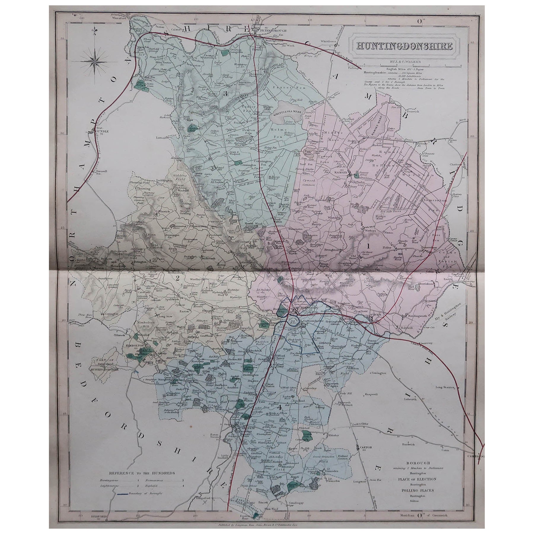
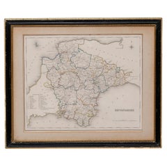
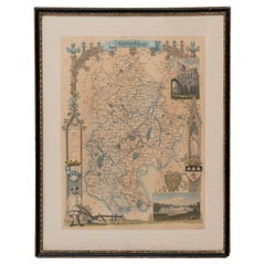
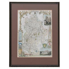
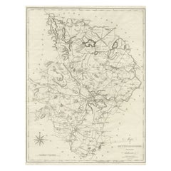
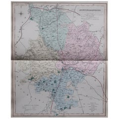
Map Huntingdonshire R Scott Archibald Fullarton & Co Glasgow
About the Item
Folding Map of Huntingdonshire by R Scott with distances from London and reference to the hundreds.
Published by Archibald Fullarton & Co Glasgow. Measure: 40cm 16" high
Framed in a modern copy of a black and gold map frame
just purchased more information to follow
- Dimensions:Height: 15.75 in (40 cm)Width: 13.19 in (33.5 cm)Depth: 0.79 in (2 cm)
- Style:Victorian (Of the Period)
- Materials and Techniques:
- Place of Origin:
- Period:
- Date of Manufacture:1833
- Condition:Wear consistent with age and use.
- Seller Location:BUNGAY, GB
- Reference Number:1stDibs: LU3867332644292
About the Seller
5.0
Vetted Seller
These experienced sellers undergo a comprehensive evaluation by our team of in-house experts.
Established in 1985
1stDibs seller since 2018
84 sales on 1stDibs
Typical response time: 13 hours
- ShippingRetrieving quote...Ships From: BUNGAY, United Kingdom
- Return PolicyA return for this item may be initiated within 7 days of delivery.
More From This SellerView All
- Map SussexLocated in BUNGAY, SUFFOLKMap of Sussex with explanation Maker unknown.Category
Antique 19th Century English Victorian Maps
MaterialsPaper
- Map Devonshire Richard Creighton J&C Walker Sculp Samuel LewisLocated in BUNGAY, SUFFOLKDevonshire drawn by Richard Creighton with reference to the Unions Artist Richard Creighton Engraved by J&C Walker Sculp Published in Samuel Lewis Topographical Dictionary 1831, a...Category
Antique 19th Century English Victorian Maps
MaterialsPaper
- Map Bedfordshire General FramedLocated in BUNGAY, SUFFOLKA general map of Bedfordshire with its hundreds A scale of 5 miles in the original green mount and traditional black and gold frame. Measures: 36cm 14" high.Category
Antique 18th Century English Georgian Maps
MaterialsPaper
- Map Bedfordshire WilliamSchmollinger Dunstable Priory Woburn Abbey Moules GothicLocated in BUNGAY, SUFFOLKARTIST William Schmollinger (1811-1869) London : George Virtue, 1832. A highly attractive map in gothick style, with an ornamental architectural border, inset views of Dunstable Priory and Woburn Abbey...Category
Antique 19th Century English Victorian Maps
MaterialsPaper
- Map Bedfordshire WilliamSchmollinger Dunstable Priory Woburn Abbey Moules GothicLocated in BUNGAY, SUFFOLKArtist William Schmollinger (1811-1869) London : George Virtue, 1832. A highly attractive map in gothick style, with an ornamental architectural border, inset views of Dunstable Priory and Woburn Abbey...Category
Antique 19th Century English Victorian Maps
MaterialsPaper
- Map Bedfordshire No 3 General FramedLocated in BUNGAY, SUFFOLKA general map of Bedfordshire with its hundreds. Measure: 37cm 14 1/2" high A scale of 5 miles. in the original green mount and traditional black and gold frame. charming map with...Category
Antique 18th Century English Georgian Maps
MaterialsPaper


You May Also Like
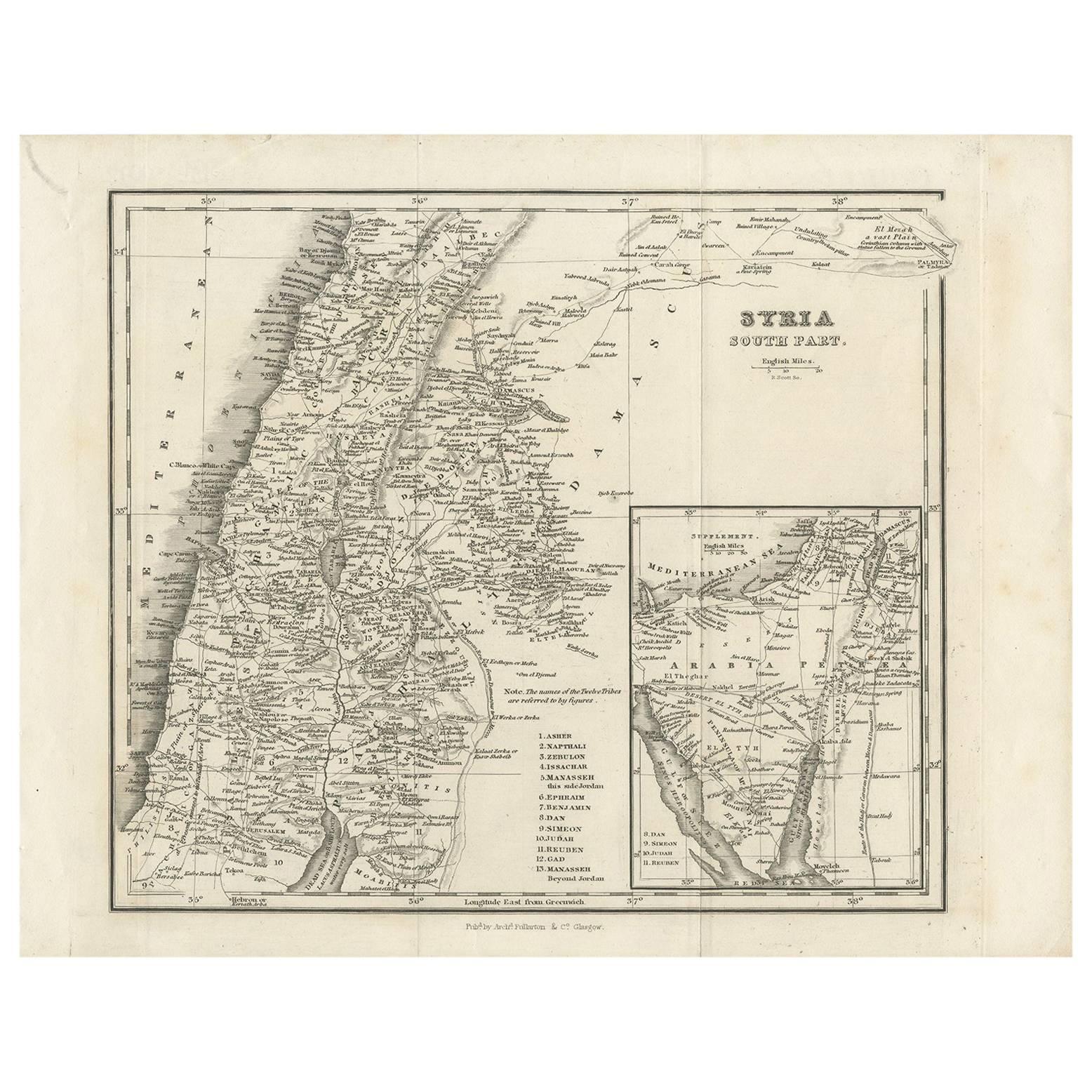
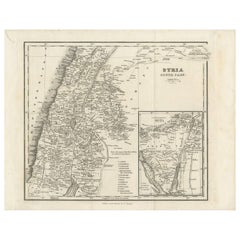
- Antique Map of Southern Syria by Fullarton & Co, circa 1860Located in Langweer, NLAntique map titled 'Syria south part'. Published by Fullarton & Co, Glasgow, circa 1860. - **Title**: Syria South Part - **Publisher**: Fullarton & Co, Glasgow - **Date of Publicati...Category
Antique Mid-19th Century Maps
MaterialsPaper
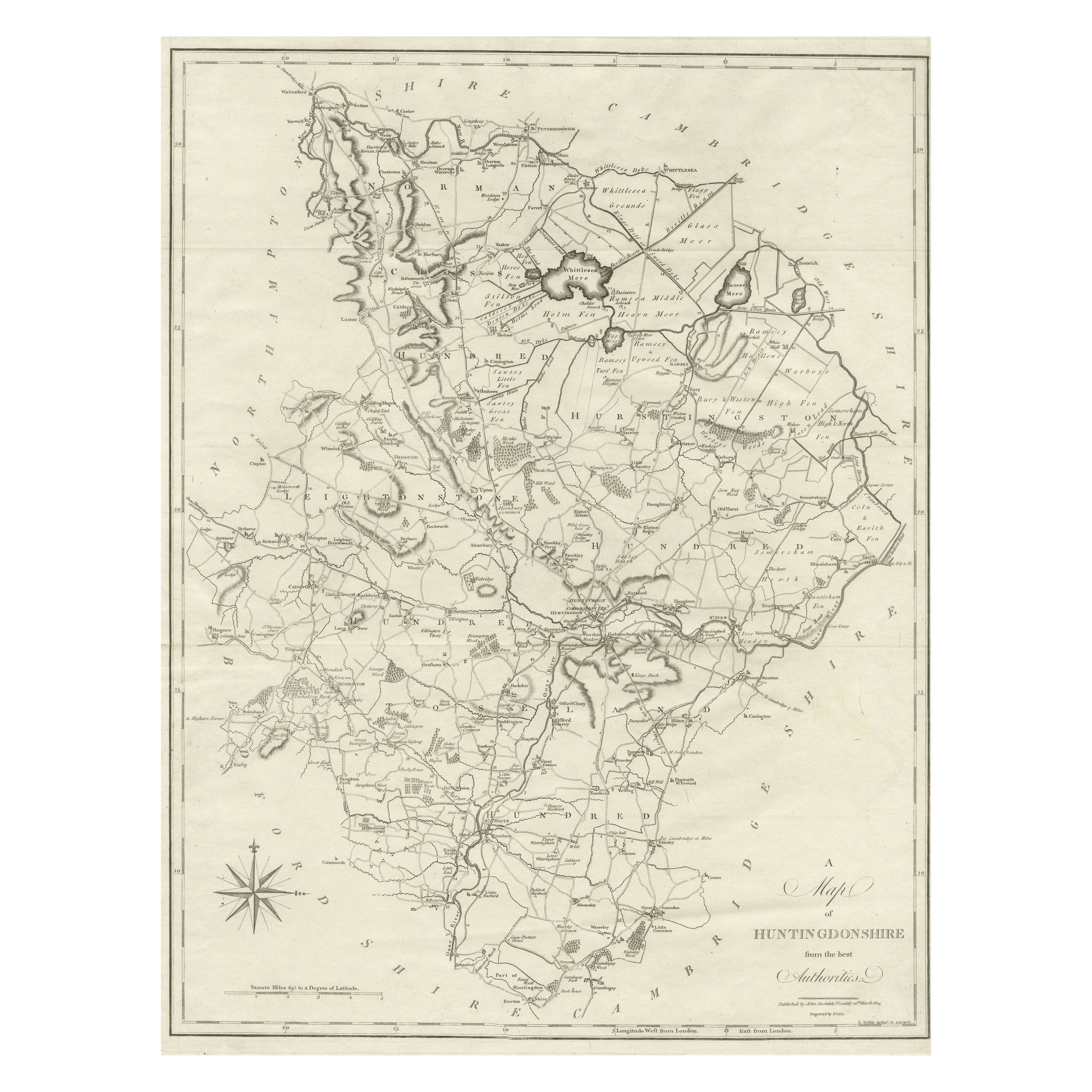
- Large Antique County Map of Huntingdonshire, EnglandLocated in Langweer, NLAntique map titled 'A Map of Huntingdonshire from the best Authorities'. Original old county map of Huntingdonshire, England. Engraved by John Cary. Originates from 'New British Atla...Category
Antique Early 19th Century Maps
MaterialsPaper
- Original Antique English County Map, Huntingdonshire, J & C Walker, 1851Located in St Annes, LancashireGreat map of Huntingdonshire Original colour By J & C Walker Published by Longman, Rees, Orme, Brown & Co. 1851 Unframed.Category
Antique 1850s English Other Maps
MaterialsPaper
- Large Original Antique Map of Australia, Fullarton, C.1870Located in St Annes, LancashireGreat map of Australia From the celebrated Royal Illustrated Atlas Engraved by Swanston after the drawing by Augustus Petermann Lithograph. Original color. Published by ...Category
Antique 1870s Scottish Maps
MaterialsPaper
- Large Original Antique Map of China, Fullarton, C.1870Located in St Annes, LancashireGreat map of China From the celebrated Royal Illustrated Atlas Lithograph by Swanston. Original color. Published by Fullarton, Edinburgh. C.1870 Repairs to minor edge te...Category
Antique 1870s Scottish Maps
MaterialsPaper
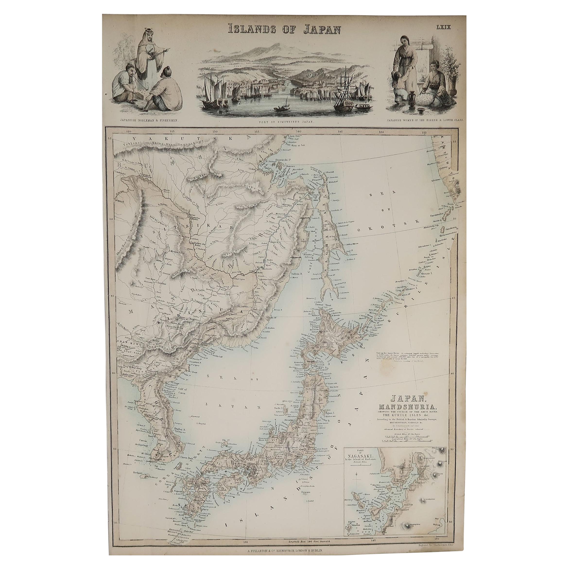
- Original Antique Decorative Map of Japan, Fullarton, C.1870Located in St Annes, LancashireGreat map of Japan Wonderful figural border From the celebrated Royal Illustrated Atlas Lithograph. Original color. Published by Fullarton, Edinburgh, C.1870 Unframed...Category
Antique 1870s Scottish Maps
MaterialsPaper


Recently Viewed
View AllMore Ways To Browse
Antique Glasgow
R And Co
Glasgow Used Furniture
Antique Furniture Glasgow
Antique Furniture In Glasgow
R Scott
Huntingdonshire Antique Map
Large Map Of London
18th Century Antique Mexican
Victorian Compass
Caribbean Antiques
Framed Atlas Map
Antique Collectors Australia
Antique Furniture Central Coast
Willem Blaeu
Antique Furniture North East England
Virginia Maps
Virginia Map