Items Similar to Antique Map of Juan Fernandez, Chile, c.1740


Want more images or videos?
Request additional images or videos from the seller
1 of 5
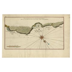
Antique Map of Juan Fernandez, Chile, c.1740
About the Item
Antique map titled 'l'Ile de Juan Fernandes dans la Mer du Sud (..)'.
This map depicts Juan Fernandez Island in the Southern Sea. Source unknown, to be determined.
Artists and Engravers: George Anson, 1st Baron Anson PC, FRS, RN (1697 -1762) was a British admiral and a wealthy aristocrat, noted for his circumnavigation of the globe and his role overseeing the Royal Navy during the Seven Years' War.
Condition: Good, some marks and small stain at bottom right. Please study image carefully.
Date: c.1740.
- Dimensions:Height: 15.48 in (39.3 cm)Width: 10.01 in (25.4 cm)Depth: 0 in (0.01 mm)
- Materials and Techniques:
- Period:
- Date of Manufacture:circa 1740
- Condition:Condition: Good, some marks and small stain at bottom right. Please study image carefully.
- Seller Location:Langweer, NL
- Reference Number:
About the Seller
5.0
Platinum Seller
These expertly vetted sellers are 1stDibs' most experienced sellers and are rated highest by our customers.
Established in 2009
1stDibs seller since 2017
1,929 sales on 1stDibs
Typical response time: <1 hour
- ShippingRetrieving quote...Ships From: Langweer, Netherlands
- Return PolicyA return for this item may be initiated within 14 days of delivery.
More From This SellerView All
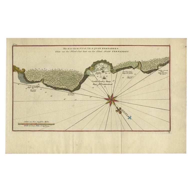
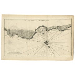
- Antique Map of Juan Fernandez Island, Chile, c.1750Located in Langweer, NLAntique map titled 'Plan de la Côte du N.E. de l 'Ile de Juan Fernandes'. Map of the northeast coast of the island of Juan Fernandez with Cumberland Bay, South America. In 1740 A...Category
Antique 18th Century Maps
MaterialsPaper
- Antique Map of Juan Fernandez Island by Anson, c.1740Located in Langweer, NLAntique map titled 'Plan de la Côte du N.E. de l 'Ile de Juan Fernandes'. Map of the northeast coast of the island of Juan Fernandez with Cumberland Bay, South America. In 1740 Ans...Category
Antique 18th Century Maps
MaterialsPaper
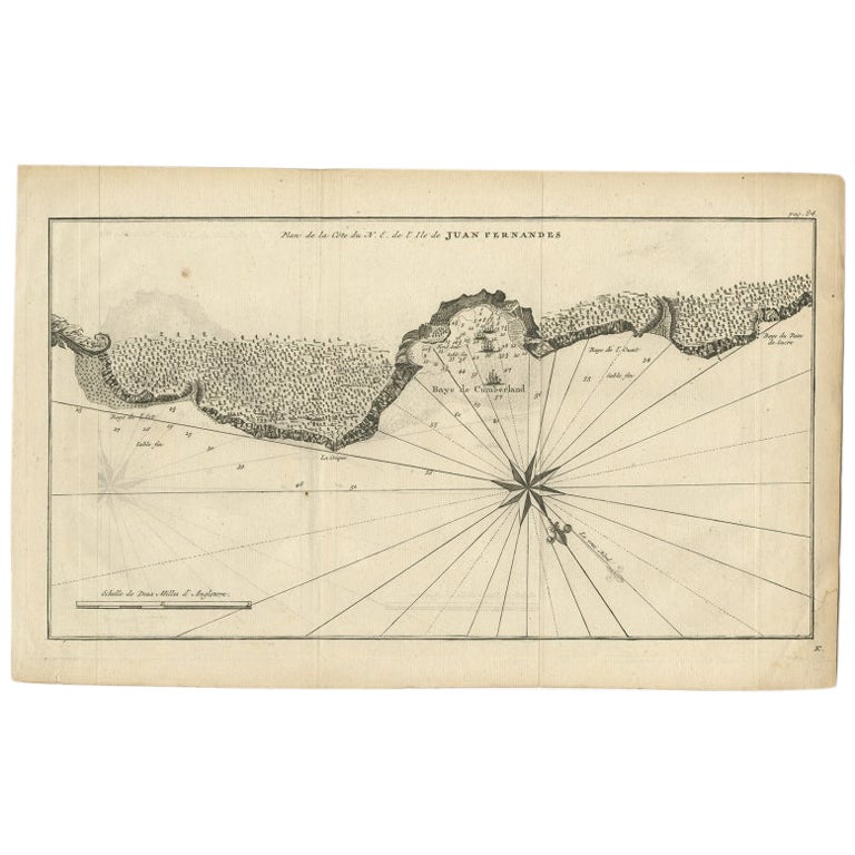
- Antique Map of Juan Fernandez Island and Cumberland Bay, Chile - c. '1749'Located in Langweer, NLAntique map titled 'Plan de la Côte du N.E. de l 'Ile de Juan Fernandes - Schets van den Noord-Oost kant van het eiland Juan Fernandes '. This map depicts the northeast coast of the ...Category
Antique Mid-18th Century Maps
MaterialsPaper
- Antique Map of Juan Fernandez Island by Anson '1749'Located in Langweer, NLAntique map titled 'l'Ile de Juan Fernandes dans la Mer du Sud (..) - Het Eiland Juan Fernandes in de Zuid Zee (..)'. This map depicts Juan Fernandez Island in the Southern Sea. This...Category
Antique Mid-18th Century Maps
MaterialsPaper
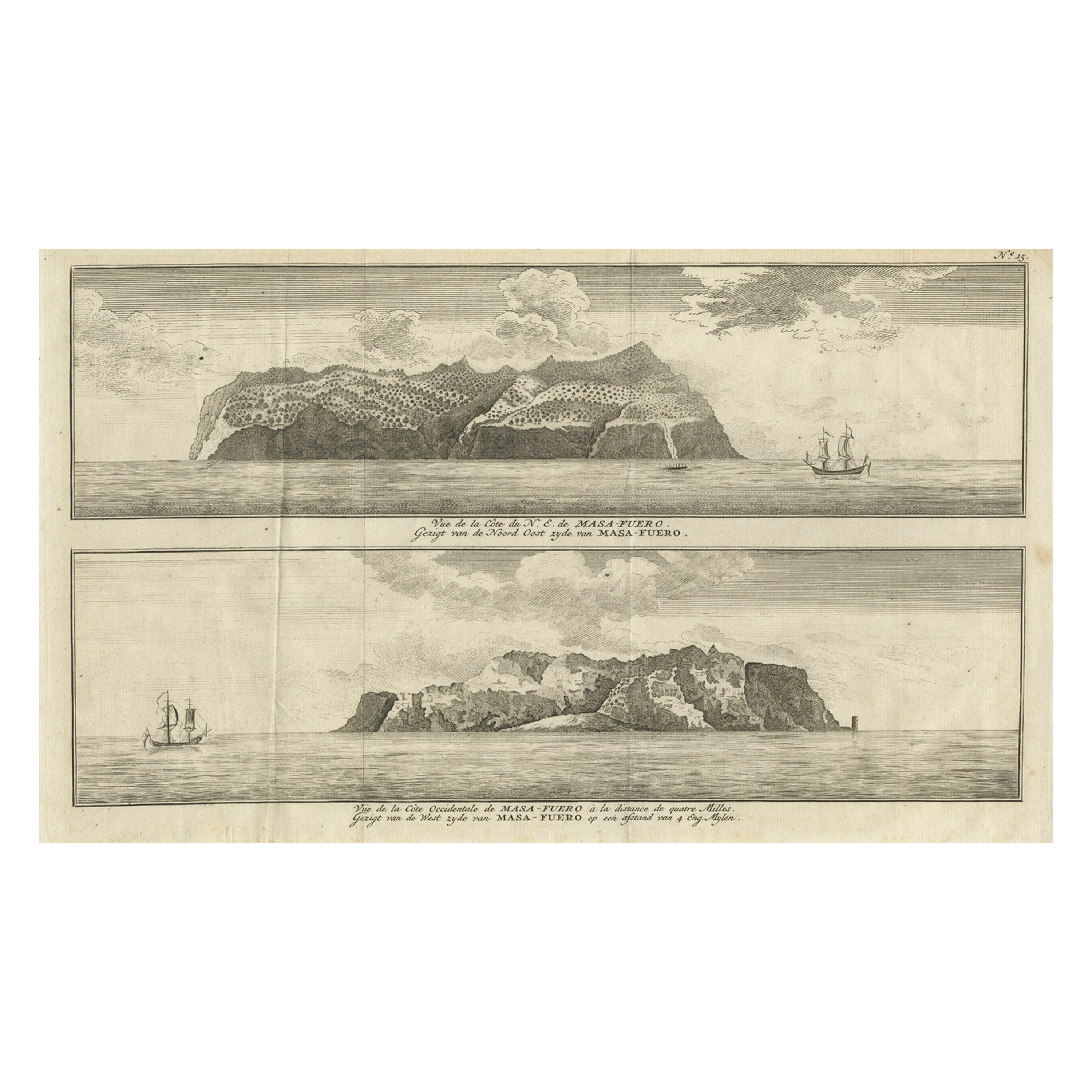
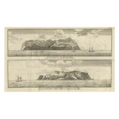
- Engraving of Alejandro Selkirk Island, Juan Fernández-archipel, Chile, 1749Located in Langweer, NLAntique print titled 'Vue de la cote du N. E. de Masa-Fuero' - 'Vue de la cote occidentale de Masa-Fuero a la distance de quatre milles.' Views of Alejandro Selkirk Island...Category
Antique 18th Century Prints
MaterialsPaper
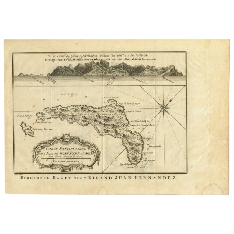
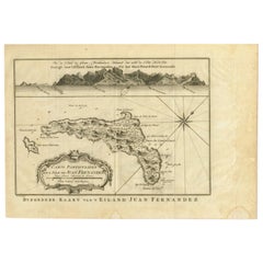
- Original Antique Map of Juan Fernandez by Van Schley, 1757Located in Langweer, NLAntique map titled 'Carte Particuliere de l'Isle de Juan Fernandez - Byzondere Kaart van 't Eiland Juan Fernandez'. Map of the Chilean Juan Fernandez Island, topped by a view of it...Category
Antique 18th Century Maps
MaterialsPaper


You May Also Like
- Antique Map of Principality of MonacoBy Antonio Vallardi EditoreLocated in Alessandria, PiemonteST/619 - "Old Geographical Atlas of Italy - Topographic map of ex-Principality of Monaco" - ediz Vallardi - Milano - A somewhat special edition ---Category
Antique Late 19th Century Italian Other Prints
MaterialsPaper
- Original Antique Map of Italy. C.1780Located in St Annes, LancashireGreat map of Italy Copper-plate engraving Published C.1780 Unframed.Category
Antique Early 1800s English Georgian Maps
MaterialsPaper

- Original Antique Map of Asia. C.1780Located in St Annes, LancashireGreat map of Asia Copper-plate engraving Published C.1780 Two small worm holes to right side of map Unframed.Category
Antique Early 1800s English Georgian Maps
MaterialsPaper

- Original Antique Map of India. C.1780Located in St Annes, LancashireGreat map of India Copper-plate engraving Published C.1780 Three small worm holes to right side of map and one bottom left corner Unframed.Category
Antique Early 1800s English Georgian Maps
MaterialsPaper

- Original Antique Map of Italy. Arrowsmith. 1820Located in St Annes, LancashireGreat map of Italy Drawn under the direction of Arrowsmith Copper-plate engraving Published by Longman, Hurst, Rees, Orme and Brown, 1820 Unframed.Category
Antique 1820s English Maps
MaterialsPaper
- Original Antique Map of China, Arrowsmith, 1820Located in St Annes, LancashireGreat map of China Drawn under the direction of Arrowsmith Copper-plate engraving Published by Longman, Hurst, Rees, Orme and Brown, 1820 Unfr...Category
Antique 1820s English Maps
MaterialsPaper


Recently Viewed
View AllMore Ways To Browse
Royal Navy Antique
Royal British Antiques
George Map
Antique Pc
Antique Sea Maps
Antique Sea Map
Sea Map
Antique Admiral
18th Century Southern Antiques
Antique British Maps
Antique Maps Of Britain
Antique Globes And Maps
Antique Maps And Globes
Antique Paper Globe
Small Antique Globes
British Royal Navy
Antique Britain Map
Antique Map Britain