Items Similar to Antique Map of the Maluku Islands by Le Rouge, c.1750


Want more images or videos?
Request additional images or videos from the seller
1 of 5
Antique Map of the Maluku Islands by Le Rouge, c.1750
About the Item
Antique map Moluccas/Spice Islands titled 'Isles Moluques'. Detailed map of the famous Spice Islands (Maluku Islands or the Moluccas). Includes also Sulawesi, Bali, Timor, part of Borneo, New-Guinea with unfinished coast line, and a bit of the northern coastline of Australia, labeled Terre du Sud.
Artists and Engravers: G. L. le Rouge (1707-1790) was a French military engineer, hydrographer and cartographer. He produced a wide rang of attractive cartographic work.
Condition: Good, small repair. General age-related toning, please study image carefully.
Date: c.1750
Overall size: 30.2 x 21.8 cm.
Image size: 27 x 20 cm.
We sell original antique maps to collectors, historians, educators and interior decorators all over the world. Our collection includes a wide range of authentic antique maps from the 16th to the 20th centuries. Buying and collecting antique maps is a tradition that goes back hundreds of years. Antique maps have proved a richly rewarding investment over the past decade, thanks to a growing appreciation of their unique historical appeal. Today the decorative qualities of antique maps are widely recognized by interior designers who appreciate their beauty and design flexibility. Depending on the individual map, presentation, and context, a rare or antique map can be modern, traditional, abstract, figurative, serious or whimsical. We offer a wide range of authentic antique maps for any budget.
- Creator:George Louis Le Rouge (Artist)
- Dimensions:Height: 8.59 in (21.8 cm)Width: 11.89 in (30.2 cm)Depth: 0 in (0.01 mm)
- Materials and Techniques:
- Period:
- Date of Manufacture:circa 1750
- Condition:
- Seller Location:Langweer, NL
- Reference Number:
About the Seller
5.0
Platinum Seller
These expertly vetted sellers are 1stDibs' most experienced sellers and are rated highest by our customers.
Established in 2009
1stDibs seller since 2017
1,929 sales on 1stDibs
Typical response time: <1 hour
- ShippingRetrieving quote...Ships From: Langweer, Netherlands
- Return PolicyA return for this item may be initiated within 14 days of delivery.
More From This SellerView All
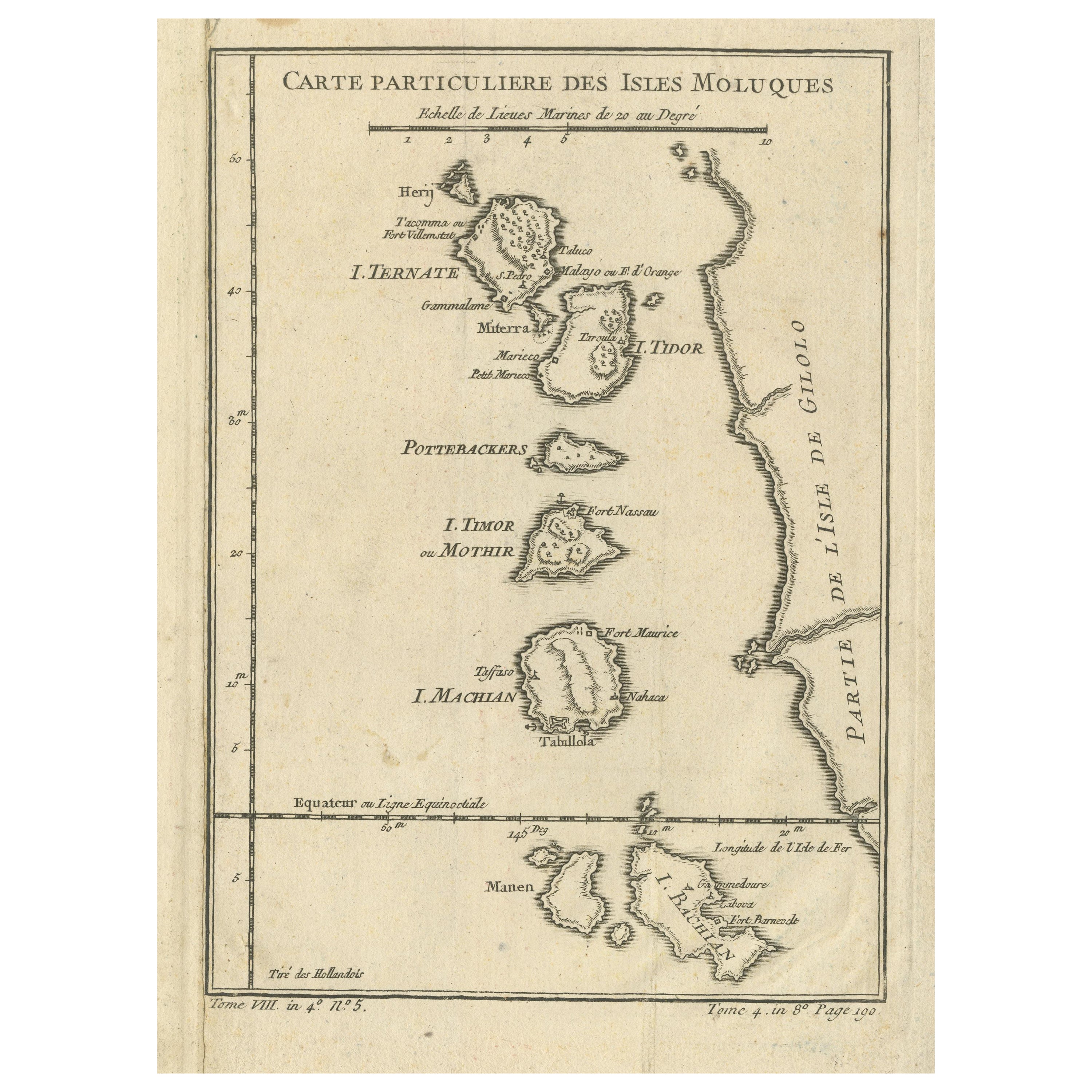
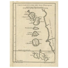
- Antique Map of the Maluku Islands by Bellin, c.1750By Jacques-Nicolas BellinLocated in Langweer, NLAntique map titled 'Carte Particuliere des Isles Moluques'. This map depicts the islands of Herij, Ternate, Tidor, Pottebackers, Timor, Machian and Bachian. The Moluccan islands were...Category
Antique 18th Century Maps
MaterialsPaper
- Antique Map of the Maluku Islands by Blaeu, c.1640Located in Langweer, NLAntique map titled 'Moluccae Insulae Celeberrimae'. Decorative map of the Maluku Islands, also known as the Moluccas or the Spice Islands. Inset of the island of Bachian (Batjan) in ...Category
Antique 17th Century Maps
MaterialsPaper
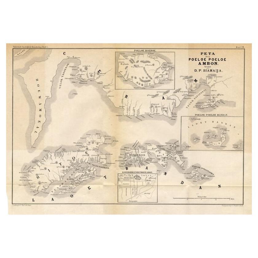
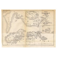
- Antique Map of the Maluku Islands 'Ambon' by Stemler, 1874Located in Langweer, NLAntique map titled 'Peta deri Poeloe Poeloe Ambon ...' (The Island of Ambon.) This very scarce map shows the Maluku Islands of Ambon, Buru, Banda. South Moluccas. Originates from 'Ti...Category
Antique 19th Century Maps
MaterialsPaper
- Antique Map of the Maluku Islands or Moluccas, IndonesiaLocated in Langweer, NLAntique map titled 'Carte Particuliere des Isles Moluques'. This map depicts the islands of Herij, Ternate, Tidor, Pottebackers, Timor, Machian and Bachian. The Moluccan islands were...Category
Antique Mid-18th Century Maps
MaterialsPaper
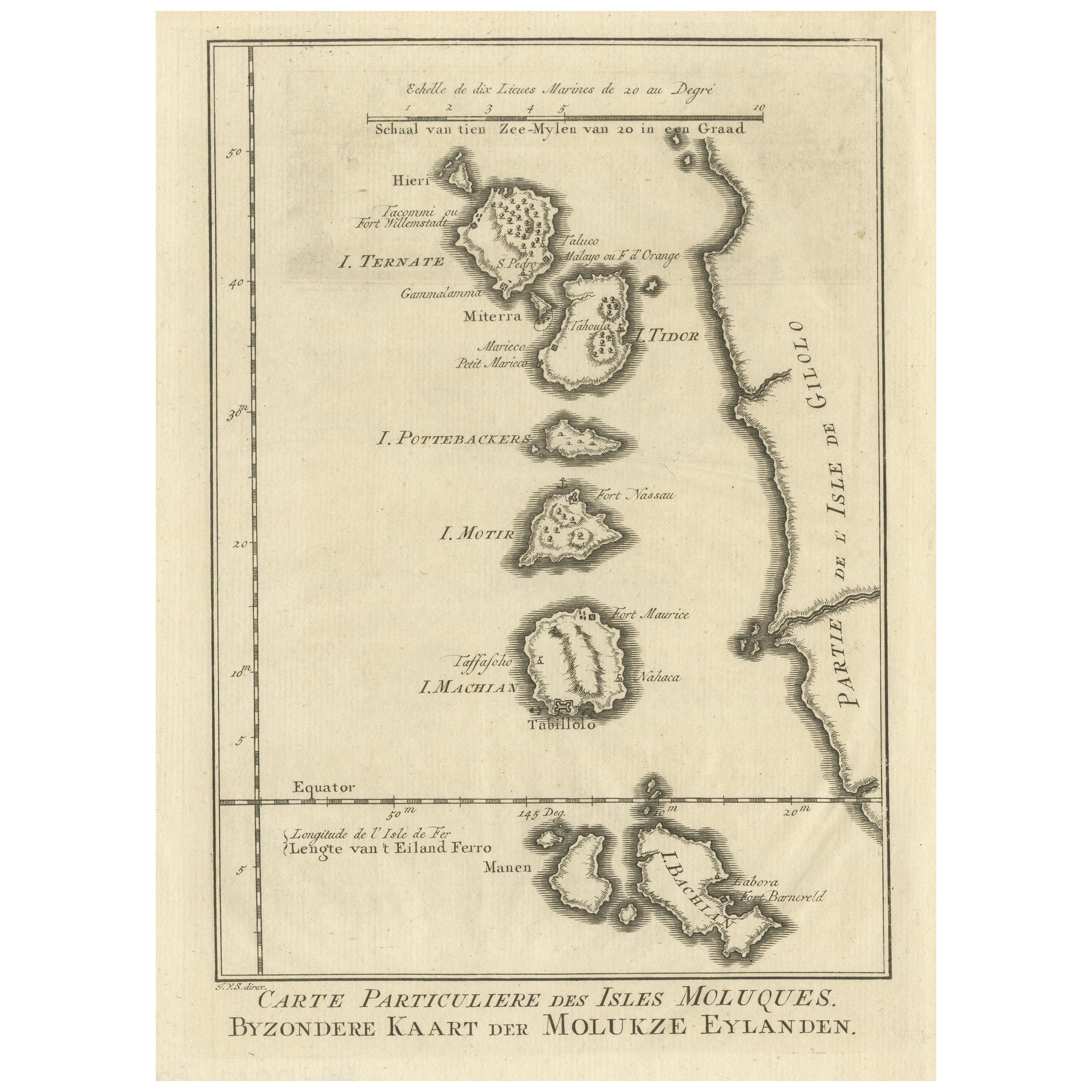
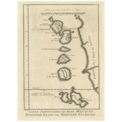
- Original Antique Map of the Maluku Islands or MoluccasLocated in Langweer, NLAntique map titled 'Carte Particuliere des Isles Moluques - Byzondere Kaart der Molukze Eylanden'. This map depicts the islands of Herij, Ternate, Tidor, Pottebackers, Timor, Machian...Category
Antique Mid-18th Century Maps
MaterialsPaper
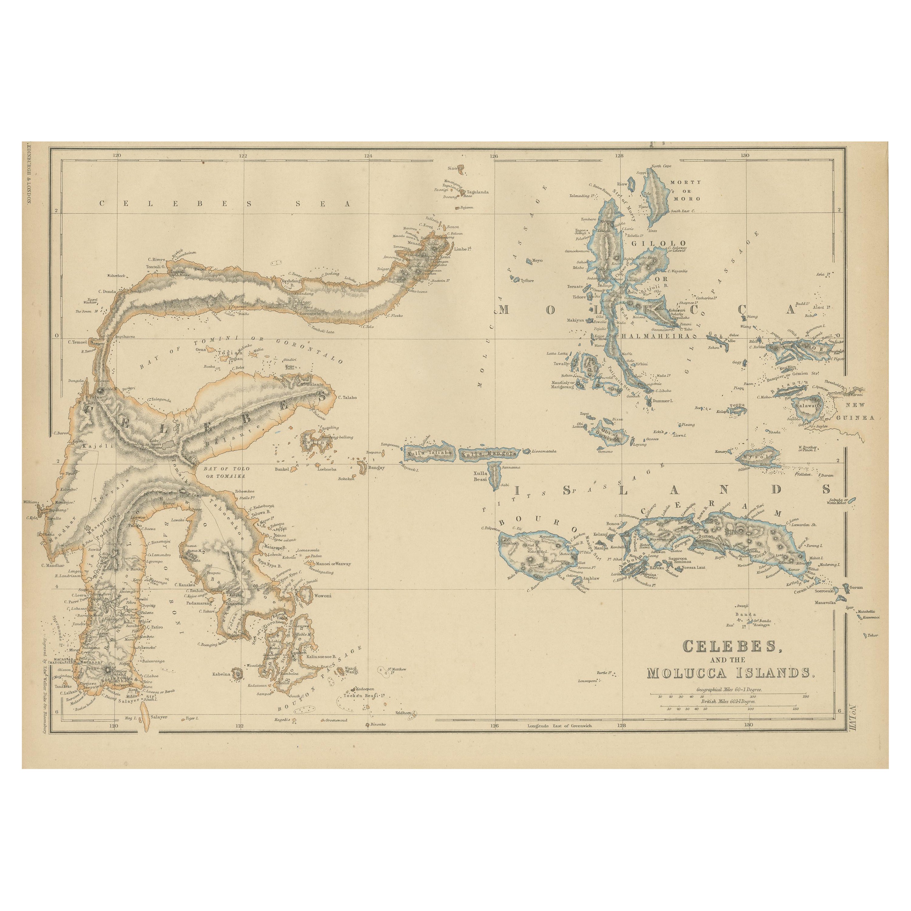
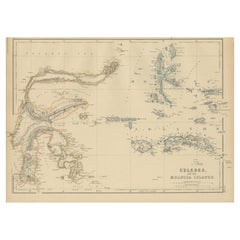
- Antique Map of Celebes and the Maluku Islands by W. G. Blackie, 1859Located in Langweer, NLAntique map titled 'Celebes and The Molucca Islands '. Original antique map of Celebes and the Maluku Islands (Moluccas). This map originates from ‘The Imperial Atlas of Modern Geogr...Category
Antique Mid-19th Century Maps
MaterialsPaper


You May Also Like
- 1854 Map of Massachusetts, Connecticut and Rhode Island, Antique Wall MapLocated in Colorado Springs, COThis striking wall map was published in 1854 by Ensign, Bridgman & Fanning and has both full original hand-coloring and original hardware. This impression is both informative and highly decorative. The states are divided into counties, outlined in red, green, and black, and subdivided into towns. Roads, canals, and railroad lines are prominently depicted, although they are not all labeled. The mapmakers also marked lighthouses, banks, churches, and prominent buildings, with a key at right. The map is an informative and comprehensive overview of the infrastructural development of New England prior to the Civil War. Physical geographies depicted include elevation, conveyed with hachure marks, rivers and lakes. The impression features an inset map of Boston...Category
Antique 19th Century American Maps
MaterialsPaper
- 1861 Topographical Map of the District of Columbia, by Boschke, Antique MapLocated in Colorado Springs, COPresented is an original map of Albert Boschke's extremely sought-after "Topographical Map of the District of Columbia Surveyed in the Years 1856 ...Category
Antique 1860s American Historical Memorabilia
MaterialsPaper
- Large Original Antique Map of Rhode Island, USA, C.1900Located in St Annes, LancashireFabulous map of Rhode Island Original color Engraved and printed by the George F. Cram Company, Indianapolis. Published, C.1900 Unframed Free ...Category
Antique 1890s American Maps
MaterialsPaper
- Large Original Vintage Map of The Pacific Islands Including HawaiiLocated in St Annes, LancashireGreat map of The Pacific Islands Unframed Original color By John Bartholomew and Co. Edinburgh Geographical Institute Published, circa 1...Category
Vintage 1920s British Maps
MaterialsPaper
- 1868 Map of the Upper Part of the Island of Manhattan Above 86th StreetBy Wm. Rogers Mfg. Co.Located in San Francisco, CAThis wonderful piece of New York City history is over 150 years old. It depicts 86th street and above. It was lithographed by WC Rogers and company. It was made to show what was the Battle of Harlem during the Revolutionary war...Category
Antique 1860s American American Colonial Maps
MaterialsPaper
- Le Cercle RougeLocated in London, GBOriginal Japanese poster for the Le Cercle Rouge, 1970. This film was written and directed by Jean-Pierre Melville and starred Alain Delon, Bourvil an...Category
Vintage 1970s Japanese Posters
MaterialsPaper


Recently Viewed
View AllMore Ways To Browse
Engraved G
20 C Design
Louis 16th
Louis The 16th Furniture
Louis The 16th
18th Century Military
French Spice
Northern France Map
French Antique Furniture Australia
Antique Maps Australia
Antique Map Australia
Australia Antique Map
Antique Australia Map
Antique Australian Map
Antique Maps Of Australia
Antique Map Of Australia
Antique Australian Maps
Le Sud