Items Similar to Steel Engraved Map of Part of the Bengal Presidency 'India & Bangladesh', 1831
Want more images or videos?
Request additional images or videos from the seller
1 of 5
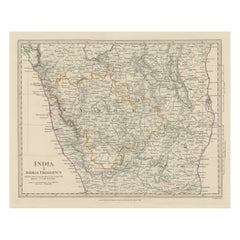
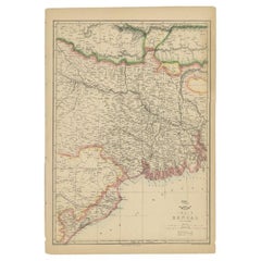
Steel Engraved Map of Part of the Bengal Presidency 'India & Bangladesh', 1831
About the Item
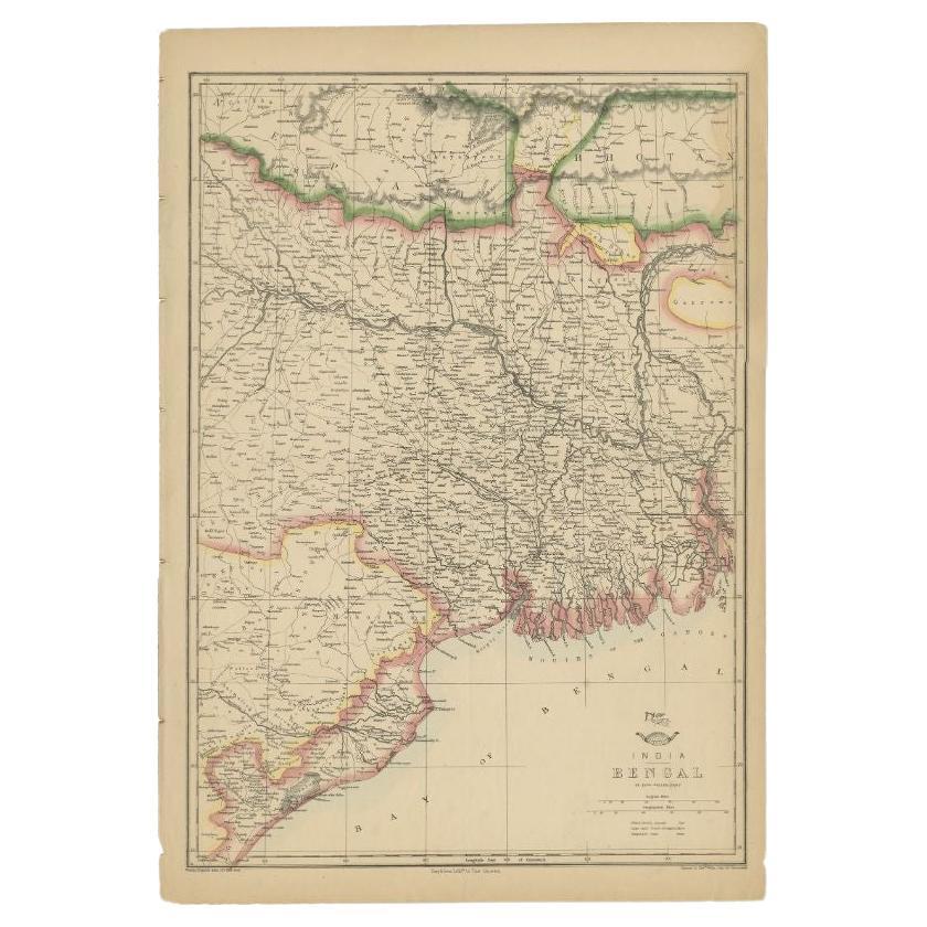
Antique map titled 'India Bengal Presidency'. Old steel engraved map of part of the Bengal Presidency. The Bengal Presidency (1757–1912), later reorganized as the Bengal Province (1912–1947), was once the largest subdivision (presidency) of British India following the dissolution of the Mughal Bengal, with its seat in Calcutta (now Kolkata). It was primarily centred in the Bengal region.
Artists and Engravers: Engraved by J. & C. Walker. Published under the superintendence of the Society for the Diffusion of Useful Knowledge. Published by Baldwin & Cradock.
- Dimensions:Height: 16.15 in (41 cm)Width: 13.78 in (35 cm)Depth: 0 in (0.02 mm)
- Materials and Techniques:
- Period:
- Date of Manufacture:1831
- Condition:Condition: Very good, general age-related toning. Please study image carefully.
- Seller Location:Langweer, NL
- Reference Number:
About the Seller
5.0
Platinum Seller
These expertly vetted sellers are 1stDibs' most experienced sellers and are rated highest by our customers.
Established in 2009
1stDibs seller since 2017
1,929 sales on 1stDibs
Typical response time: <1 hour
- ShippingRetrieving quote...Ships From: Langweer, Netherlands
- Return PolicyA return for this item may be initiated within 14 days of delivery.
More From This SellerView All
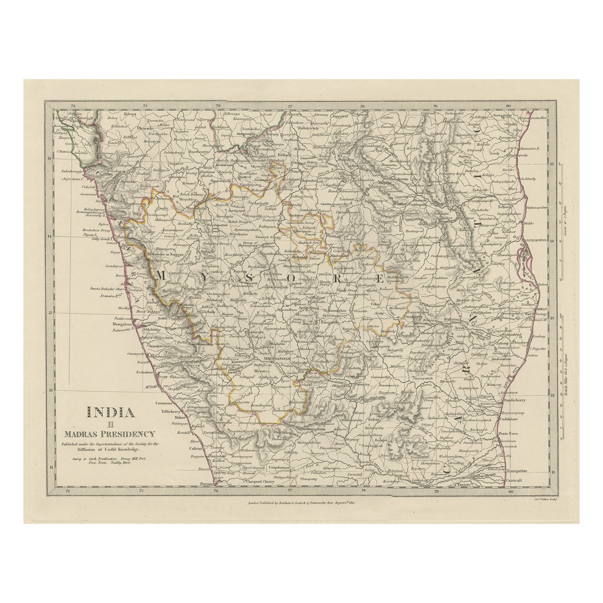
- Old Steel Engraved Map of the Western Part of the Madras Presidency, 1831Located in Langweer, NLAntique map titled 'India II Madras Presidency'. Old steel engraved map of the western part of the Madras Presidency. The Madras Presidency, or the Presidency of Fort St. George, a...Category
Antique 1830s Maps
MaterialsPaper
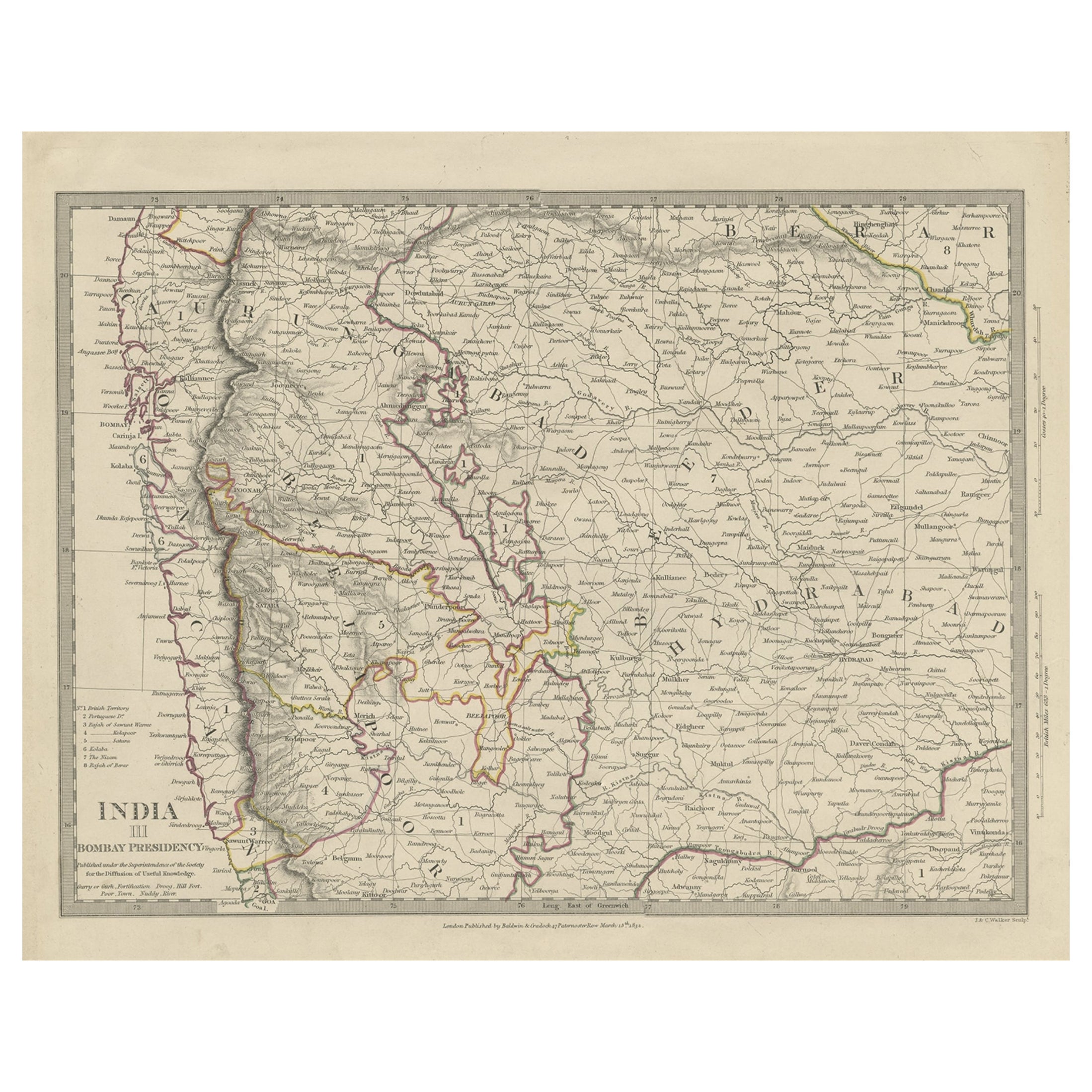
- Antique Map of Part of the Bombay Presidency in India, 1831Located in Langweer, NLAntique map titled 'India III Bombay Presidency'. Old steel engraved map of part of the Bombay Presidency. The Bombay Presidency, also known as Bombay and Sind from 1843 to 1936 and ...Category
Antique 19th Century Maps
MaterialsPaper
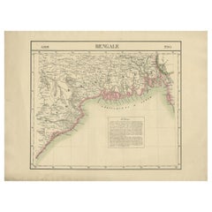
- Antique Map of the Region of the Bay of Bengal, India, c.1863By Edward WellerLocated in Langweer, NLAntique map titled 'India Bengal'. Old map of India depicting the region near the Bay of Bengal. Originates from the 'Weekly Dispatch Atlas'. Artist...Category
Antique 19th Century Maps
MaterialsPaper
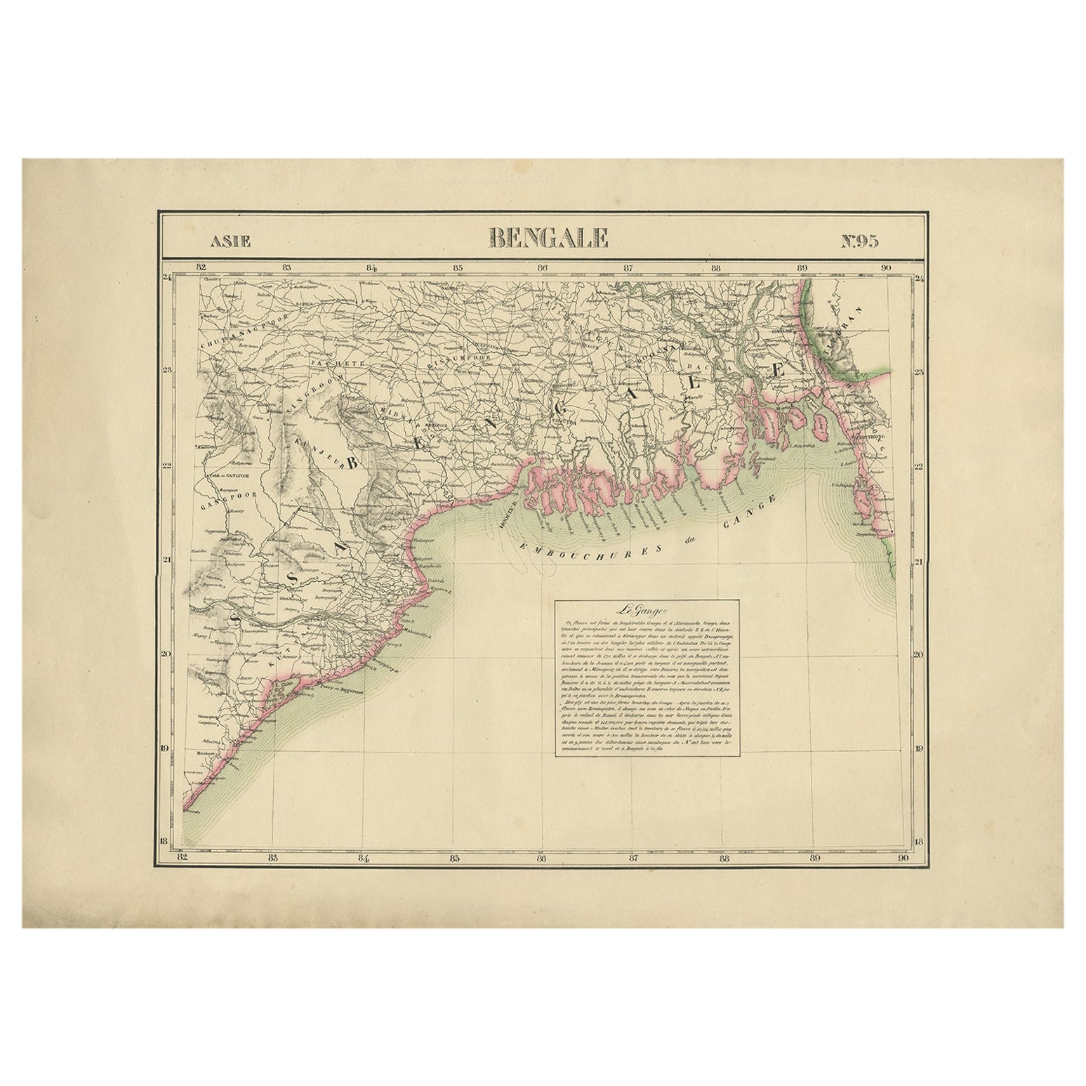
- Detailed Orginal Antique Map of Bengal, India, c.1825Located in Langweer, NLAntique map titled 'No. 95 Bengale'. Detailed map of Bengal, Bangladesh. With text about the Ganges river. Originates from 'Atlas Universel' by P.M. Vand...Category
Antique 19th Century Maps
MaterialsPaper
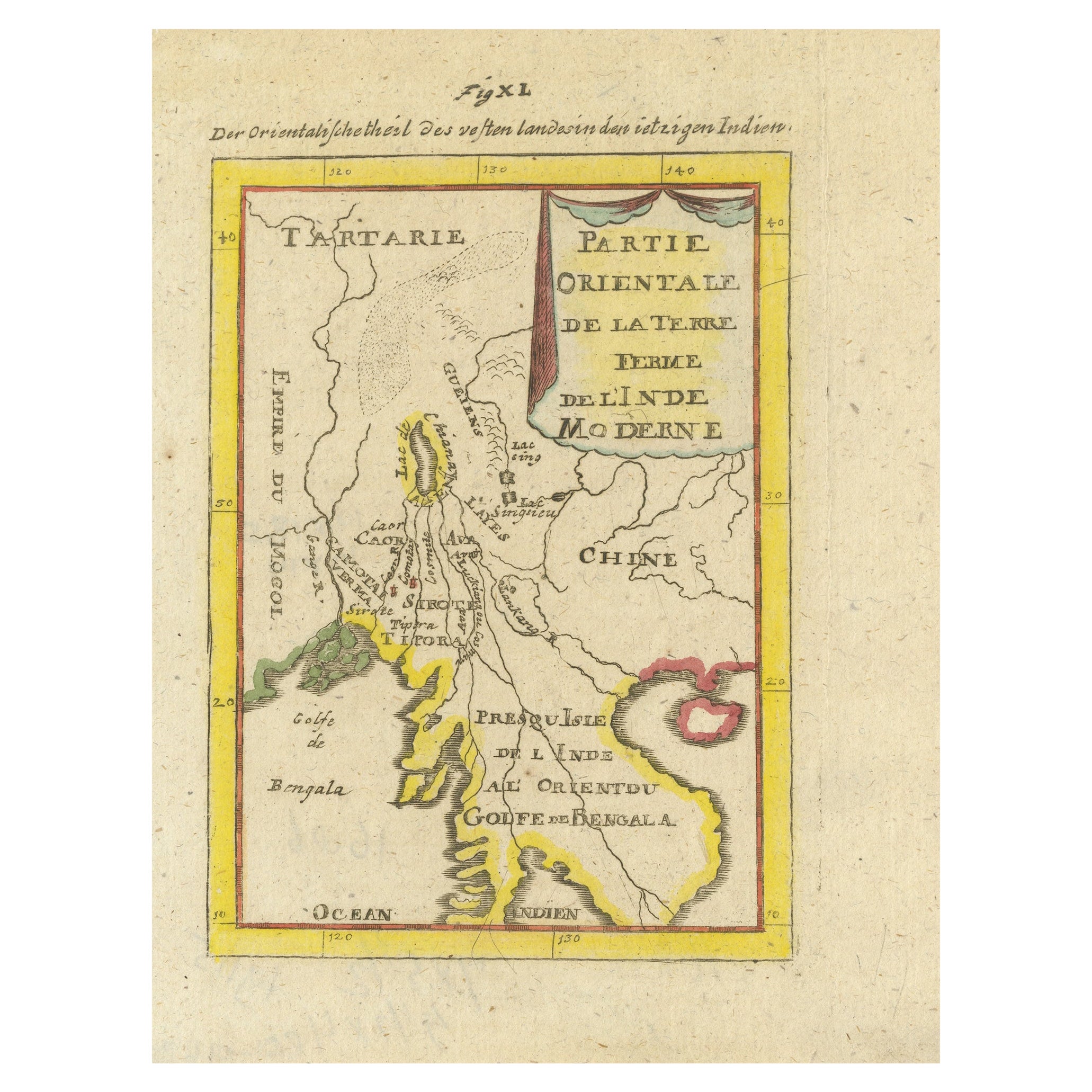
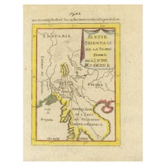
- Antique Map of India and the Gulf of Bengal by Mallet, c.1686Located in Langweer, NLAntique map titled ?Partie Orientale de la Terre Ferme de l'Inde Moderne. Small map of India and the Gulf of Bengal. This map originates from a German edition of 'Description de l' Univers'. Artists and Engravers: Alain Manesson Mallet (1630-1706) was a French cartographer and engineer. He started his career as a soldier in the army of Louis XIV, became a Sergeant-Major in the artillery and an Inspector of Fortifications. He also served under the King of Portugal, before returning to France, and his appointment to the court of Louis XIV. His military engineering and mathematical background led to his position teaching mathematics at court. His 'Description de L'Universe' contains a wide variety of information, including star maps...Category
Antique 17th Century Maps
MaterialsPaper
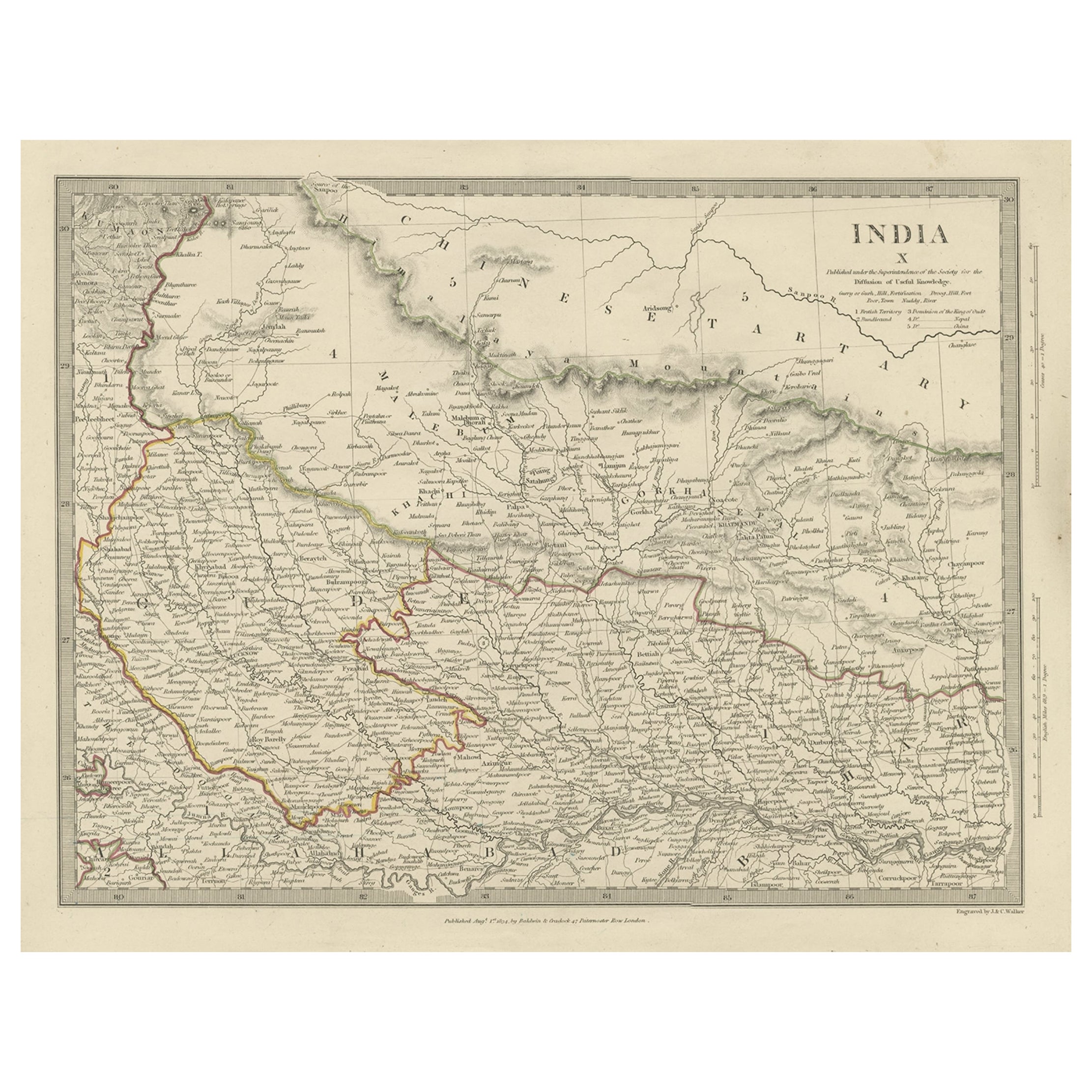
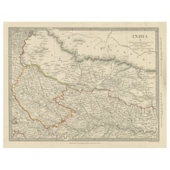
- Original Antique Map of Part of the Bahar Region (India), 1834Located in Langweer, NLAntique map titled 'India X'. Old steel engraved map of part of the Bahar region, it also shows part of Nepal. Artists and Engravers: Engraved by J. & C. Walker. Published under th...Category
Antique 19th Century Maps
MaterialsPaper
You May Also Like
- Original Antique Map of The Netherlands, Engraved by Barlow, Dated 1807Located in St Annes, LancashireGreat map of Netherlands Copper-plate engraving by Barlow Published by Brightly & Kinnersly, Bungay, Suffolk. Dated 1807 Unframed.Category
Antique Early 1800s English Maps
MaterialsPaper
- Original Antique Map of Sweden, Engraved by Barlow, 1806Located in St Annes, LancashireGreat map of Sweden Copper-plate engraving by Barlow Published by Brightly & Kinnersly, Bungay, Suffolk. 1806 Unframed.Category
Antique Early 1800s English Maps
MaterialsPaper
- Map of the Republic of GenoaLocated in New York, NYFramed antique hand-coloured map of the Republic of Genoa including the duchies of Mantua, Modena, and Parma. Europe, late 18th century. Dimension: 25...Category
Antique Late 18th Century European Maps
- Original Antique Map of Switzerland, Engraved By Barlow, Dated 1807Located in St Annes, LancashireGreat map of Switzerland Copper-plate engraving by Barlow Published by Brightly & Kinnersly, Bungay, Suffolk. Dated 1807 Unframed.Category
Antique Early 1800s English Maps
MaterialsPaper
- Map "Estuary- Mouth of the Thames"Located in Alessandria, PiemonteST/426 - Antique French Map of the estuary of the Thames, map dated 1769 - "Mape of the entrance of the Thames. Designed by filing of Navy cards fo...Category
Antique Mid-18th Century French Other Prints
MaterialsPaper
- Original Antique Map of Spain and Portugal, Engraved By Barlow, 1806Located in St Annes, LancashireGreat map of Spain And Portugal Copper-plate engraving by Barlow Published by Brightly & Kinnersly, Bungay, Suffolk. 1806 Unframed.Category
Antique Early 1800s English Maps
MaterialsPaper


Recently Viewed
View AllMore Ways To Browse
British India Antique
Antique India Map
Antique Maps India
Antique Map India
India Antique Map
Antique Map Of India
Antique Maps Of India
C Baldwin
J C Walker Map
Map Of Bengal
Bengal Map
Calcutta Map
Mughal Map
Kolkata Antique Furniture
Antique Furniture In Kolkata
General Empire
Wood And Sons Plate
Antique Caribbean