Items Similar to Very Attractive Handcolored Antique Plan of Cochin in India, 1744
Want more images or videos?
Request additional images or videos from the seller
1 of 6
Very Attractive Handcolored Antique Plan of Cochin in India, 1744
About the Item
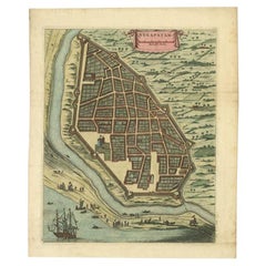
Antique map titled 'The City of Cochin (..).' Plan of Cochin, Malabar Coast, India, during the attack by Admiral van Goens in 1663. This map was published in 'The True and Exact Description of the Most Celebrated East - India Coast of Malabar and Choromandel as also of the Island of Ceylon' by Philip Baldeaus (first published in 1672); part of Churchill's 'A Collection of Voyages and Travels, some now first printed from original manuscripts others now first printed in English', printed in 1744 for Henry Lintot and John Osborn. This map originates from Churchill's 'A Collection of Voyages and Travels, some now first printed from original manuscripts others now first printed in English', printed in 1744 for Henry Lintot and John Osborn.
Artists and Engravers: Made by 'Philip Baldaeus' after an anonymous artist.
Condition: Good, given age. Some staining in the margins. A few minor spots. Original folds as issued. General age-related toning and/or occasional minor defects from handling. Please study image carefully.
Date: 1744
Overall size: 41 x 34.4 cm.
Image size: 36.2 x 27 cm.
We sell original antique maps to collectors, historians, educators and interior decorators all over the world. Our collection includes a wide range of authentic antique maps from the 16th to the 20th centuries. Buying and collecting antique maps is a tradition that goes back hundreds of years. Antique maps have proved a richly rewarding investment over the past decade, thanks to a growing appreciation of their unique historical appeal. Today the decorative qualities of antique maps are widely recognized by interior designers who appreciate their beauty and design flexibility. Depending on the individual map, presentation, and context, a rare or antique map can be modern, traditional, abstract, figurative, serious or whimsical. We offer a wide range of authentic antique maps for any budget.
- Creator:Philip Baldaeus (Artist)
- Dimensions:Height: 13.55 in (34.4 cm)Width: 16.15 in (41 cm)Depth: 0 in (0.01 mm)
- Materials and Techniques:
- Period:
- Date of Manufacture:1744
- Condition:Condition: Good, given age. Some staining in the margins. A few minor spots. Original folds as issued. General age-related toning and/or occasional minor defects from handling. Please study image carefully.
- Seller Location:Langweer, NL
- Reference Number:
About the Seller
5.0
Platinum Seller
These expertly vetted sellers are 1stDibs' most experienced sellers and are rated highest by our customers.
Established in 2009
1stDibs seller since 2017
1,919 sales on 1stDibs
Typical response time: <1 hour
- ShippingRetrieving quote...Ships From: Langweer, Netherlands
- Return PolicyA return for this item may be initiated within 14 days of delivery.
More From This SellerView All
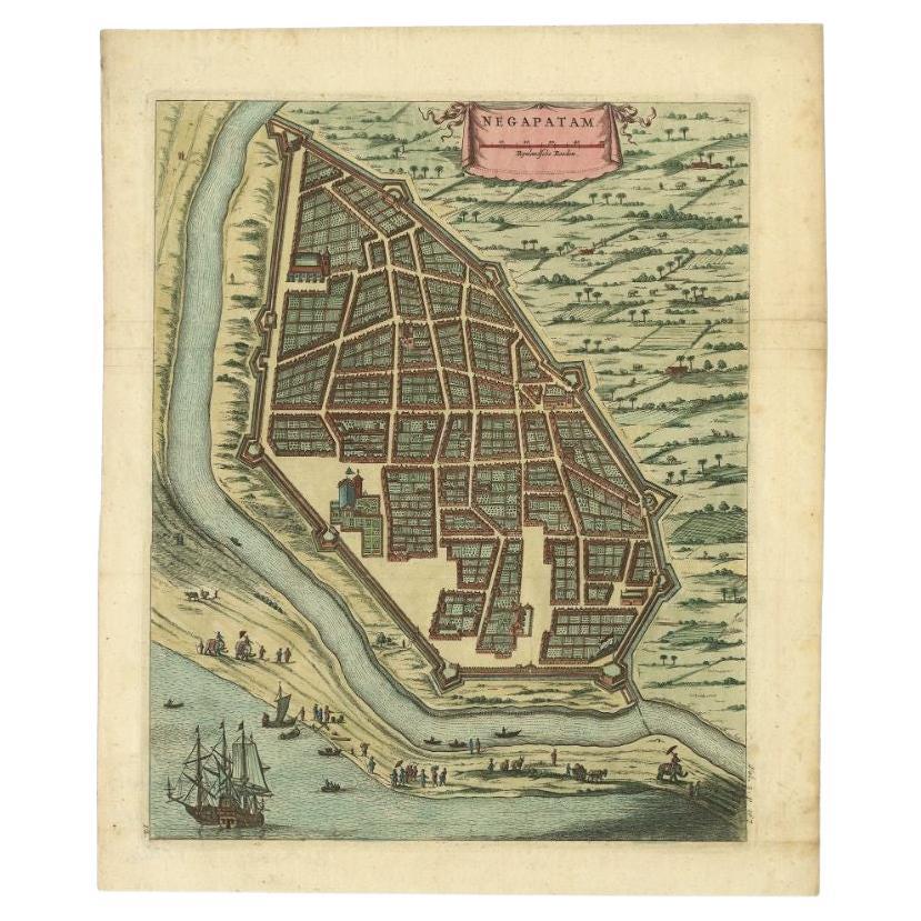
- Attractive Hand-Colored Antique Plan of Nagapattinam in India, 1744Located in Langweer, NLAntique map titled 'Negapatam.' Attractive bird's-eye view of Nagapattinam, India from Churchill's 'A Collection of Voyages and Travels, some now first printed from original manuscri...Category
Antique 18th Century Maps
MaterialsPaper
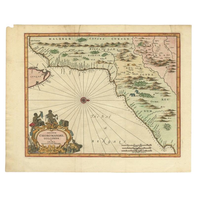
- Antique Map of Choromandel, Golconda and Orixa, Malabar, India, 1744By Philip BaldaeusLocated in Langweer, NLAntique map titled 'Regionum Choromandel, Golconda (..).' Handsome map of Choromandel, Golconda and Orixa, published in 'The True and Exact Description of the Most Celebrated East - ...Category
Antique 18th Century Maps
MaterialsPaper
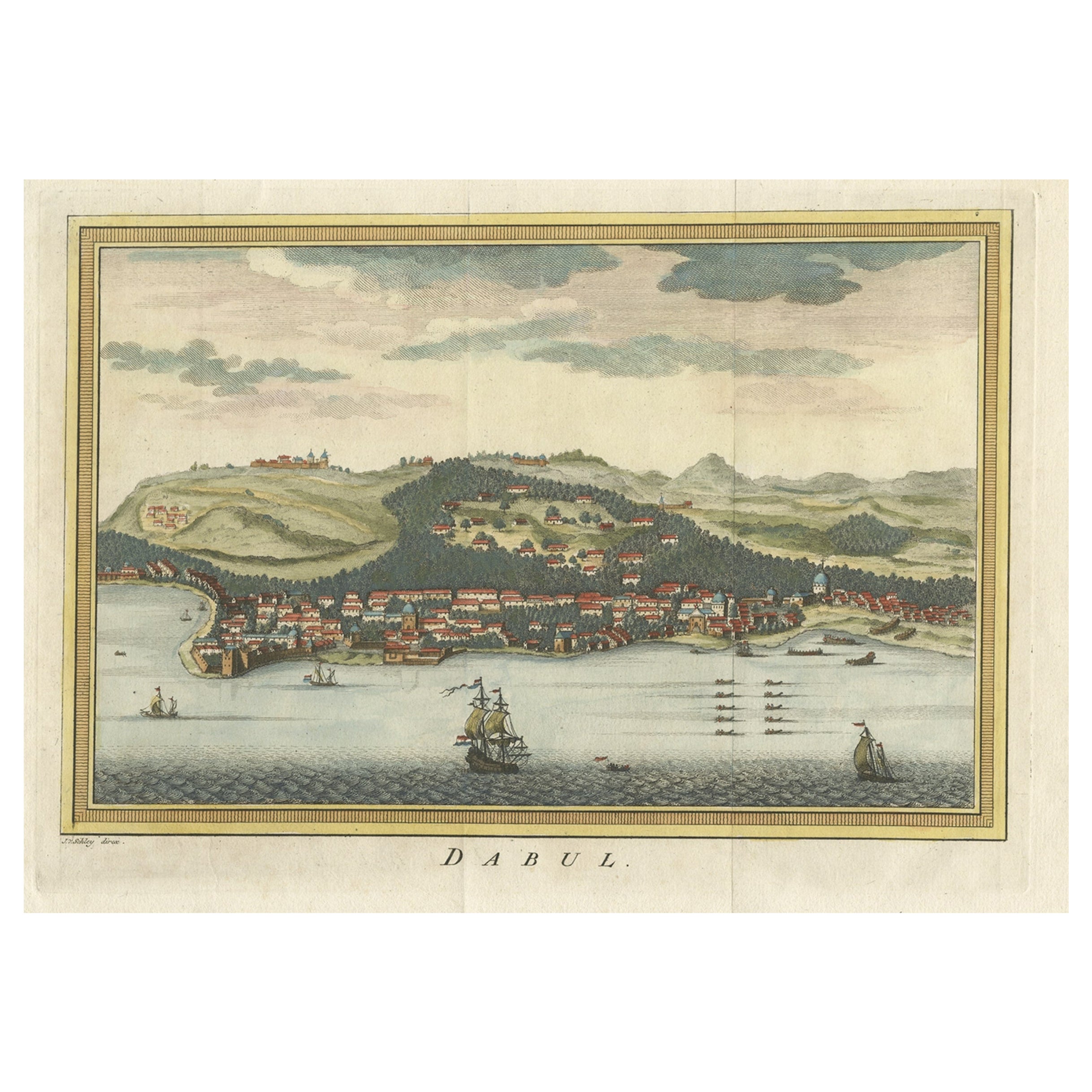
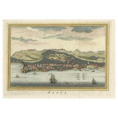
- Antique Handcolored Engraving of Dabhol or Dabul in India, '1757'Located in Langweer, NLAntique print titled 'Dabul'. Old print of the port city Dabhol in India. In the 15th and 16th centuries, Dabul was an opulent Muslim trade center. Around 1660 it was annexed to the ...Category
Antique 18th Century Prints
MaterialsPaper
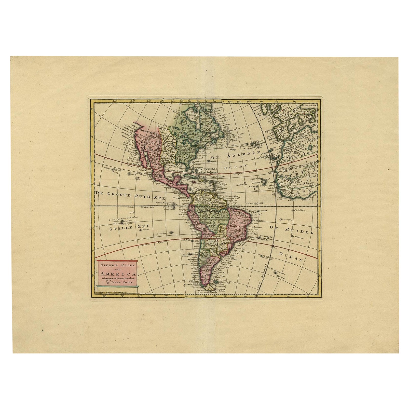
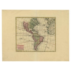
- Very Attractive Map of North and South America and Western Part of Africa, 1744Located in Langweer, NLAntique map titled 'Nieuwe Kaart van America.' Very attractive map of North and South America, the western part of Africa and south west Europe. With full contemporary hand colouring...Category
Antique 18th Century Maps
MaterialsPaper
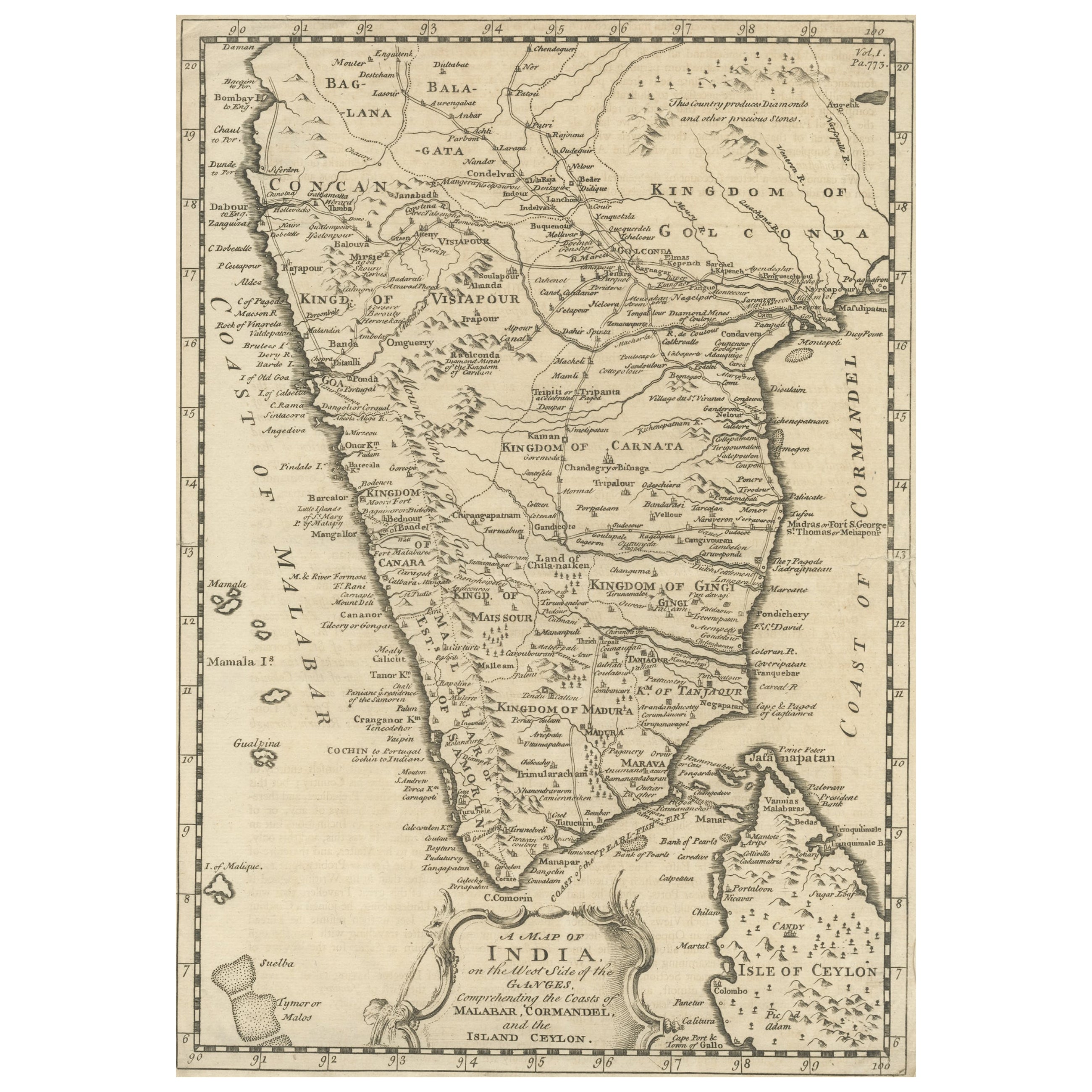
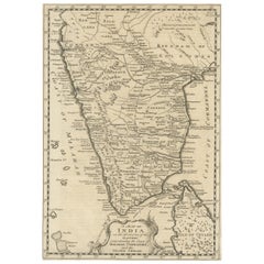
- Original Detailed Antique Map of Southern India and Most of Ceylon, 1744Located in Langweer, NLAntique map titled 'A Map of India on the west Side of the Ganges, comprehending the coasts of Malabar, Coromandel and the Island Ceylon'. Map of Southern India and most of Ceylo...Category
Antique 1740s Maps
MaterialsPaper
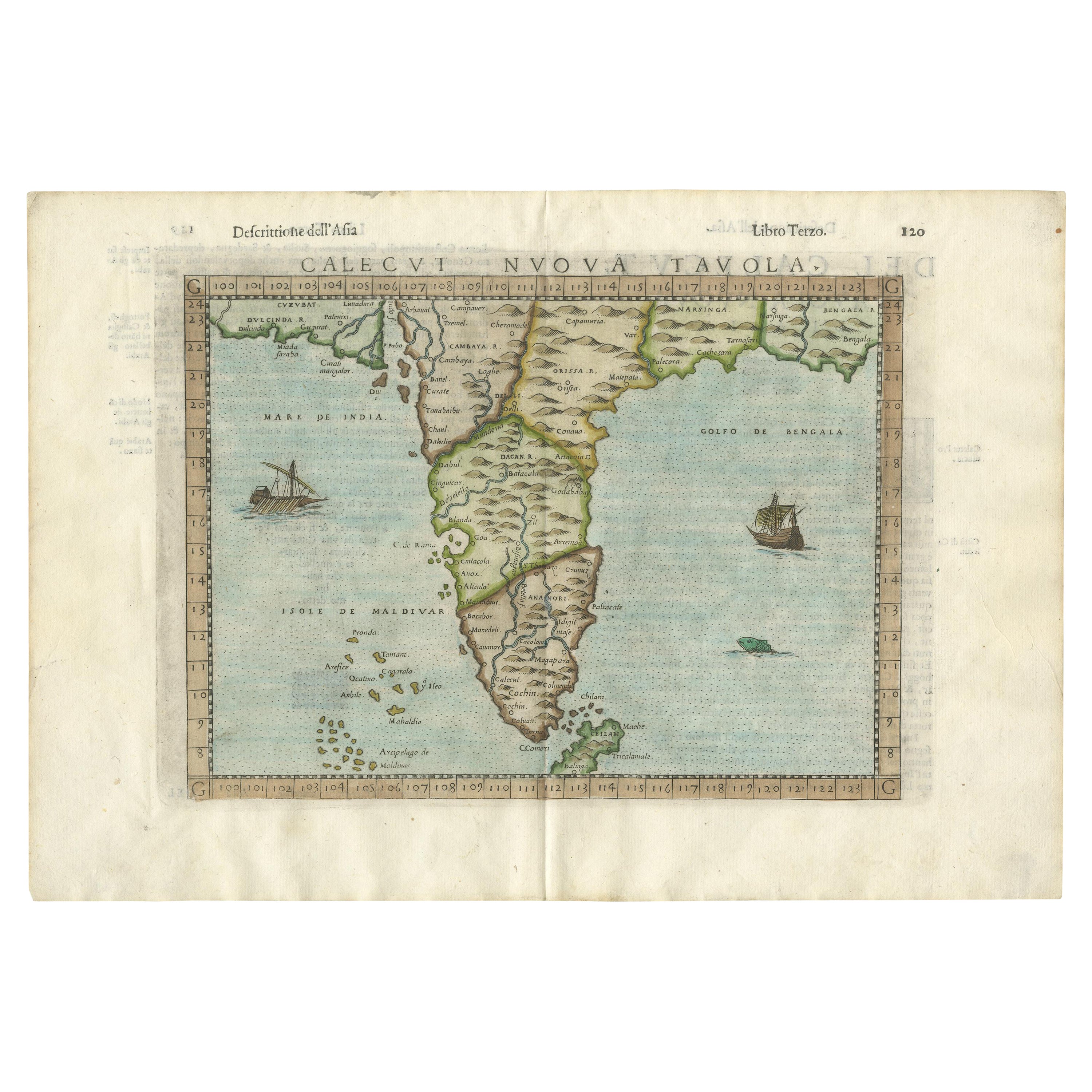
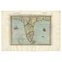
- Rare Attractive Antique Map of Asia, India, Sri Lanka, Maldives, 1599Located in Langweer, NLOriginal Antique map of Asia, India, Ceylon (Sri Lanka), Maldives by Rosaccio / Ruscelli in attractive coloring. Title: Calecut Nuova Tavola Year: 1599 Relief shown pictorially. ...Category
Antique 16th Century European Maps
MaterialsPaper
You May Also Like
- Original Antique Map of India. C.1780Located in St Annes, LancashireGreat map of India Copper-plate engraving Published C.1780 Three small worm holes to right side of map and one bottom left corner Unframed.Category
Antique Early 1800s English Georgian Maps
MaterialsPaper

- Catalogue of Engraved Views, Plans, Etc., Of New York City, 1st EdLocated in valatie, NYA catalogue of engraved views, plans, etc., Of New York City, (The Collection of Percy R. Pyne II). Privately Printed by The De Vinne Press, New York, 1912. Limited to 100 copies. Gr...Category
Early 20th Century American Books
MaterialsPaper
- Dutch Map and City Plan of La Roche-sur-Foron, France, 17th Century Hand ColoredBy Coenraet DeckerLocated in Alamo, CA"Rupes Allobrogum vulgo La Roche" by Dutch engraver Coenraet Decker (1650-1685) is from the atlas Theatrum Statuum Regiae Celestudinis Sabaudiae Ducis, published in 1682. This richly...Category
Antique Late 17th Century Dutch Maps
MaterialsPaper
- Antique Map of Principality of MonacoBy Antonio Vallardi EditoreLocated in Alessandria, PiemonteST/619 - "Old Geographical Atlas of Italy - Topographic map of ex-Principality of Monaco" - ediz Vallardi - Milano - A somewhat special edition ---Category
Antique Late 19th Century Italian Other Prints
MaterialsPaper
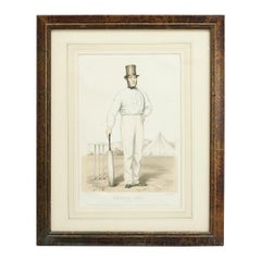
- Antique Cricket Print of Joseph Guy of NottinghamLocated in Oxfordshire, GBCricket print of Joseph Guy of Nottingham. A framed, tinted and hand colored lithographic portrait of the All- England cricketer Joseph Guy (1813 - 187...Category
Antique 1850s British Sporting Art Sports Equipment and Memorabilia
MaterialsPaper
- Original Antique Map of Italy. C.1780Located in St Annes, LancashireGreat map of Italy Copper-plate engraving Published C.1780 Unframed.Category
Antique Early 1800s English Georgian Maps
MaterialsPaper


Recently Viewed
View AllMore Ways To Browse
Antique Collection India
16th Century English Antique
India Antique 18th Century
Antique Manuscript Paper
Ceylon Antique Furniture
East Coast Antiques
Ceylon Prints
Antique Print Ceylon
Churchill Antiques
Ceylon Map
Antique Map Ceylon
Philips Spot
Malabar X
Malabar Map
Antique World Chart
Used Nautical Charts
Map Of Great Britain
Antique Char