Items Similar to 18th Century Cartographic Depiction of Upper India and Ceylon, 1835
Want more images or videos?
Request additional images or videos from the seller
1 of 8
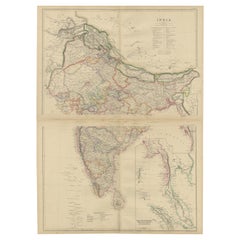
18th Century Cartographic Depiction of Upper India and Ceylon, 1835
About the Item
An exquisite set of two maps, 'Carte de la Partie Superieure De L'Inde en de Cadu Gange,' masterfully crafted by the renowned 18th-century French cartographer, Charles Marie Rigobert Bonne. This pair of maps, meticulously detailed and richly colored, offers a window into the bygone era of the Indian subcontinent and Ceylon, capturing the essence of the regions as they were known to the European powers of the time.
Presented in an elegant, adjoining format, these maps are perfectly aligned to be joined, creating a seamless and expansive cartographic display. Once framed together, they transform into a singular, magnificent panorama that is both a collector's delight and a statement piece for any discerning connoisseur of historical maps.
The potential to frame these maps side by side offers a unique opportunity not only to preserve a piece of history but also to create a breathtaking visual narrative of the cultural and geographical tapestry of Upper India and Ceylon. The maps invite admiration and contemplation, whether as an educational tool, a decorative masterpiece, or a tribute to the rich history of cartography.
Acquiring this set promises not just ownership of a rare cartographic treasure but an heirloom that carries with it the grandeur and the intrigue of the 18th century, a truly timeless addition to any collection or an elegant showpiece for a home or office.
The artist, Charles Marie Rigobert Bonne, was a significant French cartographer of the 18th century, known for his work in the 'Atlas de Toutes les Parties Connues du Globe Terrestre.' This atlas, apparently published in 1835, would include maps such as this on, showcasing detailed renderings of India and Ceylon (now known as Sri Lanka).
The maps reflect the geographical understanding and territorial divisions of the time, offering a French perspective on the Indian subcontinent and Ceylon. Bonne's work is characterized by a relatively sparse yet precise and clear style, focusing on accuracy and scientific detail rather than the ornamental aspects that were common in earlier cartography.
Such maps from Bonne's atlas would have been used for educational purposes, navigation, and by those with commercial interests in the region during a time when maritime trade routes were critical to European powers. They would also be valuable for their historical and artistic merit, representing the cartographic practices of the era.
- Dimensions:Height: 10.04 in (25.5 cm)Width: 14.57 in (37 cm)Depth: 0 in (0.02 mm)
- Materials and Techniques:Paper,Engraved
- Period:
- Date of Manufacture:1835
- Condition:Good. Some light offset. General age-related toning and/or occasional minor defects from handling. Please study scan carefully. Middle folds as issued. Few small tears in the borders, not affecting the image.
- Seller Location:Langweer, NL
- Reference Number:
About the Seller
5.0
Platinum Seller
These expertly vetted sellers are 1stDibs' most experienced sellers and are rated highest by our customers.
Established in 2009
1stDibs seller since 2017
1,922 sales on 1stDibs
Typical response time: <1 hour
- ShippingRetrieving quote...Ships From: Langweer, Netherlands
- Return PolicyA return for this item may be initiated within 14 days of delivery.
More From This SellerView All
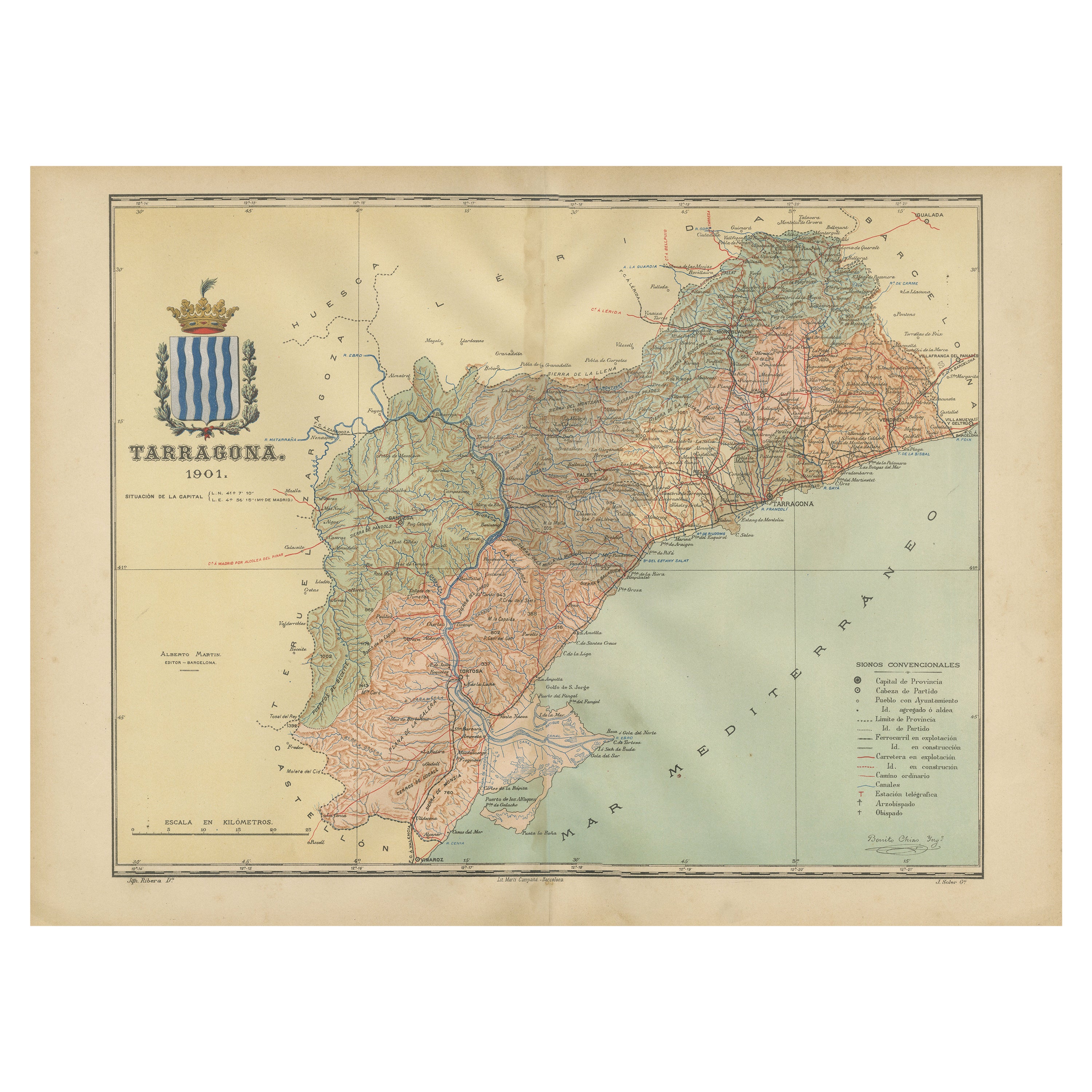
- A Catalonian Cartographic Depiction of Tarragona Province, 1901Located in Langweer, NLThis image depicts a historical map of the province of Tarragona, which is in the northeastern part of Spain, within the autonomous community of Catalonia. The map is dated 1901, sug...Category
Antique Early 1900s Maps
MaterialsPaper
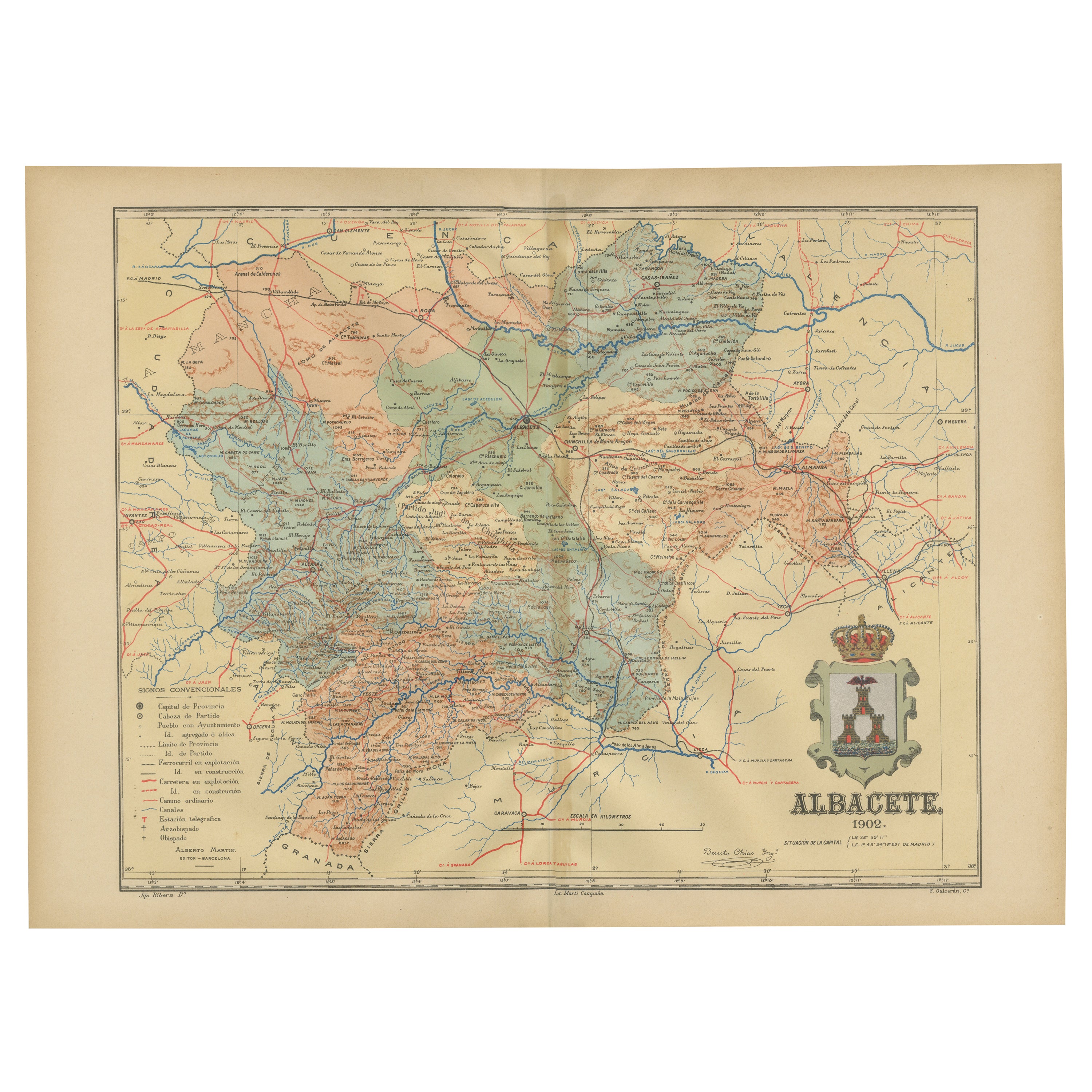
- Albacete, Spain - 1902: A Cartographic Depiction of Landscape and InfrastructureLocated in Langweer, NLAlbacete, Spain - 1902: A Cartographic Depiction of Landscape and Infrastructure An original and historical map of the province of Albacete, dated 1902, from the "Atlas Geográfico I...Category
Antique Early 1900s Maps
MaterialsPaper
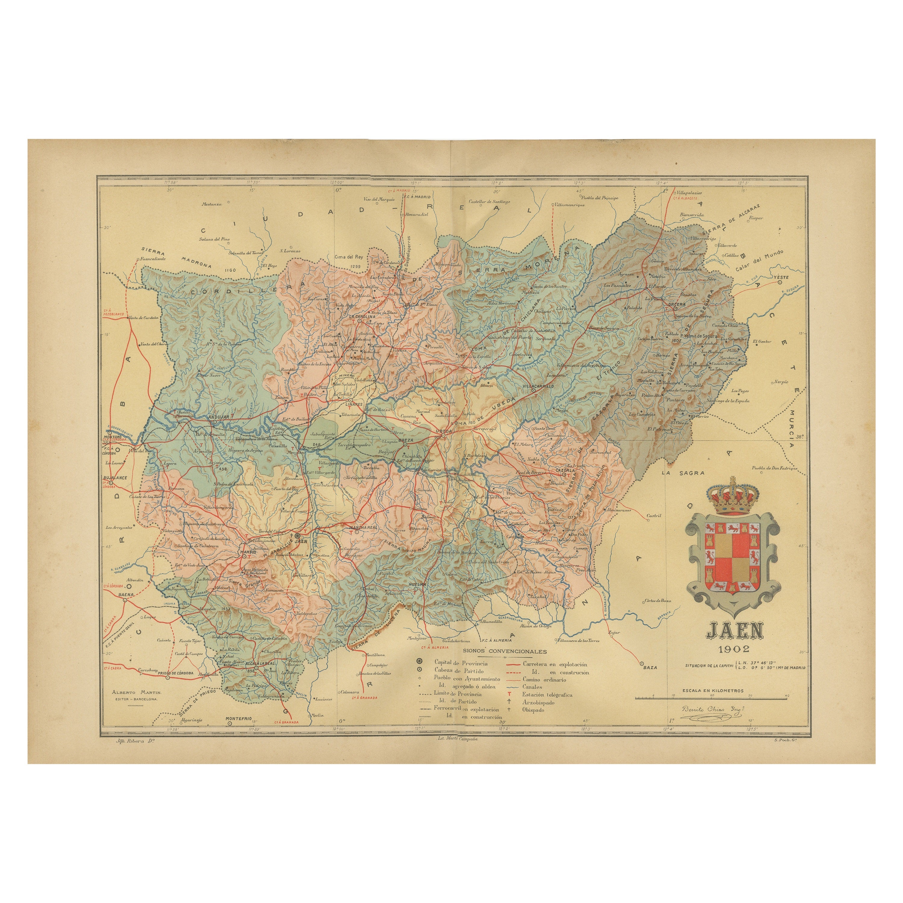
- Jaén 1902: A Cartographic Depiction of Andalusia's Olive HeartlandLocated in Langweer, NLThis original antique map displays the province of Jaén, located in the autonomous community of Andalusia in southern Spain, as of the year 1902. It contains various geographic and i...Category
Antique Early 1900s Maps
MaterialsPaper
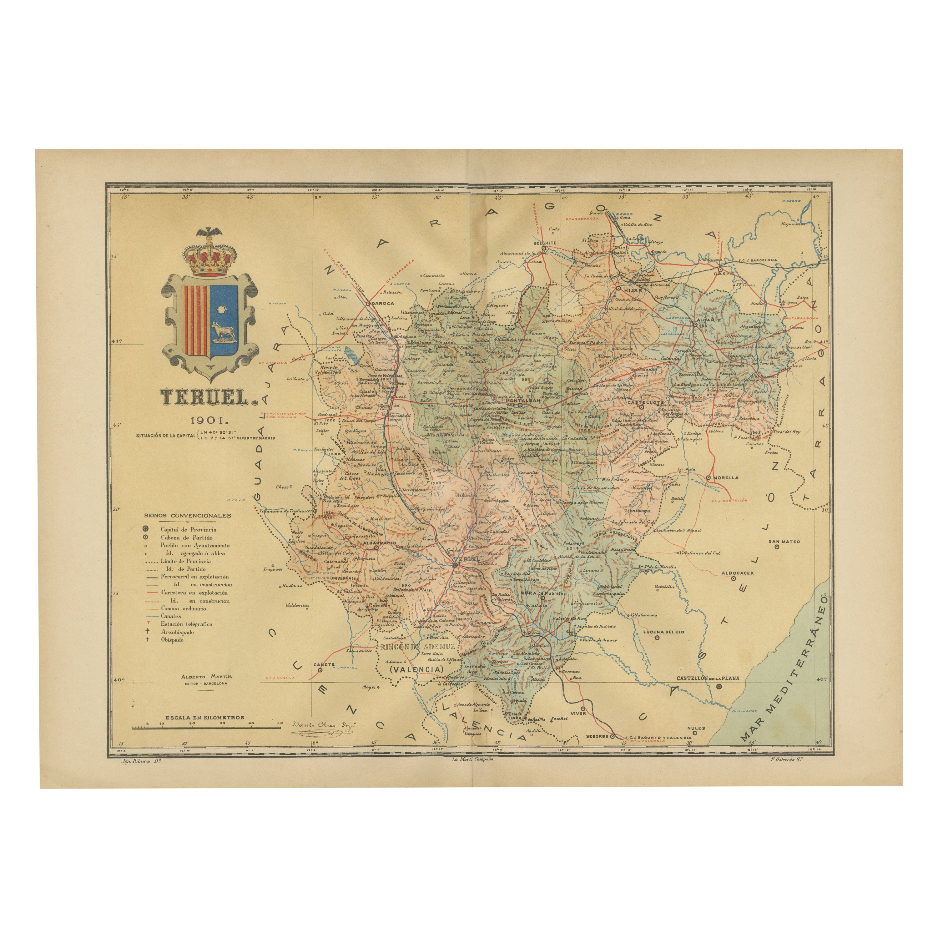
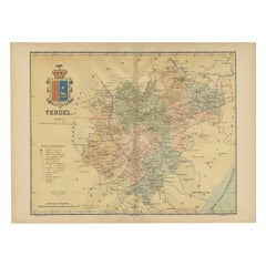
- Teruel 1901: A Cartographic Depiction of Heritage and Natural Splendor in SpainLocated in Langweer, NLOriginal antique map of Teruel in Spain, with highlighted gold. The province of Teruel, located in the region of Aragon in eastern Spain, is known for several unique features: 1. **Mudejar Architecture**: Teruel is famous for its well-preserved Mudejar architecture, which is a style that is a fusion of Christian and Islamic design. This includes notable examples like the Tower of El Salvador and the Teruel Cathedral, both of which are UNESCO World Heritage sites. 2. **Dinopolis**: It hosts Dinópolis, a paleontological park that is one of the largest of its kind in Europe, featuring dinosaur fossils and interactive...Category
Antique Early 1900s Maps
MaterialsPaper
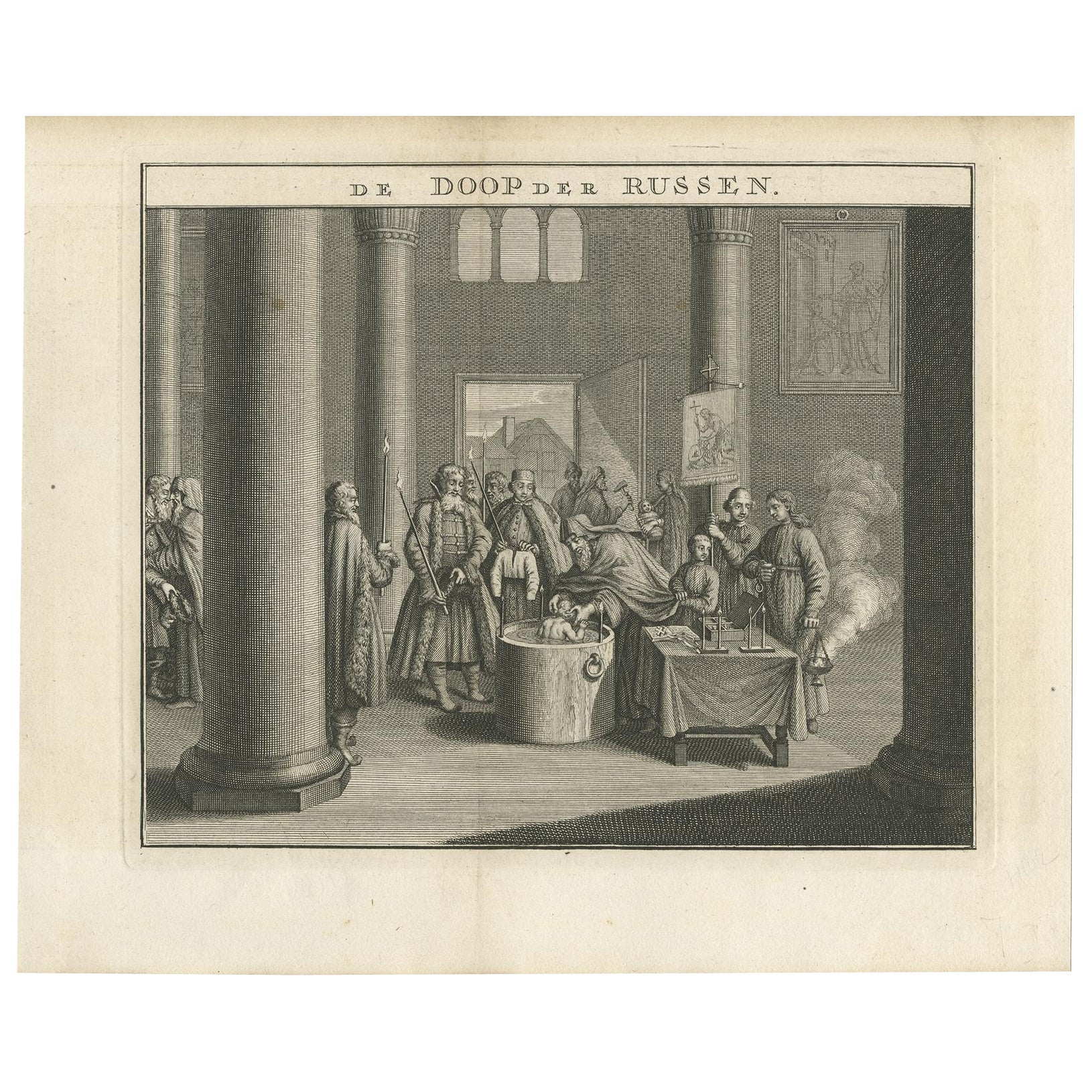
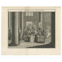
- Mid-18th Century Engraving Depicting The Baptism of Russians, 1735Located in Langweer, NLDescription: Antique print titled 'De Doop der Russen' (Dutch for 'Baptism of the Russians') Old print depicting the baptism of Russians. This print originates from 'Hedendaegsch...Category
Antique 1730s Prints
MaterialsPaper
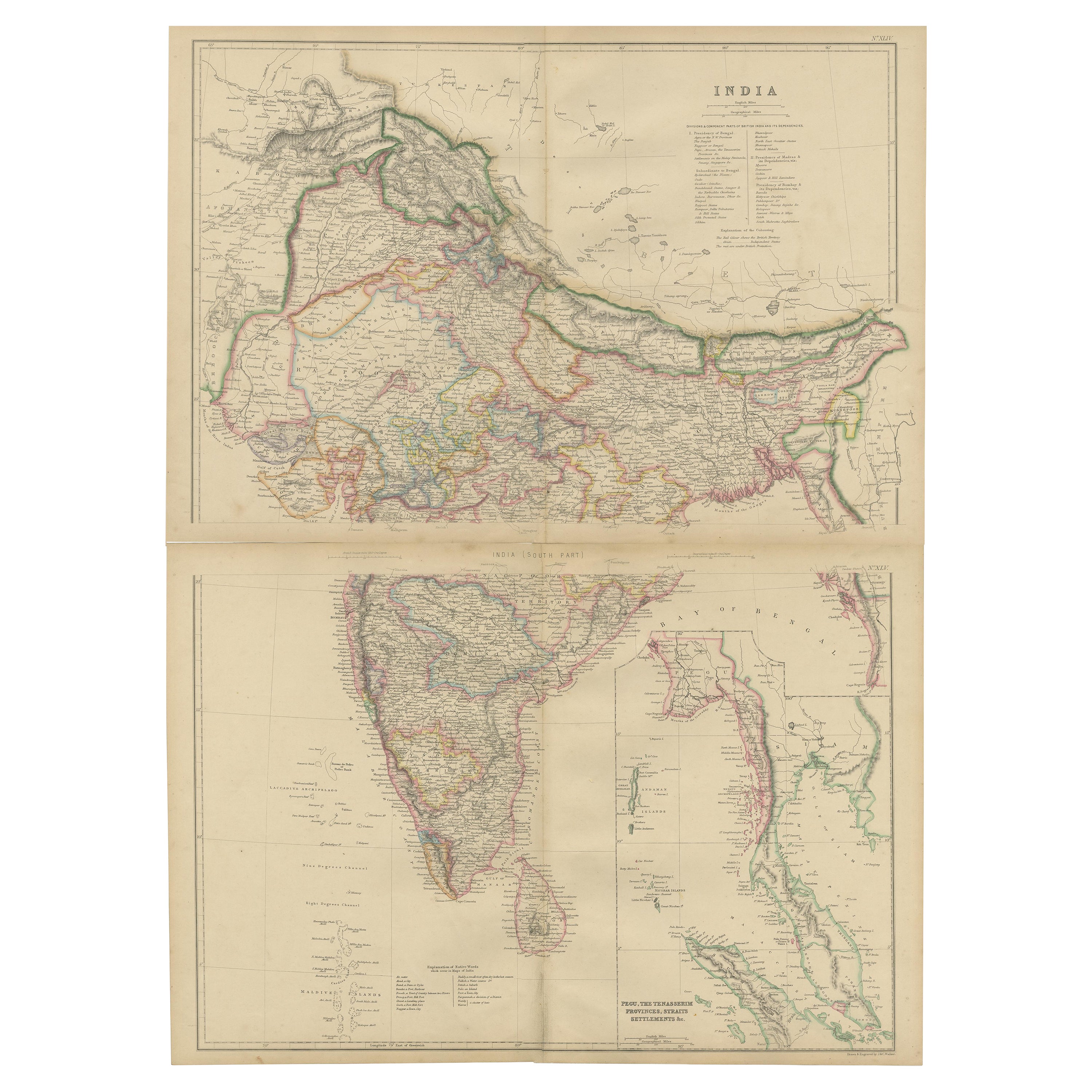
- Vintage Cartographic Collection Set of India Explored - W. G. Blackie's 1859Located in Langweer, NLAntique map titled 'India'. Original antique map of India with inset maps of Pegu, the Tenasserim Provinces, straits settlements. This map originate...Category
Antique Mid-19th Century Maps
MaterialsPaper


You May Also Like
- 18th Century Carved Oak Statue Depicting St. BartholomewLocated in Dallas, TXThis tall French statue of St. Bartholomew was hand-carved from oak in the 1700’s. This depiction of St. Bartholomew is not often seen in art, except for one of the most well known r...Category
Antique 18th Century French Figurative Sculptures
MaterialsOak
- Peace Depicting the Crucifixion in Dark Patina Bronze 18th CenturyLocated in Milan, IT18th Century. Peace depicting the Crucifixion Dark patina bronze, 21 x 14.5 cm The bronze examined is an ancient peace (in Latin osculum pacis or table pacis), the object of th...Category
Antique 18th Century Italian Religious Items
MaterialsBronze
- French 18th Century Wooden Tabernacle Door Depicting Christ / Salvator MundiLocated in Buisson, FRWonderful hand-carved Oak tabernacle door depicting Christ/ Salvator mundi. Beautiful weathered with traces of its original color. France circa 1750 Measurements include the wooden b...Category
Antique 18th Century French Baroque Religious Items
MaterialsOak
- Mid-18th Century French Alabaster Sculpture Depicting a Female Nude with AnchorLocated in Milan, ITAlabaster sculpture depicting a female nude with cloak and hat, with clasped hands and resting her foot on an anchor, as if to invoke protection for the sailors; French manufacture o...Category
Antique 1760s French Nautical Objects
MaterialsAlabaster
- Collection of 18th and 19th Century Arabic Astrolabes and QuadrantLocated in London, GBA collection of 18th and 19th century Arabic astrolabes and quadrant Persian, 18th/19th Century Largest: height 23cm, width 13cm, depth 3cm Smallest: height 6.5cm, width 4.5cm, depth 1.5cm This excellent set of antique astronomical instruments is a selection of five Persian brass astrolabes...Category
Antique Early 19th Century Persian Islamic Scientific Instruments
MaterialsBrass
- Vintage Reproduction 17th Century Map of Europe, American, Cartography, BlaeuwLocated in Hele, Devon, GBThis is a vintage reproduction map of Europe. An American, paper stock cartography print in frame after the work by Blaeuw, dating to the late 20t...Category
Late 20th Century Central American Mid-Century Modern Maps
MaterialsGlass, Wood, Paper