Items Similar to Antique Print of the Malabar Coast of India showing the VOC establishments, 1726
Want more images or videos?
Request additional images or videos from the seller
1 of 7
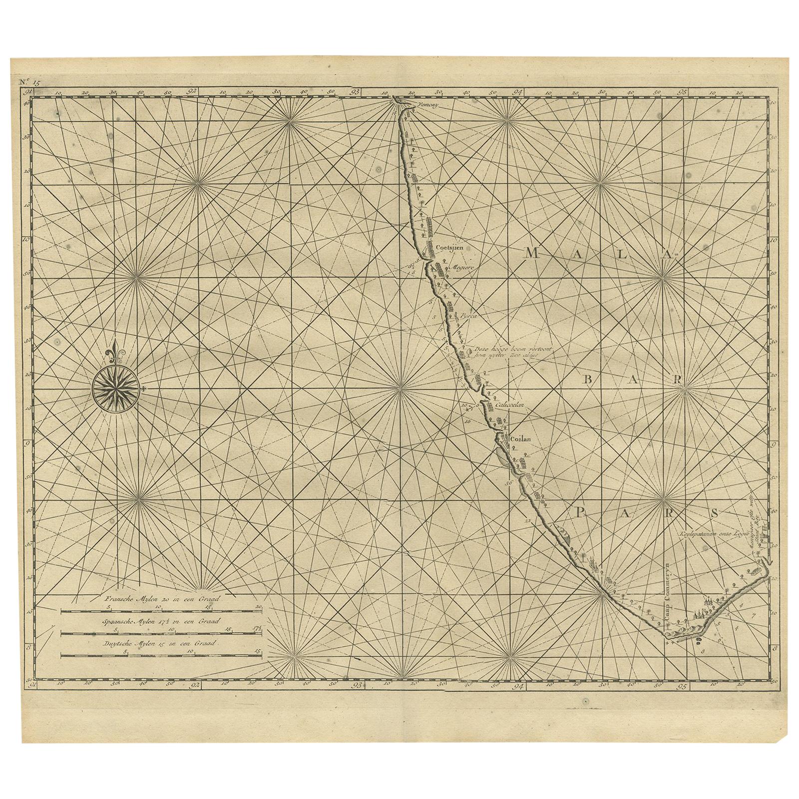
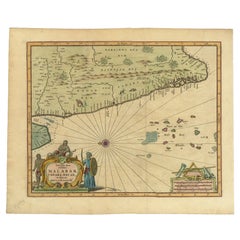
Antique Print of the Malabar Coast of India showing the VOC establishments, 1726
About the Item
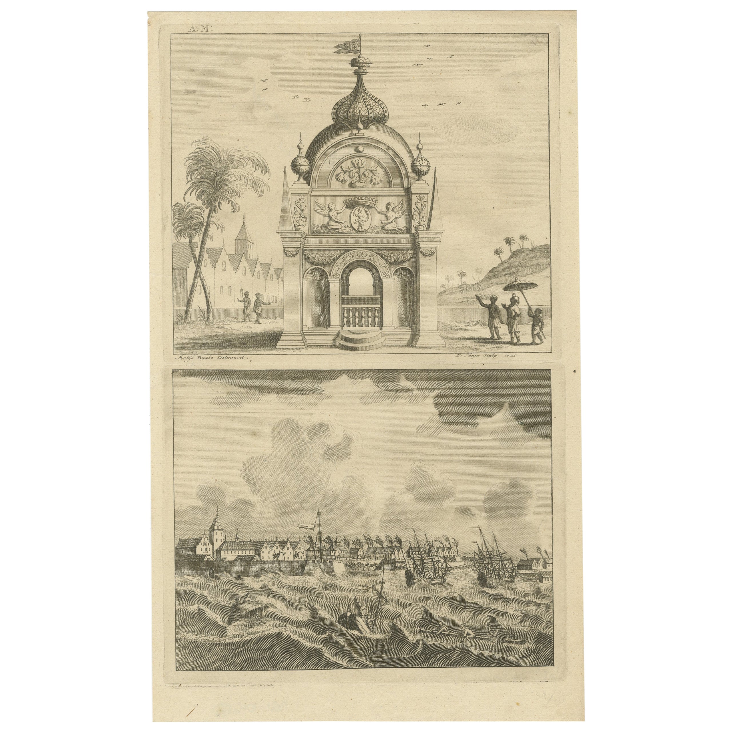
Dutch print with the title: Platte Grond van t'Fort Tricoen male met de daar aangelegen Pagoods-Berg (Trincomalee, Sri Lanka)
The map is taken from: 'Oud en Nieuw Oost-Indiën' van François Valentyn.
1) Ottens, Frederik (engraver / etcher)
2) Braam, J. van (publisher)
3) Linden, Gerard onder de (publisher)
MALABAR COAST
Sea chart of the Malabar Coast, also known as the Pepper Coast, in southwestern India. It features the most significant VOC (Dutch East India Company) establishments along this coast. A compass rose is depicted in the west; scale bars are present in the lower left. Blank verso.
Hand-colored copper engraving, published in 1724-1726 in Dordrecht by Joannes van Braam and Gerard Onder de Linden in "Oud en nieuw Oost-Indiën," encompassing a precise and extensive narrative of Dutch power in those regions, along with a comprehensive description of the Moluccas... and all the islands under their administration; the Dutch comptoir in Surat, and the lives of the Great Moguls (...), by François Valentyn.
Immerse yourself in the enchanting allure of the Malabar Coast with this captivating sea chart. Originating from the southwestern shores of India, this hand-colored copper engraving beautifully showcases the Pepper Coast, renowned as the Malabar Coast. It meticulously highlights the notable Dutch East India Company (VOC) establishments that dotted this coastal paradise.
Crafted with intricate detail and artistic precision, this map unveils the strategic points of interest along the coast, complemented by a compass rose in the western expanse and scale bars for navigational guidance in the lower left. No text on the verso.
Published between 1724-1726 in Dordrecht by Joannes van Braam and Gerard Onder de Linden as part of "Oud en nieuw Oost-Indiën," this captivating engraving forms part of François Valentyn's meticulous narrative. Offering a vivid portrayal of Dutch power in the region, it presents a rich tapestry of descriptions encompassing the Moluccas, the Dutch comptoir in Surat, and intriguing insights into the lives of the Great Moguls. An evocative piece, it invites you on a historical voyage through the treasures and maritime legacy of the Malabar Coast.
- Dimensions:Height: 13.39 in (34 cm)Width: 16.74 in (42.5 cm)Depth: 0 in (0.02 mm)
- Materials and Techniques:Paper,Engraved
- Period:1720-1729
- Date of Manufacture:1726
- Condition:Almost excellent condition, especially considering its age. A view folding lines are visible. The coloring is from recent years on a slightly discolored sheet due to age. Study the image carefully.
- Seller Location:Langweer, NL
- Reference Number:
About the Seller
5.0
Platinum Seller
These expertly vetted sellers are 1stDibs' most experienced sellers and are rated highest by our customers.
Established in 2009
1stDibs seller since 2017
1,928 sales on 1stDibs
Typical response time: <1 hour
- ShippingRetrieving quote...Ships From: Langweer, Netherlands
- Return PolicyA return for this item may be initiated within 14 days of delivery.
More From This SellerView All
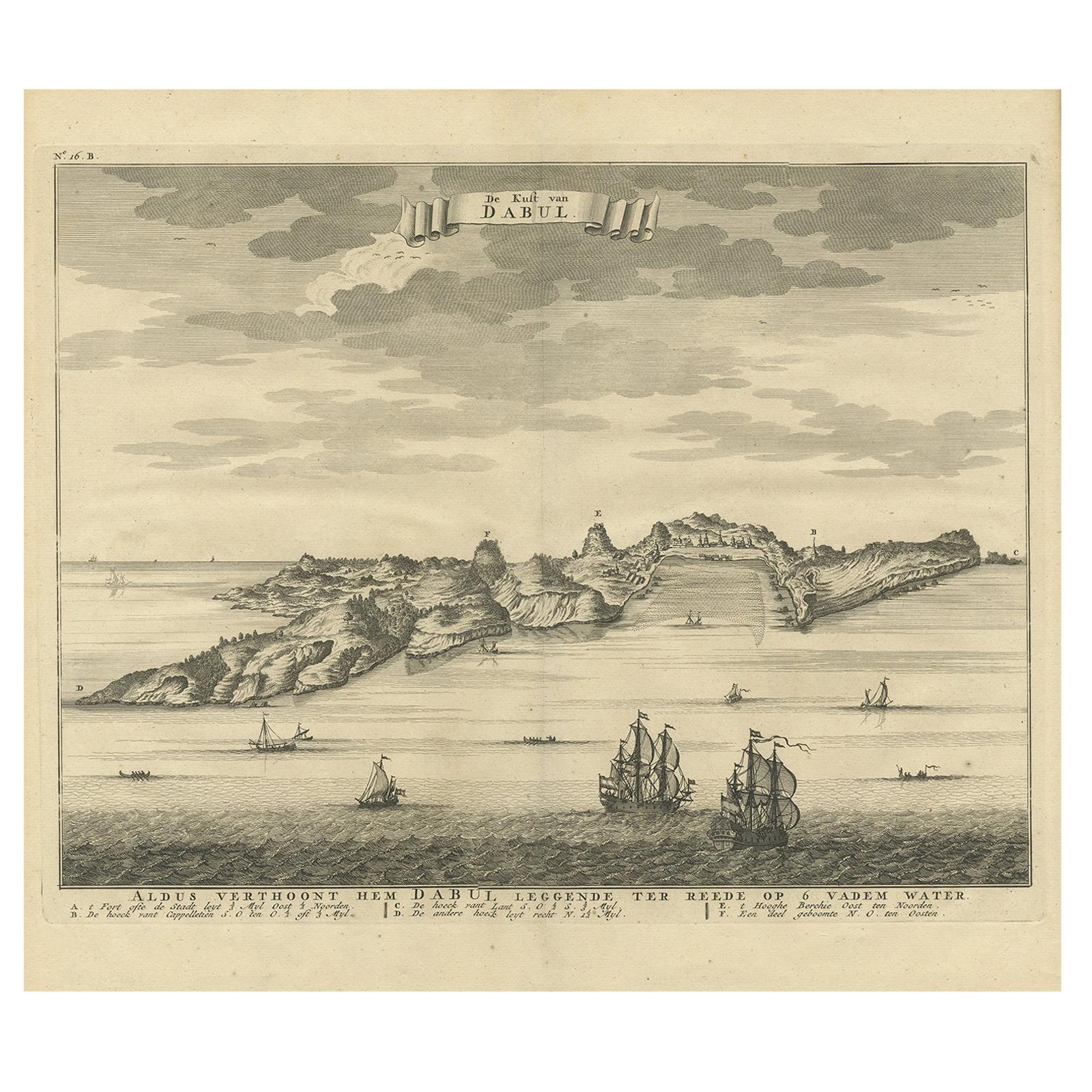
- Antique Print of the Coast of Dabhol 'India', 1726By F. ValentijnLocated in Langweer, NLAntique print titled 'De Kust van Dabul'. Antique print of the coastline near Dabhol in India. This print originates from 'Oud en Nieuw Oost-Indiën' by F. Valentijn.Category
Antique Early 18th Century Dutch Prints
MaterialsPaper
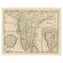
- Antique Print of the Coromandel Coast in India, 1726Located in Langweer, NLAntique print depicting the Coromandel Coast, India. This print originates from 'Oud en Nieuw Oost-Indiën' by F. Valentijn. Artists and Engravers: François Valentijn (1666-1727), a ...Category
Antique 18th Century Prints
MaterialsPaper
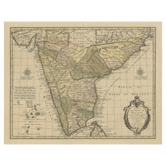
- Antique Map of Malabar Coast by Valentijn, 1726By F. ValentijnLocated in Langweer, NLUntitled sea chart of the coast of Malabar, India. This print originates from 'Oud en Nieuw Oost-Indiën' by F. Valentijn.Category
Antique Early 18th Century Dutch Maps
MaterialsPaper
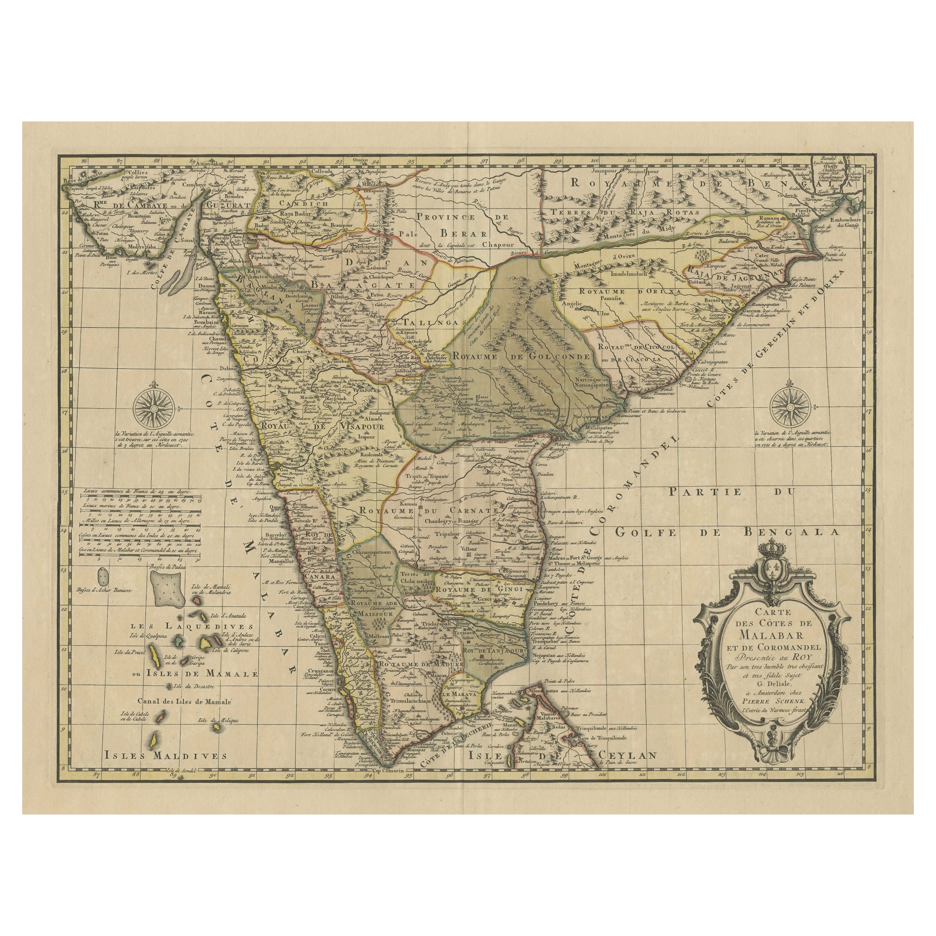
- Detailed Decorative Antique Map of the Coast of Malabar and Coromandel, IndiaLocated in Langweer, NLAntique map titled 'Carte des Côtes de Malabar et de Coromandel'. Finely engraved map of the southern part of India, first issued in 1723 by acclaimed French mapmaker Guillaume De L’...Category
Antique Mid-18th Century Maps
MaterialsPaper
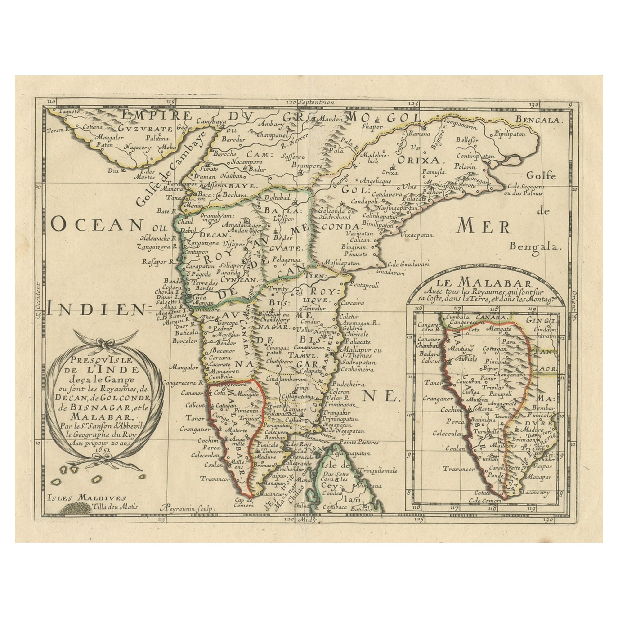
- Original Antique Map showing Southern India, Northern Sri Lanka & Malabar, 1652Located in Langweer, NLAntique map titled 'Presqu'Isle de l'Inde deca le Gange (..)'. Old map showing the southern part of India, including the northern part of Sri Lanka. With inset map of Southern India (Malabar). This map covers the subcontinent from the Bay of Bengal and the Gulf of Cambay to Ceylon. The Mogul Empire can be found in the north. Further south...Category
Antique 1650s Maps
MaterialsPaper
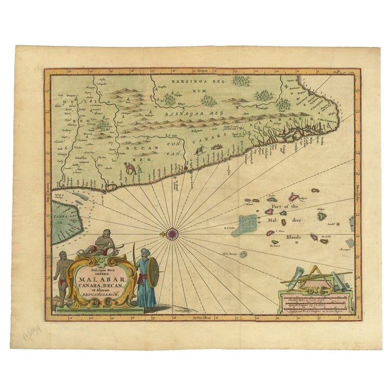
- Antique Map of the Malabar Coast by Baldaeus, 1744By Philip BaldaeusLocated in Langweer, NLAntique map titled 'Descriptio Nova Imperii Malabar (..).' Nice map of the Malabar Coast. This map was published in 'The True and Exact Description of the Most Celebrated East - Indi...Category
Antique 18th Century Maps
MaterialsPaper
You May Also Like
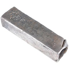
- Colonial Silver VOC 'East-India Company' IngotLocated in Amsterdam, NLA silver 'V.O.C. AMSTERDAM' ingot circa 1738, with monogram and the assay mark of the Amsterdam Grill family With V.O.C. monogram and the A for Amsterdam. L. approx. 15.5 cm W...Category
Antique 18th Century Dutch Historical Memorabilia
MaterialsSterling Silver
- John Alden’s Model of the Schooner “Malabar X”Located in Norwell, MAA scale model of the John Alden designed schooner “Malabar X". The planked deck carries a long cabin with oval portholes, toe-rail, skylights, and compa...Category
20th Century Models and Miniatures
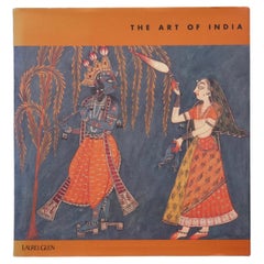
- The Art of IndiaLocated in Bradenton, FLThe Art of India. Hardcover book with dustjacket. First edition, published in 1997 by Laurel Glen Publishing. Illustrated, 97 pages.Category
Late 20th Century Books
MaterialsPaper
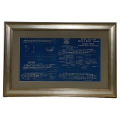
- Boat Blueprint Showing the Sand PiperLocated in Norwell, MAMotor Boating Publishing plan for a thirty foot day cruiser. Designd by William Atkin. The vessel is shown in great detail. Circa 1937 matted and framed. Weight: 7 lbs. Overall Dime...Category
Vintage 1930s North American Nautical Objects
MaterialsPaper
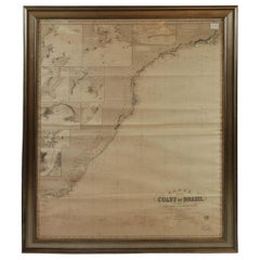
- Imray Ocean Chart of the Coast of Brazil 1876Located in Norwell, MAImray & Son 1876 Nautical chart of the Coast of Brazil between Cape Frio and the River Plate. Nicely framed. Overall Dimensions: 46" H x 56" W.Category
Antique 1870s Nautical Objects
MaterialsPaper
- Red Sea, The Saudi CoastBy Assouline PublishingLocated in NEW YORK, NYBordering the coastlines of eight countries, the Red Sea is a melting pot of civilizations, faiths and hopes. With unique coral reefs and diverse underwater life...Category
2010s American Books
MaterialsLinen


Recently Viewed
View AllMore Ways To Browse
Antique Map Of North And East Asia 1751
Map Of Mississippi
Bedfordshire Antique Map
Auge En Pierre
Covens & Mortier On Sale
Larousse Universel
Staffordshire Antique Map
Staffordshire Map
Tam Austria
Antique Furniture Manitoba
Nova Hollandia
William Wyld
Matthew Seutter On Sale
Menorca Map
Pierre Fran�ois Tardieu On Sale
Rand Mcnally Map Of Kansas
Sumba Map
1681 Moses Pitt