Items Similar to A Rare and Old Trapezoidal Projection of the Ganges and Himalaya Range in India

Want more images or videos?
Request additional images or videos from the seller
1 of 7
A Rare and Old Trapezoidal Projection of the Ganges and Himalaya Range in India
About the Item
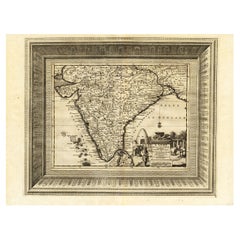
Antique map titled 'Tabula Asiae X'. This Ptolemaic map on a trapezoidal projection is centered on India with recognizable river systems, but completely lacking the sub-continental shape of the landmass. The top of a large unnamed Sri Lanka appears at bottom. Latin text on verso. This map originates from 'Geographia Cl. Ptolemaei Alexandrini (..)'.
- Dimensions:Height: 9.06 in (23 cm)Width: 12.41 in (31.5 cm)Depth: 0.02 in (0.5 mm)
- Materials and Techniques:
- Period:
- Date of Manufacture:circa 1561
- Condition:Very good, given age. General age-related toning. Original folding line, minor wear and foxing. Latin text on verso. Please study images carefully.
- Seller Location:Langweer, NL
- Reference Number:
About the Seller
5.0
Platinum Seller
These expertly vetted sellers are 1stDibs' most experienced sellers and are rated highest by our customers.
Established in 2009
1stDibs seller since 2017
1,928 sales on 1stDibs
Typical response time: <1 hour
- ShippingRetrieving quote...Ships From: Langweer, Netherlands
- Return PolicyA return for this item may be initiated within 14 days of delivery.
More From This SellerView All
- Nicely Hand-Colored Antique Map of Part of India, the Ganges & Hindustan, 1755Located in Langweer, NLAntique map titled 'Carte de l'Inde en deca du Gange comprenant l' Indoustan (..)' A map of part of India, the Ganges and Hindustan. From: Antoine Francois Prevost d'Exiles' (or ...Category
Antique 1750s Maps
MaterialsPaper
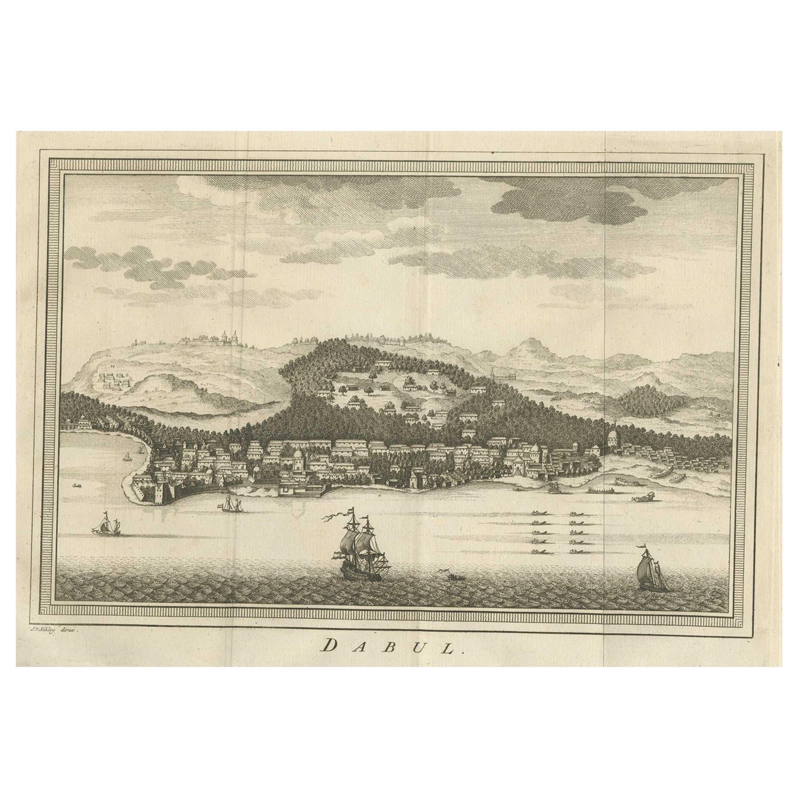
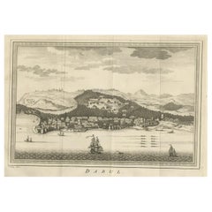
- Old Copper Engraving of the Port City Dabhol in India, 1757Located in Langweer, NLAntique print titled 'Dabul'. Old print of the port city Dabhol in India. In the 15th and 16th centuries, Dabul was an opulent Muslim trade center. Around 1660 it was annexed to th...Category
Antique 1750s Maps
MaterialsPaper
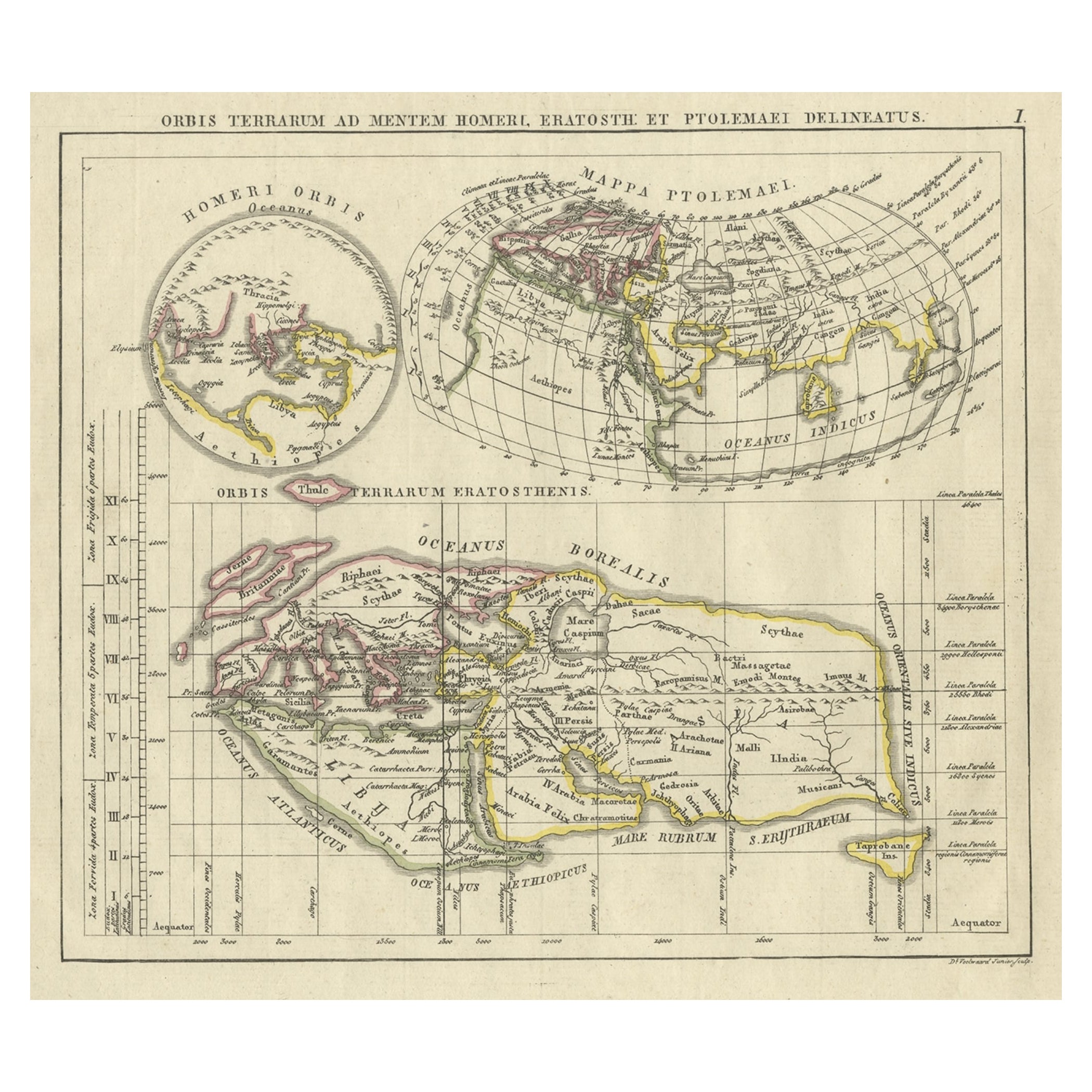
- Antique Map of the Old World Projection, Entitled Orbis Terrarum Ad Mentem, 1825Located in Langweer, NLAntique map titled 'Orbis Terrarum ad Mentem (..)'. Old map of the world originating from 'Atlas der Oude Wereld'. Artists and Engravers: Published by C. Ph. Funke and W. van Boe...Category
Antique 19th Century Maps
MaterialsPaper
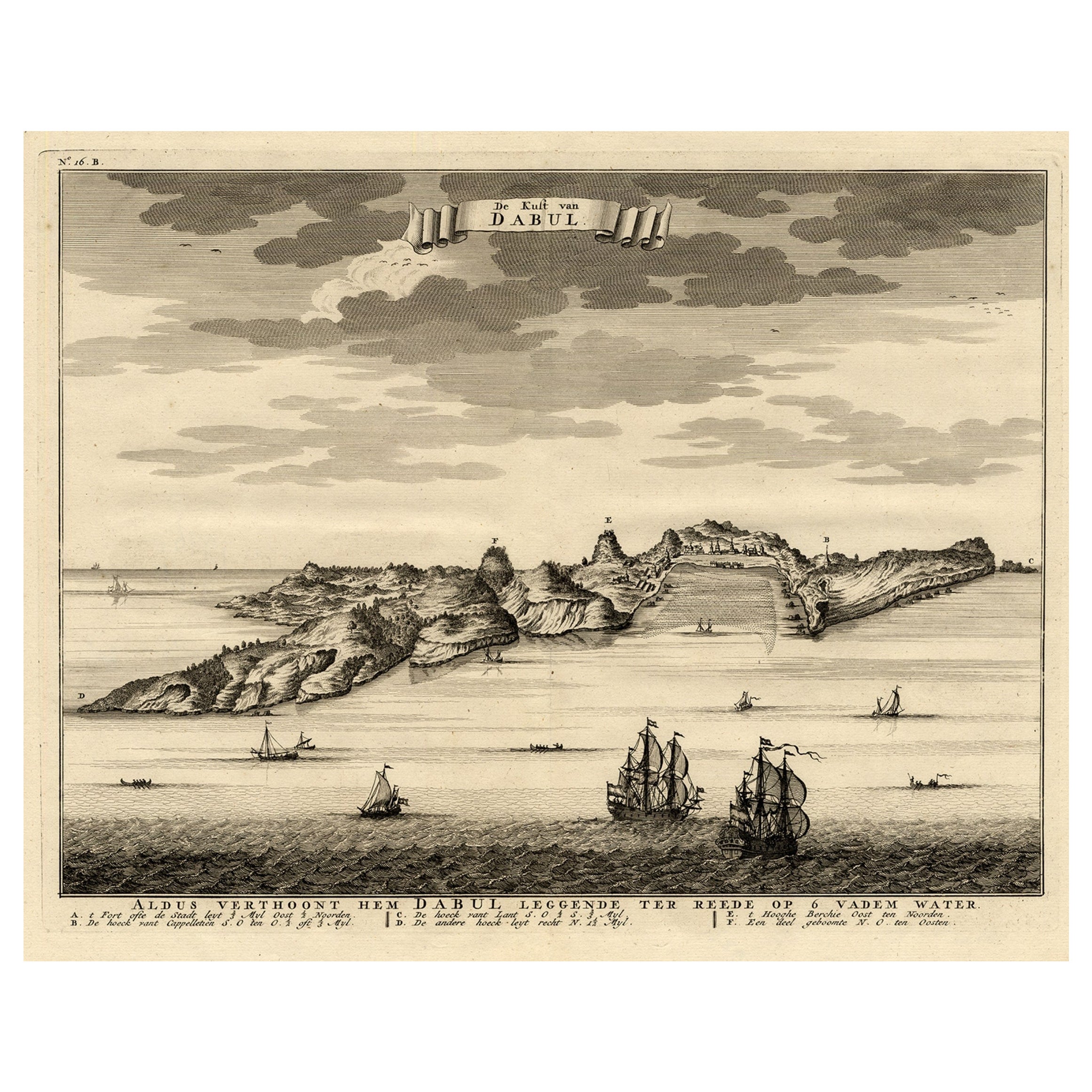
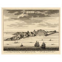
- Rare Engraving of the Coast of Dabhol or Dabul, Ratnagiri, Maharashtra in IndiaLocated in Langweer, NLAntique print titled 'De Kust van Dabul'. Antique print depicting the coast of Dabhol / Dabul in India. This print originates from 'Oud en Nieuw Oost-Indiën' by F. Valentijn. Artist...Category
Antique 18th Century Prints
MaterialsPaper
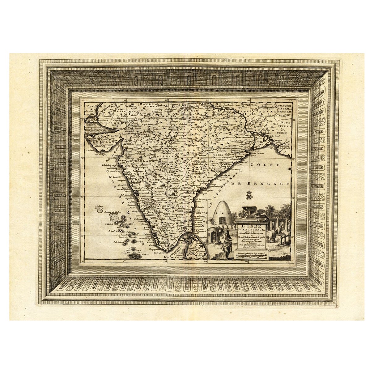
- Rare Engraved Antique Map of India with Elephants in the Cartouche, c.1725Located in Langweer, NLAntique map titled 'L'Inde de ca le Gange suivant les nouvelles observations (..)'. Detailed map of India, with part of Sri Lanka. Compass rose and decorative cartouche lower rig...Category
Antique 18th Century Maps
MaterialsPaper
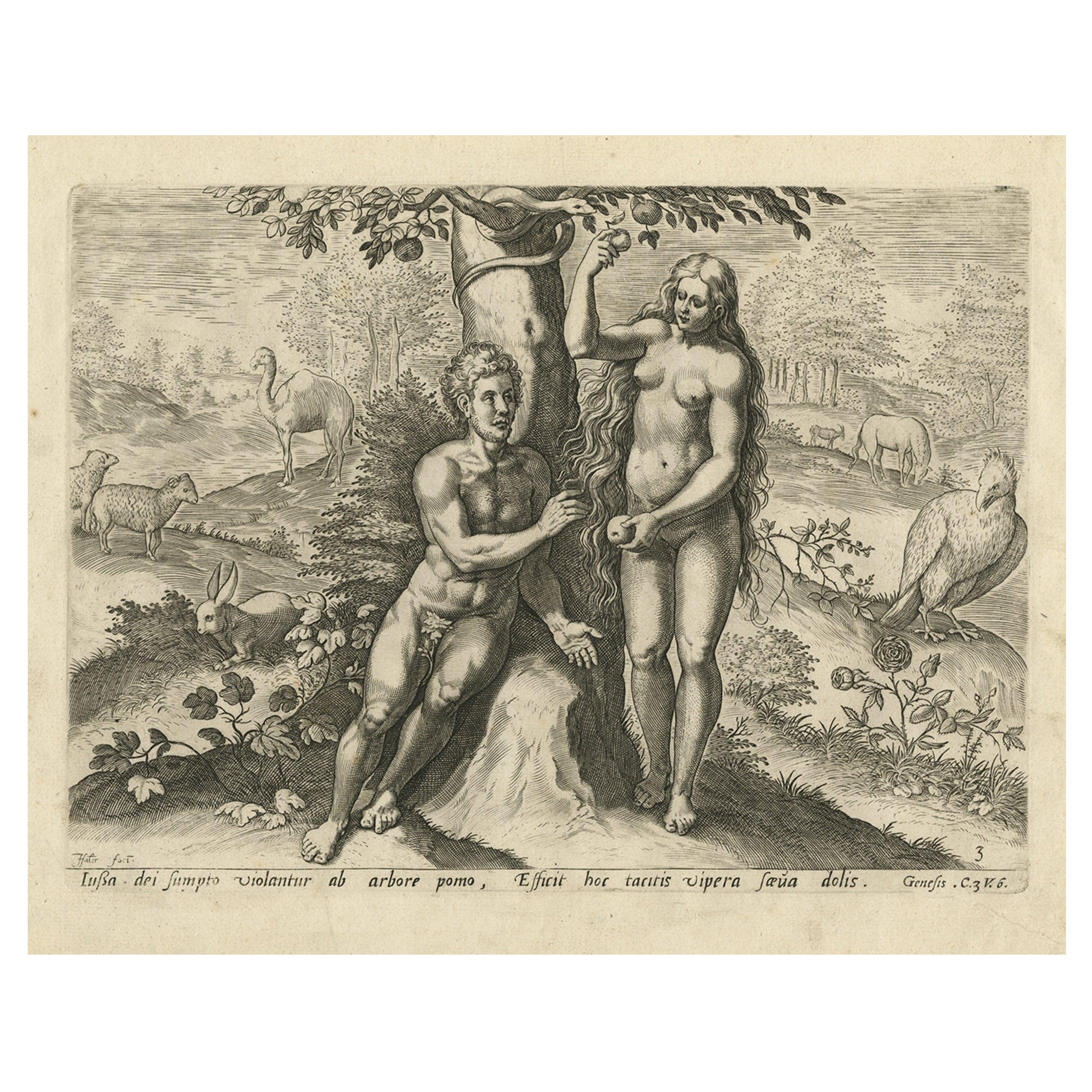
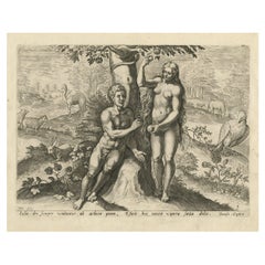
- Rare Print of Genesis in the Old Testament; Adam and Eve Eating the Apple, 1674Located in Langweer, NLAntique print, titled: 'Lussa dei sumpto violantur ab arbore pomo, Efficit hoc tacitis vipera saeua dolis.' This original antique print shows a scene from Genesis in the Old Test...Category
Antique 1670s Religious Items
MaterialsPaper
You May Also Like
- Original Antique Map of India. C.1780Located in St Annes, LancashireGreat map of India Copper-plate engraving Published C.1780 Three small worm holes to right side of map and one bottom left corner Unframed.Category
Antique Early 1800s English Georgian Maps
MaterialsPaper

- Extremely Rare Copy of the Venezuelan Declaration of Independance, 1811Located in Amsterdam, NLExtremely rare copy of the Venezuelan Declaration of Independance 'Declaracion de Independencia de las Siete Provincias Unidas de Venezuela en Congreso de 5 de Julio de 1811' By Lorenzo Lüthy (c. 1811-1877), printed in Philadelphia, Peter S. Duval, 1841. Lithograph on laid paper, mounted in passepartout, H. 84 x W. 64.5 cm (with mount H. 96,5 x W. 77 cm.) Large and extremely rare lithographed broadside Declaration of Independence of Venezuela by American immigrant...Category
Antique Early 19th Century Venezuelan Prints
MaterialsPaper
- Old Nautical Print Depicting the Bombardment of Cadiz by the French Navy 1823Located in Milan, ITPrint by engraving on copper plate of the first half of the 19th century, depicting the bombardment of Cadiz by the French Navy, 23 September 1823. The print is signed peint par Crep...Category
Antique 1830s French Nautical Objects
MaterialsPaper
- Old Nautical Map of CorsicaLocated in Alessandria, PiemonteST/556/1 - Old map of Corsica isle, surveyed by Captain Hell, of the French Royal Navy in 1824, engraved and published on 1874, with additions and corre...Category
Antique Early 19th Century English Other Prints
MaterialsPaper
- Old Horizontal Map of EnglandBy TassoLocated in Alessandria, PiemonteST/520 - Old rare Italian map of England, dated 1826-1827 - by Girolamo Tasso, editor in Venise, for the atlas of M.r Le-Sage.Category
Antique Early 19th Century Italian Other Prints
MaterialsPaper
- Lithograph Depicting the Horse Winner of the Italian Derby in 1963Located in Milan, ITLithograph on paper made in the 1990s from a painting depicting Braccio da Montone winner of the 1963 Italian Derby, ridden by Renato Antonuzzi. With frame 66.5 x 61 cm, frame thickn...Category
1990s Italian Sports Equipment and Memorabilia
MaterialsWood, Paper