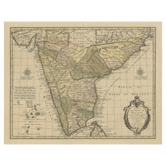
Items Similar to Attractive Detailed Map of the Empire of the Great Mogul, Incl India, 1731
Want more images or videos?
Request additional images or videos from the seller
1 of 5
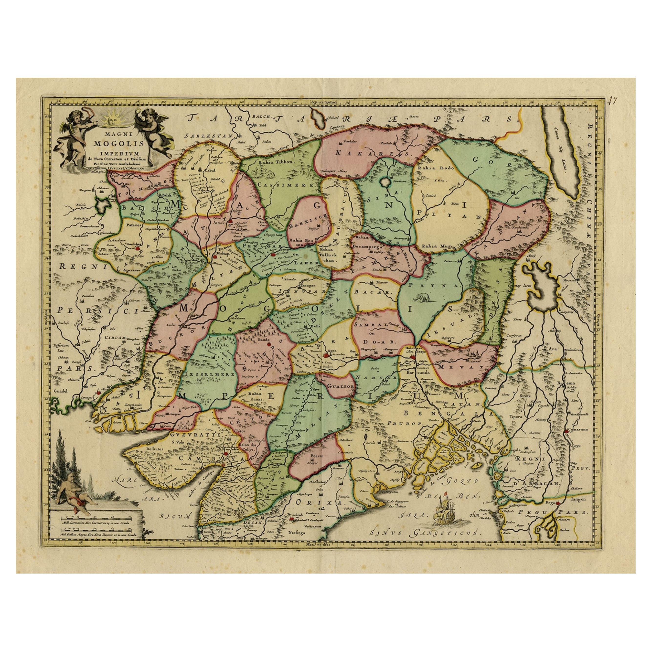
Attractive Detailed Map of the Empire of the Great Mogul, Incl India, 1731
About the Item
Antique map titled 'Nieuwe Kaart van t Keyzer Ryk Grooten Mogol.'
Attractive detailed map of the Empire of the Great Mogul, which included India, Sri Lanka, Pakistan and Bangladesh, decorated with a simple compass rose. Source unknown, to be determined.
Artists and Engravers: Made by 'Isaak Tirion' after an anonymous artist. Isaak Tirion, a Dutch publisher in Amsterdam, was born 1705. He produced serveral Atlases and Dutch town plans. The maps mainly based on those of Guillaume de l'Isle. He died in 1765.
- Dimensions:Height: 13.12 in (33.3 cm)Width: 16.15 in (41 cm)Depth: 0 in (0.02 mm)
- Materials and Techniques:
- Period:1730-1739
- Date of Manufacture:1731
- Condition:Wear consistent with age and use. Condition: Good, given age. Edges with a few tiny tears. Some discolouration top margin left, hardly touching image. Original folds as issued. General age-related toning and/or occasional minor defects from handling. Please study image carefully.
- Seller Location:Langweer, NL
- Reference Number:
About the Seller
5.0
Platinum Seller
These expertly vetted sellers are 1stDibs' most experienced sellers and are rated highest by our customers.
Established in 2009
1stDibs seller since 2017
1,928 sales on 1stDibs
Typical response time: <1 hour
- ShippingRetrieving quote...Ships From: Langweer, Netherlands
- Return PolicyA return for this item may be initiated within 14 days of delivery.
More From This SellerView All
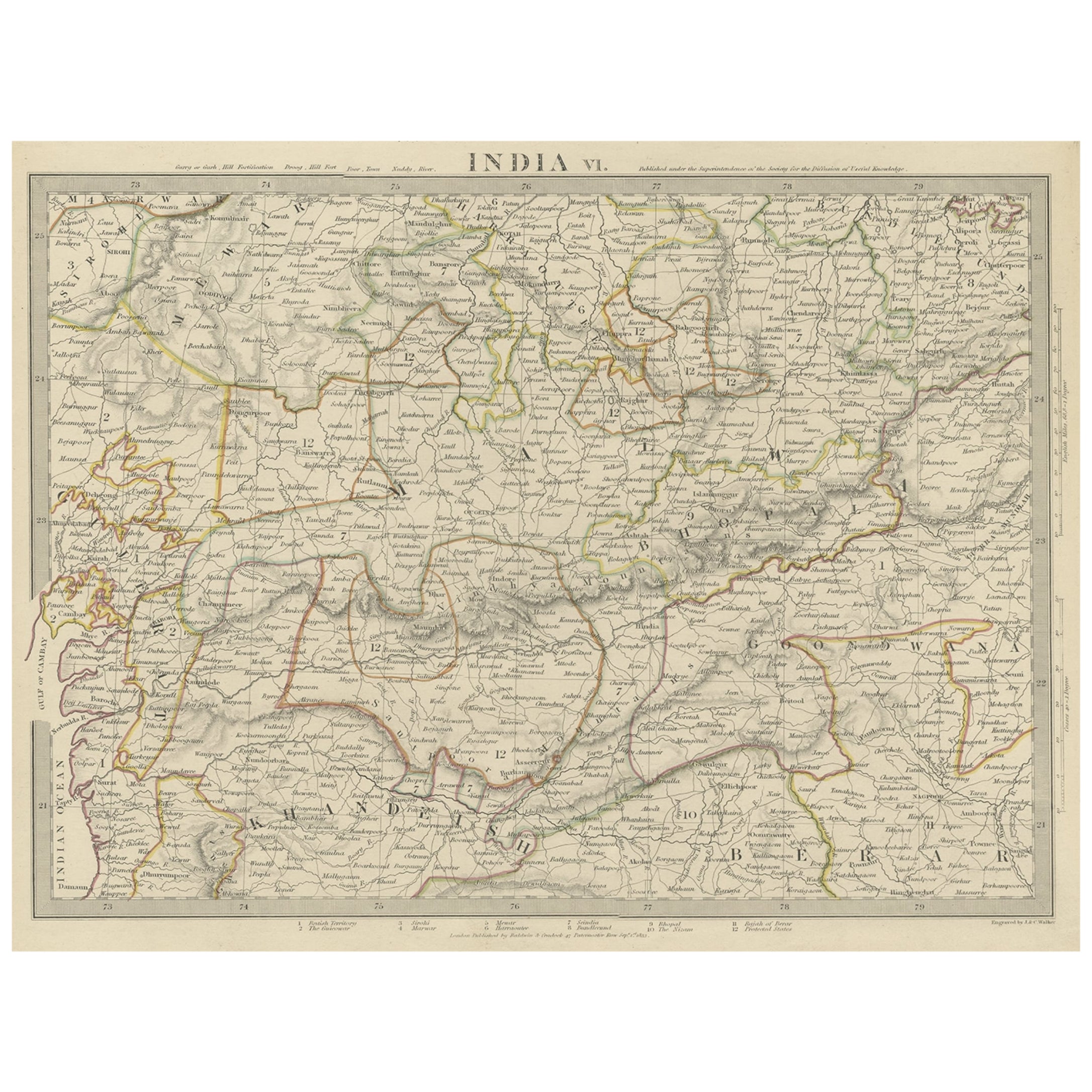
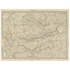
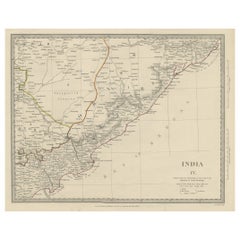
- Detailed Antique Map of the Region of Malwa in India, 1833Located in Langweer, NLAntique map titled 'India VI'. Old steel engraved map of the region of Malwa showing great detail. Artists and Engravers: Engraved by J. & C. Walker. Published under the superint...Category
Antique 19th Century Maps
MaterialsPaper
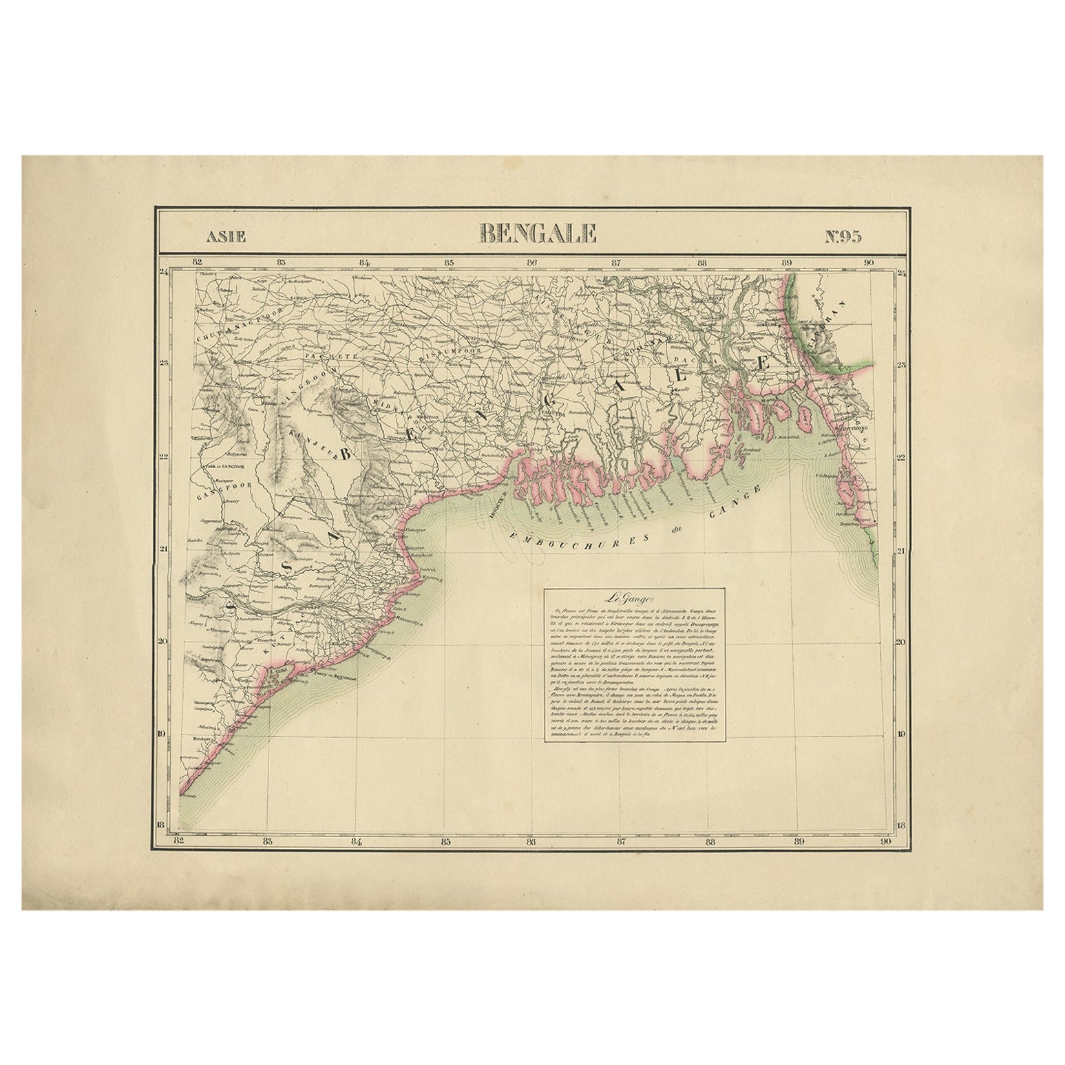
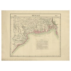
- Detailed Orginal Antique Map of Bengal, India, c.1825Located in Langweer, NLAntique map titled 'No. 95 Bengale'. Detailed map of Bengal, Bangladesh. With text about the Ganges river. Originates from 'Atlas Universel' by P.M. Vand...Category
Antique 19th Century Maps
MaterialsPaper
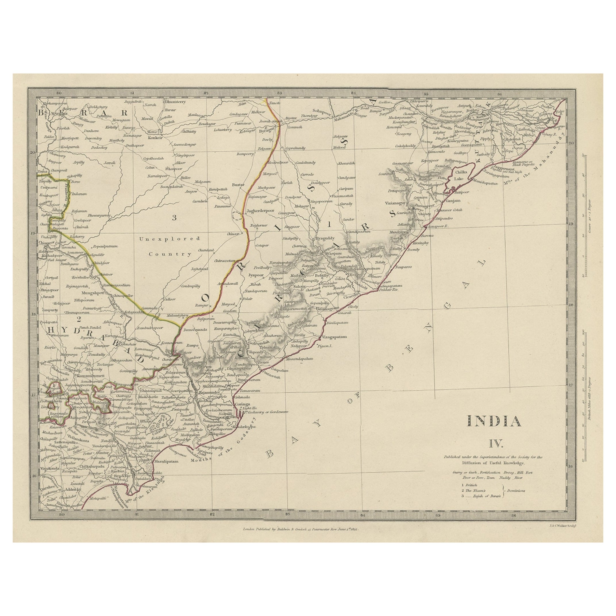
- Interesting Detailed Antique Map of Eastern India, 1832Located in Langweer, NLAntique map titled 'India IV'. Old steel engraved map of the eastern part of India, including the Bay of Bengal, Hydrabad and Masulipatam. Artists and...Category
Antique 19th Century Maps
MaterialsPaper
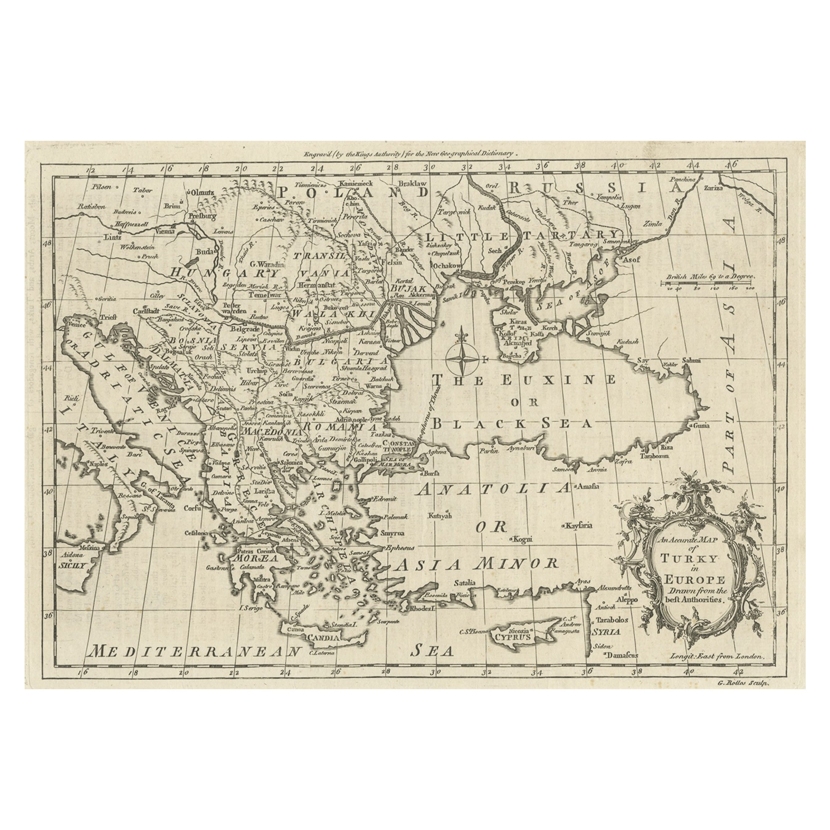
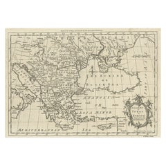
- Map of the Ottoman Empire in Europe, incl. the Balkans, Greece & Turkey, c.1760Located in Langweer, NLAntique map Turkey titled 'An Accurate Map of Turky in Europe drawn from the best Authorities'. Map of the Ottoman Empire in Europe, the Balkans, Greece, and Turkey in Europe. Engr...Category
Antique 1760s Maps
MaterialsPaper
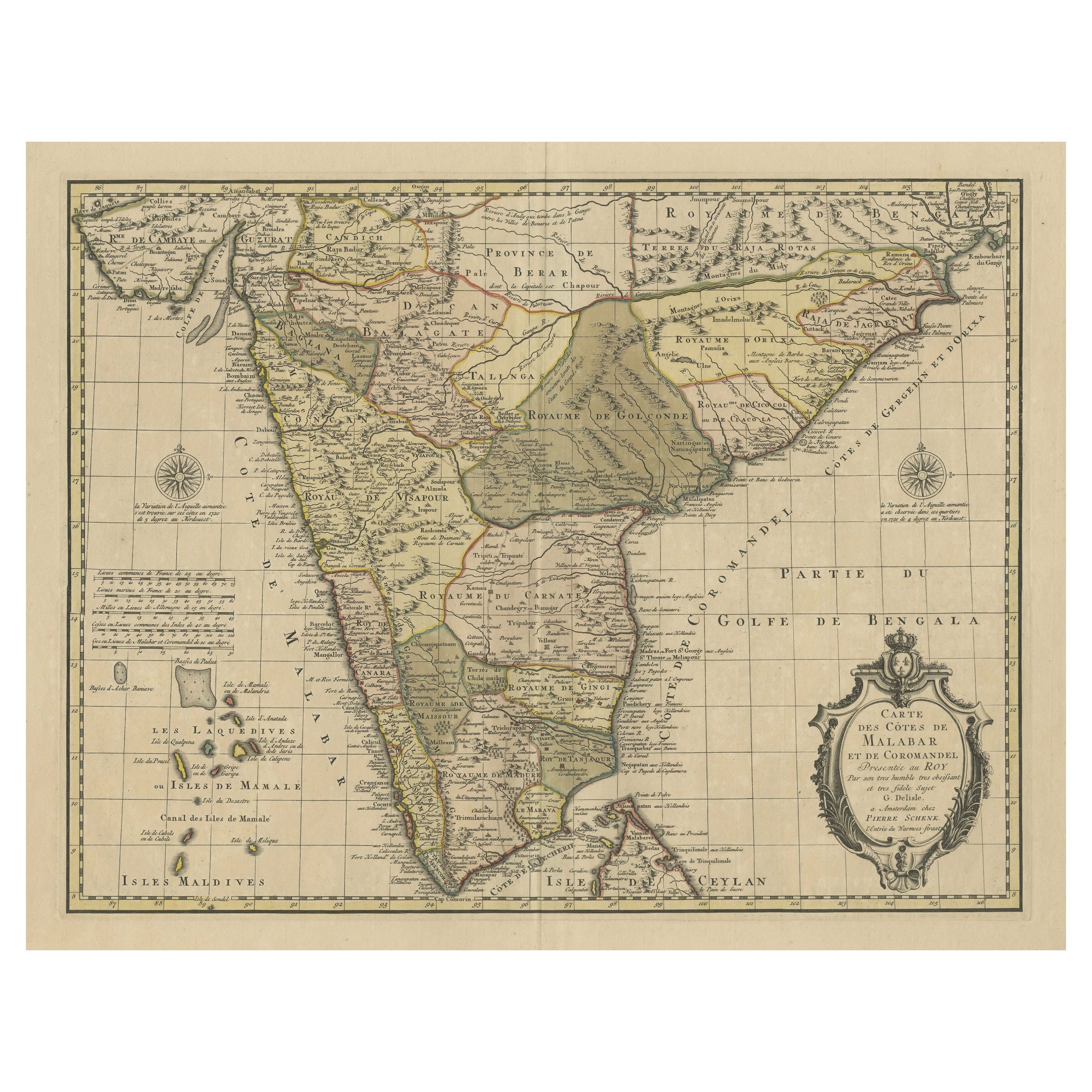
- Detailed Decorative Antique Map of the Coast of Malabar and Coromandel, IndiaLocated in Langweer, NLAntique map titled 'Carte des Côtes de Malabar et de Coromandel'. Finely engraved map of the southern part of India, first issued in 1723 by acclaimed French mapmaker Guillaume De L’...Category
Antique Mid-18th Century Maps
MaterialsPaper
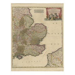
- Detailed Antique Map of Southeast England, incl Warwickshire and Hampshire, 1690Located in Langweer, NLAntique map titled 'Orientalior districtus Regni Angliae (..)'. Detailed map of southeast England encompassing the country from Lincolnshire and the Wash south and including Warw...Category
Antique 1690s Maps
MaterialsPaper
You May Also Like
- Map of the Republic of GenoaLocated in New York, NYFramed antique hand-coloured map of the Republic of Genoa including the duchies of Mantua, Modena, and Parma. Europe, late 18th century. Dimension: 25...Category
Antique Late 18th Century European Maps
- Map "Estuary- Mouth of the Thames"Located in Alessandria, PiemonteST/426 - Antique French Map of the estuary of the Thames, map dated 1769 - "Mape of the entrance of the Thames. Designed by filing of Navy cards fo...Category
Antique Mid-18th Century French Other Prints
MaterialsPaper
- England, Scotland & Ireland: A Hand Colored Map of Great Britain by TirionBy Isaak TirionLocated in Alamo, CAThis is a hand-colored double page copperplate map of Great Britain entitled "Nieuwe Kaart van de Eilanden van Groot Brittannien Behelzende de Kon...Category
Antique Mid-18th Century Dutch Maps
MaterialsPaper
- Vintage "View of the Center of Paris Taken from the Air" Lithograph MapLocated in San Diego, CAA very stylish "View of the Center of Paris Taken from the Air" lithograph map published by the Paris Ministry of Tourism, circa early 1950s. The piece measures 27" x 43" and shows...Category
20th Century French Mid-Century Modern Prints
MaterialsPaper
- New Map of North America from the Latest Discoveries, 1763Located in Philadelphia, PAA fine antique 18th century map of the North American seaboard. Entitled "A New Map of North America from the Latest Discoveries 1763". By the Cartographer/Engraver - John Spil...Category
Antique Mid-18th Century English Georgian Maps
MaterialsPaper
- Antique 18th Century Map of the Province of Pensilvania 'Pennsylvania State'Located in Philadelphia, PAA fine antique of the colony of Pennsylvania. Noted at the top of the sheet as a 'Map of the province of Pensilvania'. This undated and anonymous map is thought to be from the Gentleman's Magazine, London, circa 1775, although the general appearance could date it to the 1760's. The southern boundary reflects the Mason-Dixon survey (1768), the western boundary is placed just west of Pittsburgh, and the northern boundary is not marked. The map has a number of reference points that likely refer to companion text and appear to be connected to boundaries. The western and southern boundaries are marked Q, R, S, for example. A diagonal line runs from the Susquehanna R to the Lake Erie P. A broken line marked by many letters A, B, N, O, etc., appears in the east. There are no latitude or longitude markings, blank verso. Framed in a shaped contemporary gilt wooden frame and matted under a cream colored matte. Bearing an old Graham Arader Gallery...Category
Antique 18th Century British American Colonial Maps
MaterialsPaper


Recently Viewed
View AllMore Ways To Browse
Dior India
Compass Rose
Map Of India
Compass Map
Dutch Empire
Antique Furniture In Sri Lanka
Antique Maps India
Antique Map India
India Antique Map
Antique India Map
Antique Maps Of India
Antique Map Of India
Antique Tires
Tire Antique
Antique Compass Rose
Antique Rose Compass
Compass Rose Antique
Dutch Empire Furniture