Book Of Antique Maps
7
to
58
442
208
417
218
182
169
88
65
47
47
43
42
37
36
33
31
18
14
14
14
13
12
12
11
11
9
8
8
7
7
6
6
5
5
5
5
4
4
4
4
3
3
3
3
2
2
2
2
1
50
35
12
9
8
Sort By
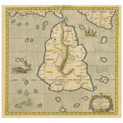
Antique Ptolemaic Map of Ceylon or nowadays Sri Lanka
Located in Langweer, NL
book of maps, one of Mercator's life works was a corrected and improved edition of maps based upon the
Category
Mid-18th Century Book Of Antique Maps
Materials
Paper
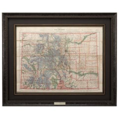
1907 Map of Colorado, Antique Topographical Map, by Louis Nell
Located in Colorado Springs, CO
This highly detailed pocket map is a topographical map of the state of Colorado by Louis Nell from
Category
Early 1900s American Book Of Antique Maps
Materials
Paper
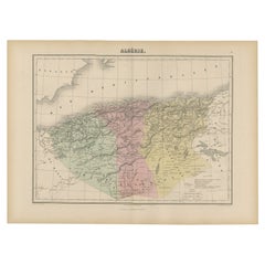
Antique Map of Algeria, 1880
Located in Langweer, NL
Antique map titled 'Algérie. Old map of Algeria. This map originates from 'Géographie Universelle
Category
19th Century Book Of Antique Maps
Materials
Paper
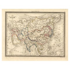
Antique Map of Asia, 1846
Located in Langweer, NL
Antique map titled 'Asie'. Original antique map of Asia. Source unknown, to be determined
Category
19th Century Book Of Antique Maps
Materials
Paper
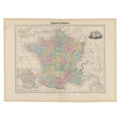
Antique Political Map of France, 1880
By J. Migeon
Located in Langweer, NL
Antique map titled 'France Féodale'. Old map of France with a decorative vignette of Castle de
Category
19th Century Book Of Antique Maps
Materials
Paper
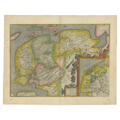
Antique Map of Friesland Also Know as the Peacock Map, C.1580
Located in Langweer, NL
Antique map titled ?Frisia Occidentalis?. Original antique map of the province of Friesland, the
Category
18th Century Book Of Antique Maps
Materials
Paper
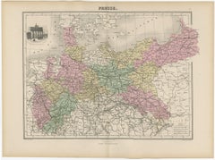
Antique Map of the Kingdom of Prussia, 1880
Located in Langweer, NL
Antique map titled 'Prusse'. Old map of the Kingdom of Prussia, with a decorative vignette of the
Category
19th Century Book Of Antique Maps
Materials
Paper
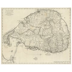
Large Antique Map of Ceylon, Sri Lanka
Located in Langweer, NL
Antique map titled 'Nieuwe Kaart van het Eyland Ceylon opgestelt door Francois Valentyn'. Beautiful
Category
Mid-18th Century Book Of Antique Maps
Materials
Paper
Antique Map of the Europe Continent, 1880
Located in Langweer, NL
Antique map titled 'Europe'. Old map of the European continent. This map originates from
Category
19th Century Book Of Antique Maps
Materials
Paper
Antique Map of France by Migeon, 1880
Located in Langweer, NL
Antique map titled 'France Physique'. Old map of France. This map originates from 'Géographie
Category
19th Century Book Of Antique Maps
Materials
Paper
Antique Map of Normandy by Janssonius, 1657
Located in Langweer, NL
cartographer Jodocus Hondius he also set up a business as book publisher in Amsterdam. His first map was
Category
17th Century Book Of Antique Maps
Materials
Paper
Antique Map of Switzerland by Janssonius, 1657
Located in Langweer, NL
business as book publisher in Amsterdam. His first map was published in 1616. Around 15 years later he set
Category
17th Century Book Of Antique Maps
Materials
Paper
Antique Map of France by Homann, 1738
Located in Langweer, NL
Antique map titled 'Gallia Benedictina seu Abbatiar & Prioratus tam Monachorum quam Monialium Ord
Category
18th Century Book Of Antique Maps
Materials
Paper
Antique Map of the Province of Overijssel, the Netherlands
Located in Langweer, NL
Hondius he also set up a business as book publisher in Amsterdam. His first map was published in 1616
Category
Mid-17th Century Book Of Antique Maps
Materials
Paper
Antique Map of Africa with Original Hand Coloring
Located in Langweer, NL
Antique map titled 'Kaart van Afrika door den Heer d'Anville'. Detailed original old map of Africa
Category
Mid-18th Century Book Of Antique Maps
Materials
Paper
Detailed Antique Map of Italy and surrounding Islands
Located in Langweer, NL
Antique map titled 'Italie volgens de allernieuwste Uitgave van den Heere d'Anville'. Very detailed
Category
Mid-18th Century Book Of Antique Maps
Materials
Paper
Antique Map of Manchuria and the Northeast Portion of Tartary
Located in Langweer, NL
Antique map titled 'Carte de la Tartarie Orientale (..)'. Detailed map of Manchuria and the
Category
Mid-18th Century Book Of Antique Maps
Materials
Paper
Antique Map of Guadelupe in the Caribbean, 1759
By Jacques-Nicolas Bellin
Located in Langweer, NL
Antique map titled 'Carte De L'Isle De La Guadeloupe'. Detailed map of Guadalupe, Mari-Galante and
Category
Mid-18th Century French Book Of Antique Maps
Materials
Paper
Antique Map of Northern Italy by Migeon, 1880
Located in Langweer, NL
Antique map titled 'Italie Septentrionale'. Old map of the northern part of Italy. This map
Category
19th Century Book Of Antique Maps
Materials
Paper
Antique Map of the Departments of France by Migeon, 1880
By J. Migeon
Located in Langweer, NL
Antique map titled 'France par Départements'. Old map of France with a decorative vignette of
Category
19th Century Book Of Antique Maps
Materials
Paper
Antique Map of the City of Roermond by Guicciardini, 1613
Located in Langweer, NL
. Guicciardini, published by J. Janssonius. We carry most maps from this book which was published from 1581-1648
Category
17th Century Book Of Antique Maps
Materials
Paper
Antique Map of Southern Italy by Migeon, 1880
Located in Langweer, NL
"Antique map titled 'Italie Méridionale'. Old map of southern Italy including Sicily/Sicilia. This
Category
19th Century Book Of Antique Maps
Materials
Paper
Antique Map of the Island of Tinos by Dapper, 1687
Located in Langweer, NL
Antique map titled 'Tino.' This original antique map shows the island of Tinos, Greece. Source
Category
17th Century Book Of Antique Maps
Materials
Paper
Antique Map of France by Janssonius, c.1650
Located in Langweer, NL
Hondius he also set up a business as book publisher in Amsterdam. His first map was published in 1616
Category
17th Century Book Of Antique Maps
Materials
Paper
Antique Map of France by Janssonius, c.1650
Located in Langweer, NL
Hondius he also set up a business as book publisher in Amsterdam. His first map was published in 1616
Category
17th Century Book Of Antique Maps
Materials
Paper
Antique Map of the Island of Psara by Dapper, 1688
Located in Langweer, NL
Antique map titled 'Sara.' Map of Psara ( Psyra or Ipsera) Island (North East Aegean Islands
Category
17th Century Book Of Antique Maps
Materials
Paper
Antique Map of the Region of Rethel by Janssonius, 1657
By Johannes Janssonius
Located in Langweer, NL
business as book publisher in Amsterdam. His first map was published in 1616. Around 15 years later he set
Category
17th Century Book Of Antique Maps
Materials
Paper
Antique Map of the City of Franeker by Janssonius, 1657
By Johannes Janssonius
Located in Langweer, NL
book publisher in Amsterdam. His first map was published in 1616. Around 15 years later he set up a
Category
17th Century Book Of Antique Maps
Materials
Paper
Antique Map of the Region of Nivernais by Janssonius, 1657
By Johannes Janssonius
Located in Langweer, NL
Hondius he also set up a business as book publisher in Amsterdam. His first map was published in 1616
Category
17th Century Book Of Antique Maps
Materials
Paper
Antique Map of the Region of Brie by Janssonius, 1657
Located in Langweer, NL
Hondius he also set up a business as book publisher in Amsterdam. His first map was published in 1616
Category
17th Century Book Of Antique Maps
Materials
Paper
Antique Map of the Region of Lyon by Janssonius, 1657
By Johannes Janssonius
Located in Langweer, NL
business as book publisher in Amsterdam. His first map was published in 1616. Around 15 years later he set
Category
17th Century Book Of Antique Maps
Materials
Paper
Antique Map of the Region of Beauvais by Janssonius, 1657
Located in Langweer, NL
set up a business as book publisher in Amsterdam. His first map was published in 1616. Around 15 years
Category
17th Century Book Of Antique Maps
Materials
Paper
Antique Map of the Region of Bresse by Janssonius, 1657
Located in Langweer, NL
set up a business as book publisher in Amsterdam. His first map was published in 1616. Around 15 years
Category
17th Century Book Of Antique Maps
Materials
Paper
Antique Map of the Region of Bourbon by Janssonius, 1657
Located in Langweer, NL
up a business as book publisher in Amsterdam. His first map was published in 1616. Around 15 years
Category
17th Century Book Of Antique Maps
Materials
Paper
Antique Map of the Region of Guyenne by Janssonius, 1657
By Johannes Janssonius
Located in Langweer, NL
Hondius he also set up a business as book publisher in Amsterdam. His first map was published in 1616
Category
17th Century Book Of Antique Maps
Materials
Paper
Antique Map of the Coast of Artois by Janssonius, 1657
By Johannes Janssonius
Located in Langweer, NL
Hondius he also set up a business as book publisher in Amsterdam. His first map was published in 1616
Category
17th Century Book Of Antique Maps
Materials
Paper
Antique Map of the Region of Périgord by Janssonius, 1657
By Johannes Janssonius
Located in Langweer, NL
Antique map of France titled 'Le Comte de Perigort'. Decorative map of the Périgord region
Category
17th Century Book Of Antique Maps
Materials
Paper
Antique Map of the Region of Dauphiné by Janssonius, 1657
Located in Langweer, NL
Antique map of France titled 'Nova et Accurata descriptio Delphinatus vulgo Dauphiné'. Decorative
Category
17th Century Book Of Antique Maps
Materials
Paper
Antique Map of the Region of Saintonge by Janssonius, 1657
By Johannes Janssonius
Located in Langweer, NL
up a business as book publisher in Amsterdam. His first map was published in 1616. Around 15 years
Category
17th Century Book Of Antique Maps
Materials
Paper
Antique Map of the City of Enkhuizen by Tirion, 1743
Located in Langweer, NL
Antique map titled ?Grondtekening der Stad Enkhuisen?. Beautiful map of the City of Enkhuizen. With
Category
18th Century Book Of Antique Maps
Materials
Paper
Antique Map of the City of Leeuwarden by Leti, 1690
Located in Langweer, NL
Antique map titled 'Leovardia.' A plan of Leeuwarden in Friesland, the Netherlands. With two coats
Category
17th Century Book Of Antique Maps
Materials
Paper
Antique Map of the City of Workum by Blaeu, 1649
Located in Langweer, NL
Antique map titled 'Worckum'. Old map of the city of Workum, Friesland. Originates from J. Blaeu's
Category
17th Century Book Of Antique Maps
Materials
Paper
Antique Map of the Gulf of Cambay, Gujarat, India, 1725
By Pieter Van Der Aa
Located in Langweer, NL
the biggest print / map book ever published. Van der Aa incorporated plates by other publishers such
Category
18th Century Book Of Antique Maps
Materials
Paper
Antique Map of Northern Asia by Mallet, 1719
Located in Langweer, NL
Antique map titled 'Das Mitternächtige Theil des Alten Asien'. This sheet of five miniature maps
Category
18th Century Book Of Antique Maps
Materials
Paper
Antique Map of the City of Arnhem by Guicciardini, 1613
Located in Langweer, NL
Paesi Bassi', by L. Guicciardini, published by J. Janssonius. We carry most maps from this book which
Category
17th Century Book Of Antique Maps
Materials
Paper
Antique Map of the Netherlands and Belgium, circa 1880
Located in Langweer, NL
Antique map titled 'Hollande et Belgique'. Old map of the Netherlands and Belgium. With decorative
Category
19th Century Book Of Antique Maps
Materials
Paper
Antique Map of the Province of Alger Algeria by Migeon, 1880
Located in Langweer, NL
Antique map titled 'Province de Constantine'. Old map of the province of Alger, Algeria. This map
Category
19th Century Book Of Antique Maps
Materials
Paper
Antique Map of The Siege of Gennep, the Netherlands, c.1650
Located in Langweer, NL
Antique map titled 'Belagerung des Besten Schloss und Passes Gennep'. Old map of the Siege of
Category
17th Century Book Of Antique Maps
Materials
Paper
Antique Map of Africa with Decorative Vignette of Saint Helena, 1880
Located in Langweer, NL
Antique map titled 'Afrique'. Old map of Africa, covering the African continent. With decorative
Category
19th Century Book Of Antique Maps
Materials
Paper
Antique Map of the Province of Constantine, Algeria by Migeon, 1880
Located in Langweer, NL
Antique map titled 'Province de Constantine'. Old map of the province of Constantine, Algeria. The
Category
19th Century Book Of Antique Maps
Materials
Paper
Antique Map of the Islands of Schiatti and Scopoli, Greece, 1687
Located in Langweer, NL
Antique map titled 'Schiatti - Scopoli.' This original antique map shows the islands Schiatti and
Category
17th Century Book Of Antique Maps
Materials
Paper
Antique Map of the Province of Oran Algeria by Migeon, 1880
Located in Langweer, NL
Antique map titled 'Province d'Oran'. Old map of the province of Oran, Algeria. The Department of
Category
19th Century Book Of Antique Maps
Materials
Paper
Antique Map of the Island of Kyra Panagia by Dapper, 1688
Located in Langweer, NL
Antique map titled 'Pelagnisi.' Map of the island of Kyra Panagia, Pelagnisi (Pelagos), Greece
Category
17th Century Book Of Antique Maps
Materials
Paper
Detailed Original Antique Map of the Picardy Region of France, 1657
Located in Langweer, NL
up a business as book publisher in Amsterdam. His first map was published in 1616. Around 15 years
Category
1650s Book Of Antique Maps
Materials
Paper
Antique Map of the City of Harlingen by Janssonius, c.1657
By Johannes Janssonius
Located in Langweer, NL
business as book publisher in Amsterdam. His first map was published in 1616. Around 15 years later he set
Category
17th Century Book Of Antique Maps
Materials
Paper
Antique Map of the Province of Overijssel by Janssonius, c.1650
Located in Langweer, NL
cartographer Jodocus Hondius he also set up a business as book publisher in Amsterdam. His first map was
Category
17th Century Book Of Antique Maps
Materials
Paper
Antique Map of the Region of Touraine, France by Janssonius, 1657
By Johannes Janssonius
Located in Langweer, NL
business as book publisher in Amsterdam. His first map was published in 1616. Around 15 years later he set
Category
17th Century Book Of Antique Maps
Materials
Paper
Antique Map of the Region of Picardy by Janssonius 'c.1650'
By Johannes Janssonius
Located in Langweer, NL
Hondius he also set up a business as book publisher in Amsterdam. His first map was published in 1616
Category
17th Century Book Of Antique Maps
Materials
Paper
Antique Map of the Region of Blois by Janssonius, c.1650
Located in Langweer, NL
set up a business as book publisher in Amsterdam. His first map was published in 1616. Around 15 years
Category
17th Century Book Of Antique Maps
Materials
Paper
Antique Map of the Region of Aiguillon by Janssonius, c.1650
Located in Langweer, NL
set up a business as book publisher in Amsterdam. His first map was published in 1616. Around 15 years
Category
17th Century Book Of Antique Maps
Materials
Paper
- 1
- ...
Get Updated with New Arrivals
Save "Book Of Antique Maps", and we’ll notify you when there are new listings in this category.
Book Of Antique Maps For Sale on 1stDibs
An assortment of book of antique maps is available at 1stDibs. The range of distinct book of antique maps — often made from paper, ceramic and pottery — can elevate any home. Book of antique maps have long been popular, with older editions for sale from the 18th Century and newer versions made as recently as the 21st Century. Book of antique maps are generally popular furniture pieces, but Victorian, neoclassical and Art Deco styles are often sought at 1stDibs. Book of antique maps have been a part of the life’s work for many furniture makers, but those produced by Johannes Janssonius, Pieter Van Der Aa and Jacobus Houbraken are consistently popular.
How Much are Book Of Antique Maps?
Prices for book of antique maps start at $35 and top out at $16,643 with the average selling for $683.
More Ways To Browse
Ukraine Antique Map
Antique Map Louisiana
Antique Map Colorado
Antique Alabama Map
Ancient Map Of Jerusalem
Alabama Map
Alabama Antique Map
Antique Map Of Alabama
Nova Totius
Mozambique Antique Map
Antique Doors Pakistan
Jordan Antique Map
Kuwait Antique
Antique Map Dordogne
J Beringer
Map Of Ural
Map Zanzibar
Ruben Benjamin
