Items Similar to Antique Map of the Netherlands and Belgium, circa 1880
Want more images or videos?
Request additional images or videos from the seller
1 of 6
Antique Map of the Netherlands and Belgium, circa 1880
About the Item
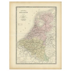
Antique map titled 'Hollande et Belgique'. Old map of the Netherlands and Belgium. With decorative vignette of the Antwerp cathedral. This map originates from 'Géographie Universelle Atlas-Migeon' by J. Migeon.
Artists and Engravers: Published by J. Migeon. Reviewed by A. Vuillemin. Alexandre Vuillemin (1812-1880) was a cartographer and an book editor based in Paris, France.
Condition: Good, age-related toning. Please study image carefully.
Date: 1880
Overall size: 34.5 x 47.5 cm.
Image size: 28 x 37 cm.
We sell original antique maps to collectors, historians, educators and interior decorators all over the world. Our collection includes a wide range of authentic antique maps from the 16th to the 20th centuries. Buying and collecting antique maps is a tradition that goes back hundreds of years. Antique maps have proved a richly rewarding investment over the past decade, thanks to a growing appreciation of their unique historical appeal. Today the decorative qualities of antique maps are widely recognized by interior designers who appreciate their beauty and design flexibility. Depending on the individual map, presentation, and context, a rare or antique map can be modern, traditional, abstract, figurative, serious or whimsical. We offer a wide range of authentic antique maps for any budget.
- Dimensions:Height: 18.71 in (47.5 cm)Width: 13.59 in (34.5 cm)Depth: 0 in (0.01 mm)
- Materials and Techniques:
- Period:
- Date of Manufacture:1880
- Condition:Condition: Good, age-related toning. Please study image carefully.
- Seller Location:Langweer, NL
- Reference Number:
About the Seller
5.0
Platinum Seller
These expertly vetted sellers are 1stDibs' most experienced sellers and are rated highest by our customers.
Established in 2009
1stDibs seller since 2017
1,928 sales on 1stDibs
Typical response time: <1 hour
- ShippingRetrieving quote...Ships From: Langweer, Netherlands
- Return PolicyA return for this item may be initiated within 14 days of delivery.
More From This SellerView All
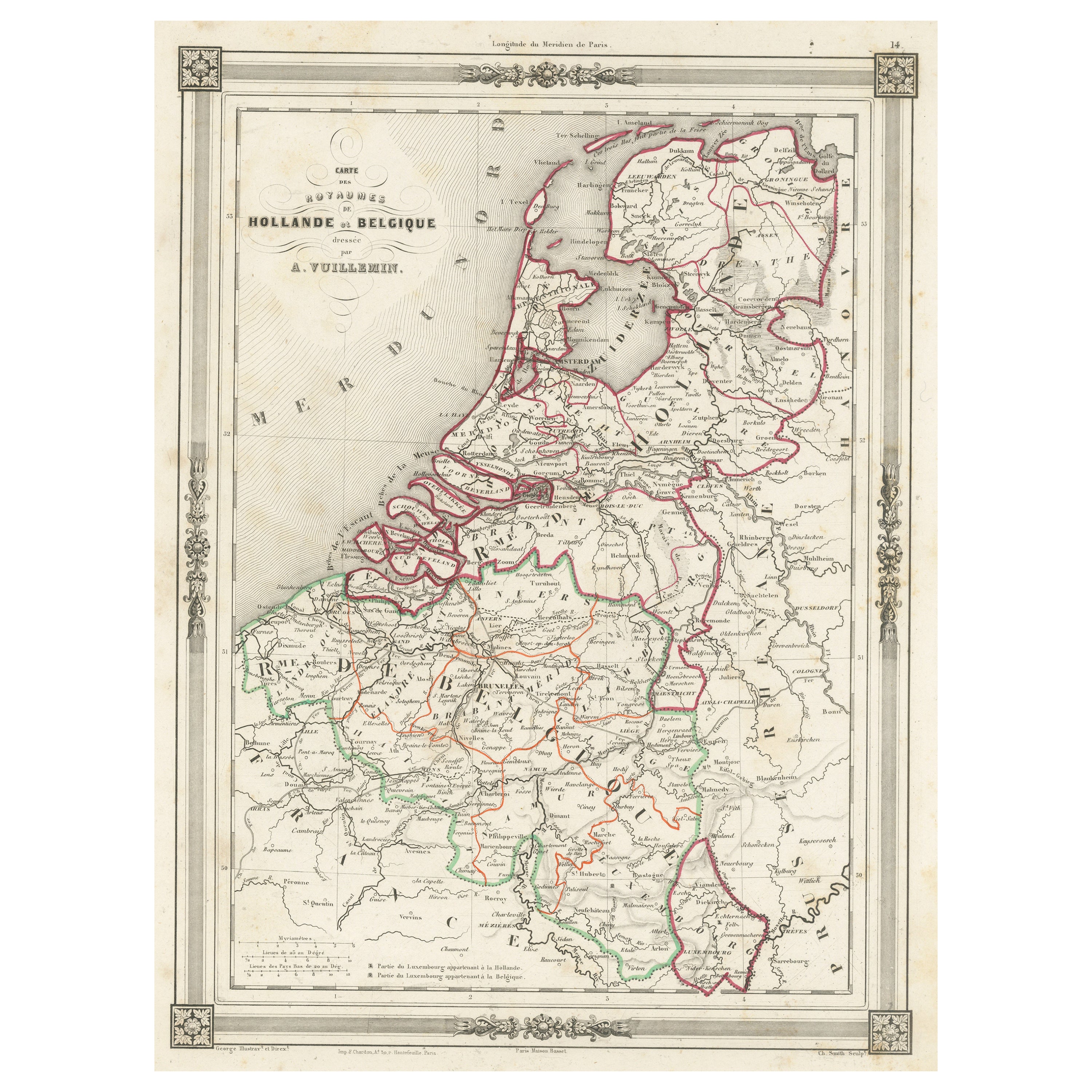
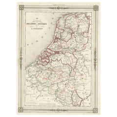
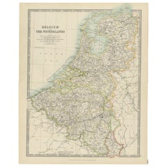
- Antique Map of the Netherlands, Belgium and LuxembourgLocated in Langweer, NLAntique map titled 'Carte des Royaumes Hollande et Belgique'. Attractive map of the Netherlands, Belgium and Luxembourg. This map originates fro...Category
Antique Mid-19th Century Maps
MaterialsPaper
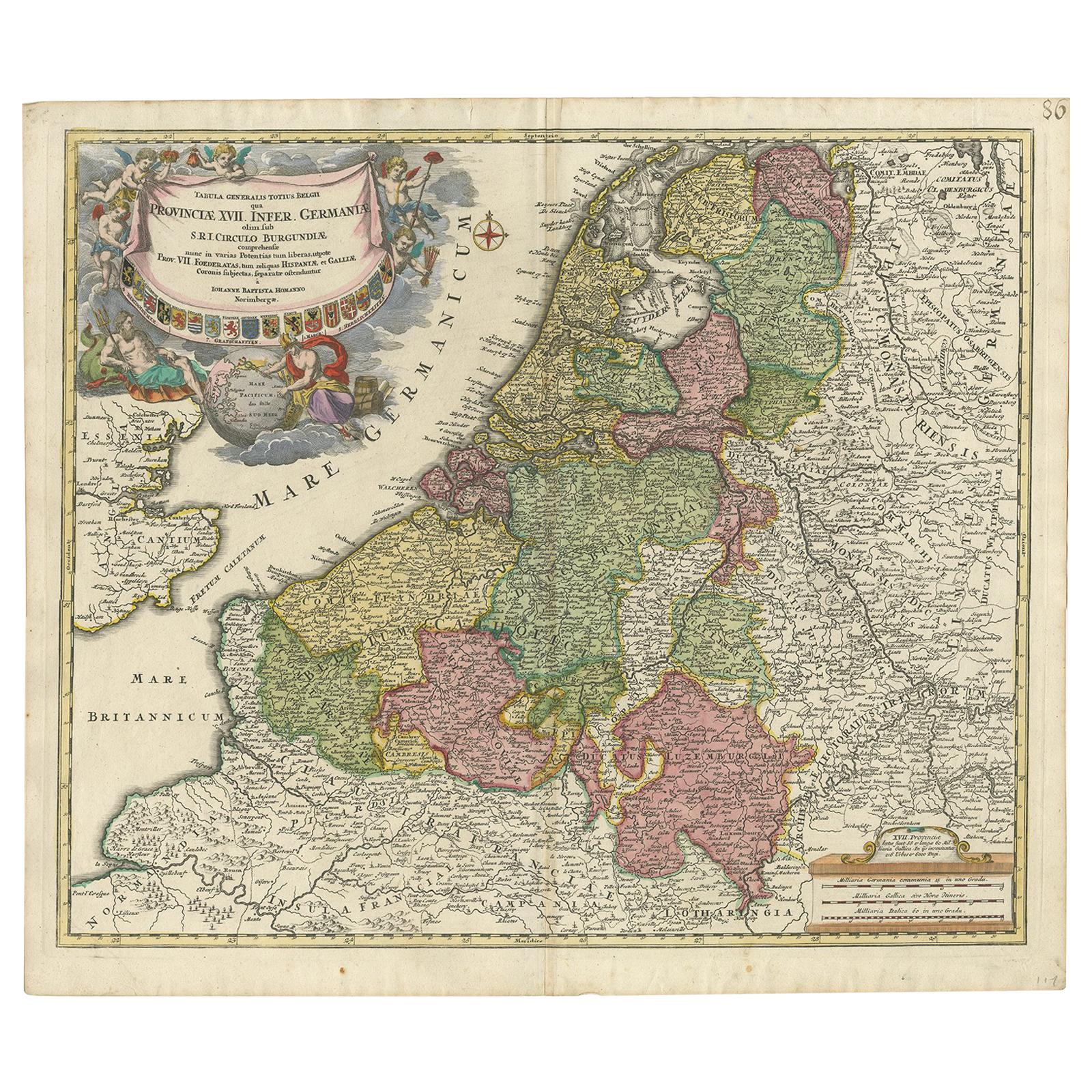
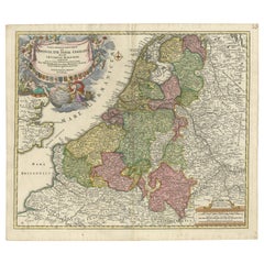
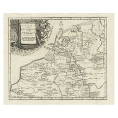
- Antique Map of the Netherlands and Belgium by Homann, circa 1710By Johann Baptist HomannLocated in Langweer, NLAntique map titled 'Tabula Generalis Totius Belgii Provinciae XVII. Infer. Germaniae (..)'. Map of the Benelux countries by Johann Baptist Homann. Shows the area between the Seine es...Category
Antique Early 18th Century German Maps
MaterialsPaper
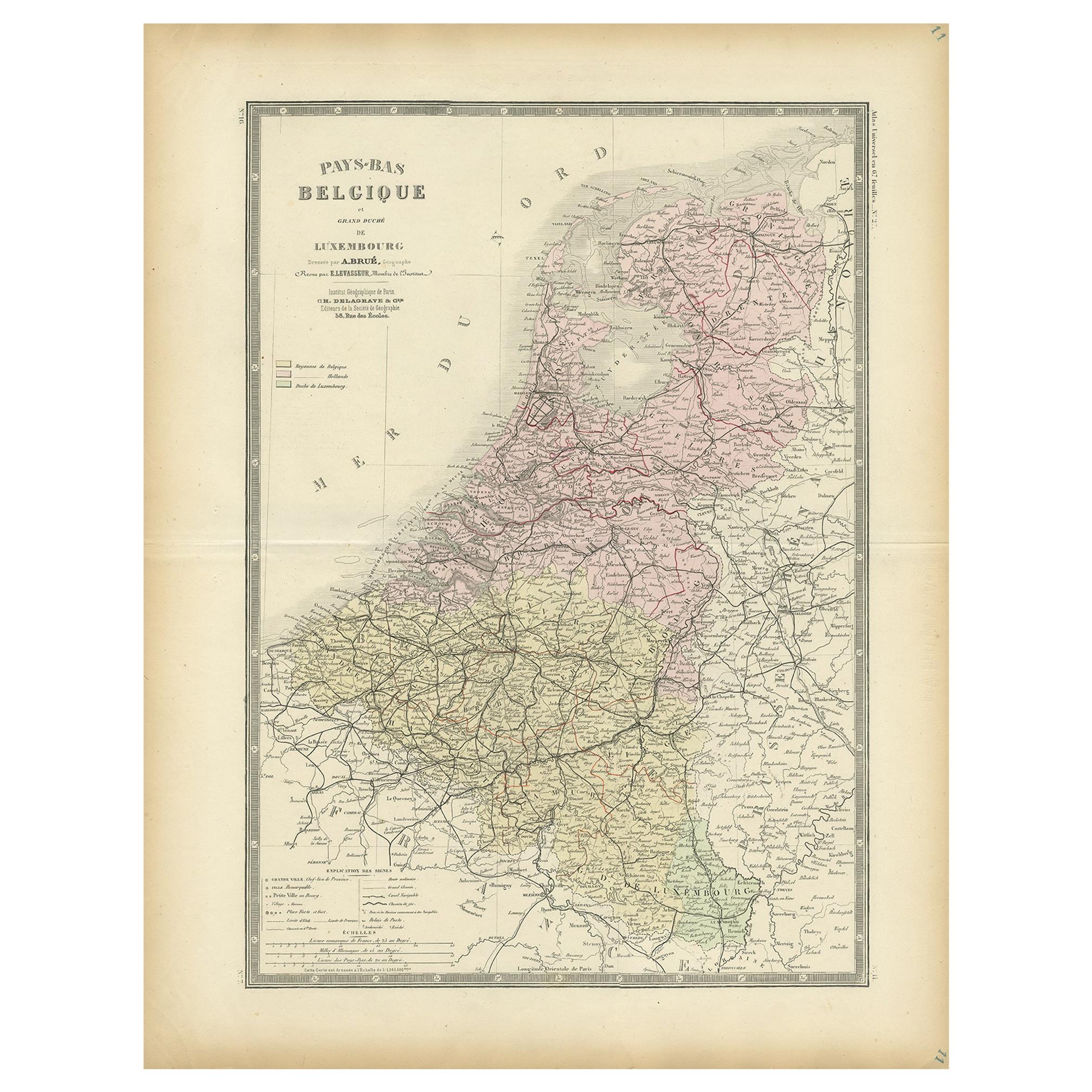
- Decorative Antique Map of the Netherlands and Belgium, ca.1875Located in Langweer, NLAntique map titled 'Pays-Bas Belgique (..)'. Large map of the Netherlands and Belgium. This map originates from 'Atlas de Géographie Moder...Category
Antique Late 19th Century Maps
MaterialsPaper
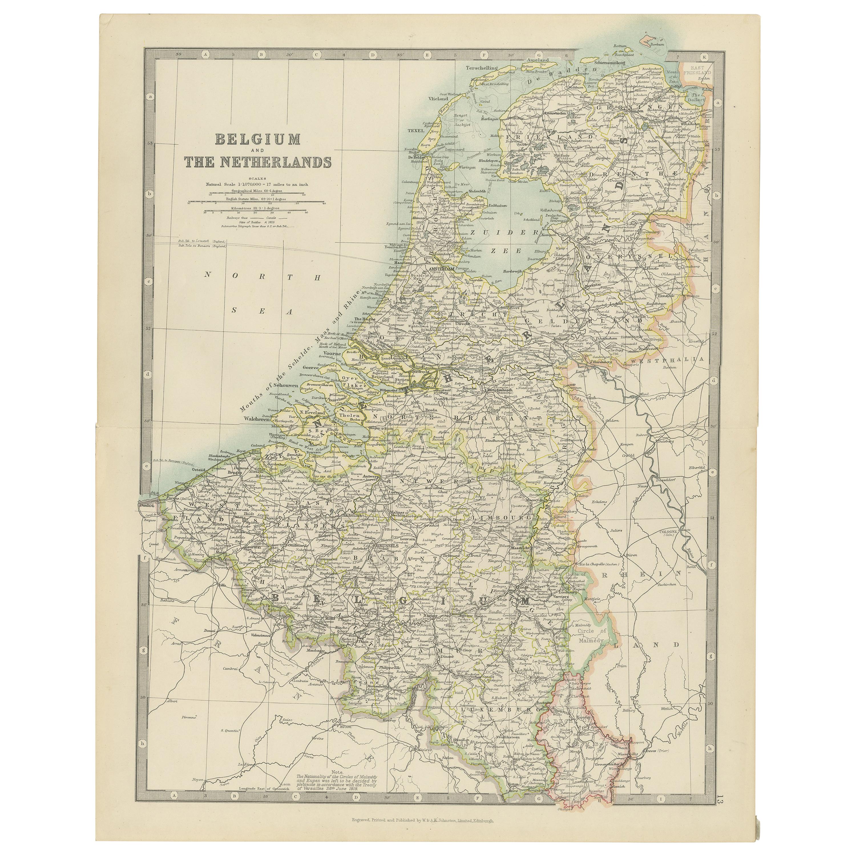
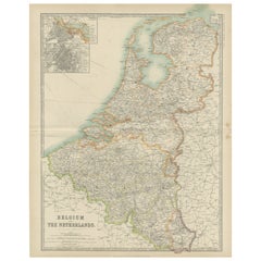
- Antique Map of Belgium and the Netherlands by Johnston 'c.1920'Located in Langweer, NLAntique map titled 'Belgium and the Netherlands'. Original antique map of Belgium and the Netherlands. Published by W. & A.K. Johnston, circa 1920.Category
20th Century Maps
MaterialsPaper
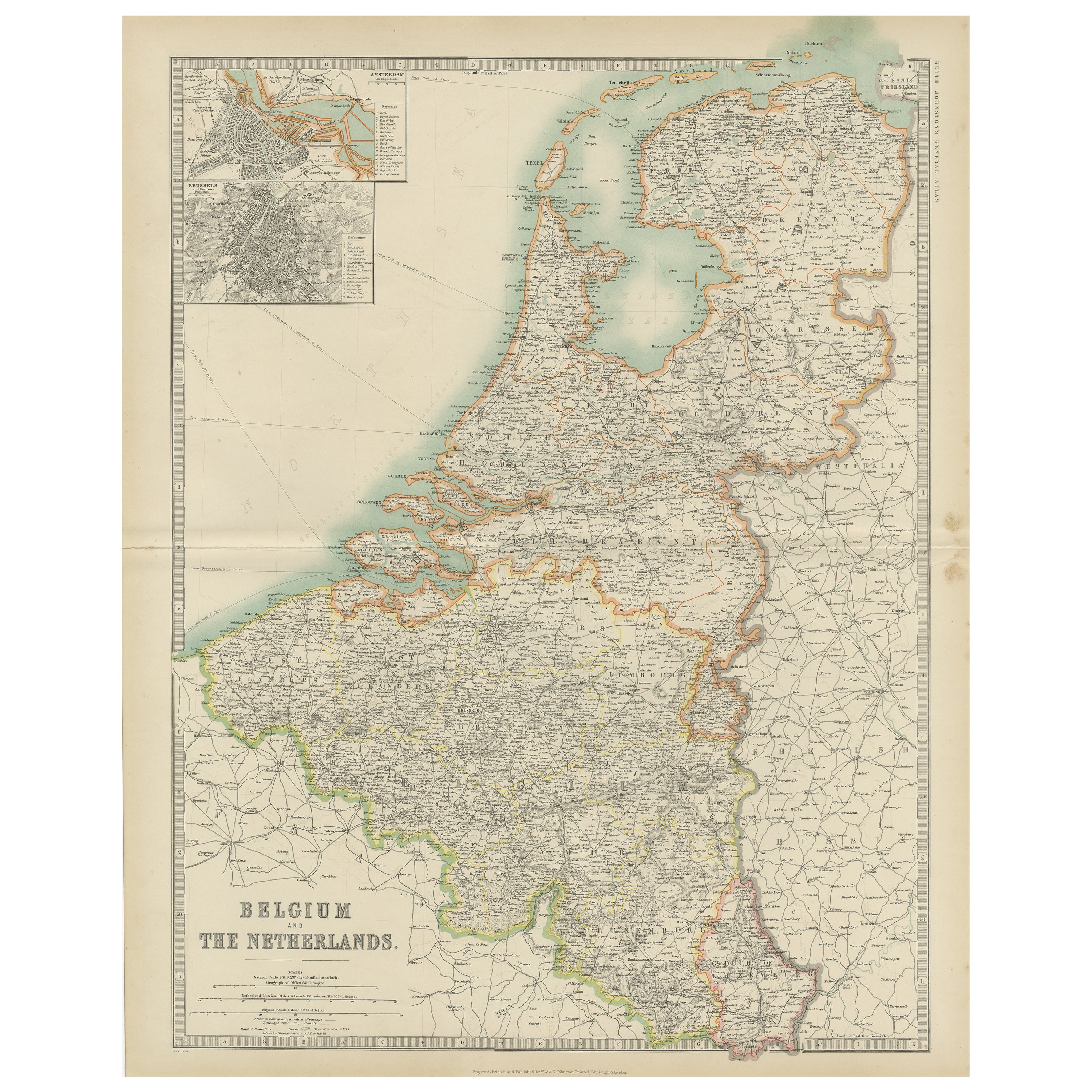
- Antique Map of Belgium and the Netherlands by Johnston '1909'Located in Langweer, NLAntique map titled 'Belgium and The Netherlands'. Original antique map of Belgium and the Netherlands. With inset maps of Amsterdam and Brussels. This m...Category
Early 20th Century Maps
MaterialsPaper
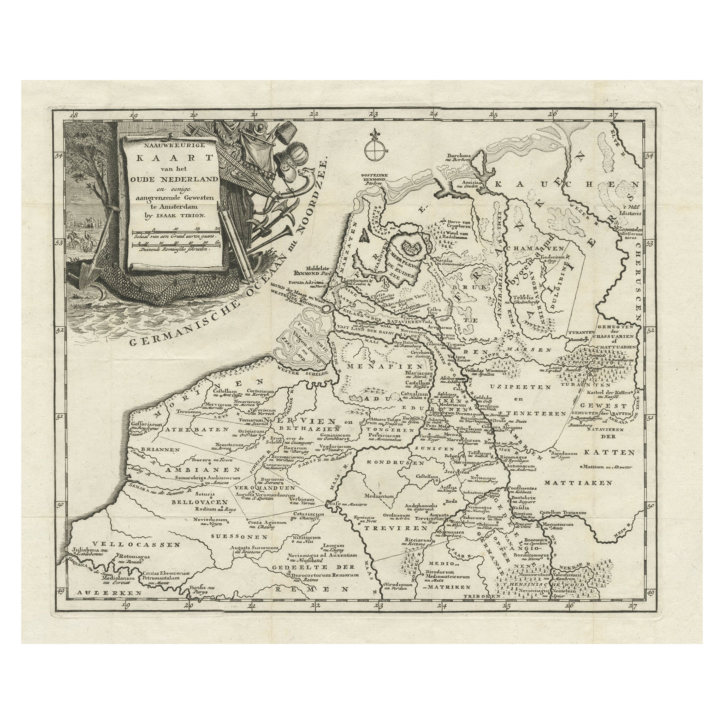
- Original Antique Map of the Ancient Netherlands and Belgium, c.1750Located in Langweer, NLDescription: Antique map titled 'Naauwkeurige Kaart van het Oude Nederland (..)'. Original antique map of the Netherlands and Belgium. This map originates from 'Vaderlandsche his...Category
Antique 1750s Maps
MaterialsPaper
You May Also Like
- 1752 Vaugoundy Map of Flanders : Belgium, France, and the Netherlands, Ric.a002Located in Norton, MALarge Vaugoundy Map of Flanders: Belgium, France, and the Netherlands Colored -1752 Ric.a002 Description: This is a 1752 Didier Robert de Vaugondy map of Flanders. The map de...Category
Antique 17th Century Unknown Maps
MaterialsPaper
- Original Antique Map of Cyprus. Circa 1880Located in St Annes, LancashireGreat map of Cyprus Drawn and Engraved by R.Walker Published W.Mackenzie, London Original colour Unframed.Category
Antique 1880s English Maps
MaterialsPaper
- Large Original Antique Map of The Environs of Dublin, Ireland, circa 1880Located in St Annes, LancashireGreat map of The Environs of Dublin Published circa 1880 Unframed Free shipping.Category
Antique 1880s Scottish Maps
MaterialsPaper
- Large Original Antique Map of the Environs of Cork, Ireland, circa 1880Located in St Annes, LancashireGreat map of The Environs of Cork Published circa 1880 Unframed Free shipping.Category
Antique 1880s Scottish Maps
MaterialsPaper
- Original Antique Map of Belgium by Tallis, Circa 1850Located in St Annes, LancashireGreat map of Belgium Steel engraving Many lovely vignettes Published by London Printing & Publishing Co. ( Formerly Tallis ), C.1850 Origin...Category
Antique 1850s English Maps
MaterialsPaper
- Original Antique Map of The Netherlands, Engraved by Barlow, Dated 1807Located in St Annes, LancashireGreat map of Netherlands Copper-plate engraving by Barlow Published by Brightly & Kinnersly, Bungay, Suffolk. Dated 1807 Unframed.Category
Antique Early 1800s English Maps
MaterialsPaper


Recently Viewed
View AllMore Ways To Browse
Antique Map Argentina
Antique Map Of Argentina
John Acton
William Acton
Antique Map Norfolk
Antique Map Of Colombia
Antique Maps Hampshire
Antique Maps Norfolk
Colombia Map Antique
Durham Antique Map
Mozambique Antique Map
Nottinghamshire Antique Map
Patagonia Map
Antique Furniture Queensland
Gabon Antique Map
Minnesota Map
Moravia Map
Alabama Map