Items Similar to Antique Map of the Netherlands, Belgium and Luxembourg
Want more images or videos?
Request additional images or videos from the seller
1 of 6
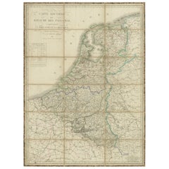
Antique Map of the Netherlands, Belgium and Luxembourg
About the Item
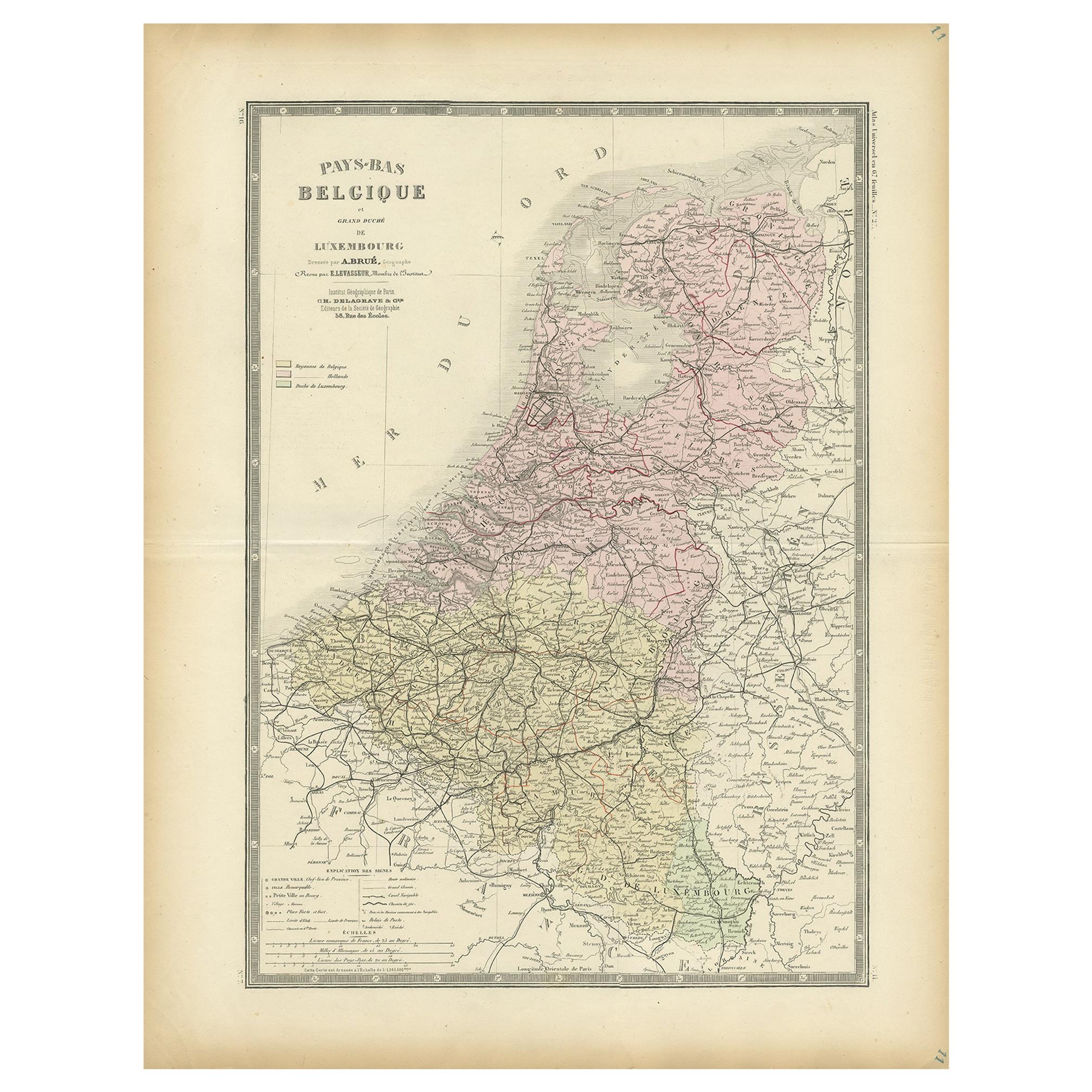
Antique map titled 'Carte des Royaumes Hollande et Belgique'. Attractive map of the Netherlands, Belgium and Luxembourg. This map originates from Maison Basset's 1852 edition of 'Atlas Illustre Destine a l'enseignement de la Geographie elementaire'.
- Dimensions:Height: 13.27 in (33.7 cm)Width: 10.2 in (25.9 cm)Depth: 0.02 in (0.5 mm)
- Materials and Techniques:
- Period:
- Date of Manufacture:1852
- Condition:General age-related toning. Shows soiling and foxing, blank verso. Please study image carefully.
- Seller Location:Langweer, NL
- Reference Number:
About the Seller
5.0
Platinum Seller
These expertly vetted sellers are 1stDibs' most experienced sellers and are rated highest by our customers.
Established in 2009
1stDibs seller since 2017
1,929 sales on 1stDibs
Typical response time: <1 hour
- ShippingRetrieving quote...Ships From: Langweer, Netherlands
- Return PolicyA return for this item may be initiated within 14 days of delivery.
More From This SellerView All
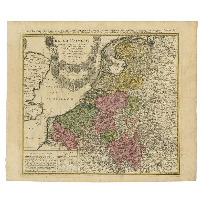
- Antique Map of the Seventeen Provinces of Netherlands, Belgium, Luxembourg, 1748By Homann HeirsLocated in Langweer, NLAntique map titled 'Belgii Universi seu Inferioris Germaniae quam XVII Provinciae (..)'. Map of the Seventeen Provinces after Tobias Meier, published by Homann's Heirs in 1748. The...Category
Antique 18th Century Maps
MaterialsPaper
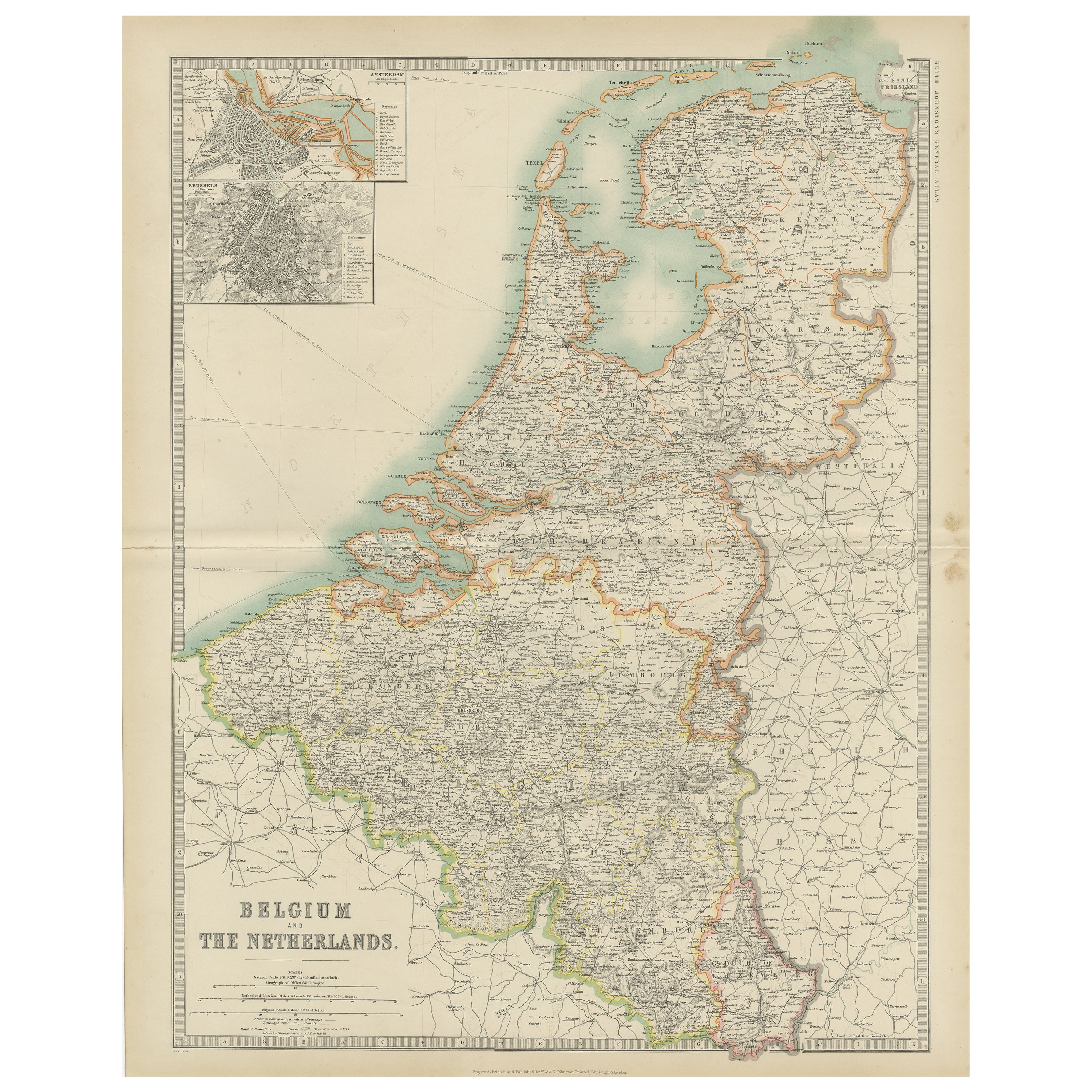
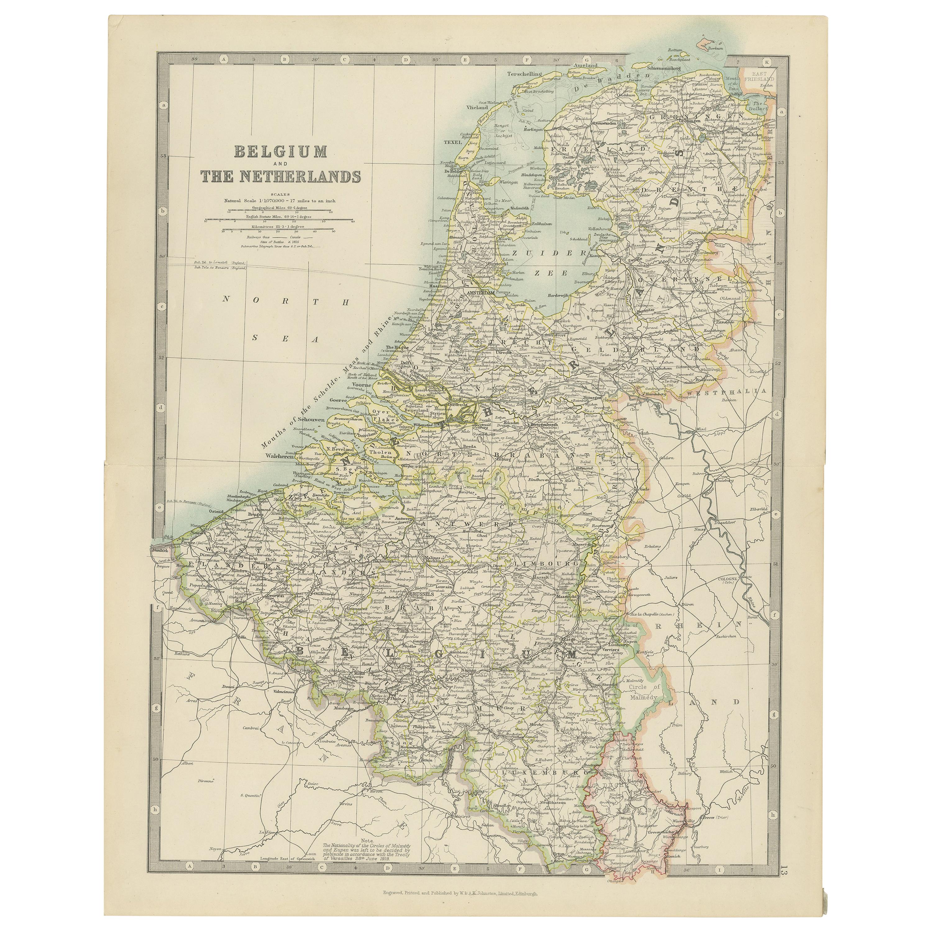
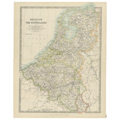
- Antique Map of Belgium and the Netherlands by Johnston '1909'Located in Langweer, NLAntique map titled 'Belgium and The Netherlands'. Original antique map of Belgium and the Netherlands. With inset maps of Amsterdam and Brussels. This m...Category
Early 20th Century Maps
MaterialsPaper
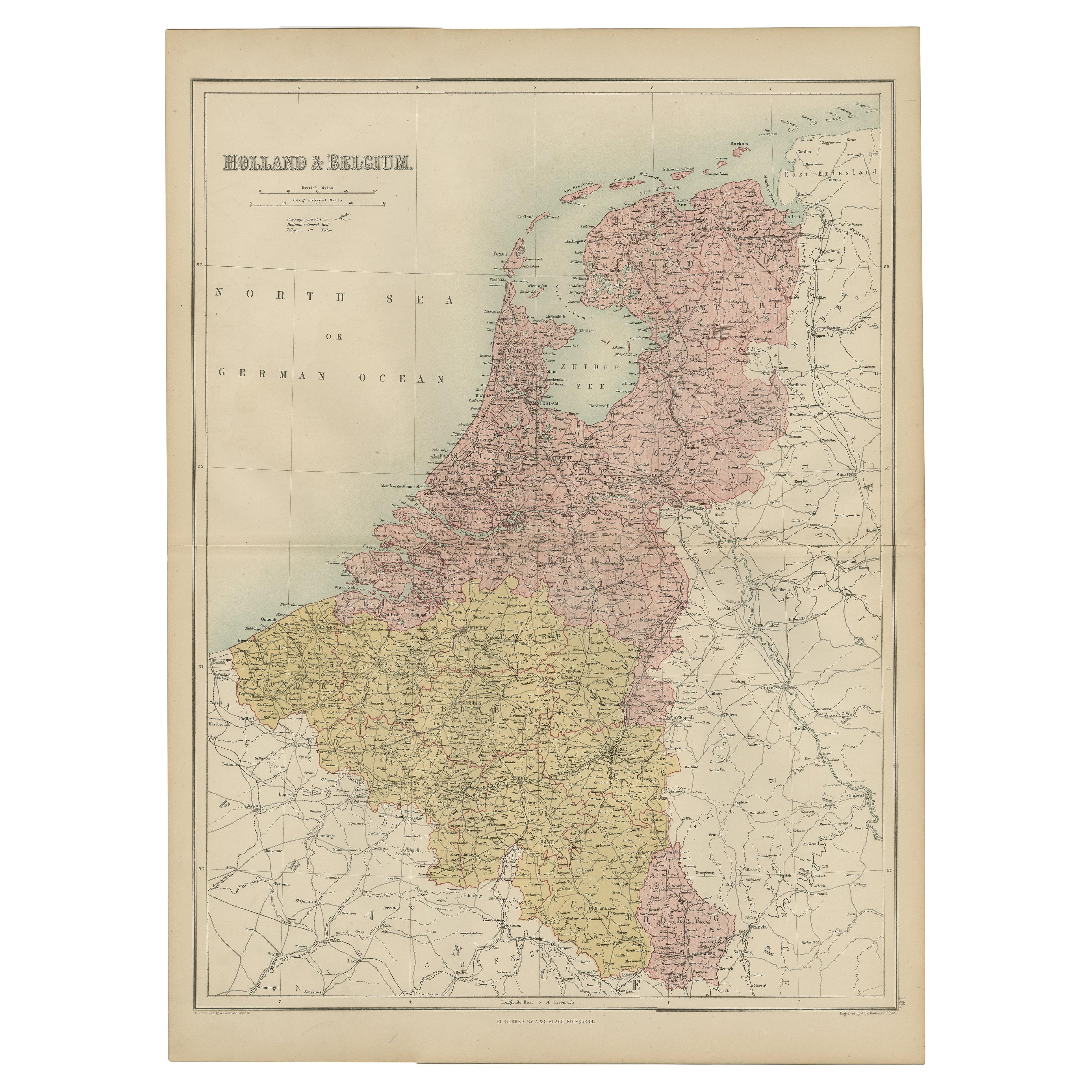
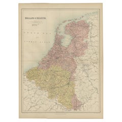
- Antique Map of The Netherlands and Belgium by A & C, Black, 1870Located in Langweer, NLAntique map titled 'Holland & Belgium'. Original antique map of Map of The Netherlands and Belgium. This map originates from ‘Black's General Atlas of The World’. Published by A & C....Category
Antique Late 19th Century Maps
MaterialsPaper
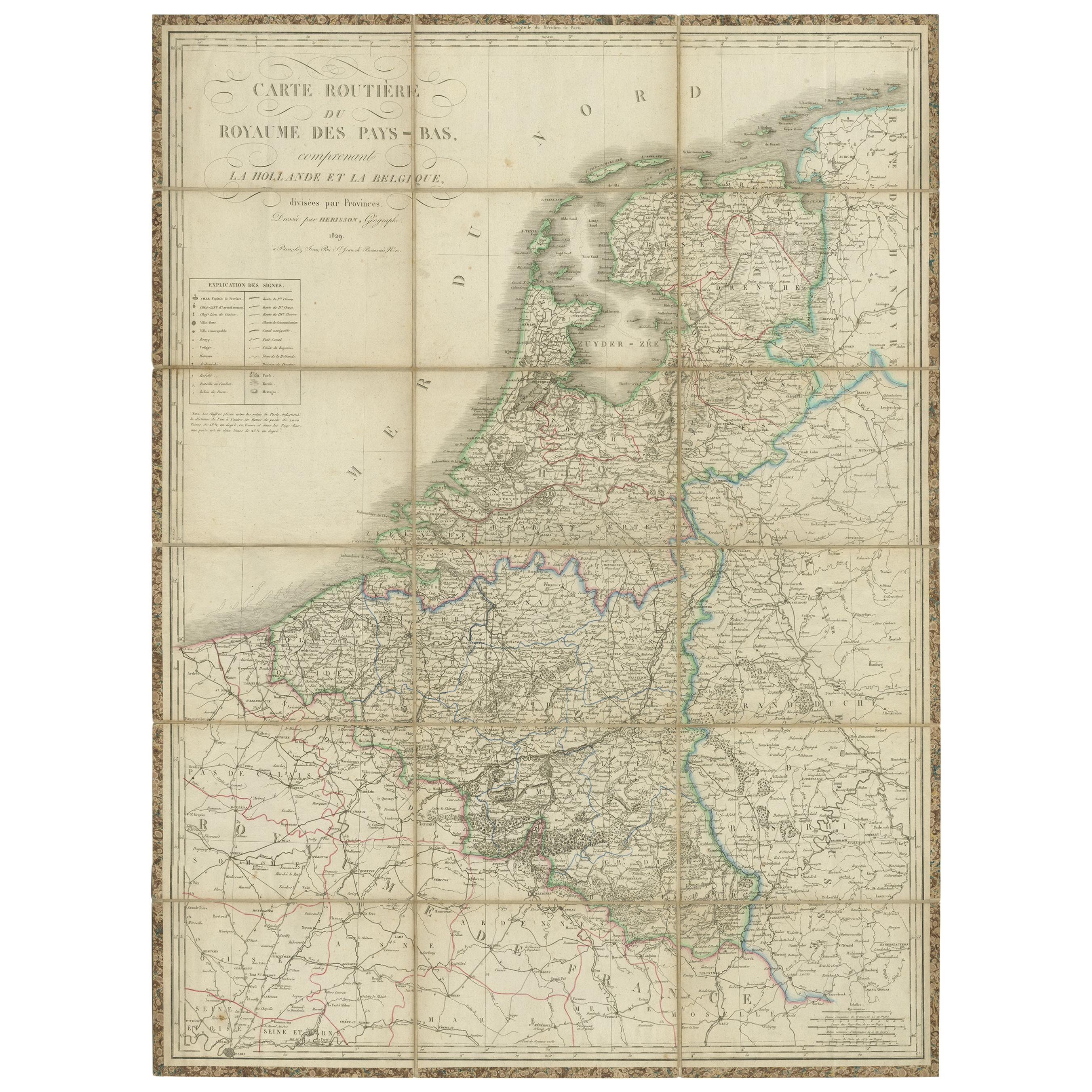
- Antique Map of the Netherlands and Belgium by Hérisson, 1829Located in Langweer, NLFor your online catalogue, here is a detailed description of the antique map titled 'Carte Routière du Royaume des Pays-Bas comprenant la Hollande et la Belgique,' published by Eustache Hérisson in 1829: **Title**: 'Carte Routière du Royaume des Pays-Bas comprenant la Hollande et la Belgique' **Publisher**: Eustache Hérisson **Publication Year**: 1829 This original antique map is a detailed depiction of the Netherlands and Belgium, dating back to 1829. As a 'Carte Routière', it focuses on the road networks of the region, providing valuable historical insights into the transportation and geographical understanding of the early 19th century. The map's delineation of the Kingdom of the Netherlands, including both Holland and Belgium, is particularly noteworthy as it represents the political geography of the period shortly before Belgium's independence in 1830. The map is sectionalised and laid on linen, a common practice in the 19th century for preserving and reinforcing maps, making them more durable and portable. This method of mounting also suggests that the map was intended for practical use, possibly by travelers or for educational purposes. **Artist and Publisher**: Eustache Hérisson, the publisher of this map, was a known figure in the cartographic and publishing world of the early 19th century. His work is characterized by attention to detail and accuracy, making this map not only a beautiful piece of art but also a reliable historical document. This map is a valuable historical artifact, offering insights into the geographical and political landscape of the Netherlands...Category
Antique Mid-19th Century Maps
MaterialsPaper
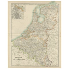
- Antique Map of Belgium and the Netherlands by Johnston 'c.1920'Located in Langweer, NLAntique map titled 'Belgium and the Netherlands'. Original antique map of Belgium and the Netherlands. Published by W. & A.K. Johnston, circa 1920.Category
20th Century Maps
MaterialsPaper
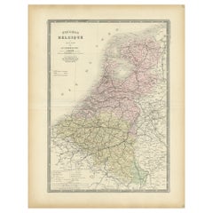
- Decorative Antique Map of the Netherlands and Belgium, ca.1875Located in Langweer, NLAntique map titled 'Pays-Bas Belgique (..)'. Large map of the Netherlands and Belgium. This map originates from 'Atlas de Géographie Moder...Category
Antique Late 19th Century Maps
MaterialsPaper

You May Also Like
- Original Antique Map of The Netherlands, Engraved by Barlow, Dated 1807Located in St Annes, LancashireGreat map of Netherlands Copper-plate engraving by Barlow Published by Brightly & Kinnersly, Bungay, Suffolk. Dated 1807 Unframed.Category
Antique Early 1800s English Maps
MaterialsPaper
- Original Antique Map of The Netherlands, Sherwood, Neely & Jones, Dated 1809Located in St Annes, LancashireGreat map of The Netherlands Copper-plate engraving by Cooper Published by Sherwood, Neely & Jones. Dated 1809 Unframed.Category
Antique Early 1800s English Maps
MaterialsPaper
- Original Antique Map of Belgium by Tallis, Circa 1850Located in St Annes, LancashireGreat map of Belgium Steel engraving Many lovely vignettes Published by London Printing & Publishing Co. ( Formerly Tallis ), C.1850 Origin...Category
Antique 1850s English Maps
MaterialsPaper
- Antique 1630 Colored Belgium Map Flandria Gallica Flanders Henricus HondiusLocated in Dayton, OH"Antique hand colored map of Flanders, Belgium, circa 1630, engraved by Henricus Hondius. “Henricus Hondius II (1597 – 16 August 1651) was a Dutch eng...Category
Antique Early 17th Century Renaissance Maps
MaterialsPaper
- Map of the Republic of GenoaLocated in New York, NYFramed antique hand-coloured map of the Republic of Genoa including the duchies of Mantua, Modena, and Parma. Europe, late 18th century. Dimension: 25...Category
Antique Late 18th Century European Maps
- 17th Century Hand Colored Map of the Liege Region in Belgium by VisscherBy Nicolaes Visscher IILocated in Alamo, CAAn original 17th century map entitled "Leodiensis Episcopatus in omnes Subjacentes Provincias distincté divisusVisscher, Leodiensis Episcopatus" by Nicolaes Visscher II, published in Amsterdam in 1688. The map is centered on Liege, Belgium, includes the area between Antwerp, Turnhout, Roermond, Cologne, Trier and Dinant. This attractive map is presented in a cream-colored mat measuring 30" wide x 27.5" high. There is a central fold, as issued. There is minimal spotting in the upper margin and a tiny spot in the right lower margin, which are under the mat. The map is otherwise in excellent condition. The Visscher family were one of the great cartographic families of the 17th century. Begun by Claes Jansz Visscher...Category
Antique Late 17th Century Dutch Maps
MaterialsPaper


Recently Viewed
View AllMore Ways To Browse
Antique Map Bahamas
Antique Map Ontario
Antique Maps Ontario
Map Lebanon
Antique Map Montreal
Antique Maps San Diego
Lebanon Antique Map
Montreal Map
Antique Furniture Perth Australia
Antique Maps Perth
Barbados Map
Antique Map Connecticut
Antique Map Of Republic Of Texas
Antique Route 66
Giovanni Maria Cassini On Sale
Antique Map Cleveland
Antique Maps Washington Dc
Daniel Bautista