Items Similar to Original Antique Map of the Ancient Netherlands and Belgium, c.1750
Want more images or videos?
Request additional images or videos from the seller
1 of 5
Original Antique Map of the Ancient Netherlands and Belgium, c.1750
About the Item
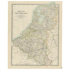
Description: Antique map titled 'Naauwkeurige Kaart van het Oude Nederland (..)'.
Original antique map of the Netherlands and Belgium. This map originates from 'Vaderlandsche historie' by J. Wagenaar, published circa 1750.
Artists and Engravers: Published by I. Tirion.
Condition:
Good, general age-related toning. Original folding lines. Shows some wear and creasing, blank verso. Please study image carefully.
- Dimensions:Height: 13.98 in (35.5 cm)Width: 18.12 in (46 cm)Depth: 0 in (0.02 mm)
- Materials and Techniques:
- Period:1750-1759
- Date of Manufacture:circa 1750
- Condition:
- Seller Location:Langweer, NL
- Reference Number:
About the Seller
5.0
Platinum Seller
These expertly vetted sellers are 1stDibs' most experienced sellers and are rated highest by our customers.
Established in 2009
1stDibs seller since 2017
1,928 sales on 1stDibs
Typical response time: <1 hour
- ShippingRetrieving quote...Ships From: Langweer, Netherlands
- Return PolicyA return for this item may be initiated within 14 days of delivery.
More From This SellerView All
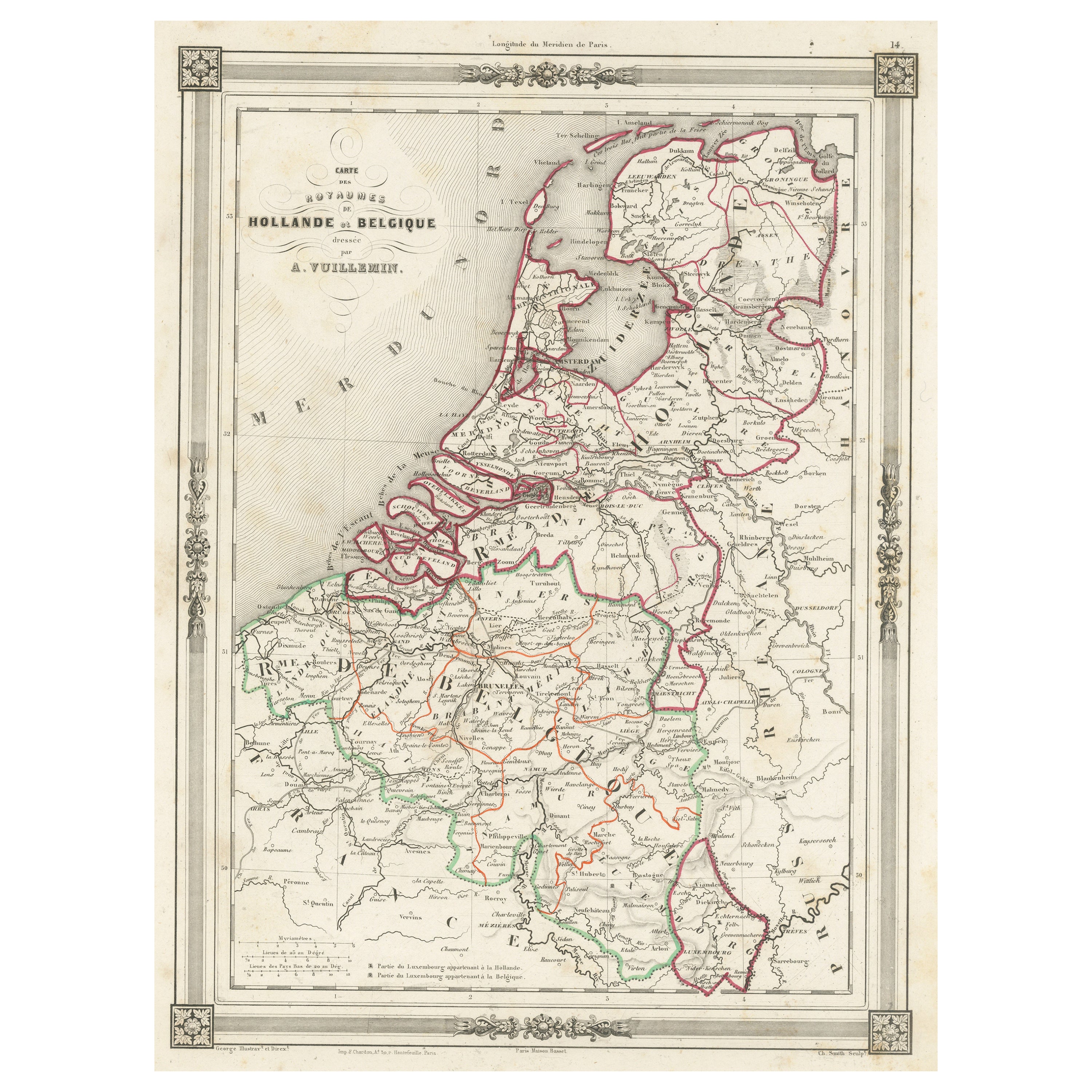
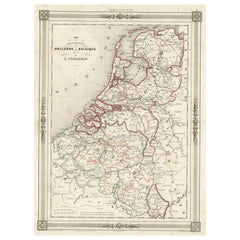
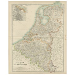
- Antique Map of the Netherlands, Belgium and LuxembourgLocated in Langweer, NLAntique map titled 'Carte des Royaumes Hollande et Belgique'. Attractive map of the Netherlands, Belgium and Luxembourg. This map originates fro...Category
Antique Mid-19th Century Maps
MaterialsPaper
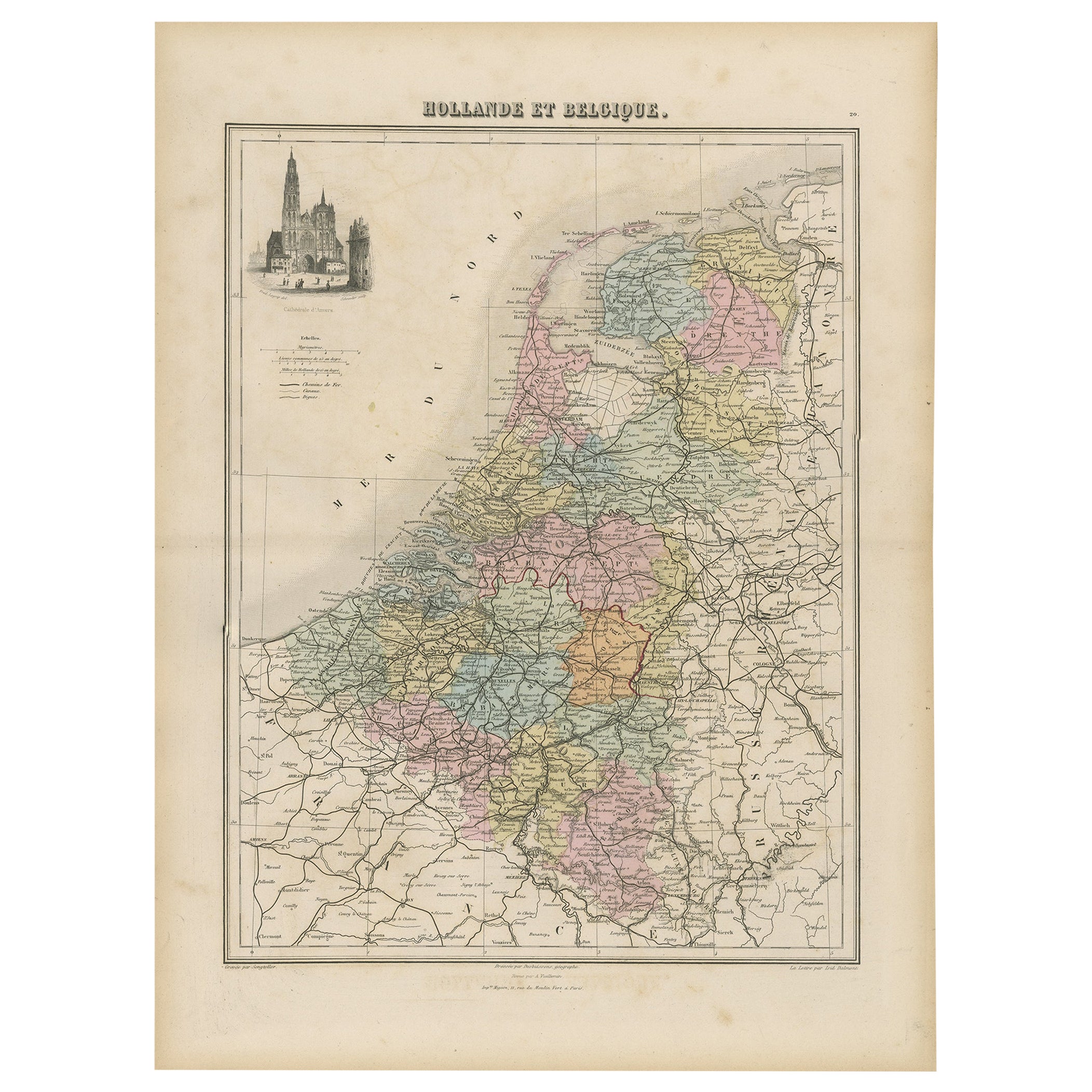
- Antique Map of the Netherlands and Belgium, circa 1880Located in Langweer, NLAntique map titled 'Hollande et Belgique'. Old map of the Netherlands and Belgium. With decorative vignette of the Antwerp cathedral. This map o...Category
Antique 19th Century Maps
MaterialsPaper
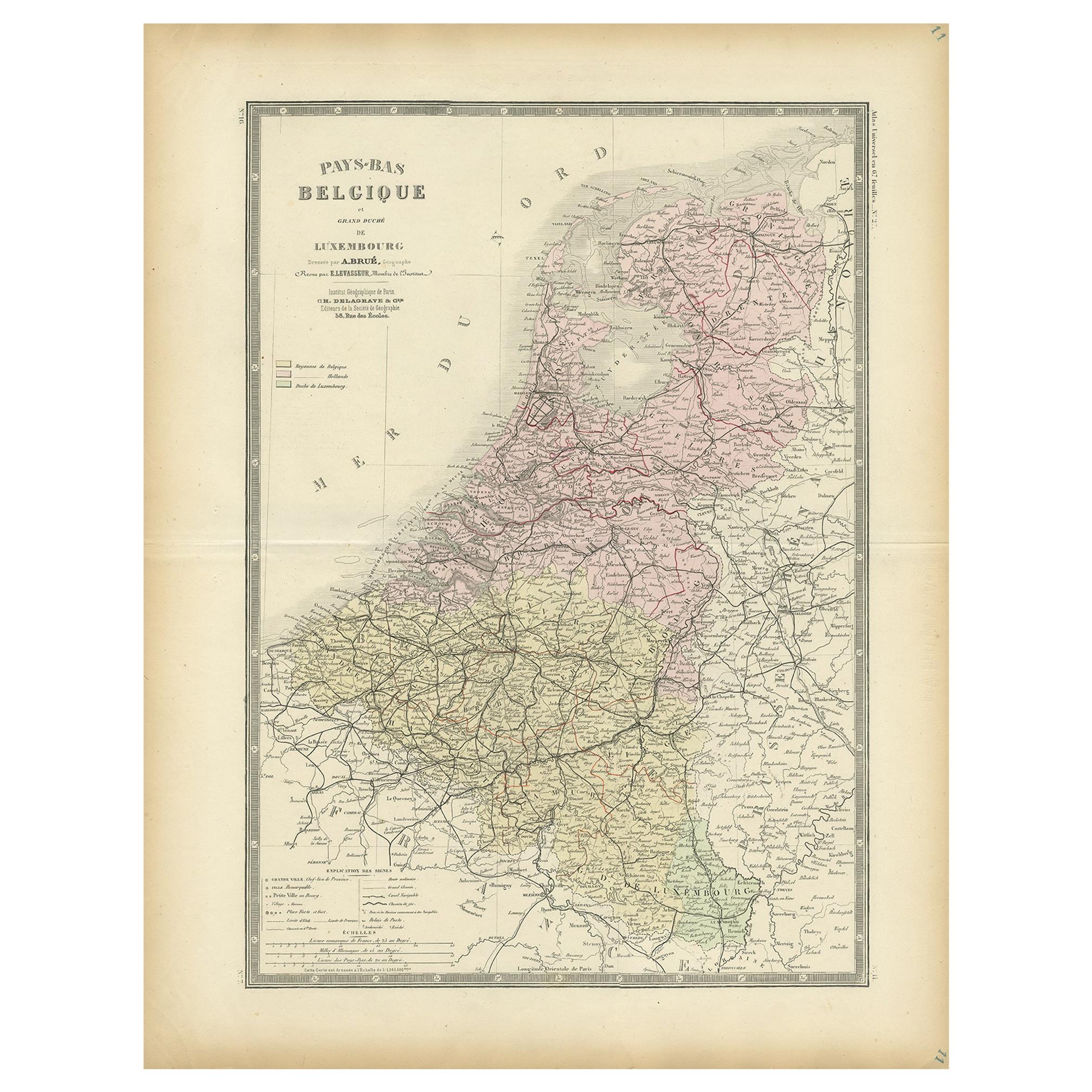
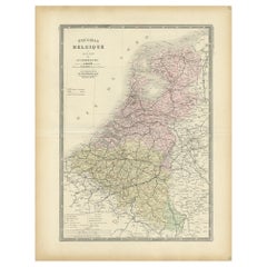
- Decorative Antique Map of the Netherlands and Belgium, ca.1875Located in Langweer, NLAntique map titled 'Pays-Bas Belgique (..)'. Large map of the Netherlands and Belgium. This map originates from 'Atlas de Géographie Moder...Category
Antique Late 19th Century Maps
MaterialsPaper
- Antique Map of Belgium and the Netherlands by Johnston 'c.1920'Located in Langweer, NLAntique map titled 'Belgium and the Netherlands'. Original antique map of Belgium and the Netherlands. Published by W. & A.K. Johnston, circa 1920.Category
20th Century Maps
MaterialsPaper
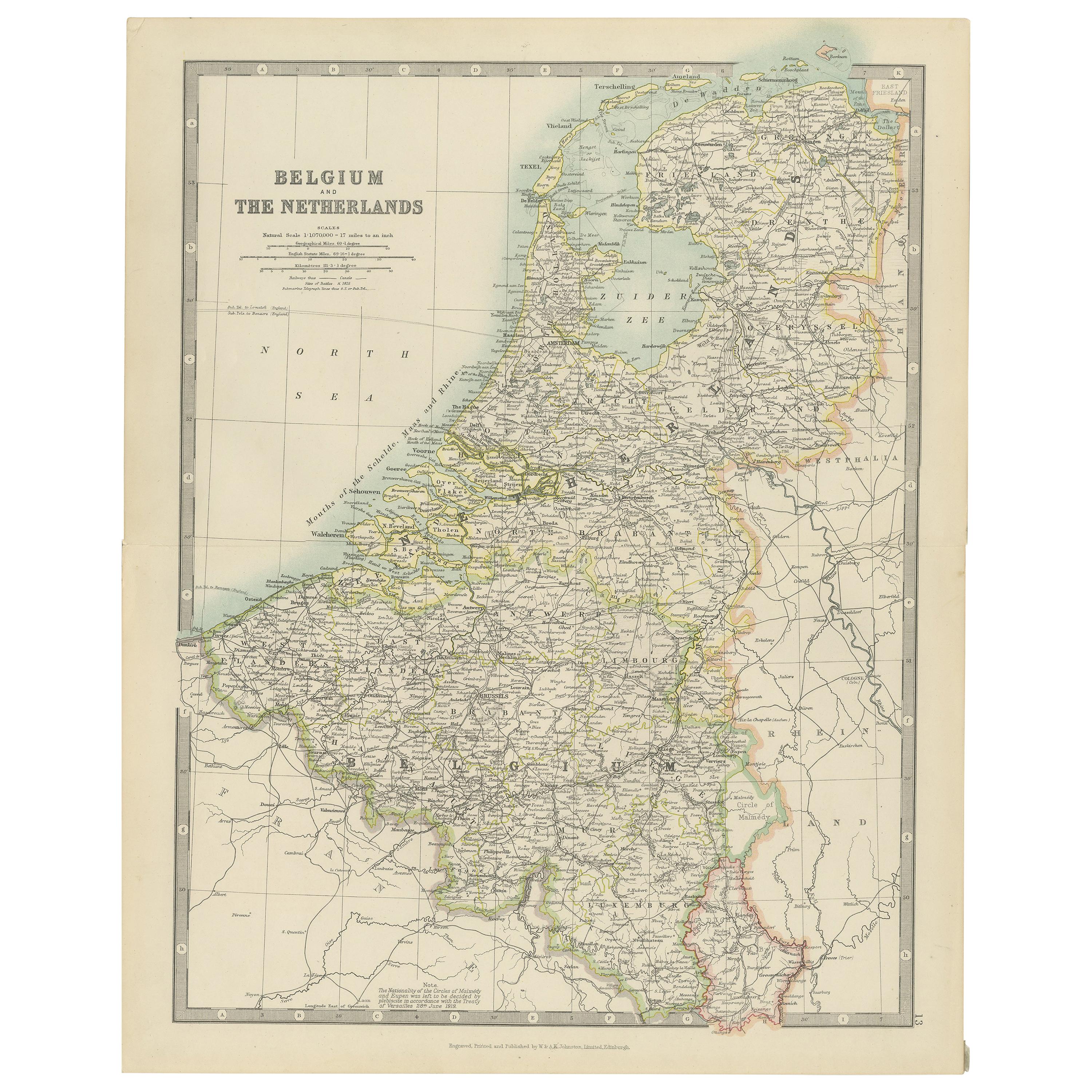
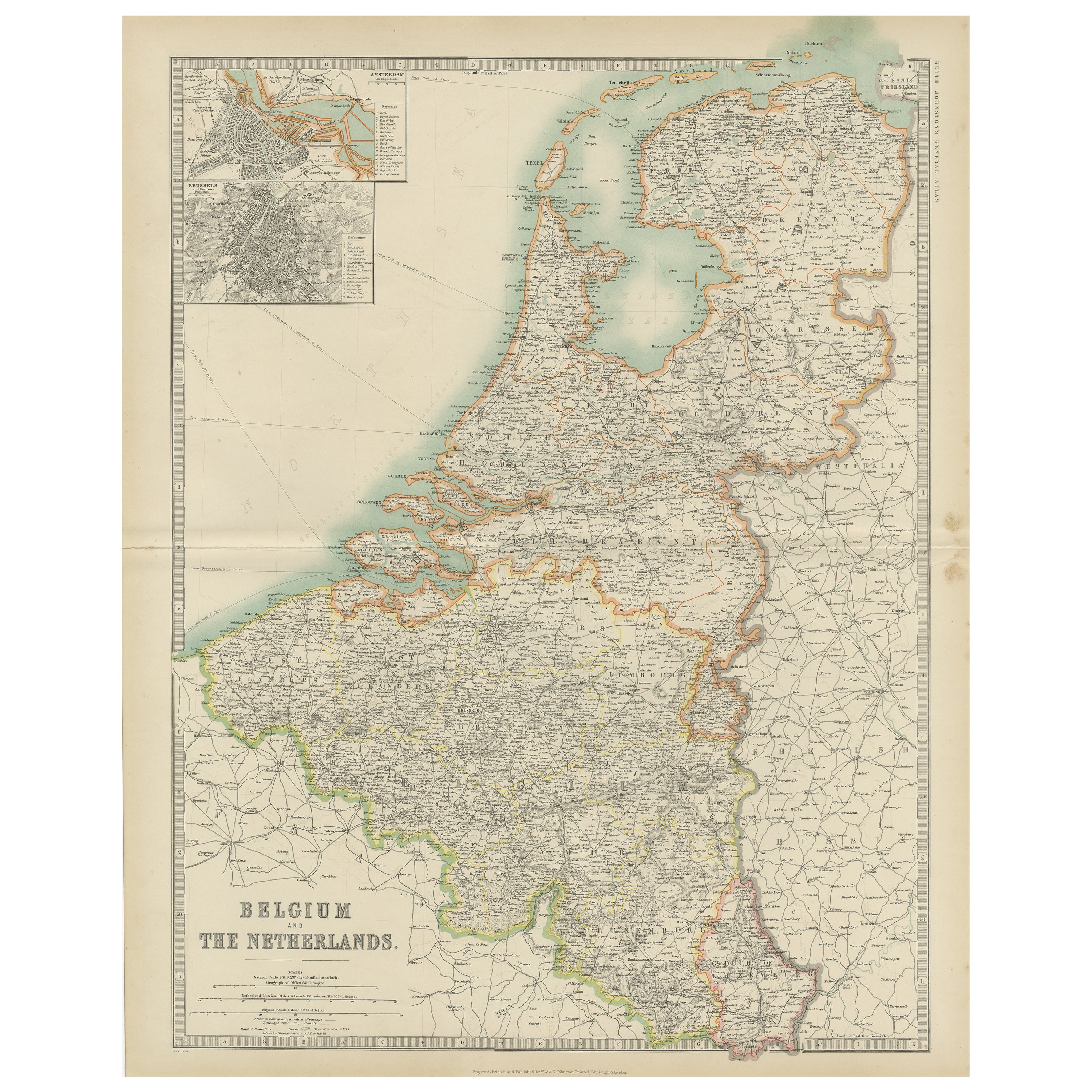
- Antique Map of Belgium and the Netherlands by Johnston '1909'Located in Langweer, NLAntique map titled 'Belgium and The Netherlands'. Original antique map of Belgium and the Netherlands. With inset maps of Amsterdam and Brussels. This m...Category
Early 20th Century Maps
MaterialsPaper
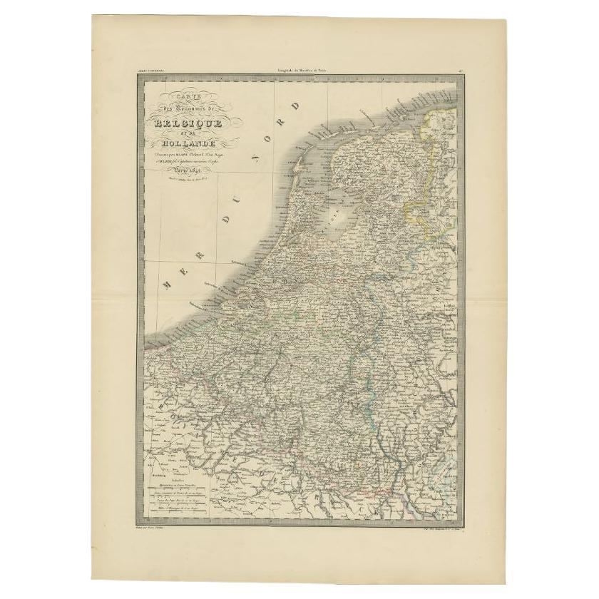
- Antique Map of the Netherlands and Belgium by Lapie, 1842By Pierre M. LapieLocated in Langweer, NLAntique map titled 'Carte des Royaumes de Belgique et de Hollande'. Map of the Netherlands and Belgium. This map originates from 'Atlas universel de géographie ancienne et moderne (....Category
Antique 18th Century Maps
MaterialsPaper


You May Also Like
- 1752 Vaugoundy Map of Flanders : Belgium, France, and the Netherlands, Ric.a002Located in Norton, MALarge Vaugoundy Map of Flanders: Belgium, France, and the Netherlands Colored -1752 Ric.a002 Description: This is a 1752 Didier Robert de Vaugondy map of Flanders. The map de...Category
Antique 17th Century Unknown Maps
MaterialsPaper
- Original Antique Map of The Netherlands, Engraved by Barlow, Dated 1807Located in St Annes, LancashireGreat map of Netherlands Copper-plate engraving by Barlow Published by Brightly & Kinnersly, Bungay, Suffolk. Dated 1807 Unframed.Category
Antique Early 1800s English Maps
MaterialsPaper
- Original Antique Map of The Netherlands, Sherwood, Neely & Jones, Dated 1809Located in St Annes, LancashireGreat map of The Netherlands Copper-plate engraving by Cooper Published by Sherwood, Neely & Jones. Dated 1809 Unframed.Category
Antique Early 1800s English Maps
MaterialsPaper
- Original Antique Map of Ancient Greece- Boeotia, Thebes, 1787Located in St Annes, LancashireGreat map of Ancient Greece. Showing the region of Boeotia, including Thebes Drawn by J.D. Barbie Du Bocage Copper plate engraving by P.F T...Category
Antique 1780s French Other Maps
MaterialsPaper
- Original Antique Map of Ancient Greece, Achaia, Corinth, 1786Located in St Annes, LancashireGreat map of Ancient Greece. Showing the region of Thessaly, including Mount Olympus Drawn by J.D. Barbie Du Bocage Copper plate engraving by P.F Tardieu Original hand color...Category
Antique 1780s French Other Maps
MaterialsPaper
- Original Antique Map of Belgium by Tallis, Circa 1850Located in St Annes, LancashireGreat map of Belgium Steel engraving Many lovely vignettes Published by London Printing & Publishing Co. ( Formerly Tallis ), C.1850 Origin...Category
Antique 1850s English Maps
MaterialsPaper


Recently Viewed
View AllMore Ways To Browse
Artists From Belgium
Belgium Map
Antique Tires
Tire Antique
J Blank
Tirion Map
Map Of Belgium
Belgium Antique Map
Antique Map Of The United States
Antique Maps Of The United States
Antique African American
African American Antique
Antique Furniture East London
Antique Eastern European Furniture
Vintage Map Of The United States
Antique House Plans
Antique Metal Window
Antique Metal Windows