Tirion Map
5
to
31
222
6
121
121
91
83
62
26
23
18
15
14
11
6
6
5
3
3
3
2
1
1
42
42
22
7
1
Sort By
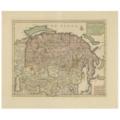
Antique Map of Siberia and Chinese Tartary, Incl Nova Zembla, ca.1732
Located in Langweer, NL
gebracht tot Amsterdam door Isaak Tirion'.
Map op Siberia and Chinese tartary. In the north Novaya
Category
Antique 1730s Maps
Materials
Paper
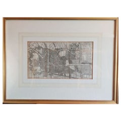
Antique Map of the City of Haarlem by Tirion, 1742
By Isaak Tirion
Located in Langweer, NL
Antique map titled 'Grondtekening van Haarlem (..)'. Original antique map of the city of Haarlem
Category
Antique 18th Century Maps
Materials
Paper
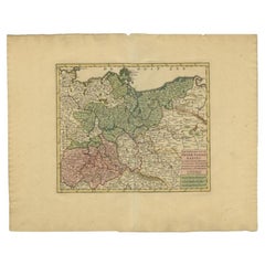
Antique Map of Upper Saxony in Germany by Tirion, circa 1740
By Isaak Tirion
Located in Langweer, NL
Antique map titled 'Nieuwe Kaart van de Opper Saxise Kreits (..).' Attractive detailed map showing
Category
Antique 18th Century Maps
Materials
Paper
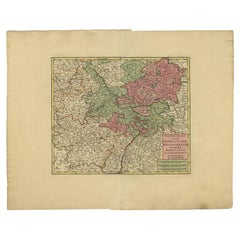
Antique Map of the Rhineland and Lotharingen by Tirion, c.1740
By Isaak Tirion
Located in Langweer, NL
Antique map titled 'Nieuwe Kaart van de Opper en Neder Rhynse Kreits nevens het Hertogdom
Category
Antique 18th Century Maps
Materials
Paper
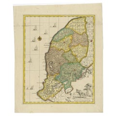
Antique Map of Westergo, Friesland in the the Netherlands, by Tirion, 1744
By Isaak Tirion
Located in Langweer, NL
Antique map titled 'Westergo'. Original antique map of Westergo, part of the province of Friesland
Category
Antique 18th Century Maps
Materials
Paper
H 19.49 in W 15.75 in D 0 in
England, Scotland & Ireland: A Hand Colored Map of Great Britain by Tirion
By Isaak Tirion
Located in Alamo, CA
the map is otherwise in excellent condition.
Isaac Tirion (1705-1765) was an 18th century Dutch
Category
Antique Mid-18th Century Dutch Maps
Materials
Paper
H 17 in W 20.75 in D 0.07 in
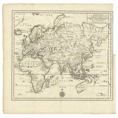
Antique Map of the Eastern Part of the World by Tirion, 1755
By Isaak Tirion
Located in Langweer, NL
Antique map titled 'Nieuwe Kaart van het Oostelykste Deel der Weereld, dienende tot Aanwyzing van
Category
Antique Mid-18th Century Dutch Maps
Materials
Paper
Free Shipping
H 15.56 in W 15.56 in D 0.02 in
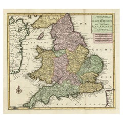
Antique Map of the South Part of Great Britain by Tirion, c.1750
By Isaak Tirion
Located in Langweer, NL
Antique map titled 'Nieuwe Kaart van 'T Zuider Gedeelte van Groot Britannie behelzende Het
Category
Antique 18th Century Maps
Materials
Paper
Antique Map of Baja California and parts of Alta California, Arizona and Sonora
Located in Langweer, NL
map of Baja California and parts of Alta California, Arizona and Sonora. Isaac Tirion's map of Baja
Category
Antique Mid-18th Century Maps
Materials
Paper
Free Shipping
H 14.1 in W 14.97 in D 0.02 in
Original Antique Map of North and South America in Attractive Old Coloring
By Isaak Tirion
Located in Langweer, NL
Antique map titled 'Nieuwe Kaart van America'. Beautiful map of America. The fabled Quivira is used
Category
Antique Mid-18th Century Maps
Materials
Paper
H 16.15 in W 19.69 in D 0.02 in
Beautiful Antique Map of the Northern Hemisphere with California as an Island
By Isaak Tirion
Located in Langweer, NL
tot Amsterdam door Isaak Tirion'. Beautiful map of the Northern Hemisphere and North Pole, which shows
Category
Antique Mid-18th Century Maps
Materials
Paper
H 13.98 in W 18.9 in D 0.02 in
Antique Map of the Sunda Islands Sumatra, Java, Malay Peninsula & Borneo (1739)
By Isaak Tirion
Located in Langweer, NL
Antique map titled 'Nieuwe kaart van de Sundasche Eilanden als Borneo, Sumatra en Groot Iava & c
Category
Antique Mid-18th Century Maps
Materials
Paper
H 12.21 in W 15.56 in D 0.02 in
Attractive Antique Map showing Denmark and part of Sweden and Germany c.1750
By Isaak Tirion
Located in Langweer, NL
Antique map titled 'Nieuwe Kaart van het Koninkryk van Deenemarken (..).' Attractive detailed map
Category
Antique 18th Century Maps
Materials
Paper
H 12.21 in W 15.36 in D 0 in
Antique Map of Oostergo by Tirion, 1744
Located in Langweer, NL
Antique map titled 'Oostergo'. Original antique map of Oostergo, part of the province of Friesland
Category
Antique 18th Century Maps
Materials
Paper
Antique Map of Oostergo by Tirion, 1744
Located in Langweer, NL
Antique map titled 'Oostergo'. Original antique map of Oostergo, part of the province of Friesland
Category
Antique 18th Century Maps
Materials
Paper
Antique Map of London by Tirion '1754'
Located in Langweer, NL
Antique map titled 'Kaart van Londen enz. en van het naby gelegen land ruim een Uur gaans rondsom
Category
Antique Mid-18th Century Maps
Materials
Paper
Antique Map of Asia by Tirion 'c.1760'
Located in Langweer, NL
Antique map titled 'Nuova Carta dell Asia'. Decorative map of Asia. Published by I. Tirion, circa
Category
Antique Mid-18th Century Maps
Materials
Paper
Antique Map of Oostergo, Friesland by Tirion, 1785
Located in Langweer, NL
Antique map Friesland titled 'Oostergo'. Antique map of part of Friesland depicting the 'Oostergo
Category
Antique 18th Century Maps
Materials
Paper
Antique Map of Oostergo, Friesland by Tirion, 1785
Located in Langweer, NL
Antique map Friesland titled 'Oostergo'. Antique map of part of Friesland depicting the 'Oostergo
Category
Antique 18th Century Maps
Materials
Paper
Antique Map of Oostergo, Friesland by Tirion, 1785
Located in Langweer, NL
Antique map Friesland titled 'Oostergo'. Antique map of part of Friesland depicting the 'Oostergo
Category
Antique 18th Century Maps
Materials
Paper
Antique Map of France by Tirion, c.1740
Located in Langweer, NL
Antique map titled 'Nieuwe Kaart van Frankryk.' - Attractive detailed map showing France. Title in
Category
Antique 18th Century Maps
Materials
Paper
Antique Map of European Russia by Tirion, c.1725
Located in Langweer, NL
te Amsterdam by Isaak Tirion'. Detailed map of European Russia.
Artists and Engravers: Isaak
Category
Antique 18th Century Maps
Materials
Paper
Antique Map of South America by Tirion, c.1765
By Thomas Kitchin
Located in Langweer, NL
Antique map titled 'Kaart van het Onderkoningschap van Peru zig uitstrekkende: over Chile, Paraguay
Category
Antique 18th Century Maps
Materials
Paper
Antique Map of the 'Biesbosch' Region by Tirion, 1749
Located in Langweer, NL
Antique map titled 'Nieuwe Kaart van het Zuid Oostelykste deel van Holland behelzende de Landen van
Category
Antique 18th Century Maps
Materials
Paper
Antique Map of South America by Tirion 'circa 1765'
Located in Langweer, NL
Antique map titled 'Kaart van het Onderkoningschap van Peru, zig uitstrekkende over Chili, Paraguay
Category
Antique Mid-18th Century Maps
Materials
Paper
Antique Map of Czech Republic by I. Tirion, 1747
Located in Langweer, NL
Antique map titled 'Nieuwe Kaart van t Koninkryk Bohemen t Hertogdom Silesien markgraafschap
Category
Antique Mid-18th Century Maps
Materials
Paper
Antique Map of the City of Enkhuizen by Tirion, 1743
Located in Langweer, NL
. The maps mainly based on those of Guillaume de l'Isle. He died in 1765. Tirion was born in Utrecht in
Category
Antique 18th Century Maps
Materials
Paper
Antique Map of the Sunda Islands by Tirion 'c.1760'
Located in Langweer, NL
Antique map titled 'Nuova Carta delle Isole di Sunda come Borneo, Sumatra e Iava Grande'. Detailed
Category
Antique Mid-18th Century Maps
Materials
Paper
Antique Map of the Turkish Empire by Tirion 'c.1760'
Located in Langweer, NL
Antique map titled 'Nieuwe Kaart van het Turksche Ryk gelegen in Europa, Asia en Africa'. Original
Category
Antique Mid-18th Century Maps
Materials
Paper
Antique Map of Spain and Portugal by Tirion, c.1760
Located in Langweer, NL
Antique map titled 'Nieuwe Kaart van Spanje en Portugal.' Attractive detailed map showing Spain and
Category
Antique 18th Century Maps
Materials
Paper
Antique Map of the City of Paris by Tirion '1763'
Located in Langweer, NL
Antique map titled 'Nieuwe Kaart der platte Grond van de Stad Parys (..)'. Beautiful city plan of
Category
Antique Mid-18th Century Maps
Materials
Paper
Antique Map of the City of Woerden by Tirion, c.1750
Located in Langweer, NL
Antique map titled 'Nieuwe Grondtekening van de Stad Woerden'. Plan of the city of Woerden, the
Category
Antique 18th Century Maps
Materials
Paper
Antique Map of the Bahia Todos Santos 'Brazil' by Tirion, circa 1750
Located in Langweer, NL
Antique map titled 'Kaart Van De Aller-Heiligen Baay Waar aan de Hoofdstad legt van Brazil
Category
Antique Mid-18th Century Maps
Materials
Paper
Antique Map of the Northern Hemisphere and North Pole by Tirion, circa 1754
Located in Langweer, NL
Antique map titled 'Nieuwe Kaart van de Noord Pool na de alderlaatste ondekking int licht gebracht
Category
Antique Mid-18th Century Maps
Materials
Paper
H 12.8 in W 14.77 in D 0.02 in
Antique Map of the Region of Bavaria and Austria by Tirion, c.1740
Located in Langweer, NL
Antique map titled 'Carte des environs de Batavia - Kaart van de Buitenstreken van Batavia'. Map of
Category
Antique 18th Century Maps
Materials
Paper
Antique Map of the Region Centered on the Malay Peninsula by Tirion 'c.1760'
Located in Langweer, NL
Antique map titled 'Nuova Carta dell' India (..)'. Decorative map of the region centered on the
Category
Antique Mid-18th Century Maps
Materials
Paper
H 13.98 in W 16.93 in D 0.02 in
Antique Plan of the City of Grave in Holland With Coats of Arms and Compass Rose
By Isaak Tirion
Located in Langweer, NL
Antique map titled 'Grondtekening der Stad Graave'. Plan of Grave, The Netherlands. With coats of
Category
Antique 18th Century Maps
Materials
Paper
H 7.6 in W 9.38 in D 0 in
Antique Map of Mozambique Bay and a Map Fort de Mozambique, c.1759
Located in Langweer, NL
Two antique maps on one sheet. The upper antique map is titled 'Plan du Fort de Mozambique tiré de
Category
Antique 18th Century Maps
Materials
Paper
Antique Map of Africa with Original Hand Coloring
Located in Langweer, NL
, with very small inset map titled 'Vlaamsche Eilanden', which shows the Azores. Published by I. Tirion
Category
Antique Mid-18th Century Maps
Materials
Paper
Detailed Antique Map of Italy and surrounding Islands
Located in Langweer, NL
Antique map titled 'Italie volgens de allernieuwste Uitgave van den Heere d'Anville'. Very detailed
Category
Antique Mid-18th Century Maps
Materials
Paper
Antique Map of Lower Saxony in Germany, c.1740
Located in Langweer, NL
plans. The maps mainly based on those of Guillaume de l'Isle. He died in 1765.
Artist: Isaak Tirion, a
Category
Antique 18th Century Maps
Materials
Paper
Antique Map of Greece, Turkey and surroundings with original coloring
Located in Langweer, NL
gebracht'. Antique map of Greece with Crete and Cyprus, Turkey and the Black Sea. Published by I. Tirion
Category
Antique Mid-18th Century Maps
Materials
Paper
H 15.67 in W 21.58 in D 0.02 in
Antique Map of Indochina, the Malaysian Peninsula and Northern Sumatra
Located in Langweer, NL
Antique map titled 'Nieuwe Kaart van India over de Ganges of van Malakka, Siam, Cambodia, Chiampa
Category
Antique Mid-18th Century Maps
Materials
Paper
H 12.29 in W 17.72 in D 0.02 in
Antique Map of the Eastern Part of the World
Located in Langweer, NL
Antique map titled 'Nieuwe Kaart van het Oostelykste Deel der Weereld, diendende tot aanwyzing van
Category
Antique Mid-18th Century Maps
Materials
Paper
Attractive Antique Hand-Coloured Map of South America, ca.1765
Located in Langweer, NL
Antique map titled 'Kaart van het Onderkoningschap van Peru zig uitstrekkende: over Chile, Paraguay
Category
Antique 1760s Maps
Materials
Paper
Antique Map of Northern Asia, with Russia, Korea and Northern Japan
Located in Langweer, NL
Antique map titled 'Nieuwe Kaart van Tartarie'. Map op Siberia and Chinese tartary. In the north
Category
Antique Mid-18th Century Maps
Materials
Paper
Detailed Antique Map of the Black Sea, Balkans and Asia Minor
Located in Langweer, NL
Antique map titled 'Nuova Carta del Europa Turchesca (..)'. This is an Italian version of Tirion
Category
Antique Mid-18th Century Maps
Materials
Paper
Original Map of The Northern Arabian Peninsula, Palestine, Iraq & Iran, 1732
Located in Langweer, NL
Dutch town plans. The maps mainly based on those of Guillaume de l'Isle. He died in 1765. Tirion was
Category
Antique 1730s Maps
Materials
Paper
H 11.66 in W 14.69 in D 0.01 in
Original Antique Map of the Ancient Netherlands and Belgium, c.1750
Located in Langweer, NL
Description: Antique map titled 'Naauwkeurige Kaart van het Oude Nederland (..)'.
Original
Category
Antique 1750s Maps
Materials
Paper
Antique Map of Japan with Scale and Compass Rose, c.1730
Located in Langweer, NL
plans. The maps mainly based on those of Guillaume de l'Isle.
Artist: Isaak Tirion, a Dutch publisher
Category
Antique 18th Century Maps
Materials
Paper
Original Antique Map of the Western Part of NEW MEXICO & CALIFORNIA
Located in Langweer, NL
Title: "Map of the Western Part of NEW MEXICO and CALIFORNIA According to the Latest Discoveries by
Category
Antique 1760s Maps
Materials
Paper
Antique Map of Singapore, Malaysia, Borneo, Sumatra and Java (Indonesia), 1739
Located in Langweer, NL
"Antique map titled 'Nieuwe kaart van de Sundasche Eilanden als Borneo, Sumatra en Groot Iava & c
Category
Antique 18th Century Maps
Materials
Paper
H 12.21 in W 15.56 in D 0 in
Antique Hand-Coloured Map of North and South America, ca.1765
Located in Langweer, NL
Description: Antique map titled 'Nieuwe Kaart van Amerika.' Attractive map of North and South
Category
Antique 1760s Maps
Materials
Paper
Antique Map of Hungary Incl Surroundings like Croatia, Bosnia, Servia, 1730
Located in Langweer, NL
Antique map titled 'Nieuwe Kaart van t Koninkryk Hongaryen en Zevenbergen na de laatste
Category
Antique 18th Century Maps
Materials
Paper
No Reserve
H 21.66 in W 17.13 in D 0 in
Attractive Detailed Authentic Map Showing Bavaria, Germany and Austria, c.1740
Located in Langweer, NL
Antique map titled 'Nieuwe Kaart van de Beyersche en Oostenryksche Kreits (..).' Attractive
Category
Antique 18th Century Maps
Materials
Paper
H 17.13 in W 21.66 in D 0 in
Antique Map op Siberia and Chinese Tartary with original hand coloring, 1732
Located in Langweer, NL
Antique map titled 'Nieuwe Kaart van Tartarie na de alderlaatste ontdekking int ligt gebragt'. Map
Category
Antique Mid-18th Century Maps
Materials
Paper
No Reserve
H 16.7 in W 21.5 in D 0.02 in
Antique Map of Bohemia in the Present-Day Chech Repubic, 1730
Located in Langweer, NL
Antique map titled 'Nieuwe Kaart van t Koninkryk Bohemen t Hertogdom Silesien markgraafschap
Category
Antique 18th Century Maps
Materials
Paper
Detailed Old Map showing Spain and Portugal Incl. Majorca, Minorca & Ibiza, 1740
Located in Langweer, NL
Antique map titled 'Nieuwe Kaart van Spanje en Portugal.'
Attractive detailed map showing Spain
Category
Antique 1740s Maps
Materials
Paper
H 17.13 in W 21.78 in D 0 in
Antique Map of Oostergo, Part of Friesland, the Netherlands. Published in 1744
Located in Langweer, NL
Antique map titled 'Oostergo'. Original antique map of Oostergo, part of the province of Friesland
Category
Antique 1740s Maps
Materials
Paper
H 14.77 in W 16.93 in D 0 in
Attractive Engraved Old Map Showing Spain, Portugal Majorca, Ibiza etc. ca.1760
Located in Langweer, NL
Antique map titled 'Nieuwe Kaart van Spanje en Portugal.'
Attractive detailed map showing Spain
Category
Antique 1760s Maps
Materials
Paper
H 14.97 in W 16.46 in D 0 in
- 1
Get Updated with New Arrivals
Save "Tirion Map", and we’ll notify you when there are new listings in this category.
