Items Similar to Antique Map of the 'Biesbosch' Region by Tirion, 1749

Want more images or videos?
Request additional images or videos from the seller
1 of 5
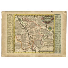
Antique Map of the 'Biesbosch' Region by Tirion, 1749
About the Item
Antique map titled 'Nieuwe Kaart van het Zuid Oostelykste deel van Holland behelzende de Landen van Heusden, Altena, de Alblasserwaard, Krimpenerwaard, de Vyf Heeren Landen enz. enz'. Detailed map of the 'Biesbosch' region, The Netherlands. Covering the area of Gouda, IJsselstein, s'Hertogenbosch, Zevenbergen, Dordrecht. Artists and Engravers: Isaak Tirion, a Dutch publisher in Amsterdam, was born 1705. He produced serveral Atlases and Dutch town plans. The maps mainly based on those of Guillaume de l'Isle. He died in 1765.
Artist: Isaak Tirion, a Dutch publisher in Amsterdam, was born 1705. He produced serveral Atlases and Dutch town plans. The maps mainly based on those of Guillaume de l'Isle. He died in 1765.
Condition: Very good, general age-related toning. Original, contemporary hand coloring. Please study image carefully,
Date: 1749
Overall size: 52.5 x 43.5 cm.
Image size: 0.001 x 37 x 32.5 cm.
Antique prints have long been appreciated for both their aesthetic and investment value. They were the product of engraved, etched or lithographed plates. These plates were handmade out of wood or metal, which required an incredible level of skill, patience and craftsmanship. Whether you have a house with Victorian furniture or more contemporary decor an old engraving can enhance your living space. We offer a wide range of authentic antique prints for any budget.
- Dimensions:Height: 17.13 in (43.5 cm)Width: 20.67 in (52.5 cm)Depth: 0 in (0.01 mm)
- Materials and Techniques:
- Period:
- Date of Manufacture:1749
- Condition:
- Seller Location:Langweer, NL
- Reference Number:
About the Seller
5.0
Platinum Seller
These expertly vetted sellers are 1stDibs' most experienced sellers and are rated highest by our customers.
Established in 2009
1stDibs seller since 2017
1,938 sales on 1stDibs
Typical response time: <1 hour
- ShippingRetrieving quote...Ships From: Langweer, Netherlands
- Return PolicyA return for this item may be initiated within 14 days of delivery.
More From This SellerView All
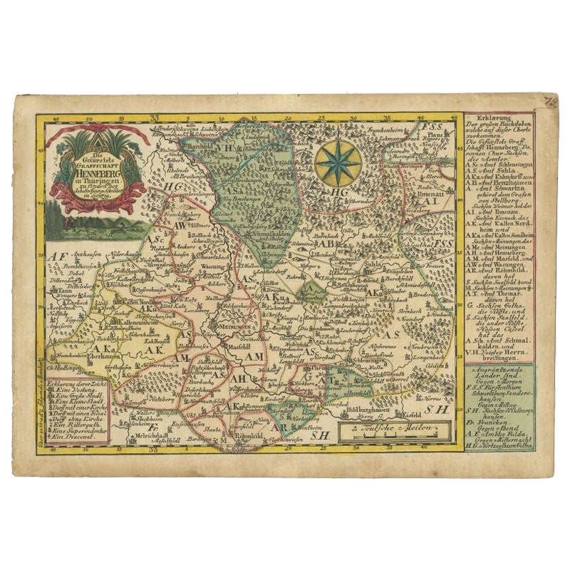
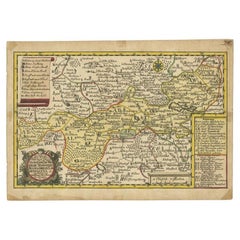
- Antique Map of the Region of Henneberg by Schreiber, 1749Located in Langweer, NLAntique map titled 'Die Gefürstete Henneberg'. Map of the region of Henneberg, Germany. This map originates from 'Atlas Selectus von allen Konigreichen und L...Category
Antique 18th Century Maps
MaterialsPaper
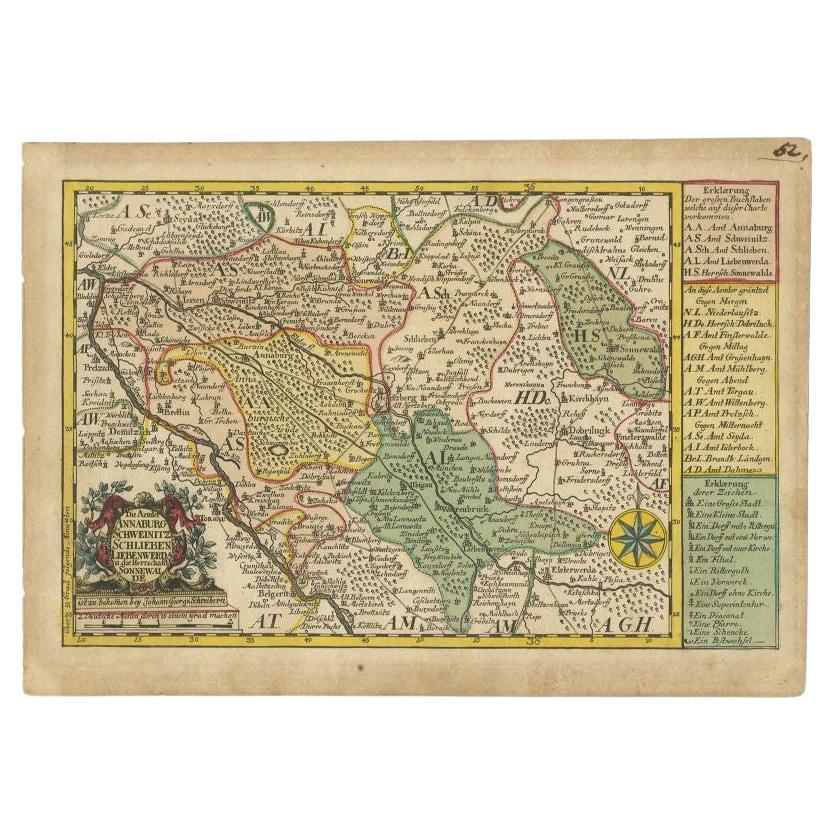
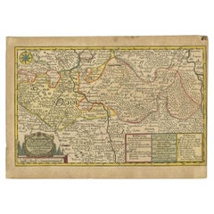
- Antique Map of the Region of Annaburg by Schreiber, 1749By SchreiberLocated in Langweer, NLAntique map titled 'Die Aemter Annaburg, Schweinitz (..)'. Map of the region of Annaburg, Germany. This map originates from 'Atlas Selectus von allen Konigreichen und Landern der Wel...Category
Antique 18th Century Maps
MaterialsPaper
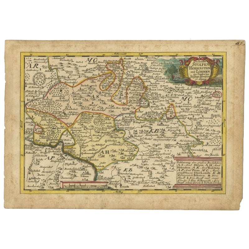
- Antique Map of the Region of Hohenstein by Schreiber, 1749Located in Langweer, NLAntique map titled 'Aemter Stolpen, Hohenstein mit Lohmen'. Map of the region of Hohenstein, Germany. This map originates from 'Atlas Selectus von allen Konigreichen und Landern der ...Category
Antique 18th Century Maps
MaterialsPaper
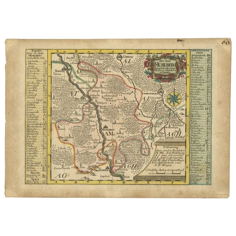
- Antique Map of the Region of Mühlberg by Schreiber, 1749Located in Langweer, NLAntique map titled 'Das Amt Muhlberg'. Map of the region of Mühlberg, Germany. This map originates from 'Atlas Selectus von allen Konigreichen und Landern de...Category
Antique 18th Century Maps
MaterialsPaper
- Antique Map of the Region of Weißensee by Schreiber, 1749By SchreiberLocated in Langweer, NLAntique map titled 'Die Chursaechsischen Aemter in Thüringen gelegen Sachsenburg, Weissensee (..)'. Map of the region of Weißensee, Germany. This map originates from 'Atlas Selectus von allen...Category
Antique 18th Century Maps
MaterialsPaper
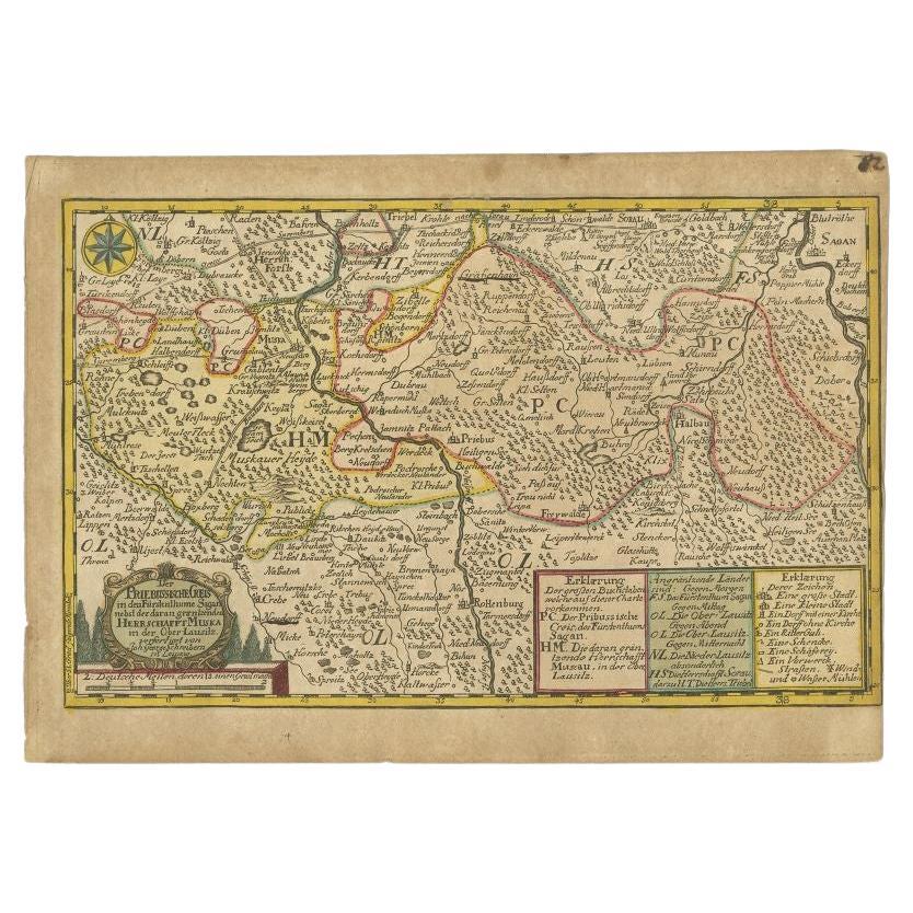
- Antique Map of the Region of Sagan by Schreiber, 1749By SchreiberLocated in Langweer, NLAntique map titled 'Der Prievussische Creis in den Fürstenthume Sagan (..)'. Map of the region of Sagan, Prussia. This map originates from 'Atlas Selectus von allen Konigreichen und ...Category
Antique 18th Century Maps
MaterialsPaper
You May Also Like
- 1861 Topographical Map of the District of Columbia, by Boschke, Antique MapLocated in Colorado Springs, COPresented is an original map of Albert Boschke's extremely sought-after "Topographical Map of the District of Columbia Surveyed in the Years 1856 ...Category
Antique 1860s American Historical Memorabilia
MaterialsPaper
- Map Kyle Carrick Aireshire Thomas Kitchen 1749By Thomas KitchinLocated in BUNGAY, SUFFOLKA Map of Kyle & Carrick Aireshire Thomas Kitchen 1749 In original black and gold frame Just purchased more information to follow MAKER Thomas Kitchin (1718-1784) English engrave...Category
Antique 18th Century English Georgian Maps
MaterialsPaper
- England, Scotland & Ireland: A Hand Colored Map of Great Britain by TirionBy Isaak TirionLocated in Alamo, CAThis is a hand-colored double page copperplate map of Great Britain entitled "Nieuwe Kaart van de Eilanden van Groot Brittannien Behelzende de Kon...Category
Antique Mid-18th Century Dutch Maps
MaterialsPaper
- 1594 Maurice Bouguereau Map of the Region Limoges, France, Ric0015Located in Norton, MA1594 Maurice Bouguereau map of the region Limoges, France, entitled "Totivs Lemovici et Confinium Pro Uinciarum Quantum ad Dioecefin Lemo Uicenfen Fpectant," Hand Colored Ric0015 Jean IV Le Clerc...Category
Antique 16th Century Dutch Maps
MaterialsPaper
- 17th Century Hand Colored Map of the Liege Region in Belgium by VisscherBy Nicolaes Visscher IILocated in Alamo, CAAn original 17th century map entitled "Leodiensis Episcopatus in omnes Subjacentes Provincias distincté divisusVisscher, Leodiensis Episcopatus" by Nicolaes Visscher II, published in Amsterdam in 1688. The map is centered on Liege, Belgium, includes the area between Antwerp, Turnhout, Roermond, Cologne, Trier and Dinant. This attractive map is presented in a cream-colored mat measuring 30" wide x 27.5" high. There is a central fold, as issued. There is minimal spotting in the upper margin and a tiny spot in the right lower margin, which are under the mat. The map is otherwise in excellent condition. The Visscher family were one of the great cartographic families of the 17th century. Begun by Claes Jansz Visscher...Category
Antique Late 17th Century Dutch Maps
MaterialsPaper
- The Normandy Region of France: A 17th C. Hand-colored Map by Sanson and JaillotBy Nicolas SansonLocated in Alamo, CAThis large hand-colored map entitled "Le Duché et Gouvernement de Normandie divisée en Haute et Basse Normandie en divers Pays; et par evêchez, avec le Gouvernement General du Havre ...Category
Antique 1690s French Maps
MaterialsPaper


