Items Similar to Antique Map of Lower Saxony in Germany, c.1740


Want more images or videos?
Request additional images or videos from the seller
1 of 5
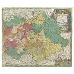
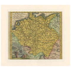
Antique Map of Lower Saxony in Germany, c.1740
About the Item
Antique map titled 'Nieuwe Kaart van de Neder Saxise Kreits (..).' Attractive detailed map showing Lower Saxony, Germany, including Mekelenburg, Lauwenburg, Holstein, Bremen, Verden Brunswyk, Lunenburg, Hanover, Hildesheim, Halberstad and Maagdenburg. Source unknown, to be determined. Artists and Engravers: Isaak Tirion, a Dutch publisher in Amsterdam, was born 1705. He produced serveral Atlases and Dutch town plans. The maps mainly based on those of Guillaume de l'Isle. He died in 1765.
Artist: Isaak Tirion, a Dutch publisher in Amsterdam, was born 1705. He produced serveral Atlases and Dutch town plans. The maps mainly based on those of Guillaume de l'Isle. He died in 1765.
Condition: Good, given age. Edges with an occasional tiny tear. Light soiling and some spots in the margins. Original middle fold as issued. General age-related toning and/or occasional minor defects from handling. Please study image carefully.
Date: c.1740
Overall size: 55.3 x 43.5 cm.
Image size: 33.8 x 28.4 cm.
- Dimensions:Height: 21.78 in (55.3 cm)Width: 17.13 in (43.5 cm)Depth: 0 in (0.01 mm)
- Materials and Techniques:
- Period:
- Date of Manufacture:circa 1740
- Condition:
- Seller Location:Langweer, NL
- Reference Number:
About the Seller
5.0
Platinum Seller
These expertly vetted sellers are 1stDibs' most experienced sellers and are rated highest by our customers.
Established in 2009
1stDibs seller since 2017
1,933 sales on 1stDibs
Typical response time: <1 hour
- ShippingRetrieving quote...Ships From: Langweer, Netherlands
- Return PolicyA return for this item may be initiated within 14 days of delivery.
More From This SellerView All
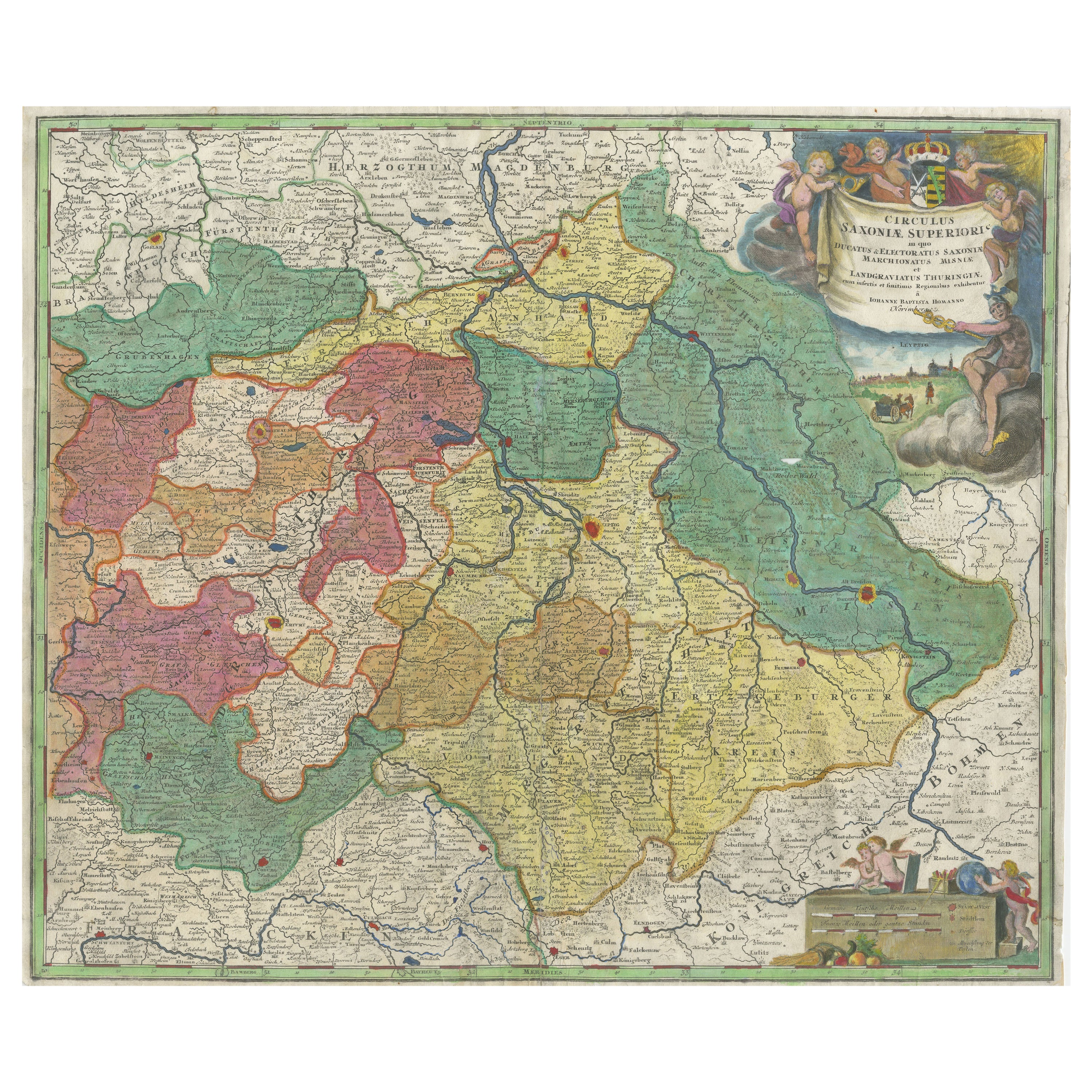
- Antique Map of Saxony, GermanyLocated in Langweer, NLOriginal antique map titled 'Circulus Saxoniae Superioris'. Original antique map of Saxony, Germany. The cities of Leipzig, Freiburg and many others are highlighted in gold. This map originates from 'Atlas Novus Terrarum Orbis...Category
Antique Early 18th Century Maps
MaterialsPaper
- Antique Map of Lower Saxony by Clouet, 1787Located in Langweer, NLAntique map titled 'Basse Saxe'. Antique map of Lower Saxony, Germany. Originates from 'Geographie moderne avec une introduction' by J.B.L. Clouet.Category
Antique Late 18th Century Maps
MaterialsPaper
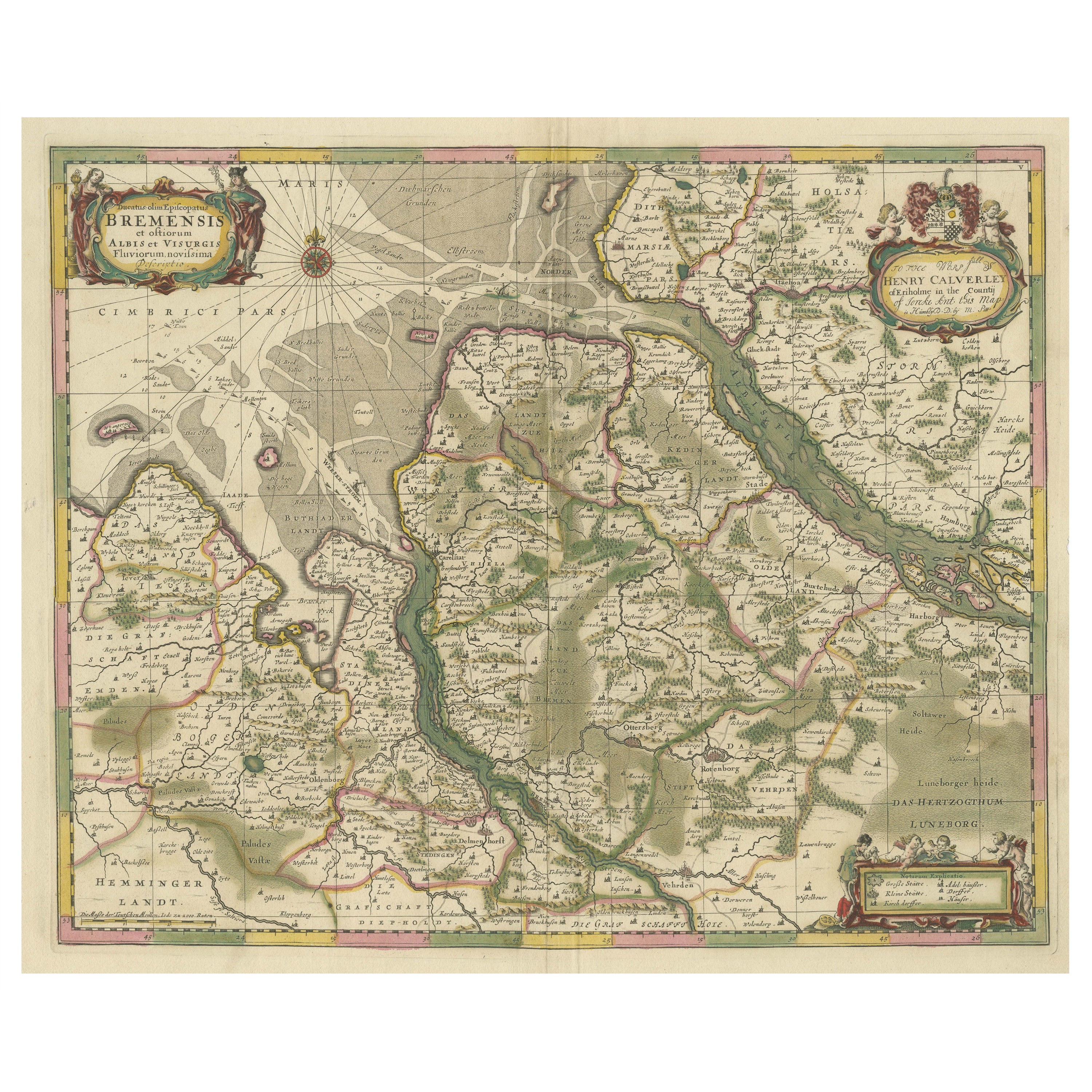
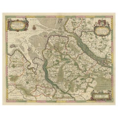
- Original Antique Map of the Area of Bremen and Lower SaxonyBy Johannes JanssoniusLocated in Langweer, NLAntique map titled 'Ducatus olim Episcopatus Bremensis et ostiorum Albis et Visurgis Fluviorum novissima Descriptio'. Original old map of the area of ??Bremen and Lower Saxony. Uncom...Category
Antique Mid-17th Century Maps
MaterialsPaper
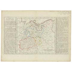
- Antique Map of Upper Saxony in Germany by Clouet, 1787Located in Langweer, NLAntique map titled 'Du Cercle de Haute Saxe'. Antique map of Upper Saxony, Germany. Originates from 'Geographie moderne avec une introduction' by J.B.L. Clouet.Category
Antique Late 18th Century Maps
MaterialsPaper
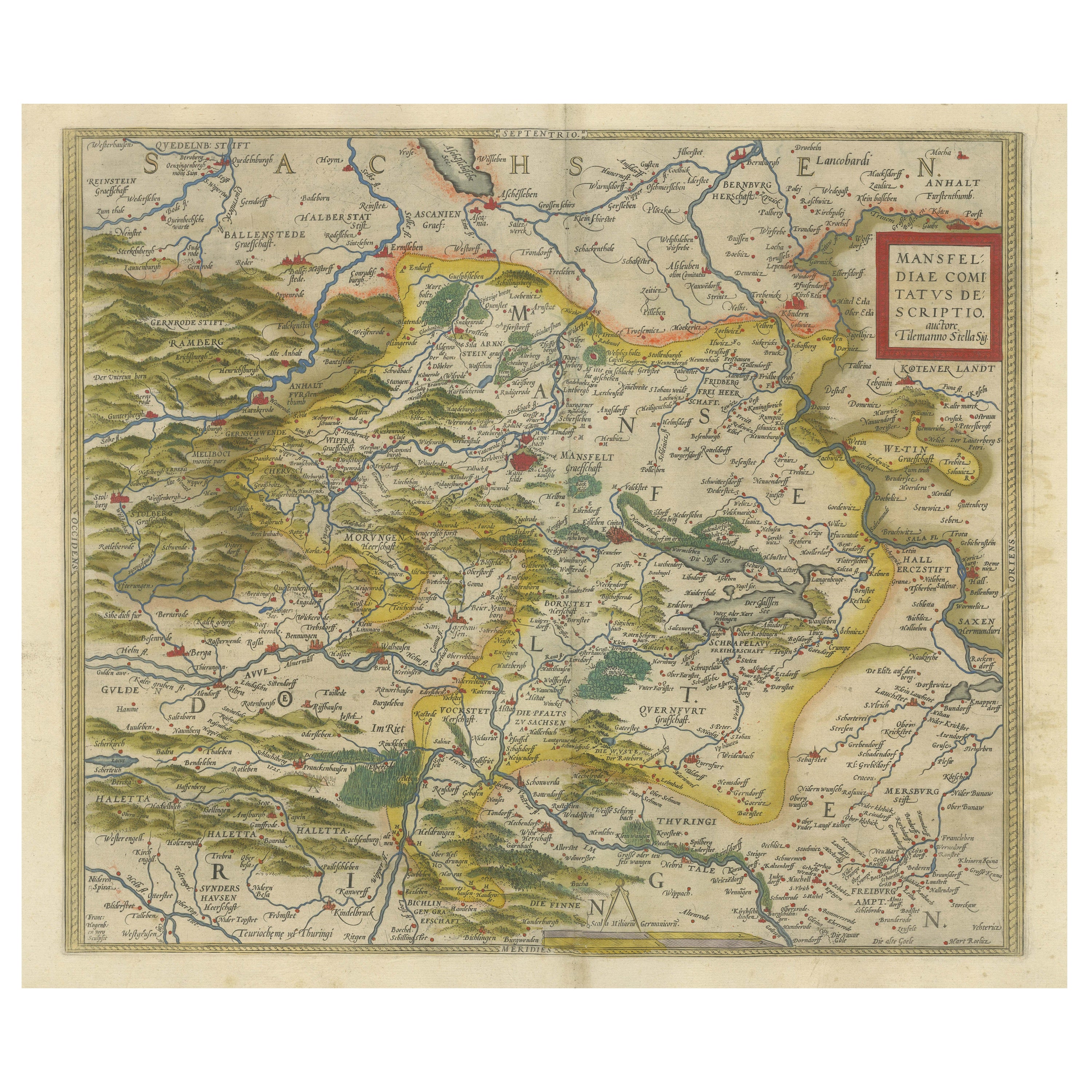
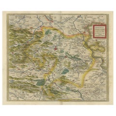
- Antique Map of the Region of Mansfeld, Saxony-Anhalt, GermanyBy Abraham OrteliusLocated in Langweer, NLAntique map titled 'Mansfeldiae Comitatus Descriptio'. Original antique map of the region of Mansfeld, Saxony-Anhalt, Germany. Shows the area between Halle a. d. Saale, Aschersleben,...Category
Antique Early 17th Century Maps
MaterialsPaper
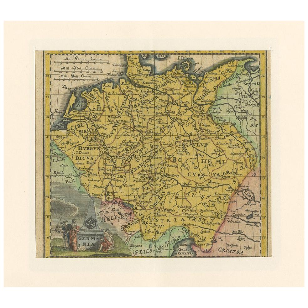
- Antique Map of Germany by Hederichs 'circa 1740'Located in Langweer, NLAntique map titled 'Germania'. Rare miniature map of Germany and surroundings. This map covers the entirety of those lands traditionally occupied by Germanic peoples, from the Blatic...Category
Antique Mid-18th Century Maps
MaterialsPaper

You May Also Like
- Antique Map of Principality of MonacoBy Antonio Vallardi EditoreLocated in Alessandria, PiemonteST/619 - "Old Geographical Atlas of Italy - Topographic map of ex-Principality of Monaco" - ediz Vallardi - Milano - A somewhat special edition ---Category
Antique Late 19th Century Italian Other Prints
MaterialsPaper
- Original Antique Map of Italy. C.1780Located in St Annes, LancashireGreat map of Italy Copper-plate engraving Published C.1780 Unframed.Category
Antique Early 1800s English Georgian Maps
MaterialsPaper

- Original Antique Map of Asia. C.1780Located in St Annes, LancashireGreat map of Asia Copper-plate engraving Published C.1780 Two small worm holes to right side of map Unframed.Category
Antique Early 1800s English Georgian Maps
MaterialsPaper

- Original Antique Map of India. C.1780Located in St Annes, LancashireGreat map of India Copper-plate engraving Published C.1780 Three small worm holes to right side of map and one bottom left corner Unframed.Category
Antique Early 1800s English Georgian Maps
MaterialsPaper

- 17th Century Hand-Colored Map of a Region in West Germany by JanssoniusBy Johannes JanssoniusLocated in Alamo, CAThis attractive highly detailed 17th century original hand-colored map is entitled "Archiepiscopatus Maghdeburgensis et Anhaltinus Ducatus cum terris adjacentibus". It was published ...Category
Antique Mid-17th Century Dutch Maps
MaterialsPaper
- Original Antique Map of Canada, Arrowsmith, 1820Located in St Annes, LancashireGreat map of Canada. Drawn under the direction of Arrowsmith. Copper-plate engraving. Published by Longman, Hurst, Rees, Orme and Brown, 1820 ...Category
Antique 1820s English Maps
MaterialsPaper


