Fine Antique Maps
12
to
70
422
189
323
240
110
99
88
62
62
61
42
40
32
32
24
24
18
17
16
13
9
9
8
7
7
7
6
6
5
5
5
5
4
4
4
4
3
3
3
3
3
3
2
2
2
2
2
1
1
1
1
17
16
12
5
5
Sort By
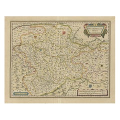
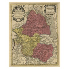
Antique Map of the Duchy of Westphalia, Germany
Located in Langweer, NL
Original antique map titled 'Westphalia Ducatus'. Fine map of the Duchy of Westphalia, Germany. The
Category
Mid-17th Century Fine Antique Maps
Materials
Paper
1640 Joan Bleau Map Entitled"Diocecese de rheims et le pais de rethel, " Eic.a011
Located in Norton, MA
BLAEU
Diocecese de Rheims, et le pais de Rethel.
Handcolored engraving, c.1640.
A fine map of the
Category
17th Century Dutch Fine Antique Maps
Materials
Paper
H 19.3 in W 23.63 in D 0.4 in
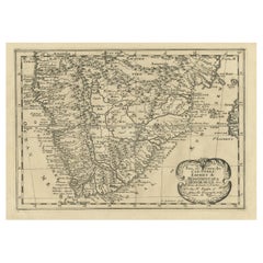
Original Copperplate Engraved Detailed Map of South Africa, ca.1680
Located in Langweer, NL
of his fine maps came to the attention of King Louis XIII who, admiring the quality of his work
Category
1680s Fine Antique Maps
Materials
Paper
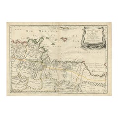
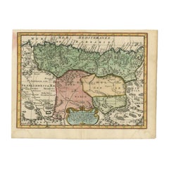
Rare Antique Map of 'Barbarie' or Northern Africa, 1655
Located in Langweer, NL
illustrate his historical studies. In the course of his research some of his fine maps came to the attention
Category
17th Century Fine Antique Maps
Materials
Paper
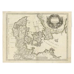
Antique Map of Denmark and Southern Sweden, c.1658
Located in Langweer, NL
as a way to illustrate his historical studies. In the course of his research some of his fine maps
Category
17th Century Fine Antique Maps
Materials
Paper
Antique Map of Barbary and Biledulgerid by Sanson, 1705
Located in Langweer, NL
illustrate his historical studies. In the course of his research some of his fine maps came to the attention
Category
18th Century Fine Antique Maps
Materials
Paper
Antique Map of the Holy Land Described in the Old and New Testament, ca.1660
Located in Langweer, NL
illustrate his historical studies. In the course of his research some of his fine maps came to the attention
Category
1660s Fine Antique Maps
Materials
Paper
No Reserve
H 16.15 in W 21.46 in D 0 in
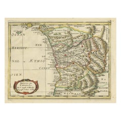
Antique Map of Gabon, Angola and the Congo Region in Africa c.1680
Located in Langweer, NL
illustrate his historical studies. In the course of his research some of his Fine maps came to the attention
Category
17th Century Fine Antique Maps
Materials
Paper
Free Shipping
H 9.65 in W 14.57 in D 0 in
Detailed Antique Map of the Province of Overijssel in the Netherlands, ca.1700
Located in Langweer, NL
studies. In the course of his research some of his fine maps came to the attention of King Louis XIII who
Category
Early 1700s Fine Antique Maps
Materials
Paper
H 24.57 in W 19.69 in D 0 in
Fine French Antique 1856 Hand Watercolour Map of Dept Des Hautes Pyrenees
Located in GB
We are delighted to offer for sale this stunning 1856 hand watercolour map of the Austrian Alps
Category
1850s French Early Victorian Fine Antique Maps
Materials
Paper
H 16.34 in W 21.46 in D 0.99 in
Fine Antique 1856 Hand Watercolour Map of Dept Des Hautes Alpes by Levasseur's
Located in GB
We are delighted to offer for sale this stunning 1856 hand watercolour map of the Austrian Alps
Category
1850s French Early Victorian Fine Antique Maps
Materials
Paper
H 16.34 in W 21.46 in D 0.99 in
1844 Map "Russia in Eurpoe, Part II to Part VIII", 7 Maps Ric.r023
Located in Norton, MA
1844 Map "Russia in Eurpoe, Part II to Part VIII"
7 Maps
Ric.r023
Fine, original, steel
Category
19th Century Unknown Fine Antique Maps
Materials
Paper
1812 United States Map, by Pierre Tardieu, Antique French Map Depicting the U.S.
By Pierre François Tardieu
Located in Colorado Springs, CO
fine works including maps of Louisiana, Mexico, Russia, and Asia in addition to his illustrations of
Category
1810s French Fine Antique Maps
Materials
Paper
H 43.5 in W 48 in D 2.25 in
A Decorative Detailed Map of the Crimea, with an Inset Map of Sebastopol, c 1851
Located in Langweer, NL
from 1849 to 1853, was the last decorative world atlas. 'The Crimea' map was typical of the many fine
Category
1850s Fine Antique Maps
Materials
Paper
H 10.83 in W 14.18 in D 0 in
Antique Map of the Ancient Greek Colonization
Located in Langweer, NL
Antique map titled 'Map I containing the Western Division of the Grecian Colonies & Conquests
Category
Late 18th Century Fine Antique Maps
Materials
Paper
Antique Map of Silesia centered on Glogau
Located in Langweer, NL
especially ornate coat of arms and a key to the symbols used in the map. At bottom right is a fine scale of
Category
Mid-17th Century Fine Antique Maps
Materials
Paper
Decorative Original Antique Map of Normandy, France
Located in Langweer, NL
Original antique map titled 'Ducato D'Normandie Scala di Miglia d'Italia'. Very decorative map of
Category
Late 17th Century Fine Antique Maps
Materials
Paper
1851 Map of "Independent Tartary", Ric. R018
Located in Norton, MA
.
Tartary Antique Map Tartaria Russia by Tallis Rakin 1851
Title: Independent Tartarie
Description: Fine
Category
19th Century Unknown Fine Antique Maps
Materials
Paper
Antique Map of Smallingerland by Kuyper, 1868
Located in Langweer, NL
Antique map titled 'Provincie Friesland - Gemeente Smallingerland'. Map of the township of
Category
19th Century Fine Antique Maps
Materials
Paper
Antique Map of Ooststellingwerf by Kuyper, 1868
Located in Langweer, NL
Antique map titled 'Provincie Friesland - Gemeente Oost-Stellingwerf'. Map of the township of
Category
19th Century Fine Antique Maps
Materials
Paper
Antique Map of Oostdongeradeel by Kuyper, 1868
Located in Langweer, NL
Antique map titled 'Provincie Friesland - Gemeente Oost Dongeradeel'. Map of the township of
Category
19th Century Fine Antique Maps
Materials
Paper
Antique Map of the Baarderadeel Township, 1718
Located in Langweer, NL
Antique map Friesland titled 'Baardera Deel de Vierde Grietenije van Wester Goo (..)'. Old map of
Category
18th Century Fine Antique Maps
Materials
Paper
Antique Lithography Map, Buckinghamshire, English, Framed Cartography, Victorian
Located in Hele, Devon, GB
quality antique lithography map of Buckinghamshire, with fine cartographic interest. Delivered ready to
Category
Mid-19th Century British Victorian Fine Antique Maps
Materials
Wood, Paper
H 16.15 in W 13.19 in D 0.6 in
Antique Lithography Map, Bedfordshire, English, Framed Engraving, Cartography
Located in Hele, Devon, GB
antique lithography map of Bedfordshire, with fine cartographic interest. Delivered ready to display
Category
Mid-19th Century British Victorian Fine Antique Maps
Materials
Wood
H 15.75 in W 13.19 in D 0.6 in
Antique Lithography Map, Hertfordshire, English, Framed Engraving, Cartography
Located in Hele, Devon, GB
antique lithography map of Hertfordshire, with fine cartographic interest. Delivered ready to display
Category
Mid-19th Century British Victorian Fine Antique Maps
Materials
Wood
H 13.59 in W 15.75 in D 16.34 in
Antique Lithography Map, Lincolnshire, English, Framed, Engraving, Cartography
Located in Hele, Devon, GB
antique lithography map of Lincolnshire, with fine cartographic interest. Delivered ready to display
Category
Mid-19th Century British Victorian Fine Antique Maps
Materials
Wood
H 15.95 in W 13.39 in D 0.6 in
Antique Lithography Map, Gloucestershire, English, Framed Engraving, Cartography
Located in Hele, Devon, GB
antique lithography map of Gloucestershire, with fine cartographic interest. Delivered ready to display
Category
Mid-19th Century British Victorian Fine Antique Maps
Materials
Wood
H 15.75 in W 13 in D 0.6 in
Antique Lithography Map, Northumberland, English, Framed, Engraving, Cartography
Located in Hele, Devon, GB
antique lithography map of Northumberland, with fine cartographic interest. Delivered ready to display
Category
Mid-19th Century British Victorian Fine Antique Maps
Materials
Wood
H 16.74 in W 13.98 in D 0.6 in
Antique Decorative Coloured Map of North America, 1882
Located in Langweer, NL
This original antique map of North America is from the Blackie & Son Atlas published in 1882. Here
Category
1880s Fine Antique Maps
Materials
Paper
Antique Lithography Map, Worcestershire, English, Framed Engraving, Cartography
Located in Hele, Devon, GB
quality antique lithography map of Worcestershire, with fine cartographic interest. Delivered ready to
Category
Early 19th Century British Regency Fine Antique Maps
Materials
Wood
H 15.95 in W 13.19 in D 0.6 in
Antique Map of of Brazil, Paraguay and Uruguay
Located in Langweer, NL
Antique map titled 'Bresil Paraguay et Uruguay'. Fine steel engraved map of Brazil, Paraguay and
Category
Mid-19th Century Fine Antique Maps
Materials
Paper
Antique Map of Dantumadeel, Friesland, The Netherlands, 1868
Located in Langweer, NL
Antique map titled 'Provincie Friesland - Gemeente Dantumadeel'. Map of the township of Dantumadeel
Category
19th Century Fine Antique Maps
Materials
Paper
Antique Map of Java by Janssonius, circa 1650
Located in Langweer, NL
Antique map titled 'Insulae Iavae cum parte insularum Borneo Sumatrae, et circumjacentium insularum
Category
Mid-17th Century Fine Antique Maps
Materials
Paper
Antique Map of Siberia and Russia, c.1885
Located in Langweer, NL
Antique map titled 'Siberie ou Russie d?Asie'. This is a fine example of J. Migeon's map of Russia
Category
19th Century Fine Antique Maps
Materials
Paper
17th Century Nicolas Visscher Map of Southeastern Europe
Located in Hamilton, Ontario
A beautiful, highly detailed map of southeastern Europe by Nicolas Visscher. Includes regions of
Category
17th Century Dutch Fine Antique Maps
Materials
Paper
Antique County Map, Norfolk, English, Framed Lithography, Cartography, Victorian
Located in Hele, Devon, GB
lithography map of Norfolk, with fine cartographic interest. Delivered ready to display.
Dimensions:
Max
Category
Mid-19th Century British Victorian Fine Antique Maps
Materials
Glass, Wood
H 14.57 in W 16.93 in D 0.6 in
Antique County Map, Rutlandshire, English, Framed, Cartography, Victorian, 1860
Located in Hele, Devon, GB
antique lithography map of Rutlandshire, with fine cartographic interest. Delivered ready to display
Category
Mid-19th Century British Victorian Fine Antique Maps
Materials
Wood
H 15.75 in W 13.19 in D 0.6 in
Antique Lithography Map, County Durham, English, Framed Cartography, Victorian
Located in Hele, Devon, GB
lithography map of County Durham, with fine cartographic interest. Delivered ready to display.
Dimensions
Category
Mid-19th Century British Mid-Century Modern Fine Antique Maps
Materials
Wood
H 13.98 in W 16.15 in D 0.6 in
Antique Map of Europe by R. Bonne, 1780
Located in Langweer, NL
A fine example of Rigobert Bonne and Guilleme Raynal’s 1780 map of Europe. Drawn by R. Bonne for G
Category
Late 18th Century Fine Antique Maps
Materials
Paper
Antique Lithography Map, Northamptonshire, English, Framed Cartography, C.1860
Located in Hele, Devon, GB
quality antique lithography map of Northamptonshire, with fine cartographic interest. Delivered ready to
Category
Mid-19th Century British Victorian Fine Antique Maps
Materials
Wood
H 15.95 in W 13.19 in D 0.6 in
Antique Map of Northern India by Bonne, 1780
Located in Langweer, NL
Antique map titled 'Carte de la partie Supérieure de l'Inde (..)'. A fine example of Rigobert Bonne
Category
18th Century Fine Antique Maps
Materials
Paper
Antique Lithography Map, Cumbria, English, Framed Cartography Interest, Georgian
Located in Hele, Devon, GB
map of Cumbria, with fine cartographic interest. Delivered ready to display.
Dimensions:
Max Width
Category
Early 18th Century British Georgian Fine Antique Maps
Materials
Wood
H 21.86 in W 25.2 in D 0.79 in
Antique Lithography Map, Western Russia, English, Framed, Cartography, Victorian
Located in Hele, Devon, GB
quality antique lithography map of Western Russia, with fine cartographic interest. Delivered ready to
Category
Mid-19th Century British Early Victorian Fine Antique Maps
Materials
Wood
H 21.46 in W 17.33 in D 0.6 in
Antique Lithography Map, West Africa, English, Framed, Cartography, Victorian
Located in Hele, Devon, GB
quality antique lithography map of Western Africa, with fine cartographic interest. Delivered ready to
Category
Mid-19th Century British Early Victorian Fine Antique Maps
Materials
Wood
H 17.52 in W 19.89 in D 0.79 in
Antique Lithography Map, Durham, English, Framed, Cartography, Early Georgian
Located in Hele, Devon, GB
This is a quality antique lithography map of Durham, with fine cartographic interest. Delivered ready
Category
Early 18th Century British Georgian Fine Antique Maps
Materials
Wood
H 20.28 in W 21.86 in D 0.6 in
Antique Lithography Map, Black Sea, English, Framed, Cartography, Victorian
Located in Hele, Devon, GB
antique lithography map of the Black Sea region, with fine cartographic interest. Delivered ready to
Category
Mid-19th Century British Early Victorian Fine Antique Maps
Materials
Wood
H 17.72 in W 20.48 in D 0.79 in
Antique Lithography Map, South America, English, Framed, Cartography, Victorian
Located in Hele, Devon, GB
ease of mounting
This is a quality antique lithography map of South America, with fine cartographic
Category
Mid-19th Century British Early Victorian Fine Antique Maps
Materials
Wood
H 21.86 in W 17.13 in D 0.79 in
Original 1882 Map of Arabia, Red Sea & Persian Gulf
Located in Langweer, NL
This print is a historically significant map titled "Arabia, the Red Sea, and the Persian Gulf
Category
1880s Fine Antique Maps
Materials
Paper
Antique Map of Ijlst , Friesland in the Netherlands, 1865
Located in Langweer, NL
Friesland: Gemeente IjJlst. These scarse detailed maps of Dutch Towns originate from the 'Gemeente
Category
19th Century Fine Antique Maps
Materials
Paper
Old Map of the French Department of Ardèche, France
By Victor Levasseur
Located in Langweer, NL
Antique map titled 'Dépt. de l'Ardèche'. Map of the Department of Ardèche, France. This region is
Category
Mid-19th Century Fine Antique Maps
Materials
Paper
Antique Map of Greece by J. Jansson, circa 1653
Located in Langweer, NL
8 sheet work by Nikolaos Sophianos, published in 1540. The map presents a fine distinction of the
Category
Mid-17th Century Fine Antique Maps
Materials
Paper
Antique Map of Persia, Georgia and Kazakhstan, ca.1780
Located in Langweer, NL
Antique map titled 'Carte de la Perse, de la Georgie, et de la Tartarie Independante'.
Map of
Category
1780s Fine Antique Maps
Materials
Paper
Antique Map of Calvados ‘France’ by V. Levasseur, 1854
By Victor Levasseur
Located in Langweer, NL
Antique map titled 'Dépt. du Calvados'. Map of the French department of Calvados, France. This area
Category
Mid-19th Century Fine Antique Maps
Materials
Paper
Antique Map of Ain ‘France’ by V. Levasseur, 1854
By Victor Levasseur
Located in Langweer, NL
Antique map titled 'Dépt. de l'Ain'. Map of the French department of l'Ain, France. This area of
Category
Mid-19th Century Fine Antique Maps
Materials
Paper
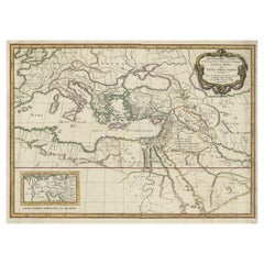
Large Decorative Antique Map of the Mediterranean, ca.1770
Located in Langweer, NL
fine engraved double-page and folding maps that join to create a large wall map of the Mediterranean
Category
1770s Fine Antique Maps
Materials
Paper
Antique Map of Batavia 'Jakarta, Indonesia' by Montanus, 1679
Located in Langweer, NL
Fine early plan of Batavia (Jakarta), published by Arnoldus Montanus. This map has a vignette at
Category
Late 17th Century Unknown Fine Antique Maps
Materials
Paper
Antique Map of Tarn and Garonne in France, 1854
By Victor Levasseur
Located in Langweer, NL
, France. This map is centered around the city of Moissac, which is known for its fine desert grapes. This
Category
Mid-19th Century Fine Antique Maps
Materials
Paper
Rare Map of Dutch Municipality Noorddijk Near Groningen, 1865
Located in Langweer, NL
border coloured maps.
Condition: Fine; occasional foxing as visible on the scans; sheet irregularly cut
Category
19th Century Fine Antique Maps
Materials
Paper
Antique Map of Asia by A. Blondeau, circa 1800
Located in Langweer, NL
This is a fine circa 1800 map of Asia by Alexandre Blondeau. It covers the entire continent from
Category
Early 19th Century Fine Antique Maps
Materials
Paper
Antique Map of North Africa by Ortelius, c.1580
Located in Langweer, NL
Antique map titled 'Barbariae et Biledulgerid Nova Descriptio'. Original antique map of North
Category
16th Century Fine Antique Maps
Materials
Paper
- 1
Get Updated with New Arrivals
Save "Fine Antique Maps", and we’ll notify you when there are new listings in this category.
Fine Antique Maps For Sale on 1stDibs
At 1stDibs, there are several options of fine antique maps available for sale. The range of distinct fine antique maps — often made from paper, wood and metal — can elevate any home. Fine antique maps have been made for many years, and versions that date back to the 18th Century alongside those produced as recently as the 20th Century. Fine antique maps are generally popular furniture pieces, but Baroque, Victorian and Georgian styles are often sought at 1stDibs. There have been many well-made fine antique maps over the years, but those made by Victor Levasseur, Jacques-Nicolas Bellin and Henry George Keller are often thought to be among the most beautiful.
How Much are Fine Antique Maps?
The average selling price for at 1stDibs is $737, while they’re typically $82 on the low end and $275,000 highest priced.
More Ways To Browse
Les Scala
Map Of Jerusalem Antique
Bulgaria Antique Map
Croatia Antique Map
Antique Map Of Cyprus
Le Bouton
Royal Worcester Evesham
Map Of Alps
Dom Perignon Champagne
Antique Map Bali
Antique Curiosities North Carolina
Map Alps
Antique Water Wagon
Cyprus Antique Maps
Ortelius Map Italy
Oxford Kent
Antique South Carolina Maps
Chinese Wall Pocket
