Items Similar to 1844 Map "Russia in Eurpoe, Part II to Part VIII", 7 Maps Ric.r023
Want more images or videos?
Request additional images or videos from the seller
1 of 10
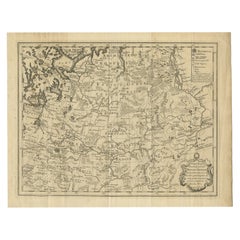
1844 Map "Russia in Eurpoe, Part II to Part VIII", 7 Maps Ric.r023
About the Item
1844 Map "Russia in Eurpoe, Part II to Part VIII"
7 Maps
Ric.r023
Fine, original, steel-engraved Map of Russia in Europe Part II t oPart VIII, by the Society for the Diffusion of Useful Knowledge. Detailed map of the regions to the northeast of Moscow. Including Arkhangel, Vologda, Viatka, Perm, Olonetz, Iaroslavl. The SDUK began its map publishing project under the leadership of Captain Francis Beaufort R.N. in 1829, and published the maps in parts, haltingly, over the next 15 years, completing the series in 1844, finally permitting the publication of a whole atlas. Many of the maps were actually drawn by Beaufort, who at the time was the Hydrographer to the Royal Navy, and all were closely supervised by him. J. & C. Walker worked closely with Beaufort in engraving the maps. Finely engraved, carefully researched, the maps set a standard of excellence for commercial map-makers in England for decades to come.
Dimension: Paper: 44 cm W x 36 cm H ; Sight: 40 cm W x 31cm H.
Condition: Good Condition, please see photos.
- Dimensions:Height: 14.18 in (36 cm)Width: 17.33 in (44 cm)Depth: 0.4 in (1 cm)
- Materials and Techniques:
- Place of Origin:
- Period:
- Date of Manufacture:1844
- Condition:
- Seller Location:Norton, MA
- Reference Number:1stDibs: LU5848230268762
About the Seller
5.0
Platinum Seller
These expertly vetted sellers are 1stDibs' most experienced sellers and are rated highest by our customers.
Established in 2000
1stDibs seller since 2021
85 sales on 1stDibs
Typical response time: <1 hour
- ShippingRetrieving quote...Ships From: Norton, MA
- Return PolicyA return for this item may be initiated within 3 days of delivery.
More From This SellerView All
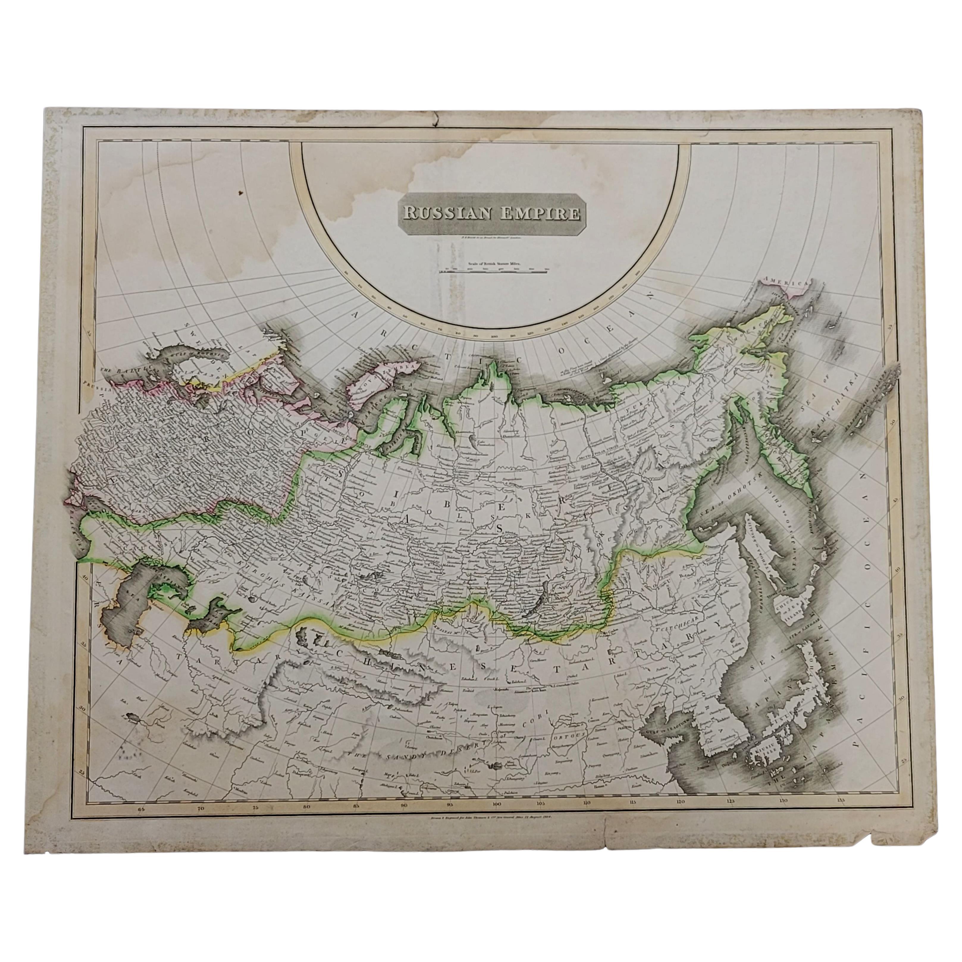
- 1814 Map of "Russian Empire" Ric.r032Located in Norton, MA1814 Map of "Russian Empire" Ric.r032 Russian Empire. Description: This is an 1814 John Thomson map of the Russian Empire. The map depicts the region from the Baltic Sea, Prussia, and Sweden to the Aleutian Islands and from the Arctic Ocean to the Yellow River. Highly detailed, myriad cities, towns, and villages are labeled throughout, including St. Petersburg, Moscow, Minsk, Kiev, and Kharkov. Rivers and mountain ranges are also identified, as are islands and numerous locations along the coastlines. It is important to note that the long-disputed sea between Korea and Japan is identified as the 'Sea of Japan. Historical Context: In 1815, Tsarist Russia emerged from the Napoleonic Wars economically insolvent and politically fearful of the Revolutionary fervor that had just swept through Europe. In order to shore up Russia's economic position, the Tsars began an aggressive series of expansions into the Caucuses and Central Asia that would vastly increase the landmass of the Russian Empire. Publication History Thomson maps are known for their stunning color, awe inspiring size, and magnificent detail. Thomson's work, including this map, represents some of the finest cartographic art...Category
Antique 19th Century Unknown Maps
MaterialsPaper
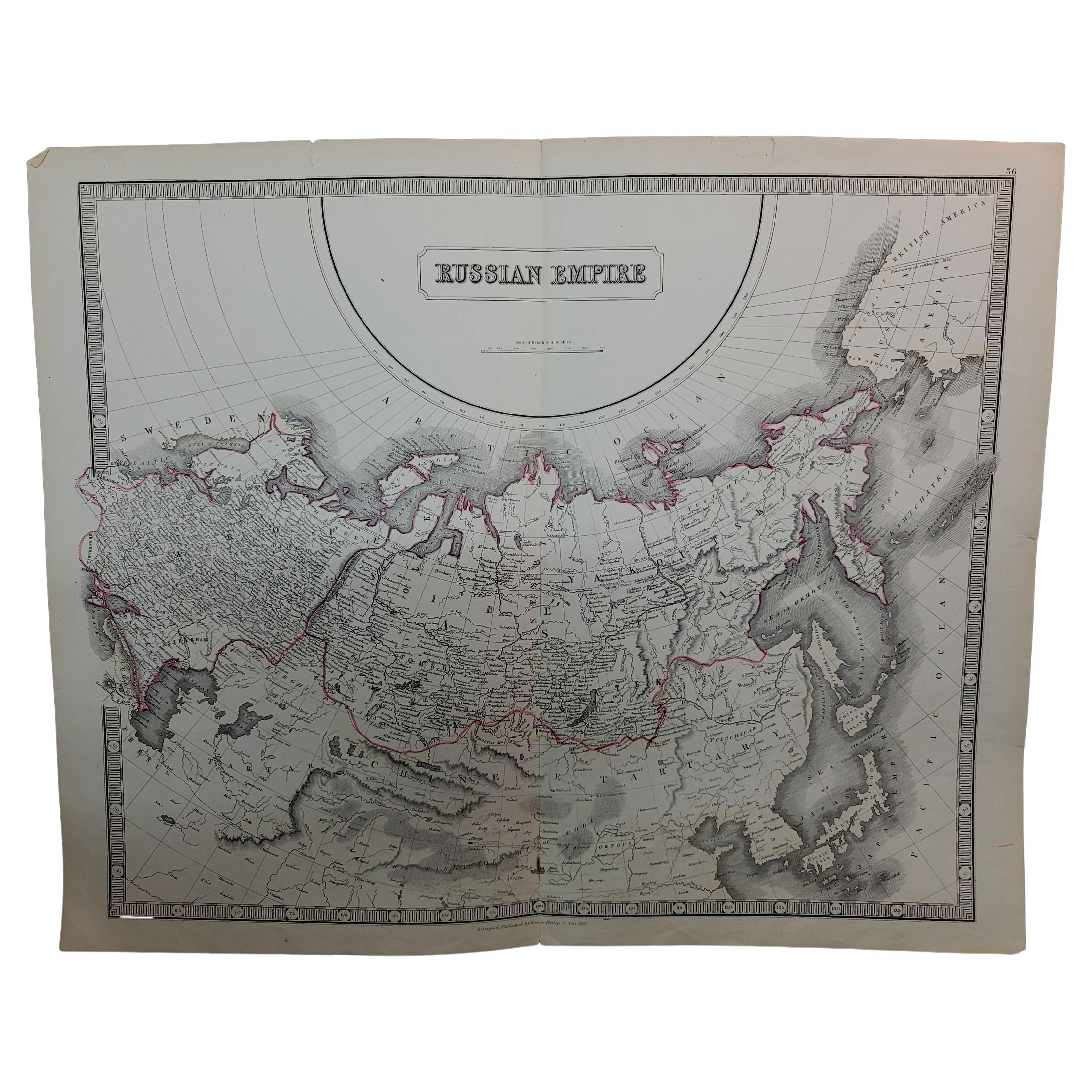
- Large1852 Map "Russian Empire" Ric.r0011Located in Norton, MALarge 1852 map "Russian Empire" George Phillips & Son 1852 Ric.r0011 Dimension: Paper: 67 cm W x 52 cm H ; Sight: 60cm W x 50 cm H Condition: Good Condition with aged tonin...Category
Antique 19th Century Unknown Maps
MaterialsPaper
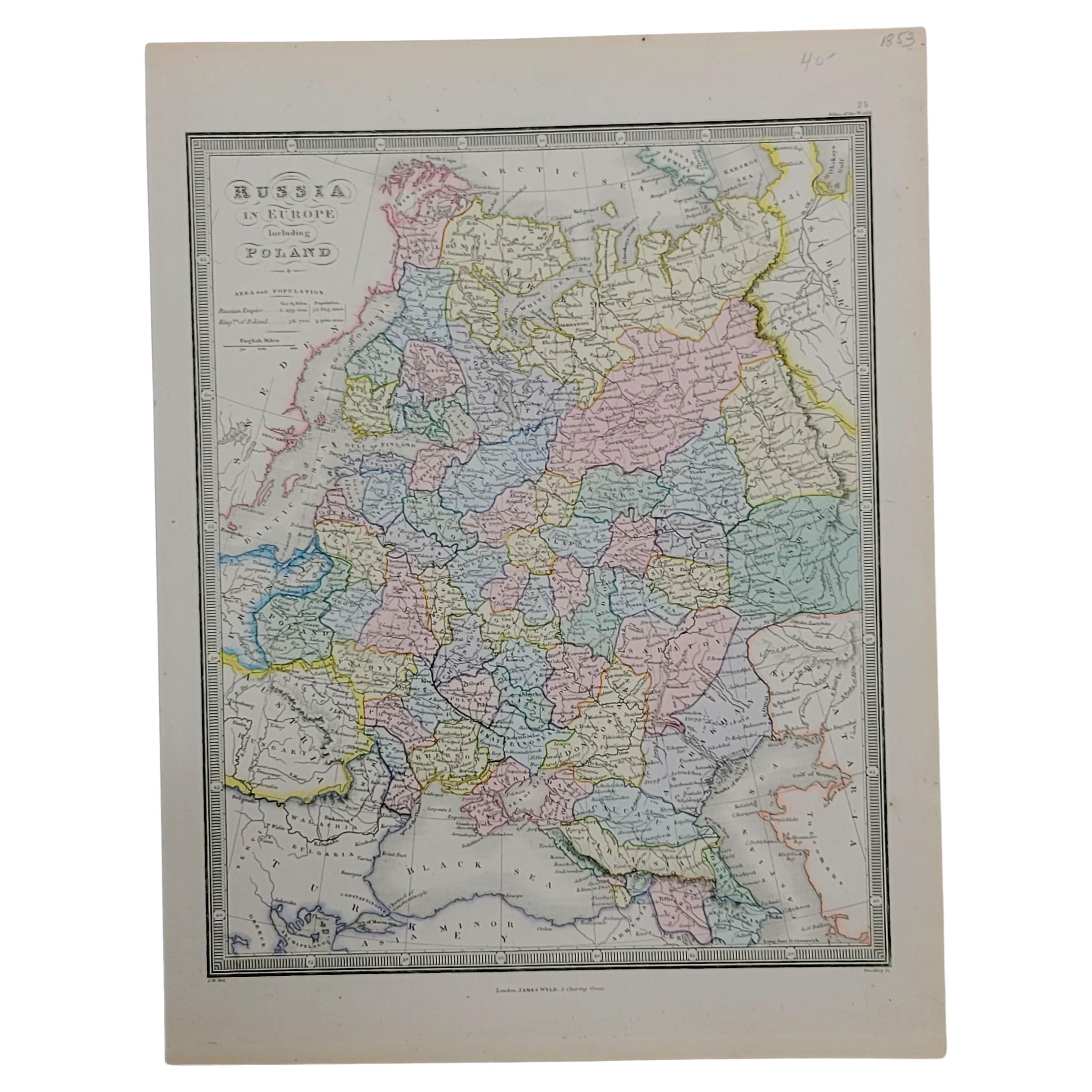
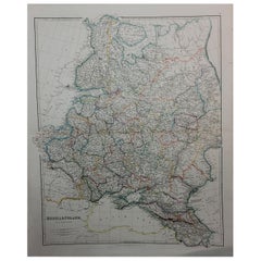
- 1853 Map of "Russia in Europe Including Poland" Ric.r016Located in Norton, MADescription Russia in Europe incl. Poland by J Wyld c.1853 Hand coloured steel engraving Dimension: Paper: 25 cm W x 33 cm H ; Sight: 22 cm W x 28 cm H Condition: Good ...Category
Antique 19th Century Unknown Maps
MaterialsPaper
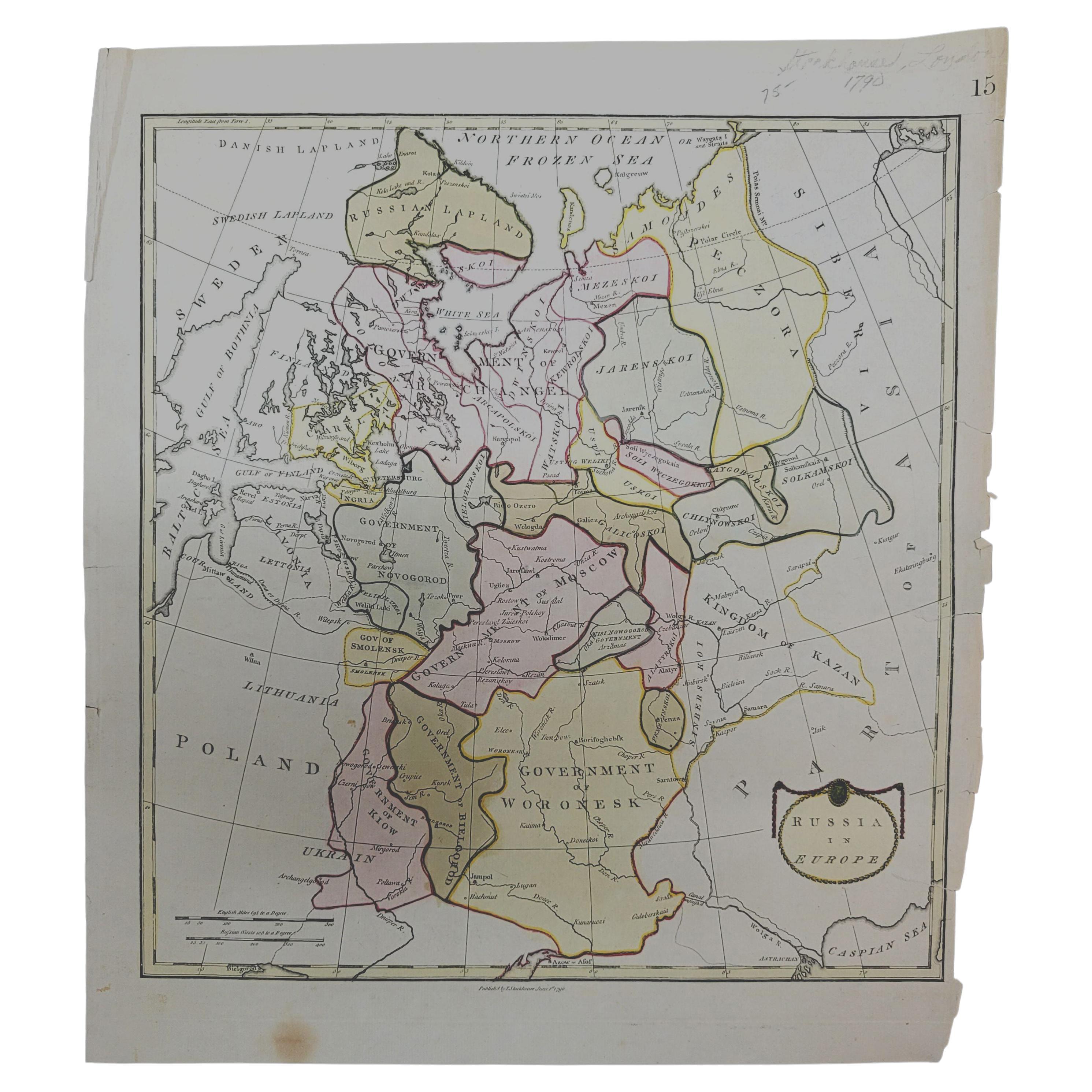
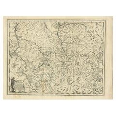
- 1790 Thomas Stackhouse Map, Entitled "Russia in Europe, " , Ric.a004Located in Norton, MA1790 Thomas Stackhouse map, entitled "Russia in Europe" Ric.a004 Stackhouse, Thomas Russia in Europe [map] London: T. Stackhouse, 1783. Map. Matted hand-colored copper engraving. Image size: 14.5 x 15.25 inches. Mat size: 22.75 x 23.75 inches. A beautiful example of this map of Eastern Europe...Category
Antique 17th Century Unknown Maps
MaterialsPaper
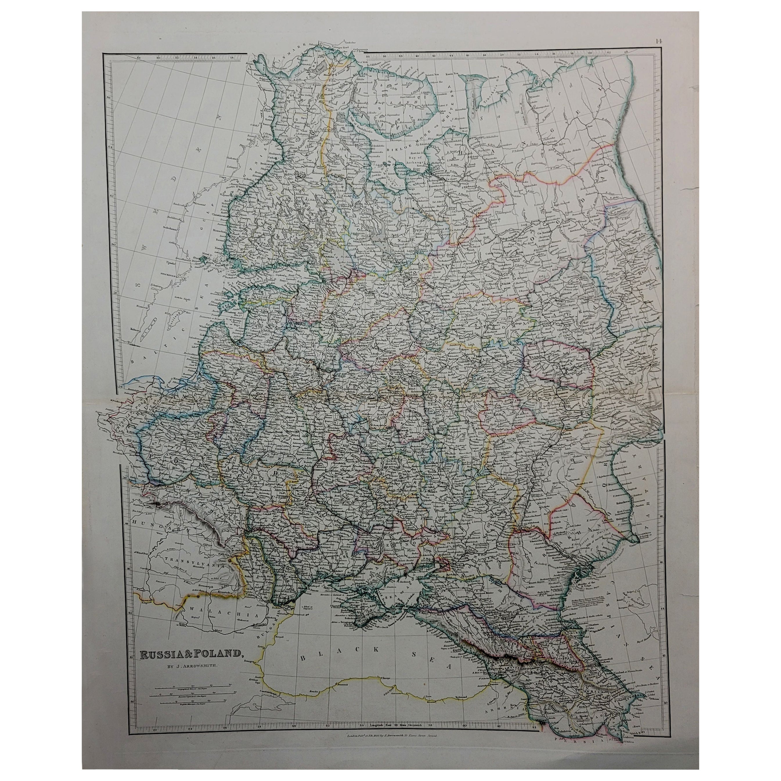
- 1832 Large Map "Russian & Poland" Ric. R0012Located in Norton, MALarge map 1832 "Russian & Poland" Ric.r0012 Russia & Poland, by J. Arrowsmith. London, pubd. 15 Feby. 1832 by J. Arrowsmith, 35 Essex Street, Strand., ...Category
Antique 19th Century Unknown Maps
MaterialsPaper
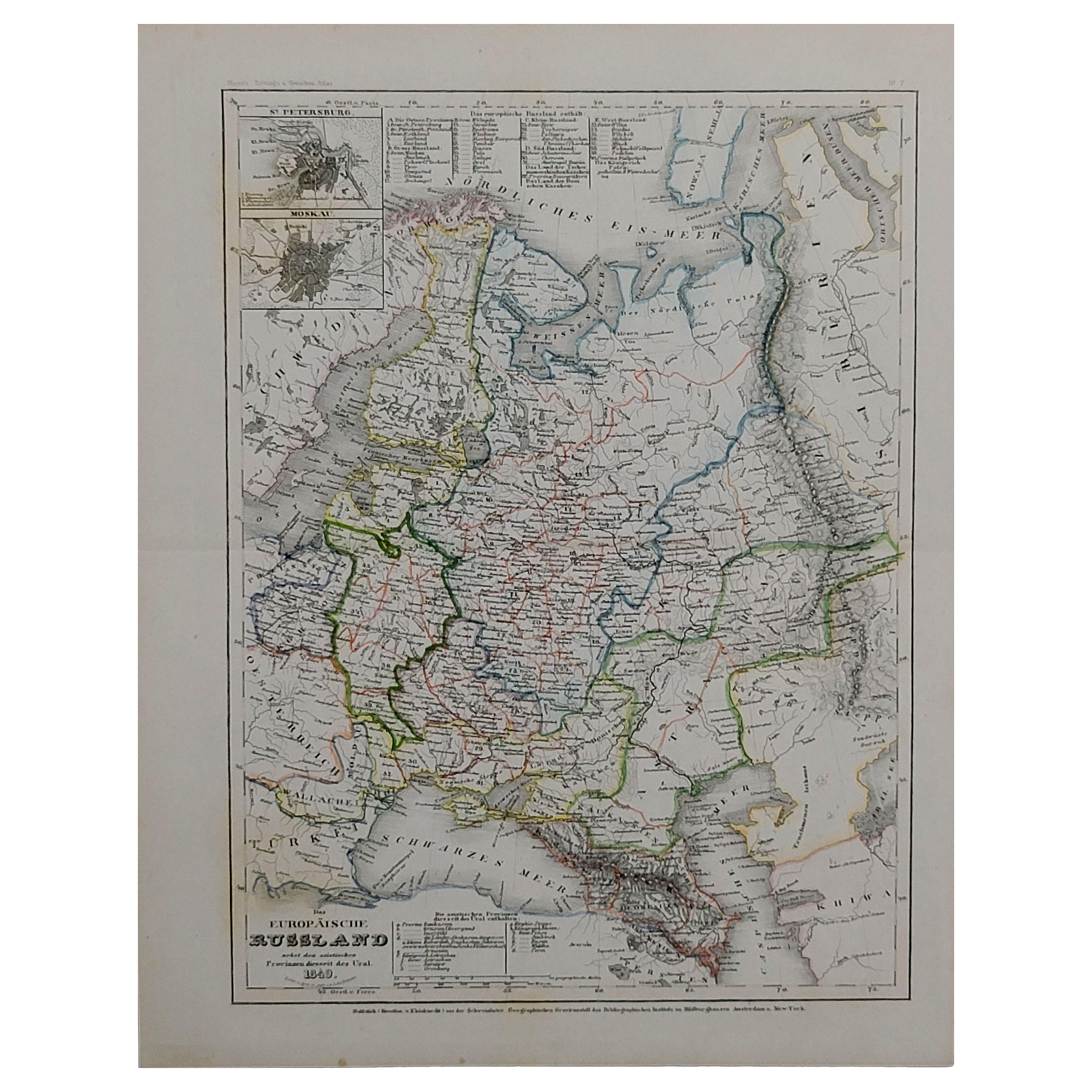
- 1849 Map of "Europaische Russland", 'Meyer Map of European Russia', Ric. R017Located in Norton, MA1849 Map of "Europaische Russland" ( Meyer Map of European Russia) Ric.r017 A lovely map of European Russia dating to 1849 by Joseph Meyer. It covers the European portions of...Category
Antique 19th Century Unknown Maps
MaterialsPaper


You May Also Like
- Antique Map of Part of Russia, c.1740Located in Langweer, NLAntique map titled 'Ienisensis Provinicia cum adjacentibus Toboliensis & Irkutensis'. Old map of part of Russia including the city of Tobolsk and others. Source unknown, to be determ...Category
Antique 18th Century Maps
MaterialsPaper
- Antique Map of Part of Russia by Spyk, c.1740Located in Langweer, NLAntique map titled 'Mappa Geogr: Continens partem Russici Imperii (..)'. Old map of part of Russia including the city of Moscow, Vologda, Tobolsk and others. Source unknown, to be de...Category
Antique 18th Century Maps
MaterialsPaper
- Original Antique Map of the Northwestern Part of Russia in Europe, 1753Located in Langweer, NLAntique map titled 'Partie septentrionale de la Russie Européenne'. Detailed map of the Northwestern part of Russia, from the Gulf of Finland and Poland, to the western part of Asian Russia. Artists and Engravers: Gilles Robert de Vaugondy (1688-1766) was the head of a leading family of geographers in eighteenth century France. Gilles got his start when he jointly inherited the shop of Pierre-Moullart Sanson, grandson of the famous geographer Nicholas Sanson. The inheritance included the business, its stock of plates, and a roller press...Category
Antique 1750s Maps
MaterialsPaper
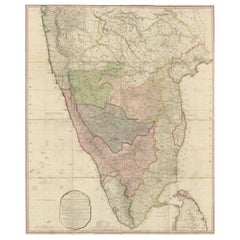
- Original Antique Map of the Peninsula of India with Part of Ceylon by Wyld, 1844Located in Langweer, NLThis extensive map of India, spanning two sheets, draws from Reynell’s original map and incorporates data provided by Sir Archibald Campbell, as well as surveys conducted by Colonel ...Category
Antique Mid-18th Century Maps
MaterialsPaper
- Uncommon Old Map of Lapland to Russia and Denmark to Kazan in the South, 1785Located in Langweer, NLDescription: Antique map titled 'Kaart van het Noorderdeel van Europa, Bevattende Deenmarken, Noorwegen, Zweden, Lapland en het Grootste Gedeelte van Europeesch Rusland.' This un...Category
Antique 1780s Maps
MaterialsPaper
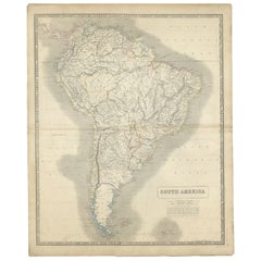
- Antique Map of South America by Johnston, 1844Located in Langweer, NLAntitique map titled 'South America'. Beautiful original antique map of South America. This map originates from 'The National Atlas of His...Category
Antique 19th Century Maps
MaterialsPaper

Recently Viewed
View AllMore Ways To Browse
Antique Navy Paint
Moscow Map
Map Of Moscow
Engraving Navy
J C Walker Map
Antique Texas Collectables
Antique Furniture Alexandria
Victorian Fence
Alexandria Antique Furniture
Battle Maps
Antique Malaysia
Russian Antique Plates
Antique Railroad Collectables
Antique Railroad Collectibles
Floor Vase Wood
Antique Railroad Collectibles Collectibles
Mariner Furniture
Map Print Set