Items Similar to Uncommon Old Map of Lapland to Russia and Denmark to Kazan in the South, 1785
Want more images or videos?
Request additional images or videos from the seller
1 of 5
Uncommon Old Map of Lapland to Russia and Denmark to Kazan in the South, 1785
About the Item
Description: Antique map titled 'Kaart van het Noorderdeel van Europa, Bevattende Deenmarken, Noorwegen, Zweden, Lapland en het Grootste Gedeelte van Europeesch Rusland.'
This uncommon Dutch edition of Bonne's map of Northern Europe covers the region from Lapland to Russia in the north and Denmark to Kazan in the south. Six distance scales balance the decorative title. Source unknown, to be determined.
Artists and Engravers: Made by 'Rigobert Bonne' after an anonymous artist. Rigobert Bonne, (1727 - 1795), was one of the most important cartographers of the late 18th century. He succeeded Jacques Nicolas Bellin as Royal Cartographer to France in the office of the Hydrographer at the French Depôt de la Marine. Engraved by Gaspard Andre.
Condition: Good, given age. Soft horizontal crease in the top of the sheet. Original folds as issued. General age-related toning and/or occasional minor defects from handling. Please study image carefully.
- Dimensions:Height: 10.04 in (25.5 cm)Width: 14.73 in (37.4 cm)Depth: 0 in (0.02 mm)
- Materials and Techniques:
- Period:1780-1789
- Date of Manufacture:1785
- Condition:
- Seller Location:Langweer, NL
- Reference Number:
About the Seller
5.0
Platinum Seller
These expertly vetted sellers are 1stDibs' most experienced sellers and are rated highest by our customers.
Established in 2009
1stDibs seller since 2017
1,928 sales on 1stDibs
Typical response time: <1 hour
- ShippingRetrieving quote...Ships From: Langweer, Netherlands
- Return PolicyA return for this item may be initiated within 14 days of delivery.
More From This SellerView All
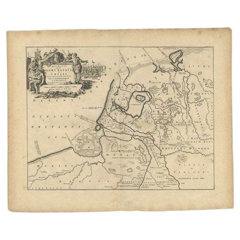
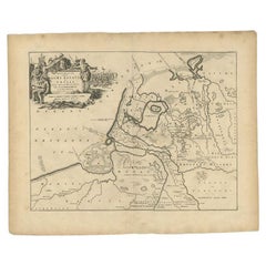
- Antique Map of the Old Land of Batavia and FriesLand, The Netherlands, 1697Located in Langweer, NLAntique map Friesland titled 'Descriptio veteris Agri Batavi et Frisii (..)'. Old map of Friesland, the Netherlands. Depicts the old land of Batavia and Friesland. This map originate...Category
Antique 17th Century Maps
MaterialsPaper
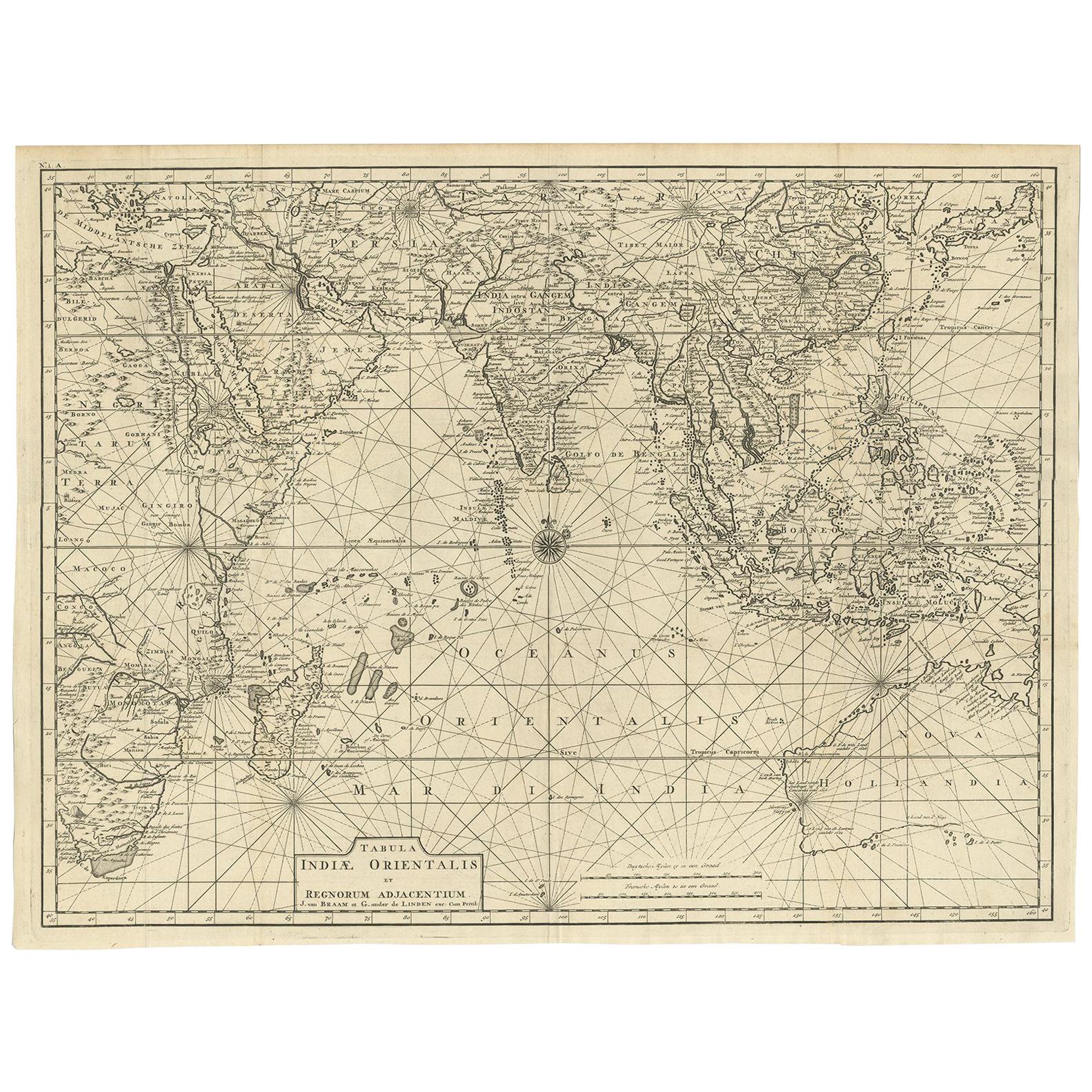
- Antique Map of South East Asia, Australia and the Indian Ocean, 1726By F. ValentijnLocated in Langweer, NLAntique map titled 'Tabula Indiae Orientalis'. Beautiful detailed map of Australia, Southeast Asia and the Indian Ocean. The map features a fine depiction of the outlines of the western two-thirds of Australia, based on the discoveries of explorers working for the Dutch East India Company (the VOC). These include Willem Jansz's discoveries in the Gulf of Carpentaria in 1606; the encounters of Dirk...Category
Antique Mid-18th Century Dutch Maps
MaterialsPaper
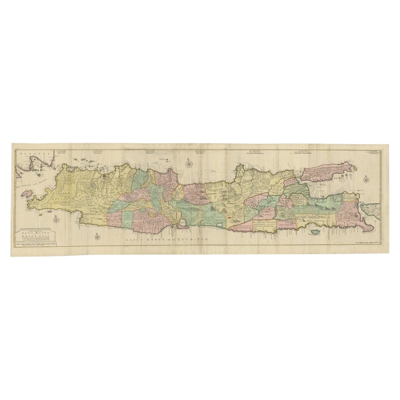
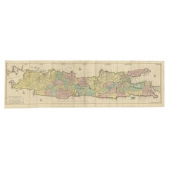
- Huge Old Map of Java, Indonesia, Published by the Dutch in Colonial Times, 1728Located in Langweer, NLAntique map titled 'Nieuwe en zeer naaukeurige Kaart van t Eyland Java Major of Groot Java'. This large-scale map of Java is richly engraved with details of agricultural fields, road...Category
Antique 18th Century Maps
MaterialsPaper
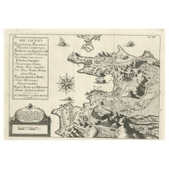
- Old Original Map of Pozzuoli Near Naples in the Campania Region, Italy, ca.1740Located in Langweer, NLAntique map titled 'Hic Jacent Puteolorum Bajarum (..)'. Old map of the region of Pozzuoli showing the topographic and architectural features of interest. Pozzuoli is a city and comu...Category
Antique 1740s Maps
MaterialsPaper
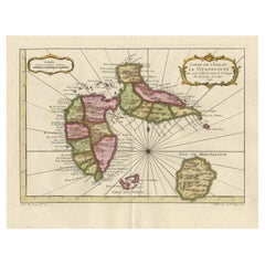
- Antique Map of Guadelupe in the Caribbean, 1759By Jacques-Nicolas BellinLocated in Langweer, NLAntique map titled 'Carte De L'Isle De La Guadeloupe'. Detailed map of Guadalupe, Mari-Galante and the Isles de Saintes. Produced by Nichlas Bellin for Prevost d'Exiles influential t...Category
Antique Mid-18th Century French Maps
MaterialsPaper
- Antique Map of South America by Wyld, circa 1850By J. WyldLocated in Langweer, NLBeautiful folding map of South America titled 'Colombia Prima or South America Drawn from the Large Map in Eight Sheets by Louis Stanislas D ' Arcy Delarochette'. Three insets in the...Category
Antique Mid-19th Century British Maps
MaterialsPaper


You May Also Like
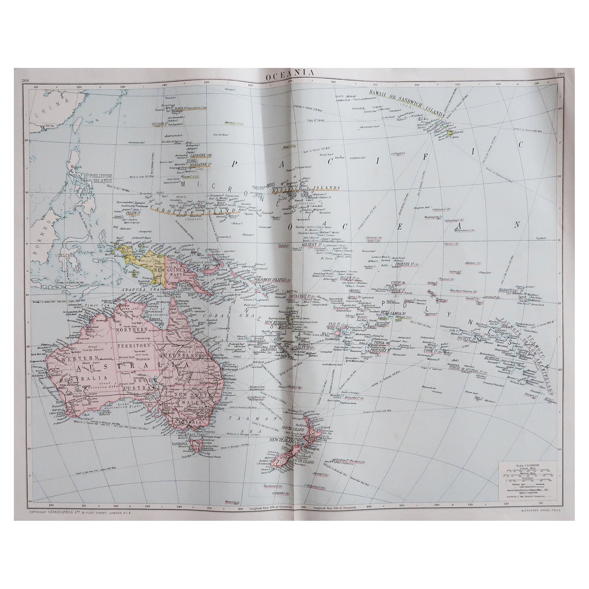
- Large Original Vintage Map of The South Pacific, circa 1920Located in St Annes, LancashireGreat map of The South Pacific Original color. Good condition / repairs to minor edge tears on top edge Published by Alexander Gross Unf...Category
Vintage 1920s English Edwardian Maps
MaterialsPaper
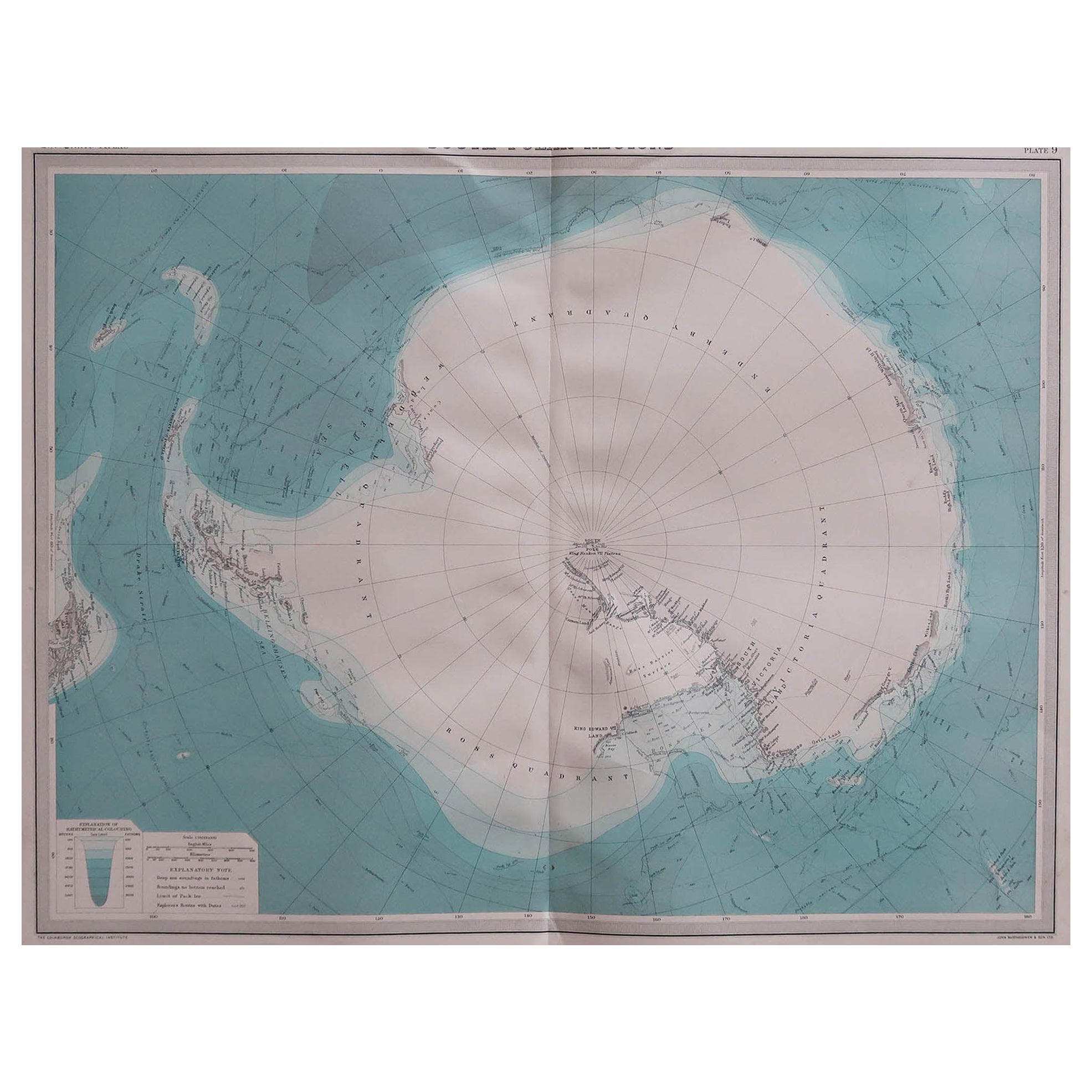
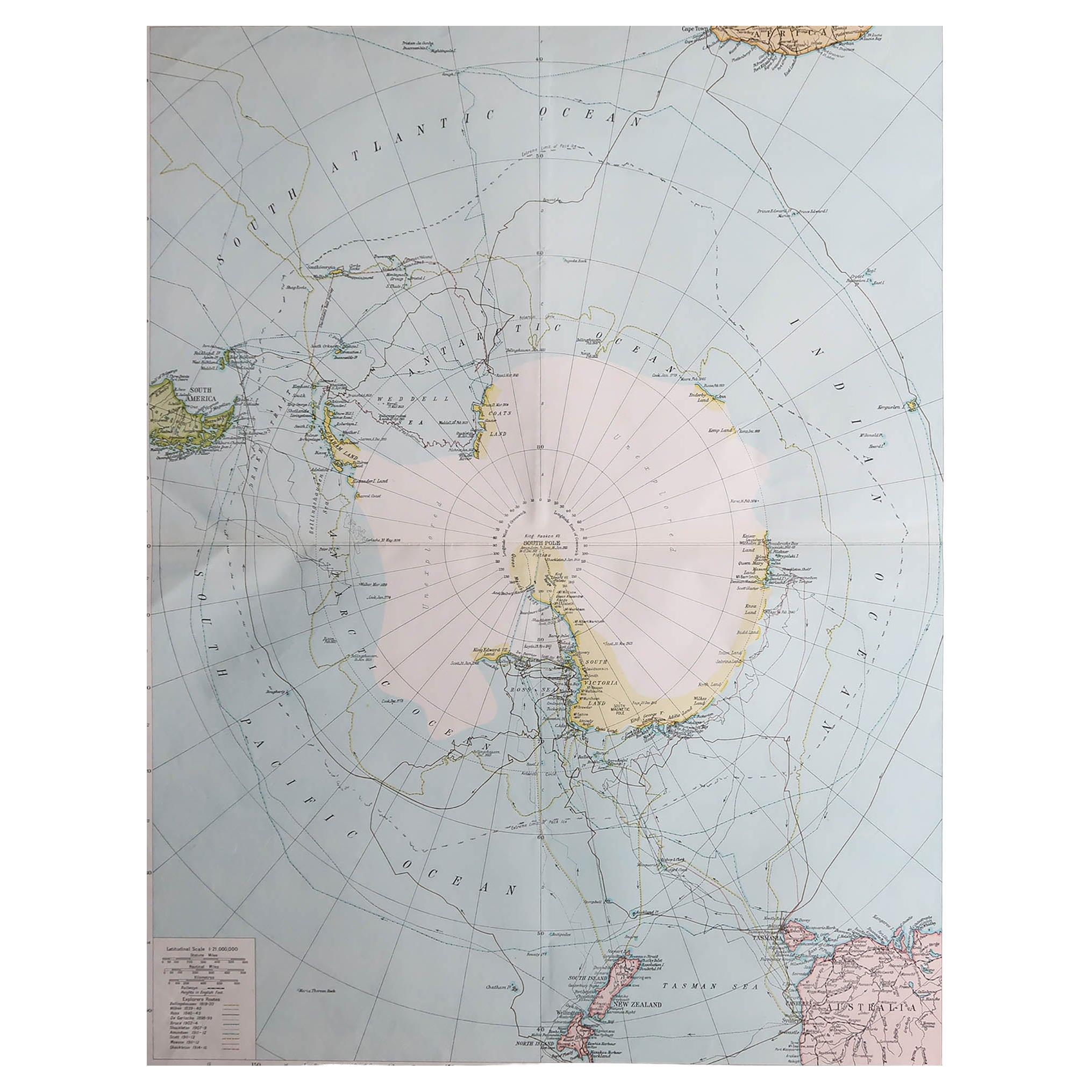
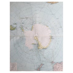
- Large Original Vintage Map of The South Pole, circa 1920Located in St Annes, LancashireGreat map of The South Pole Original color. Published by Alexander Gross Unframed. Repairs to minor edge tearsCategory
Vintage 1920s English Maps
MaterialsPaper
- Large Original Vintage Map of the South Pole, circa 1920Located in St Annes, LancashireGreat map of the South pole. Unframed. Original color. By John Bartholomew and Co. Edinburgh Geographical Institute. Published, circa 1920.Category
Vintage 1920s British Maps
MaterialsPaper
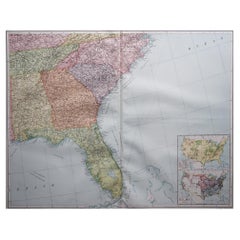
- Large Original Vintage Map of the South Eastern States Inc. Florida, circa 1920Located in St Annes, LancashireGreat map of The South Eastern States Original color. Good condition Published by Alexander Gross Unframed.Category
Vintage 1920s English Maps
MaterialsPaper
- Large Original Vintage Map of South Africa, circa 1920Located in St Annes, LancashireGreat map of South Africa Original color. Good condition / repair to a minor edge tear middle bottom Published by Alexander Gross Unframed. ...Category
Vintage 1920s English Edwardian Maps
MaterialsPaper
- Large Original Antique Map of South Carolina, USA, 1894By Rand McNally & Co.Located in St Annes, LancashireFabulous map of South Carolina Original color By Rand, McNally & Co. Published, 1894 Unframed Free shipping.Category
Antique 1890s American Maps
MaterialsPaper


Recently Viewed
View AllMore Ways To Browse
Old Antique Scales
Marine Collectibles
French Balance Scales
Map Russia
Russian Map
Balance Scales Antique
Antique Balance Scales
Antique Balance Scale
Antique Balance Scales Scales
Antique Balance Scale Scales
Antique Balancing Scales
Antique Balancing Scale
Balance Antique Scales
Map Of Russia
Maps Of Russia
Antique Scales And Balances
Map Of South Of France
Old Maps Of Europe