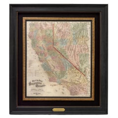
Scale Map
13
to
90
652
511
499
353
313
273
212
131
124
107
58
49
44
44
37
35
34
32
30
26
24
23
22
18
17
16
14
12
11
10
9
9
9
8
8
8
7
6
6
6
6
5
5
4
4
4
4
4
3
3
3
3
2
2
2
2
2
2
2
1
1
81
54
45
42
42
Sort By
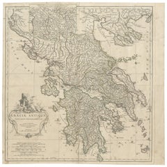
Large Scale Map of Greece, Extending to Cythera with Inset of Macedonia, ca.1786
Located in Langweer, NL
Antique map titled 'Graeciae Antiquae'.
Large scale map of Greece, extends south to the island
Category
Antique 1780s Maps
Materials
Paper
H 21.26 in W 21.26 in D 0 in
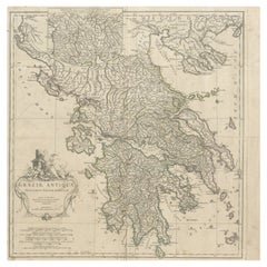
Large Scale Map of Greece with Inset Map of Macedonia, c.1786
Located in Langweer, NL
Antique map titled 'Graeciae Antiquae'. Large scale map of Greece, extends south to the island of
Category
Antique 18th Century Maps
Materials
Paper
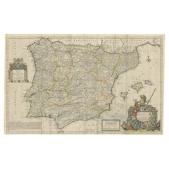
Beautiful Large Scale Map of Spain and Portugal Published by Herman Moll in 1711
Located in Langweer, NL
Title: A New and Exact Map of Spain & Portugal
Author: Herman Moll
Date: 1711
Medium: ?Hand
Category
Antique 1710s Maps
Materials
Paper
H 24.81 in W 39.38 in D 0.02 in
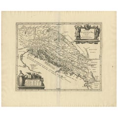
Antique Map of the Adriatic Sea and the Balkan by J. Janssonius, circa 1650
Located in Langweer, NL
Striking large-scale map of the Greater Balkans. Decorated with two large-scale cartouches, one
Category
Antique Mid-17th Century Maps
Materials
Paper
H 20.79 in W 24.81 in D 0.02 in
Large Antique Map of Java ‘Indonesia’ by F. Valentijn, 1728
Located in Langweer, NL
large-scale map of Java is richly engraved with details of agricultural fields, roads, temples, and
Category
Antique Early 18th Century Maps
Materials
Paper
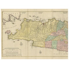
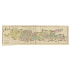
Huge Old Map of Java, Indonesia, Published by the Dutch in Colonial Times, 1728
Located in Langweer, NL
large-scale map of Java is richly engraved with details of agricultural fields, roads, temples, and
Category
Antique 18th Century Maps
Materials
Paper
H 68.12 in W 21.07 in D 0 in
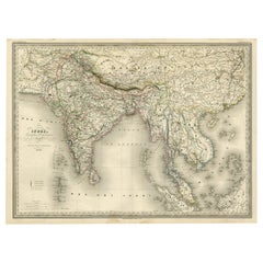
Superb, Large Map of British India, Chinese Empire, Indochina, Malaysia, 1860
Located in Langweer, NL
. A superb, large-scale map of British India, the Chinese Empire, Indochina, the Malay Peninsula, and
Category
Antique 1860s Maps
Materials
Paper
H 22.8 in W 31.07 in D 0 in
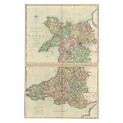
Two Sheet Map of the Principality of Wales Divided into Counties, 1804
Located in Langweer, NL
A well engraved and detailed large-scale map of Wales, printed on two sheets .
The map is
Category
Antique Early 1800s Maps
Materials
Paper
H 21.26 in W 25.2 in D 0.02 in
1873 "Map of the States of California and Nevada" by Chas. Drayton Gibbes
Located in Colorado Springs, CO
is considered to be one of the finest large-scale maps of California to appear in the second half of
Category
Antique 1870s American Maps
Materials
Paper
1842 Wall Map of the United States by J. H. Young, Published by S. A. Mitchell
Located in Colorado Springs, CO
. This map was also very likely the first, large-scale map to have been steel plate-engraved
Category
Antique 1840s American Maps
Materials
Paper
H 45 in W 38 in D 1 in
Stunning Large Scale Antique Map of Martinique, Rare, Published 1758
Located in Langweer, NL
Antique map titled 'Carte Reduite de l'Isle de la Martinique Dressee au Depost des Cartes Plans et
Category
Antique 18th Century Maps
Materials
Paper
Large Scale Antique Scroll Map of Lincolnshire, England, Dated 1778
Located in St Annes, Lancashire
Wonderful scroll map of Lincolnshire
By Captain Armstrong, 1778
Copper plate engraving on
Category
Antique 1770s English Georgian Maps
Materials
Wood, Paper
Free Shipping
H 84 in W 60 in D 1.5 in
Antique Map of Japan with Scale and Compass Rose, c.1730
Located in Langweer, NL
Japan. With scale and compass rose. This map originates from 'Hedendaegsche historie, of tegenwoordige
Category
Antique 18th Century Maps
Materials
Paper
Antique Map of Africa with French Cartouche and Scale, c.1780
Located in Langweer, NL
Antique map titled 'L'Afrique'. Original antique map of Africa. With beautiful title cartouche and
Category
Antique 18th Century Maps
Materials
Paper
Set of 10 Large Scale Vintage Maps of The United Kingdom, circa 1900
Located in St Annes, Lancashire
Great set of maps of the UK
Lithographs. By John Bartholomew & Co.
Published by The Edinburgh
Category
Antique Early 1900s English Maps
Materials
Paper
No Reserve
H 18 in W 23.5 in D 0.13 in
Antique Detailed Map of Jerusalem in Israël with Extensive Key and Scale, 1698
Located in Langweer, NL
Antique map titled 'Jerusalem.'
Plan of the ancient city of Jerusalem. With extensive key and
Category
Antique 17th Century Maps
Materials
Paper
H 15.16 in W 12.01 in D 0 in
Antique Map of France with a Nice Cartouche of a Distance Scale, c.1756
Located in Langweer, NL
Antique map titled 'France'. Engraved map of France with a small, decorative title cartouche and
Category
Antique 18th Century Maps
Materials
Paper
1907 Map of Colorado, Antique Topographical Map, by Louis Nell
Located in Colorado Springs, CO
This highly detailed pocket map is a topographical map of the state of Colorado by Louis Nell from
Category
Antique Early 1900s American Maps
Materials
Paper
Map Bedfordshire General Framed
Located in BUNGAY, SUFFOLK
A general map of Bedfordshire with its hundreds
A scale of 5 miles
in the original green mount
Category
Antique 18th Century English Georgian Maps
Materials
Paper
Map Bedfordshire No 3 General Framed
Located in BUNGAY, SUFFOLK
A general map of Bedfordshire with its hundreds. Measure: 37cm 14 1/2" high
A scale of 5 miles
Category
Antique 18th Century English Georgian Maps
Materials
Paper
Antique Map of Silesia centered on Glogau
Located in Langweer, NL
especially ornate coat of arms and a key to the symbols used in the map. At bottom right is a fine scale of
Category
Antique Mid-17th Century Maps
Materials
Paper
Antique Map of Asia by Larousse, 1897
Located in Langweer, NL
Front: 'Carte Generale de l'Asie.' (General map of Asia). Rear: 'Asie.' (Asia, scenes of Asia
Category
Antique 19th Century Maps
Materials
Paper
Antique Map of London by Tirion '1754'
Located in Langweer, NL
of 1744, the map's title, imprint and key appears in a table at top left. The scale bars are in a
Category
Antique Mid-18th Century Maps
Materials
Paper
Antique Map of China by Larousse, 1897
By Pierre Larousse
Located in Langweer, NL
Sheet: Front: 'Chine.' (China map). Verso: 'China.' (China views, nature, animals, costume). This
Category
Antique 19th Century Maps
Materials
Paper
Antique Decorative Coloured Map of North America, 1882
Located in Langweer, NL
This original antique map of North America is from the Blackie & Son Atlas published in 1882. Here
Category
Antique 1880s Maps
Materials
Paper
Antique Map of Egypt and the Nile River
Located in Langweer, NL
Antique map titled 'Egypten nach dem Zustand der alten Zeit vorgestellt'. This uncommon and richly
Category
Antique Mid-18th Century Maps
Materials
Paper
Antique Map of Madagascar by Mariette 'c.1670'
Located in Langweer, NL
(..)'. Original large-scale antique map of Madagascar, Africa. Published by Pierre Mariette, circa 1670.
Category
Antique Mid-17th Century Maps
Materials
Paper
Antique Map of Greece by Allard (c.1698)
Located in Langweer, NL
Antique map titled 'Hellas seu Graecia Universa' Detailed map of Greece, with Crete, the Aegean
Category
Antique Late 17th Century Maps
Materials
Paper
Old Map of Java, Indonesia by Stemler, 1875
By Stemler
Located in Langweer, NL
Antique map titled 'Hoofddriehoeken - Java en madoera.' (Main triangles measured by the
Category
Antique 19th Century Maps
Materials
Paper
Antique Map of Herefordshire by Morden, c.1700
Located in Langweer, NL
Antique map titled 'Herefordshire'. Detailed map of the county of Herefordshire embellished with a
Category
Antique 18th Century Maps
Materials
Paper
Antique Map of Southeast Asia by Dussy, 1778
Located in Langweer, NL
"Antique map titled 'Indostan presqu'isles de l'Inde, Chine, Tartarie Independante.' - A map of
Category
Antique 18th Century Maps
Materials
Paper
Antique Map of Java by Janssonius, circa 1650
Located in Langweer, NL
Antique map titled 'Insulae Iavae cum parte insularum Borneo Sumatrae, et circumjacentium insularum
Category
Antique Mid-17th Century Maps
Materials
Paper
Original Antique Map of the Duchy of Holstein
By Willem Blaeu
Located in Langweer, NL
Antique map titled 'Ducatus Holsatiae Nova Tabula'. Original old map of the Duchy of Holstein, the
Category
Antique Mid-17th Century Maps
Materials
Paper
Antique Map of Denmark by Valk 'circa 1690'
Located in Langweer, NL
possibly other details such as the scale of miles, a dedication, or the mapmaker's mark. The map's utility
Category
Antique Late 17th Century Maps
Materials
Paper
Antique Lithography Map, Cumbria, English, Framed Cartography Interest, Georgian
Located in Hele, Devon, GB
This is an antique lithography map of Cumbria. An English, framed engraving of cartographic
Category
Antique Early 18th Century British Georgian Maps
Materials
Wood
H 21.86 in W 25.2 in D 0.79 in
Decorative Antique Map of Eastern Canada, Published in 1882
Located in Langweer, NL
.
The map's longitude and latitude markers, the detailed scale at the bottom, and the clear labeling of
Category
Antique 1880s Maps
Materials
Paper
Free Shipping
H 14.97 in W 22.45 in D 0 in
Antique Map of Southeast Asia by Larousse, 1897
Located in Langweer, NL
"Front: 'Carte Generale des Indes.' (General map of India / The Indies / Thailand / Malaysia). Rear
Category
Antique 19th Century Maps
Materials
Paper
Antique Map of Zeeland, The Netherlands, by Jaillot, 1693
Located in Langweer, NL
Antique map titled 'Le Comte de Zeelande (..).' Detailed map of the province of Zeeland, The
Category
Antique 17th Century Maps
Materials
Paper
Antique Map of the Empire of the Great Mogul
Located in Langweer, NL
. The map is further embellished with a title cartouche flanked by two putty and a distance scale
Category
Antique Late 17th Century Maps
Materials
Paper
Antique Map of Java 'Indonesia' by Arkstee & Markus (1763)
Located in Langweer, NL
the island of Java, Indonesia. With cartouche, scale and compass rose. This map originates from
Category
Antique Mid-18th Century Maps
Materials
Paper
Antique Map of Greece by J. Jansson, circa 1653
Located in Langweer, NL
Christianity. The map is embellished with a decorative distance scale and title cartouche featuring two armored
Category
Antique Mid-17th Century Maps
Materials
Paper
Antique Map of East Frisia by Ortelius, c.1595
Located in Langweer, NL
Antique print, titled: 'Frisia Orientalis.' Map of East Frisia originating from 'Theatrum Orbis
Category
Antique 16th Century Maps
Materials
Paper
Antique Map of Sulawesi by Winkler Prins, c.1900
Located in Langweer, NL
the Sunda islands. With inset maps of South-west Sulawesi and Semenanjung Minahassa. Legend and scale
Category
20th Century Maps
Materials
Paper
Antique Map of the Island Java, Indonesia, c.1650
Located in Langweer, NL
Antique map titled 'Insulae Iavae cum parte insularum Boreno Sumatrae (..)'.
Beautiful map of the
Category
Antique 17th Century Maps
Materials
Paper
Antique Map Depicting Burma, Siam, Annam (Vietnam) and Japan, 1882
Located in Langweer, NL
the bottom left corner shows the "Loo-Choo Islands" (Ryukyu Islands) on a larger scale.
Both maps are
Category
Antique 1880s Maps
Materials
Paper
Free Shipping
H 14.97 in W 22.45 in D 0 in
Antique Map of Russia and Surroundings by Stieler, 1874
Located in Langweer, NL
Antique map titled 'Nord- & Mittal-Asien, Ubersicht des Russischen Reiches.' A map of Russia in
Category
Antique 19th Century Maps
Materials
Paper
Cartographic Tapestry: Antique Map of Asia Minor, circa 1640
Located in Langweer, NL
Title: "Historical Tapestry: Antique Map of Asia Minor, circa 1640"
Description:
This authentic
Category
Antique Mid-17th Century Maps
Materials
Paper
Antique Map of Switzerland by N. Visscher, circa 1690
Located in Langweer, NL
Beautifully detailed map of Switzerland and surrounding regions in present-day France, Germany, and
Category
Antique Late 17th Century Maps
Materials
Paper
Antique 19th Century Map of China by Blackie & Son, 1882
Located in Langweer, NL
This map is an 1882 Blackie & Son map of China. The title "CHINA." is prominently displayed at the
Category
Antique 1880s Maps
Materials
Paper
Road Map, John Ogilby, No 54, London, Yarmouth, Britannia
By John Ogilby
Located in BUNGAY, SUFFOLK
-sixth year, as a publisher of maps and geographical accounts.
Ogilby was born outside Dundee, in
Category
Antique 1670s English Baroque Maps
Materials
Paper
Authentic Old Map of Arabia with Original Border Coloring, 1745
Located in Langweer, NL
Title: "Kaartje van Arabië na de stelling van den Heer Guillaume de L'Isle"
Translates to "Map of
Category
Antique 1740s Maps
Materials
Paper
Map of Polynesia Highlighting Cultural Landscapes and Maritime Activities, 1851
Located in Langweer, NL
John Tallis & Company was a London-based map publisher that flourished during the 19th century
Category
Antique 1850s Maps
Materials
Paper
H 10.71 in W 14.26 in D 0 in
Authentic Old Map of Persia with Original Border Coloring, 1745
Located in Langweer, NL
Title: "Kaartje van Persien na de stelling van den Heer Guillaume de L'Isle"
Translates to "Map
Category
Antique 1740s Maps
Materials
Paper
Antique Map of Southern Sweden by Covens & Mortier, 'circa 1720'
Located in Langweer, NL
Antique map titled 'Regni Gothiae (..)'. Detailed map of South Sweden. Embellished with beautiful
Category
Antique Early 18th Century Maps
Materials
Paper
Original Antique Map of the Road from Andover to Crewkerne
Located in Langweer, NL
Antique map titled 'The Continuations of the Road from London to the Lands End'. Original antique
Category
Antique Late 17th Century Maps
Materials
Paper
Antique Map of The United States of North America, 1882
Located in Langweer, NL
, suggests it was a comprehensive educational or navigational tool for its time. The map's scale and grid of
Category
Antique 1880s Maps
Materials
Paper
Antique Map of the Region of Bretagne by Janssonius '1657'
By Johannes Janssonius
Located in Langweer, NL
the title, key and scale, a large armorial and several vignette galleons. This map originates from
Category
Antique Mid-17th Century Maps
Materials
Paper
Antique Map of the County of Hainaut by Jaillot, 1692
Located in Langweer, NL
joined the Sanson heirs and redrew Nicolas Sanson's maps on a larger scale.
Condition: Fair, original
Category
Antique 17th Century Maps
Materials
Paper
Antique Map of the Region of Batavia by Conrade, 1782
Located in Langweer, NL
Antique map titled 'Carte des environs de Batavia.' (Map of Batavia and its surroundings.) Map of
Category
Antique 18th Century Maps
Materials
Paper
Antique Map of the Island of Java by Conrade, 1782
Located in Langweer, NL
Antique map titled 'Nouvelle Carte de l' Isle de Java.' (New Map of Java.) This very detailed map
Category
Antique 18th Century Maps
Materials
Paper
- 1
- ...
Get Updated with New Arrivals
Save "Scale Map", and we’ll notify you when there are new listings in this category.
Scale Map For Sale on 1stDibs
Find many varieties of an authentic scale map available at 1stDibs. Frequently made of paper, wood and plastic, every scale map was constructed with great care. Your living room may not be complete without a scale map — find older editions for sale from the 18th Century and newer versions made as recently as the 20th Century. When you’re browsing for the right scale map, those designed in Georgian styles are of considerable interest. Many designers have produced at least one well-made scale map over the years, but those crafted by Gerard van Keulen, Herman Moll and Nicolas Joannes Piscator are often thought to be among the most beautiful.
How Much is a Scale Map?
A scale map can differ in price owing to various characteristics — the average selling price 1stDibs is $1,475, while the lowest priced sells for $200 and the highest can go for as much as $225,000.
More Ways To Browse
Bremen Town
Arabian Peninsula
New Guinea African
Map Of Michigan
Macedonia Map
Map Danube
Croatia Antique Map
Erie Canal
Antique Iranian Map
Map Of Jerusalem Antique
Antique Map Bali
Cyprus Antique Maps
Antique Map Of Cyprus
Royal Worcester Evesham
Antique New Orleans Maps
Antique Map New Orleans
Antique Map Of New Orleans
Antique Maps Of New Orleans
