Items Similar to Antique Map of the Island of Java by Conrade, 1782


Want more images or videos?
Request additional images or videos from the seller
1 of 5
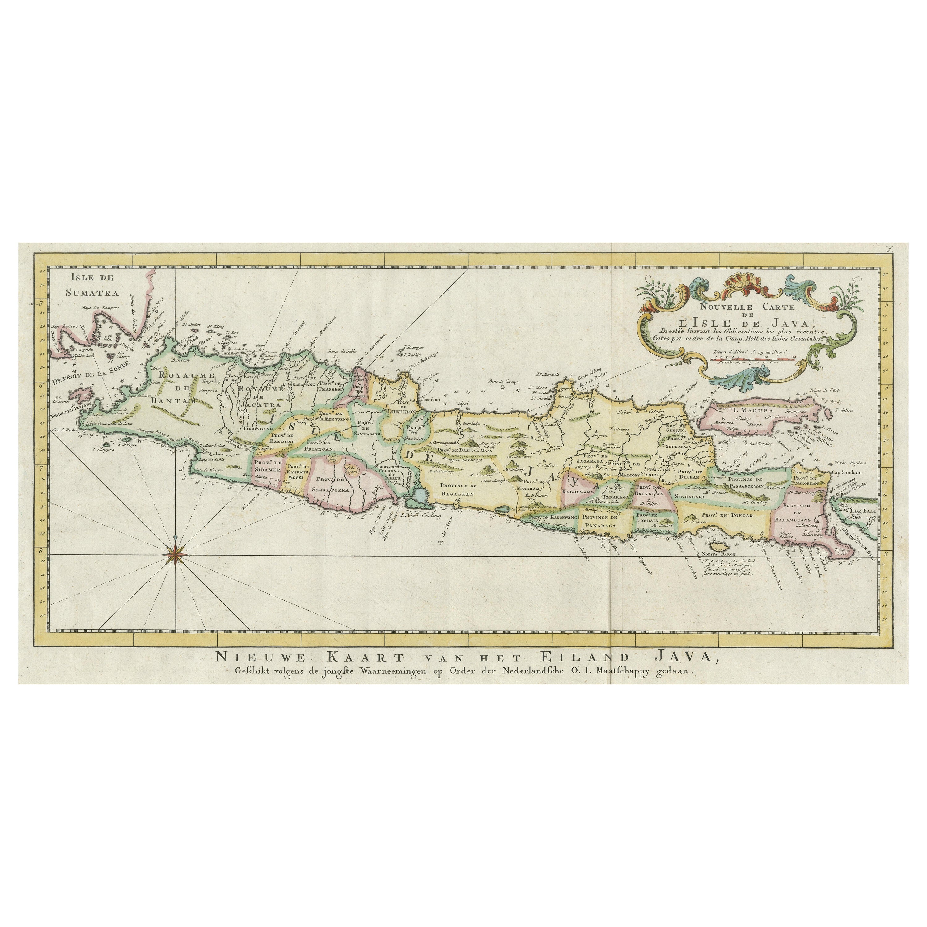
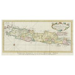
Antique Map of the Island of Java by Conrade, 1782
About the Item
Antique map titled 'Nouvelle Carte de l' Isle de Java.' (New Map of Java.) This very detailed map shows the Indonesian Island of Java. With cartouche, scale and compass rose. This print originates from 'Batavia, de Hoofdstad van Neerlands O. Indien (..)', 1782.
Artists and Engravers: Published by Petrus Conrade and Volkert van der Plaats.
Condition: Good, general age related toning; some light staining from handling. Please study image carefully.
Date: 1782
Overall size: 48 x 27 cm.
Image size: 44 x 21.5 cm.
We sell original antique maps to collectors, historians, educators and interior decorators all over the world. Our collection includes a wide range of authentic antique maps from the 16th to the 20th centuries. Buying and collecting antique maps is a tradition that goes back hundreds of years. Antique maps have proved a richly rewarding investment over the past decade, thanks to a growing appreciation of their unique historical appeal. Today the decorative qualities of antique maps are widely recognized by interior designers who appreciate their beauty and design flexibility. Depending on the individual map, presentation, and context, a rare or antique map can be modern, traditional, abstract, figurative, serious or whimsical. We offer a wide range of authentic antique maps for any budget.
- Dimensions:Height: 10.63 in (27 cm)Width: 18.9 in (48 cm)Depth: 0 in (0.01 mm)
- Materials and Techniques:
- Period:
- Date of Manufacture:1782
- Condition:
- Seller Location:Langweer, NL
- Reference Number:
About the Seller
5.0
Platinum Seller
These expertly vetted sellers are 1stDibs' most experienced sellers and are rated highest by our customers.
Established in 2009
1stDibs seller since 2017
1,929 sales on 1stDibs
Typical response time: <1 hour
- ShippingRetrieving quote...Ships From: Langweer, Netherlands
- Return PolicyA return for this item may be initiated within 14 days of delivery.
More From This SellerView All
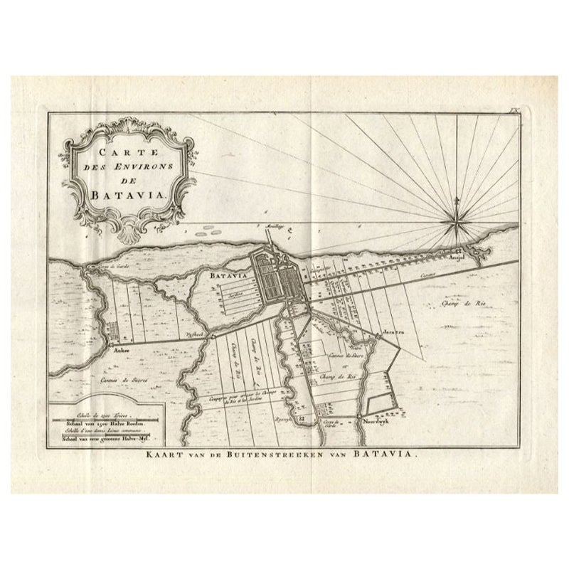
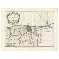
- Antique Map of the Region of Batavia by Conrade, 1782Located in Langweer, NLAntique map titled 'Carte des environs de Batavia.' (Map of Batavia and its surroundings.) Map of the Batavia area (Jakarta) in Indonesia. With cartouche, scale and compass rose. Thi...Category
Antique 18th Century Maps
MaterialsPaper
- Antique Map of the Island of Java, IndonesiaLocated in Langweer, NLAntique map titled 'Nouvelle Carte de l'Isle de Java (..) - Nieuwe Kaart van het Eiland Java (..)'. Chart of the island of Java, depicting soundings around the coast, all principal h...Category
Antique Late 18th Century Maps
MaterialsPaper
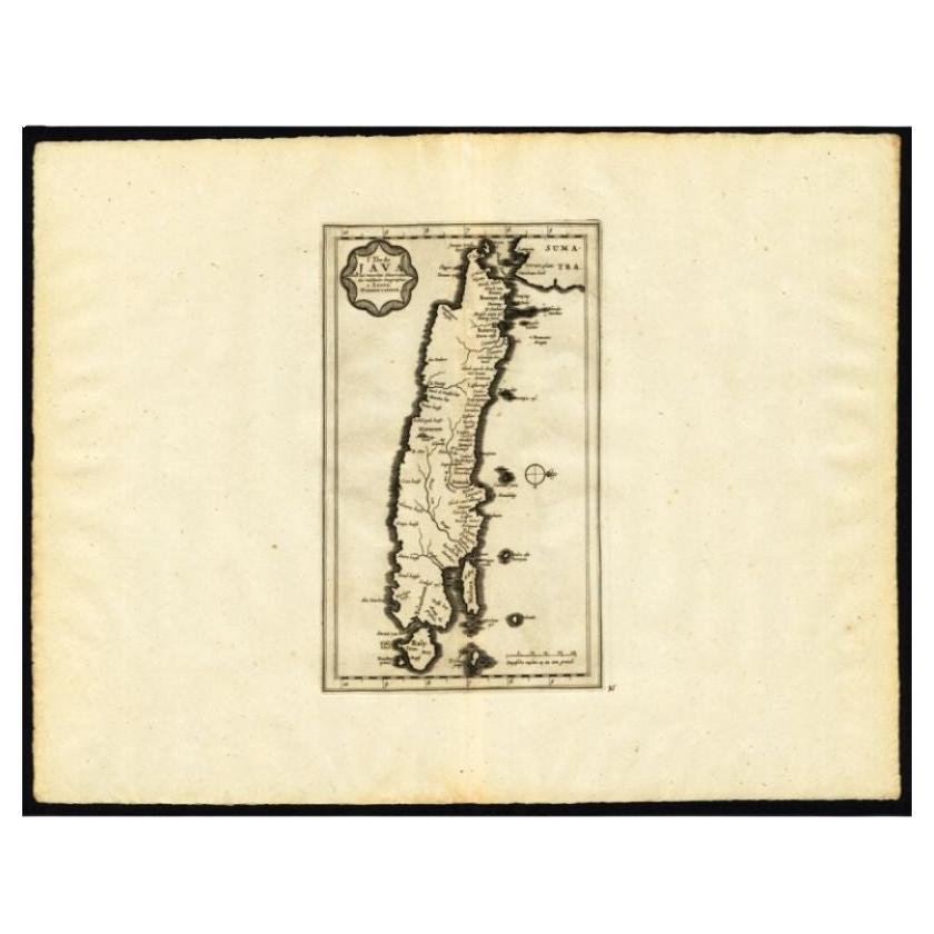
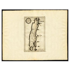
- Antique Map of the Island Java, Indonesia, c.1650Located in Langweer, NLAntique map titled 'Insulae Iavae cum parte insularum Boreno Sumatrae (..)'. Beautiful map of the island of Java and part of Borneo, Bali, Madura and Sumatra. With decorative carto...Category
Antique 17th Century Maps
MaterialsPaper
- Scarce Antique Map of the Island of Java, IndonesiaLocated in Langweer, NLTitle: "Kaart van 't Eyland Groot Java: Antique Map of Java, Indonesia" Description: This antique map, titled "Kaart van 't Eyland Groot Java," offers a rare and valuable depiction ...Category
Antique Late 18th Century Maps
MaterialsPaper
- Antique Map of the Island of Java by Van Der Aa, 1725By Pieter Van Der AaLocated in Langweer, NLAntique map titled 'Map: 'L'Ile de Java'. (The island of Java.) This map shows the Indonesian island of Java. With compass rose and scale. This plate originates from the very scarse:...Category
Antique 18th Century Maps
MaterialsPaper
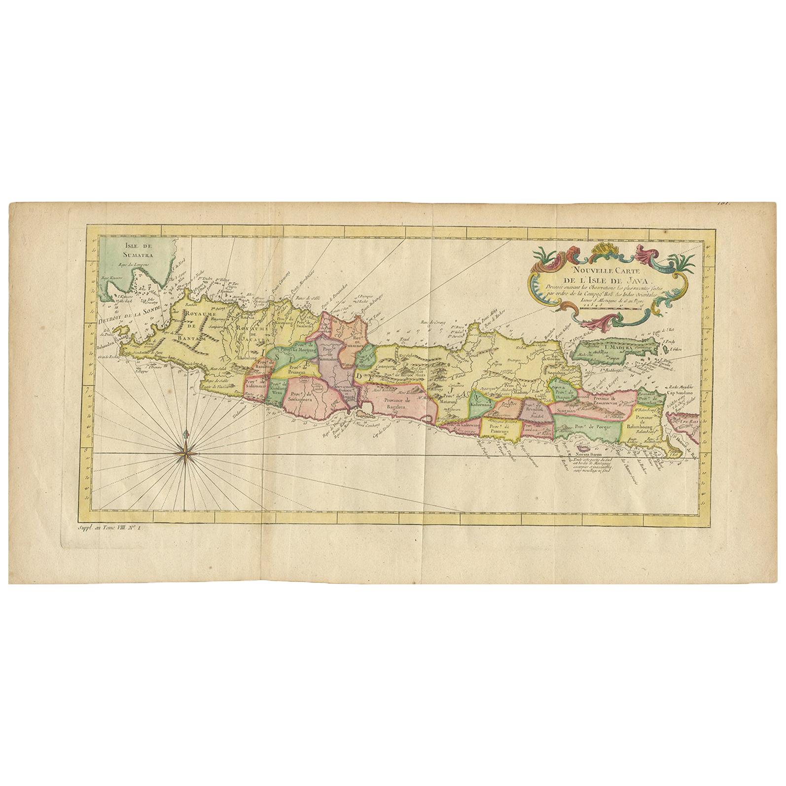
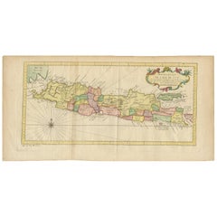
- Antique Map of the Island of Java in Indonesia, circa 1760By Jacques-Nicolas BellinLocated in Langweer, NLAntique map Indonesia titled 'Nouvelle Carte de l'Isle de Java'. Chart of the island of Java, depicting soundings around the coast, all principa...Category
Antique Mid-18th Century Maps
MaterialsPaper


You May Also Like
- 1854 Map of Massachusetts, Connecticut and Rhode Island, Antique Wall MapLocated in Colorado Springs, COThis striking wall map was published in 1854 by Ensign, Bridgman & Fanning and has both full original hand-coloring and original hardware. This impression is both informative and highly decorative. The states are divided into counties, outlined in red, green, and black, and subdivided into towns. Roads, canals, and railroad lines are prominently depicted, although they are not all labeled. The mapmakers also marked lighthouses, banks, churches, and prominent buildings, with a key at right. The map is an informative and comprehensive overview of the infrastructural development of New England prior to the Civil War. Physical geographies depicted include elevation, conveyed with hachure marks, rivers and lakes. The impression features an inset map of Boston...Category
Antique 19th Century American Maps
MaterialsPaper
- Large Original Antique Map of Java and Borneo, Fullarton, C.1870Located in St Annes, LancashireGreat map of Java and Borneo Wonderful figurative borders From the celebrated Royal Illustrated Atlas Lithograph. Original color. Published by Fullarton, Edinburgh. C.1870 Unfr...Category
Antique 1870s Scottish Maps
MaterialsPaper
- 1861 Topographical Map of the District of Columbia, by Boschke, Antique MapLocated in Colorado Springs, COPresented is an original map of Albert Boschke's extremely sought-after "Topographical Map of the District of Columbia Surveyed in the Years 1856 ...Category
Antique 1860s American Historical Memorabilia
MaterialsPaper
- Large Original Vintage Map of The Pacific Islands Including HawaiiLocated in St Annes, LancashireGreat map of The Pacific Islands Unframed Original color By John Bartholomew and Co. Edinburgh Geographical Institute Published, circa 1...Category
Vintage 1920s British Maps
MaterialsPaper
- 1868 Map of the Upper Part of the Island of Manhattan Above 86th StreetBy Wm. Rogers Mfg. Co.Located in San Francisco, CAThis wonderful piece of New York City history is over 150 years old. It depicts 86th street and above. It was lithographed by WC Rogers and company. It was made to show what was the Battle of Harlem during the Revolutionary war...Category
Antique 1860s American American Colonial Maps
MaterialsPaper
- Framed Mid-19th Century Wall Map of Long Island, the HamptonsLocated in Sag Harbor, NYA Framed museum quality find. This large wall map dates to the mid-1800s. Detailed inset maps of, Sag Harbor, East Hampton, Amagansett, Shelter Island and most villages in Long Islan...Category
Antique Mid-19th Century American Maps
MaterialsLinen, Paper


Recently Viewed
View AllMore Ways To Browse
Java Antique Furniture
Java Antiques
Batavia Map
Petrus Van
Antique South America Map
Antique Map Of North America
Plantation Signs
Antique Map Of South America
Antique Maps Of South America
Antique Map Of Japan
Antique Map Edinburgh
Antique Map Of Edinburgh
Mercator Map
Antique Architecture Plan
Seven Fold
Coat Of Arms German
West German Antiques
17th Map Large