17th Map Large
5
to
47
179
108
263
223
93
38
29
24
21
17
14
7
6
6
6
5
5
4
4
3
3
3
3
3
2
2
2
2
2
2
1
1
1
1
1
1
1
1
1
1
15
13
12
10
8
Sort By
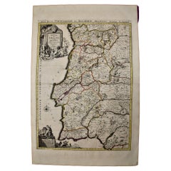
Portugal: A Large 17th Century Hand-colored Map by Sanson and Jaillot
By Nicolas Sanson
Located in Alamo, CA
This large hand-colored map entitled "Le Royaume de Portugal et des Algarves Divisee en see
Category
Antique 1690s French Maps
Materials
Paper
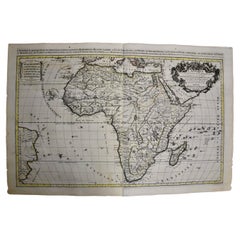
Africa: A Large 17th Century Hand-Colored Map by Sanson and Jaillot
By Nicolas Sanson
Located in Alamo, CA
This large original hand-colored copperplate engraved map of Africa entitled "L'Afrique divisee
Category
Antique 1690s French Maps
Materials
Paper
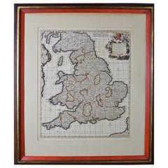
Large 17th Century Hand Colored Map of England and the British Isles by de Wit
By Frederick de Wit
Located in Alamo, CA
A large hand colored 17th century map of England and the British Isles by Frederick de Wit entitled
Category
Antique Late 17th Century Dutch Maps
Materials
Paper
H 35 in W 30.5 in D 2 in
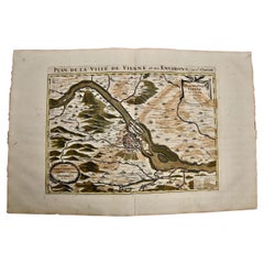
Vienna, Austria: A Large 17th Century Hand-Colored Map by Sanson and Jaillot
By Nicolas Sanson
Located in Alamo, CA
This large 17th century hand-colored map of Vienna, Austria and the surrounding countryside and
Category
Antique 1690s French Maps
Materials
Paper
H 20 in W 24.88 in D 0.13 in
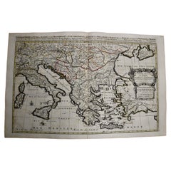
Southern & Eastern Europe: A Large 17th C. Hand-colored Map by Sanson & Jaillot
By Nicolas Sanson
Located in Alamo, CA
This large hand-colored map entitled "Estats de L'Empire des Turqs en Europe, ou sont les
Category
Antique 1690s French Maps
Materials
Paper
H 24.88 in W 38 in D 0.13 in
Southern Greece: A Large 17th C. Hand-colored Map by Sanson and Jaillot
By Nicolas Sanson
Located in Alamo, CA
This large original hand-colored copperplate engraved map of southern Greece and the Pelopponese
Category
Antique 1690s French Maps
Materials
Paper
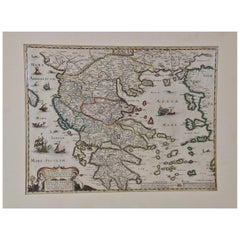
Greece, "Graeciae Antiquae"" A 17th Century Hand-colored Map by Sanson
By Nicolas Sanson
Located in Alamo, CA
This is an original 17th century hand colored copperplate engraved map of Greece entitled "Graeciae
Category
Antique Mid-17th Century French Maps
Materials
Paper
H 24.75 in W 29.75 in D 0.13 in
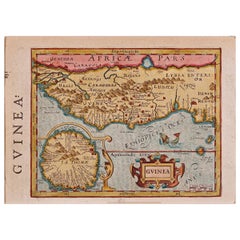
17th Century Hand-Colored Map of West Africa by Mercator/Hondius
Located in Alamo, CA
A 17th century hand-colored map entitled "Guineae Nova Descriptio" by Gerard Mercator and Jodocus
Category
Antique Mid-17th Century Dutch Maps
Materials
Paper
Persia, Armenia & Adjacent Regions: A 17th Century Hand-colored Map by De Wit
By Frederick de Wit
Located in Alamo, CA
A large 17th century hand colored copperplate engraved map entitled "Novissima nec non
Category
Antique Late 17th Century Dutch Maps
Materials
Paper
H 23.5 in W 27 in D 1.325 in
Prussia, Poland, N. Germany, Etc: A Hand-colored 17th Century Map by Janssonius
By Johannes Janssonius
Located in Alamo, CA
This is an attractive hand-colored copperplate engraved 17th century map of Prussia entitled
Category
Antique Mid-17th Century Dutch Maps
Materials
Paper
H 21.25 in W 24.63 in D 0.07 in
Original Antique Map of England and Wales with Large Cartouche
Located in Langweer, NL
Antique map titled 'Le Royaume d'Angleterre divisé en plusieurs Parties (..)'. Large and rare map
Category
Antique Late 17th Century Maps
Materials
Paper
North & South America: A 17th Century Hand-colored Map by Jansson & Goos
By Johannes Janssonius
Located in Alamo, CA
A 17th century hand-colored map of North & South America entitled "Americae Descriptio" by the
Category
Antique 1620s Dutch Maps
Materials
Paper
Large Antique Map of France by De Wit, c.1680
By Frederick de Wit
Located in Langweer, NL
Antique map titled 'Accuratissima Galliae Tabula vulgo Royaume de France'. Detailed map of France
Category
Antique 17th Century Maps
Materials
Paper
Large Map of Castile's Southern Realms - Granada, Andalusia, and Murcia, 1652
Located in Langweer, NL
the map, which represents the southern parts of the Crown of Castile during the mid-17th century, they
Category
Antique Mid-17th Century Maps
Materials
Paper
H 17.64 in W 23.75 in D 0.02 in
Early Original Antique Map of South East Asia with Large Parts Still Unknown
Located in Langweer, NL
Antique map titled 'Insulae Indiae Orientalis'. Original antique map of Southeast Asia. Shows towns
Category
Antique Late 17th Century Maps
Materials
Paper
H 8.47 in W 11.42 in D 0.02 in
The Normandy Region of France: A 17th C. Hand-colored Map by Sanson and Jaillot
By Nicolas Sanson
Located in Alamo, CA
This large hand-colored map entitled "Le Duché et Gouvernement de Normandie divisée en Haute et
Category
Antique 1690s French Maps
Materials
Paper
H 24.88 in W 38 in D 0.13 in
Antique Map of Westphalia, West Orientation
Located in Langweer, NL
Antique map titled 'Nova totius Westphaliae Descriptio'. Detailed map of Westphalia, Northern
Category
Antique Late 17th Century Maps
Materials
Paper
Antique Map of Silesia centered on Glogau
Located in Langweer, NL
Antique map titled 'Ducatus Silesiae Glogani vera delineatio'. This decorative map shows the Odra
Category
Antique Mid-17th Century Maps
Materials
Paper
Antique Map of the Niederrhein region, Germany
Located in Langweer, NL
Antique map titled 'Circulus Electorum Rheni sive Rhenanus Inferior (..)'. Original antique map of
Category
Antique Late 17th Century Maps
Materials
Paper
Antique Map of Belgium and Surroundings, 1692
Located in Langweer, NL
Antique map titled 'Provincie Meridionali de Paesi Bassi Intese sotto nome di Fiandra overo Li
Category
Antique 17th Century Maps
Materials
Paper
Antique Map of Venezuela by Montanus, 1671
By Arnoldus Montanus
Located in Langweer, NL
Antique map titled 'Venezuela cum parte Australi Novae Andalusiae'. The map extends from Coquibocoa
Category
Antique Mid-17th Century English Maps
Materials
Paper
Large Copper Engraved Map of the Coastline of Friesland and Terschelling, c.1670
Located in Langweer, NL
Antique print, titled: 'Dominii Frisiae Tabula, inter Flevum et Lavicum (…)'
This large copper
Category
Antique 1670s Maps
Materials
Paper
H 20.28 in W 23.9 in D 0 in
Antique Map of the Northwestern Coast of Spain
Located in Langweer, NL
Antique map titled 'Gallaecia Regnum'. Original old map of the northwestern coast of Spain
Category
Antique Mid-17th Century Maps
Materials
Paper
Antique Map of Madagascar by Mariette 'c.1670'
Located in Langweer, NL
(..)'. Original large-scale antique map of Madagascar, Africa. Published by Pierre Mariette, circa 1670.
Category
Antique Mid-17th Century Maps
Materials
Paper
Antique Map of Chili by Montanus, circa 1671
By Arnoldus Montanus
Located in Langweer, NL
Antique map titled 'Chili'. A very attractive map covering the known coastal region of Chile. The
Category
Antique Mid-17th Century Maps
Materials
Paper
Antique Map of Prussia by Blaeu, circa 1635
By Willem Blaeu
Located in Langweer, NL
Antique map titled 'Prussiae Nova Tabula'. Rare early edition of Blaeu's map of Prussia
Category
Antique Mid-17th Century Maps
Materials
Paper
Antique Map of Prussia by Blaeu, c.1680
Located in Langweer, NL
Antique map titled 'Prussiae nova Tabula'. Later edition of Blaeu's map of Prussia, embellished
Category
Antique 17th Century Maps
Materials
Paper
Antique Map of Zeeland, The Netherlands, by Jaillot, 1693
Located in Langweer, NL
Antique map titled 'Le Comte de Zeelande (..).' Detailed map of the province of Zeeland, The
Category
Antique 17th Century Maps
Materials
Paper
Antique Detailed World Map Drawn on Mercator's Projection, 1700
Located in Langweer, NL
Antique world map titled 'Carte generale du monde, ou description du monde terrestre & Aquatique
Category
Antique 17th Century Maps
Materials
Paper
Antique Map of Greece by J. Jansson, circa 1653
Located in Langweer, NL
, circa 1653. This striking 17th century map of Greece was based on “Totius Graeciae Descriptio,” a large
Category
Antique Mid-17th Century Maps
Materials
Paper
Antique Map of the Empire of the Great Mogul
Located in Langweer, NL
features of the map, along with the large mythical lake of Chiamay Lacus located in northern Burma. Wild
Category
Antique Late 17th Century Maps
Materials
Paper
Antique Map of Mexico by Ortelius, circa 1602
By Abraham Ortelius
Located in Langweer, NL
Antique map titled 'Hispaniae Novae Sivae Magnae Recens Et Vera Descriptio 1579'. Map of western
Category
Antique Early 17th Century Belgian Maps
Materials
Paper
Spectacular Large Map of Upper and Lower Austria between Passau and Wien, c.1700
Located in Langweer, NL
Antique map titled 'Austriae Archiducatus pars superior in omnes ejusdem (..).'
Spectacular large
Category
Antique Early 1700s Maps
Materials
Paper
H 21.15 in W 35.63 in D 0 in
Original Antique Hand- Map of Africa by Allard '1697'
Located in Langweer, NL
Antique map titled 'Novissima et Perfectissima Africae (..)'. Beautiful large map of Africa. This
Category
Antique Late 17th Century Maps
Materials
Paper
Antique Map of Southeast Asia by Blaeu, c.1640
Located in Langweer, NL
"Antique map titled 'India quae Orientalis dicitur et Insulae adiacentes'. Map of Southeast Asia
Category
Antique 17th Century Maps
Materials
Paper
Antique Map of Denmark by F. de Wit, 1680
Located in Langweer, NL
Antique map titled 'Dania Regnum'. Large, attractive map of Denmark, Sleschwig-Holstein and
Category
Antique Late 17th Century Maps
Materials
Paper
Antique Map of Austria by N. Visscher, circa 1690
Located in Langweer, NL
Antique map titled 'Austriae Archiducatus pars superior in omnes ejusdem'. Spectacular large map of
Category
Antique Late 17th Century Maps
Materials
Paper
1633 Map Entitled "Beauvaisis Comitatus Belova Cium, Ric.0002
Located in Norton, MA
as a result of the discoveries made on the Schouten/Le Maire voyage of 1615-17. * c. 1624 World Map
Category
Antique 17th Century Dutch Maps
Materials
Paper
Original Antique Map of the Holy Land with Decorative Cartouche
Located in Langweer, NL
Antique map titled 'Totius Terrae Sanctae'. Original old map of the Holy Land, with a large
Category
Antique Late 17th Century Maps
Materials
Paper
Antique Map of Batavia 'Jakarta, Indonesia' by Montanus, 1679
Located in Langweer, NL
in the background. The plan is based on the earlier, much larger map of Batavia published by Clement
Category
Antique Late 17th Century Unknown Maps
Materials
Paper
Antique Map of the County of Hainaut by Jaillot, 1692
Located in Langweer, NL
Antique map titled 'Le Comté de Haynaut divisé en Chateliensis, Balliages, Prevoste's (..)'. Large
Category
Antique 17th Century Maps
Materials
Paper
Antique Map of Switzerland by N. Visscher, circa 1690
Located in Langweer, NL
Italy. This map features two decorative cartouches: the larger is flanked by two putti, one in military
Category
Antique Late 17th Century Maps
Materials
Paper
Antique Map of the Limoges Region in France, c.1690
Located in Langweer, NL
Antique map titled 'Le Diocèse de Limoges'. Large map of the Limoges region, France.
The map is
Category
Antique 17th Century Maps
Materials
Paper
Antique Map of the Region of Wonseradeel by Schotanus, 1664
By B. Schotanus
Located in Langweer, NL
Antique map titled 'De Grietenije van Wonsera-deel (..).' Map of the Grietenij of Wonseradeel
Category
Antique 17th Century Maps
Materials
Paper
Original Antique Map of Friesland in Decorative Hand-Colouring, 1600
Located in Langweer, NL
Antique map titled 'Frisiae antiquissima trans rhenu provinc et adiacentium regionum nova et exacta
Category
Antique 17th Century Maps
Materials
Paper
Antique Map of the Hainaut Region by Visscher, c.1690
By Nicolaes Visscher II
Located in Langweer, NL
Antique map titled 'Comitatus Hannoniae et Archiepiscopatus Cameracensis Tabula'. Large map of the
Category
Antique 17th Century Maps
Materials
Paper
Antique Map of Drenthe, a Province in The Netherlands, 1658
Located in Langweer, NL
, a province in the Netherlands. Large cartouche with coats of arms. This map is made by J. Janssonius
Category
Antique 17th Century Maps
Materials
Paper
Decorative Original Antique Map of Greece by Ortelius, c.1609
Located in Langweer, NL
ship and a large ornate strapwork cartouche. This map originates from 'Theatrum Orbis Terrarum' by A
Category
Antique 17th Century Maps
Materials
Paper
1657 Janssonius Map of Vermandois and Cappelle, Ric. A-004
Located in Norton, MA
, Preone, Lafere, Channi, and Noyon, among other larger towns in the region. The Cappelle map is centered
Category
Antique 17th Century Unknown Maps
Materials
Paper
Original Hand-coloured Antique Map of Pomerania by Sanson '1684'
By Nicolas Sanson
Located in Langweer, NL
Antique map titled 'Le Duche de Pomeranie divise en ses Principales Parties (..)'. Large map of
Category
Antique Late 17th Century Maps
Materials
Paper
Antique Map of the Region of Bretagne by Janssonius '1657'
By Johannes Janssonius
Located in Langweer, NL
the title, key and scale, a large armorial and several vignette galleons. This map originates from
Category
Antique Mid-17th Century Maps
Materials
Paper
Antique Map of the Artois region by Visscher, c.1690
Located in Langweer, NL
Antique map titled 'Geographica Artesiae Comitatus Tabula'. Large map of the Artois region, France
Category
Antique 17th Century Maps
Materials
Paper
Antique Map of Thracia ‘Greece’ by J. Janssonius, circa 1650
Located in Langweer, NL
This antique map of Thracia is engraved and published by J. Janssonius after the cartographical
Category
Antique Mid-17th Century Maps
Materials
Paper
Original Antique Map of the Picardy Region in Northern France, 1694
Located in Langweer, NL
Antique map titled 'La Province de Picardie (..)'. Large map of the Picardy region of France. Shows
Category
Antique 17th Century Maps
Materials
Paper
Antique Map of Sri Lanka with an unusual five-sided shape
Located in Langweer, NL
Antique map titled 'Ins. Ceilan quae incolis Tenarisin dicitur'. This exquisite, early map of Sri
Category
Antique Early 17th Century Maps
Materials
Paper
1654 Joan Blaeu Map the Sutherland, Scotland, Entitled "Southerlandia, "Ric0007
Located in Norton, MA
1654 Joan Blaeu map of the
Sutherland, Scotland, entitled
"Southerlandia,"
Hand Colored
Category
Antique 17th Century Dutch Maps
Materials
Paper
H 20.36 in W 23.23 in D 0.4 in
Antique Map of the Region of Gaasterland, Friesland, The Netherlands, 1664
Located in Langweer, NL
Antique map titled 'De Grietenie van Gaesterlandt (..)'. Map of the region of Gaasterland in
Category
Antique 17th Century Maps
Materials
Paper
H 11.82 in W 14.77 in D 0 in
Antique Map of Guinea in West Africa by Blaeu, c.1638
Located in Langweer, NL
Antique map titled 'Guinea'.
Decorative map of West Africa, including numerous animals in the
Category
Antique 17th Century Maps
Materials
Paper
Antique Map of Flanders 'Belgium' by F. de Wit, circa 1680
Located in Langweer, NL
Antique map titled 'Comitatus Flandriae Tabula, in Lucem Edita'. Large map of Flanders, Belgium
Category
Antique Late 17th Century Maps
Materials
Paper
Antique Map of Macedonia by the Famous Mapmaker Blaeu, c.1650
Located in Langweer, NL
Antique map titled 'Macedonia, Epirus et Achaia'.
Ornated with a nice allegoric cartouche, one
Category
Antique 17th Century Maps
Materials
Paper
- 1
Get Updated with New Arrivals
Save "17th Map Large", and we’ll notify you when there are new listings in this category.
17th Map Large For Sale on 1stDibs
Surely you’ll find the exact 17th map large you’re seeking on 1stDibs — we’ve got a vast assortment for sale. Finding the perfect 17th map large may mean sifting through those created during different time periods — you can find an early version that dates to the 17th Century and a newer variation that were made as recently as the 18th Century. If you’re looking to add a 17th map large to create new energy in an otherwise neutral space in your home, you can find a work on 1stDibs that features elements of gray, brown, beige and more. A 17th map large from Nicholas Sanson d'Abbeville and Frederick de Wit — each of whom created distinctive versions of this kind of work — is worth considering. Artworks like these — often created in engraving — can elevate any room of your home.
How Much is a 17th Map Large?
A 17th map large can differ in price owing to various characteristics — the average selling price for items in our inventory is $2,175, while the lowest priced sells for $675 and the highest can go for as much as $2,375.
More Ways To Browse
Antique Alaska Maps
Antique Maps Of Israel
Antique Map Poland
Alaska Antique Map
Antique Map Of Israel
Antique Sicily Map
Framed Africa Maps
Antique Map Sicily
Framed Map Asia
Oath Of The
Antique African Wooden Sculptures
Pirate Sculpture
Copper Whale
Antique Urn Print
Porto Plate
Map Of Jerusalem
Map Of Alaska
Rush Seat Set Of 12
