Items Similar to Large Copper Engraved Map of the Coastline of Friesland and Terschelling, c.1670

Want more images or videos?
Request additional images or videos from the seller
1 of 5
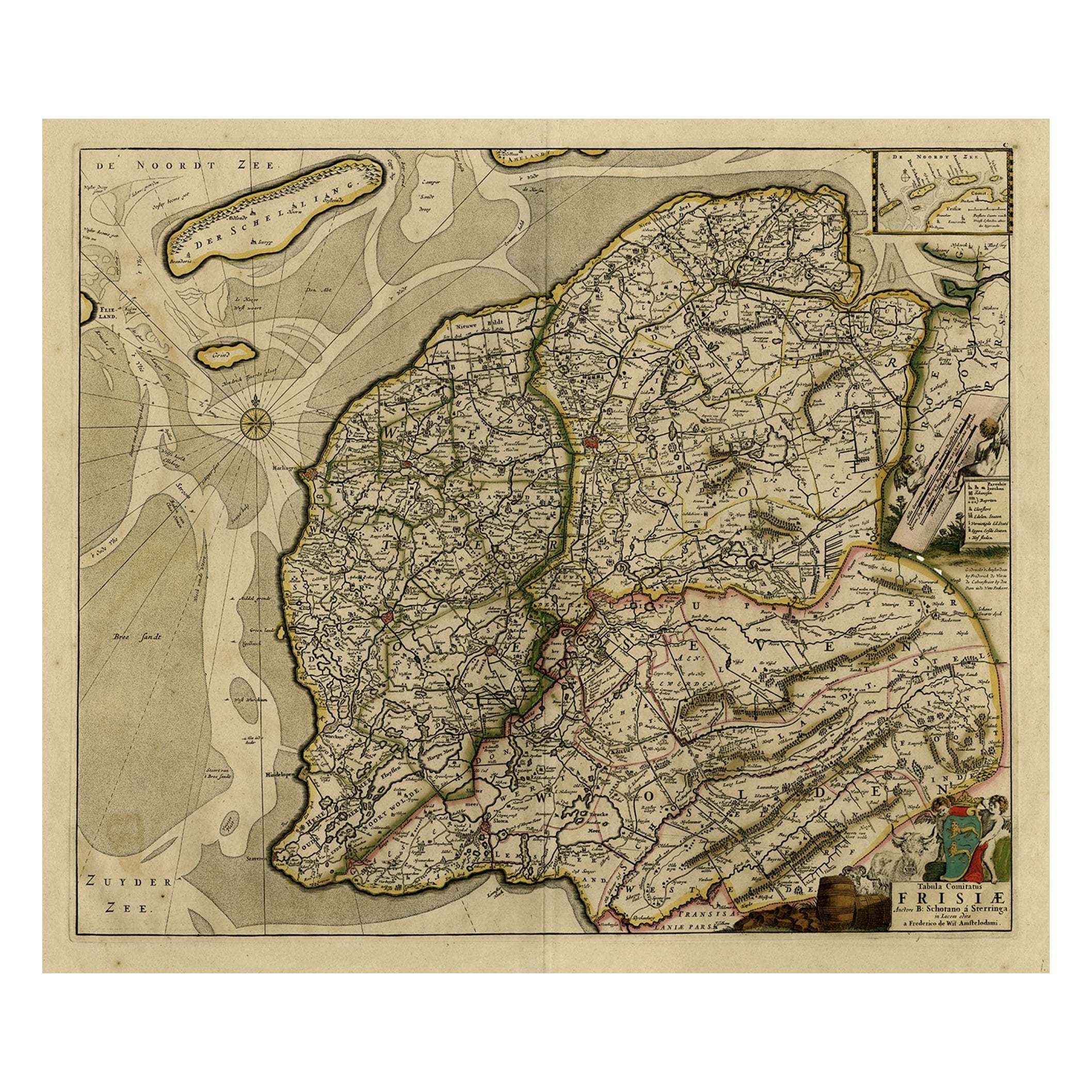
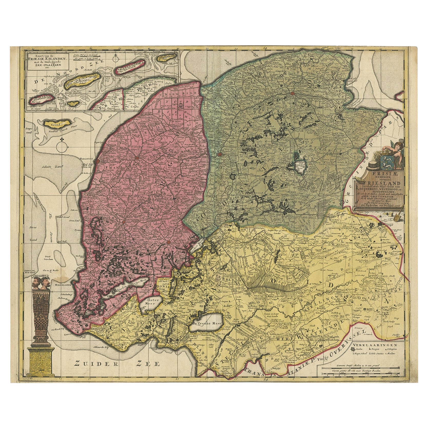
Large Copper Engraved Map of the Coastline of Friesland and Terschelling, c.1670
About the Item
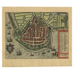
Antique print, titled: 'Dominii Frisiae Tabula, inter Flevum et Lavicum (…)'
This large copper engraved map details the coastline of Friesland and Terschelling. At east is a part of Groningen. The main cities are colored in red. The very decorative cartouches displays putti and a coat of arms. At the right corner there is an inset with the isles belonging to this province. From: 'Germania Inferiorsive XVII Provinciarum Geographicae Generalis uit et Particulares tabulae.' (Kaert-Boeck van de XVII Nederlandtsche Provincien.), published by Nicolaas Visscher II in Amsterdam. ca. 1670. Exact ed. to be determined. Ref: Koeman III Vis 10 (18).
Artists and Engravers: Publisher: Nicolaes Visscher II. Cartographer: Bernardus Schotanus a Sterringa (1640-1704). Publisher: The Visscher family were art and map dealers in Amsterdam during the 17th century. Funded by C. J. Visscher (1587-1652), the business was continued by his son and grandson both named Nicolas. Nicolas Visscher I was born 1618 in Wenns, Austria. He died 1679 in Linz. After the death of Nicolas II, his widow passed the business to Pieter Schenk.
- Dimensions:Height: 20.28 in (51.5 cm)Width: 23.9 in (60.7 cm)Depth: 0 in (0.02 mm)
- Materials and Techniques:
- Period:1670-1679
- Date of Manufacture:circa 1670
- Condition:Condition: Good, given age. Original middle fold, as issued. Slight paper separation at top and lower middle fold, Backed. Remains of paper from previous Atlas attachment at rear middle fold. Paper edges browned. Light soiling. Original coloring.
- Seller Location:Langweer, NL
- Reference Number:
About the Seller
5.0
Platinum Seller
These expertly vetted sellers are 1stDibs' most experienced sellers and are rated highest by our customers.
Established in 2009
1stDibs seller since 2017
1,947 sales on 1stDibs
Typical response time: <1 hour
- ShippingRetrieving quote...Ships From: Langweer, Netherlands
- Return PolicyA return for this item may be initiated within 14 days of delivery.
More From This SellerView All
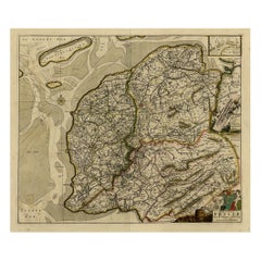
- Map of Friesland with Terschelling, Vlieland, Ameland En Schiermonnikoog, C.1670Located in Langweer, NLAntique print, titled: 'Tabula Comitatus Frisiae …' Map of Friesland with the island Terschelling, Vlieland, Ameland en Schiermonnikoog. With a cartouche and a compass rose. Publ...Category
Antique 1670s Maps
MaterialsPaper
- Antique Map of Friesland ‘The Netherlands’ by N. Visscher, circa 1670By Nicolaes Visscher IILocated in Langweer, NLThis large copper engraved map details the coastline of Friesland and Terschelling. At east is a part of Groningen. The main cities are colored in red. The very decorative cartouches...Category
Antique Late 17th Century Maps
MaterialsPaper
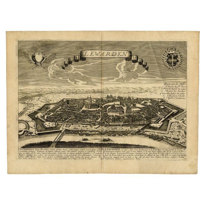
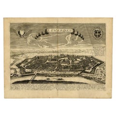
- Antique Print of the Capital of Friesland Leeuwarden, The Netherlands, c.1670Located in Langweer, NLAntique print titled 'Lewarden.' A bird's eye view of Leeuwarden (Friesland, the Netherlands). Views of Jollain are scarse and sought after by collectors. Artists and Engravers: M...Category
Antique 17th Century Prints
MaterialsPaper
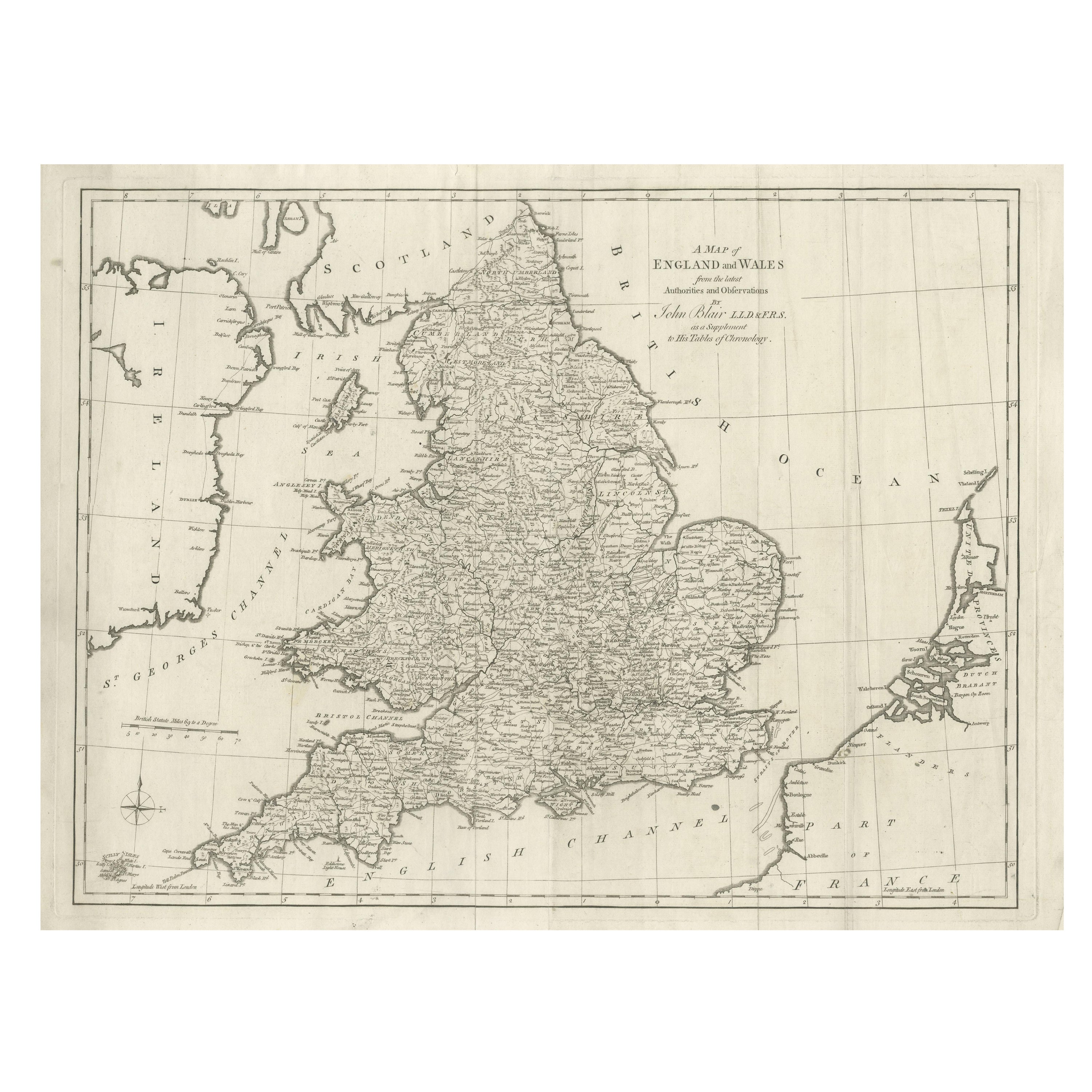
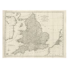
- Large Antique Map England and Wales, with Part of the CoastlinesLocated in Langweer, NLAntique map titled 'A Map of England and Wales (..)'. Large antique map of England and Wales, with part of the continental and Irish coasts. Published J. Blair, circa 1779.Category
Antique Late 18th Century Maps
MaterialsPaper
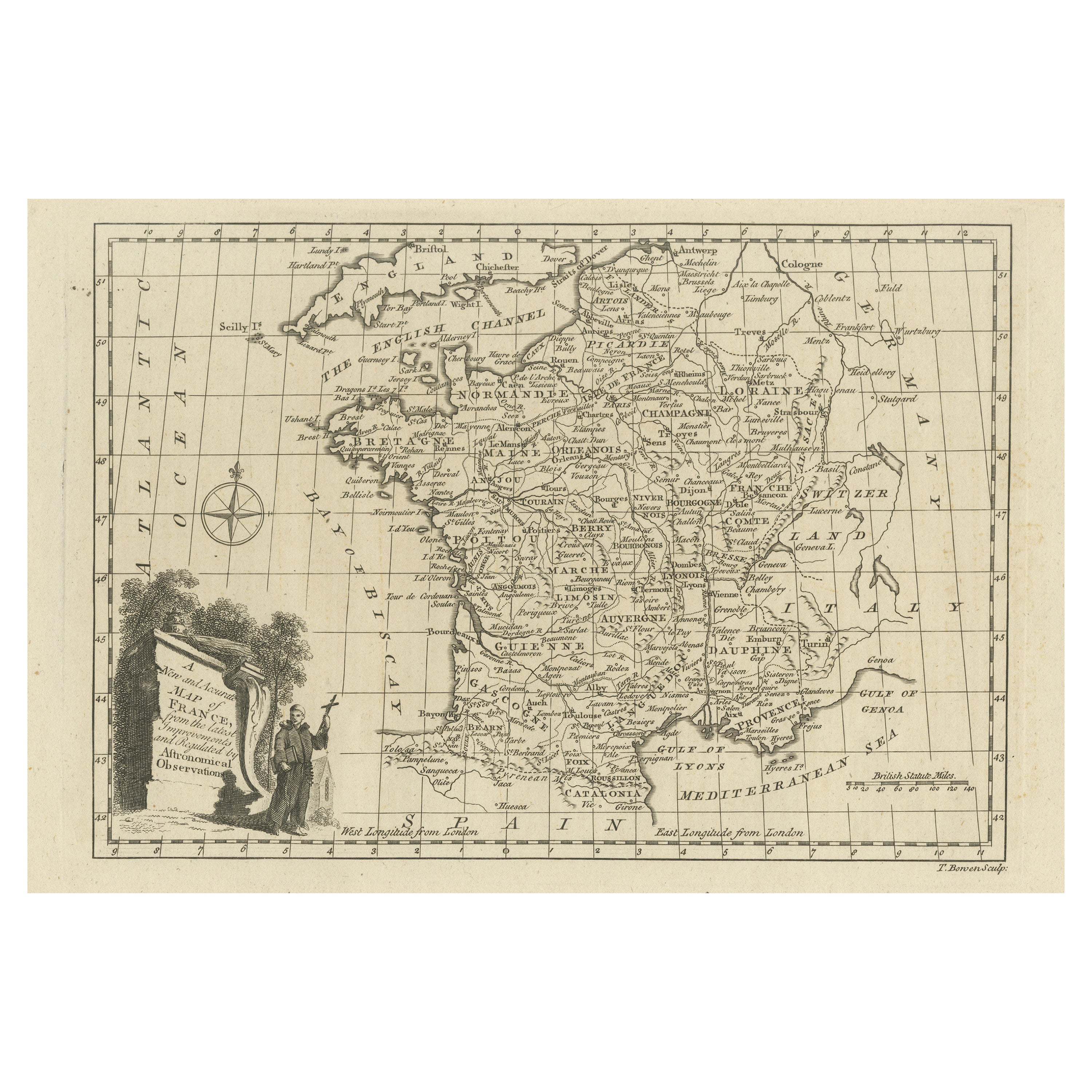
- Original Copper Engraved Map of FranceLocated in Langweer, NLAntique map titled 'New and Accurate Map of France from the latest improvements'. Original copper engraved map of France. Engraved by T. Bowen, published circa 1771.Category
Antique Late 18th Century Maps
MaterialsPaper
- Detailed Copper Engraved City Map of Enkuizen, the Netherlands, c.1620By L. GuicciardiniLocated in Langweer, NLAntique map titled 'Die stadt Enchuijsen.' Detailed copper engraved city map of Enkuizen, the Netherlands, by Lodovico Guicciardini and published by Janssonius. Highly decorated with...Category
Antique 17th Century Maps
MaterialsPaper


You May Also Like
- Original Antique Map of The Netherlands, Engraved by Barlow, Dated 1807Located in St Annes, LancashireGreat map of Netherlands Copper-plate engraving by Barlow Published by Brightly & Kinnersly, Bungay, Suffolk. Dated 1807 Unframed.Category
Antique Early 1800s English Maps
MaterialsPaper
- Original Antique Map of Sweden, Engraved by Barlow, 1806Located in St Annes, LancashireGreat map of Sweden Copper-plate engraving by Barlow Published by Brightly & Kinnersly, Bungay, Suffolk. 1806 Unframed.Category
Antique Early 1800s English Maps
MaterialsPaper
- Map of the Republic of GenoaLocated in New York, NYFramed antique hand-coloured map of the Republic of Genoa including the duchies of Mantua, Modena, and Parma. Europe, late 18th century. Dimension: 25...Category
Antique Late 18th Century European Maps
- Map "Estuary- Mouth of the Thames"Located in Alessandria, PiemonteST/426 - Antique French Map of the estuary of the Thames, map dated 1769 - "Mape of the entrance of the Thames. Designed by filing of Navy cards fo...Category
Antique Mid-18th Century French Other Prints
MaterialsPaper
- Large Antique 1859 Map of North AmericaLocated in Sag Harbor, NYThis Map was made by Augustus Mitchell in 1859 It is in amazing condition for being 163 years old. This price is for the rolled up easy to ship version of this piece. I will be Frami...Category
Antique Mid-19th Century American Maps
MaterialsCanvas, Paper

- Large 17th Century Hand Colored Map of England and the British Isles by de WitBy Frederick de WitLocated in Alamo, CAA large hand colored 17th century map of England and the British Isles by Frederick de Wit entitled "Accuratissima Angliæ Regni et Walliæ Principatus", published in Amsterdam in 1680. It is a highly detailed map of England, Scotland, the Scottish Isles...Category
Antique Late 17th Century Dutch Maps
MaterialsPaper


Recently Viewed
View AllMore Ways To Browse
Large Coat Of Arms
Austrian Dealers
Dior Coat Red
Antique Copper Antiques Art Collectables
Antique Copper Art Collectibles
Austrian 17th
Large City Maps
17th Map Large
Map Austria
Map Of Austria
Vans Coat Of Arms
Large Antique City Maps
Amsterdam Coat Of Arms
18c Engraved Prints
18 C Copper
Antique Map Art Collectibles
Antique Maps Art Collectibles
Antique Map Schenk