Items Similar to Original Antique Map of England and Wales with Large Cartouche


Want more images or videos?
Request additional images or videos from the seller
1 of 6
Original Antique Map of England and Wales with Large Cartouche
About the Item
Antique map titled 'Le Royaume d'Angleterre divisé en plusieurs Parties (..)'. Large and rare map of England and Wales by J.B. Nolin after Coronelli. With decorative cartouche, table and inset map of the Jersey and Guernsey Islands. Published 1689.
- Dimensions:Height: 18.12 in (46 cm)Width: 23.75 in (60.3 cm)Depth: 0.02 in (0.5 mm)
- Materials and Techniques:
- Period:Late 17th Century
- Date of Manufacture:1689
- Condition:General age-related toning. Original folding line, with split. Narrow margins. Shows some wear and soiling. Blank verso. Please study image carefully.
- Seller Location:Langweer, NL
- Reference Number:
About the Seller
5.0
Platinum Seller
These expertly vetted sellers are 1stDibs' most experienced sellers and are rated highest by our customers.
Established in 2009
1stDibs seller since 2017
1,916 sales on 1stDibs
Typical response time: <1 hour
- ShippingRetrieving quote...Ships From: Langweer, Netherlands
- Return PolicyA return for this item may be initiated within 14 days of delivery.
More From This SellerView All
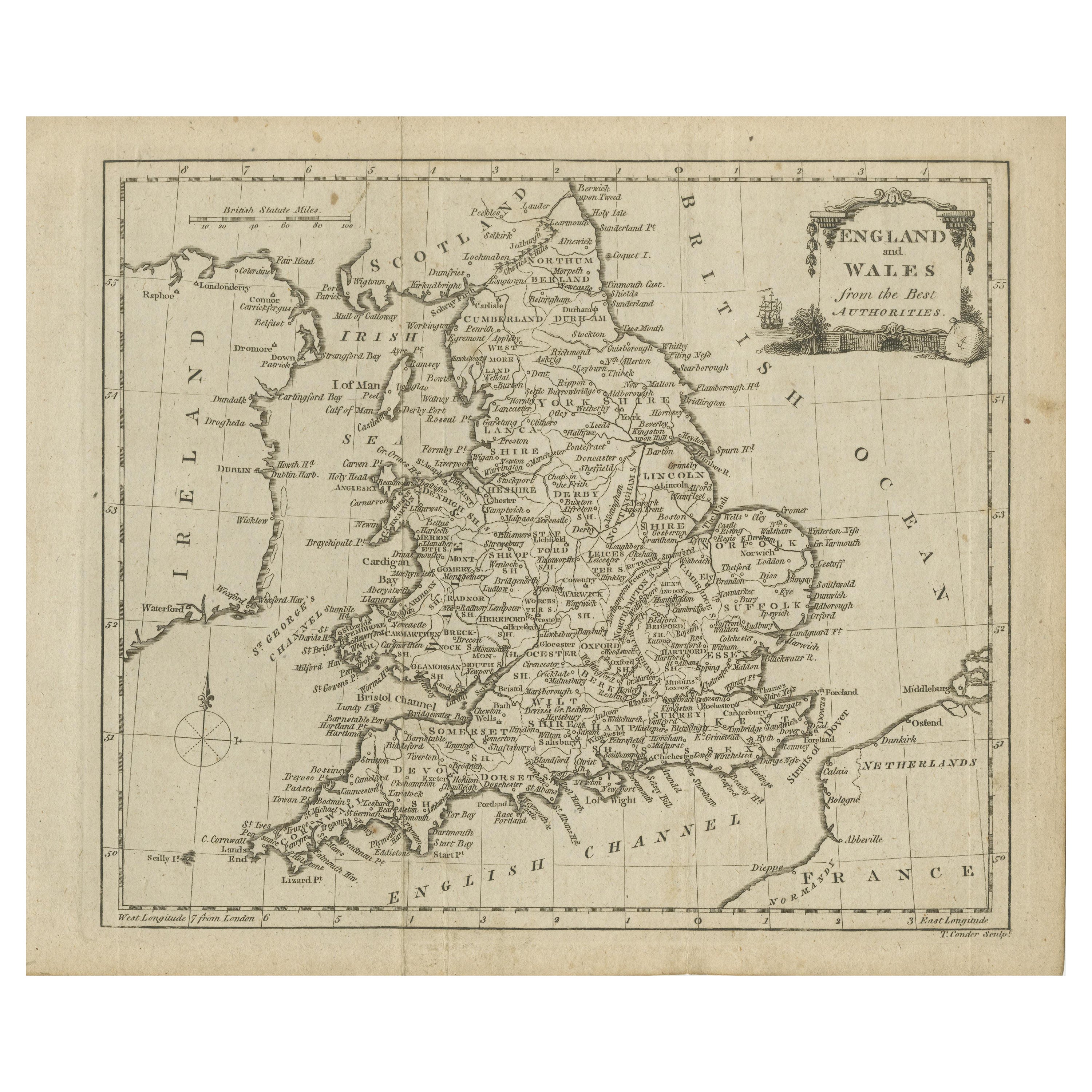
- Original Antique Map of England and Wales, with Decorative CartoucheLocated in Langweer, NLAntique map titled 'England and Wales from the best Authorities'. Original antique map of England and Wales, with decorative cartouche. Engraved by T. Conder. Published circa 1790.Category
Antique Late 18th Century Maps
MaterialsPaper
- Original Antique Map of England and WalesLocated in Langweer, NLAntique map titled 'A New and Correct Map of England and Wales from the Latest and Best Improvements'. Original antique map of England and Wales. Printed by Alex Hogg, London for George Henry Millar's 'New, Complete and Universal System...Category
Antique Late 18th Century Maps
MaterialsPaper
- Large Antique Map of England and WalesLocated in Langweer, NLAntique map titled 'An Accurate Map of England and Wales'. Original old map of England and Wales. Engraved by John Cary. Originates from 'New British Atlas' by John Stockdale, publis...Category
Antique Early 19th Century Maps
MaterialsPaper
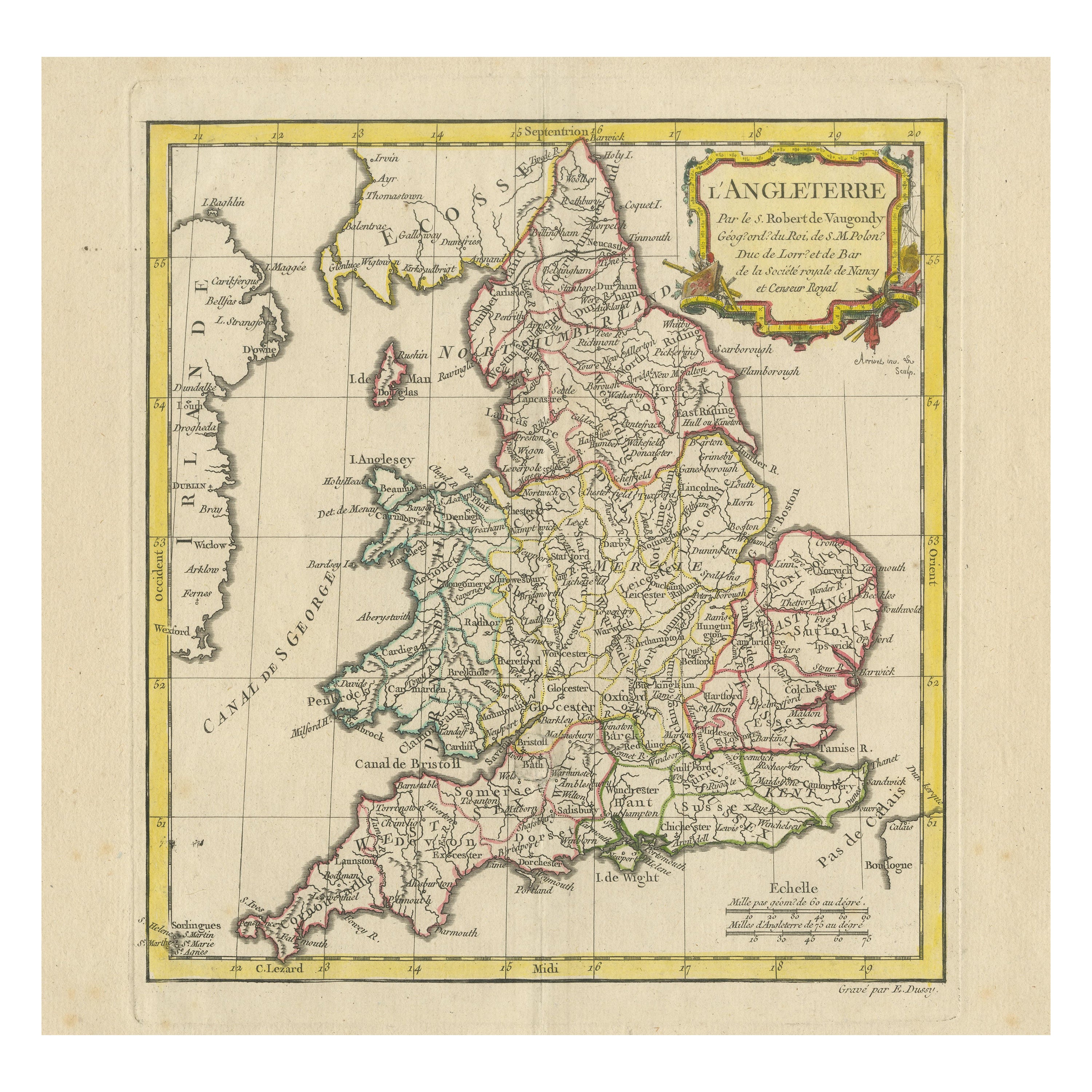
- Original Antique Map of England with Decorative CartoucheLocated in Langweer, NLAntique map titled 'l'Angleterre (..)'. Original antique map of England, with beautiful hand coloring and decorative cartouche. This map originates from 'Nouvel Atlas Portatif destin...Category
Antique Late 18th Century Maps
MaterialsPaper
- Original Antique Map of England, Ireland, Scotland and WalesLocated in Langweer, NLAntique map titled 'Les Isles Britanniques, ou sont les Royaumes d Angleterre (..)'. Detailed map of England, Ireland, Scotland and Wales, with French coast and part of the Netherlan...Category
Antique Early 18th Century Maps
MaterialsPaper
- Miniature Antique Map of England and WalesLocated in Langweer, NLMiniature map titled 'England & Wales'. Original antique map of England & Wales. This map originates from 'Darton's New Miniature Atlas' publis...Category
Antique Early 19th Century Maps
MaterialsPaper


You May Also Like
- Large Original Antique Folding Map of Manchester, England, Dated 1793Located in St Annes, LancashireSuperb map of Manchester and Salford Folding map. Printed on paper laid on to the original canvas Unframed. Published by C. Laurent, 1793. ...Category
Antique 1790s English Georgian Maps
MaterialsCanvas, Paper
- Large Original Vintage Map of New South Wales, Australia, circa 1920Located in St Annes, LancashireGreat map of New South Wales Original color. Good condition Published by Alexander Gross Unframed.Category
Vintage 1920s English Edwardian Maps
MaterialsPaper
- Large Scale Antique Scroll Map of Lincolnshire, England, Dated 1778Located in St Annes, LancashireWonderful scroll map of Lincolnshire By Captain Armstrong, 1778 Copper plate engraving on paper laid on canvas Original ebonized wood frame with lo...Category
Antique 1770s English Georgian Maps
MaterialsWood, Paper
- Large Original Antique Map of Java and Borneo, Fullarton, C.1870Located in St Annes, LancashireGreat map of Java and Borneo Wonderful figurative borders From the celebrated Royal Illustrated Atlas Lithograph. Original color. Published by Fullarton, Edinburgh. C.1870 Unfr...Category
Antique 1870s Scottish Maps
MaterialsPaper
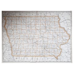
- Large Original Antique Map of Iowa, USA, 1894By Rand McNally & Co.Located in St Annes, LancashireFabulous map of Iowa. Original color. By Rand, McNally & Co. Published, 1894. Unframed. Free shipping.Category
Antique 1890s American Maps
MaterialsPaper
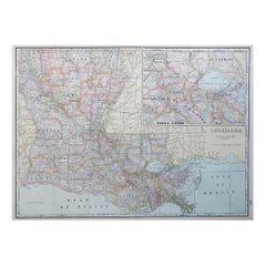
- Large Original Antique Map of Louisiana, USA, C.1900Located in St Annes, LancashireFabulous map of Louisiana. Original color. Engraved and printed by the George F. Cram Company, Indianapolis. Published, c.1900. Unframed. Repair ...Category
Antique 1890s American Maps
MaterialsPaper


Recently Viewed
View AllMore Ways To Browse
Guernsey England
Pakistan Antique Map
Armenia Map
Armenian Map
Antique Maps Uk
Antique Uk Map
Antique Uk Maps
Northumberland Map
Uk Antique Map
Ancient Map Of Jerusalem
Antique Jamaica Map
Antique Map Brooklyn
Antique Map Of Brooklyn
Antique Map Of Jamaica
Corse Antique
Map Of The Bahamas
Old Sicily Map
Saudi Arabia Antique Map