Items Similar to Original Antique Map of England with Decorative Cartouche

Want more images or videos?
Request additional images or videos from the seller
1 of 6
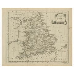
Original Antique Map of England with Decorative Cartouche
About the Item
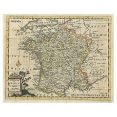
Antique map titled 'l'Angleterre (..)'. Original antique map of England, with beautiful hand coloring and decorative cartouche. This map originates from 'Nouvel Atlas Portatif destine principalement sur l’Etude de la Geographie par le S.Robert Vaugondy (..)'. Engraved by E. Dussy. Published 1778.
- Dimensions:Height: 11.3 in (28.7 cm)Width: 16.34 in (41.5 cm)Depth: 0.02 in (0.5 mm)
- Materials and Techniques:
- Period:
- Date of Manufacture:1778
- Condition:General age-related toning, original folding line. Minor wear and soiling. Small piece of tape on top and bottom margin. Blank verso. Please study image carefully.
- Seller Location:Langweer, NL
- Reference Number:
About the Seller
5.0
Platinum Seller
These expertly vetted sellers are 1stDibs' most experienced sellers and are rated highest by our customers.
Established in 2009
1stDibs seller since 2017
1,916 sales on 1stDibs
Typical response time: <1 hour
- ShippingRetrieving quote...Ships From: Langweer, Netherlands
- Return PolicyA return for this item may be initiated within 14 days of delivery.
More From This SellerView All
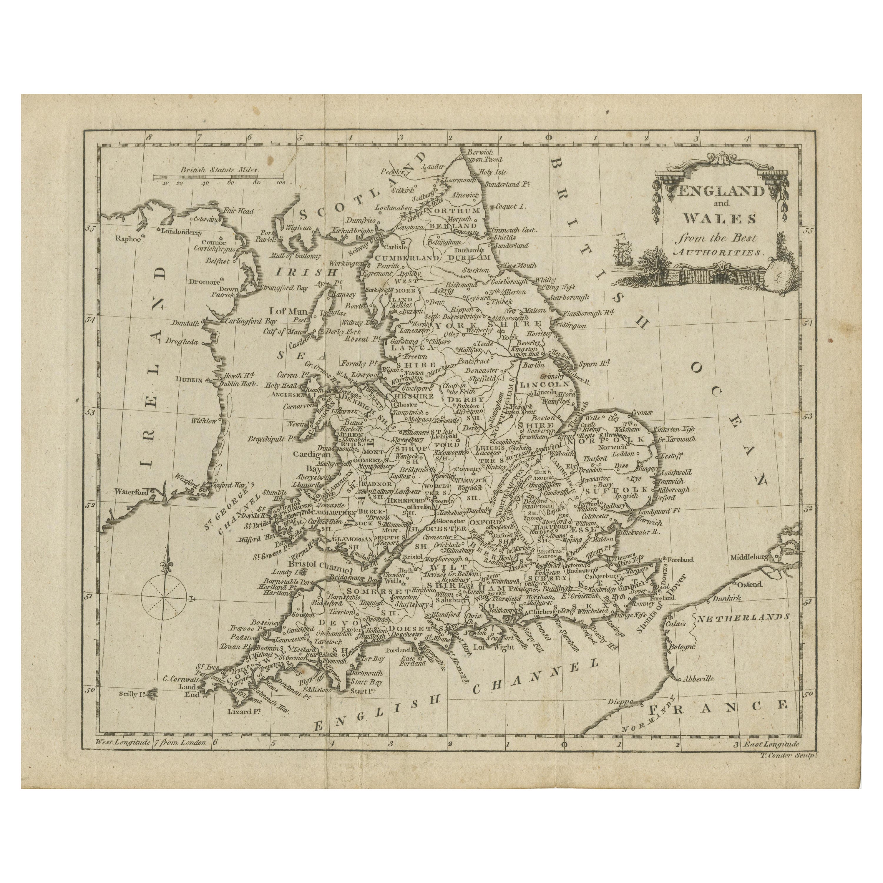
- Original Antique Map of England and Wales, with Decorative CartoucheLocated in Langweer, NLAntique map titled 'England and Wales from the best Authorities'. Original antique map of England and Wales, with decorative cartouche. Engraved by T. Conder. Published circa 1790.Category
Antique Late 18th Century Maps
MaterialsPaper
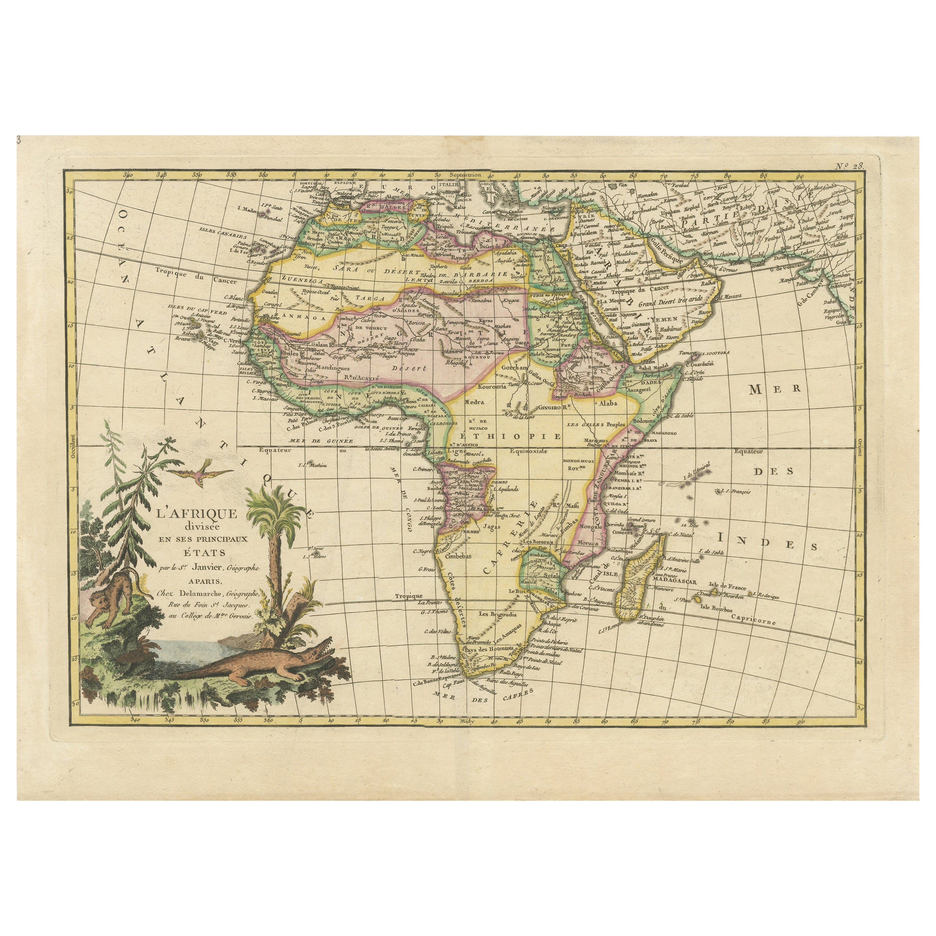
- Original Antique Map of Africa with large decorative cartoucheLocated in Langweer, NLOriginal antique map titled 'L'Afrique divisée en ses principaux États'. Attractive and precise map of Africa, with large decorative cartouche. Engraved by Janvier. Published by Dela...Category
Antique Late 18th Century Maps
MaterialsPaper
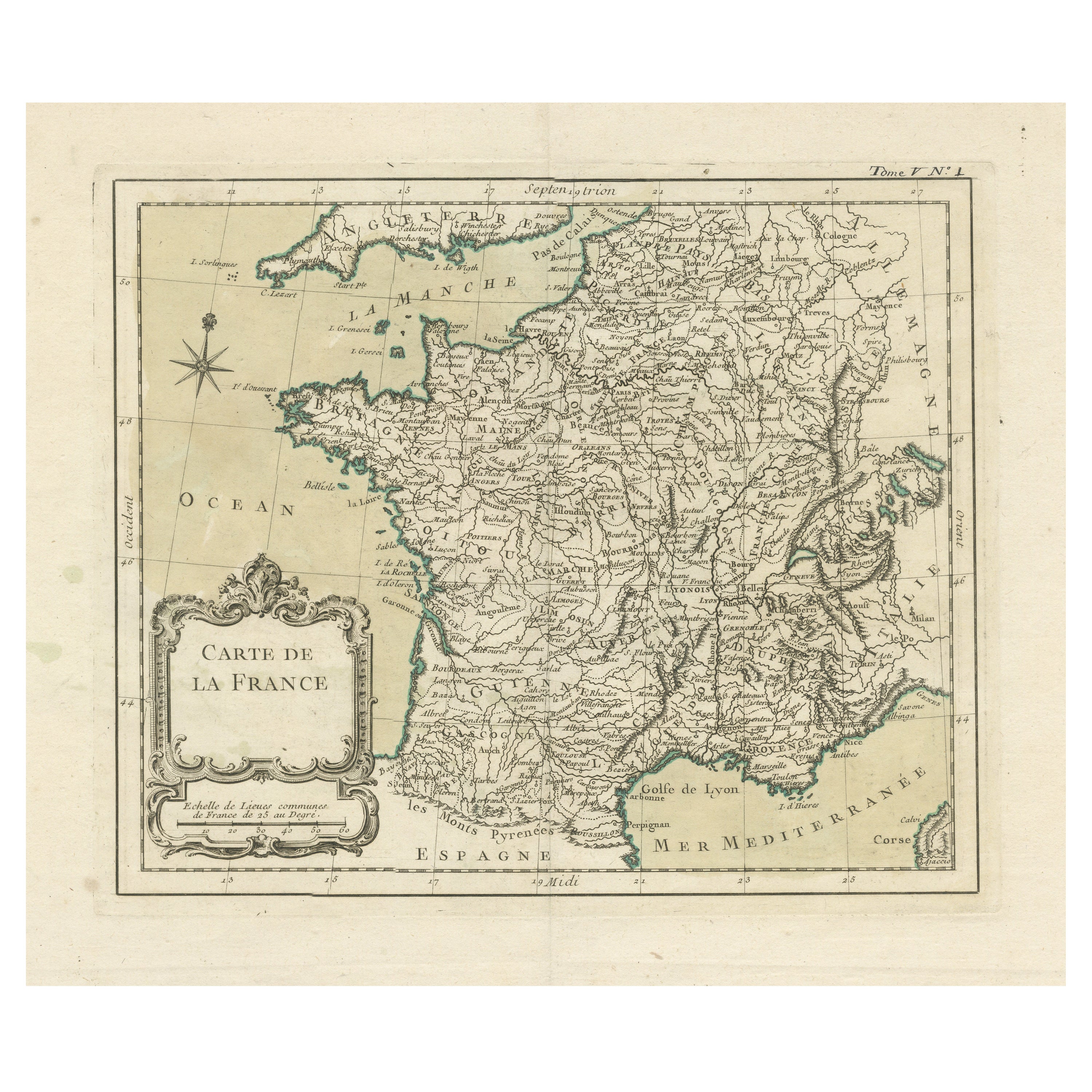
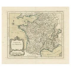
- Antique Map of France with Decorative Title CartoucheLocated in Langweer, NLAntique map titled 'Carte de la France'. Original old map of France. This map originates from 'Le Petit Atlas Maritime Recueil De Cartes et Plans Des Quatre Parties Du Monde (..) by ...Category
Antique Mid-18th Century Maps
MaterialsPaper
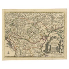
- Antique French Map of Hungary with Decorative Title Cartouche, c.1730Located in Langweer, NLAntique map titled 'La Hongrie suivant les Nouvelles Observations (..)'. Antique map of Hungary with decorative title cartouche. Artists and Engravers: ...Category
Antique 18th Century Maps
MaterialsPaper
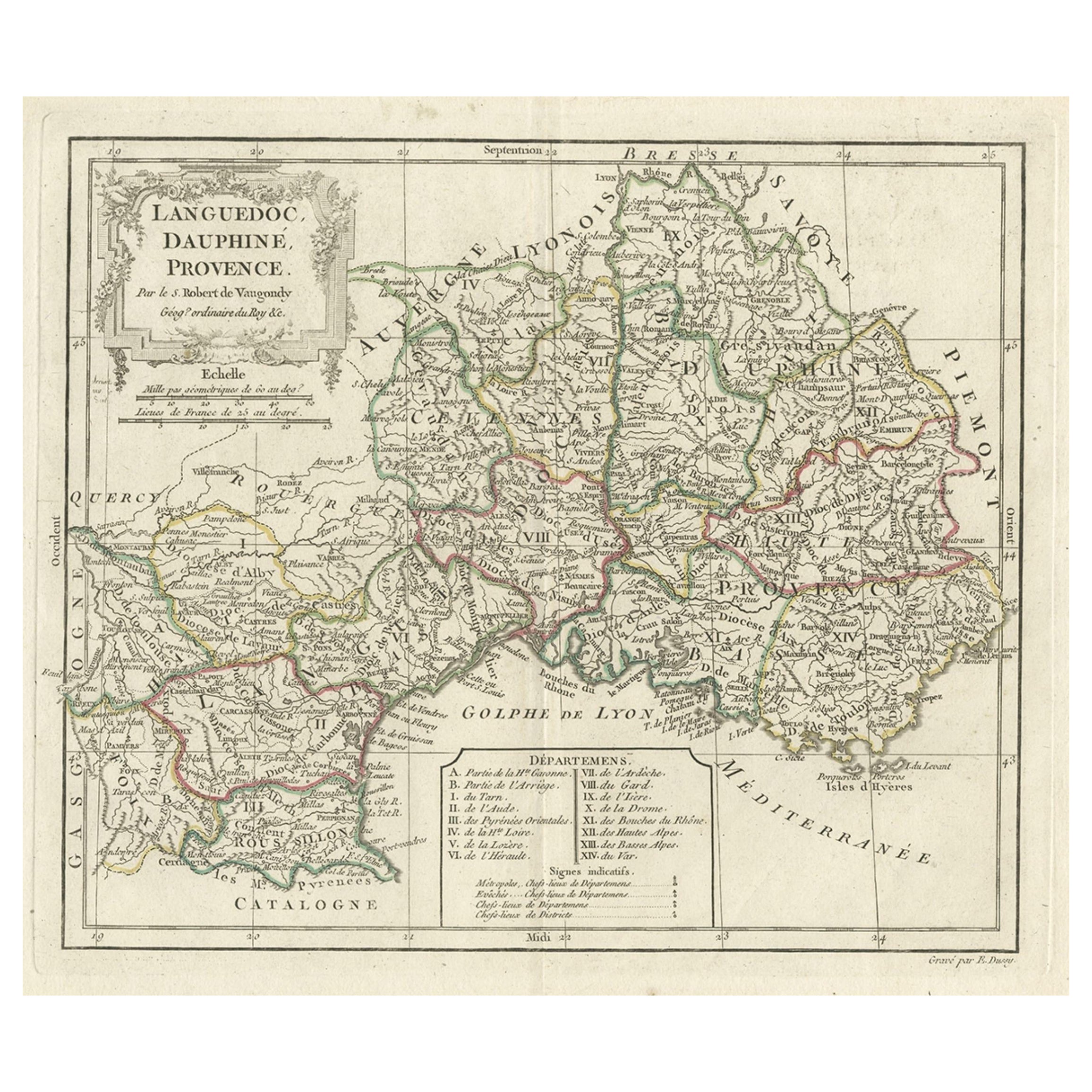
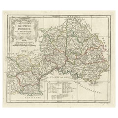
- Beautiful Antique Map of Southeastern France with Decorative Cartouche, ca.1790Located in Langweer, NLAntique map titled 'Languedoc, Dauphiné, Province'. Beautiful antique map of Southeastern France with decorative cartouche. Map includes topographical detail as well as a referen...Category
Antique 1790s Maps
MaterialsPaper
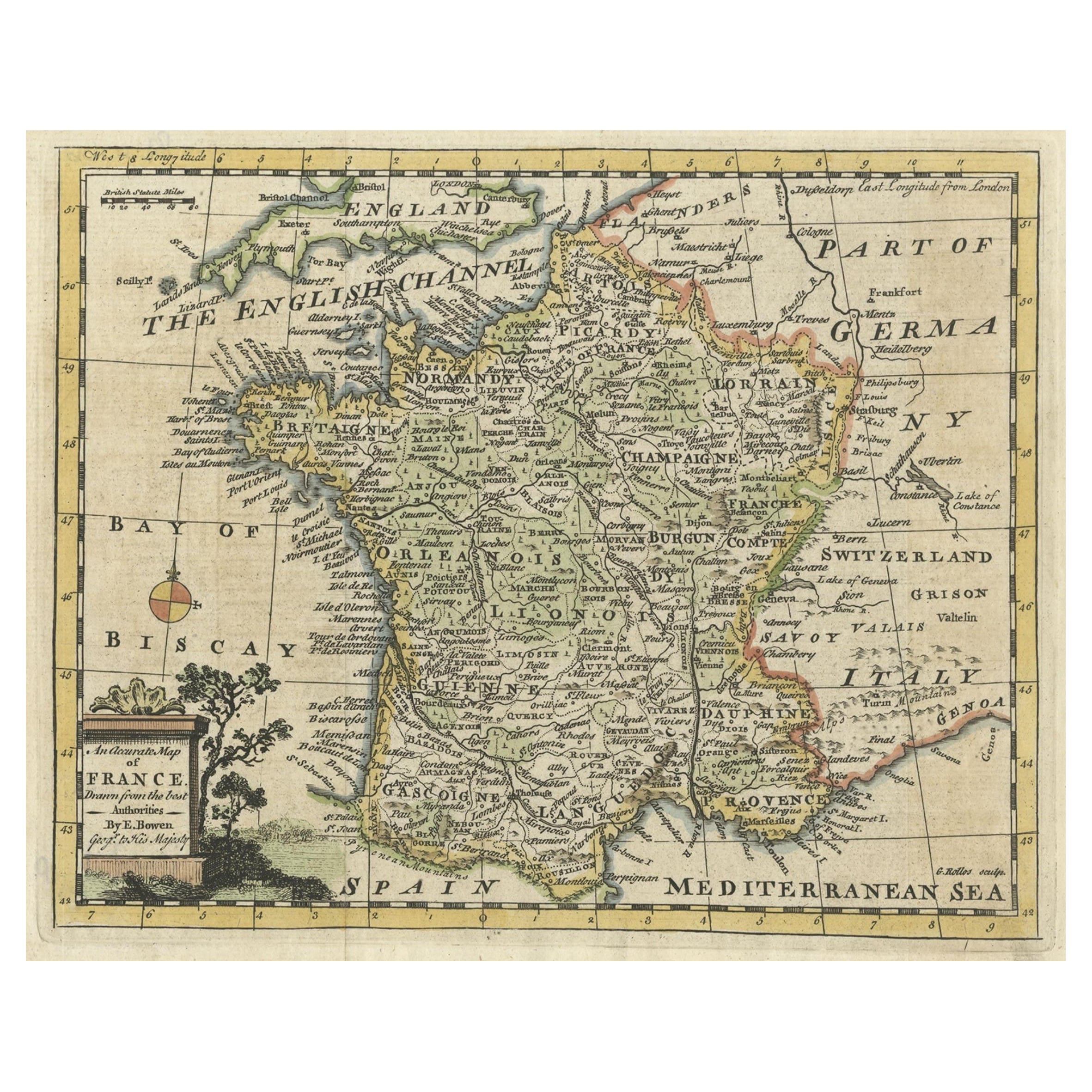
- Small Detailed Antique Map of France, with Decorative Title Cartouche, 1754Located in Langweer, NLAntique map France titled 'An Accurate Map of France drawn from the best authorities'. Small, detailed map of France. With decorative title cartouche. ...Category
Antique 1750s Maps
MaterialsPaper

You May Also Like
- Old Horizontal Map of EnglandBy TassoLocated in Alessandria, PiemonteST/520 - Old rare Italian map of England, dated 1826-1827 - by Girolamo Tasso, editor in Venise, for the atlas of M.r Le-Sage.Category
Antique Early 19th Century Italian Other Prints
MaterialsPaper
- Original Antique Map of Italy. C.1780Located in St Annes, LancashireGreat map of Italy Copper-plate engraving Published C.1780 Unframed.Category
Antique Early 1800s English Georgian Maps
MaterialsPaper

- Original Antique Map of Asia. C.1780Located in St Annes, LancashireGreat map of Asia Copper-plate engraving Published C.1780 Two small worm holes to right side of map Unframed.Category
Antique Early 1800s English Georgian Maps
MaterialsPaper

- Original Antique Map of India. C.1780Located in St Annes, LancashireGreat map of India Copper-plate engraving Published C.1780 Three small worm holes to right side of map and one bottom left corner Unframed.Category
Antique Early 1800s English Georgian Maps
MaterialsPaper

- Original Antique Map of Canada, Arrowsmith, 1820Located in St Annes, LancashireGreat map of Canada. Drawn under the direction of Arrowsmith. Copper-plate engraving. Published by Longman, Hurst, Rees, Orme and Brown, 1820 ...Category
Antique 1820s English Maps
MaterialsPaper
- Original Antique Map of Europe, Arrowsmith, 1820Located in St Annes, LancashireGreat map of Europe Drawn under the direction of Arrowsmith. Copper-plate engraving. Published by Longman, Hurst, Rees, Orme and Brown, 1820 ...Category
Antique 1820s English Maps
MaterialsPaper


Recently Viewed
View AllMore Ways To Browse
1681 Moses Pitt
Antique Cabbage Cutter
Antique Chesapeake Bay Map
Antique Handcrafted Model Sailboat
Antique Map Of Chesapeake Bay
Cartier 1730
Devonia Antique
Eso Antique Map
Eso Antique Maps
Formosa Vintage Map
M S Merian
Union Pacific Map
Ian Maguire
Map Scandinavia
Pakistan Antique Map
Antique Map Iceland
Antique Map Of Iceland
Antique Map Scandinavia