Framed Africa Maps
49
8
to
7
29
28
57
57
57
5
2
1
1
1
1
23
10
16
8
2
11
1
4
4
3
1
38
12
9
8
3
31
21
15
15
11
2
1
1
1
1
Sort By
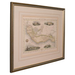
Antique Lithography Map, West Africa, English, Framed, Cartography, Victorian
Located in Hele, Devon, GB
This is an antique lithography map of Western Africa. An English, framed atlas engraving of
Category
Antique Mid-19th Century British Early Victorian Maps
Materials
Wood
H 17.52 in W 19.89 in D 0.79 in
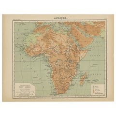
Antique Map of Africa, Cartouche with Elephant Tusks and Horned Serpent, 1737
Located in Langweer, NL
Antique map of Africa titled 'Africa Secundum Legitimas Projectionis Stereographicae regulas
Category
Antique 18th Century Maps
Materials
Paper
H 21.26 in W 24.81 in D 0 in
West Coast of Africa, Guinea & Sierra Leone: An 18th Century Map by Bellin
By Jacques-Nicolas Bellin
Located in Alamo, CA
. Christophe", Reference #: LU117328585712 and a map of St. Lucie framed in lucite, Reference: LU117324370471
Category
Antique Mid-18th Century French Maps
Materials
Paper
H 10 in W 14.25 in D 0.07 in
Road Map John Ogilby No 75 Kings Lyn Harwich, Britannia Framed Wallhanging
By John Ogilby
Located in BUNGAY, SUFFOLK
floated in the original black and gold frame, c1961. Some creasing commensurate with age. The back of the
Category
Antique 1670s European Baroque Maps
Materials
Paper
H 15.75 in W 19.69 in D 0.6 in
Map Road John Ogilby Britannia No 74 Ipswich to Norwich Cromer Framed
By John Ogilby
Located in BUNGAY, SUFFOLK
Alesham to Cromer.
Hand colored and floated in the original black and gold frame, circa 1961. Some
Category
Antique 1670s English Baroque Maps
Materials
Paper
Road Map John Ogilby London St David's Britannia No 15 Abingdon Monmouth Framed
By John Ogilby
Located in BUNGAY, SUFFOLK
John Ogilby (British 1600-1676) Cosmographer and Geographick Printer to Charles II. A road map from
Category
Antique 1670s English Baroque Maps
Materials
Paper
H 20.48 in W 24.41 in D 0.6 in
Road Map Britannia No 32 the Road from London to Barnstable John Ogilby Framed
By John Ogilby
Located in BUNGAY, SUFFOLK
collector with no 15 London to St Davids. Framed as a pair.
Measures: Black Linear Border around Map
Category
Antique Late 17th Century English Charles II Maps
Materials
Paper
H 20.48 in W 24.41 in D 0.6 in
Road Map Britannia No 15 London to St Davids John Ogilby Brown Gilt Frame
By John Ogilby
Located in BUNGAY, SUFFOLK
Lechlade, to Fairford, to Barnsley to Gloucester showing Monmouth as the destination. A road map from
Category
Antique Late 17th Century British Charles II Maps
Materials
Paper
H 22.05 in W 26.19 in D 0.6 in
Road Map Britannia No 25 London to the Lands End, John Ogilby Brown Gilded Frame
By John Ogilby
Located in BUNGAY, SUFFOLK
Senan in Cornwall. By John Ogilby His Majesties Cosmographer. A road map from Britannia, 1675/6. No 25
Category
Antique Late 17th Century British Charles II Maps
Materials
Paper
H 22.05 in W 26.19 in D 0.6 in
Road Map Britannia 1675/6 No 5 Road London to Barwick, London Stilton Grey Frame
By John Ogilby
Located in BUNGAY, SUFFOLK
John Ogilby (British 1600-1676) cosmographer and geographick printer to Charles II.
A road map from
Category
Antique Late 17th Century British Charles II Maps
Materials
Paper
H 22.84 in W 25.99 in D 0.4 in
Road Map, John Ogilby, No 54, London, Yarmouth, Britannia
By John Ogilby
Located in BUNGAY, SUFFOLK
Yarmouth.
Hand colored and floated in the original black and gold frame, circa 1961. Some creasing
Category
Antique 1670s English Baroque Maps
Materials
Paper
Map Silk Embroidered Western Eastern Hemisphere New Old World Asia America Afri
Located in BUNGAY, SUFFOLK
A rare, late-18th century, silk, embroidered, double hemisphere, world map, blackwork, sampler
Category
Antique 18th Century British Georgian Maps
Materials
Silk
H 0.4 in W 0.4 in D 0.4 in
Map Road Strip Britannia Sheet 2 John Ogilby London Aberistwith Islip Bramyard
By John Ogilby
Located in BUNGAY, SUFFOLK
framer, print seller, Oxford. Annotated.
The second of 100 sheets of strip maps made for John Ogilby
Category
Antique 17th Century English Baroque Maps
Materials
Paper
H 14.38 in W 19.3 in D 0.79 in
St. Christophe 'St. Kitts' Island: An 18th Century Hand-colored Map by Bellin
By Jacques-Nicolas Bellin
Located in Alamo, CA
# LU117328585822 and a map of St. Lucie framed in lucite, Reference: LU117324370471. These maps would make a
Category
Antique Mid-18th Century French Maps
Materials
Paper
H 10 in W 14.25 in D 0.07 in
Antique Map of Southern Asia with India, the Maldives, Ceylon and Arabia, c.1700
Located in Langweer, NL
Stunning Old Map of Asia.
Description: Two-sheet map of Asia, joined. The left part of this
Category
Antique Early 18th Century Maps
Materials
Paper
H 24.81 in W 37.01 in D 0 in
Road Map No43 London to Kings Lynn, Royston to Downham, John Ogilby, Britannia
By John Ogilby
Located in BUNGAY, SUFFOLK
John Ogilby (British 1600-1676) Cosmographer and Geographick Printer to Charles II.
A road map
Category
Antique Late 17th Century British Charles II Maps
Materials
Paper
H 20.48 in W 24.41 in D 0.4 in
Original Antique Sea Chart of the Coastline from England to Gibraltar, ca.1700
Located in Langweer, NL
Antique map titled 'A Chart of the Sea-Coast from England to the Streights.'
Original antique map
Category
Antique Early 1700s Maps
Materials
Paper
H 18.47 in W 23.55 in D 0 in
Original Vintage Travel Poster Rhodesia Pictorial Map Southern Africa Zimbabwe
Located in London, GB
decorative compass point. A smaller framed map below marking the area and the South Atlantic Ocean and Indian
Category
Vintage 1930s British Posters
Materials
Paper
H 39.38 in W 24.41 in D 0.04 in
Original Vintage Poster Union Of South Africa Map Natural & Industrial Resources
Located in London, GB
image of a larger map of Africa marking South Africa in front of the Union flag of South Africa framing
Category
Vintage 1940s British Posters
Materials
Paper
H 19.69 in W 29.53 in D 0.04 in
Pair of Prints Depicting Antique World Maps Framed in Burl Wood
Located in Dallas, TX
A pair of prints depicting antique world maps framed in burl wood. One picture contains a depiction
Category
20th Century American Prints
Materials
Paper
Original Vintage Illustrated Map Poster Afrique Equatoriale Francaise Cameroon
Located in London, GB
Original vintage illustrated map poster for Cameroun AOF Afrique Occidentale Francaise / Cameroon
Category
Vintage 1950s French Posters
Materials
Paper
H 47.25 in W 30.71 in D 0.04 in
Framed Oil on Canvas "Arrowheads" by Michael Francis Reagan
Located in Savannah, GA
in Ivory Coast West Africa, where he worked as a graphic designer and illustrator of textbooks.
Now
Category
21st Century and Contemporary American Paintings
Materials
Canvas
Framed Oil on Canvas "Gulf Stream" by Michael Francis Reagan
Located in Savannah, GA
in Ivory Coast West Africa, where he worked as a graphic designer and illustrator of textbooks.
Now
Category
21st Century and Contemporary American Paintings
Materials
Canvas
Framed Oil on Board "Salt Marsh" by Michael Francis Reagan
Located in Savannah, GA
in Ivory Coast West Africa, where he worked as a graphic designer and illustrator of textbooks.
Now
Category
21st Century and Contemporary American Paintings
Materials
Canvas
Framed Oil on Board "November Morning" by Michael Francis Reagan
Located in Savannah, GA
in Ivory Coast West Africa, where he worked as a graphic designer and illustrator of textbooks.
Now
Category
21st Century and Contemporary American Paintings
Materials
Canvas
Framed Oil on Canvas "North Star" by Michael Francis Reagan
Located in Savannah, GA
in Ivory Coast West Africa, where he worked as a graphic designer and illustrator of textbooks.
Now
Category
21st Century and Contemporary American Paintings
Materials
Canvas
Framed Oil on Canvas "The Stopping Tree" by Michael Francis Reagan
Located in Savannah, GA
in Ivory Coast West Africa, where he worked as a graphic designer and illustrator of textbooks.
Now
Category
21st Century and Contemporary American Paintings
Materials
Canvas
Pocket Globe, Nicholas Lane, London, post 1779
By Nicholas Lane
Located in Milano, IT
the North Pacific Ocean, above the Tropic of Cancer, the globe bears a cartouche framed with small
Category
Antique 1780s English Other Models and Miniatures
Materials
Leather, Wood, Paper
Original Vintage Travel Poster BOAC World Air Routes Western Hemisphere Design
By E.O. Seymour
Located in London, GB
pictorial map with colourful illustrations of people in national dress, places of historic interest
Category
Vintage 1940s British Posters
Materials
Paper
H 30.71 in W 20.48 in D 0.04 in
Antique Chart of the Southern Pole, Showing Three Routes of Captain Cook, 1803
Located in Langweer, NL
Antique map titled 'Kaart van het Zuider Halfrond'. Circular chart within a square frame centred on
Category
Antique 19th Century Prints
Materials
Paper
H 24.02 in W 28.94 in D 0 in
19TH CENTURY TINTERN ABBEY FRANCIS NICHOLSON 1753-1844 WATERCOLOUR PAiNTING
Located in GB
Map Showing the Kingdom of Judah on the West Coast of Africa
This 1747 Negroland map identifies the
Category
Antique 19th Century English Country Decorative Art
Materials
Paper
H 16.15 in W 20.48 in D 0.6 in
Interesting Large Victorian Relief Map of Africa
Located in Stamford, CT
Good relief map with a great patina and original oak frame
Category
Antique 19th Century American Decorative Art
Materials
Wood
Map of Egypt in a Beautiful Orientalist Gold Leaf Frame
Located in Bordeaux, FR
Map of Egypt beautifully framed.
Egypt, country located in the northeastern corner of Africa
Category
1990s Egyptian Picture Frames
Materials
Paper
Painting of a Cotton Picker by William Aiken Walker
By William Aiken Walker
Located in Alexandria, VA
lower left.
Painting size: 8.25” x 4.25”.
Frame size: 12.5” x 8.5”.
A lifelong artist, Walker
Category
Antique 1870s American Paintings
Materials
Composition
Hammond's Map of the Mediterranean, Europe, and Africa, circa 1941
Located in Colorado Springs, CO
This is an original WWII folding folio map of the Mediterranean, Europe, and Africa. The map was
Category
Vintage 1940s Maps
Antique Map of the Turkish Empire by Tirion, 1763
Located in Langweer, NL
Antique map titled 'Nieuwe Kaart van het Turksche Ryk gelegen in Europa, Asia en Africa
Category
Antique Mid-18th Century Maps
Materials
Paper
Early 20th C. Relief Maps: Asia Wood and Leather Frames
Located in New York, NY
features of South America, Asia, and Africa. The maps, meticulously crafted, are elevated by their
Category
Early 20th Century American Victorian Maps
Materials
Leather, Wood, Paper
1837 "Mercator Projection" Map of the World by James Wyld
Located in Colorado Springs, CO
-colored in outline, backed onto linen. The map has been artfully framed to archival standards.
Category
Antique 1830s English Maps
Antique Map of the Eastern and Western Hemisphere by Bodenehr, circa 1720
Located in Langweer, NL
America' and 'Der alte Welt Begriff bestehende in 3 haubt theilen als Africa, Europa, Asia'. Two maps on
Category
Antique Early 18th Century Maps
Materials
Paper
H 11.23 in W 15.56 in D 0.6 in
Venice, Italy Bird's-Eye View Hand-Colored Dutch Map, circa 1720
Located in Colorado Springs, CO
representing the city of Venice, and two winged African putti.
The bird's-eye view extends beyond Venice to
Category
Antique 1720s Maps
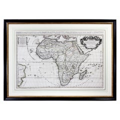
Framed Map of Africa by Hubert Jaillot
Located in Essex, MA
Black and white engraving. Framed and matted under plexiglass.
Category
Antique 1690s French Decorative Art
Materials
Paper
Original Vintage Poster Illustrated Map Madagascar French Colony Industry Travel
Located in London, GB
Original vintage travel poster for Madagascar located in the Indian Ocean near Africa featuring an
Category
Vintage 1930s French Posters
Materials
Paper
H 47.25 in W 31.5 in D 0.04 in
Framed Oil on Canvas "Marsh Islands" by Michael Francis Reagan
Located in Savannah, GA
in Ivory Coast West Africa, where he worked as a graphic designer and illustrator of textbooks.
Now
Category
21st Century and Contemporary American Paintings
Materials
Canvas
Framed Oil on Canvas "Downeast Sunrise" by Michael Francis Reagan
Located in Savannah, GA
in Ivory Coast West Africa, where he worked as a graphic designer and illustrator of textbooks.
Now
Category
21st Century and Contemporary American Paintings
Materials
Canvas
"My Early Life" by Winston Churchill, First Edition, Cosway-Style Asprey Binding
By Winston Churchill
Located in Colorado Springs, CO
decorated with a Cosway-style inlaid watercolor oval portrait of Winston Churchill. The portrait is framed
Category
Vintage 1930s British Books
Materials
Leather, Paper
H 9 in W 6.13 in D 2.13 in
Rare Engraved Map of Africa by Samuel Boulton, 1800
By Samuel Boulton
Located in Miami Beach, FL
Rare and important large engraved map of Africa with old water coloring accents.
The cartouche
Category
Antique Early 1800s English Neoclassical Maps
Materials
Paper
19th Century Hand-Colored Map of Africa by Henry Tanner
By Henry Schenck Tanner
Located in Alamo, CA
Monrovia.
This colorful map of Africa is presented in a polished burl wood frame with a double mat; the
Category
Antique Mid-19th Century American Maps
Materials
Paper
18th Century Hand Colored Homann Africa Map "Totius Africae Nova Representatio"
By Johann Baptist Homann
Located in Alamo, CA
This is a scarce richly hand colored copper plate engraved map of Africa entitled "Totius Africae
Category
Antique Early 18th Century German Maps
Materials
Paper
H 21 in W 24.75 in D 1 in
Large 1907 Vintage Relief Map of Africa by Atlas School Supply of Chicago
By Atlas School Supply
Located in Lafayette, IN
Remarkably original, 1907 Relief map of Africa by the Atlas School Supply Co. of Chicago, Illinois
Category
Early 20th Century American Industrial Maps
Materials
Paper, Oak
Antique Map of the Ancient World by Cellarius, 1703
Located in Langweer, NL
. This map originates from 'Notitia Orbis Antiquae' by Christophorus Cellarius.
Frame included. We
Category
Antique Early 18th Century Maps
Materials
Paper
1843 London "Metropolis" Hand-Colored Pocket Map by John Arrowsmith
Located in Colorado Springs, CO
, John Arrowsmith’s maps covered all areas of the globe. He published maps of Africa, Asia, the Americas
Category
Antique 1840s Maps
1747 British Map Showing the Kingdom of Judah on the West Coast of Africa
Located in GB
West Coast of Africa.
This 1747 Negroland map identifies the nationality of the Transatlantic Slaves
Category
20th Century English Other Decorative Art
Materials
Oak, Paper
H 17.33 in W 20.87 in D 1.38 in
Map of Africa in Olive Wood Veneer Frame
Located in Los Angeles, CA
Graphic vintage French school map of colonial Africa. Newly framed.
Category
Vintage 1950s French Maps
Materials
Linen, Wood, Glass
Large Framed Schoolhouse Map
Located in Los Angeles, CA
Lovely faded Rand McNally School map of Europe, North Africa and the Middle East. Titled "The
Category
Vintage 1940s American Maps
Materials
Paper, Wood, Plexiglass
Very Large Vintage map of Asia
Located in Los Angeles, CA
, South America and Africa from the same set that hung in a Government office in Florence. The map has
Category
Vintage 1930s Italian Maps
Materials
Wood, Plexiglass, Linen
Sabena Map of Europe, Africa & Asia
Located in Los Angeles, CA
This map outlines the importance of Sabena as an aircraft with main coverage towards Africa
Category
Vintage 1950s Belgian Prints
Materials
Lithograph, Paper
Very Fine and Small English Sampler Needlework, dated 1808
Located in Philadelphia, PA
, south, east and west, and continents, Europe, Asia, Africa and America, all centered very nicely. We
Category
Antique Early 1800s English Folk Art Quilts and Blankets
Materials
Textile
Get Updated with New Arrivals
Save "Framed Africa Maps", and we’ll notify you when there are new listings in this category.
Framed Africa Maps For Sale on 1stDibs
There is a range of framed africa maps for sale on 1stDibs. Frequently made of paper, oak and wood, all framed africa maps available were constructed with great care. There are all kinds of framed africa maps available, from those produced as long ago as the 18th Century to those made as recently as the 20th Century. There are many kinds of framed africa maps to choose from, but at 1stDibs, Baroque and industrial framed africa maps are of considerable interest. Many framed africa maps are appealing in their simplicity, but Jacques-Nicolas Bellin, Johann Baptist Homann and Winston Churchill produced popular framed africa maps that are worth a look.
How Much are Framed Africa Maps?
Prices for framed africa maps start at $406 and top out at $13,500 with the average selling for $1,742.
More Ways To Browse
Cuban Street Scenes
Oil Painting Of Salt Marsh
Vintage Tobacco Posters
Great Yarmouth
Vintage Green Mountain Poster
Antique French Bread Board
California As An Island Map
Coronation Plates
Map Of Vietnam
Robert Falk
Charles J Fox
Deal Kent
Gold Medal Folding Furniture
Gold Medal Folding
Nigel Wood
Old Vintage City Maps
Antique Royal Worcester China
Bishop Table