Items Similar to Antique Map of the County of Hainaut by Jaillot, 1692
Want more images or videos?
Request additional images or videos from the seller
1 of 5
Antique Map of the County of Hainaut by Jaillot, 1692
About the Item
Antique map titled 'Le Comté de Haynaut divisé en Chateliensis, Balliages, Prevoste's (..)'. Large map of the county of Hainaut (France) with its most important cities, Mons (Bergen), Cambrai (Kamerijk) and Charleroi.
Artists and Engravers: Alexis-Hubert Jaillot (1632-1712), French cartographer. He joined the Sanson heirs and redrew Nicolas Sanson's maps on a larger scale.
Condition: Fair, original/contemporary hand coloring. Repair on foldin line and several defects, creasing and other wear. Blank verso, please study image carefully.
Date: 1692
Overall size: 80 x 59 cm.
Image size: 73 x 53 cm
We sell original antique maps to collectors, historians, educators and interior decorators all over the world. Our collection includes a wide range of authentic antique maps from the 16th to the 20th centuries. Buying and collecting antique maps is a tradition that goes back hundreds of years. Antique maps have proved a richly rewarding investment over the past decade, thanks to a growing appreciation of their unique historical appeal. Today the decorative qualities of antique maps are widely recognized by interior designers who appreciate their beauty and design flexibility. Depending on the individual map, presentation, and context, a rare or antique map can be modern, traditional, abstract, figurative, serious or whimsical. We offer a wide range of authentic antique maps for any budget
- Dimensions:Height: 23.23 in (59 cm)Width: 31.5 in (80 cm)Depth: 0 in (0.01 mm)
- Materials and Techniques:
- Period:
- Date of Manufacture:1692
- Condition:
- Seller Location:Langweer, NL
- Reference Number:
About the Seller
5.0
Platinum Seller
These expertly vetted sellers are 1stDibs' most experienced sellers and are rated highest by our customers.
Established in 2009
1stDibs seller since 2017
1,929 sales on 1stDibs
Typical response time: <1 hour
- ShippingRetrieving quote...Ships From: Langweer, Netherlands
- Return PolicyA return for this item may be initiated within 14 days of delivery.
More From This SellerView All
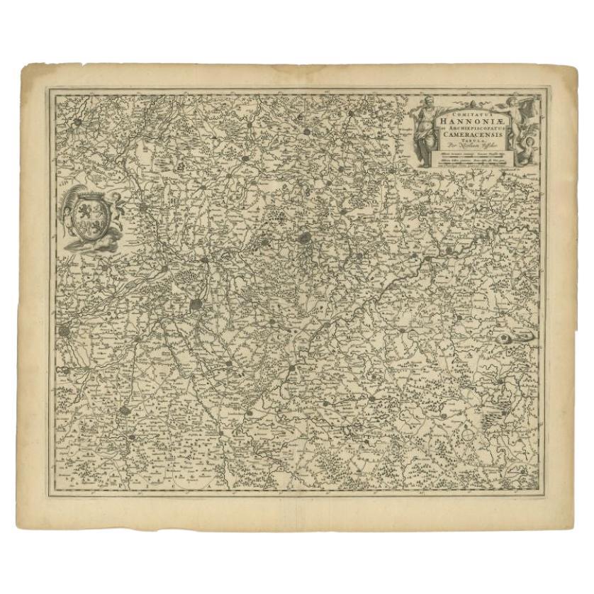
- Antique Map of the Hainaut Region by Visscher, c.1690By Nicolaes Visscher IILocated in Langweer, NLAntique map titled 'Comitatus Hannoniae et Archiepiscopatus Cameracensis Tabula'. Large map of the Hainaut region, France. Artists and Engravers: Nicolaes Visscher II (1649, Amst...Category
Antique 17th Century Maps
MaterialsPaper
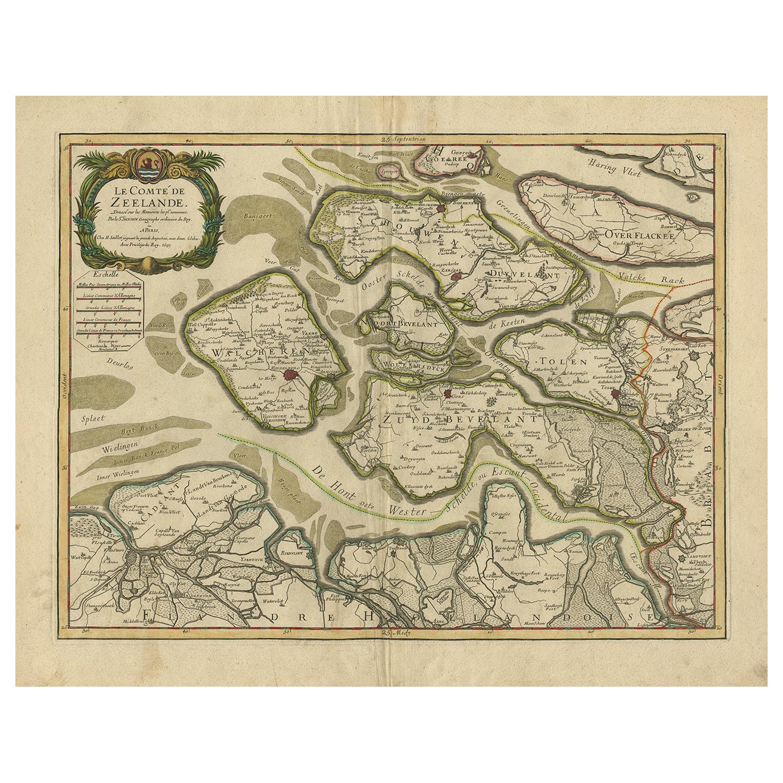
- Antique Map of Zeeland, The Netherlands, by Jaillot, 1693Located in Langweer, NLAntique map titled 'Le Comte de Zeelande (..).' Detailed map of the province of Zeeland, The Netherlands. Details shown include fortified towns, roads, sandbanks and marshlands. Base...Category
Antique 17th Century Maps
MaterialsPaper
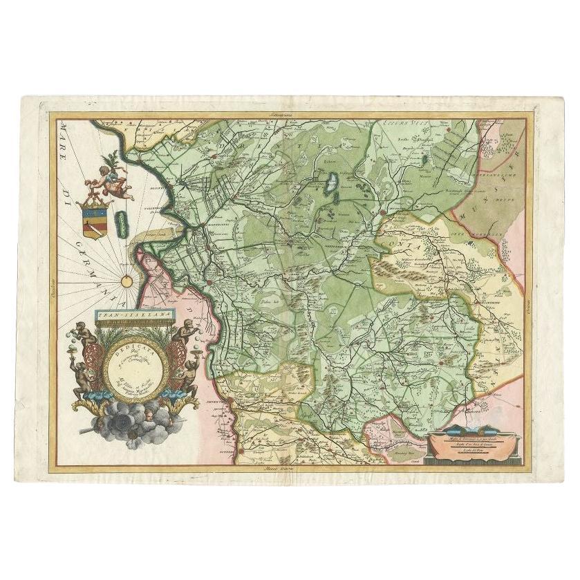
- Antique Map of the Province of Overijssel by Coronelli, c.1692Located in Langweer, NLAntique map titled 'Tran-siselana' Splendid detailed and decorative map of the province of Overijssel in the Netherlands by Vincenzo Coronelli. An elaborate title cartouche garlanded...Category
Antique 17th Century Maps
MaterialsPaper
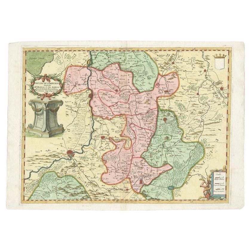
- Antique Map of the Province of Limburg by Coronelli, 1692Located in Langweer, NLAntique map titled 'Ducea di Limburgo (..)'. Beautiful map of the Dutch province of Limburg. Originates from 'Corso Geographico Universale'. Artists and Engravers: Published in Ven...Category
Antique 17th Century Maps
MaterialsPaper
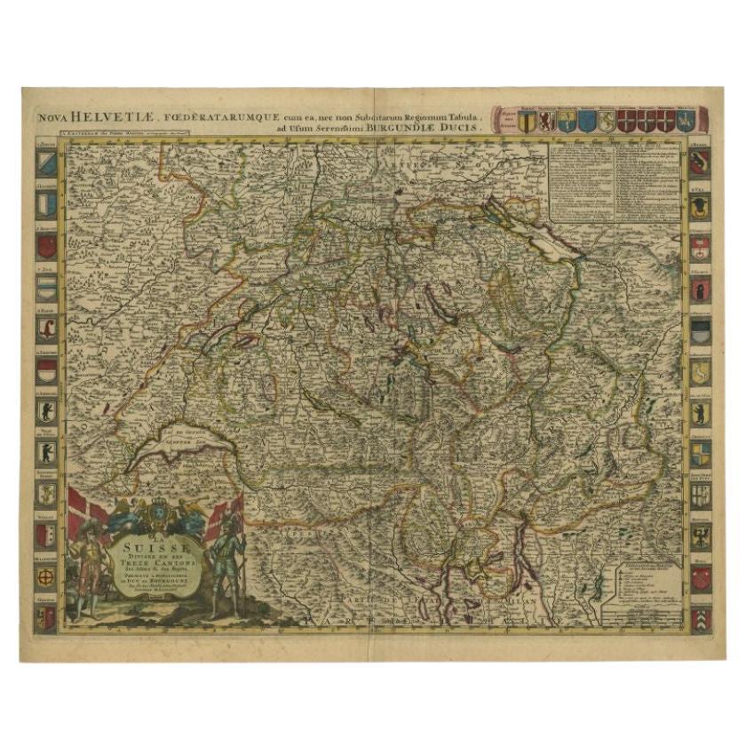
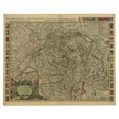
- Antique Map of Switzerland by Jaillot, c.1705Located in Langweer, NLAntique map Switerzland titled 'La Suisse Divisee en ses Treze Cantons, ses Alliez & ses Sujets (..)'. Beautiful map of Switzerland with 33 coats of arms. The map is dedicated to the...Category
Antique 18th Century Maps
MaterialsPaper
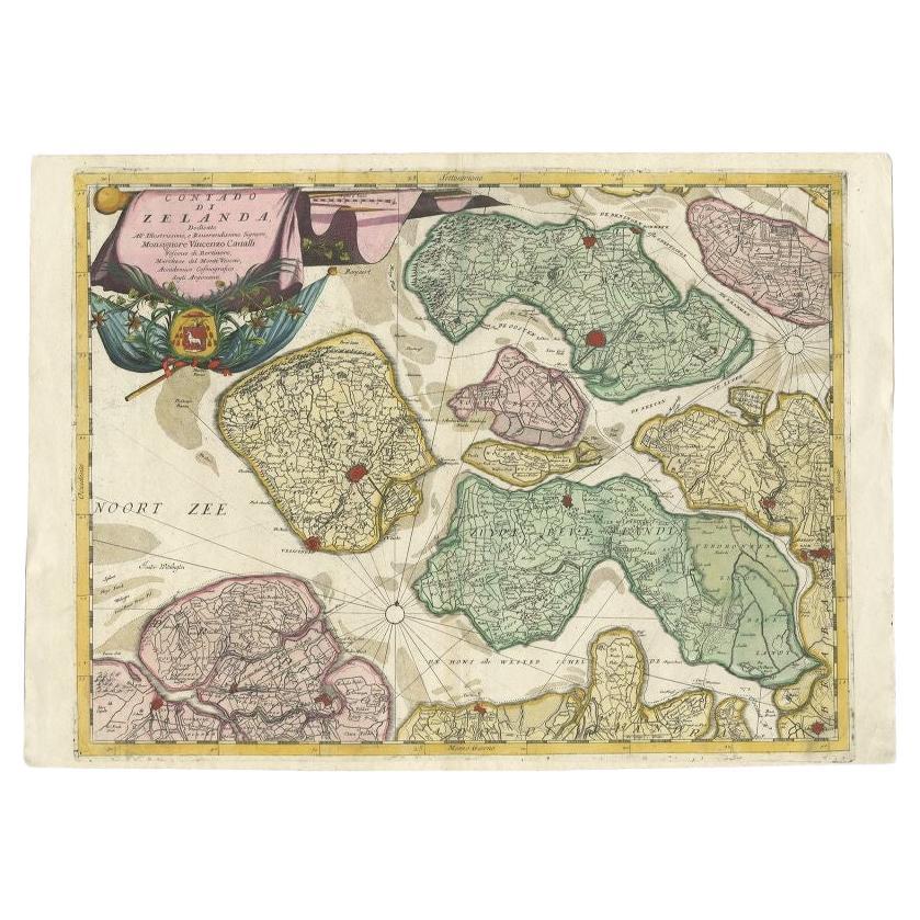
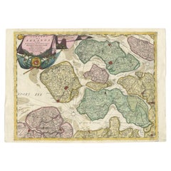
- Antique Map of the Province of Zeeland, The Netherlands by Coronelli, 1692Located in Langweer, NLAntique map titled 'Contado di Zelanda'. Beautiful map of the Dutch province of Zeeland. With the islands of Walcheren, Schouwen-Duiveland, Noord-Beveland, Zuid-Beveland, Tholen and ...Category
Antique 17th Century Maps
MaterialsPaper


You May Also Like
- The Normandy Region of France: A 17th C. Hand-colored Map by Sanson and JaillotBy Nicolas SansonLocated in Alamo, CAThis large hand-colored map entitled "Le Duché et Gouvernement de Normandie divisée en Haute et Basse Normandie en divers Pays; et par evêchez, avec le Gouvernement General du Havre ...Category
Antique 1690s French Maps
MaterialsPaper
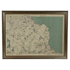
- 1891 Map of Plymouth County MassLocated in Norwell, MAOriginal 1891 map showing Sandwich, Bourne, Plymouth Carver, Middleborough, Plympton and Kingston. Showing Long Beach in Plymouth also as well as all shore points. Cape Cod Bay is ma...Category
Antique 1890s North American Maps
MaterialsPaper
- 1891 Map of Norfolk County MassachusettsLocated in Norwell, MA1891 map of Norfolk county Massachusetts including the towns of Wrentham, Franklin, Medfield, Sherborn, Norwood etc., measures: 23 x 31.Category
Antique 19th Century Maps
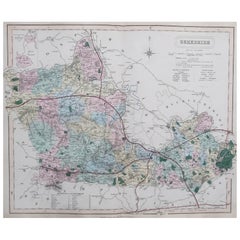
- Original Antique English County Map, Hampshire, J & C Walker, 1851Located in St Annes, LancashireGreat map of Hampshire Original colour By J & C Walker Published by Longman, Rees, Orme, Brown & Co. 1851 Unframed.Category
Antique 1850s English Other Maps
MaterialsPaper
- Original Antique English County Map, Berkshire. J & C Walker, 1851Located in St Annes, LancashireGreat map of Berkshire Original colour By J & C Walker Published by Longman, Rees, Orme, Brown & Co. 1851 Unframed.Category
Antique 1850s English Other Maps
MaterialsPaper
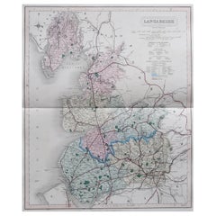
- Original Antique English County Map, Lancashire, J & C Walker, 1851Located in St Annes, LancashireGreat map of Lancashire Original colour By J & C Walker Published by Longman, Rees, Orme, Brown & Co. 1851 Unframed.Category
Antique 1850s English Other Maps
MaterialsPaper


Recently Viewed
View AllMore Ways To Browse
French County
Large City Maps
17th Map Large
Large Antique City Maps
Premier Antiques
Compass 18th Century
18th Century Compass
Antique Furniture Building Plans
Antique Spain Map
Large City Maps
Spain Antique Map
Military Map
Antique Maps Of Spain
Antique Map Of Spain
Antique Japanese Map
Antique Japanese Maps
Military Maps
South America Antique Map