Items Similar to Antique Map of East Frisia by Ortelius, c.1595


Want more images or videos?
Request additional images or videos from the seller
1 of 5
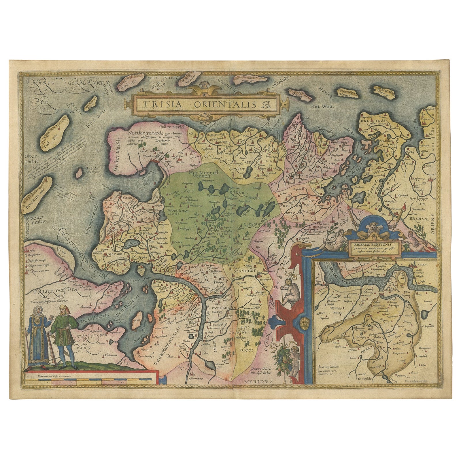
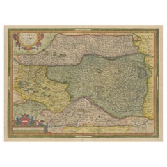
Antique Map of East Frisia by Ortelius, c.1595
About the Item
Antique print, titled: 'Frisia Orientalis.' Map of East Frisia originating from 'Theatrum Orbis Terrarum'. It is based on the manuscript map by Jon Bloemmaerts or Johannes Florianus and depicts the important shipping center of Emden and the Watten Islands. An inset shows the region inundated by the great flood on Christmas Day, 1277, surrounded by an elaborate strapwork cartouche. The map is finely engraved with a stippled sea and a distance scale surmounted by male and female figures displaying the costumes of the region. Latin text on verso.
Artists and Engravers: Abraham Ortelius was born 1528 in Antwerp. He studied mathematics, Greek and Latin and travelled a lot across Europe. He established a business in dealing with books and drawing maps. His first remarkable map was a 8 sheet world map in the year 1564, but only three copies have survived. In 1570 he issued the ""Theatrum Orbis Terrarum"", the first modern ""Atlas"" with uniformly sized maps in a systematic collection. The term ""Atlas"" was not used until Mercator introduced it 20 years later. Most of the maps in Theatrum have been engraved by Frans Hogenberg. At the time of publication, the atlas was the most expensive book ever printed. Nevertheless it was a big success and around 7000 copies have been printed until 1612 in many editions and six different languages. Beside the Theatrum, Ortelius compiled a series of historical maps and published it in the ""Parergon Theatri"" which was bound with the Theatrum from 1579 onwards or published separately.
Condition: Good. Age-related toning. Please study image carefully.
Date: c.1595
Overall size: 55.8 x 46 cm.
Image size: 0.001 x 49.6 x 37.4 cm.
We sell original antique maps to collectors, historians, educators and interior decorators all over the world. Our collection includes a wide range of authentic antique maps from the 16th to the 20th centuries. Buying and collecting antique maps is a tradition that goes back hundreds of years. Antique maps have proved a richly rewarding investment over the past decade, thanks to a growing appreciation of their unique historical appeal. Today the decorative qualities of antique maps are widely recognized by interior designers who appreciate their beauty and design flexibility. Depending on the individual map, presentation, and context, a rare or antique map can be modern, traditional, abstract, figurative, serious or whimsical. We offer a wide range of authentic antique maps for any budget.
- Dimensions:Height: 18.12 in (46 cm)Width: 21.97 in (55.8 cm)Depth: 0 in (0.01 mm)
- Materials and Techniques:
- Period:
- Date of Manufacture:c.1595
- Condition:
- Seller Location:Langweer, NL
- Reference Number:
About the Seller
5.0
Platinum Seller
These expertly vetted sellers are 1stDibs' most experienced sellers and are rated highest by our customers.
Established in 2009
1stDibs seller since 2017
1,929 sales on 1stDibs
Typical response time: <1 hour
- ShippingRetrieving quote...Ships From: Langweer, Netherlands
- Return PolicyA return for this item may be initiated within 14 days of delivery.
More From This SellerView All
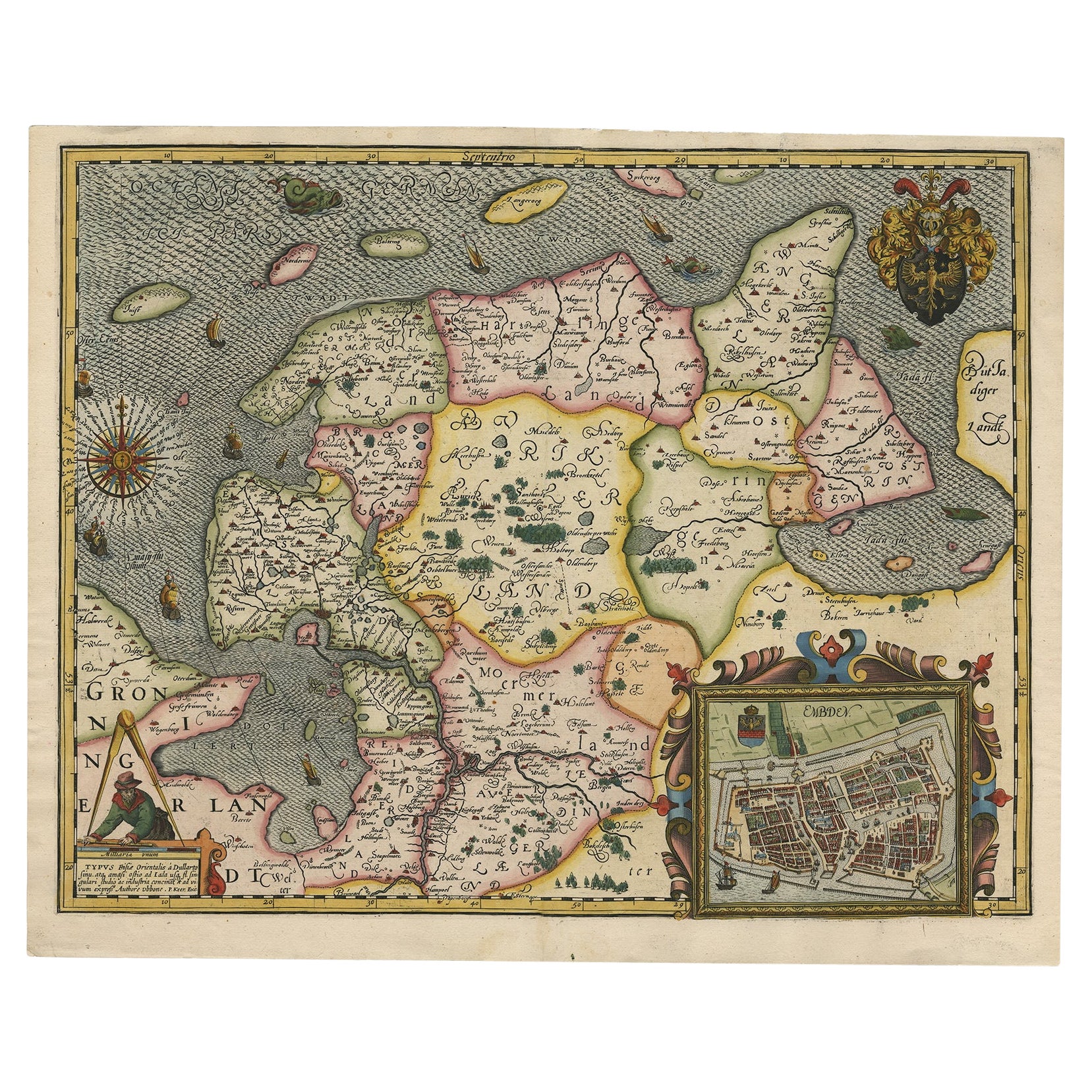
- Stunning Decorative Antique Map of East Frisia with an Inset of Emden, c.1610Located in Langweer, NLDescription: Antique map titled 'Typus Frisie Orientalis a Dullarto (..)'. One of the most decorative maps of East Frisia and its important shipping center of Emden and the Watten Is...Category
Antique 1610s Maps
MaterialsPaper
- Antique Map of Austria by Ortelius, c.1612Located in Langweer, NLAntique map titled 'Austriae Descrip. per Wolfgangum Lazium' Original antique map of Austria. Published by A. Ortelius, circa 1612. Artists a...Category
Antique 17th Century Maps
MaterialsPaper
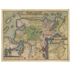
- Map of East Frisian Islands & Northwestern Tip of Germany, Ostfriesland, c.1595Located in Langweer, NLAntique map titled 'Frisia Orientalis'. Beautiful map of east Frisian islands and the northwestern tip of Germany, Ostfriesland. With people in local costumes. Ornamented inset of the Eems estuary. Based on a manuscript map...Category
Antique 16th Century Maps
MaterialsPaper
- Antique Map of Southeast Asia by Ortelius '1587'By Abraham OrteliusLocated in Langweer, NLAntique map titled 'Indiae Orientalis Insularumque Adiacientium Typus'. Ortelius includes early European depictions of both Japan and China and is the first to name Formosa (Taiwan). The Philippines and East Indies or Spice Islands are shown based upon Portuguese and Spanish sources, and before their penetration by the Dutch. Japan is shown in kite form, as a large oval island...Category
Antique 16th Century Maps
MaterialsPaper

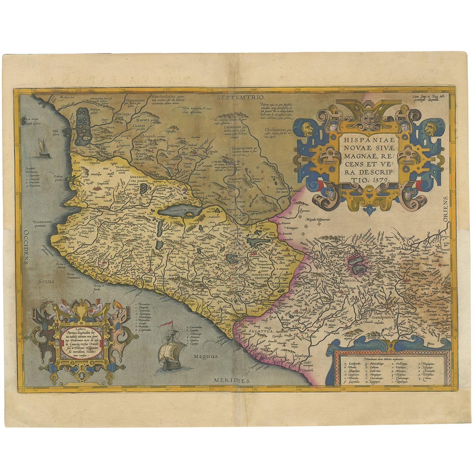
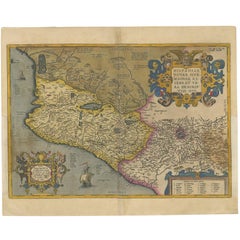
- Antique Map of Mexico by Ortelius, circa 1602By Abraham OrteliusLocated in Langweer, NLAntique map titled 'Hispaniae Novae Sivae Magnae Recens Et Vera Descriptio 1579'. Map of western New Spain, showing the recently-created Spanish settlements, many rivers, and large l...Category
Antique Early 17th Century Belgian Maps
MaterialsPaper
- Antique Map of the Region of Poitou by Ortelius, circa 1600Located in Langweer, NLAntique map titled 'Poictou'. Original antique map of the region of Poitou, a former province of west-central France whose capital city was Poitiers. Published by A. Ortelius, circa ...Category
Antique Early 17th Century Maps
MaterialsPaper

You May Also Like
- Original Antique Map of South East Asia by Becker, circa 1840Located in St Annes, LancashireGreat map of South East Asia Steel engraving with original color outline Engraved by Becker Published by Virtue, circa 1840. Unframed.Category
Antique 1840s English Other Maps
MaterialsPaper
- Original Antique Map of South East Asia by Thomas Clerk, 1817Located in St Annes, LancashireGreat map of South East Asia Copper-plate engraving Drawn and engraved by Thomas Clerk, Edinburgh. Published by Mackenzie And Dent, 1817 Unframed.Category
Antique 1810s English Maps
MaterialsPaper
- Original Antique Map of South East Asia, Arrowsmith, 1820Located in St Annes, LancashireGreat map of South East Asia Drawn under the direction of Arrowsmith Copper-plate engraving Published by Longman, Hurst, Rees, Orme and Brown, 1820 Unframed.Category
Antique 1820s English Maps
MaterialsPaper
- Original Antique English County Map, East Yorkshire, J & C Walker, 1851Located in St Annes, LancashireGreat map of The East Riding of Yorkshire Original colour By J & C Walker Published by Longman, Rees, Orme, Brown & Co. 1851 Unframed.Category
Antique 1850s English Other Maps
MaterialsPaper
- Antique Map of Italy by Andriveau-Goujon, 1843By Andriveau-GoujonLocated in New York, NYAntique Map of Italy by Andriveau-Goujon, 1843. Map of Italy in two parts by Andriveau-Goujon for the Library of Prince Carini at Palazzo Carini i...Category
Antique 1840s French Maps
MaterialsLinen, Paper
- Antique Map of Principality of MonacoBy Antonio Vallardi EditoreLocated in Alessandria, PiemonteST/619 - "Old Geographical Atlas of Italy - Topographic map of ex-Principality of Monaco" - ediz Vallardi - Milano - A somewhat special edition ---Category
Antique Late 19th Century Italian Other Prints
MaterialsPaper


