Items Similar to Antique Detailed Map of Jerusalem in Israël with Extensive Key and Scale, 1698
Want more images or videos?
Request additional images or videos from the seller
1 of 6
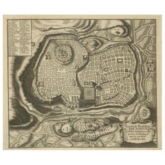
Antique Detailed Map of Jerusalem in Israël with Extensive Key and Scale, 1698
About the Item
Antique map titled 'Jerusalem.'
Plan of the ancient city of Jerusalem. With extensive key and scale. Source unknown, to be determined.
Artists and Engravers: Made by 'Cornelis de Bruijn' after an anonymous artist. Cornelis de Bruijn (also spelled Cornelius de Bruyn)(1652 - 1726/7) was a Dutch artist and traveler. He made two large tours and published illustrated books with his observations of people, buildings, plants and animals. Best known as a landscape artist, Le Bruyn travelled widely from a young age to Vienna, on to Rome then to Smyrna, Constantinople, Egypt, Jerusalem, Syria, Lebanon, and Turkey. Everywhere he went Le Bruyn depicted the scenes around him, he was especially interested in places of antiquity or historic interest, and his are the first images of the interior of a pyramid and Jerusalem to be widely available to Westerners. After an eight-year stay in Venice, Le Bruyn returned to The Hague in 1693 to publish this first book. From 1701 he started a second journey into Russia, Persia...
Artist: Made by 'Cornelis de Bruijn' after an anonymous artist. Cornelis de Bruijn (also spelled Cornelius de Bruyn)(1652 - 1726/7) was a Dutch artist and traveler. He made two large tours and published illustrated books with his observations of people, buildings, plants and animals. Best known as a landscape artist, Le Bruyn travelled widely from a young age to Vienna, on to Rome then to Smyrna, Constantinople, Egypt, Jerusalem, Syria, Lebanon, and Turkey. Everywhere he went Le Bruyn depicted the scenes around him, he was especially interested in places of antiquity or historic interest, and his are the first images of the interior of a pyramid and Jerusalem to be widely available to Westerners. After an eight-year stay in Venice, Le Bruyn returned to The Hague in 1693 to publish this first book. From 1701 he started a second journey into Russia, Persia...
Condition: Good, given age. Edges with a few tiny tears. Original middel fold as issued. General age-related toning and/or occasional minor defects from handling. Please study image carefully.
Date: 1698
Overall size: 38.5 x 30.5 cm.
Image size: 37 x 28.5 cm.
- Dimensions:Height: 15.16 in (38.5 cm)Width: 12.01 in (30.5 cm)Depth: 0 in (0.01 mm)
- Materials and Techniques:
- Period:
- Date of Manufacture:1698
- Condition:Condition: Good, given age. Edges with a few tiny tears. Original middel fold as issued. General age-related toning and/or occasional minor defects from handling. Please study image carefully.
- Seller Location:Langweer, NL
- Reference Number:
About the Seller
5.0
Platinum Seller
These expertly vetted sellers are 1stDibs' most experienced sellers and are rated highest by our customers.
Established in 2009
1stDibs seller since 2017
1,919 sales on 1stDibs
Typical response time: <1 hour
- ShippingRetrieving quote...Ships From: Langweer, Netherlands
- Return PolicyA return for this item may be initiated within 14 days of delivery.
More From This SellerView All
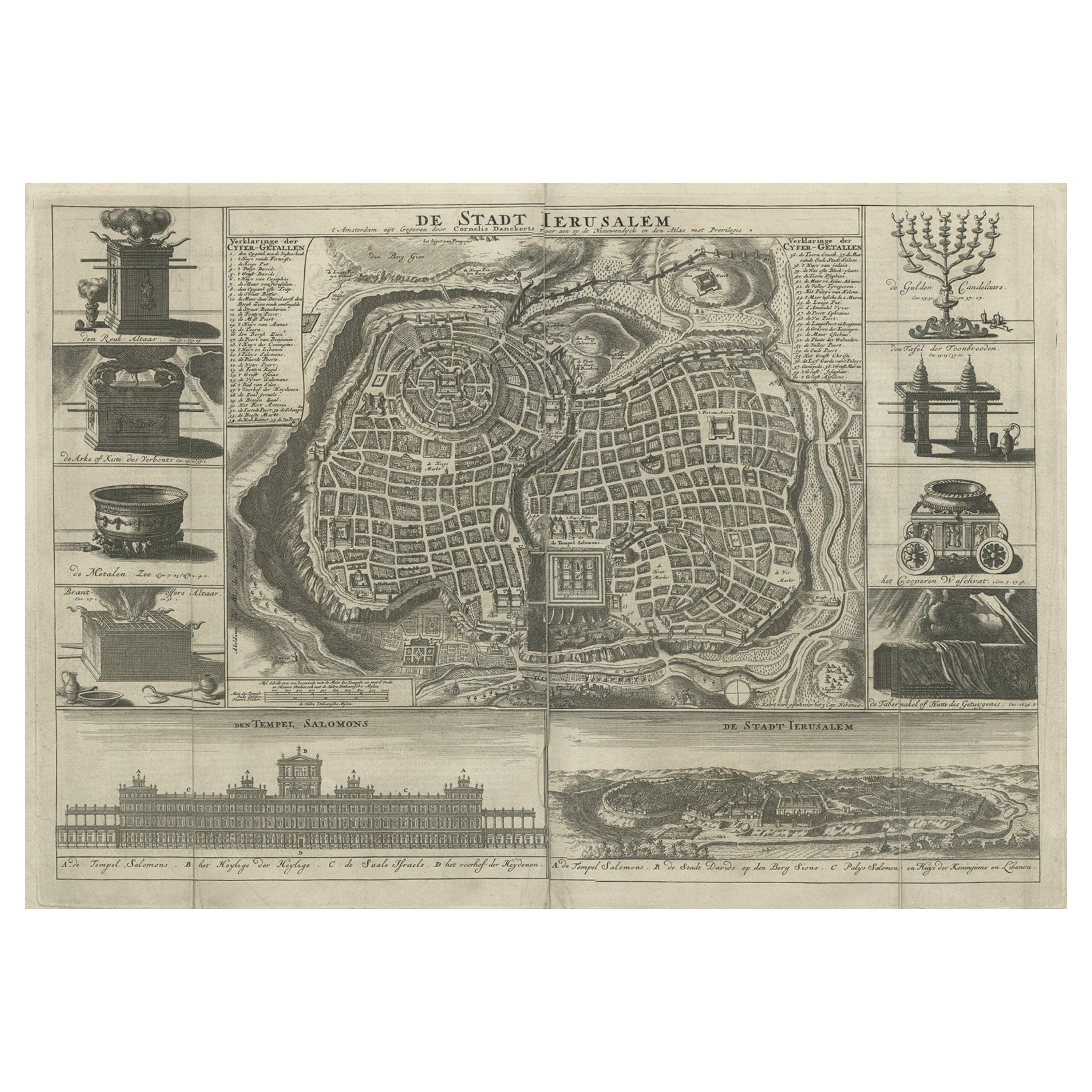
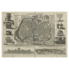
- Antique Map of the Holy City Jerusalem in Israël, c.1700Located in Langweer, NLAntique map of the Holy City titled 'De Stadt Ierusalem'. Rare state of this bird's eye plan of the holy city flanked by engravings of religious icons. At ...Category
Antique 18th Century Maps
MaterialsPaper
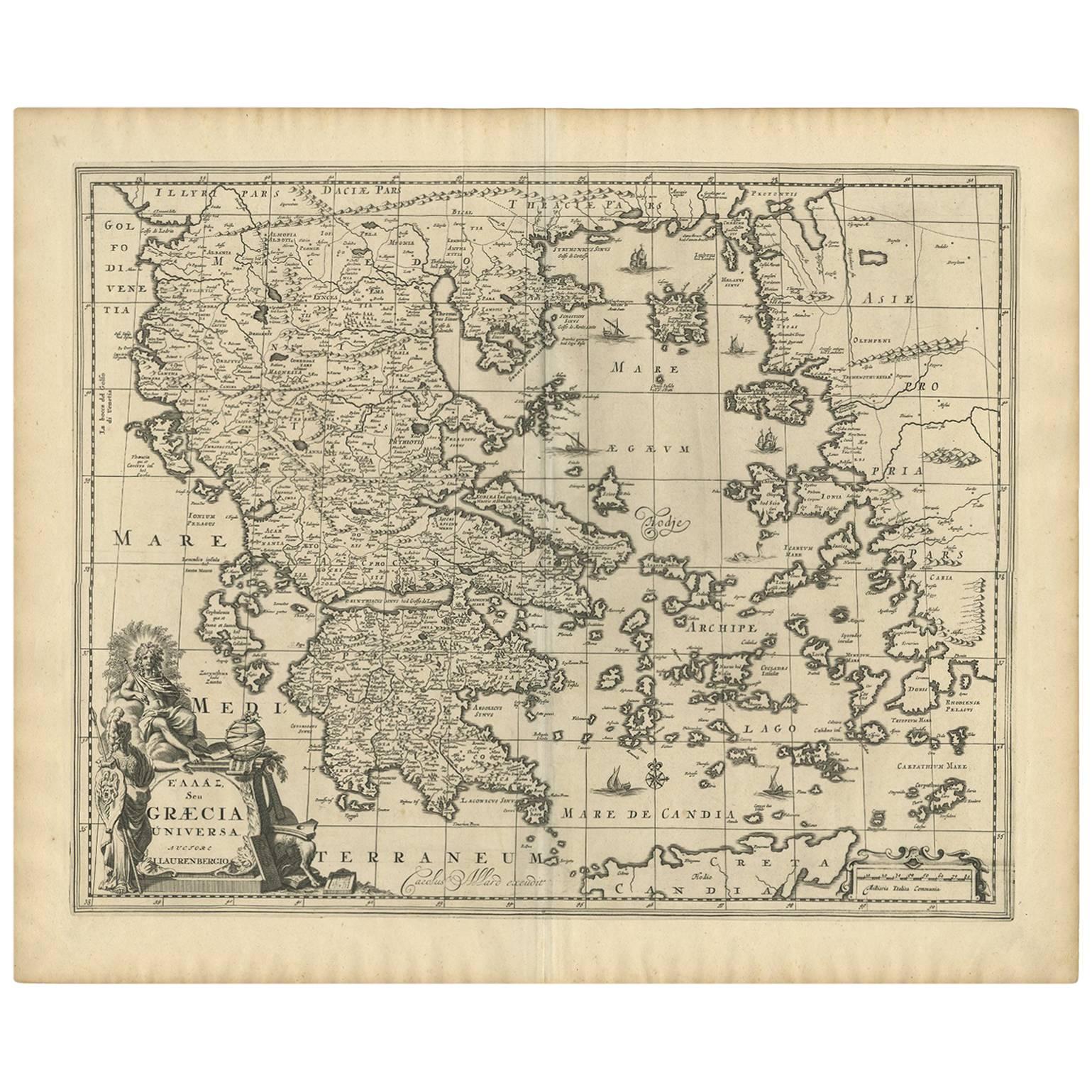
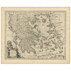
- Antique Map of Greece by Allard (c.1698)Located in Langweer, NLAntique map titled 'Hellas seu Graecia Universa' Detailed map of Greece, with Crete, the Aegean Islands, and part of Turkey. With two cartouches, compass rose and scale. Carolus Alla...Category
Antique Late 17th Century Maps
MaterialsPaper
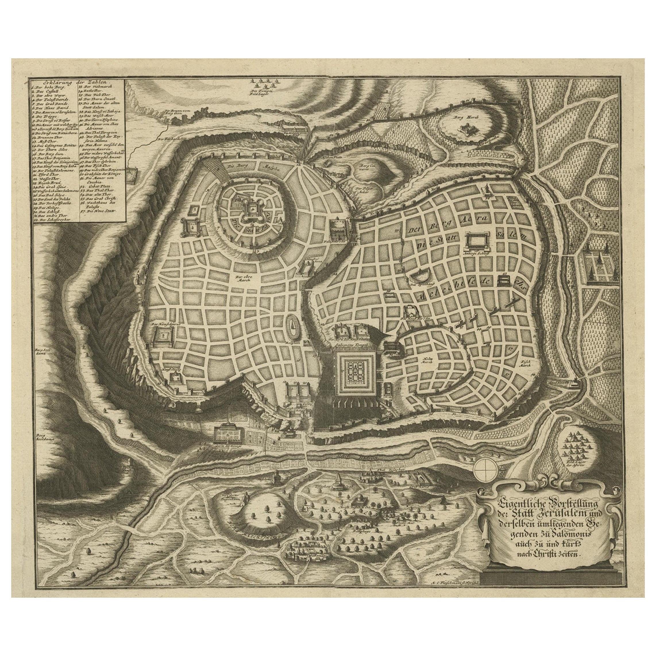
- Rare Town Plan of Jerusalem, Includes an Extensive Key to Locations etc, 1708Located in Langweer, NLAntique map titled 'Eigentliche Vorstellung der Statt Jerusalem und derselben umliegenden Gegenden zu Salomonis auch zu und kurtz nach Christi Zeiten.' Rare town plan...Category
Antique Early 1700s Religious Items
MaterialsPaper
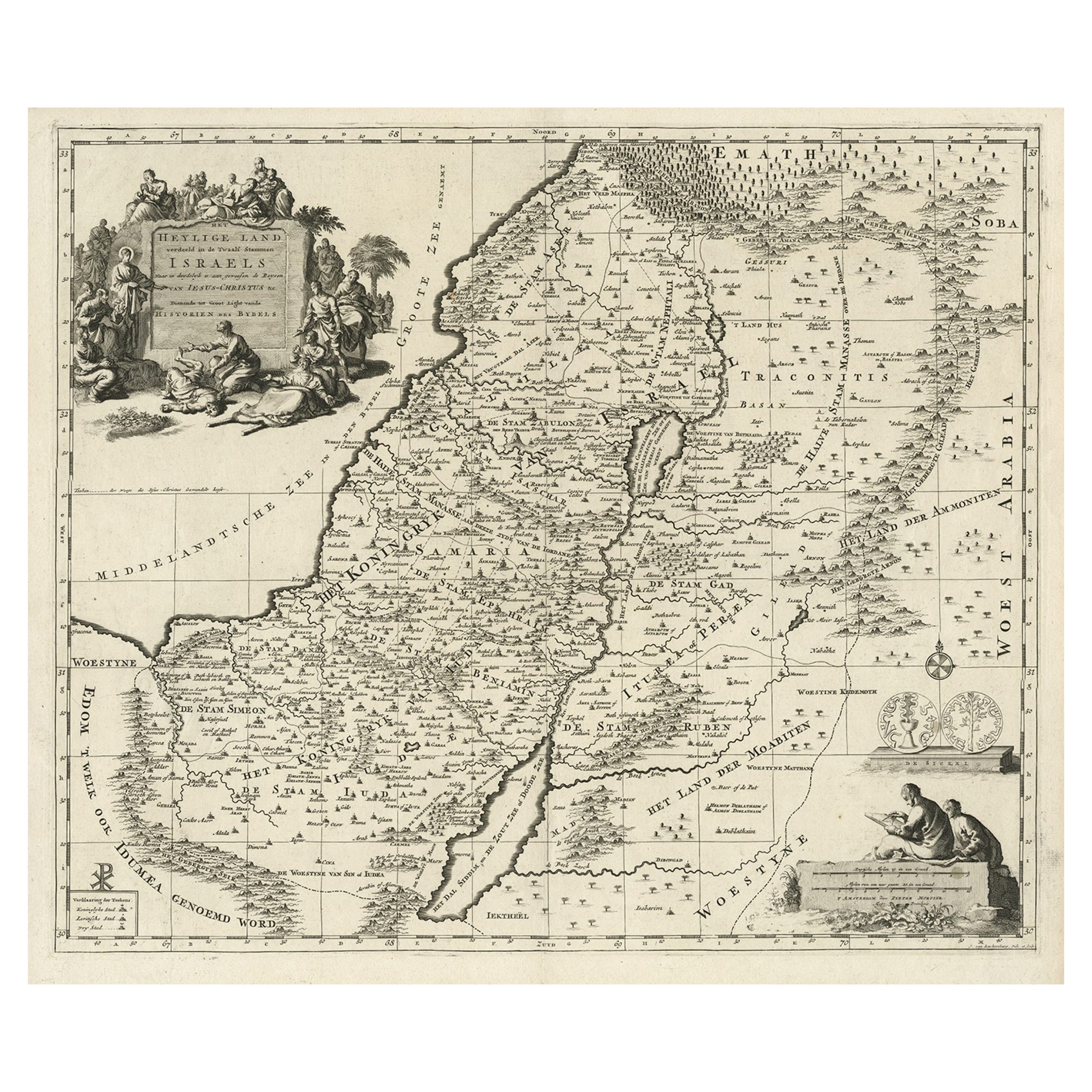
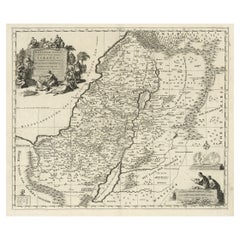
- Highly Detailed Antique Map of the Holy Land Showing 12 Tribes of Israel, c.1720Located in Langweer, NLAntique map titled 'Heylige Land verdeeld in de Twaalf Stammen Israels (..).' Highly detailed map of the Holy Land divided into 12 tribes of Israel...Category
Antique 1720s Maps
MaterialsPaper
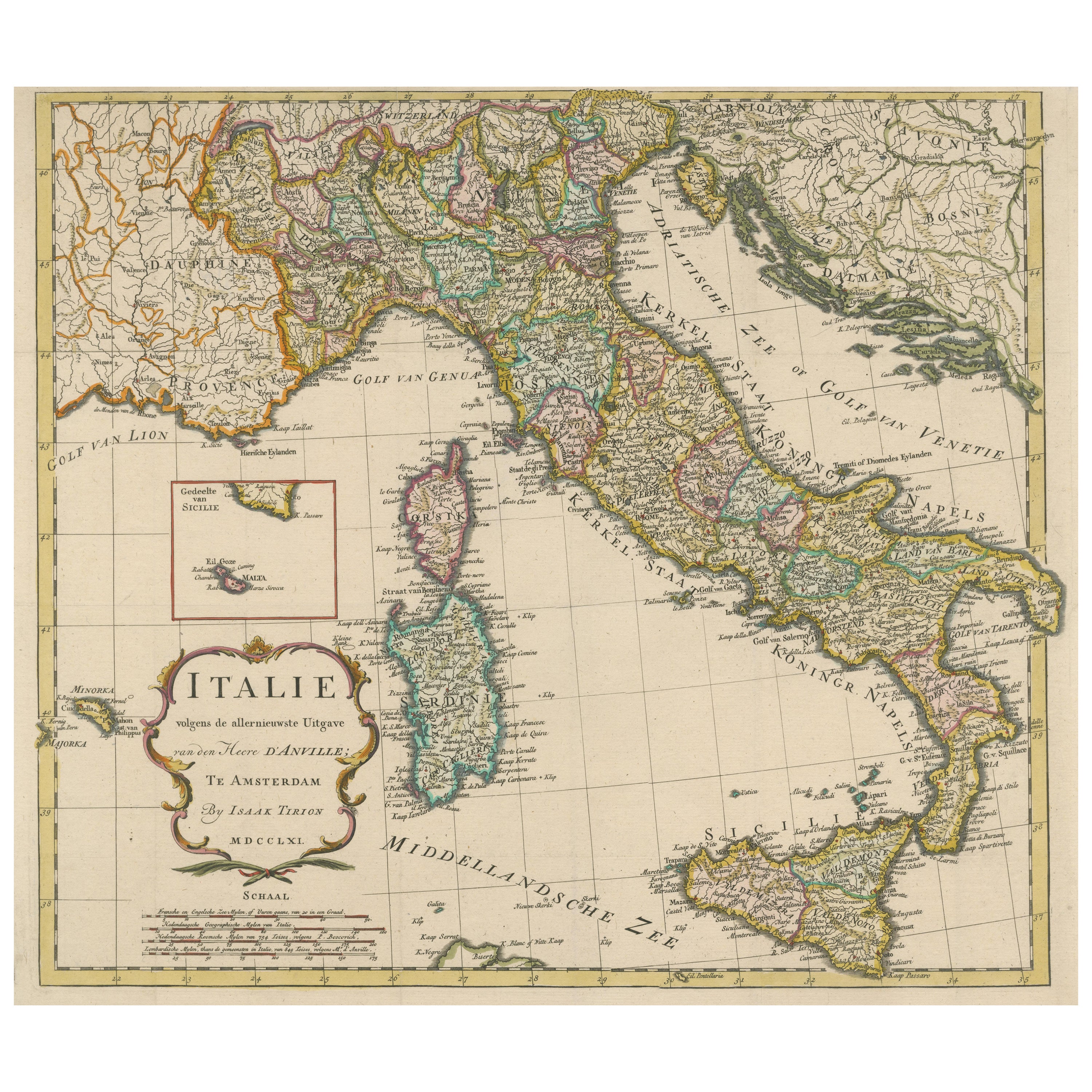
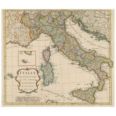
- Detailed Antique Map of Italy and surrounding IslandsLocated in Langweer, NLAntique map titled 'Italie volgens de allernieuwste Uitgave van den Heere d'Anville'. Very detailed antique map, based on D'Anville's important map of It...Category
Antique Mid-18th Century Maps
MaterialsPaper
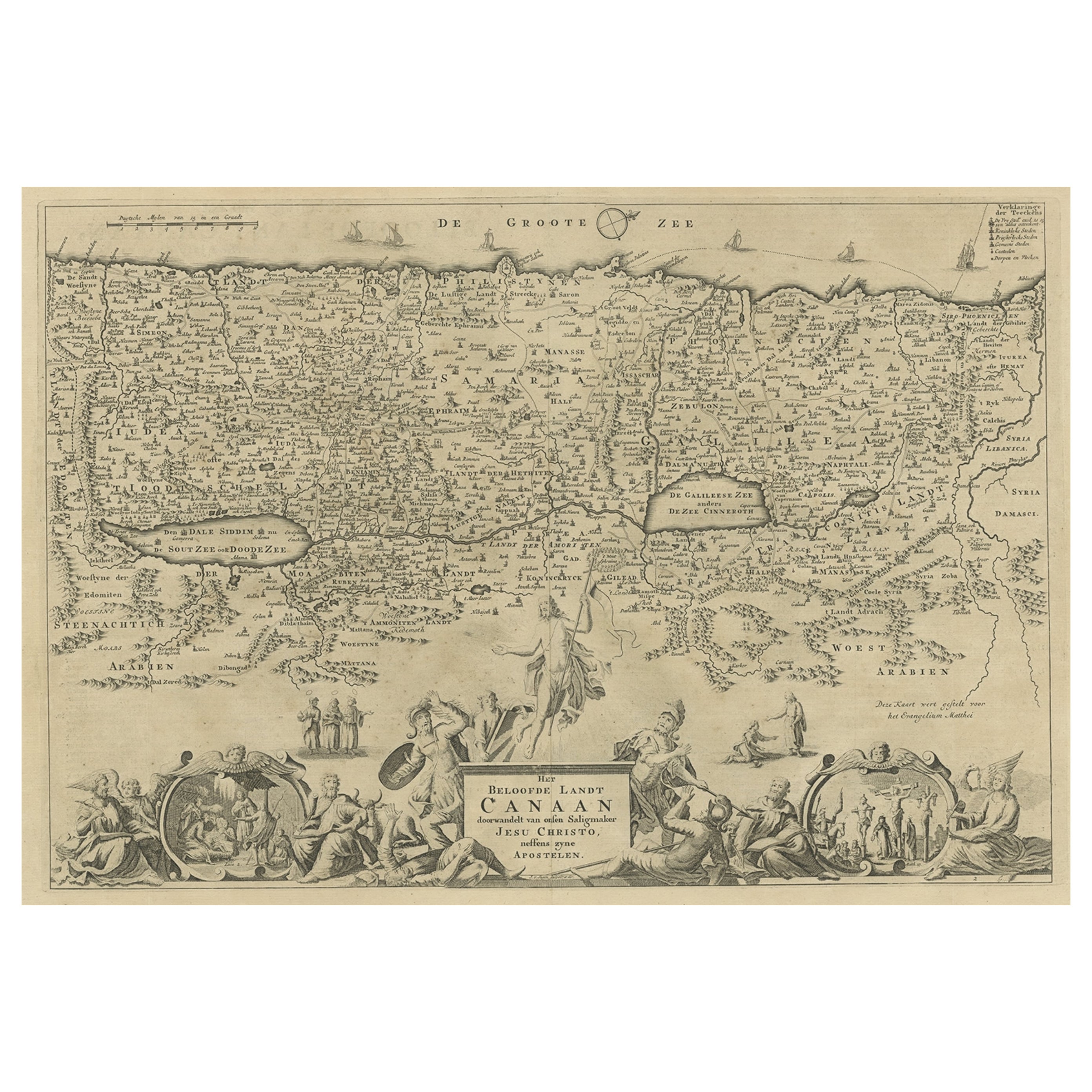
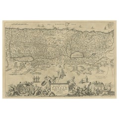
- Antique Map of Israel Filled with Biblical Scenes, Published in 1748Located in Langweer, NLAntique map Holy Land titled 'Het beloofde landt Canaan doorwandelt van onsen Saligmaker Jesu Christo neffens zyne Apostelen'. Antique map of Israel ...Category
Antique 1740s Maps
MaterialsPaper
You May Also Like
- Large Scale Antique Scroll Map of Lincolnshire, England, Dated 1778Located in St Annes, LancashireWonderful scroll map of Lincolnshire By Captain Armstrong, 1778 Copper plate engraving on paper laid on canvas Original ebonized wood frame with lo...Category
Antique 1770s English Georgian Maps
MaterialsWood, Paper
- Large Original Vintage Map of Israel, circa 1920Located in St Annes, LancashireGreat map of Israel Original color. Good condition Published by Alexander Gross Unframed.Category
Vintage 1920s English Edwardian Maps
MaterialsPaper
- Antique Brass and Wood Set of Scales with Assorted WeightsLocated in New Orleans, LA19th Century Victorian Era Brass and Wood Set of Scales with Assorted Weights.Category
Antique 19th Century English Scientific Instruments
MaterialsBrass
- 1854 Map of Massachusetts, Connecticut and Rhode Island, Antique Wall MapLocated in Colorado Springs, COThis striking wall map was published in 1854 by Ensign, Bridgman & Fanning and has both full original hand-coloring and original hardware. This impression is both informative and highly decorative. The states are divided into counties, outlined in red, green, and black, and subdivided into towns. Roads, canals, and railroad lines are prominently depicted, although they are not all labeled. The mapmakers also marked lighthouses, banks, churches, and prominent buildings, with a key at right. The map is an informative and comprehensive overview of the infrastructural development of New England prior to the Civil War. Physical geographies depicted include elevation, conveyed with hachure marks, rivers and lakes. The impression features an inset map of Boston...Category
Antique 19th Century American Maps
MaterialsPaper
- Antique Map of Principality of MonacoBy Antonio Vallardi EditoreLocated in Alessandria, PiemonteST/619 - "Old Geographical Atlas of Italy - Topographic map of ex-Principality of Monaco" - ediz Vallardi - Milano - A somewhat special edition ---Category
Antique Late 19th Century Italian Other Prints
MaterialsPaper
- Mid-20th Century Israeli Silver Hanukkah Lamp by Bezalel School JerusalemLocated in New York, NYHandmade silver Hanukkah lamp Menorah by Bezalel. Decorated with filigree work, and with acid etched Hebrew text: "these candles are holy". The Menorah can also serve as Shabbat Cand...Category
Mid-20th Century Israeli Religious Items
MaterialsSilver


Recently Viewed
View AllMore Ways To Browse
Antique Scales Collectables
Antique Scales Collectibles
Antique Scales Collectable Scales
Keys Collectible Antique
Collecting Antique Keys
Israeli Artist Furniture
Scale Map
Jerusalem Furniture
Ancient Egyptian Antiques
17th Century Keys
Antique Israel
Israel Antique
Spell Antique
Large Scale Map
Antique Furniture Israel
Antique Ancient Keys
Antique Ancient Key
Book In Russian