Items Similar to Antique Map of Herefordshire by Morden, c.1700


Want more images or videos?
Request additional images or videos from the seller
1 of 5
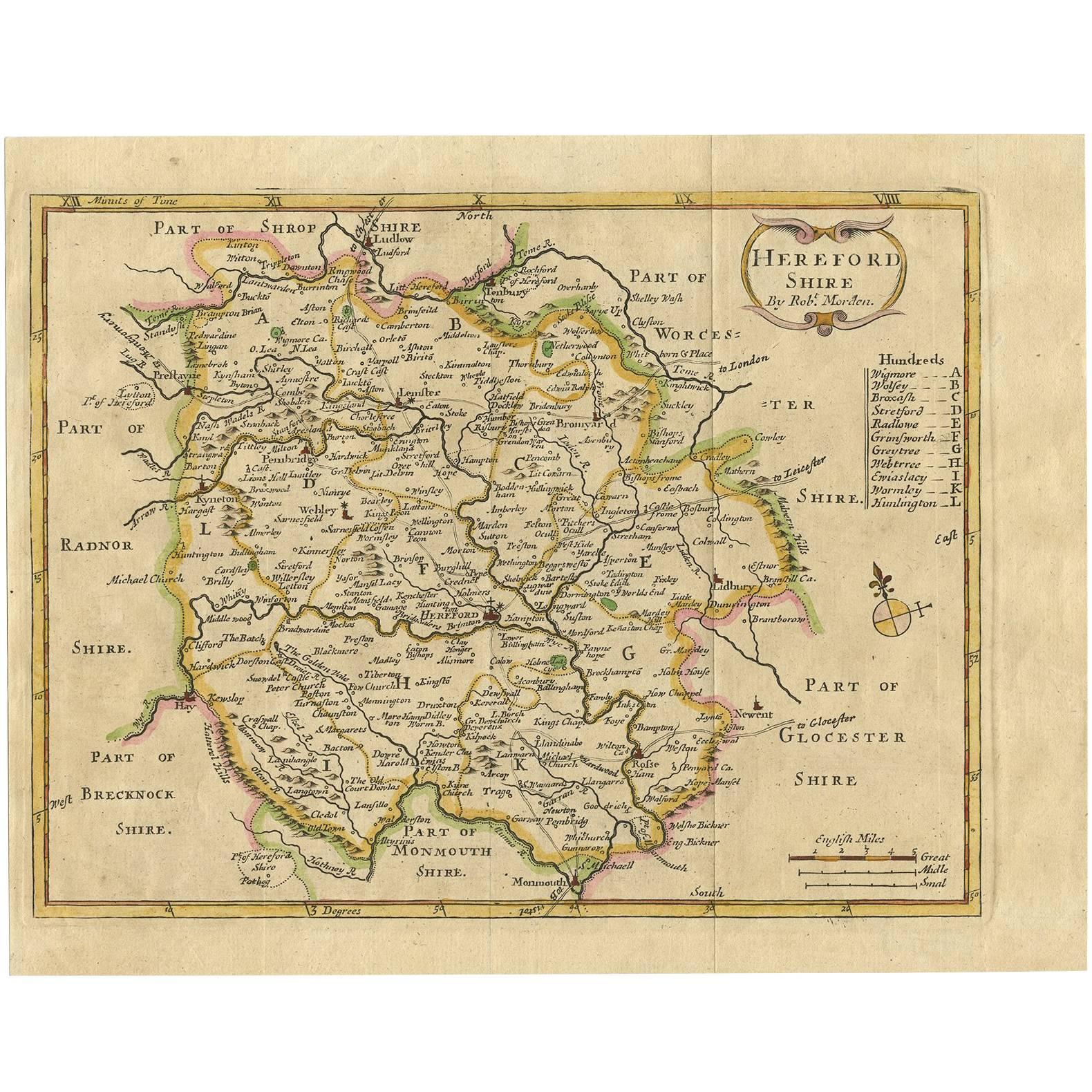
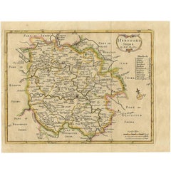
Antique Map of Herefordshire by Morden, c.1700
About the Item
Antique map titled 'Herefordshire'. Detailed map of the county of Herefordshire embellished with a decorative title cartouche. Three scales. Imprint of Abel Swale, Awnsham Churchill and John Churchill. Source unknown, to be determined. Artists and Engravers: Made by 'Robert Morden' after an anonymous artist. Robert Morden (c. 1650 ? 1703) was an English bookseller, publisher, and maker of maps and globes. He was among the first successful commercial map makers.
Artist: Made by 'Robert Morden' after an anonymous artist. Robert Morden (c. 1650 ? 1703) was an English bookseller, publisher, and maker of maps and globes. He was among the first successful commercial map makers.
Condition: Good, given age. Edges with an occasional tiny tear, not affecting image. Some light crinkles. Original middle fold as issued. General age-related toning and/or occasional minor defects from handling. Please study image carefully.
Date: c.1700
Overall size: 44.5 x 38.7 cm.
Image size: 0.001 x 41.8 x 36.1 cm.
We sell original antique maps to collectors, historians, educators and interior decorators all over the world. Our collection includes a wide range of authentic antique maps from the 16th to the 20th centuries. Buying and collecting antique maps is a tradition that goes back hundreds of years. Antique maps have proved a richly rewarding investment over the past decade, thanks to a growing appreciation of their unique historical appeal. Today the decorative qualities of antique maps are widely recognized by interior designers who appreciate their beauty and design flexibility. Depending on the individual map, presentation, and context, a rare or antique map can be modern, traditional, abstract, figurative, serious or whimsical. We offer a wide range of authentic antique maps for any budget.
- Dimensions:Height: 17.52 in (44.5 cm)Width: 15.24 in (38.7 cm)Depth: 0 in (0.01 mm)
- Materials and Techniques:
- Period:
- Date of Manufacture:circa 1700
- Condition:
- Seller Location:Langweer, NL
- Reference Number:
About the Seller
5.0
Platinum Seller
These expertly vetted sellers are 1stDibs' most experienced sellers and are rated highest by our customers.
Established in 2009
1stDibs seller since 2017
1,933 sales on 1stDibs
Typical response time: <1 hour
- ShippingRetrieving quote...Ships From: Langweer, Netherlands
- Return PolicyA return for this item may be initiated within 14 days of delivery.
More From This SellerView All
- Antique Map of Herefordshire 'England' by R. Morden, 1708Located in Langweer, NLThis antique County map of Herefordshire by Robert Morden was first published in 1701 in a work entitled 'The New Description and State of England'...Category
Antique Early 18th Century Maps
MaterialsPaper
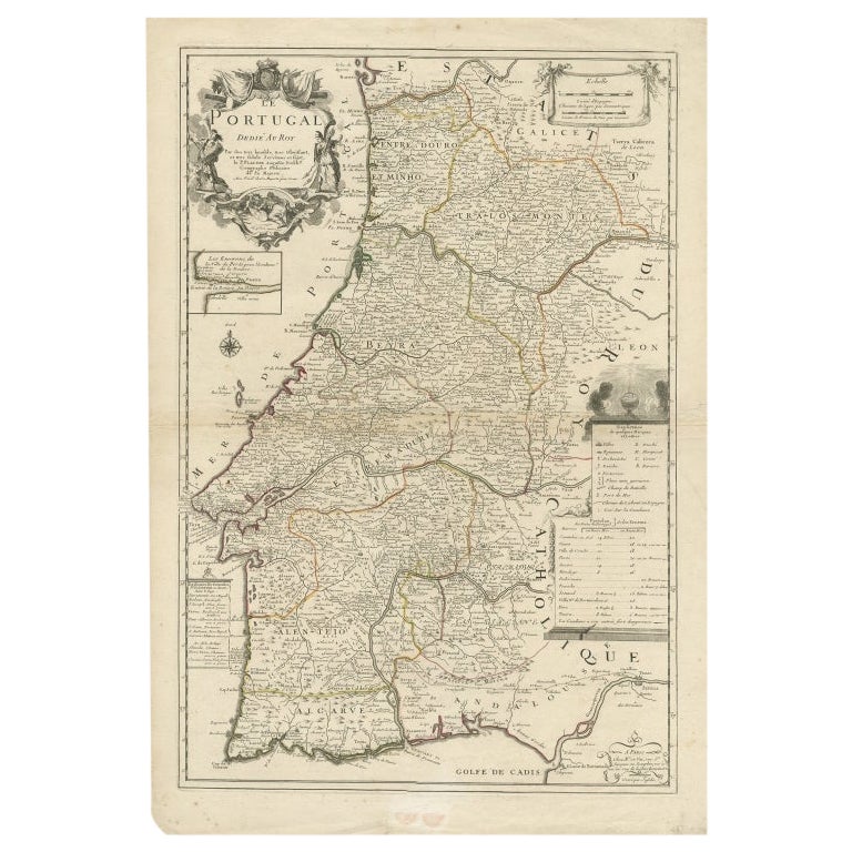
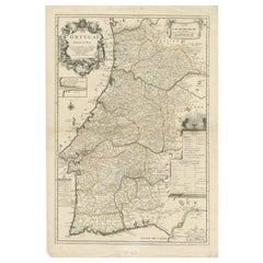
- Antique Map of Portugal by Placide, c.1700Located in Langweer, NLAntique map titled 'Le Portugal dedié au Roy (..)'. Large and detailed map of Portugal. With a small inset map of Porto. Artists and Engravers: Publish...Category
Antique 18th Century Maps
MaterialsPaper
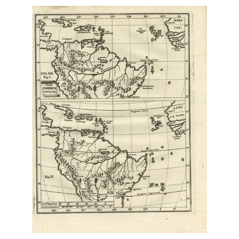
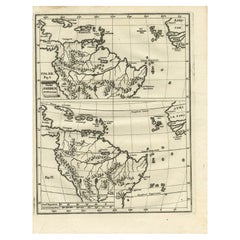
- Antique Map of South America by Scherer, c.1700By Thomas KitchinLocated in Langweer, NLAntique map of part of South America. Two maps on a single sheet, each depicting nearly the same area. On close examination there are slight differences in the rivers, lakes and moun...Category
Antique 18th Century Maps
MaterialsPaper
- Antique Map of Portugal by P. Schenk, circa 1700Located in Langweer, NLAntique map titled 'Portugalliae et Algarbia'. Striking example of Schenk's rare map of Portugal, with the coats of arms of Portugal, Algarbia and a Spanish sailing vessell in the ca...Category
Antique Early 18th Century Maps
MaterialsPaper
- Antique Map of the Middle East by Mortier, 1700Located in Langweer, NLAntique map titled 'Carte de la Situation du Paradis Terrestre (..)'. Detailed map of the Holy Land and the Middle East, centered on the Garden of Eden and including a large Cyprus. ...Category
Antique 18th Century Maps
MaterialsPaper
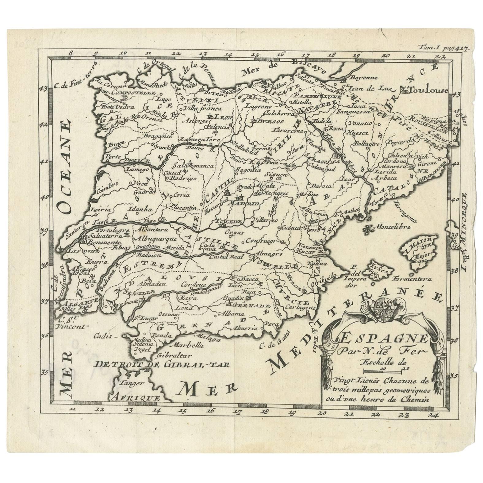
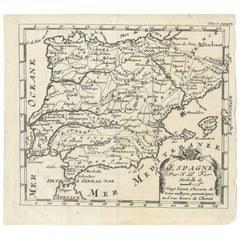
- Antique Map of Spain by N. de Fer, circa 1700Located in Langweer, NLAntique map of Spain and Portugal with a title cartouche. Nicolas de Fer was the youngest son of the Paris printer and publisher Antoine de Fer. At the ...Category
Antique Early 18th Century Maps
MaterialsPaper


You May Also Like
- 1861 Topographical Map of the District of Columbia, by Boschke, Antique MapLocated in Colorado Springs, COPresented is an original map of Albert Boschke's extremely sought-after "Topographical Map of the District of Columbia Surveyed in the Years 1856 ...Category
Antique 1860s American Historical Memorabilia
MaterialsPaper
- 1907 Map of Colorado, Antique Topographical Map, by Louis NellLocated in Colorado Springs, COThis highly detailed pocket map is a topographical map of the state of Colorado by Louis Nell from 1907. The map "has been complied from all availabl...Category
Antique Early 1900s American Maps
MaterialsPaper
- Antique Map of Italy by Andriveau-Goujon, 1843By Andriveau-GoujonLocated in New York, NYAntique Map of Italy by Andriveau-Goujon, 1843. Map of Italy in two parts by Andriveau-Goujon for the Library of Prince Carini at Palazzo Carini i...Category
Antique 1840s French Maps
MaterialsLinen, Paper
- Antique Map of Principality of MonacoBy Antonio Vallardi EditoreLocated in Alessandria, PiemonteST/619 - "Old Geographical Atlas of Italy - Topographic map of ex-Principality of Monaco" - ediz Vallardi - Milano - A somewhat special edition ---Category
Antique Late 19th Century Italian Other Prints
MaterialsPaper
- Original Antique Map of Russia By Arrowsmith. 1820Located in St Annes, LancashireGreat map of Russia Drawn under the direction of Arrowsmith Copper-plate engraving Published by Longman, Hurst, Rees, Orme and Brown, 1820 Unframed.Category
Antique 1820s English Maps
MaterialsPaper
- 1864 Map of North America, Antique Hand-Colored Map, by Adolphe Hippolyte DufourLocated in Colorado Springs, COOffered is a map of North America entitled Amerique du Nord from 1864. This rare, separately published wall map was produced by Adolphe Hippolyte Dufour. This map includes vibrant an...Category
Antique 1860s French Maps
MaterialsPaper


Recently Viewed
View AllMore Ways To Browse
1700 Antique Furniture
Map Light
Antique Globes Of The World
Antique Paper Light
18th C Interior
Scale Map
16th Century English Antique
Antique English Maps
Used Booksellers
Used Bookseller
Antique Maps And Globes
Antique Globes And Maps
Antique Paper Globe
World Map Globe
Antique Bookseller
Antique Booksellers
Antique County Maps
Antique Map Globe