Items Similar to Antique Map of Portugal by Placide, c.1700


Want more images or videos?
Request additional images or videos from the seller
1 of 5
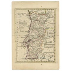
Antique Map of Portugal by Placide, c.1700
About the Item
Antique map titled 'Le Portugal dedié au Roy (..)'. Large and detailed map of Portugal. With a small inset map of Porto. Artists and Engravers: Published by P. Placide. Placide was Du Val's brother-in-law. He only published one atlas titled 'Cartes de Geographie'.
Artist: Published by P. Placide. Placide was Du Val's brother-in-law. He only published one atlas titled 'Cartes de Geographie'.
Condition: Good, minor defects from handling. Small split on folding line, please study image carefully.
Date: c.1700
Overall size: 53 x 78 cm.
Image size: 0.001 x 46.5 x 68.5 cm.
Antique prints have long been appreciated for both their aesthetic and investment value. They were the product of engraved, etched or lithographed plates. These plates were handmade out of wood or metal, which required an incredible level of skill, patience and craftsmanship. Whether you have a house with Victorian furniture or more contemporary decor an old engraving can enhance your living space. We offer a wide range of authentic antique prints for any budget.
- Dimensions:Height: 30.71 in (78 cm)Width: 20.87 in (53 cm)Depth: 0 in (0.01 mm)
- Materials and Techniques:
- Period:
- Date of Manufacture:circa 1700
- Condition:
- Seller Location:Langweer, NL
- Reference Number:
About the Seller
5.0
Platinum Seller
These expertly vetted sellers are 1stDibs' most experienced sellers and are rated highest by our customers.
Established in 2009
1stDibs seller since 2017
1,933 sales on 1stDibs
Typical response time: <1 hour
- ShippingRetrieving quote...Ships From: Langweer, Netherlands
- Return PolicyA return for this item may be initiated within 14 days of delivery.
More From This SellerView All
- Antique Map of Portugal by P. Schenk, circa 1700Located in Langweer, NLAntique map titled 'Portugalliae et Algarbia'. Striking example of Schenk's rare map of Portugal, with the coats of arms of Portugal, Algarbia and a Spanish sailing vessell in the ca...Category
Antique Early 18th Century Maps
MaterialsPaper
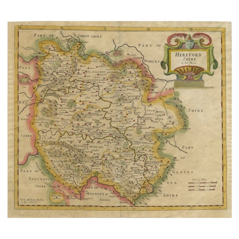
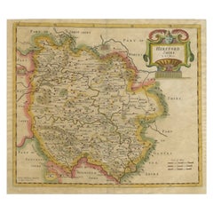
- Antique Map of Herefordshire by Morden, c.1700Located in Langweer, NLAntique map titled 'Herefordshire'. Detailed map of the county of Herefordshire embellished with a decorative title cartouche. Three scales. Imprint of Abel Swale, Awnsham Churchill ...Category
Antique 18th Century Maps
MaterialsPaper
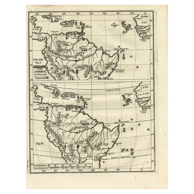
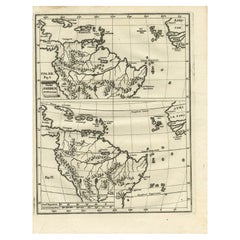
- Antique Map of South America by Scherer, c.1700By Thomas KitchinLocated in Langweer, NLAntique map of part of South America. Two maps on a single sheet, each depicting nearly the same area. On close examination there are slight differences in the rivers, lakes and moun...Category
Antique 18th Century Maps
MaterialsPaper
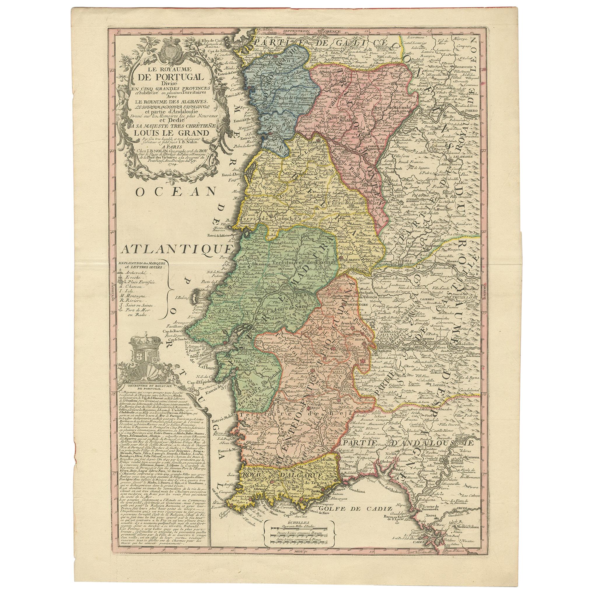
- Antique Map of Portugal by Nolin '1704'Located in Langweer, NLAntique map titled 'Le Royaume de Porutgal divisé en cinq grandes Provinces (..)'. Rare and very decorative map of Portugal. It shows the territory of ...Category
Antique Early 18th Century Maps
MaterialsPaper
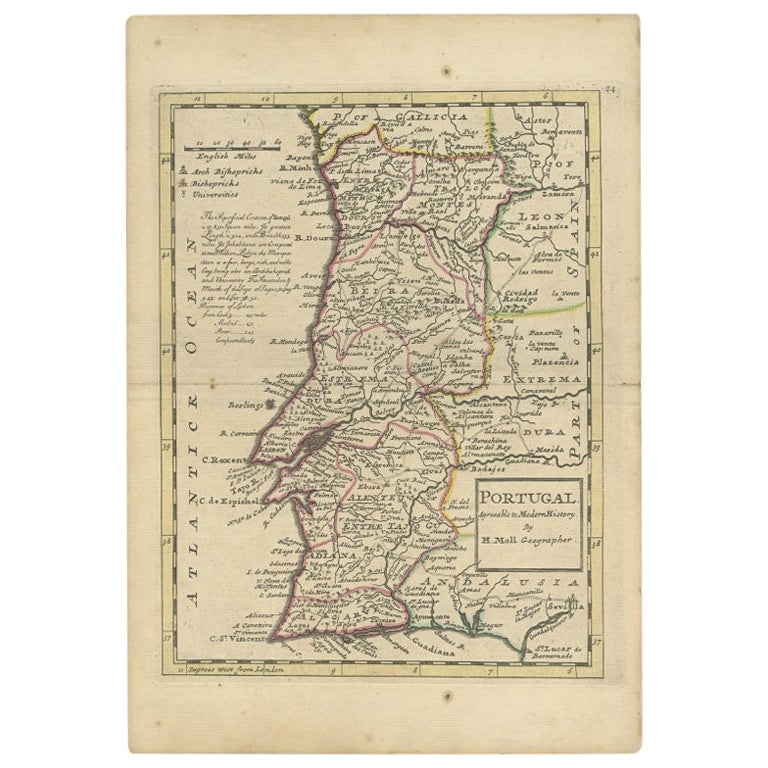
- Antique Map of Portugal by Moll, 1727Located in Langweer, NLAntique map Portugal titled 'Portugal Agreeable to Modern History'. Detailed map of Portugal showing major routes, waterways, arch bishoprics, bis...Category
Antique 18th Century Maps
MaterialsPaper
- Antique Map of the Middle East by Mortier, 1700Located in Langweer, NLAntique map titled 'Carte de la Situation du Paradis Terrestre (..)'. Detailed map of the Holy Land and the Middle East, centered on the Garden of Eden and including a large Cyprus. ...Category
Antique 18th Century Maps
MaterialsPaper


You May Also Like
- Original Antique Map of Spain and Portugal by Thomas Clerk, 1817Located in St Annes, LancashireGreat map of Spain and Portugal Copper-plate engraving Drawn and engraved by Thomas Clerk, Edinburgh. Published by Mackenzie And Dent, 1817 Unframed.Category
Antique 1810s English Maps
MaterialsPaper
- Original Antique Map of Spain and Portugal, Engraved By Barlow, 1806Located in St Annes, LancashireGreat map of Spain And Portugal Copper-plate engraving by Barlow Published by Brightly & Kinnersly, Bungay, Suffolk. 1806 Unframed.Category
Antique Early 1800s English Maps
MaterialsPaper
- Original Antique Map of Spain and Portugal, circa 1790Located in St Annes, LancashireSuper map of Spain and Portugal Copper plate engraving by A. Bell Published, circa 1790. Unframed.Category
Antique 1790s English Other Maps
MaterialsPaper
- 1861 Topographical Map of the District of Columbia, by Boschke, Antique MapLocated in Colorado Springs, COPresented is an original map of Albert Boschke's extremely sought-after "Topographical Map of the District of Columbia Surveyed in the Years 1856 ...Category
Antique 1860s American Historical Memorabilia
MaterialsPaper
- 1907 Map of Colorado, Antique Topographical Map, by Louis NellLocated in Colorado Springs, COThis highly detailed pocket map is a topographical map of the state of Colorado by Louis Nell from 1907. The map "has been complied from all availabl...Category
Antique Early 1900s American Maps
MaterialsPaper
- 18th Century Hand Colored Map of Spain and Portugal by VisscherBy Nicolaes Visscher IILocated in Alamo, CAThis is an early 18th century map of Spain and Portugal, with attractive original hand-coloring, entitled "Hispaniae et Portugalliae Regna per Nicolaum Visscher cum Privilegio Ordinu...Category
Antique Early 18th Century Dutch Maps
MaterialsPaper


Recently Viewed
View AllMore Ways To Browse
Plate Portugal
Portuguese Plates
Antique Wood Cart
Folding Trolley Cart
Foldable Trolley Cart
Antique Plate With Metal Handle
Antique Portuguese Wood Furniture
Antique Wood Trolley
Engravings 1700
Victorian Trolley
Antique Metal Carts
18th C Large Prints
Portugal Map
Map Of Portugal
Du Val
Roy Paper Plate
Antique Map Of Portugal
Antique Map Portugal