Map Of Portugal
10
to
35
187
36
123
66
50
45
39
23
22
17
15
14
14
12
11
11
10
10
10
9
7
7
5
5
4
4
4
4
4
3
3
2
2
2
2
2
2
2
1
1
1
1
1
1
1
1
1
1
1
1
1
9
5
4
4
2
Sort By
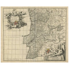
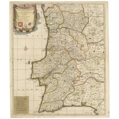
Antique Map of Portugal by Nolin '1704'
Located in Langweer, NL
decorative map of Portugal. It shows the territory of the Kingdom of Portugal as well as the Algarve and
Category
Antique Early 18th Century Maps
Materials
Paper
Antique Map of Portugal by J. De Ram, circa 1680
Located in Langweer, NL
A detailed map of Portugal. Embellished with beautiful cartouche, sailing vessels and many putti
Category
Antique Late 17th Century Maps
Materials
Paper
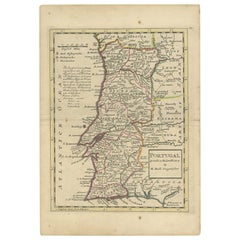
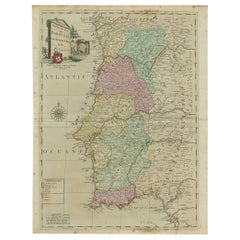
Antique Map of Portugal by Moll, 1727
Located in Langweer, NL
Antique map Portugal titled 'Portugal Agreeable to Modern History'. Detailed map of Portugal
Category
Antique 18th Century Maps
Materials
Paper
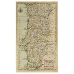
Detailed Antique Map of Portugal, Published for the 'Gentleman's Magazine', 1758
Located in Langweer, NL
Antique map Portugal titled 'A Map of the Kingdom of Portugal'.
Detailed map of Portugal
Category
Antique 1750s Maps
Materials
Paper
H 14.57 in W 7.88 in D 0 in
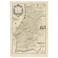
Antique Map of Portugal by Placide, c.1700
Located in Langweer, NL
Antique map titled 'Le Portugal dedié au Roy (..)'. Large and detailed map of Portugal. With a
Category
Antique 18th Century Maps
Materials
Paper
Antique Map of Portugal by P. Schenk, circa 1700
Located in Langweer, NL
Antique map titled 'Portugalliae et Algarbia'. Striking example of Schenk's rare map of Portugal
Category
Antique Early 18th Century Maps
Materials
Paper
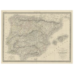
Antique Decorative Map of Portugal and Spain, 1842
Located in Langweer, NL
Antique map titled 'Carte de la Peninsule comprenant l'Espagne et le Portugal'.
Map of Spain
Category
Antique 1840s Maps
Materials
Paper
18th Century Portugal Original Antique Engraving by Bowles
Located in Langweer, NL
Antique map titled 'Bowles's New Pocket Map of Portugal, Laid Down According to the Sr. Nolin
Category
Antique 18th Century Maps
Materials
Paper
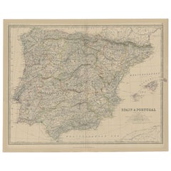
Antique Map of Spain and Portugal, 1882
Located in Langweer, NL
"Antique map titled 'Spain & Portugal'.
Old map of Spain and Portugal. This map originates from
Category
Antique 19th Century Maps
Materials
Paper
Original Antique Map of Spain and Portugal, 1882
Located in Langweer, NL
Embark on a historical voyage with an original Antique Map of Spain and Portugal from the esteemed
Category
Antique 1880s Maps
Materials
Paper
Antique Hand-Colored Map of Northern Portugal, 1756
Located in Langweer, NL
Antique map Portugal titled 'Parte Sepentrional del Reyno de Portugal'.
Antique map of Northern
Category
Antique 1750s Maps
Materials
Paper
Antique Map of Spain and Portugal by Johnston, '1909'
Located in Langweer, NL
Antique map titled 'Spain and Portugal'. Original antique map of Spain and Portugal. With inset
Category
Early 20th Century Maps
Materials
Paper
Antique Map of Spain and Portugal by Lowry, '1852'
Located in Langweer, NL
Antique map titled 'Spain and Portugal'. Original map of Spain and Portugal. This map originates
Category
Antique Mid-19th Century Maps
Materials
Paper
Antique Map of Spain and Portugal by Levasseur, '1875'
Located in Langweer, NL
Antique map titled 'Carte générale de l'Espagne et du Portugal (..)'. Large map of Spain and
Category
Antique Late 19th Century Maps
Materials
Paper
Original Antique Map of Spain and Portugal, circa 1790
Located in St Annes, Lancashire
Super map of Spain and Portugal
Copper plate engraving by A. Bell
Published, circa 1790
Category
Antique 1790s English Other Maps
Materials
Paper
Antique Map of Spain and Portugal by Barlow, 1809
Located in Langweer, NL
"Antique map titled 'Spain and Portugal from the best Authorities'. Detailed antique map of Spain
Category
Antique 19th Century Maps
Materials
Paper
Antique Map of Spain and Portugal by Petri, 1852
Located in Langweer, NL
Antique map titled 'Spanje en Portugal'. Map of Spain and Portugal. This map originates from
Category
Antique 19th Century Maps
Materials
Paper
Antique Colourful Antique Map of Spain and Portugal, 1815
Located in Langweer, NL
Antique map of Spain and Portugal. Thomson's map includes both countries in full, with Spain being
Category
Antique 1810s Maps
Materials
Paper
Antique Map of Spain and Portugal by Migeon, 1880
Located in Langweer, NL
Antique map titled 'Espagne et Portugal'. Old map of Spain and Portugal with a decorative vignette
Category
Antique 19th Century Maps
Materials
Paper
Antique Map of Spain and Portugal by Mitchell, 1846
Located in Langweer, NL
Antique map titled 'Kingdom of Spain and Portugal'. Old map of Spain and Portugal, with an inset
Category
Antique 19th Century Maps
Materials
Paper
Antique Map of Spain and Portugal by Harris, 1802
Located in Langweer, NL
"Antique map titled 'Spain and Portugal'. Uncommon circular map of Spain and Portugal. Artists and
Category
Antique 19th Century Maps
Materials
Paper
Antique Map of Spain and Portugal by Kitchin, 1770
Located in Langweer, NL
Antique map titled 'Spain and Portugal by Tho. Kitchin'. Rare detailed map of Spain and Portugal
Category
Antique 18th Century Maps
Materials
Paper
Old Map of Spain and Portugal, with an Inset Map of the Region of Madrid, 1846
Located in Langweer, NL
Antique map titled 'Kingdom of Spain and Portugal'.
Old map of Spain and Portugal, with an
Category
Antique 1840s Maps
Materials
Paper
H 13.78 in W 17.13 in D 0 in
Antique Map of Spain and Portugal by Thomson, 1815
Located in Langweer, NL
Antique map titled 'Spain & Portugal.' Map of Spain and Portugal. From Thomson's 'New General Atlas
Category
Antique 19th Century Maps
Materials
Paper
Antique Map of Spain and Portugal by Cruchley, 1854
Located in Langweer, NL
"Antique map of Spain and Portugal. Also depicts the islands Formentera, Ibiza, Mallorca and
Category
Antique 19th Century Maps
Materials
Paper
Antique Map of Spain and Portugal, with Frame Style Border
Located in Langweer, NL
Antique map titled 'Espagne et Portugal'. Attractive map of Spain and Portugal. The map covers all
Category
Antique Mid-19th Century Maps
Materials
Paper
Engraved Large Map of The Kingdom of Portugal Original Handcolored, 1854
Located in Langweer, NL
Antique map titled 'Mappa Corografica do Reino de Portugal - Chorographical map of the Kingdom of
Category
Antique 1850s Maps
Materials
Paper
H 30.91 in W 22.84 in D 0 in
Antique Map of Spain & Portugal 'Iberian Peninsula', Decorative Cartouche, c1755
Located in Langweer, NL
Antique map titled 'Spain and Portugal'.
Small, detailed antique map of Spain and Portugal
Category
Antique 1750s Maps
Materials
Paper
H 7.88 in W 9.85 in D 0 in
Antique Map of France, Spain and Portugal by Johnson, 1872
Located in Langweer, NL
Antique map titled 'Johnson's France (..)'. Original map showing France, Spain and Portugal. With
Category
Antique Late 19th Century Maps
Materials
Paper
Antique Map of Spain and Portugal by Petri, c.1873
Located in Langweer, NL
Antique map titled 'Spanje en Portugal'. Old map depicting Spain and Portugal. This map originates
Category
Antique 19th Century Maps
Materials
Paper
Antique Map of Spain and Portugal by Bowles, c.1780
Located in Langweer, NL
"Antique map titled 'Bowles's New Pocket Map of the Kingdom of Spain and Portugal according to De
Category
Antique 18th Century Maps
Materials
Paper
Antique Map of Spain and Portugal by Tirion, c.1760
Located in Langweer, NL
Antique map titled 'Nieuwe Kaart van Spanje en Portugal.' Attractive detailed map showing Spain and
Category
Antique 18th Century Maps
Materials
Paper
Antique Map of Spain and Portugal by Weller, c.1890
Located in Langweer, NL
Antique map titled 'Spain and Portugal.' Map of Spain and Portugal, with the Balearic Islands
Category
Antique 19th Century Maps
Materials
Paper
Antique Map of Spain and Portugal by Tardieu, circa 1795
Located in Langweer, NL
The image is an antique map titled "Hispanie Betique et Lusitanie", which depicts the Iberian
Category
Antique Late 18th Century Maps
Materials
Paper
Antique Map of the Kingdoms of Spain and Portugal by Wyld '1845'
Located in Langweer, NL
Antique map titled 'Kingdoms of Spain and Portugal'. Original antique map of the Kingdoms of Spain
Category
Antique Mid-19th Century Maps
Materials
Paper
Antique Map of Spain and Portugal by A & C. Black, 1870
Located in Langweer, NL
Antique map titled 'Spain and Portugal'. Original antique map of General map of Spain and Portugal
Category
Antique Late 19th Century Maps
Materials
Paper
Map of Spain & Portugal Incl. the islands of Ibiza, Minorque & Majorque, 1780
Located in Langweer, NL
Antique map titled 'Les Royaumes d'Espagne et de Portugal.'
Map of Spain and Portugal. Includes
Category
Antique 1780s Maps
Materials
Paper
H 10.24 in W 15.16 in D 0 in
Original Antique Map of Spain and Portugal, Engraved By Barlow, 1806
Located in St Annes, Lancashire
Great map of Spain And Portugal
Copper-plate engraving by Barlow
Published by Brightly
Category
Antique Early 1800s English Maps
Materials
Paper
No Reserve
H 8 in W 10 in D 0.07 in
Antique Map of Spain and Portugal by Keizer & de Lat, 1788
Located in Langweer, NL
Spain and Portugal. This map originates from 'Nieuwe Natuur- Geschied- en Handelkundige Zak- en
Category
Antique Late 18th Century Maps
Materials
Paper
Original Antique Map of Spain and Portugal by Thomas Clerk, 1817
Located in St Annes, Lancashire
Great map of Spain and Portugal
Copper-plate engraving
Drawn and engraved by Thomas Clerk
Category
Antique 1810s English Maps
Materials
Paper
No Reserve
H 8.25 in W 10.25 in D 0.07 in
18th Century Hand Colored Map of Spain and Portugal by Visscher
By Nicolaes Visscher II
Located in Alamo, CA
This is an early 18th century map of Spain and Portugal, with attractive original hand-coloring
Category
Antique Early 18th Century Dutch Maps
Materials
Paper
Large Antique Map of Ancient Spain and Portugal, Published in circa 1760
Located in Langweer, NL
Antique map titled 'Hispania Antiqua (..)'. Map of ancient Spain and Portugal. Engraved by G
Category
Antique Mid-18th Century Maps
Materials
Paper
No Reserve
H 20.16 in W 26.86 in D 0.02 in
Set of 2 Costume Prints and a Map of Spain and Portugal, circa 1720
Located in Langweer, NL
Set of two costume prints and a map of Spain and Portugal. The costume prints show costumes of
Category
Antique Early 18th Century Maps
Materials
Paper
Antique Map of Iberia or the Iberian Peninsula with Portugal and Spain, 1842
Located in Langweer, NL
Antique map titled 'Carte de l'Ibérie ou Espagne Ancienne'. Map of Iberia, or the Iberian Peninsula
Category
Antique 19th Century Maps
Materials
Paper
H 26.78 in W 19.89 in D 0 in
Beautiful Old Map of Spain and Portugal With Decorative Title Cartouche, ca.1740
Located in Langweer, NL
Antique map Spain titled 'L’Espagne dressée sur la Description qui en a eté faite par Rodrigo
Category
Antique 1740s Maps
Materials
Paper
H 20.87 in W 25.6 in D 0 in
Beautiful Large Scale Map of Spain and Portugal Published by Herman Moll in 1711
Located in Langweer, NL
Title: A New and Exact Map of Spain & Portugal
Author: Herman Moll
Date: 1711
Medium: ?Hand
Category
Antique 1710s Maps
Materials
Paper
H 24.81 in W 39.38 in D 0.02 in
Attractive Engraved Old Map Showing Spain, Portugal Majorca, Ibiza etc. ca.1760
Located in Langweer, NL
Antique map titled 'Nieuwe Kaart van Spanje en Portugal.'
Attractive detailed map showing Spain
Category
Antique 1760s Maps
Materials
Paper
H 14.97 in W 16.46 in D 0 in
Detailed Old Map showing Spain and Portugal Incl. Majorca, Minorca & Ibiza, 1740
Located in Langweer, NL
Antique map titled 'Nieuwe Kaart van Spanje en Portugal.'
Attractive detailed map showing Spain
Category
Antique 1740s Maps
Materials
Paper
H 17.13 in W 21.78 in D 0 in
Portugal: A Large 17th Century Hand-colored Map by Sanson and Jaillot
By Nicolas Sanson
Located in Alamo, CA
This large hand-colored map entitled "Le Royaume de Portugal et des Algarves Divisee en see
Category
Antique 1690s French Maps
Materials
Paper
Islands of Diversity: Portugal's Atlantic Archipelagos in 1903
Located in Langweer, NL
The image is an original historical map from 1903 depicting Portuguese possessions in the Atlantic
Category
Antique Early 1900s Maps
Materials
Paper
Free Shipping
H 14.77 in W 20.08 in D 0 in
Antique Map of Alentejo: Land of Tradition and Tranquility, 1903
Located in Langweer, NL
The image is a historical original antique map of the Alentejo region in Portugal. This map
Category
Antique Early 1900s Maps
Materials
Paper
Free Shipping
H 20.08 in W 14.77 in D 0 in
Antique Map of Southeast Asia by Ortelius '1587'
By Abraham Ortelius
Located in Langweer, NL
Antique map titled 'Indiae Orientalis Insularumque Adiacientium Typus'. Ortelius includes early
Category
Antique 16th Century Maps
Materials
Paper
Antique Map of Northern Asia by Mallet, 1719
Located in Langweer, NL
Antique map titled 'Das Mitternächtige Theil des Alten Asien'. This sheet of five miniature maps
Category
Antique 18th Century Maps
Materials
Paper
An Antique Map of Extremadura: Crossroads of History and Nature, 1903
Located in Langweer, NL
The image is a historical map of Extremadura, an autonomous community of Spain, from an unspecified
Category
Antique Early 1900s Maps
Materials
Paper
Free Shipping
H 20.08 in W 14.77 in D 0 in
Large Antique Map of the west coast of Celebes, Sulawesi, Indonesia
Located in Langweer, NL
Original antique map titled 'Kaart der Westkust van Celebes van Makasser tot Laijkan'. This large
Category
Antique Mid-19th Century Maps
Materials
Paper
Antique Map of South America by Tirion 'circa 1765'
Located in Langweer, NL
Antique map titled 'Kaart van het Onderkoningschap van Peru, zig uitstrekkende over Chili, Paraguay
Category
Antique Mid-18th Century Maps
Materials
Paper
Original Antique Map of Malabar, Coromandel 'India' and Ceylon
Located in Langweer, NL
Antique map titled 'Peninsula Indiae citra Gangem, hoc est Orae celeberrimae Malabar & Coromandel
Category
Antique Mid-18th Century Maps
Materials
Paper
Antique Map of the Empire of the Assyriens by Mallet, 1683
By Alain Manesson Mallet
Located in Langweer, NL
Antique map titled 'Empire des Assyriens' and 'Assyrie Chaldee et Mesopotamie selon les Anciens
Category
Antique 17th Century Maps
Materials
Paper
Antique Map of Celebes 'Sulawesi', Island in Indonesia, 1754
By Jacques-Nicolas Bellin
Located in Langweer, NL
Antique map titled 'Carte De L'Isle Celebes ou Macassar'. Detailed copper engraved map of Celebes
Category
Antique 18th Century Maps
Materials
Paper
Antique Map of South America by Tirion, c.1765
By Thomas Kitchin
Located in Langweer, NL
Antique map titled 'Kaart van het Onderkoningschap van Peru zig uitstrekkende: over Chile, Paraguay
Category
Antique 18th Century Maps
Materials
Paper
- 1
Get Updated with New Arrivals
Save "Map Of Portugal", and we’ll notify you when there are new listings in this category.
Map Of Portugal For Sale on 1stDibs
At 1stDibs, there are many versions of the ideal map of portugal for your home. Frequently made of paper, every map of portugal was constructed with great care. Your living room may not be complete without a map of portugal — find older editions for sale from the 18th Century and newer versions made as recently as the 19th Century. A map of portugal is a generally popular piece of furniture, but those created in Georgian styles are sought with frequency. Johannes Janssonius and Nicolaes Visscher II each produced at least one beautiful map of portugal that is worth considering.
How Much is a Map Of Portugal?
A map of portugal can differ in price owing to various characteristics — the average selling price 1stDibs is $346, while the lowest priced sells for $102 and the highest can go for as much as $1,950.
Questions About Map Of Portugal
- 1stDibs ExpertFebruary 1, 2024Whether Lanvin sneakers are made in Portugal depends on the style. The French luxury fashion house does produce some of its sneakers, like the iconic model DBB1, in Portugal. However, Lanvin also produces some styles at factories in Italy and Spain. On 1stDibs, find an assortment of Lanvin sneakers from some of the world's top boutiques.

