Items Similar to Antique Map of West Flanders in Belgium, c.1840


Want more images or videos?
Request additional images or videos from the seller
1 of 6
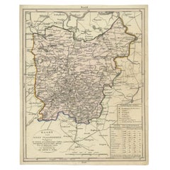
Antique Map of West Flanders in Belgium, c.1840
About the Item
Antique map titled 'Kaart van West Vlaanderen'. Original antique map of West Flanders, Belgium. Source unkown, to be determined. Published circa 1840.
Artists and Engravers: Engraved by D. Veelwaard. Published by Erven F. Bohn.
Condition: Good, general age-related toning. Minor wear, blank verso. Please study image carefully.
Date: c.1840
Overall size: 21.5 x 27 cm.
Image size: 20.5 x 26 cm.
We sell original antique maps to collectors, historians, educators and interior decorators all over the world. Our collection includes a wide range of authentic antique maps from the 16th to the 20th centuries. Buying and collecting antique maps is a tradition that goes back hundreds of years. Antique maps have proved a richly rewarding investment over the past decade, thanks to a growing appreciation of their unique historical appeal. Today the decorative qualities of antique maps are widely recognized by interior designers who appreciate their beauty and design flexibility. Depending on the individual map, presentation, and context, a rare or antique map can be modern, traditional, abstract, figurative, serious or whimsical. We offer a wide range of authentic antique maps for any budget.
- Dimensions:Height: 10.63 in (27 cm)Width: 8.47 in (21.5 cm)Depth: 0 in (0.01 mm)
- Materials and Techniques:
- Period:
- Date of Manufacture:c.1840
- Condition:Condition: Good, general age-related toning. Minor wear, blank verso. Please study image carefully.
- Seller Location:Langweer, NL
- Reference Number:
About the Seller
5.0
Platinum Seller
These expertly vetted sellers are 1stDibs' most experienced sellers and are rated highest by our customers.
Established in 2009
1stDibs seller since 2017
1,932 sales on 1stDibs
Typical response time: <1 hour
- ShippingRetrieving quote...Ships From: Langweer, Netherlands
- Return PolicyA return for this item may be initiated within 14 days of delivery.
More From This SellerView All
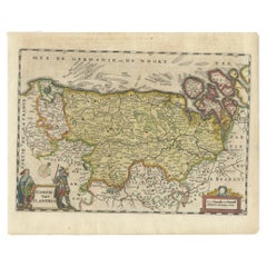
- Antique Map of East Flanders, Belgium, c.1840Located in Langweer, NLAntique map titled 'Kaart van Oost Vlaanderen'. Original antique map of East Flanders, Belgium. Source unkown, to be determined. Published circa 1840. Artists and Engravers: Engr...Category
Antique 19th Century Maps
MaterialsPaper
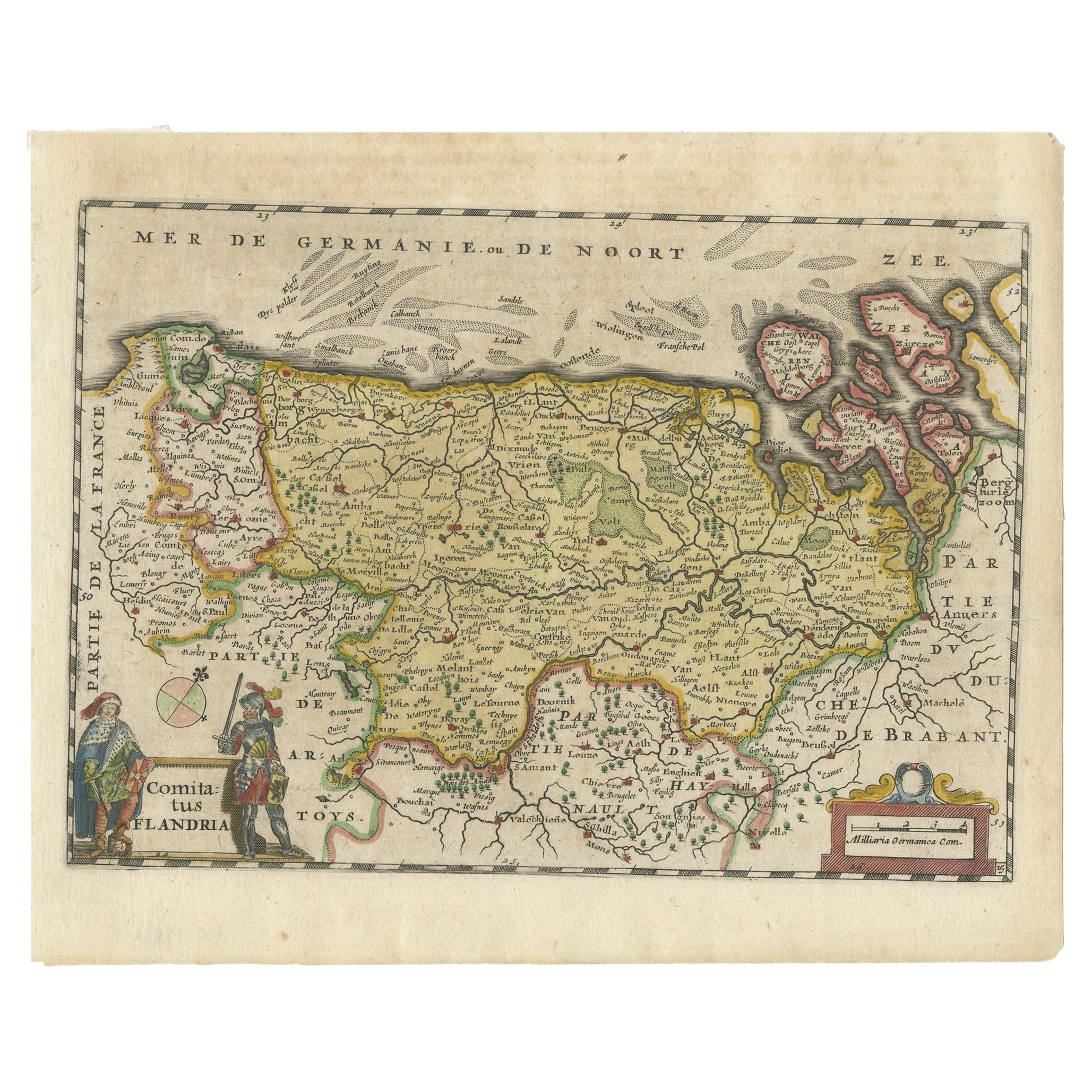
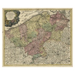
- Antique Map of Flanders, Belgium, 1630Located in Langweer, NLAntique map titled 'Comitatus Flandria'. Original antique map of Flanders, Belgium. This map originates from 'Vyerige Colom verthonende de 17 Nederlandsche Provintien' published 1630...Category
Antique 17th Century Maps
MaterialsPaper
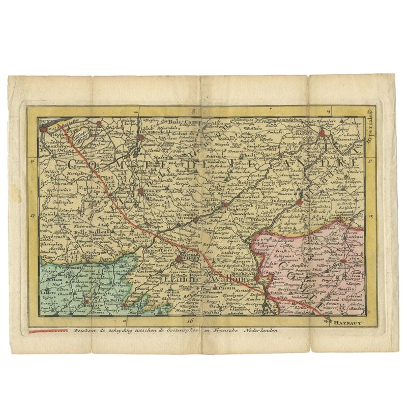
- Antique Map of the Region of Flanders in Belgium, 1737Located in Langweer, NLUntitled map of the region of Flanders, Belgium. This map originates from 'Nieuw en beknopt Kaart-Boekje vertoonende de XVII. Nederlandse Provintien (..)'. Artists and Engravers: A...Category
Antique 18th Century Maps
MaterialsPaper
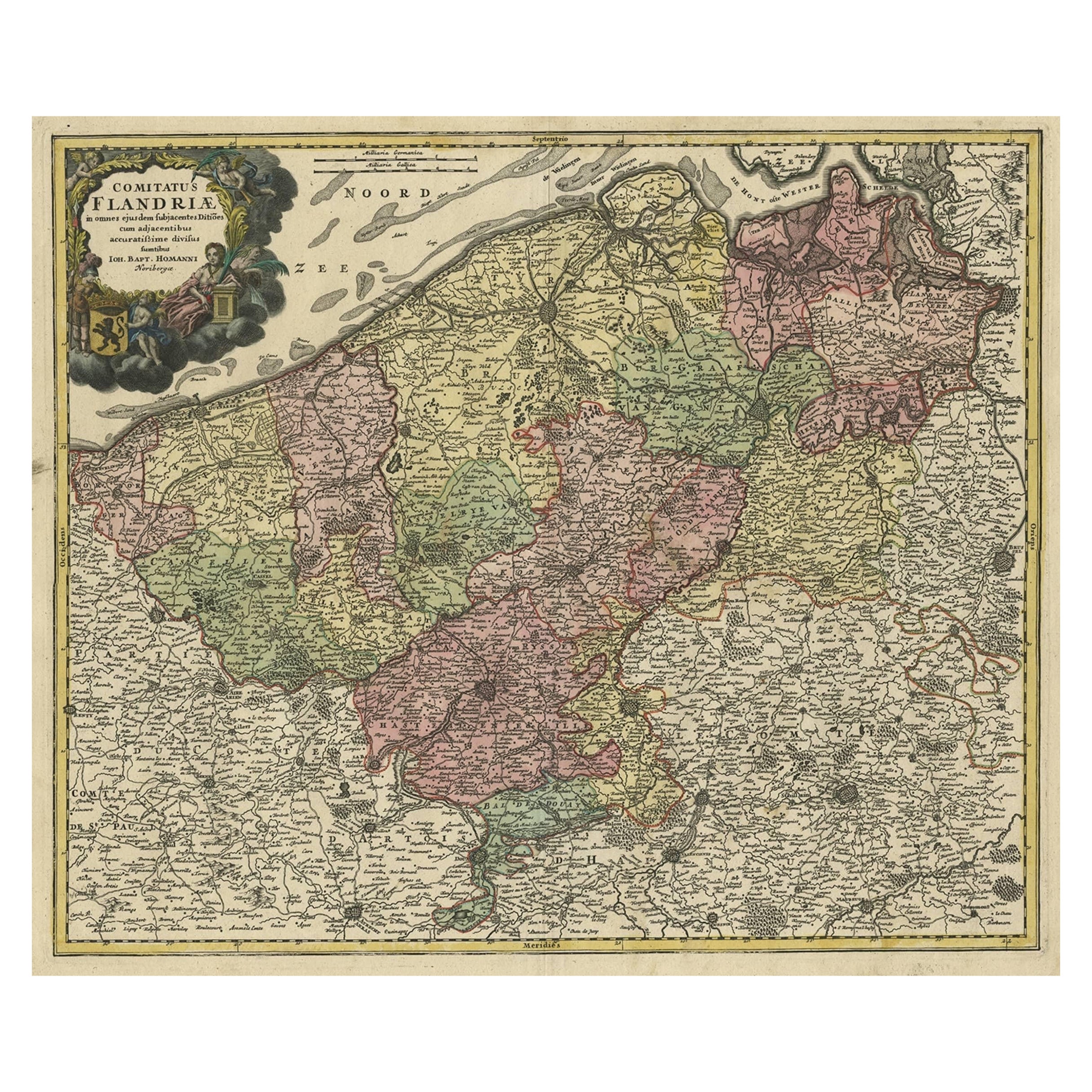
- Antique Map of Flanders, Belgium by Homann Heirs, c.1735Located in Langweer, NLAntique map titled 'Comitatus Flandriae in omnes ejusdem subjecentes Ditioes (..).' Original antique map of Flanders, Belgium. This map details the coastline from Grevelingen to Zeel...Category
Antique 18th Century Maps
MaterialsPaper
- Antique Map of Flanders 'Belgium' by F. de Wit, circa 1680Located in Langweer, NLAntique map titled 'Comitatus Flandriae Tabula, in Lucem Edita'. Large map of Flanders, Belgium. Published by F. de Wit, circa 1680.Category
Antique Late 17th Century Maps
MaterialsPaper
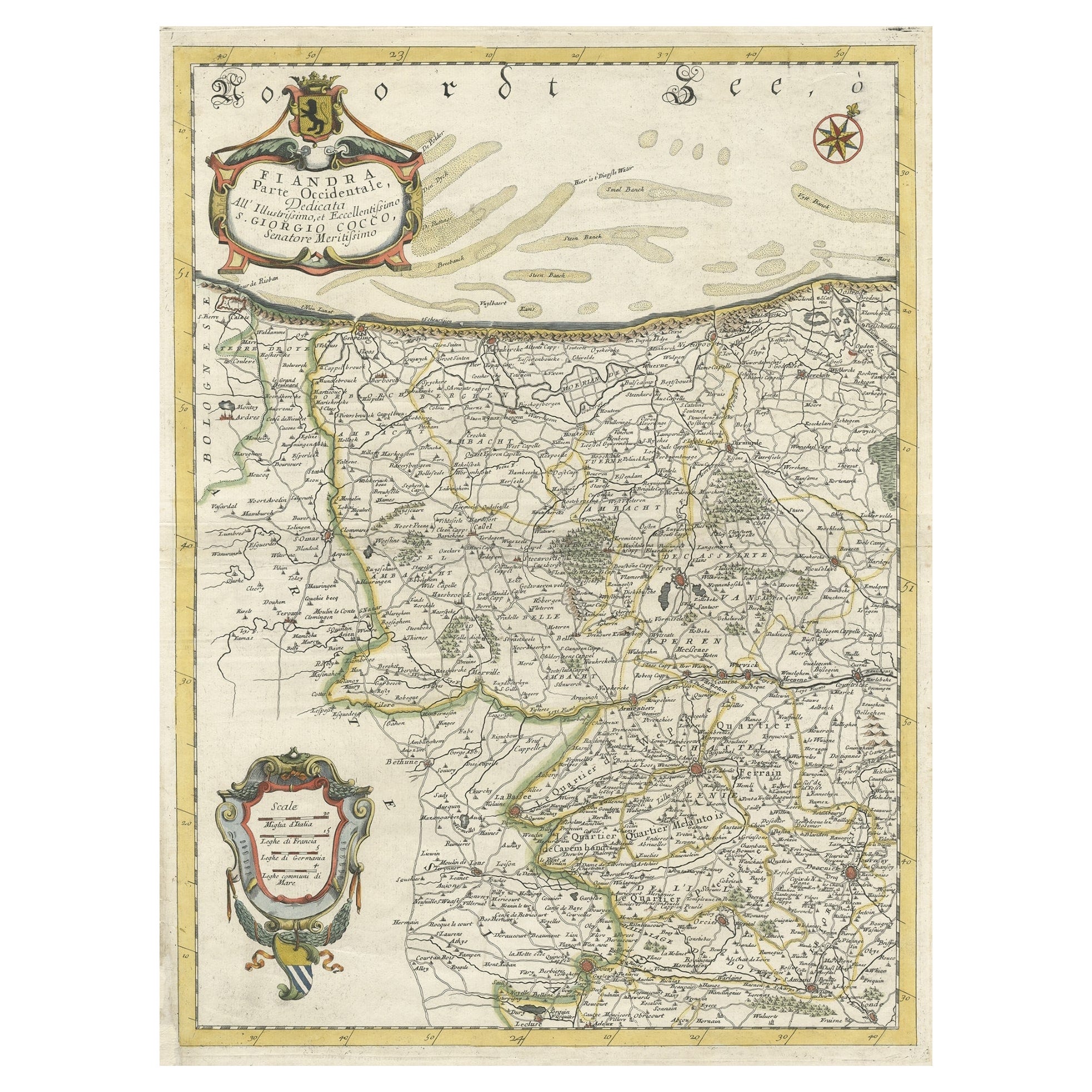
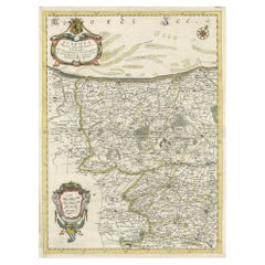
- Decorative Original Antique Map of the North of Flanders, Belgium, 1697Located in Langweer, NLAntique map titled 'Fiandra Parte Occidentale (..)'. Depicts northern part of Flanders, from North Sea, extends through the northern region of France to the cities of Douai and V...Category
Antique 1690s Maps
MaterialsPaper


You May Also Like
- Antique 1630 Colored Belgium Map Flandria Gallica Flanders Henricus HondiusLocated in Dayton, OH"Antique hand colored map of Flanders, Belgium, circa 1630, engraved by Henricus Hondius. “Henricus Hondius II (1597 – 16 August 1651) was a Dutch eng...Category
Antique Early 17th Century Renaissance Maps
MaterialsPaper
- 1752 Vaugoundy Map of Flanders : Belgium, France, and the Netherlands, Ric.a002Located in Norton, MALarge Vaugoundy Map of Flanders: Belgium, France, and the Netherlands Colored -1752 Ric.a002 Description: This is a 1752 Didier Robert de Vaugondy map of Flanders. The map de...Category
Antique 17th Century Unknown Maps
MaterialsPaper
- Original Antique Map of Ireland- Kerry. C.1840Located in St Annes, LancashireGreat map of Kerry Steel engraving Drawn under the direction of A.Adlard Published by How and Parsons, C.1840 Unframed.Category
Antique 1840s English Maps
MaterialsPaper
- Original Antique Map of Ireland- Tipperary and Waterford. C.1840Located in St Annes, LancashireGreat map of Tipperary and Waterford Steel engraving Drawn under the direction of A.Adlard Published by How and Parsons, C.1840 Unframed.Category
Antique 1840s English Maps
MaterialsPaper
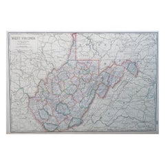
- Large Original Antique Map of West Virginia, USA, C.1900Located in St Annes, LancashireFabulous map of West Virginia Original color Engraved and printed by the George F. Cram Company, Indianapolis. Published, C.1900 Unframed Free shipping.Category
Antique 1890s American Maps
MaterialsPaper
- Original Antique Map of Belgium by Tallis, Circa 1850Located in St Annes, LancashireGreat map of Belgium Steel engraving Many lovely vignettes Published by London Printing & Publishing Co. ( Formerly Tallis ), C.1850 Origin...Category
Antique 1850s English Maps
MaterialsPaper


Recently Viewed
View AllMore Ways To Browse
Antique Map Livonia
Antique Maps Denver
Menorca Map
Sumba Map
Antique Cabbage Cutter
Wyld Globes
Antique Life Buoy
Antique Life Buoys
Atlantis Antique
Map Of Armenia
Gambia Antique Map
Victor Levasseur On Sale
Nova Totius
Antique Barbie Furniture
Antique Map Dordogne
Antique Yemen
Antique Map Montreal
Antique Map Of Puerto Rico