Items Similar to Detailed Regional Antique Map of Northwestern France and Catholic Belgium, 1648


Want more images or videos?
Request additional images or videos from the seller
1 of 5
Detailed Regional Antique Map of Northwestern France and Catholic Belgium, 1648
About the Item
Antique map titled 'Picardie et les Pays Bas Catholiques (..)'.
Detailed regional map of Northwestern France and Catholic Belgium, from an early edition of Sanson's Atlas.
Artists and Engravers: Nicholas Sanson (1600-1667) is considered the father of French cartography in its golden age from the mid-seventeenth century to the mid-eighteenth. Over the course of his career he produced over 300 maps.
- Dimensions:Height: 17.72 in (45 cm)Width: 23.23 in (59 cm)Depth: 0 in (0.02 mm)
- Materials and Techniques:
- Period:1640-1649
- Date of Manufacture:1648
- Condition:Condition: Good, original/contemporary hand coloring. Minor wear, please study image carefully.
- Seller Location:Langweer, NL
- Reference Number:
About the Seller
5.0
Platinum Seller
These expertly vetted sellers are 1stDibs' most experienced sellers and are rated highest by our customers.
Established in 2009
1stDibs seller since 2017
1,932 sales on 1stDibs
Typical response time: <1 hour
- ShippingRetrieving quote...Ships From: Langweer, Netherlands
- Return PolicyA return for this item may be initiated within 14 days of delivery.
More From This SellerView All
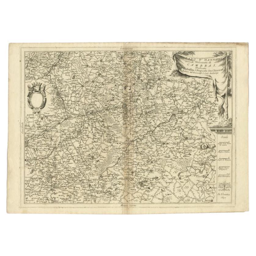
- Detailed Antique Map of Western Belgium and Eastern France by Coronelli, 1690By Vincenzo CoronelliLocated in Langweer, NLAntique map titled 'Contado d'Hannonia (..)'. Map of western Belgium and eastern France, from south of Brussels (not shown) to Cambrai, France, generally centered around the towns of...Category
Antique 17th Century Maps
MaterialsPaper
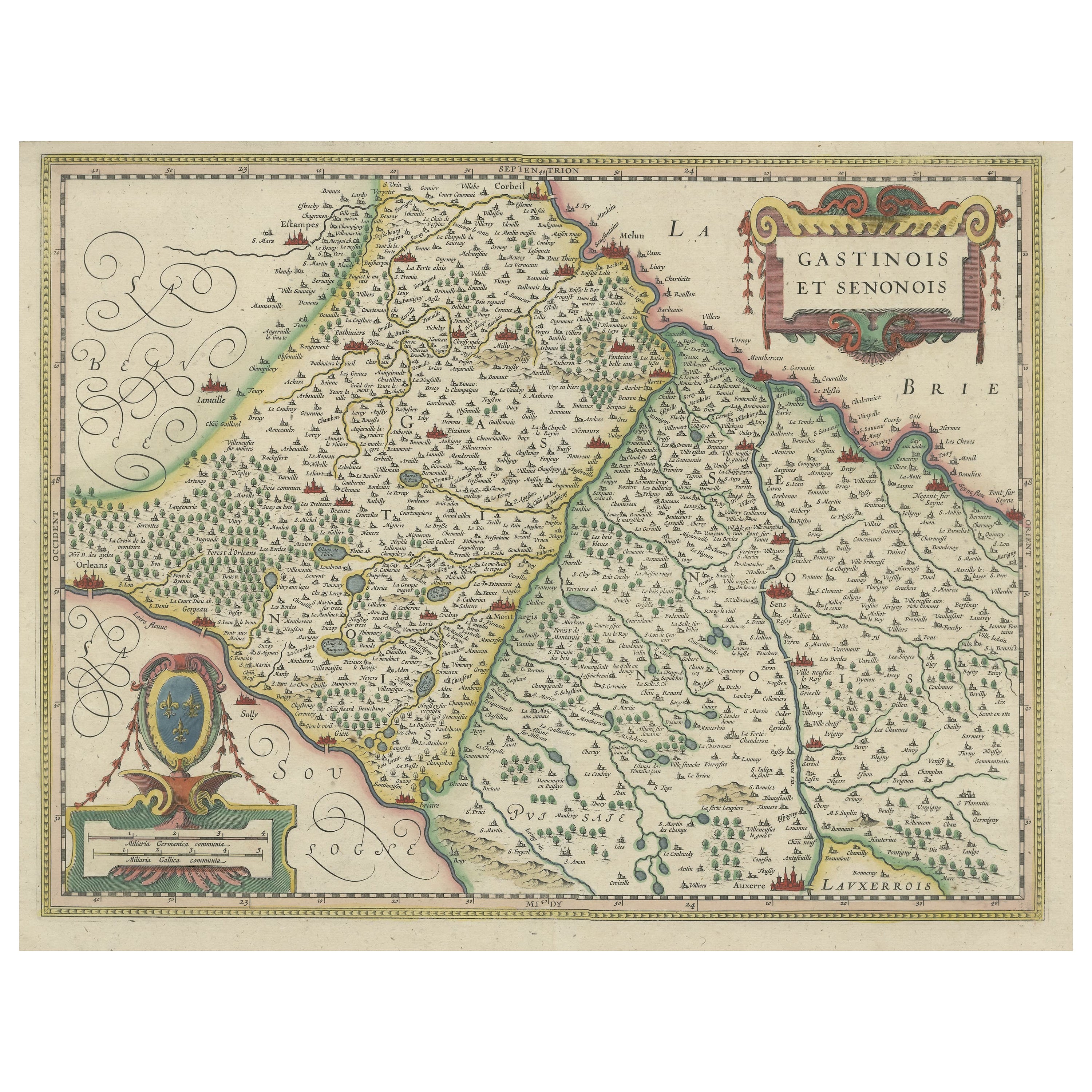
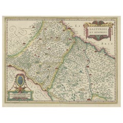
- Original Antique Regional Map of France with Orleans, Auxerre and MontargisBy Johannes JanssoniusLocated in Langweer, NLOriginal antique map titled 'Gastinois et Senonois'. Beautiful regional map of France. With Corbeil in the north, Pont sur Seyne in the east, Auxerre in the south, and Orleans in the...Category
Antique Mid-17th Century Maps
MaterialsPaper
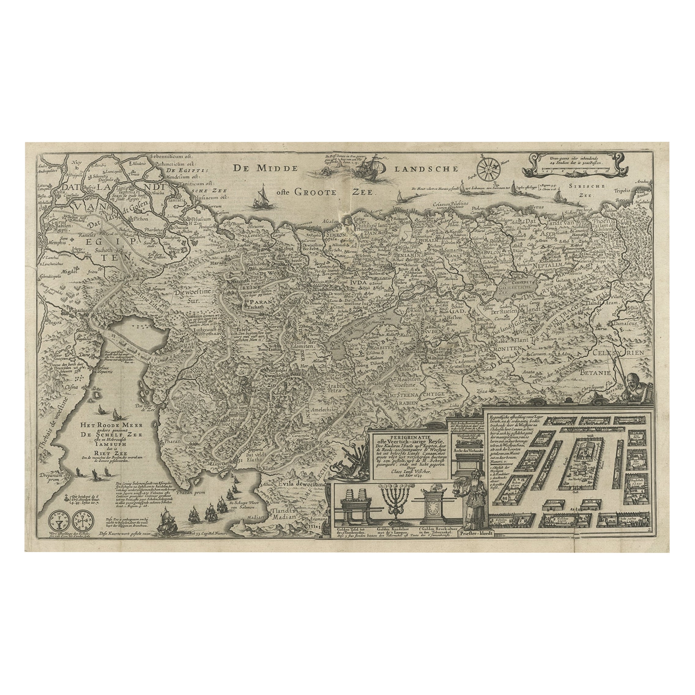
- Beautiful Rare Antique Map of the Holy Land, 1648Located in Langweer, NLAntique map Holy Land titled 'Perigrinatie ofte Veertich-Iarige Reyse, der kinderen Israels uyt Egipten, door de Roode-Zee; mitsgaders de Woestyne tot int Beloofde Landt Canaan, : met groote vlyt uyt verscheryden auctoren by een gestelt, uyt de H. Schrift gecorigeert, ende int licht gegeven'. Beautiful and rare antique map of the Holy Land...Category
Antique 1640s Maps
MaterialsPaper
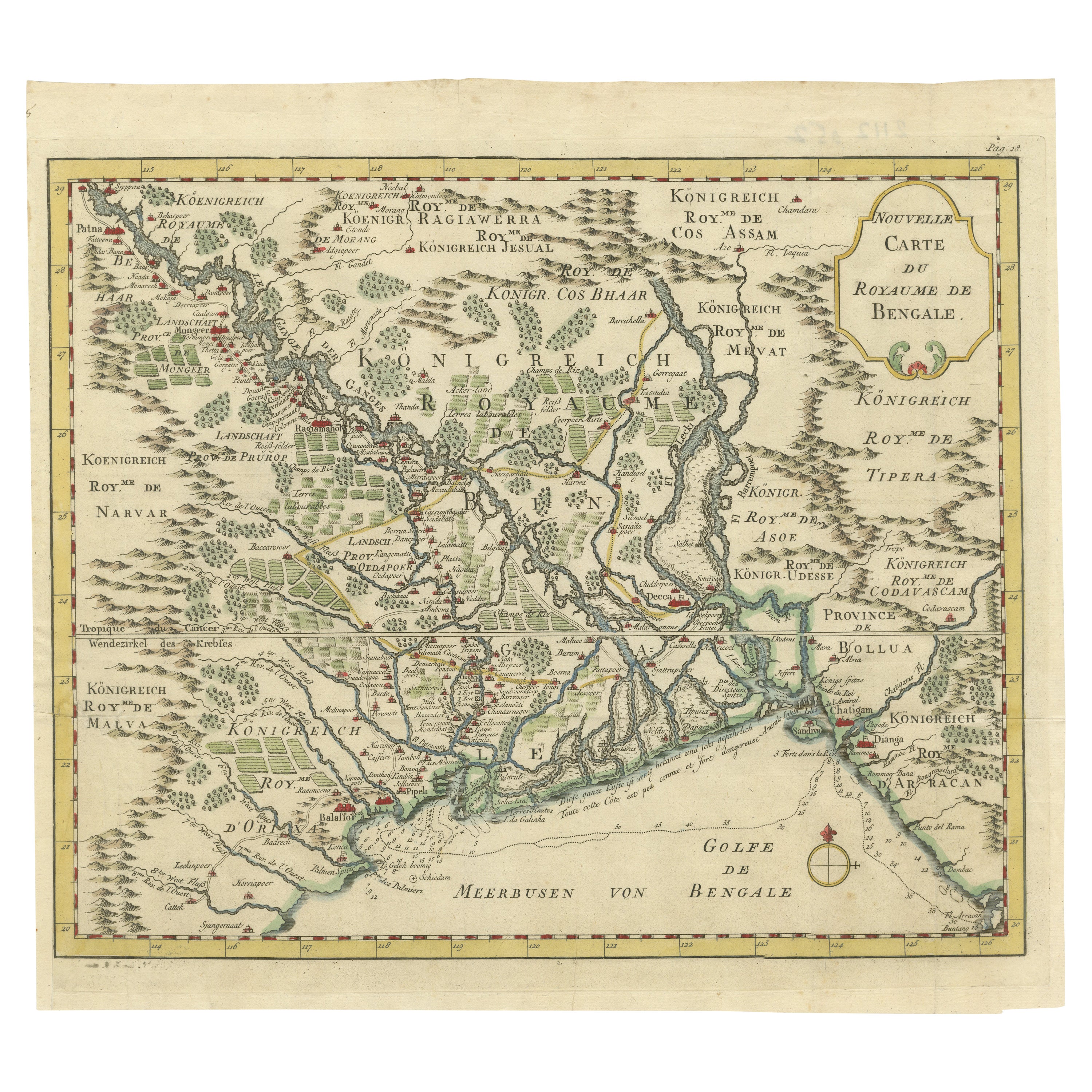
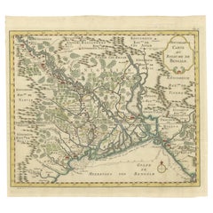
- Detailed Regional Map of the Gulf of Bengal and the Lower Ganges River, ca.1750Located in Langweer, NLTitle of this original and rare antique map: Nouvelle Carte Du Royaume De Bengale Mapmaker: Jacques-Nicolas Bellin (1703-1772). He was among the most important mapmakers of the eighteenth century. In 1721, at only the age of 18, he was appointed Hydrographer to the French Navy. In August 1741, he became the first Ingénieur de la Marine of the Dépôt des cartes...Category
Antique 1750s Maps
MaterialsPaper
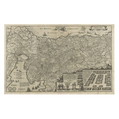
- Antique Map of Belgium and Surroundings, 1692Located in Langweer, NLAntique map titled 'Provincie Meridionali de Paesi Bassi Intese sotto nome di Fiandra overo Li Paesi Bassi Cattolici con li confini di Francia di Allemagna et di Hollanda'. Uncommon map of Belgium...Category
Antique 17th Century Maps
MaterialsPaper
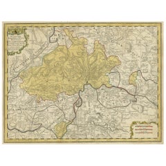
- Original Hand-Colored Antique Regional Map of Switzerland, 1753Located in Langweer, NLAntique map Switzerland titled 'Territorium Reipublicae liberae Helveticae Scaphusiensis (..)'. Regional map of Switzerland. Artists and En...Category
Antique 1750s Maps
MaterialsPaper


You May Also Like
- Original Antique Map of Belgium by Tallis, Circa 1850Located in St Annes, LancashireGreat map of Belgium Steel engraving Many lovely vignettes Published by London Printing & Publishing Co. ( Formerly Tallis ), C.1850 Origin...Category
Antique 1850s English Maps
MaterialsPaper
- Original Antique Map of France, Arrowsmith, 1820Located in St Annes, LancashireGreat map of France Drawn under the direction of Arrowsmith. Copper-plate engraving. Published by Longman, Hurst, Rees, Orme and Brown, 1820 Unframed.Category
Antique 1820s English Maps
MaterialsPaper
- Antique 1630 Colored Belgium Map Flandria Gallica Flanders Henricus HondiusLocated in Dayton, OH"Antique hand colored map of Flanders, Belgium, circa 1630, engraved by Henricus Hondius. “Henricus Hondius II (1597 – 16 August 1651) was a Dutch eng...Category
Antique Early 17th Century Renaissance Maps
MaterialsPaper
- Antique Map of Principality of MonacoBy Antonio Vallardi EditoreLocated in Alessandria, PiemonteST/619 - "Old Geographical Atlas of Italy - Topographic map of ex-Principality of Monaco" - ediz Vallardi - Milano - A somewhat special edition ---Category
Antique Late 19th Century Italian Other Prints
MaterialsPaper
- Original Antique Map of France, Sherwood, Neely & Jones, Dated 1809Located in St Annes, LancashireGreat map of France Copper-plate engraving by Cooper Published by Sherwood, Neely & Jones. Dated 1809 Unframed.Category
Antique Early 1800s English Maps
MaterialsPaper
- Original Antique Map of Spain and Portugal, circa 1790Located in St Annes, LancashireSuper map of Spain and Portugal Copper plate engraving by A. Bell Published, circa 1790. Unframed.Category
Antique 1790s English Other Maps
MaterialsPaper


Recently Viewed
View AllMore Ways To Browse
Artists From Belgium
Northwestern Furniture
Antique Cartography
Catholic Furniture
Antique Catholic
Catholic Antique
Belgium Map
French Catholic
Map Of Belgium
Belgium Antique Map
Antique French Globe
18th Century Southern Antiques
South African Antique Furniture
Antique Furniture South Africa
Used Booksellers
Used Bookseller
Antique British Maps
Antique 17th Century World Map