Items Similar to Matthaus Seutter, Framed 1730 Color Engraving Map of "Belgium Fonderatum"


Want more images or videos?
Request additional images or videos from the seller
1 of 14
Matthaus Seutter, Framed 1730 Color Engraving Map of "Belgium Fonderatum"
About the Item
Label on verso. From Grosser Atlas. The name Belgium comes from the ancient designation "Gallis Belgica". Figural decoration upper left. M. Seutter was a famed German mapmaker in the 18th c. There is a presentation inscription on the back as well as some signatures.
sight 19 1/4 x 22 1/4"
matted and framed in burled wood 27 1/2”x 31" x .75” deep.
Condition: Please see all detail photos. There are some age-related brown spots in the sea upper center, otherwise good condition and presenting very well.
- Dimensions:Height: 27.5 in (69.85 cm)Width: 31 in (78.74 cm)Depth: 0.75 in (1.91 cm)
- Style:Renaissance (In the Style Of)
- Materials and Techniques:
- Place of Origin:
- Period:
- Date of Manufacture:18th Century
- Condition:Wear consistent with age and use.
- Seller Location:Bridgeport, CT
- Reference Number:
About the Seller
5.0
Vetted Seller
These experienced sellers undergo a comprehensive evaluation by our team of in-house experts.
1stDibs seller since 2015
1,593 sales on 1stDibs
Typical response time: <1 hour
- ShippingRetrieving quote...Ships From: Bridgeport, CT
- Return PolicyThis item cannot be returned.
More From This SellerView All
- Framed 1731 Color Engraving, Map of Rotterdam by Matthaus Seutter, "Roterodami"Located in Bridgeport, CT"Roterodami". Seutter (1678-1757) was an important German 18th century map maker. Bird's eye view of the city above with full details, neoclassi...Category
Antique 18th Century European Renaissance Maps
MaterialsGlass, Wood, Paper
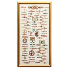
- Framed Large Collection Of Vintage Cigar BandsLocated in Bridgeport, CTVarious brands including one with a collie, one with a horse, an eagle (Turkish), cows (Turkish), birds (Egyptian Deities, and others). A large one at top for La Reclama, Havana Ciga...Category
20th Century Hollywood Regency Tobacco Accessories
MaterialsLinen, Wood, Paper, Glass
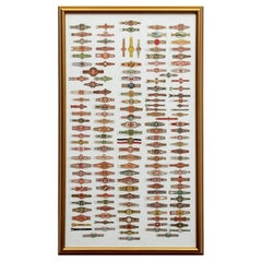
- Large Collection Of Framed Vintage Cigar BandsLocated in Bridgeport, CTMulticolored and gilt bands of different types. Including some Egyptian, Habana and Turkish (upper right ones with a steam ship and a river landscape). Mounted on white linen in a gi...Category
20th Century Tobacco Accessories
MaterialsWood, Paper, Glass, Linen
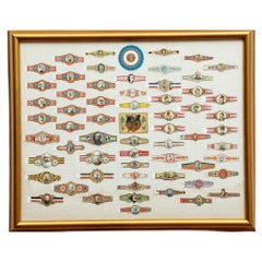
- Fine Collection of Custom Framed Vintage Cigar LabelsLocated in Bridgeport, CTA collection of various multi-colored and gilt cigar bands all with portrait heads. Including- Franz Joseph I, and other rulers. Along with a serrated round label with a bust in prof...Category
20th Century Hollywood Regency Tobacco Accessories
MaterialsLinen, Glass, Wood, Paper
- Large Custom Framed 1857 U.S. Coast Survey of the Chesapeake BayLocated in Bridgeport, CTAn antique 1850's nautical map with hand-painted color accents entitled “Chesapeake Bay; Sheet no. 2: Head of the Bay to the Mouth of the Potomac River”....Category
Antique 1850s American American Classical Maps
MaterialsPaper
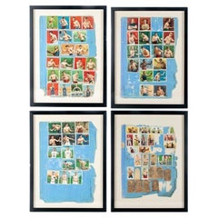
- Rare Set of Four Framed Antique Boxing and Sports Collectible CardsLocated in Bridgeport, CTFour groups of colored paper collectible sports cards mounted on blue paper pierced in the margin for placing in a notebook. Now mounted on off white card and custom framed. The cards include images of boxers Al Kaufman, Mike Sullivan, Gans and Nelson and many others. Along with images of track and field and swim athletes. Some faded black printed faded paper ones with portraits of boxers e.g Jack...Category
Early 20th Century American Classical Sports Equipment and Memorabilia
MaterialsPaper


You May Also Like
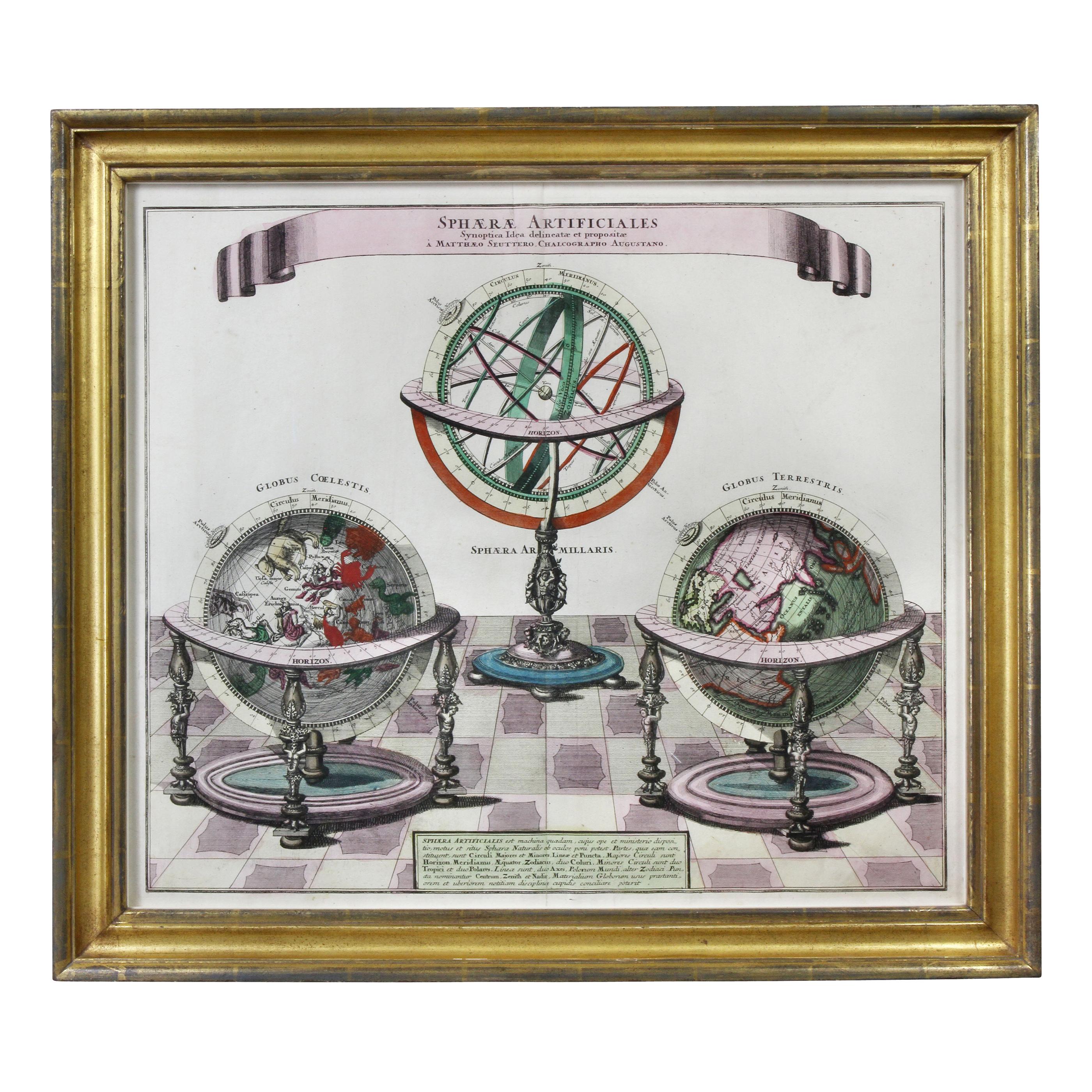
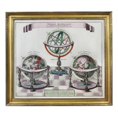
- Framed Engraving By Matthaus Seutter Of Sphaerae ArtificialesLocated in Essex, MACartographer from Germany 1678-1757. Hand colored. Gilt wood frame. Estate of William Hodgins.Category
Antique Early 1700s German Prints
MaterialsPaper
- Antique Map of Northern Germany by M. Seutter, circa 1730By Matthew SeutterLocated in Langweer, NLAntique map titled 'Saxoniae Inferioris Circulus'. Old map of the northern part of Germany by M. Seutter. Covering the area of Lower Saxony, Mecklenburg-Vorpommern and Schleswig-Hols...Category
Antique Mid-18th Century Maps
MaterialsPaper
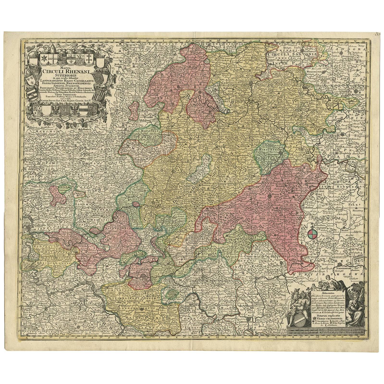
- Hand-Colored Antique Map of part of Germany by M. Seutter, c. 1730By Matthew SeutterLocated in Langweer, NLAntique map titled 'Mappa Circuli Rhenani Superioris (..). Original map with hand coloring of part of Germany. It includes the region of Kassel, Göttingen, Eisenach, Schweinfurt, Wer...Category
Antique Mid-18th Century Maps
MaterialsPaper
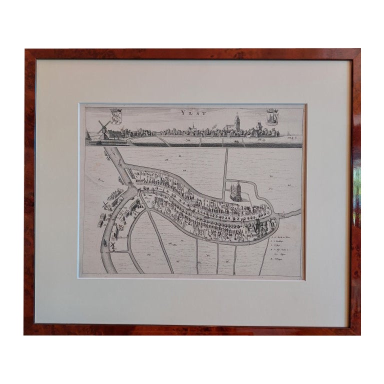
- Antique City View and Map of IJlst, City in Friesland, Holland, Framed, 1664Located in Langweer, NLAntique map titled 'Ylst'. Old map and city view of the city of IJlst, Friesland. This map originates from 'Beschrijvinge van de Heerlyckheydt van Frieslandt' by B. Schotanus à Sterr...Category
Antique 17th Century Maps
MaterialsPaper
- Antique Map of Greece by Seutter or Lotter, 'c.1740'Located in Langweer, NLAntique map titled 'Graecia pars Septentrionalis'. Original antique map of Greece, uncommon. Signed cum Gratia et Privil. S.R.I. Vicariatus (..)'. Published by Seutter or Lotter, cir...Category
Antique Mid-18th Century Maps
MaterialsPaper
- Antique Map of the Low Countries by Seutter, c.1745Located in Langweer, NLAntique map titled ‘XVII Provinciae Belgii sive Germaniae Inferioris (..)’. Detailed hand colored map of the Low Countries. Includes colored decorative cartouche, compass rose and co...Category
Antique 18th Century Maps
MaterialsPaper


Recently Viewed
View AllMore Ways To Browse
Antique Paper Color
19 Century Frames
Belgian Renaissance
Burled Wood Frame
Framed Burled Wood
German Renaissance Wood Furniture
Framed Atlas Map
Atlas Figure
Galli C
Large Map Of London
18th Century Antique Mexican
Victorian Compass
Caribbean Antiques
Framed Atlas Map
Antique Collectors Australia
Antique Furniture Central Coast
Willem Blaeu
Antique Furniture North East England